APHG MAPS
1/10
There's no tags or description
Looks like no tags are added yet.
Name | Mastery | Learn | Test | Matching | Spaced |
|---|
No study sessions yet.
11 Terms
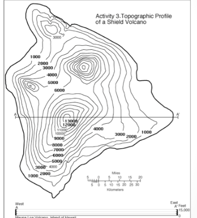
Topographic map
maps that use isolines to represent constant elevations
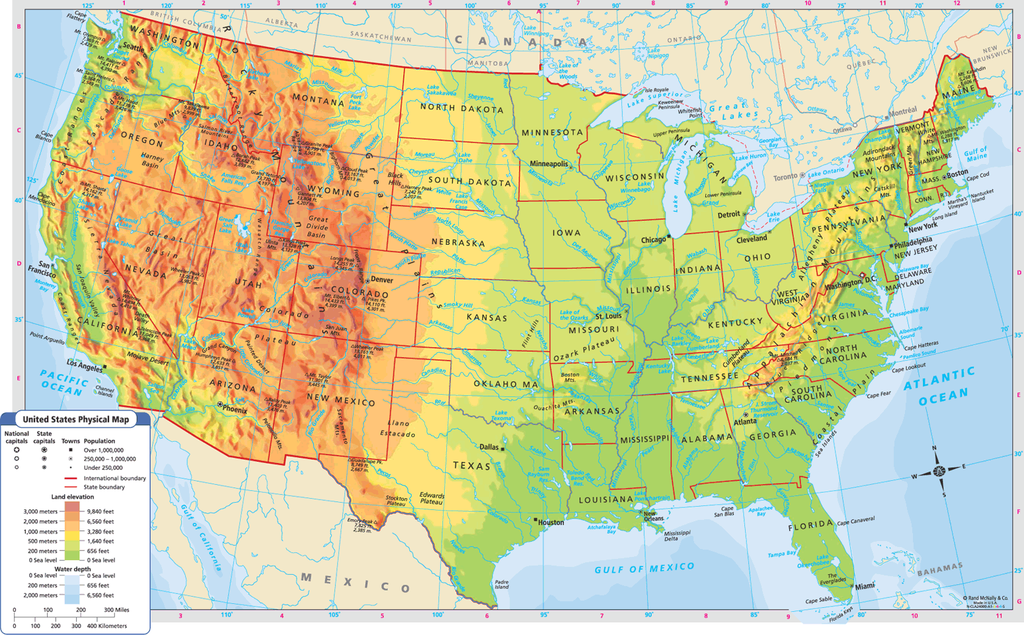
Physical map
Displays different types of land such as deserts, mountains, plains, and bodies of water, providing a clear picture of the local terrain.
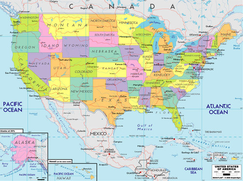
Political map
Maps displaying governmental boundaries such as cities, states, provinces, and countries.es

Choropleth map
A thematic map that uses different colors or shades to show the average values per unit of data in a specific area.
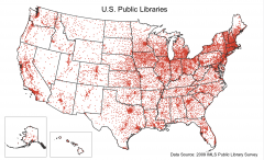
Dot map
thematic map which uses points to show exact locations like crimes, car accidents, or births.
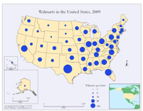
Graduated Symbol map
A map displaying symbols that adjust in size based on the value they represent.
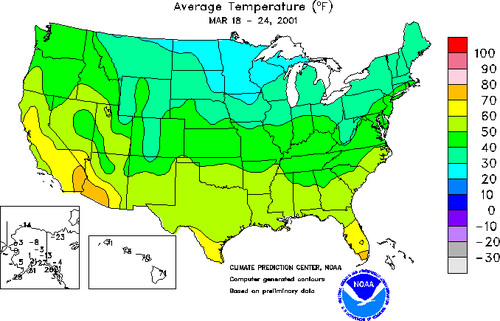
isoline map
A type of thematic map that uses lines to connect points of equal value, such as elevation or temperature.
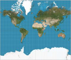
Mercator Projection
Shows direction and good for navigation purposes. However distorts areas, especially near the poles.
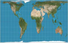
Gall-Peters Projection
Shows direction area is accurate. However, it distorts shape and continents appear elongated.
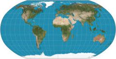
Robinson Projection
A globe-like appearance that does not distort the size and shape not too much. However, it minimally distorts areas and extremely distorts the poles.
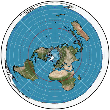
Azimuthal Projection
It preserves direction, and when used from the point of the North Pole, no country is seen as the center. However, it only shows one half of the earth and distorts shape and area.