Geostrophic winds, midlatitude atmospheric variability, monsoons, past and future climate change
 Call Kai
 Learn
Learn Practice Test
 Spaced Repetition
 Match
Match Flashcards
 Knowt Play
1/21

There's no tags or description
Looks like no tags are added yet.
Name | Mastery | Learn | Test | Matching | Spaced | Call with Kai | Chat |
|---|
No analytics yet
Send a link to your students to track their progress
22 Terms
What is Geostrophic balance?
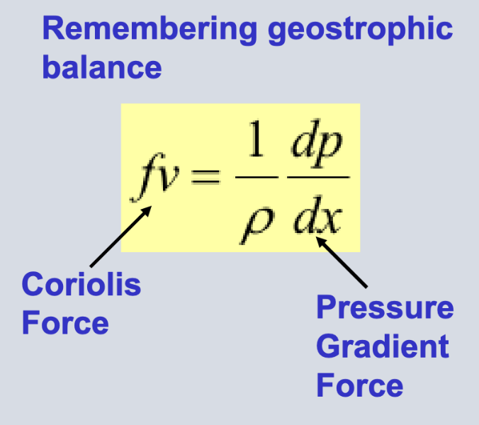
Balance of the horizontal components of Pressure Gradient Force and the Coriolis force.
Coriolis force = - pressure gradient force
results in wind moving parallel across isobars instead of across them.
wind speed is proportional to pressure gradient, or inversely proportional to isoline spacing.
95% percent of the time have geostrophic balance however invalid in strong storms or disturbances.
What is Geostrophic wind?
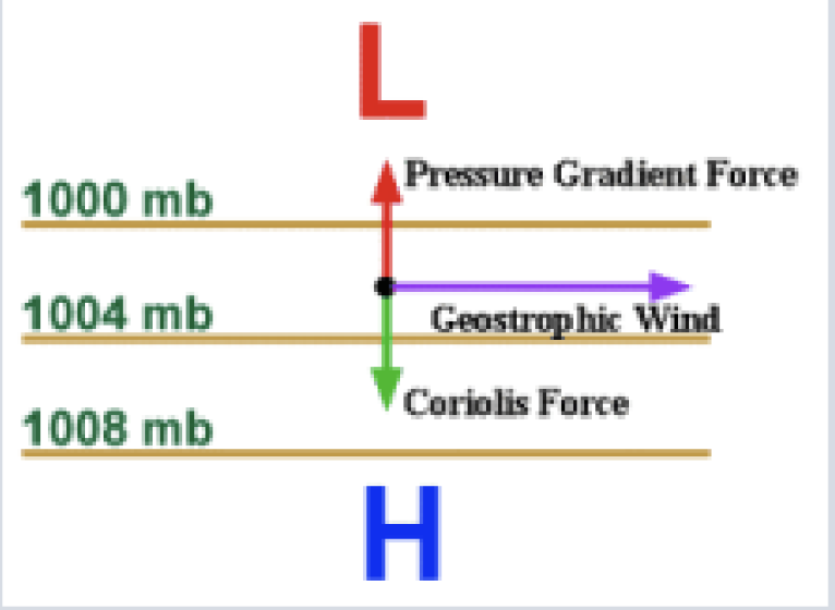
Geostrophic wind is the wind that results when the Coriolis force perfectly balances the pressure gradient force.
occurs at high altitudes - friction slows down because weaker the gravitational pull meaning weight is lower.
Air naturally moves from areas of high-low pressure this is due to the pressure gradient force.
Coriolis force deflects air to the right in the northern hemisphere and left in the southern hemisphere.
Geostrophic wind causes the air to flow parallel to the isobars bars.
Where on Earth is there 0 Coriolis force?
The equator.
No horizontal movement of objects moving north or south.
What are Jet Streams?
Bands of strong wind generally flowing from west to east in the upper troposphere, where planes fly.
They from when cold air mass meets hot air mass and there is a strong temperature gradient and hence, strong vertical wind shear.
The major jet streams are the Polar Front and the Subtropical jet.
What is the Polar Front Jet?
occurs over midlatitudes influencing weather over UK and Europe.
thermal wind
forms at cold, polar air to the north and warm subtropical air to the south.
What is the Subtropical Jet?
Forms where the Hadley and Ferrel cells meet.
Can be explained by the conservation of angular momentum - as air is moving around in a circle if you move air towards the North Pole the air will rotate the other way as it is conserved.
What type of waves are fundamental for the creation of mid-latitude cyclones?
Rossby/ planetary waves.
Explain how Rossby waves work?
They are giant meanders in high altitude winds in the mid-latitudes moving eastwards.
When they go up warm air is taken from the tropics up north because warm air rises.
When they travel down carry cold air from the arctic towards the south.
Cold air pushes underneath warm air, which creates a cyclone because of the density indifferences.
What are the 2 types of Rossby waves?
Freely and forced waves
Free waves would exist even if the planet had no surface structure, form due to the instability of the atmosphere.
Forced waves are due to mountain ranges and temperature differences between oceans and continents.
Explain the 4 fronts?
Cold dry air mass pushes a warm humid air mass get a cold front, forcing the warm air upwards quickly. Abrupt intense weather - lots of rain. The most dramatic.
Warm air pushes into a cool, dry air mass you get a warm front , warm air is forced upwards but a gentle slope. Widespread cloud and precipitation.
Don’t need moving air masses if there is an abrupt boundary between 2 air masses, cold and warm air, get a stationary front. Weather associated with a warm front but can last for days.
The fronts themselves push into one another, resulting in the entire boundary between cool air and warm air lifted of the ground - occluded front. Combination of both weathers, can be quite severe.
What is anticyclonic weather?
A high atmospheric pressure system, causing stable conditions usually clear and sunny and fog in winter.
Does not have any fronts and don’t find pressure isolines together because the pressure balances.
What is Gradient wind?
When isobars are curved, wind follows the same path. How does wind move in a curved path…
Influenced by pressure gradient force, Coriolis force and centrifugal force.
wind shifts occur with the passage of weather fronts.
It influences flow in the Rossby waves, and can cause upper-level divergence and convergence, which can influence the generation of new cyclones.
Upper level divergence - surface low pressure meaning cyclogenesis
Convergence - surface high pressure, suppressing weather.
What is a monsoon?
Climate that is heavily influenced by strong seasonal changes in the wind. It can also be used for climates with a clear alternation between winter dry and summer rainy seasons.
Prominent in tropical Asia, Australia, Africa and the Indian Ocean.
Describe an example of a summer monsoon.
Indian summer monsoon:
starts early June in South East India and travels up North
retreats early September
results in some wet and dry days, Arabian Sea causes lots of rain in the West.
What is the thermal theory for the Indian Summer monsoon?
Describes the monsoon to be driven by differential heating and cooling of the continent and the ocean.
Summer monsoon - Land is hotter than the ocean = low pressure over India = thermally induced pressure gradient = winds from ocean to Indian subcontinent = heavy rainfall as winds pick up moisture.
Winter monsoon - Land is cooler than the ocean = high pressure over India = reversed pressure gradient = winds from land to sea = dry as land has little moisture.
What are the drawbacks of the thermal theory?
Doesn’t explain regional details
Thermal gradients play a role, but are one of many factors.
Higher rainfall is associated with lower temperatures; this is the opposite to the thermal theory.
Describe the classical and modern view of monsoons.
Classical view:
monsoons occur due to the land-sea temperature contrast.
Modern view:
Monsoons are responses to hemispheric energy imbalances, surpluses and deficits.
Atmosphere transports energy away via ITCZ shift and moisture transport, resulting in a monsoon.
Why would maximum precipitation be north of the equator?
Intertropical Convergence Zone (ITCZ) is north of the equator.
How does the ITCZ work?
ITCZ - area of low pressure typically within the tropics.
How does it create a monsoon?
Equator receives intense solar radiation, causing it to expand and rise.
Rising air = low pressure = rainfall
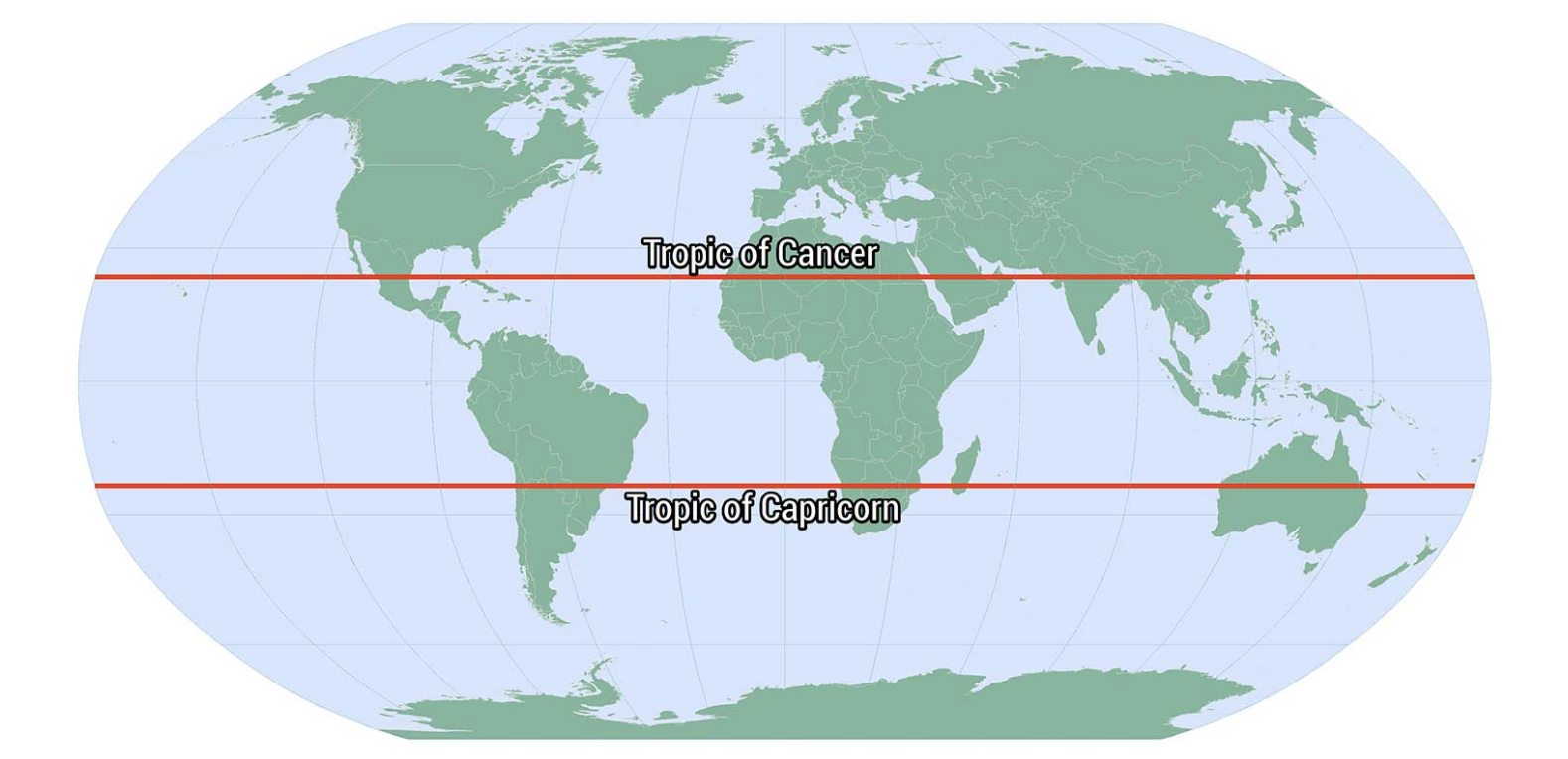
As concentration of sunlight varies per season depending on the position of the earth relative to the sun. The ITCZ also varies throughout the year. Areas of low pressure shift from the Tropic of Cancer to the Tropic of Capricorn.
The ITCZ moves to meet the area of solar concentration, bringing high levels of precipitation with it. The south then experiences a dry season.
E.g. India has high levels of rainfall in the month of July and dry in December.
What is the evidence for increased global mean temperature?
Glacier retreat
Arctic sea ice melting
tree rings are a proxy
Observed increase in CO2 emissions in ice cores in Antartica
Observed change per 1 degree celsius per global warming
Increased frequency and intensity of heavy precipitation over land.
Increase in droughts.
How has temperature changed over time?
Medieval Warm Period
Little Ice Age
Rapid warming post industrialisation
What is the predicted climate?
Global mean temperature increases
wet regions become wetter and dry become drier, with increased rainfall intensity.
More extreme events like heatwaves, droughts.
Increase in sea level due to melting glaciers
Stronger warming over land and a high latitudes.