HASS Mapping Skills Test
1/22
Earn XP
Description and Tags
idrk if this is needed??? better safe than sorry thooo
Name | Mastery | Learn | Test | Matching | Spaced | Call with Kai |
|---|
No analytics yet
Send a link to your students to track their progress
23 Terms
Physical Feature
A naturally occurring feature on the Earth’s surface which did not result due to human tampering, like a mountain or ocean. The three main types are landforms (like rocks), vegetation (like trees), and waterbodies (like oceans)
Cultural Feature
A feature on the Earth’s surface which came as a result of human tampering, like an orchard, or house. The three main types are settlement (like an apartment), transport (like a road), and land use (like farms)
Easting
The vertical numbered lines on a map which measure increase as they go from east to west. Go first in AF and GF
Northing
The horizontal numbered lines on a map which increase as they g from south to north. Go second in AF and GF
Area Reference
The four digit code that describes a specific square on a map. Is ordered by easting, then northing, e.g. 1342, 0205
Grid Reference
The six digit code that describes a specific square on the map in the 1st, 2nd, 4th and 5th digits, and a location within that specific square with the 3rd (which describes the easting) and 6th which describes the northing). E.g., 135864,
Contour Line
A thin, brown line on a map which shows areas of equal elevation, showing depth
Contour Interval
The difference in elevation between each adjacent contour line. Can change between each map
Spot Height
A point which marks the highest point on a mountain, including it’s height
How to write the elevation of something between contour lines
Lower contour line [in metres] < object < Higher Contour Line
E.g., 180m < rock elevation < 200m
How to Figure out the Flow of a River
If a river is surrounded by contour lines in a v shape, the point of the v points towards the source, and the rest is flowing away from it (e.g., if the v points down on a map, the river is flowing up)
If a river is flowing through contour lines, it cannot flow upward, meaning it has to be flowing to lower contour lines
How to Write a scale in words
Only use WORDS (no numbers)
Write basically “One centimeter on the map represents ________ on the ground”
ALWAYS USE REPRESENT, NOT EQUAL TO
Small Scale Map
A map with small amounts of detail, but showcases a large area. For example, an atlas, or map of a country
Medium Scale Map
AKA topographic map, a map with average detail and area size, like a map of a town
Large Scale Map
A map with a small amount of area, but large amount of area. E.g., a map of a house
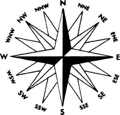
The compass
(can be rotated on different maps, like north pointing to the right)
Formula For Speed
Speed = distance/time
Formula For Time
Time = Distance/Speed
Where to start from when “From” Is In Direction Questions (like “what direction is a from b")
Always start at point b
How many cms are in a km
100,000
5 Common Characteristics of a Topographic Map
Title
Key/Legend
Scale
North Point (where north points to)
Grid System (eastings and northings)
How to Figure out Contour Interval
Look for it somewhere around the map
Find two closeby contour lines with their elevation labelled. Count the number of gaps from line to the other, and divide the difference in elevation between them, by the number of gaps (e.g., if there are lines 280m and 340m that have 3 gaps between them, since the difference in elevation between them is 60m, you do 60m/3=20m, so the contour interval is 20m)
How to figure out the Area of a Map
Use the formula for a rectangle (length times width), by using ruler to calculate the length and width of the map. Convert the units using the scale before multiplying
(e.g., if the height is 5cm, and the width is 2cm, and the scale is 1:50,000, then the height is 2.5km (5cm x 50,000) and the width is 1km (2cm × 50,000), so the area is 2.5km2 (because its 2.5 × 1))