Geography: Exam 1
1/78
There's no tags or description
Looks like no tags are added yet.
Name | Mastery | Learn | Test | Matching | Spaced | Call with Kai |
|---|
No study sessions yet.
79 Terms
absolute location
based on some type of math for the purposes of the world; coordinate system (latitude, longitude)
contagious diffusion
the spread of something through physical proximity or direct contact among individuals (rapidly spreads; mass media/social media; first seen through the spread of diseases)
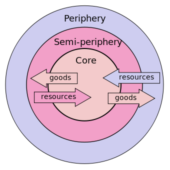
core-periphery
core of the region (everything bascially the same) Periphery (getting less of the same now a little more difficult to determine) then further and further away from the shared traits (less and less of the same)
diffusion
the process where cultural elements, ideas, technologies, or practices spread from a point of origin to other areas
emigration
moving out of a place
expansion diffusion
3 types:
Hierarchical: one person knows something that tells someone else; slow diffusion, works through those levels, takes time to spread
Contagious: the spread of something through physical proximity or direct contact among individuals; rapidly spreads; mass media/social media; first seen through the spread of diseases
Stimulus: when an underlying concept diffuses, but the specifics of it change; hwy a cow and a deer are the same story
formal region
doesnt have specified boundaries or limits they are only based on traits, no definative boreder; some kind of trates that differentiate this region; physcial or cultural traits
functional region
they have a purpose for being; based off a social, economical, or political function
global population clusters
specific, high-density geographic regions where the majority of the world's population resides, occupying only a small percentage of the Earth's habitable land
hierarchical diffusion
one person knows something and tells someone elsewho tells someone else etc.; hierarchy; slow diffusion has to work through the levels
hinterlands
the often uncharted areas beyond a coastal district or a river's banks; an area lying beyond what is visible or known
human-environmental interaction
people change the environment → those environmental changes change the people → people change to change the environment → the cycle keeps repeating; not one without the other
immigration
moving to a place; large scale movement
in movement
moving into; winthin a country; small scale movement
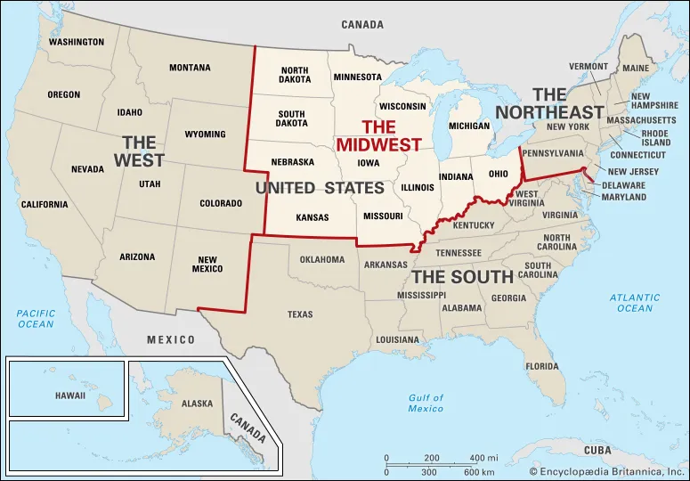
midwest
the nation's agricultural and industrial heartland, stretching from Ohio in the east to the Plains states in the west (really the north east)
movement
defining the flow, mobility, and interconnection of people, goods, ideas, and information across the Earth's surface. 3 types:
movement of people → migration
movement of goods
movement of intangibles: things you cannot see, touch, or feel; ideas, beliefs, diseases, digital media, religion, music, language
movement of goods
Advancement in transportation means goods are no longer locally sourced; they have become spread out: water cargo, air, etc.
movement of intangibles
things you cannot see, touch, or feel; ideas, beliefs, diseases, digital media, religion, music, language
out movement
moving out; within a country; small scale movement
place
the description of a location; the process in which we give a location meaning; can include physcial features, cultural, location → most subjective of the the,es, place is highlut based on a persons knowledge of that location
region
An area of the Earth's surface characterized by shared, unifying, or similar physical (climate, landforms) or human (culture, language, politics) characteristics that distinguish it from surrounding areas.
relative location
a place’s position in relation to other human or physical landmarks, rather than using exact coordinates
relocation diffusion
the spread of a cultural trait, idea, or innovation through the physical movement of people who take their cultural practices with them to a new location, often establishing communities and influencing the local culture, like the spread of languages (Spanish, English) or foods (sushi) through migration
spatial perspective
a way of viewing the world by focusing on the arrangement, patterns, and relationships of phenomena (both human and physical) across the Earth's surface
stimulus diffusion
a type of cultural diffusion where a core idea spreads to a new area, but gets adapted, modified, or changed by the receiving culture, leading to a new, unique practice that keeps the underlying principle but alters the specific traits
vernacular region
an area defined by people's informal perceptions, beliefs, and cultural identity, rather than by official boundaries, existing in the collective imagination with subjective limits, like "the South," "the Midwest," or "Silicon Valley" in the U.S.
2 components of the canadian core (Quebec vs. Ontario)Canadian
In Canadian geography, the "core" (or heartland) is defined by the densely populated and industrialised region of Central Canada, which is composed of two primary components: Southern Ontario and the St. Lawrence Lowlands of Quebec. Together, these regions house over 60% of Canada's population and dominate the nation's economic, political, and cultural landscape.
agriculture in North America
a highly mechanized, commercial, and market-oriented industry characterized by large-scale, capital-intensive, and specialized production. It is defined by monoculture farming (e.g., corn, wheat, soybeans)
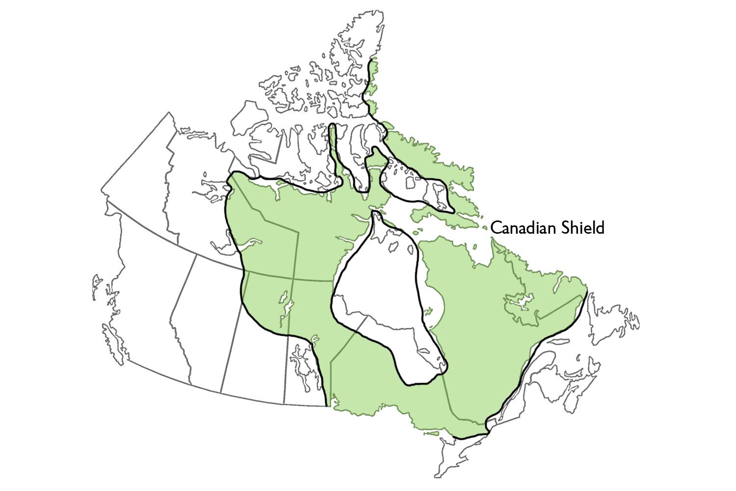
canadian shield
a vast, horseshoe-shaped geological formation of ancient, exposed Precambrian igneous and metamorphic rocks forming the core of the North American continent (Laurentia), characterized by thin soil, millions of lakes, boreal forests, and abundant natural resources, shaped significantly by glacial erosion
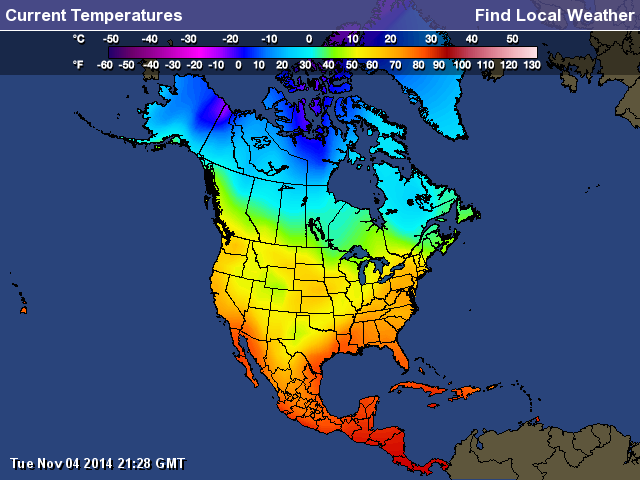
climates of north america
an extremely diverse range of zones, spanning from Arctic tundra in the north to tropical, humid conditions in Central America. Influenced by mountain barriers, oceanic currents, and latitudinal extent, major types include polar, continental, temperate, arid/semi-arid, and tropical, with significant moisture reduction moving west.
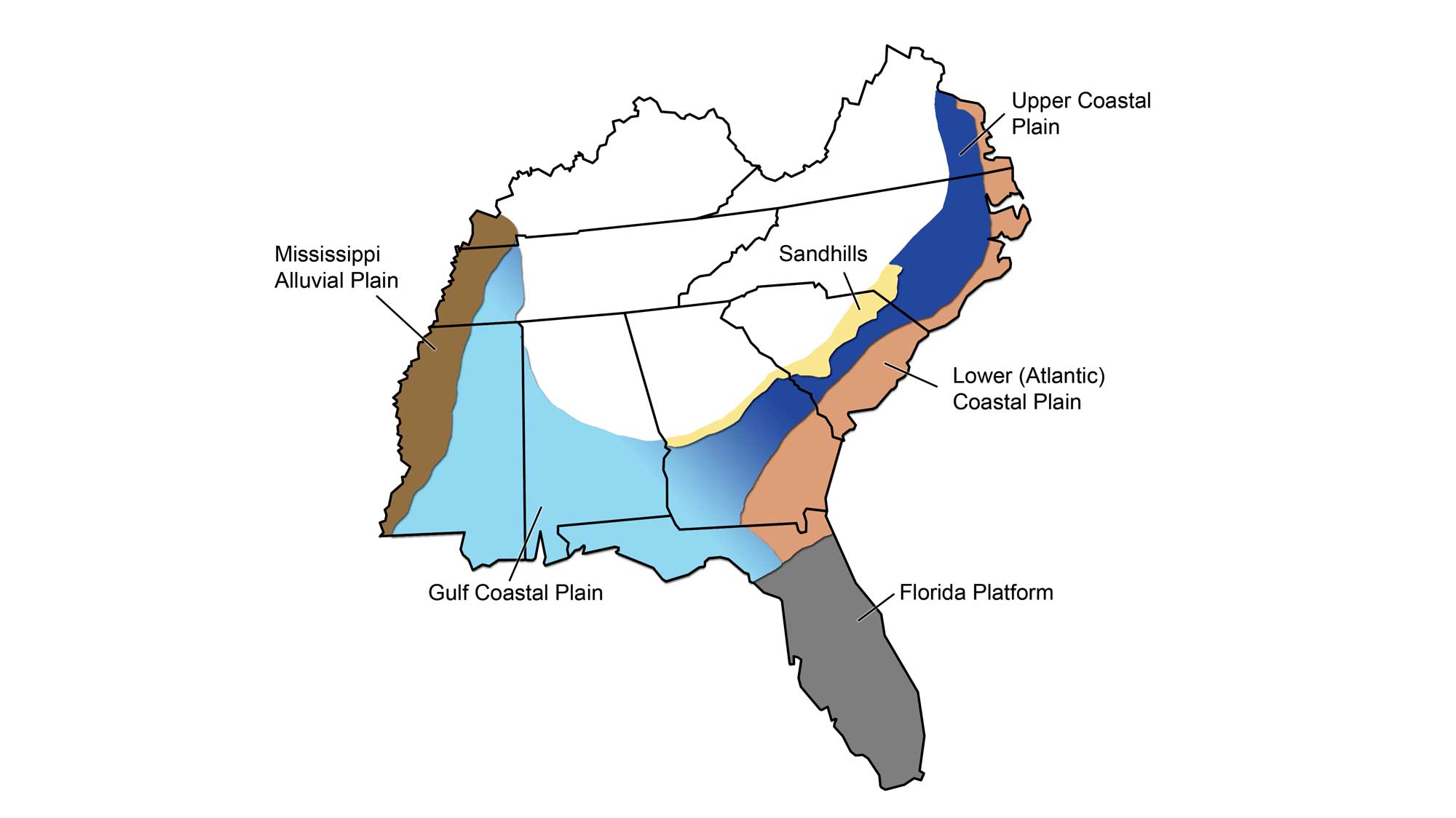
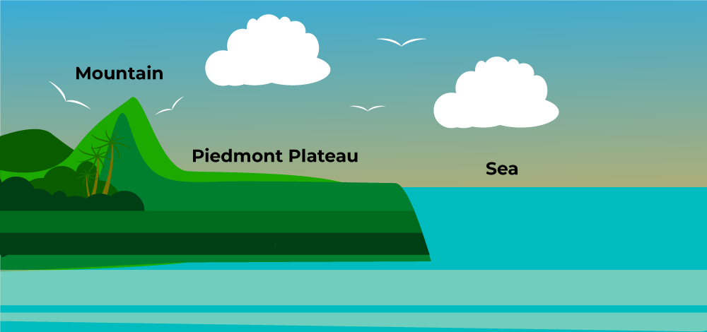
coastal plain
a flat, low-lying area of land next to the sea, formed from marine and river sediment, characterized by gradual seaward slopes, marshes, beaches, and varying elevations, serving as a transition zone from inland highlands to the ocean
french long lots
a cadastral land division method characterized by long, narrow, ribbon-shaped parcels of land extending perpendicular to a river, road, or canal
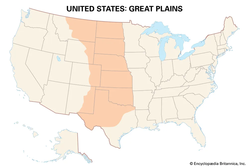
great plains
a vast, high plateau of grasslands and prairie in North America, stretching east of the Rocky Mountains from Canada down to Texas
industrial revolution
the shift from agrarian to machine-based manufacturing, starting in Britain (mid-18th century) and spreading globally, transforming landscapes through urbanization, creating factory systems near resources (coal, water), driving transportation (canals, railways), and reshaping settlements and economies through mass production and global trade networks
interior lowlands
relatively flat to rolling terrain located in the central part of a continent, specifically between the Appalachian Mountains and Great Plains in North America
inuit
Indigenous peoples of the Arctic and Subarctic, traditionally inhabiting Greenland, Canada (Nunavut, NWT, Yukon, Quebec, Labrador), Alaska, and Russia (Chukotka). Their geography is defined by this vast, cold tundra and sea environment
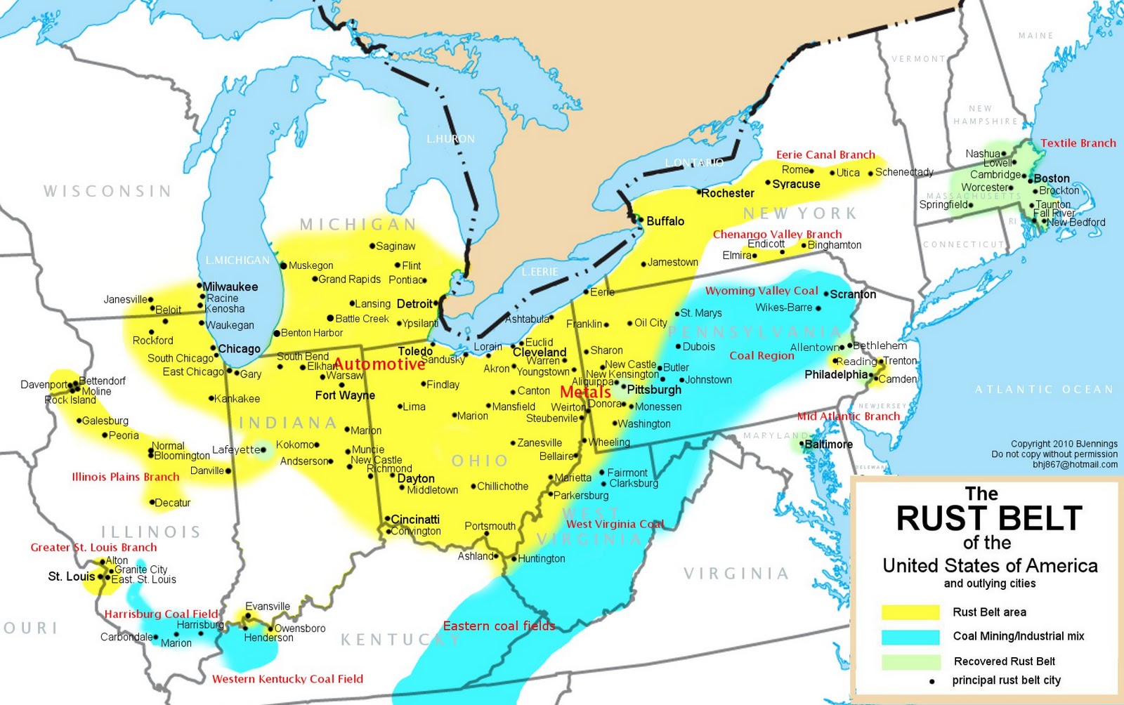
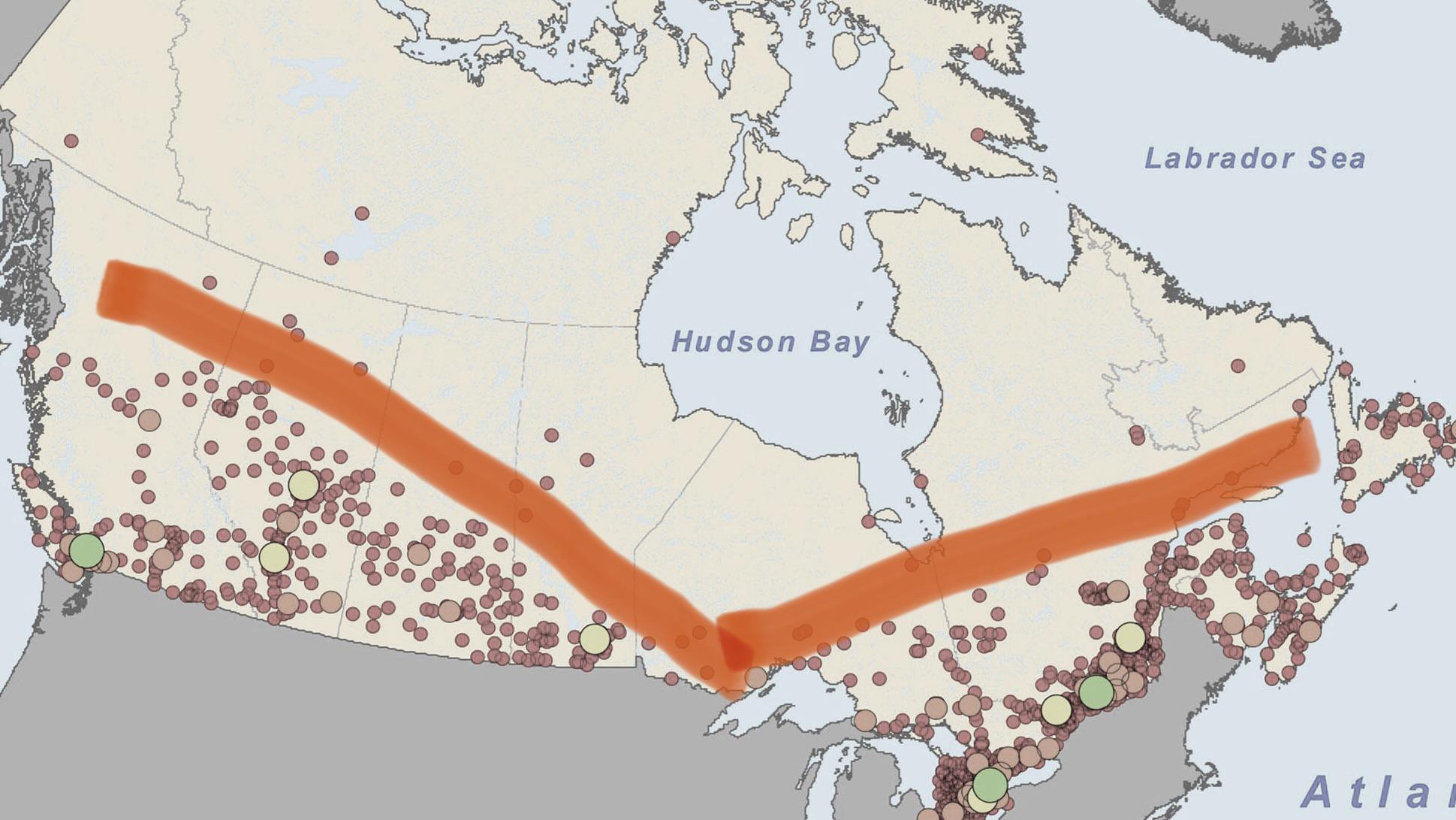
manufacturing belt
a historic, densely concentrated industrial region in the Northeastern and Midwestern United States and Southeastern Canada that dominated industrial production from the late 19th to mid-20th century
meech lake accords
a failed package of proposed Canadian constitutional amendments aimed at persuading Quebec to endorse the Constitution Act of 1982. It sought to decentralize federal power by recognizing Quebec as a "distinct society," granting provinces more veto power, and increasing control over immigration.
natural resources in north america
the abundant, naturally occurring materials—including fertile soil, massive forests, freshwater (Great Lakes), and extensive mineral/fossil fuel deposits (oil, coal, natural gas)
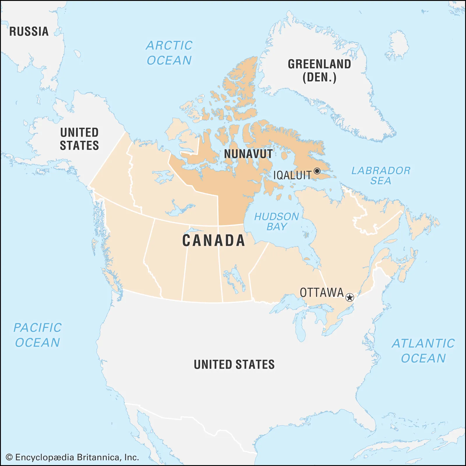
nunavut
means "our land" in Inuktitut, is Canada's largest, newest, and northernmost territory, officially established on April 1, 1999, from the eastern Northwest Territories. It is a vast, sparsely populated Arctic region encompassing most of the Canadian Arctic Archipelago, mainland tundra, and Hudson Bay islands, governed as an Inuit homeland.
parti quebecois
a sovereignist, social-democratic provincial political party in Quebec, Canada, advocating for the province's independence from Canada and the establishment of a sovereign state
piedmont
a hilly, gently sloping region at the base of a mountain range, acting as a transition zone between mountains and flatter land like a coastal plain
population size of the US
342 million, making it the third most populous country
population size of canada
41.5 million, characterized in geography as a small, highly concentrated population relative to its massive land area
provinces
a primary administrative, political, or territorial subdivision within a country or empire. Provinces are used to divide large territories into smaller, manageable units for local governance
quebec refrendum history (dates, key moments, etc.)
two province-wide votes in Quebec, Canada, that asked voters whether the province should pursue sovereignty (independence) from the Canadian federation. These votes took place in 1980 and 1995, both resulting in a victory for the "No" side (staying in Canada), with the 1995 vote being one of the narrowest margins in political history.
urbanization
the process where increasing percentages of a population move from rural to urban areas, leading to city growth, higher population densities, and the transformation of land for residential, commercial, and industrial use, fundamentally changing social, economic, and environmental landscapes
waters impact on climate modernization
the intersection of water, climate change, and modernization refers to how the anthropogenic acceleration of the water cycle (driven by climate change) interacts with human-dominated landscapes (urbanization, agriculture, and infrastructure) to alter water availability, risk, and management. This "modern" era, often termed the Anthropocene, is characterized by water being both a victim of climate change (floods/droughts) and a key tool for adaptation (water management).
wave 1 of immigration
Date Range: 1500-1820
Source Region: coastal europe (spain, english, dutch, etc) africa
Destination: northeast rural interior US
Push/Pull Factor: Religious persecution, wealth (natural resources land etc)
Volume: few thousand (very small)
wave 2 of immigration
Date Range: 1820-1890
Source Region: northwest europe (germans and irish)
Destination: northeast rural interior
Push/Pull Factor: political problems, land and agriculture (lots of farmers migrating)
Volume: 15 million
wave 3 of immigration
Date Range: 1890-1920
Source Region: southern and eastern europe (italian, jewish, Polish)
Destination: northeast urban centers
Push/Pull Factor: political problems, job opportunities (industrial)
Volume: 18 million
wave 4 of immigration
Date Range:1920-1965
Source Region: mexico
Destination: southwest urban centers
Push/Pull Factor: no strong motivator, just because they could
Volume: 8 million
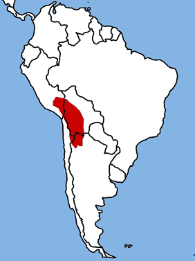
altiplano
the most extensive high-elevation plateau on Earth outside Tibet, located in west-central South America where the Andes are widest
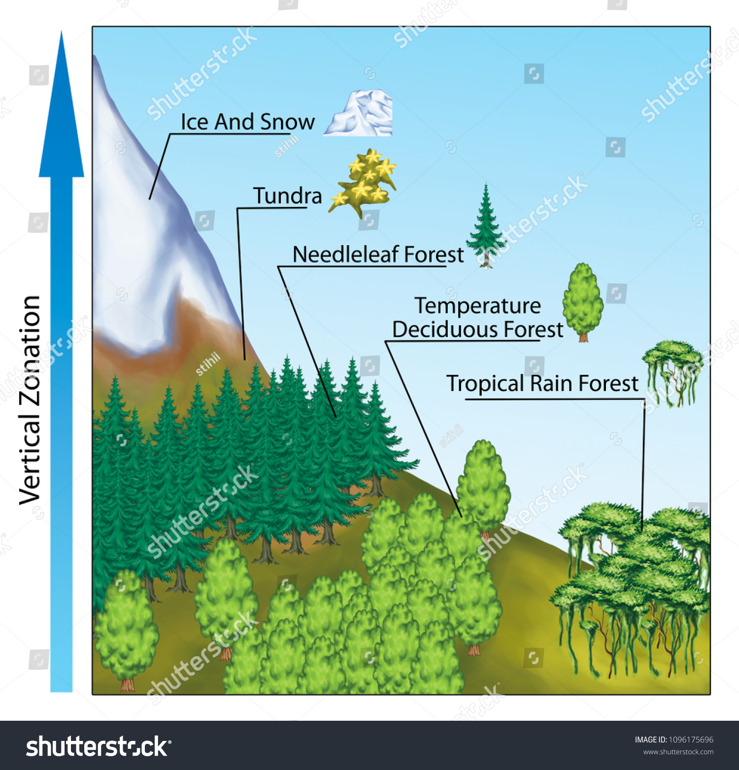
altitudinal zonation
the natural, vertical layering of ecosystems, vegetation, and animal species on mountain slopes caused by changing environmental conditions—like temperature, humidity, and pressure—as altitude increases
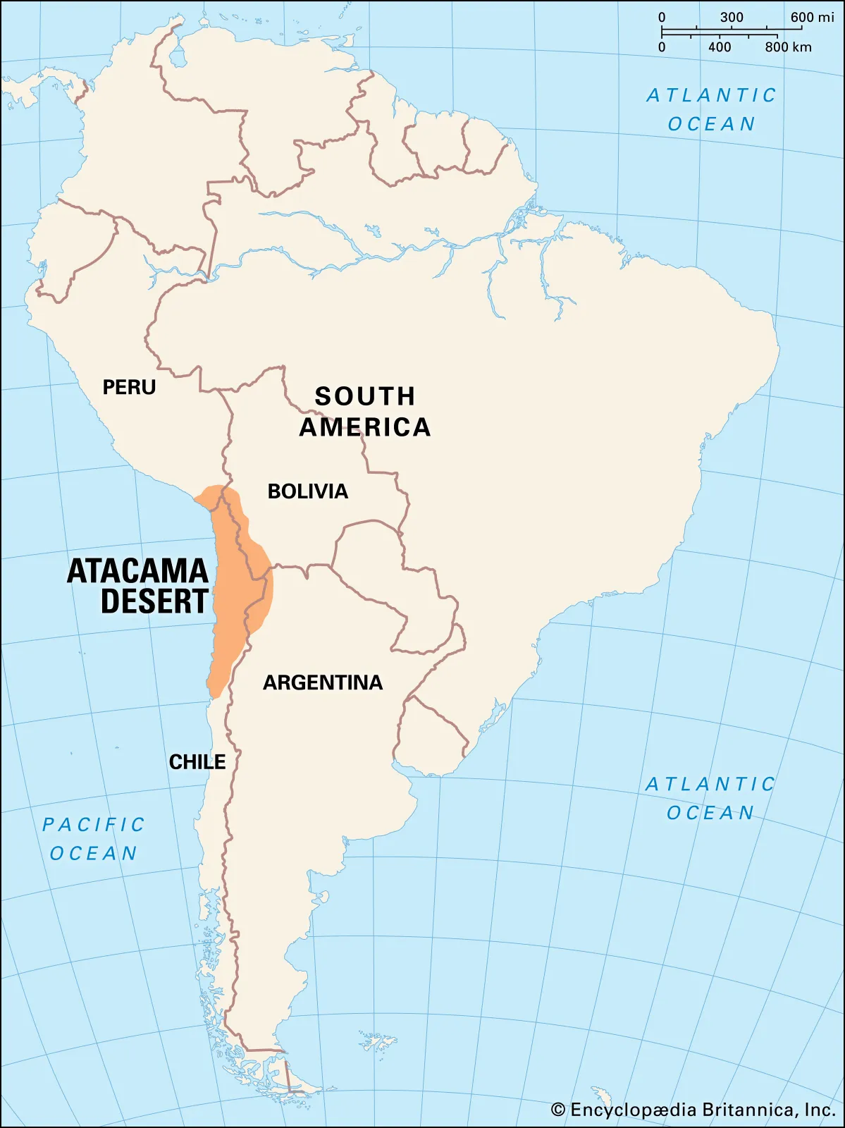
atacama desert
a 1,000-km (600-mile) long, nonpolar, hyperarid plateau in northern Chile, South America, located between the Andes Mountains and the Pacific Ocean
aztecs
Mesoamerican culture that established a powerful, tributary empire in Central Mexico from the 14th to 16th centuries, centered in the Valley of Mexico. Geographically, they were defined by their capital, Tenochtitlan, built on an island in Lake Texcoco. Their civilization relied on, and transformed, a highland lake ecosystem, utilizing advanced irrigation and agricultural techniques like chinampas.
barrios
a Spanish term for a neighborhood, district, or municipal division within a city, often characterizing, but not limited to, areas with a high concentration of Hispanic or Latino residents. Geographically, they represent distinct, often ethnically homogeneous urban enclaves that can reflect cultural identities, social networks, and histories of segregation or marginalization
economic variation
the highly uneven spatial distribution of economic activity, wealth, and development across the globe. Key drivers include climate, access to coastlines, natural resources, and, agglomeration effects where industries cluster for productivity, with high-income regions often concentrated in temperate zones, while tropical regions face, on average, lower economic output and higher, disease burdens.
economedia system
16th-century Spanish colonial institution, granted conquistadors the labor of indigenous populations in the Americas and Philippines in exchange for "protection" and religious education, though it functionally served as forced labor. It was pivotal for exploiting resources like agriculture and mining, transforming local economies.
european colonization
a transformative geographical process where European powers (Spain, Portugal, Britain, France, Netherlands, etc.) seized foreign territories, establishing global empires through settlement, resource exploitation, and political control
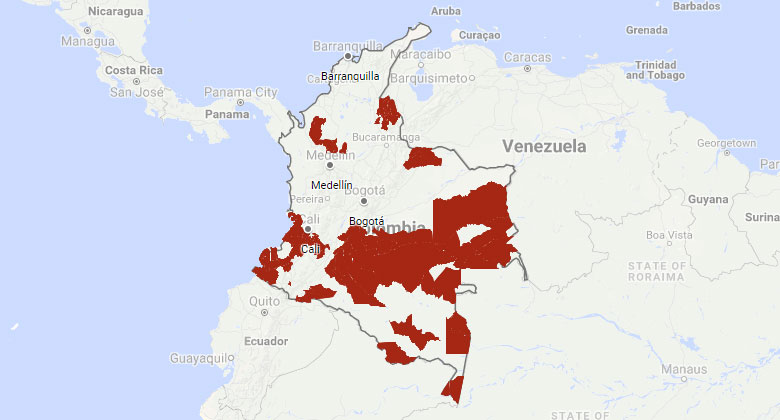
FARC
The Revolutionary Armed Forces of Colombia (1964–2016) were a Marxist-Leninist guerrilla group that historically controlled large, rural, and isolated, jungle-covered regions in Colombia, operating mostly in the southern and northeastern parts of the country. They leveraged difficult, underdeveloped, and mountainous terrain to establish "safe havens" and fund their operations.
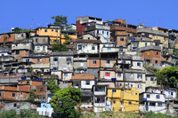
favelas
informal, low-income, and often illegal settlements in Brazil, typically located on the periphery or hillsides of major cities like Rio de Janeiro and São Paulo. Characterized by self-built, high-density housing, they lack formal infrastructure, property titles, and basic services (sanitation, water), reflecting rapid, uneven urban growth.
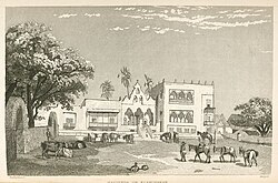
hacienda
a large landed estate or plantation in Spanish-speaking regions (primarily Latin America) originating from the colonial period, characterized by its role as a self-sufficient economic unit focused on agriculture, mining, or livestock
incas
a civilization (c. 1438–1533) that established the largest pre-Columbian empire in the Americas, centered in the Andean Mountains of South America with its capital at CuscoThey controlled a vast territory stretching from modern-day Colombia to Chile, mastering diverse, extreme environments—including high mountains, deserts, and jungles—through advanced engineering, terrace farming, and an extensive road network.
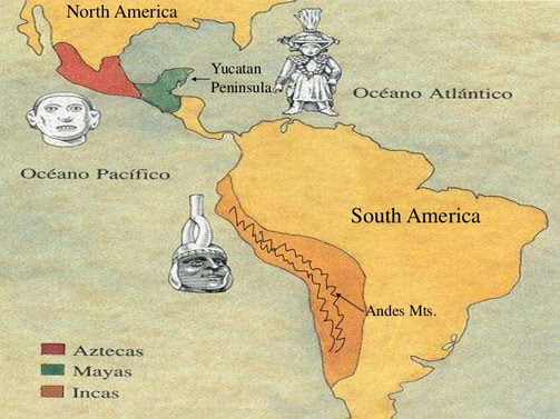
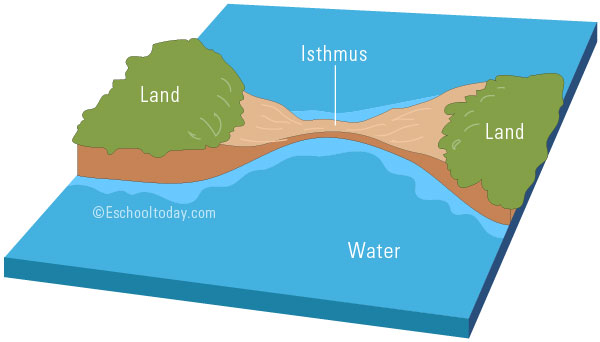
isthmus
a narrow strip of land connecting two larger landmasses and separating two bodies of water, acting as a natural bridge for land migration and a strategic point for trade, famously seen with the Isthmus of Panama
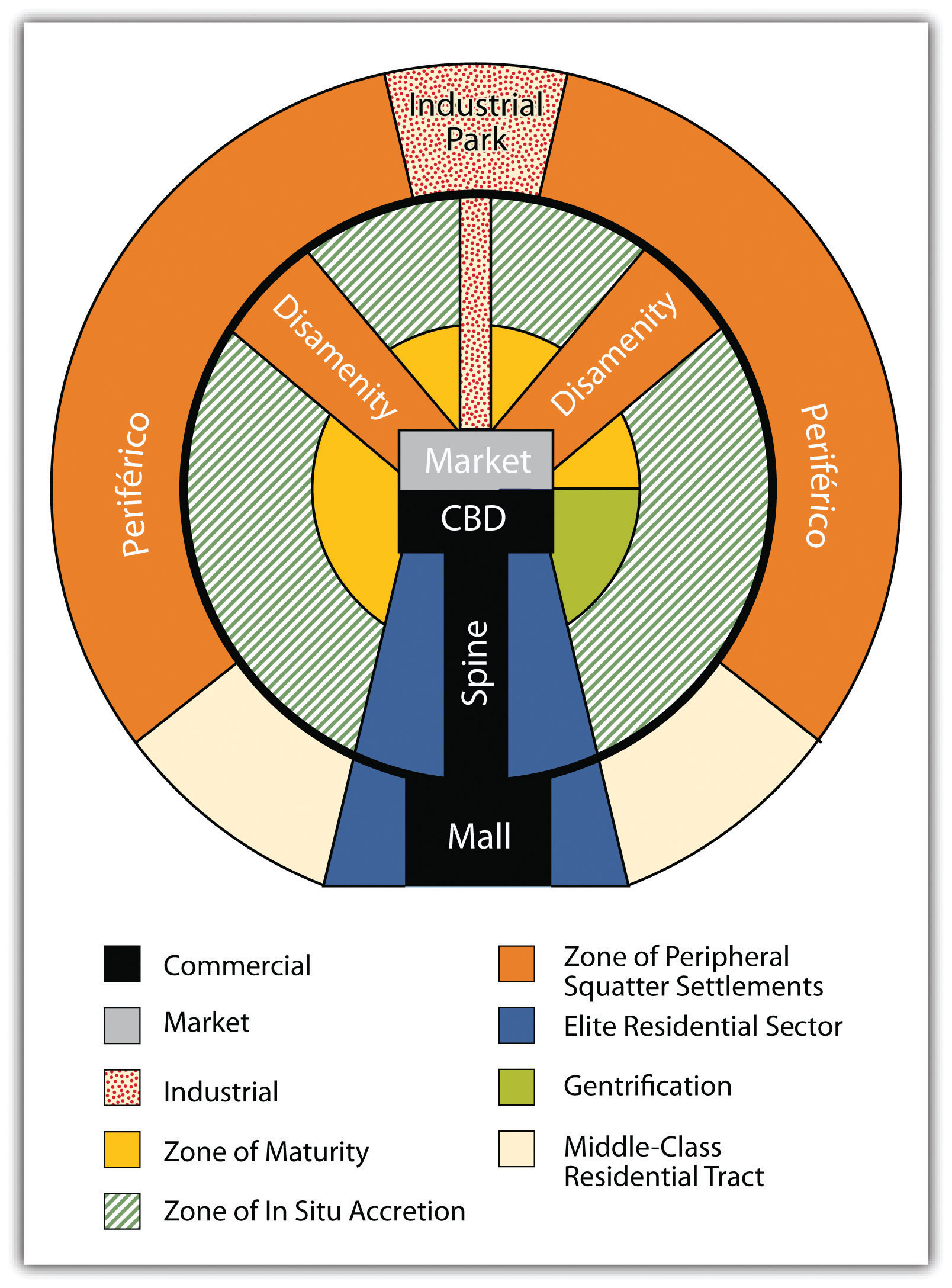
latin america city model (elements and descriptions)
a theoretical framework in geography developed by Ernest Griffin and Larry Ford in the early 1980s to describe the distinctive structure of urban areas in Central and South America. It combines traditional, colonial-era elements with modern, globalized sectors, characterized by a, high-density, high-class, wealthy core that transitions to low-income, informal housing on the periphery—an "inverted" pattern compared to many North American cities.
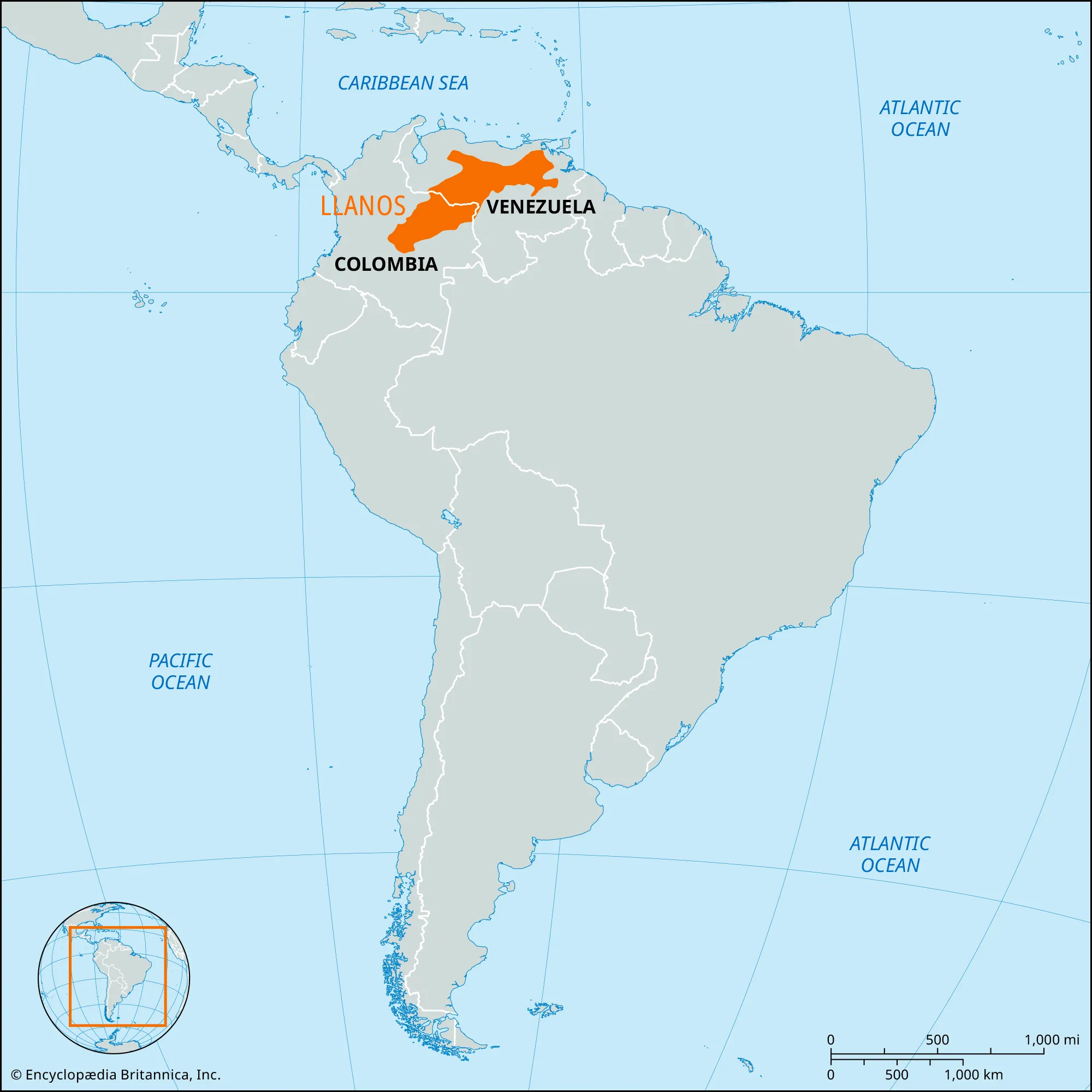
llanos
a vast tropical grassland plain situated to the east of the Andes in Colombia and Venezuela
Machu Picchu
a 15th-century Incan citadel situated on a mountain ridge at 2,430 meters (7,970 ft) in the Andes Mountains of Peru, above the Urubamba River valley
mayas
indigenous civilization and modern ethnic group hailing from Mesoamerica—specifically southern Mexico (Yucatán, Chiapas), Guatemala, Belize, and parts of Honduras/El Salvador. They are defined by their historically continuous occupation of diverse environmental zones, including the northern limestone lowlands and southern volcanic highlands.
mountains (impacts of)
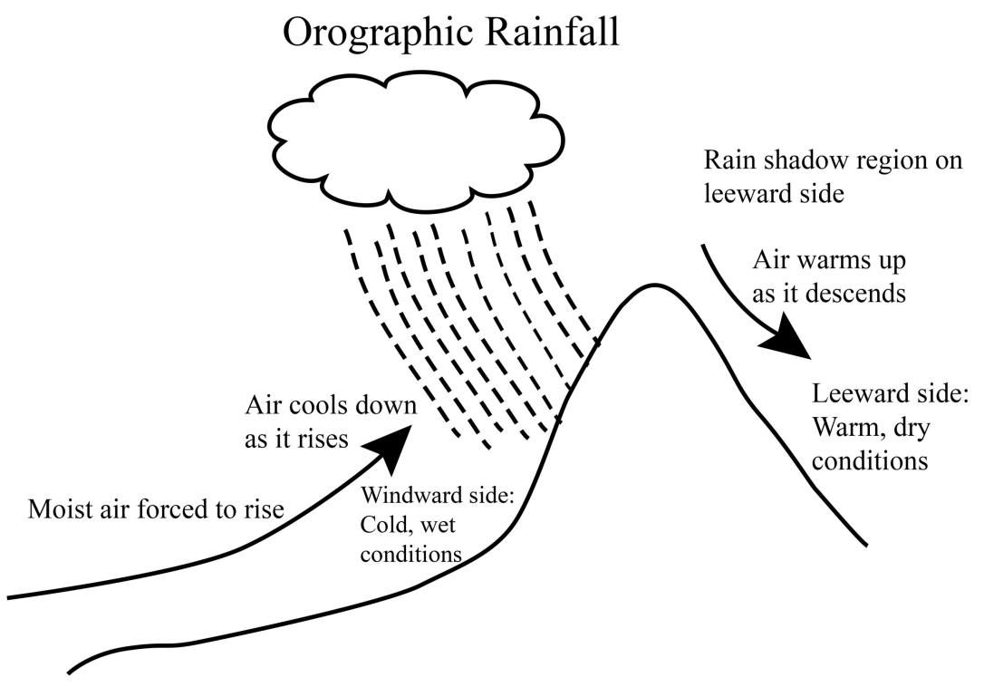
the profound ways in which high-elevation, steep-sloped landforms shape physical and human environments. They act as natural climate barriers (creating rain shadows), define political boundaries, supply freshwater, and influence ecosystems, while also restricting transport and shaping cultural development.
orographic precipitation
moisture-laden air forced to rise and cool over elevated terrain, such as mountains, causing condensation and heavy rain or snow on the windward side
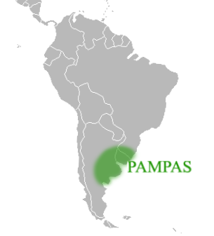
pampas
vast, fertile South American lowland plains characterized by extensive grasslands, rich soil, and a temperate climate, primarily located in Argentina, Uruguay, and southern Brazil
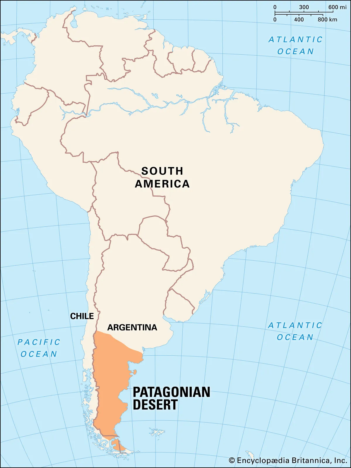
patagonia
a vast, sparsely populated geographic region covering the southern tip of South America, shared by Chile and Argentina
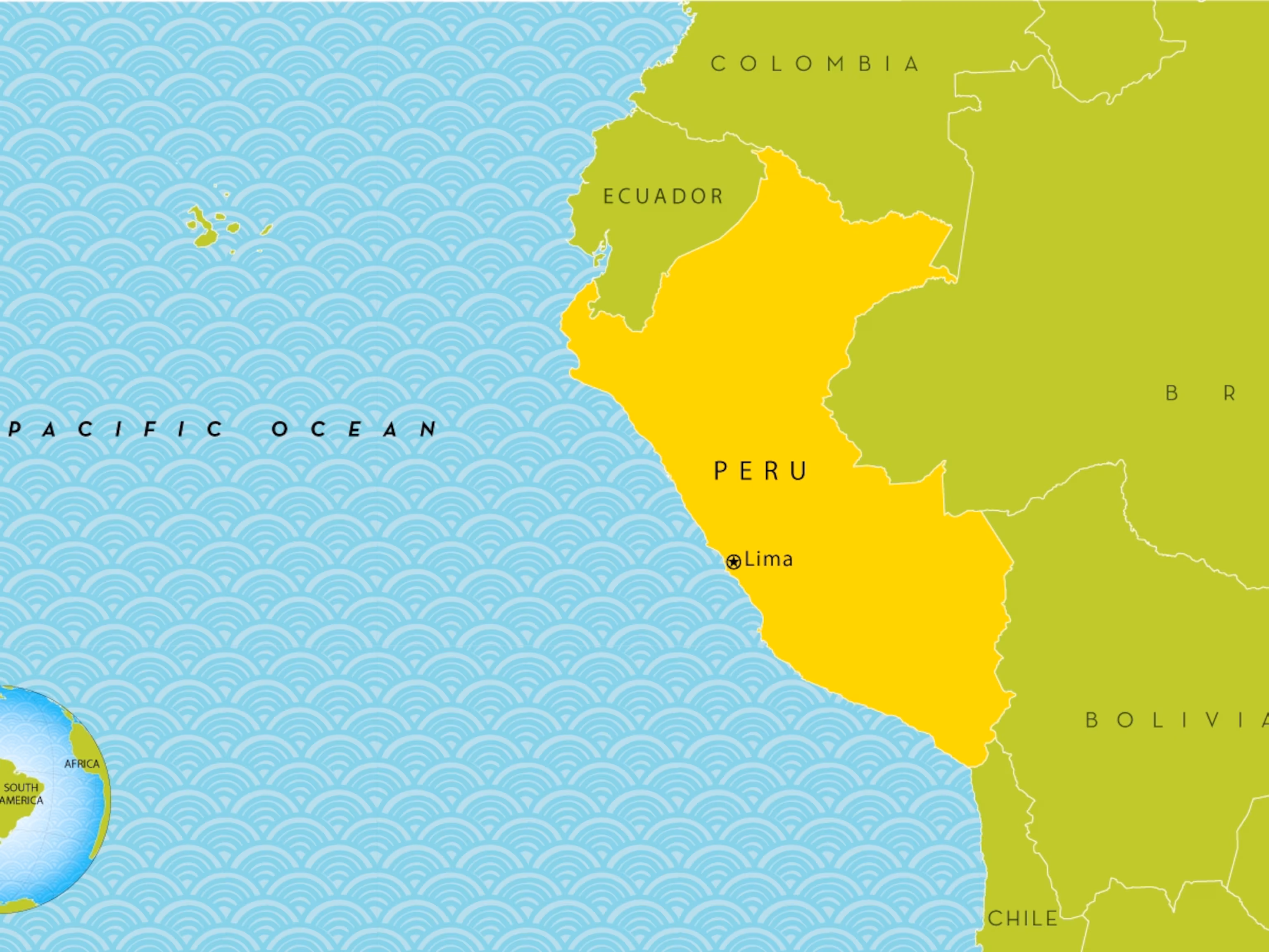
peru
a country in western South America, defined by three distinct longitudinal geographical regions: a narrow arid coastal plain, the high-altitude Andes Mountains, and the eastern Amazon Basin rainforest
religious unity
the spatial, social, and cultural cohesion of a population based on shared religious beliefs, practices, and institutions. It acts as a centripetal force—a force that unifies people and strengthens social stability within a particular territory.
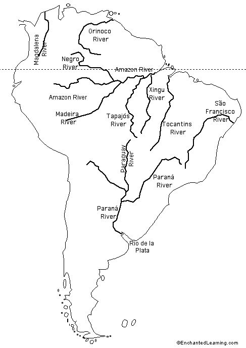
rivers in latin america
immense, biodiversity-rich waterways primarily located in South America, flowing east from the Andes Mountains into the Atlantic Ocean. Major systems, including the Amazon (world's largest) and Orinoco, are critical for regional transportation, irrigation, and hydropower, often defining national boundaries and ecological zones.
urbanization
the process where increasing percentages of a population move from rural to urban areas, leading to city growth, higher population densities, and the transformation of land for residential, commercial, and industrial use, fundamentally changing social, economic, and environmental landscapes
tropical deforestation
the widespread clearing, removal, or burning of forest ecosystems in tropical regions, largely driven by human activities like industrial agriculture, ranching, logging, and infrastructure development. It involves converting forested land to non-forest uses, causing significant biodiversity loss, soil degradation, and increased greenhouse gas emissions.
wave 5
Date range: 1965-today
Source Region: asia & latin america
Destination: costal metropolitan areas (LA, Chicago, etc.)
Push/Pull factor: civil war and perscecution, better quality of life
Volume: 72 million