Looks like no one added any tags here yet for you.
Human Geography
Study of the events and process that have shaped how humans understand, use, and alter the Earth
Absolute Location
The exact location of an object, usually expressed in coordinates of longitude and latitude
Relative location
Description of where a place is in relation to other places or features
Site
Absolute location and physical characteristics of a place
Situation
A place's location in relation to other places or the surrounding features
Density
Number of things- people, animals, objects- in a specific area
Flow
Of people, goods, and information and the economic, social, political, and cultural effects of these movements on society
Pattern
How things are arranged in a particular space
Distribution
Arrangement of things in a given place
Distance decay
The trailing-off phenomenon of diminishing contact with the increase in distance
Environmental possiblism
Argues that humans a are active agents in determining their behaviors
Sustainability
The use of earths land and natural resources in ways that will be available in the future
Scales of analysis
Global, regional, national, state, local
Region
Area of earths surface with certain characteristics that make it distinct from others
Wallerstein World Systems Theory
1970: describe the spatial and functional relationship between countries in the world economy
Cartography
The science of map making
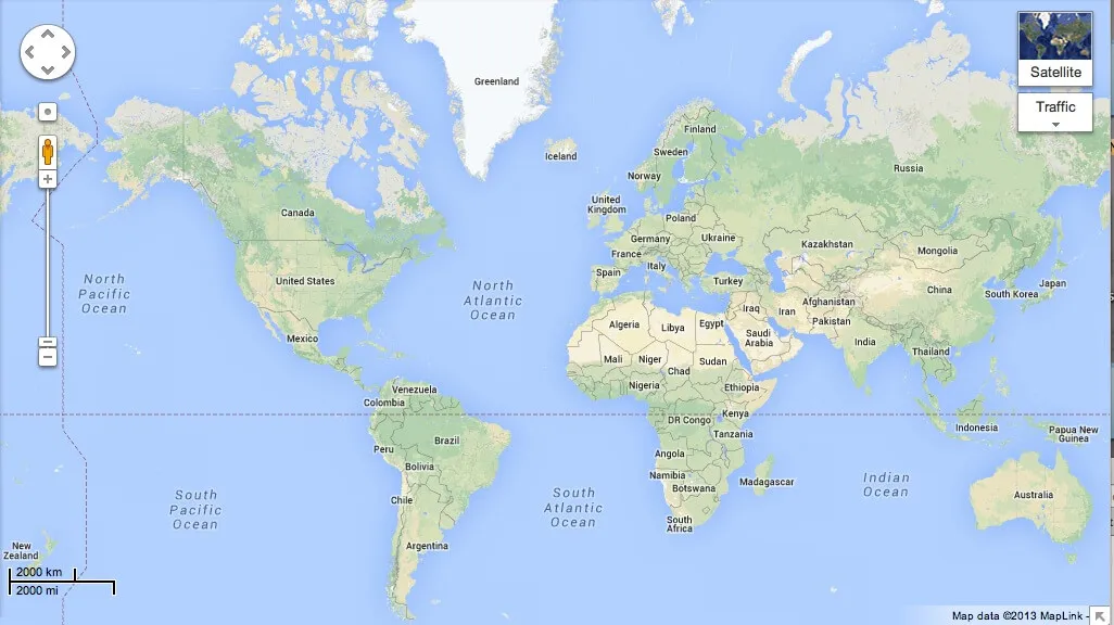
Mercator projection
•shows true direction •good for navigational purposes •distorts area •distorted near poles
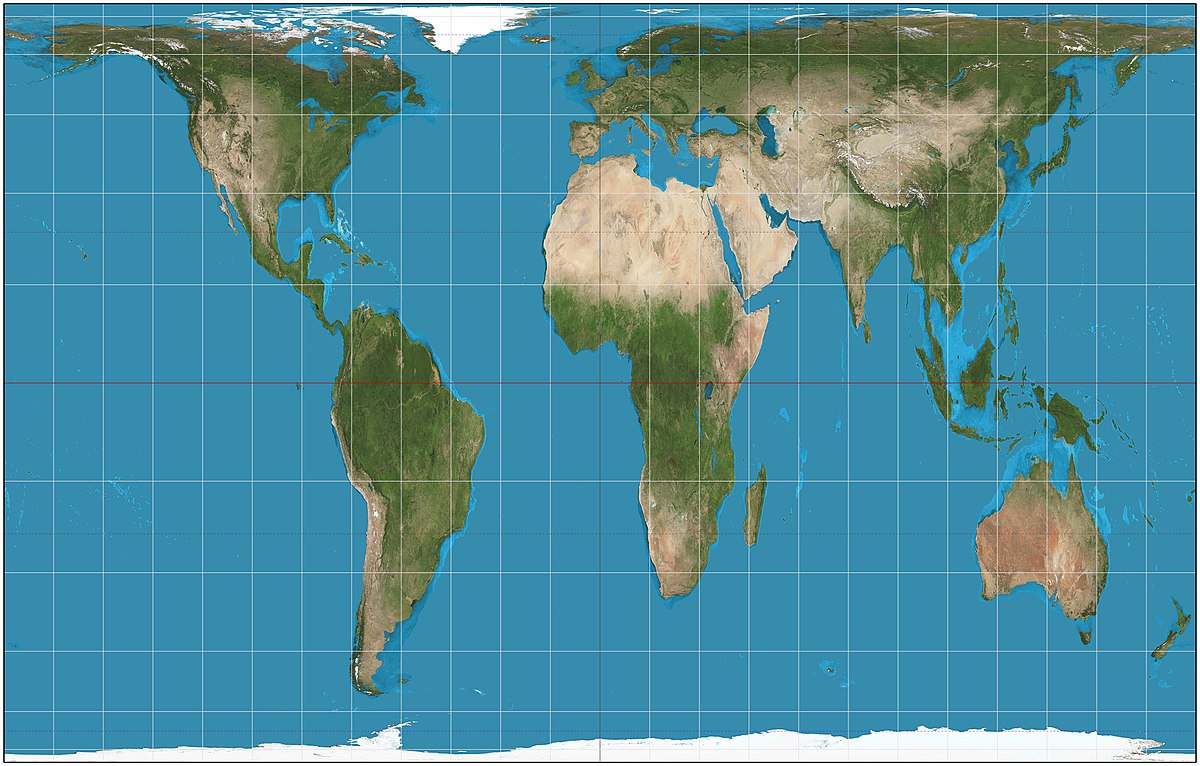
Galls-Peter Projection
•shows true direction •area is relatively precise •distorts shape •continents appear elongated
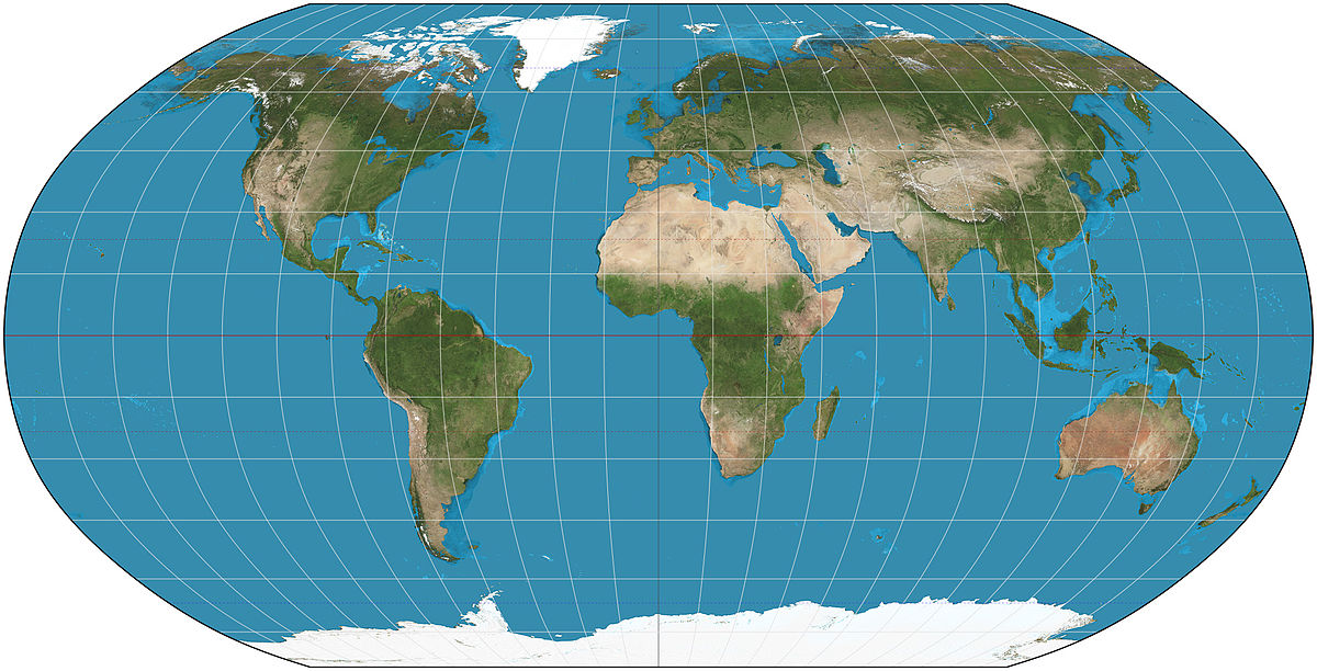
Robinson Projection
•appearance” looks real” •distorts size and shape, but not too much •imprecise measurements •extreme distortion of poles; flat on poles, compressed on equator
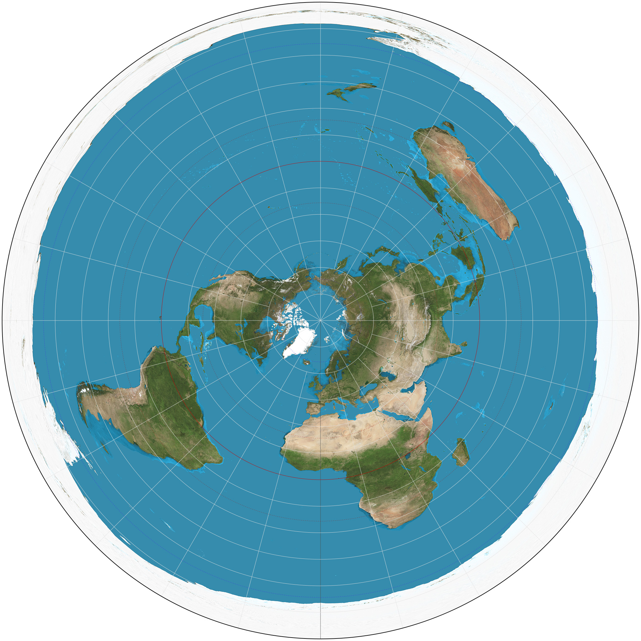
Azimuthal Projection
•practices direction •when used from the point of North Pole, no country seen as center •distorts shape and area •only shows 1/2 of Earth
Isoline Map
Uses lines of equal value to represent data like elevation, barometric pressure, or temperature
Chloropeth Map
A variable is depicted with shading, patterns, or colors
Proportion symbol map
Size of the symbol varies in proportion to the intensity of the mapped variable
Dot map
A dot represents some frequency of the mapped variable
Cartogram map
Uses relative size of political unites to convey value
The goal of geography
Identify and explain equal patterns and processes of humans and the physical environment
Geographic Positioning System (GPS)
Gives us an absolute or mathematical location (longitude and latitude)
Geographic Information System (GIS)
A computer system that stores and queries data stored in LAYERS
Space-Time Compression
Describes shrinking of relative distance between places due to advance in transportation and communication (importance of globalization)
Globalization
Expansion of economic, cultural, and political process on a worldwide scale
Quantitive data collection
Information measured by numbers
Qualitative data collection
Interpretation of data
Physical Geography
Study of where things are found on earths surface and the reasons for their locations