March Airport Info
1/42
There's no tags or description
Looks like no tags are added yet.
Name | Mastery | Learn | Test | Matching | Spaced |
|---|
No study sessions yet.
43 Terms
What is the elevation of March Airport?
750 Feet ASL
What is the magnetic variation for March Airport?
5 degrees east
What are the geographic coordinates for March Airport?
N 51 14 52 | W 96 00 06
What is the MF area for March Airport?
5NM centered on interesections 09/27+14/32. Capped at 3800 feet ASL (3000 AAE)
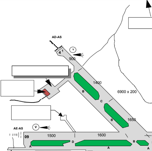
What are the dimensions of runway 09/27?
200 feet wide + 8800 feet long
What are the dimensions of runway 14/32?
200 feet wide + 6900 feet long
State the runway headings for all runways (09,27,14,32)
090°, 270°, 140°, 320°
What is the MF frequency for March airport?
122.3 MHz
What is the VCS frequency for March Airport?
122.6 MHz
What is the frequency for Midtown (MDZQ) ACC?
119.4 MHz / 247.5 UHF
What is the emergency frequency FSS monitors?
121.5 MHz / 243.0 UHF
What approaches are available for Runway 09?
ILS
What approaches are available for Runway 27?
RNAV(GNSS) Z RWY 27
What approaches are available for Runway 14?
NDB RWY 14
What approaches are available for Runway 32?
VOR/DME RWY 32
What lighting is available for Runway 09/27?
High intensity (HI)
What lighting is available for runway 14/32?
Medium intensity (ME)
What type of approach lighting is available for runway 09/27?
AE,AS,TE(HI), V2
What type of approach lighting is available for runway 14/32?
AD, AS, TE(ME), V1
How wide are all taxiways at march airport?
75 feet wide
Which taxiways are designated as Rapid Exit?
D,E
How many aprons are available at march airport? What are they?
3, Main/North/East
Where is the helipad located on March Airport? Dimensions/surface pavement? What kind of lighting?
South of east apron, 126 FT circular concrete&turf, RF(FL)
Where do itinerant aircraft park when arriving to march airport?
East side of main apron
Where do aircraft clearing customs park?
Northwest corner of main apron
Where are aircraft plug-in spots located?
East apron: south wall of TC hangar.
For itinerant: East side of main apron.
Where are aircraft tie-down spots located?
East apron, next to TC hangar
What height are circuits to be performed at March?
1800 feet ASL
Which circuits are left hand?
09+14
Which circuits are right hand?
27+32
State the dimensions of the flight training area near march
15NM to 20NM south of the airport.
Western edge: road to eganville
Eastern edge: bearing 180° from airport
Vertical dimensions: sfc to 5000feet ASL
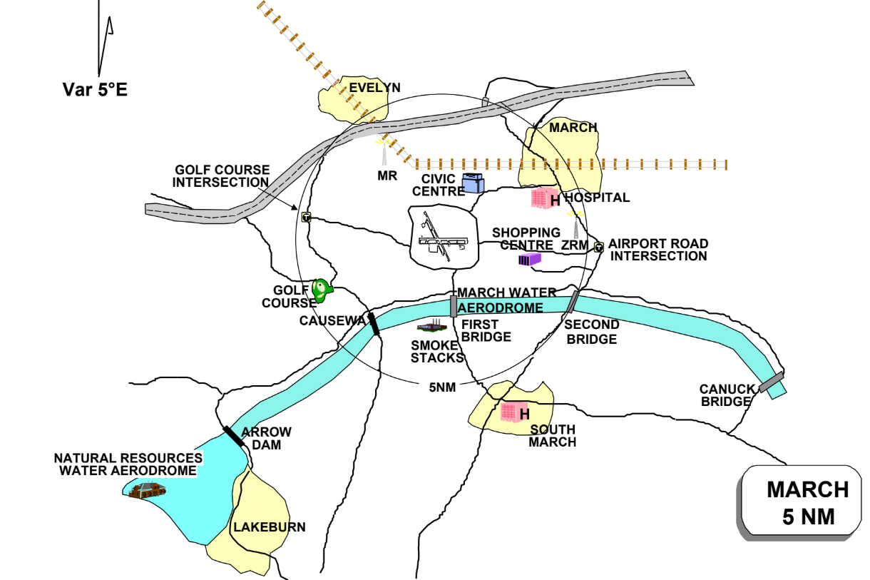
What is the highest obstacle within the March MF area?
Hydro power station SMOKE STACKS, located 3.1 NM South of aerodrome (Bearing 185°), 300 feet AGL; 1050 ASL
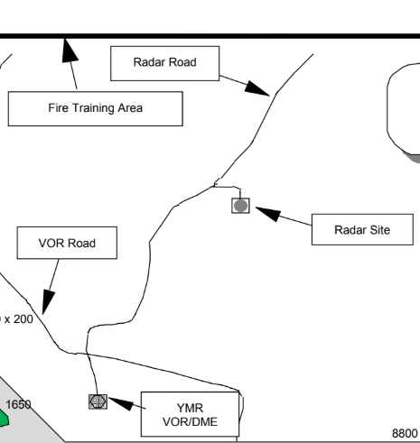
Label the following locations on march airport(NE) (top to bottom)
Radar Site/Radar Road/YMR VOR/DME
Label the following locations on march airport(NW) (top to bottom)
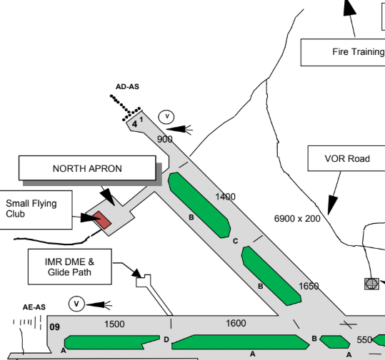
Fire training area/North Apron/Small flying club/IMR DME&Glide path
Label the following locations on march airport(SW) (top to bottom)
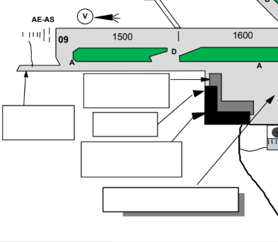
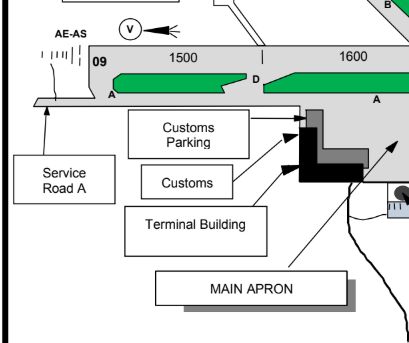
Customs parking/Service road A/Customs building/Terminal building/Main apron
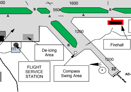
Label the following locations on march airport(S) (top to bottom)
Firehall/ De-ice area/FSS Station/Compass swing area
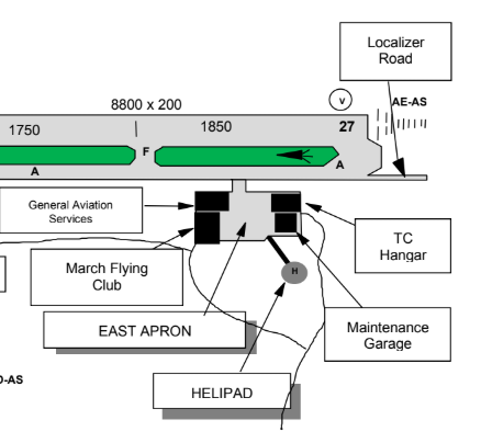
Label the following locations on march airport(SE) (top to bottom)
Localizer Road/TC Hangar/G.A.Services Hangar/March Flying Club/East Apron/Maintenance garage/Helipad
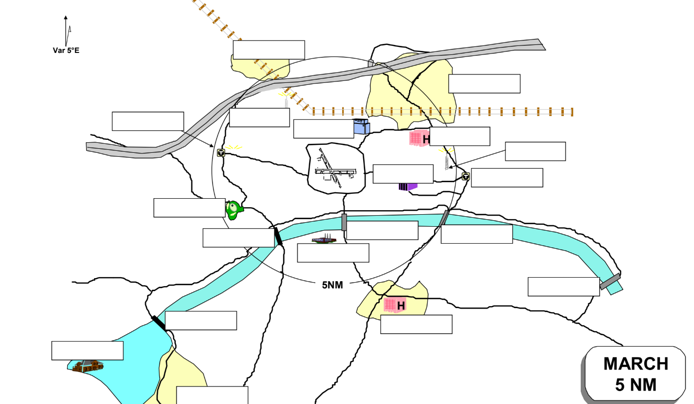
Label all locations from the 5NM march airport chart
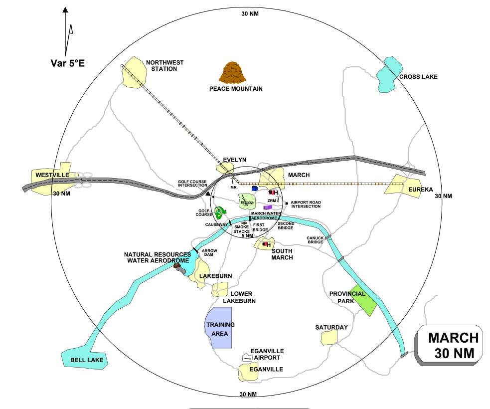
Label all locations from the 30NM march airport chart
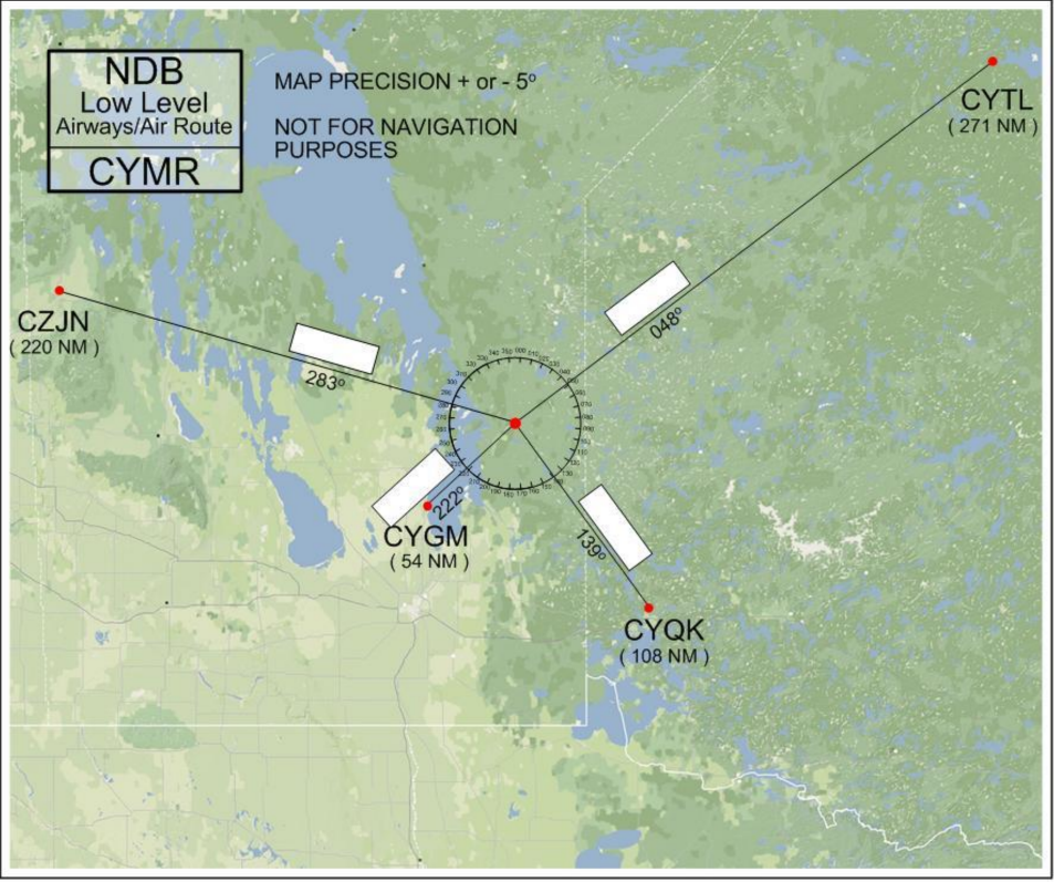
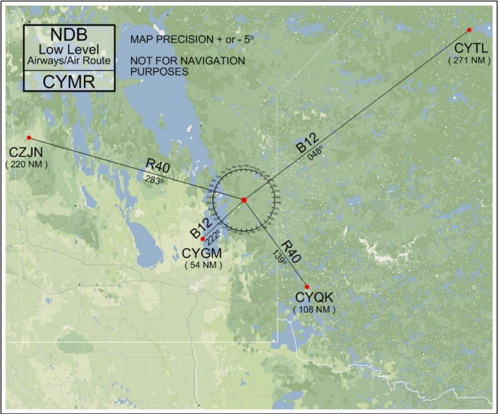
Label all routes from the low level NDB chart
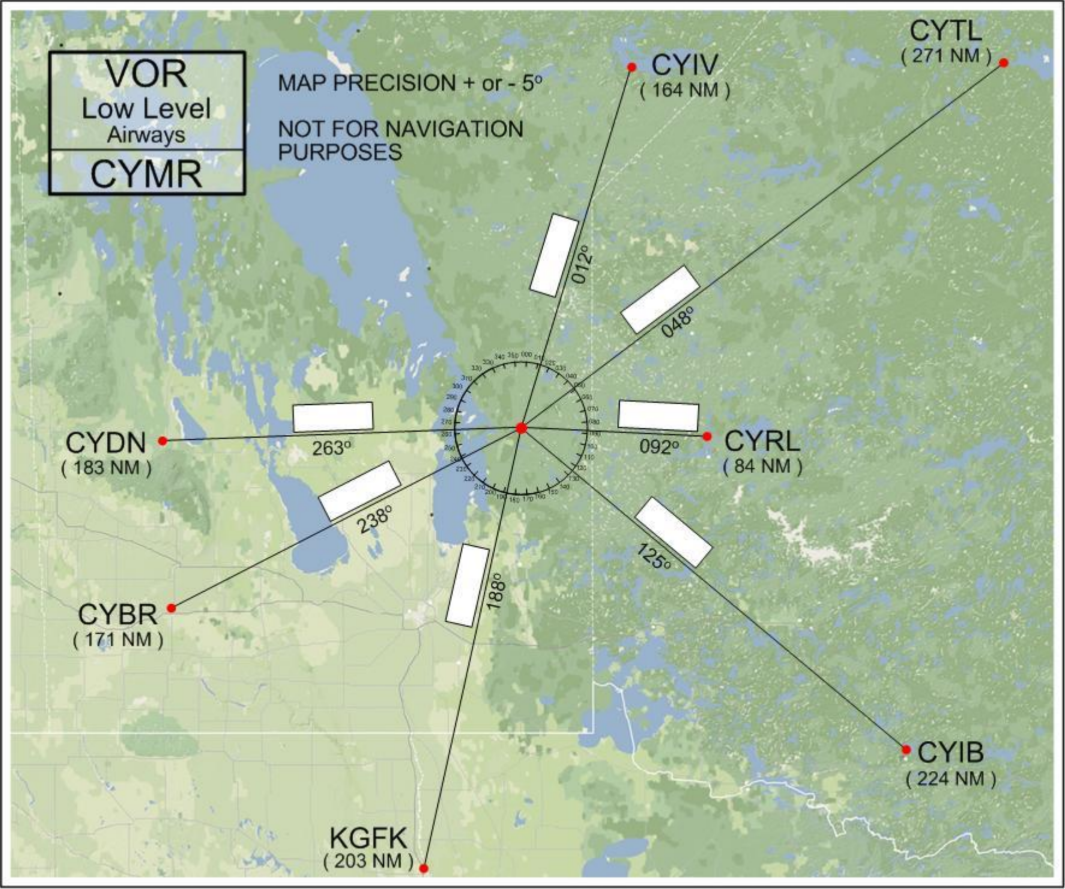
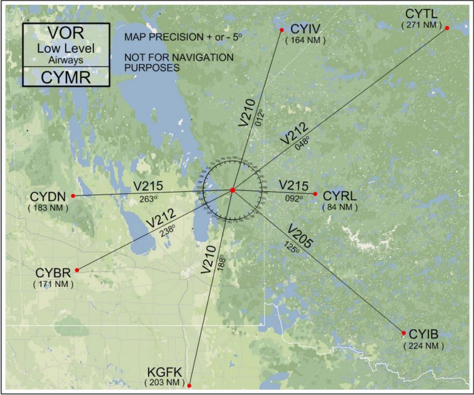
Label all routes from the low level VOR chart
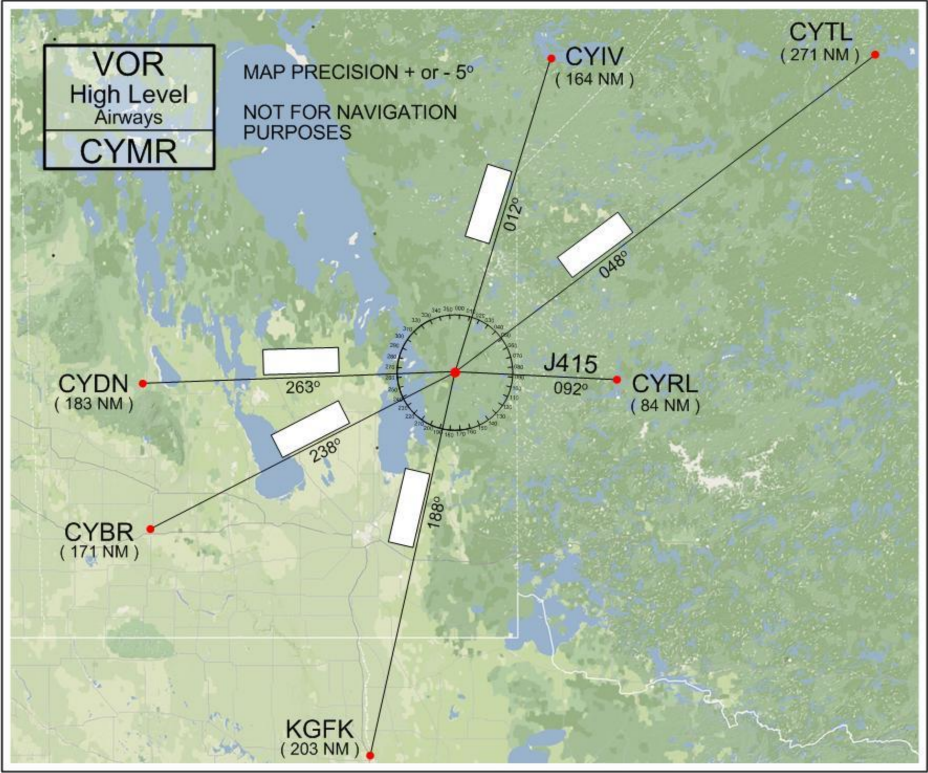
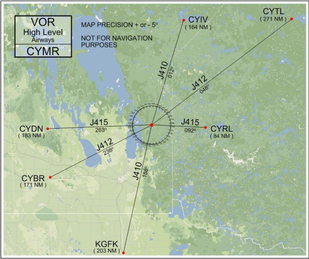
Label all routes from the high level VOR chart