Video - Maps and Dispersion (Vocabulary Flashcards)
1/27
Earn XP
Description and Tags
Vocabulary flashcards covering dispersion concepts, reference and thematic maps, map projections, and distortion.
Name | Mastery | Learn | Test | Matching | Spaced |
|---|
No study sessions yet.
28 Terms
Dispersion
Spread of a phenomenon over an area; how far things are spread out.
Clustered (agglomerated)
Spatially close together.
Dispersed/Scattered
Spread out.
Reference Map
Displays boundaries and names to identify geographic areas; used for locating features.
Thematic Maps
Maps designed to illustrate a specific theme or variable across geographic areas (e.g., distribution, density).
Choropleth Map
A thematic map that uses colors or shading, easy to recognize distribution
Dot (Density) Map
A thematic map that uses dots to show the distribution or density of a phenomenon.
Isoline Map
Familiar with topographic maps and terrain representations, continuous phenomenon
Proportional Symbol Map
A thematic map where symbol size is proportional to a data value.
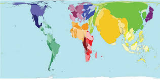
Cartogram Map
A map in which geographic areas are distorted in size to reflect a variable’s value.
Robinson Projection
A compromise projection with somewhat distorted polar regions; land area and shape are fairly accurate, especially at the eastern and western edges.
Mercator Projection
Preserves direction and shapes but greatly exaggerates size at high latitudes; poles appear much larger than in reality.
Goode's Interrupted Equal-Area Projection
Shows true size and shape of land masses, but distances are distorted; interrupted to reduce distortion.
Equal-Area Projection
Preserves area across the map, but shapes and distances may be distorted.
Map Distortion
Alteration of shape, distance, relative size, or direction caused by projecting the earth onto a 2D map.
Shape Distortion
Distortion of geometric shapes on a map projection.
Distance Distortion
Alteration of distances between locations on a projection.
Relative Size Distortion
Distortion of the apparent size of geographic areas on a projection.
Direction Distortion
Distortion of directional relationships (angles) on a projection.
Map Distortions
Relative size, Distance, Shape, and Direction

Cartogram
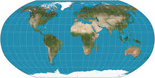
robinson projection
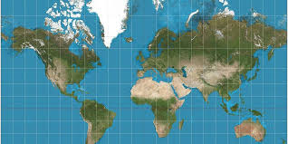
mercator projection
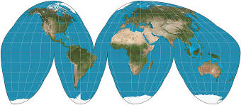
goodes equal area interrupted map
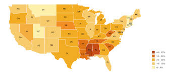
choropleth map
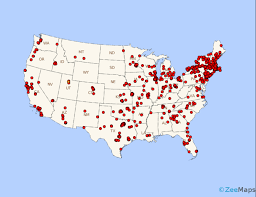
dot (density) map
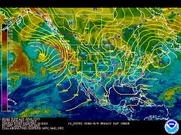
isoline map
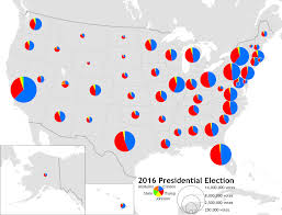
proportional symbol map