APES - Unit 4
1/101
There's no tags or description
Looks like no tags are added yet.
Name | Mastery | Learn | Test | Matching | Spaced |
|---|
No study sessions yet.
102 Terms
Trophosphere
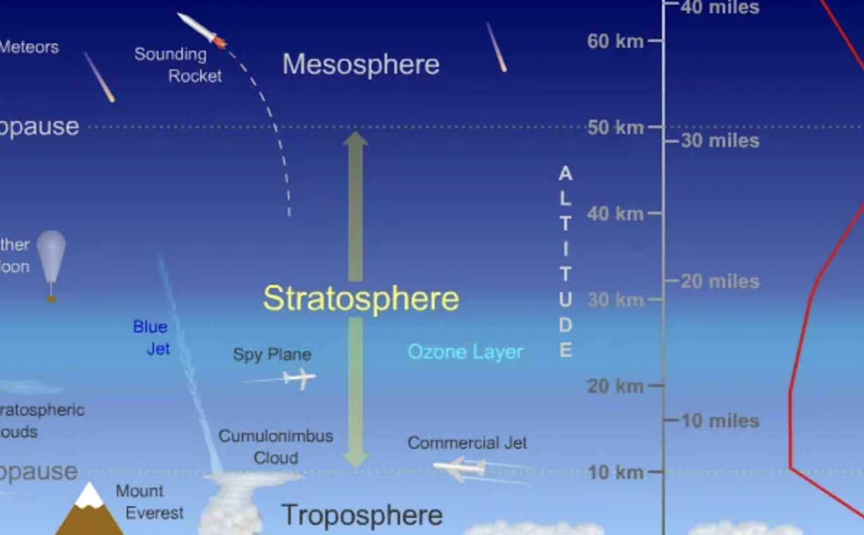
The lowest layer of Earth's atmosphere, where weather occurs and where most of the atmosphere's mass is found.
Stratosphere
The layer above the troposphere, characterized by a temperature increase with altitude and containing the ozone layer.
Albedo
The percentageof incoming solar radiation that is reflected by a surface.
Determine how Air circulates in the atmosphere: Saturation point
The maximum amount of water vapor that air can hold at a given temperature and pressure, beyond which condensation occurs.
Determine how Air circulates in the atmosphere: Air density
Less dense air rises —> warm (heat rises)
More dense air sinks —> cold air has less water vapor and is generally heavier than warm air. This difference in density drives atmospheric circulation patterns.
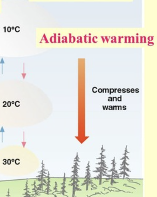
Adiabatic Heating
The process by which the temperature of an air parcel increases as it is compressed due to rising pressure, without heat exchange with the surrounding environment.
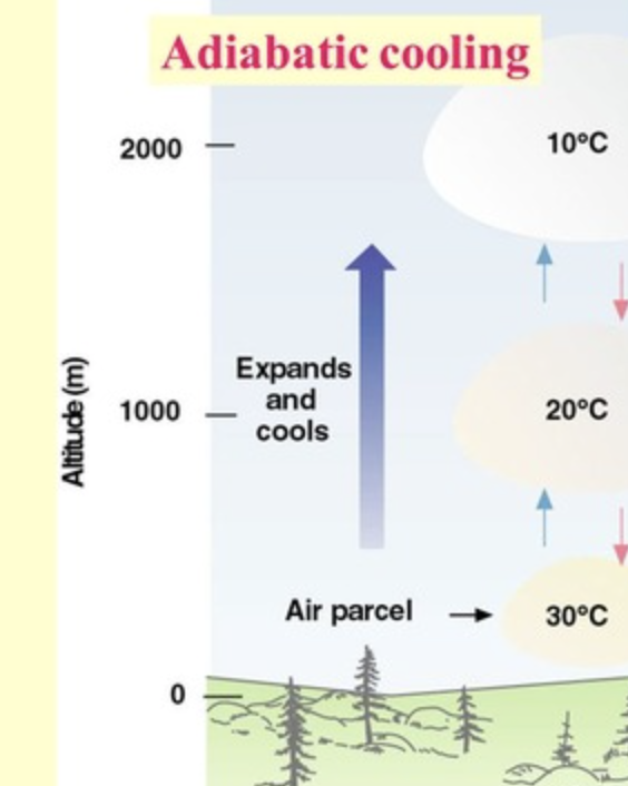
Adiabatic Cooling
The process by which the temperature of an air parcel decreases as it expands due to decreasing pressure, without heat exchange with the surrounding environment.
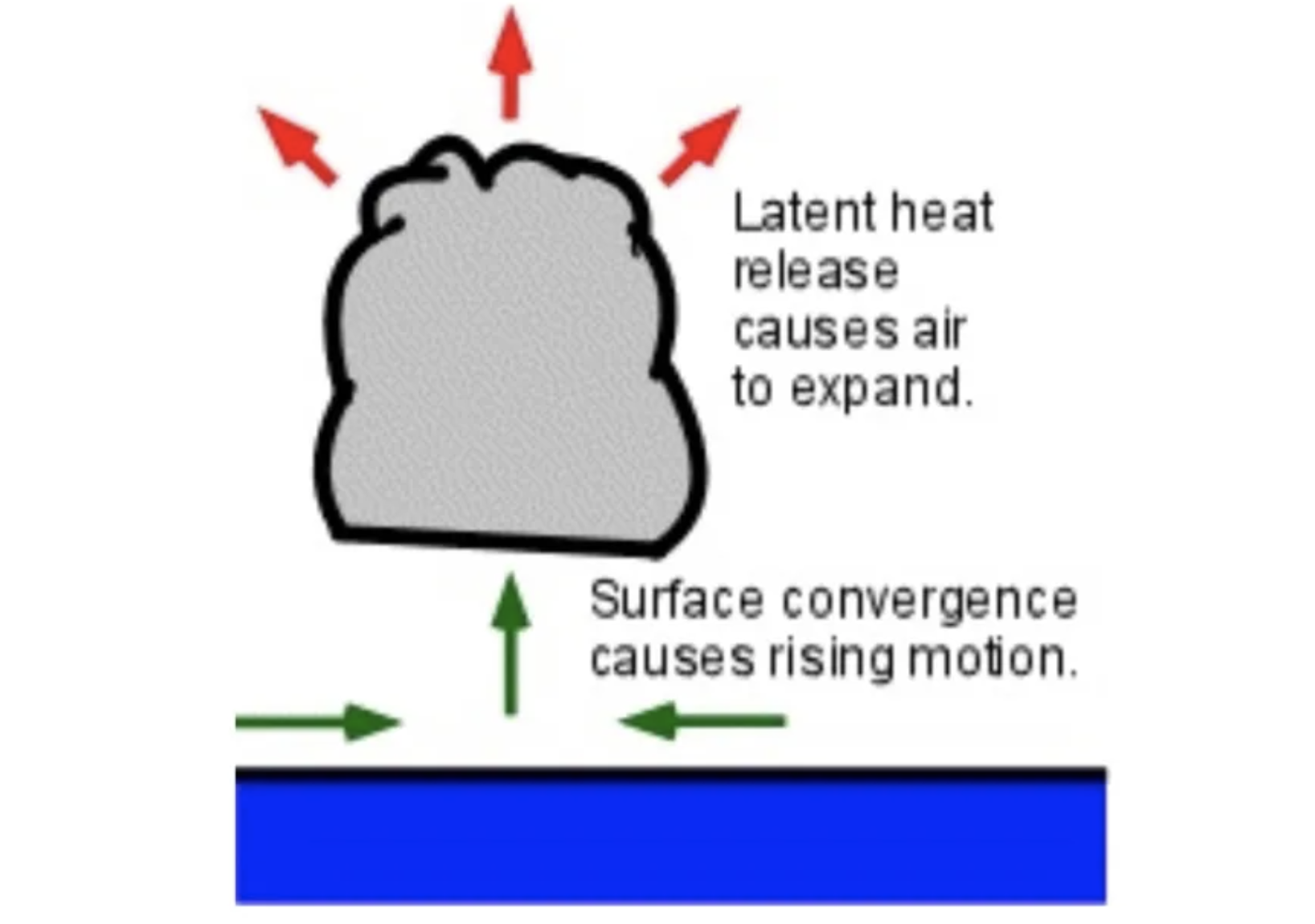
Latent Heat Release
The heat released when water vapor condenses into liquid water, warming the surrounding air and contributing to atmospheric processes.
Atmospheric Convection Currents
The vertical movement of air in the atmosphere, driven by temperature differences, which creates wind patterns and influences weather systems.
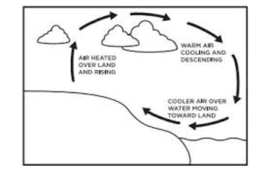
Hadley Cell
A large-scale atmospheric circulation pattern that occurs in tropical regions, characterized by rising warm air at the equator and sinking cooler air at about 30 degrees latitude, leading to trade winds.
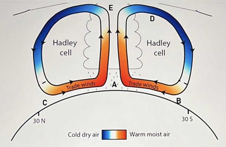
Intertropical Convergence Zone (ITCZ)
A region near the equator where trade winds from the northern and southern hemispheres converge, leading to frequent thunderstorms and heavy rainfall.
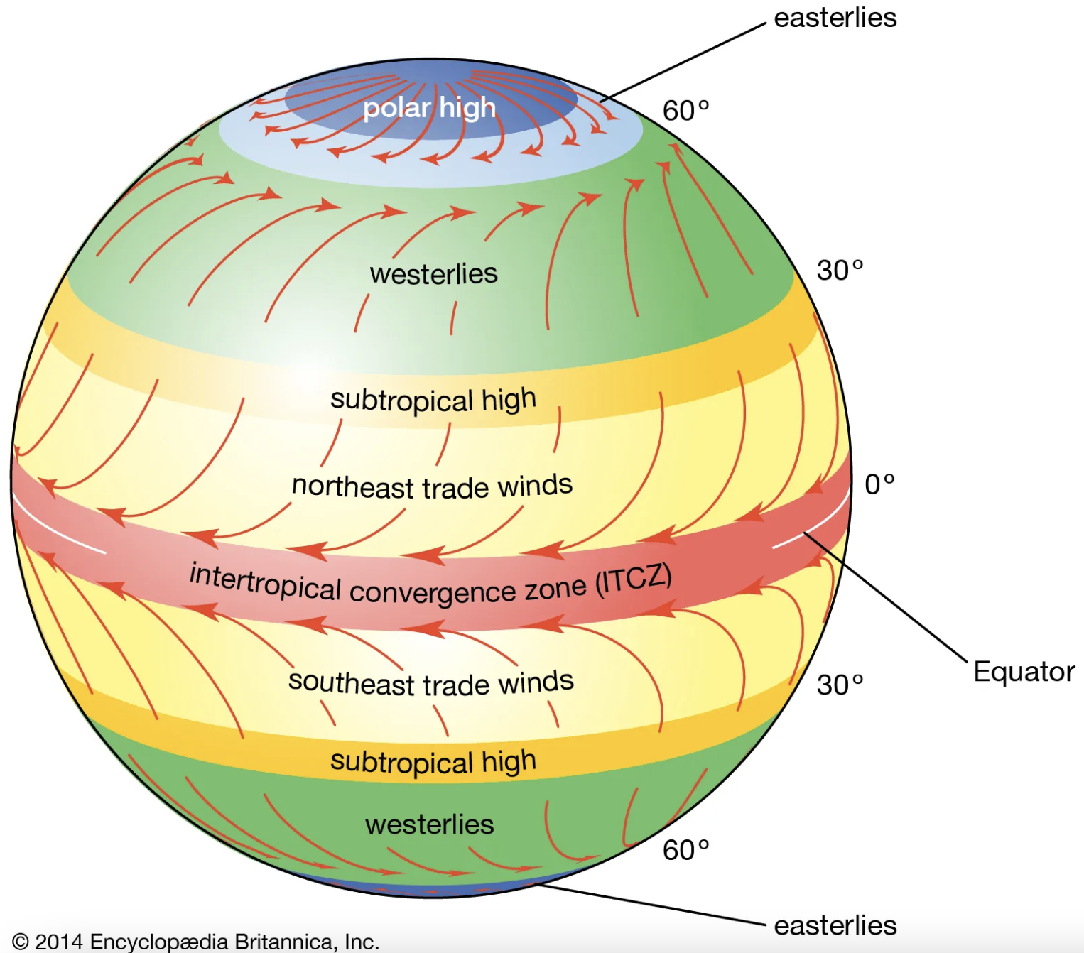
Polar Cell
A large-scale atmospheric circulation pattern found in polar regions, characterized by sinking cold air at the poles and rising air around 60 degrees latitude, influencing polar weather.
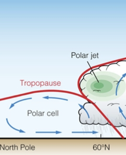
Ferrel Cell
A large-scale atmospheric circulation pattern located between the Hadley and Polar Cells, characterized by rising air around 60 degrees latitude and sinking air around 30 degrees latitude, influencing mid-latitude weather patterns.

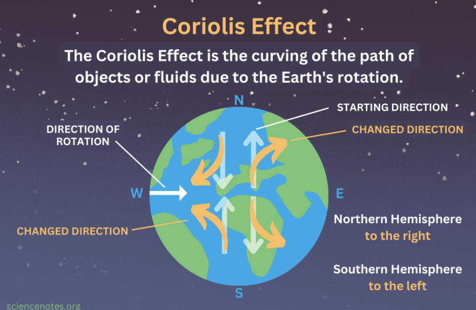
Coriolis Effect
The deflection of moving objects, such as air and water, caused by the Earth's rotation, influencing wind patterns and ocean currents.
Rain Shadow
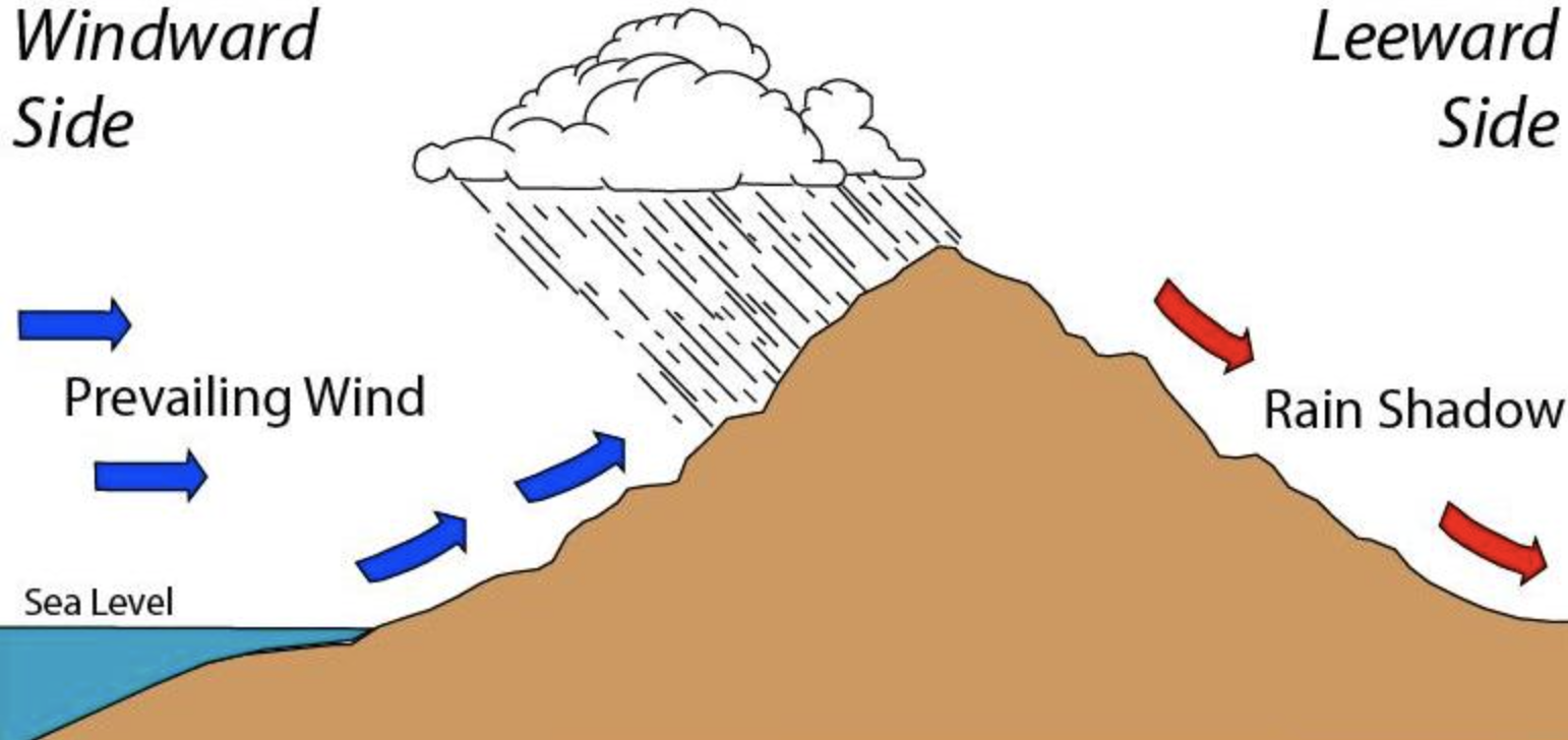
A dry area on the leeward side of a mountain range, created when moist air rises and cools, causing precipitation on the windward side.
Gyre
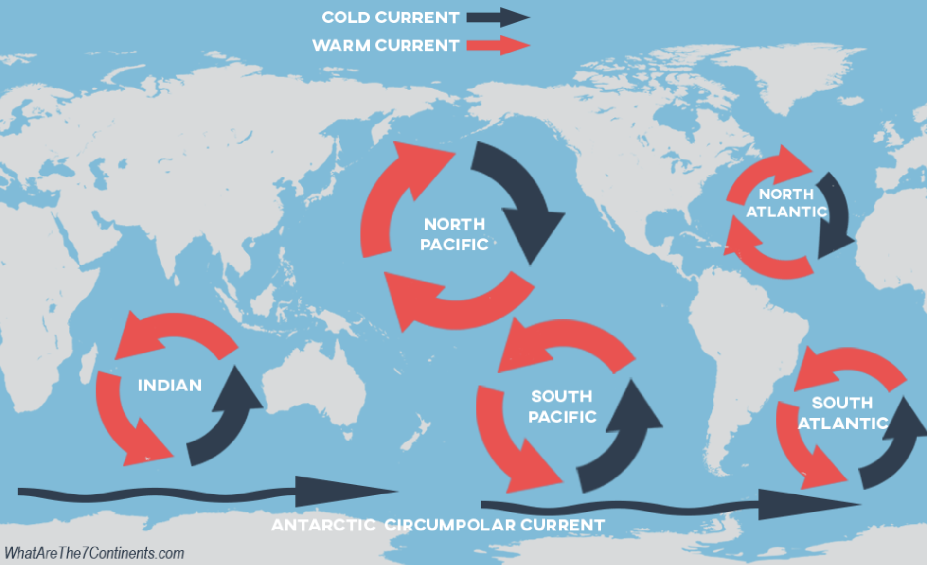
A large system of circulating ocean currents, driven by global wind patterns and the Coriolis effect, typically found in the world's oceans.
Upwelling
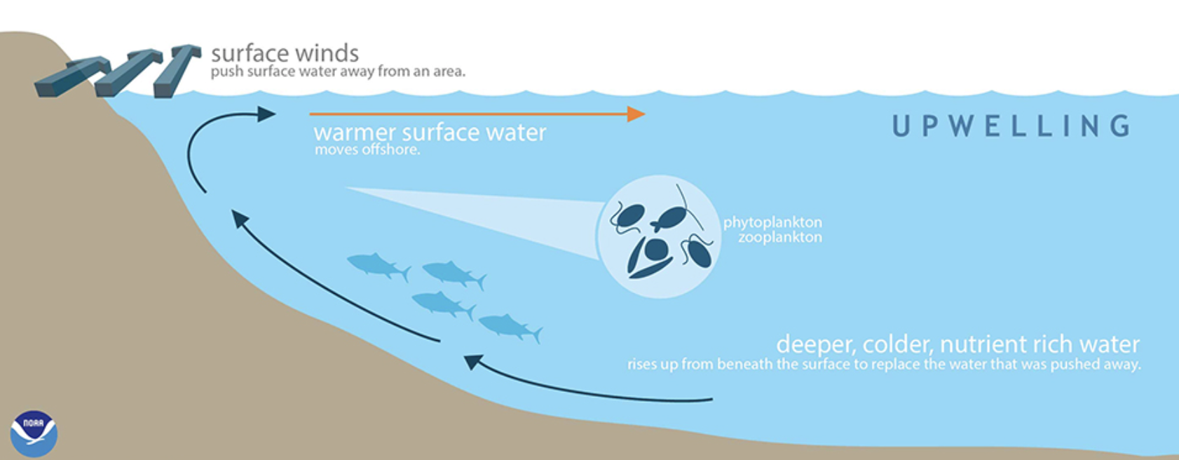
The process where deep, cold water rises to the surface, often bringing nutrients to the ocean's upper layers, supporting marine life.
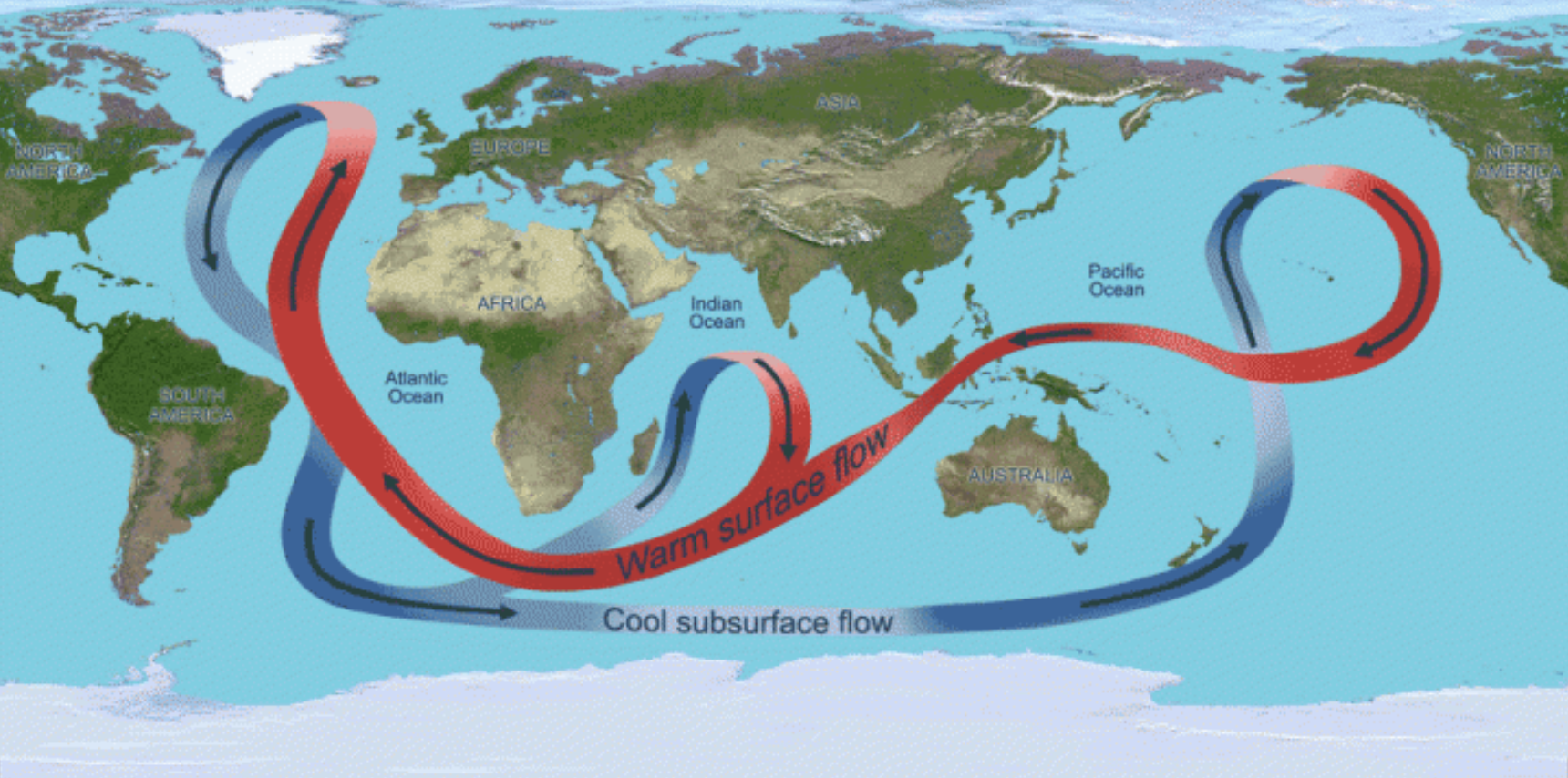
Thermohaline Circulation
The global conveyor belt of ocean currents driven by temperature and salinity differences, playing a crucial role in regulating climate and distributing heat across the oceans.
El Nino (ENSO)
Trade winds weakenen, then reverse (W—> E)
Warm eq. current brings heat and percip. to Americans (N&S)
supressed upwelling of South Am coast (damaging fisheries)
Cooler drier conditions in Australia & SE Asia \
H pressure in West Pacific
L pressure in East Pacific
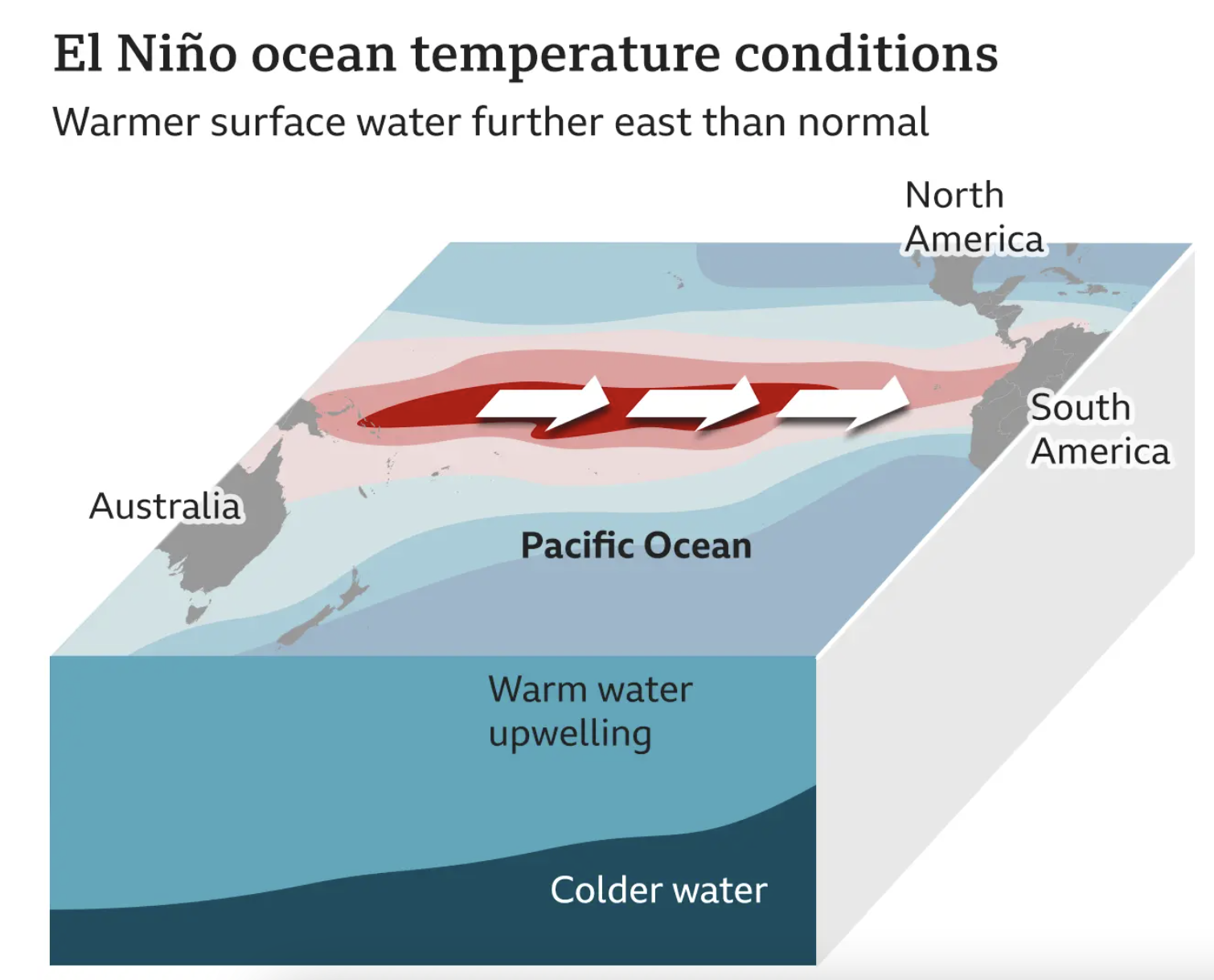
El Nino Conditions
Sea levels higher in the Eastern Pacific Ocean and warmer water in South America coastline
No/weaker upwelling on South America coastline
Reduced/weakened tradewinds
Warm, wet conditions in Chile
Drought in Australia
Plate tectonics
The scientific theory that explains the structure and movement of Earth's lithosphere, which is divided into tectonic plates that float on the semi-fluid asthenosphere, leading to geological activity such as earthquakes and volcanic eruptions.
Tectonic Cycle
The process of formation, movement, and destruction of tectonic plates, which recycles Earth's crust and drives geological phenomena such as earthquakes, volcanic activity, and mountain building.
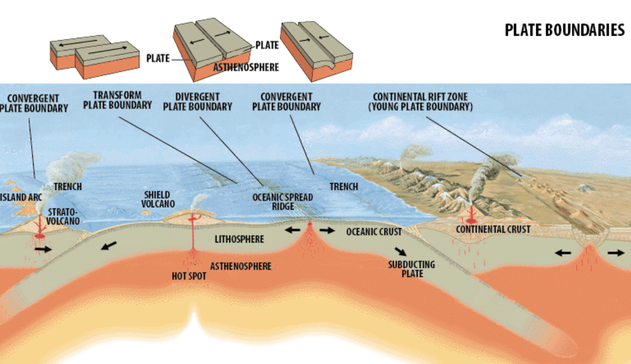
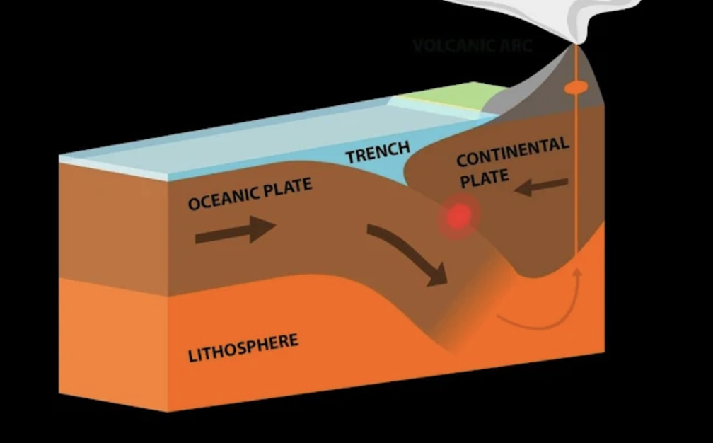
Subduction
is the geological process where one tectonic plate moves under another, sinking into the mantle and leading to volcanic activity and earthquakes.
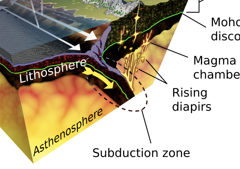
Convergent plate boundary
A type of tectonic boundary where two plates move toward each other, often resulting in subduction, mountain building, and volcanic activity.
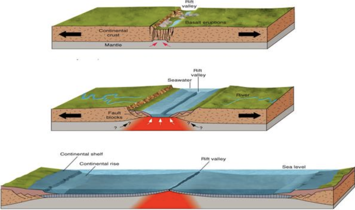
Divergent Plate Boundaries
are regions where two tectonic plates move away from each other, typically resulting in the formation of new crust, mid-ocean ridges, and volcanic activity.
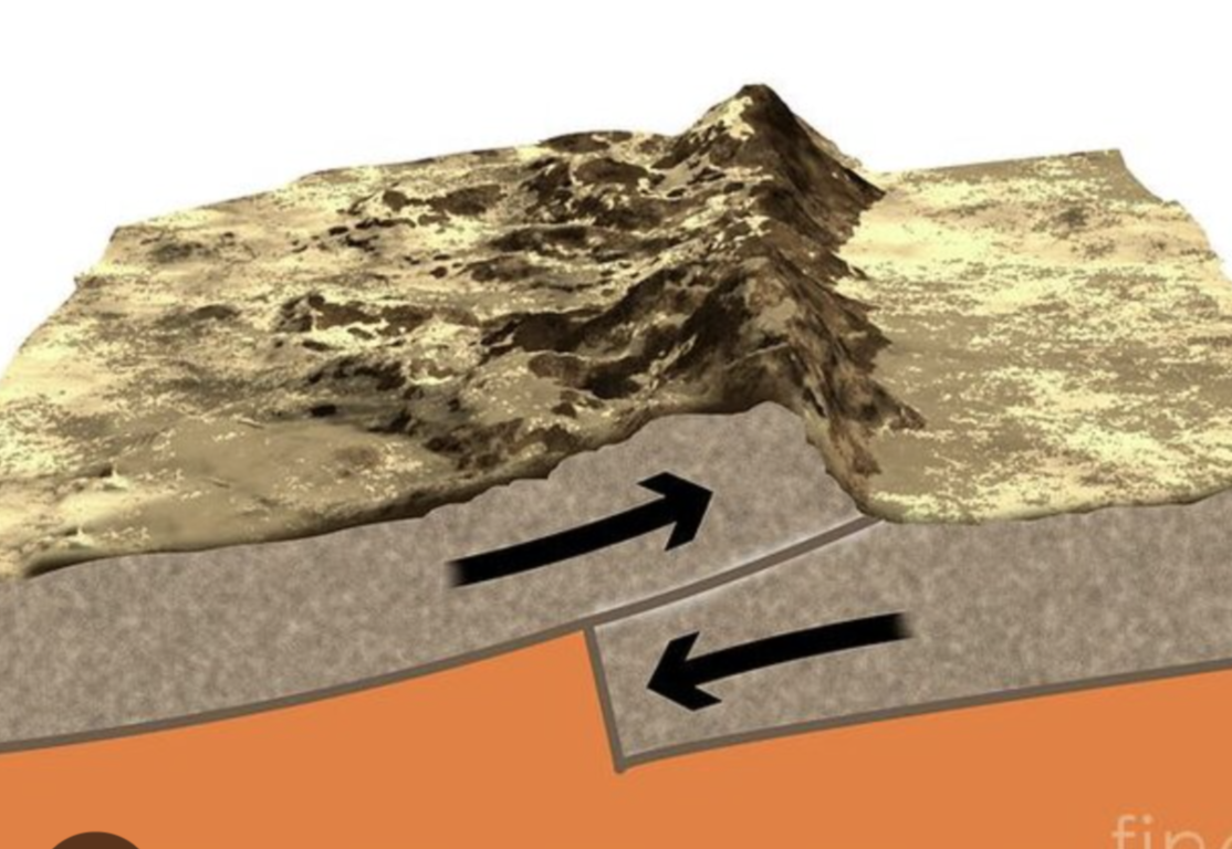
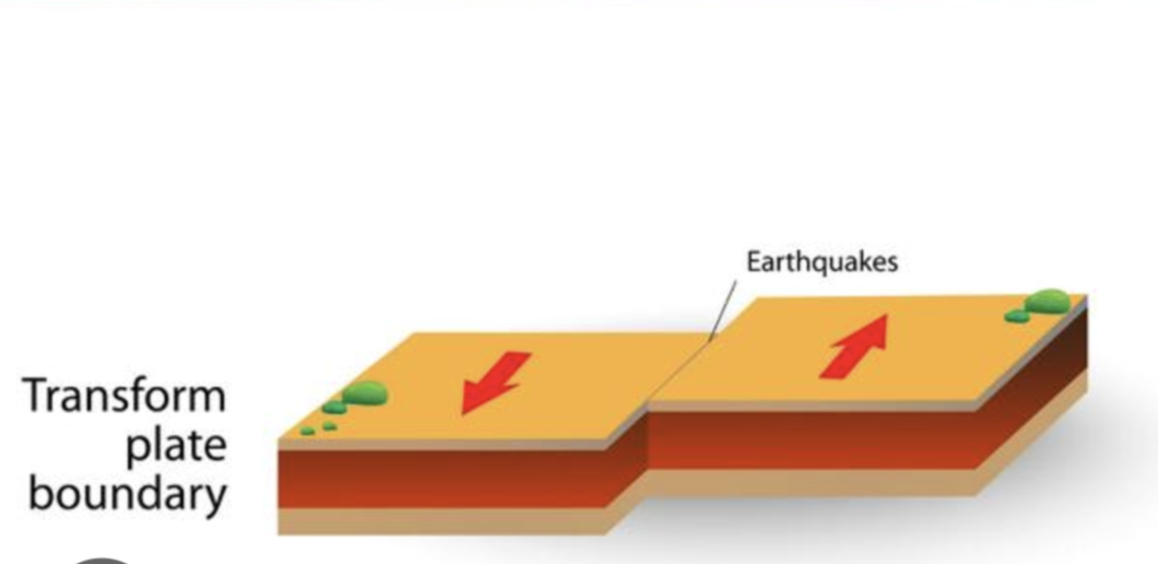
Transform Plate Boundary
is a type of tectonic boundary where two plates slide past each other, leading to earthquakes without significant volcanic activity.
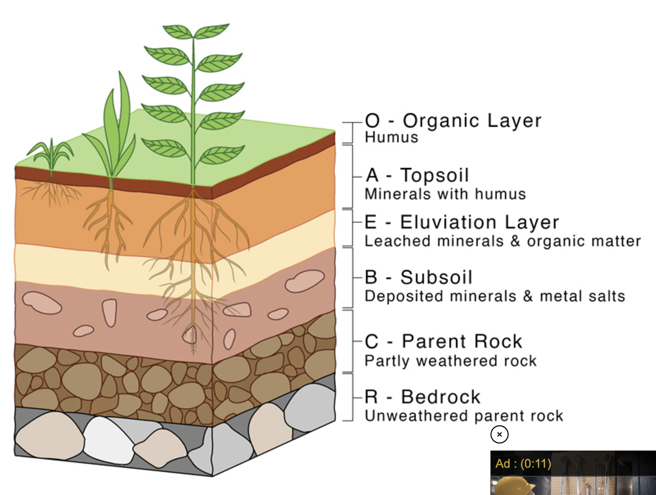
Four Soil Horizons
are layers of soil that differ in composition, texture, and color, typically including the O (organic), A (topsoil), E (eluviation), B (subsoil), and C (parent material) horizons.
Core
The innermost zone of Earth’s interior, composed of mostly iron and nickle. It includes a liquid outer layer and a solid inner layer.
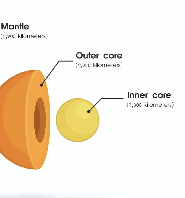
Mantle
The layer of Earth above the core, containing magma
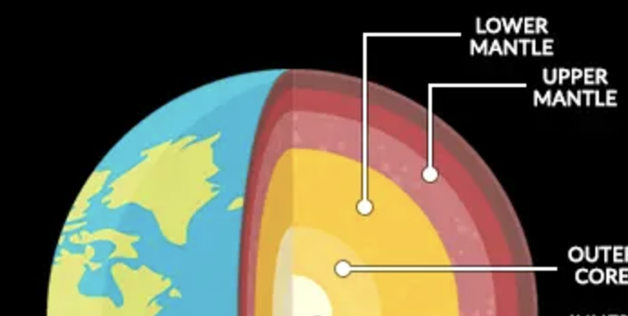
Asthenosphere
The layer of Earth located in the outer part of the mantle, composed of semi-molten rock
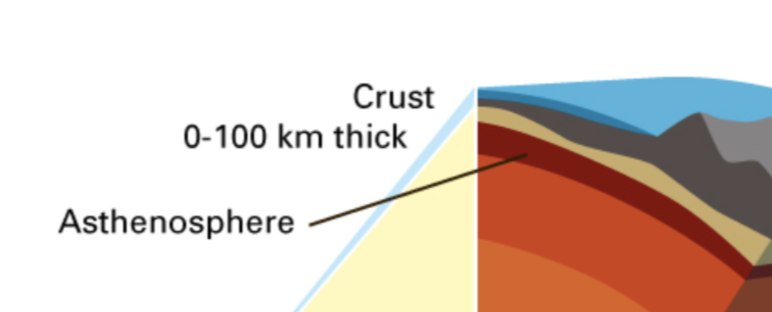
Lithosphere
The outermost larger of Earth, including the mantle and crust
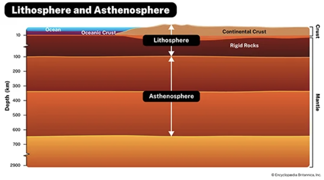
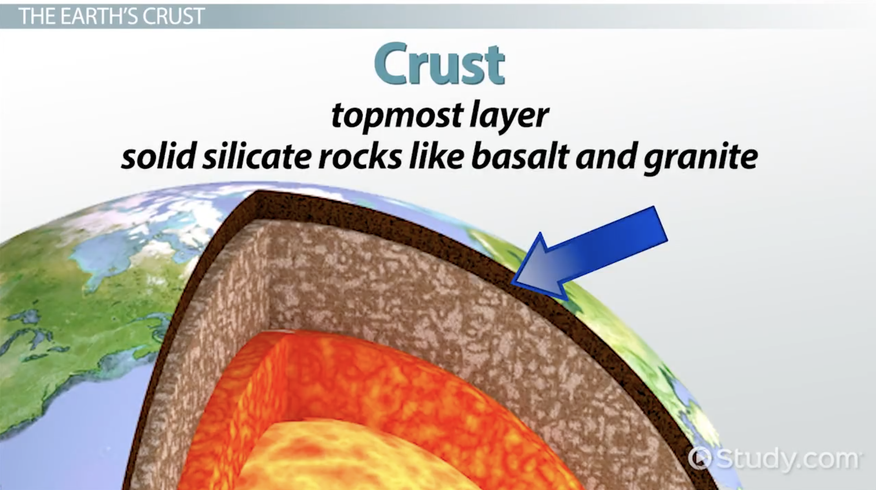
Crust
The chemically distinct outermost layer of the lithosphere
Hot Spots
A place where molten material from Earth’s mantle reaches the lithosphere
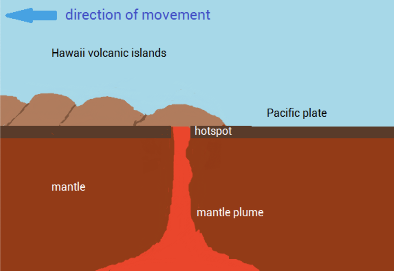
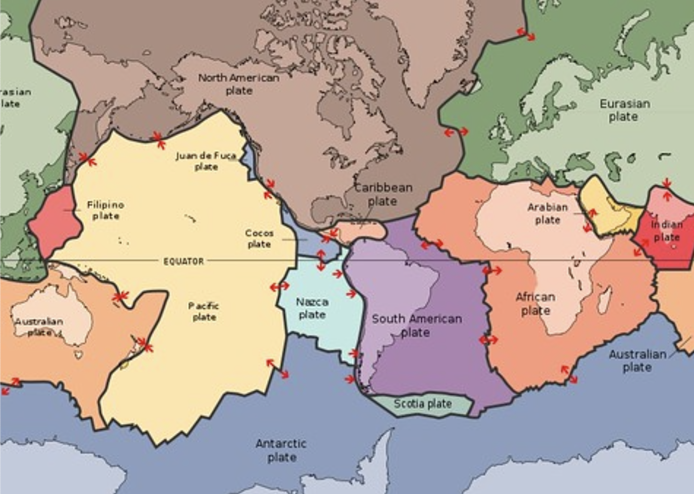
Plate Tectonics
The theory that the lithosphere of Earth is decisions into plates, most of which are in constant motion
Oceanic Tectonic
Type of tectonic plates that make up the ocean floor.
Continental Tectonic
Tectonic plates make up the continents.
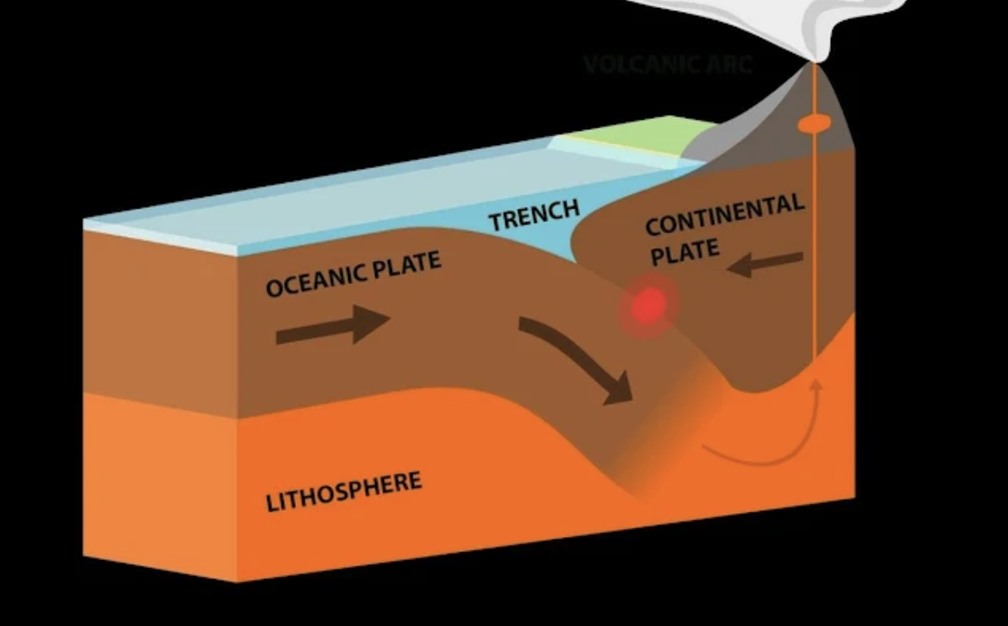
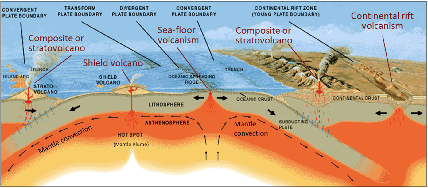
Tectonic Cycle
The sum of the processes that build up and breakdown the lithosphere.
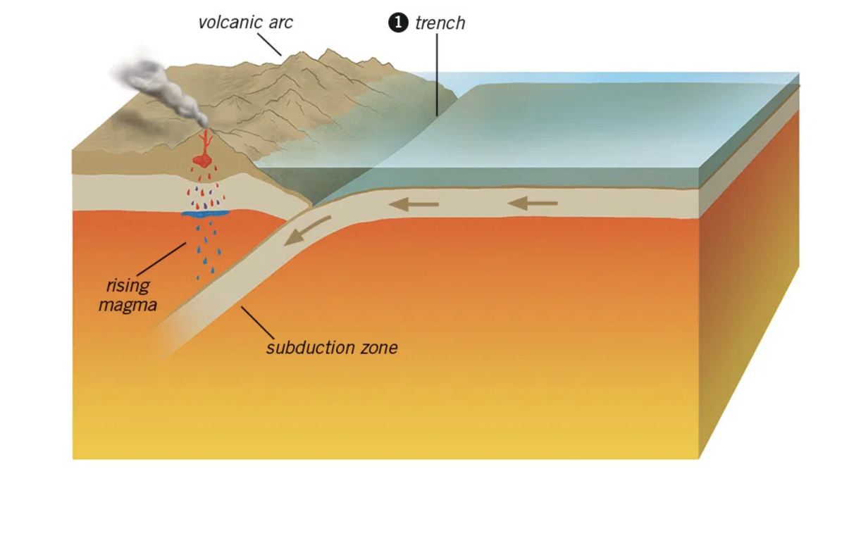
Subduction
The process of one crustal plate passing under another
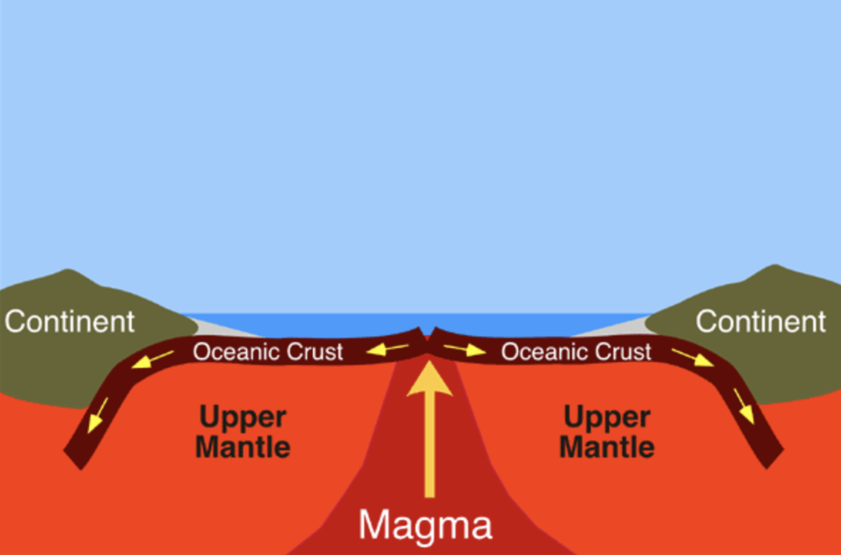
Seafloor Spreading
The formation of new ocean crust as a result of magma pushing upward and outward from Earth’s mantle to the surface
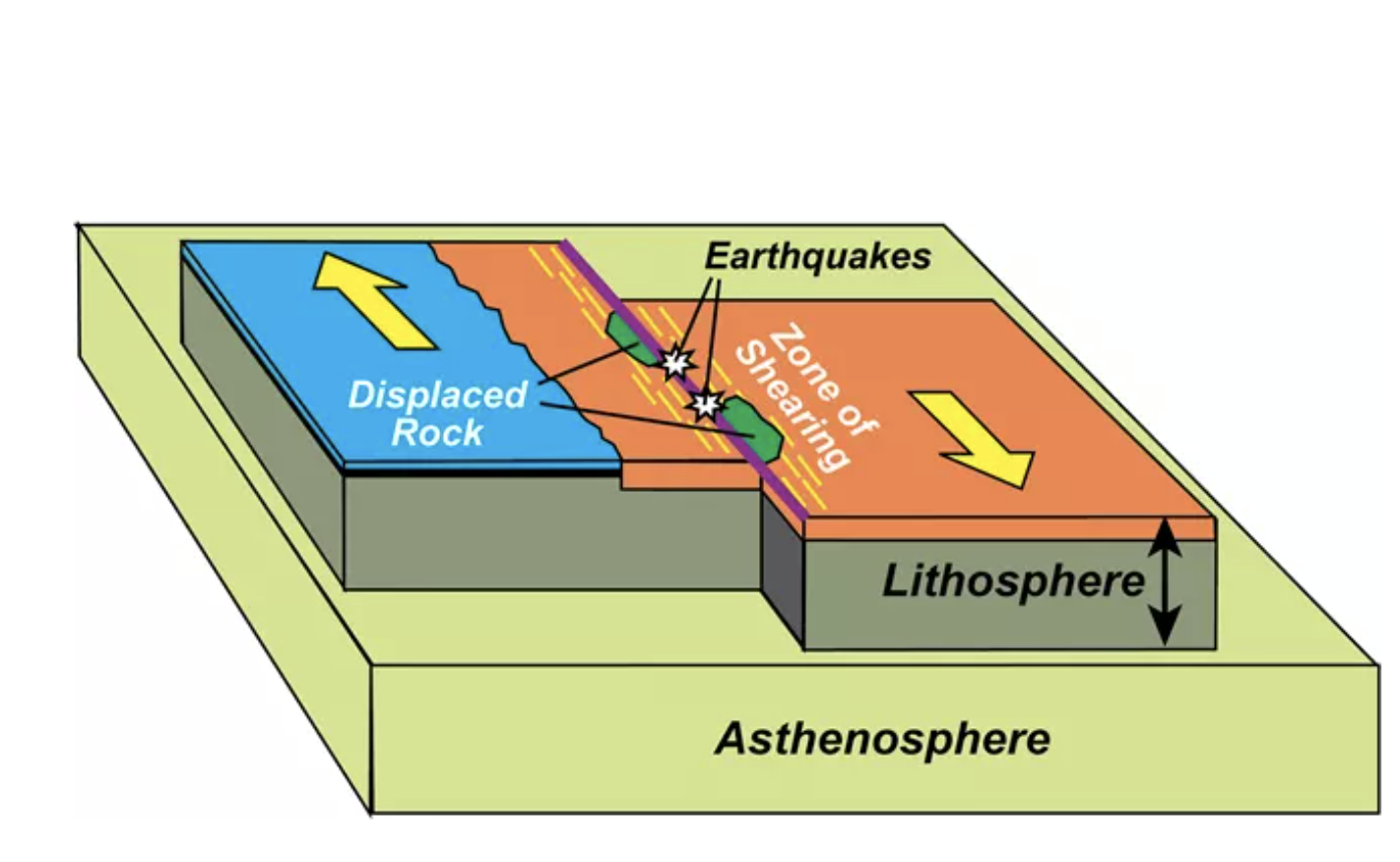
Transform Fault Boundary
An area where tectonic plates move sideways past each other
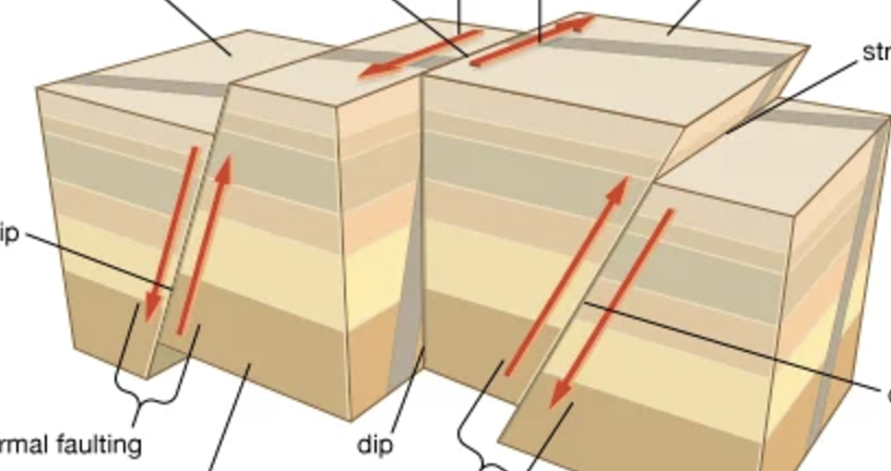
Fault
A fracture in rock caused by a movement of Earth’s crust
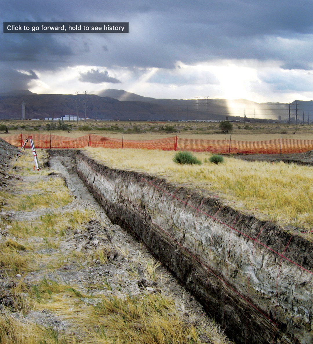
Seismic Activity
The frequency and intensity of earthquakes experienced over true
Fault Zone
A large expanse of rock where a fault has occurred
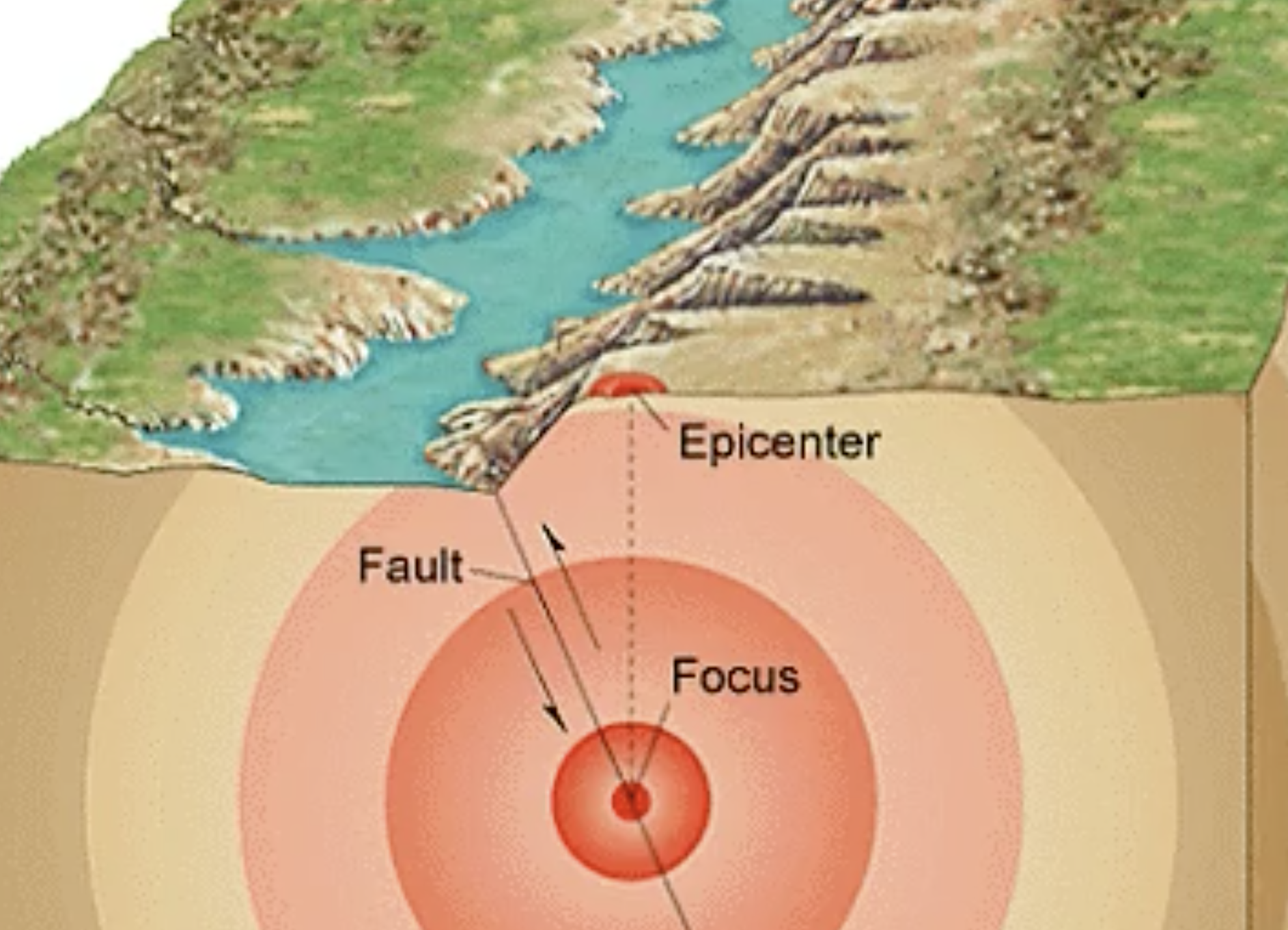
Epicenter
The exact point on the surface of Earth directly above where rock ruptures during an earthquake
Richter Scale
A scale that measure the largest ground movement that occurs during an earthquake, (increases by intervals of 100, range from 1-10)
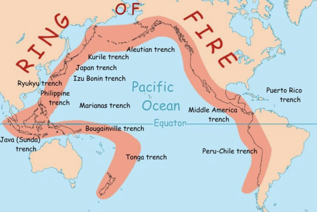
Ring of Fire
A string of volcanoes and sites of seismic activity, or earthquakes, around the edges of the Pacific Ocean
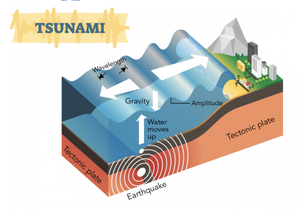
Tsunami
A series of waves in the ocean caused by seismic activity or an undersea volcano
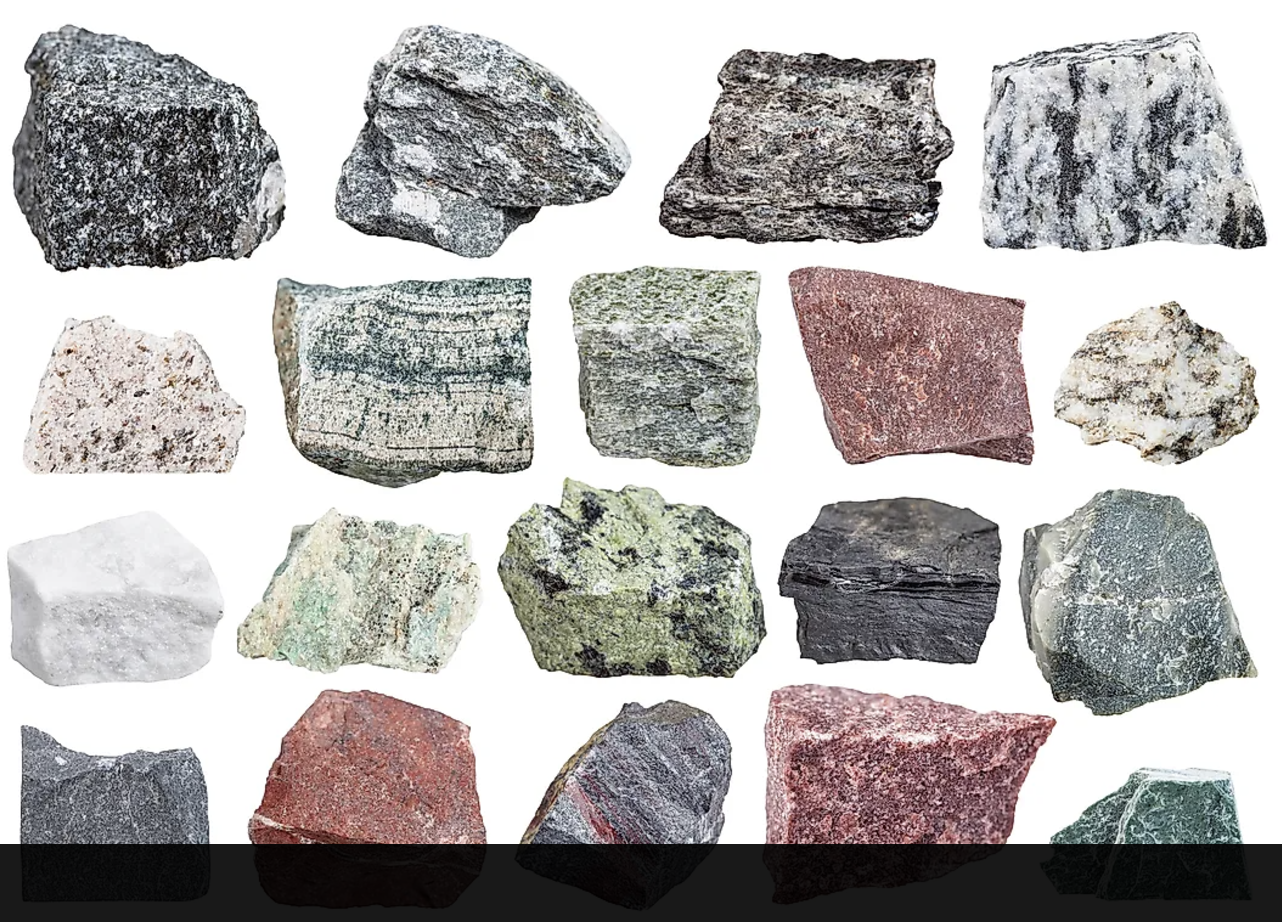
Rock Cycle
The geological cycle governing the constant formation, alteration, and destruction if rock material that results in forms when magma rises yo and cools in a place underground.
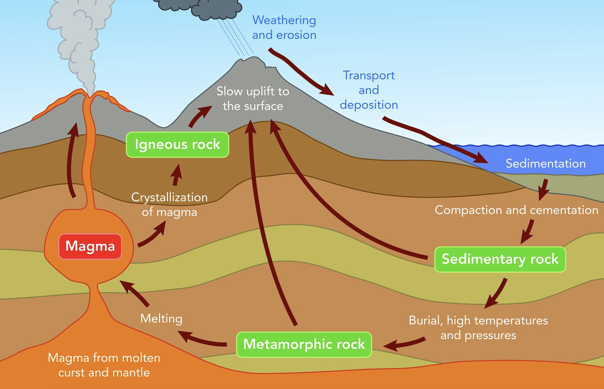
Igneous Rock
Rock formed directly from magma
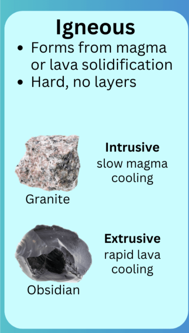
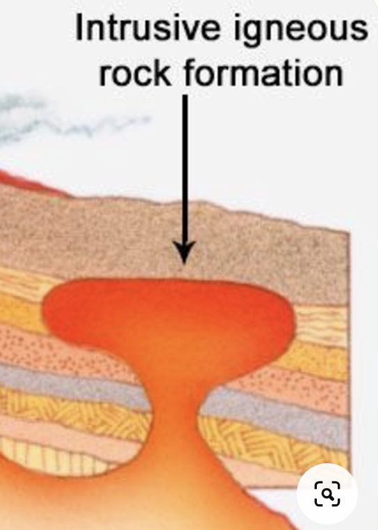
Intrusive Igneous Rock
Igneous rock that forms when magma rises up and cools in a place underground
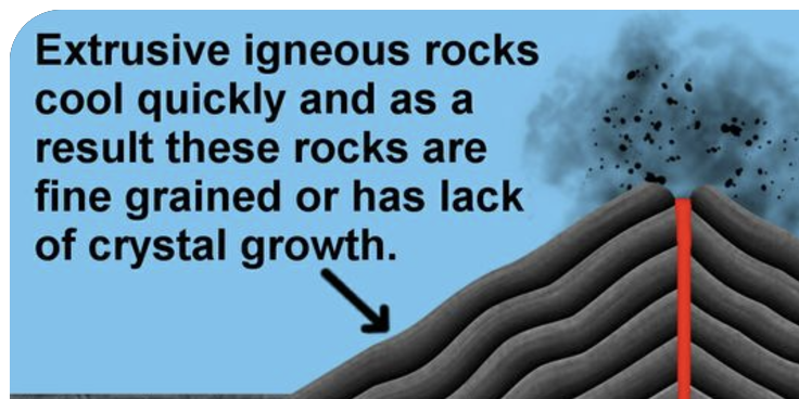
Extrusive Igneous Rock
Rock that forms when magma cools above Earth’s surface
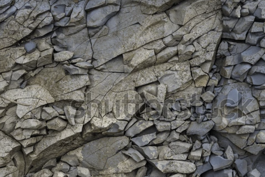
Fracture
A crack that occurs in rock as it cools
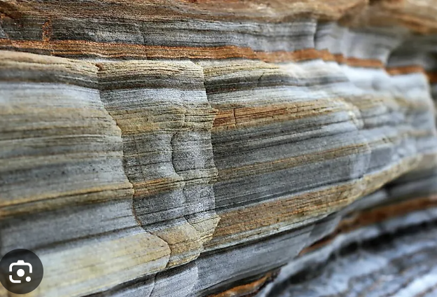
Sedimentary Rock
Formed from layers of pre-existing rocks or organic material that accumulate on the Earth's surface and are compacted and cemented together
Metamorphic Rock
Rock that forms when sedimentary rock or other metamorphic rock is subjected to high temperature or pressure
What cause a divergent plate boundaries
Tectonic plates diverge due to convection currents in the Earth's mantle, which cause rising hot material to push plates apart. As the plates move away, magma from the mantle fills the gap, forming new crust. This process occurs at mid-ocean ridges or continental rift zones.
How transform boundaries cause earthquakes
Transform boundaries cause earthquakes when two tectonic plates slide past each other horizontally, creating friction. This friction prevents smooth movement, causing stress to build up. When the stress is released, it results in an earthquake.
How maps of plate boundaries can predict locations of volcanoes, earthquakes and island arcs
Maps of plate boundaries show where plates interact, such as at convergent, divergent, or transform boundaries. Earthquakes and volcanoes are common at convergent and divergent boundaries due to plate movement and subduction. Island arcs form at convergent boundaries, where one plate subducts beneath another, causing magma to rise and form volcanic islands.
Ring of Fire
The Ring of Fire is a volcanic and earthquake-prone region around the Pacific Ocean, where several tectonic plates meet. It is characterized by frequent volcanic eruptions and seismic activity due to subduction zones and plate movements.
Parent material
Parent material is the underlying geological material, such as bedrock or sediment, from which soil forms. It influences soil texture, mineral content, and fertility.
Physical weathering and how it affects soil formation
Physical weathering is the mechanical breakdown of rocks into smaller particles through processes like freeze-thaw, abrasion, and thermal expansion. It contributes to soil formation by breaking down rock into fine particles that mix with organic matter to form soil.
Chemical weathering and how it contributes to soil formation
Chemical weathering is the breakdown of rocks through chemical reactions, such as acid rain or oxidation, which alter minerals and release nutrients. It contributes to soil formation by breaking down parent material into finer particles and enriching the soil with essential minerals for plant growth.
Soil Horizons
O, A, B, and C horizons distinct soil layers
O Horizon
Organic layer:
Description: Composed of organic material, such as decomposed leaves, twigs, and plant material.
Function: Supports decomposers like fungi and bacteria; contributes to nutrient cycling.
Characteristics: Dark and rich in organic matter.
A Horizon
Topsoil Layer:
Description: A mix of organic material and mineral particles.
Function: The most fertile layer, crucial for plant growth; contains humus.
Characteristics: Darker than the lower layers, with high biological activity (roots, microbes).
B Horizon
Subsoil:
Description: Accumulates minerals like iron, aluminum, and clay leached from the upper layers.
Function: Acts as a zone of storage and accumulation; less organic matter compared to A.
Characteristics: Lighter in color, denser, and more compact than A horizon.
C Horizon
Parent material
How particle size relates to porosity of soil
In soil, smaller particles like clay have high porosity because they pack tightly, creating many tiny pores that retain water. Larger particles like sand have low porosity because they leave larger gaps, allowing water to drain quickly. Silt is intermediate, balancing water retention and drainage.
two chemical measures of soil quality and how they relate to plate growth
Two chemical measures of soil quality are pH and nutrient content. Soil pH affects nutrient availability; most plants thrive in slightly acidic to neutral soil (pH 6-7). Nutrient content, particularly levels of nitrogen, phosphorus, and potassium (NPK), directly supports plant growth by providing essential elements for development.
Relative abundance percent of each gas in earths atmosphere
- Nitrogen (N₂): 78%
- Oxygen (O₂): 21%
- Argon (Ar): 0.93%
- Carbon dioxide (CO₂): 0.04% (increasing due to human activity)
- Trace gases (e.g., neon, helium, methane): <0.03%.
Water vapor varies from 0-4%, depending on humidity.
5 layers of earths atmosphere
1. Troposphere: Closest to Earth's surface; weather occurs here.
2. Stratosphere: Contains the ozone layer; temperature increases with altitude.
3. Mesosphere: Protects Earth by burning up meteors; coldest layer.
4. Thermosphere: High temperatures; contains the ionosphere, where auroras occur.
5. Exosphere: Outermost layer; transitions into space.
How Coriolis determines global wind patterns
The Coriolis effect causes winds to curve due to Earth's rotation. In the Northern Hemisphere, winds curve to the right, and in the Southern Hemisphere, they curve to the left. This deflection creates global wind patterns like trade winds, westerlies, and polar easterlies.
Why deserts form predictably at 30 N/S
Deserts form at 30° N/S because dry air descends there. This air, part of the Hadley Cell, loses its moisture near the equator, creating arid conditions as it compresses and warms, inhibiting precipitation.
Why there is so much precipitation around the equator
High precipitation occurs around the equator because intense sunlight heats the surface, causing warm, moist air to rise. As the air cools in the atmosphere, water vapor condenses into clouds and rain. This process, part of the Hadley Cell, drives heavy rainfall in the tropics.
Watershed
A watershed is an area of land where all water drains into a common body, such as a river, lake, or ocean. It includes surface and groundwater flow, influenced by topography.
Human impact on watershed
Humans influence watersheds through activities like urbanization, agriculture, and deforestation, which can lead to pollution, altered water flow, and habitat destruction. These actions can increase runoff, reduce water quality, and disrupt the natural water cycle.
How the angle of the suns rays striking the Earth determine intensity of solar radiation
The angle of the Sun's rays determines solar radiation intensity because rays striking the Earth at a steeper angle spread over a larger area, reducing intensity. At a direct angle, the rays are concentrated over a smaller area, increasing their intensity. This is why equatorial regions receive more intense solar radiation than higher latitudes.
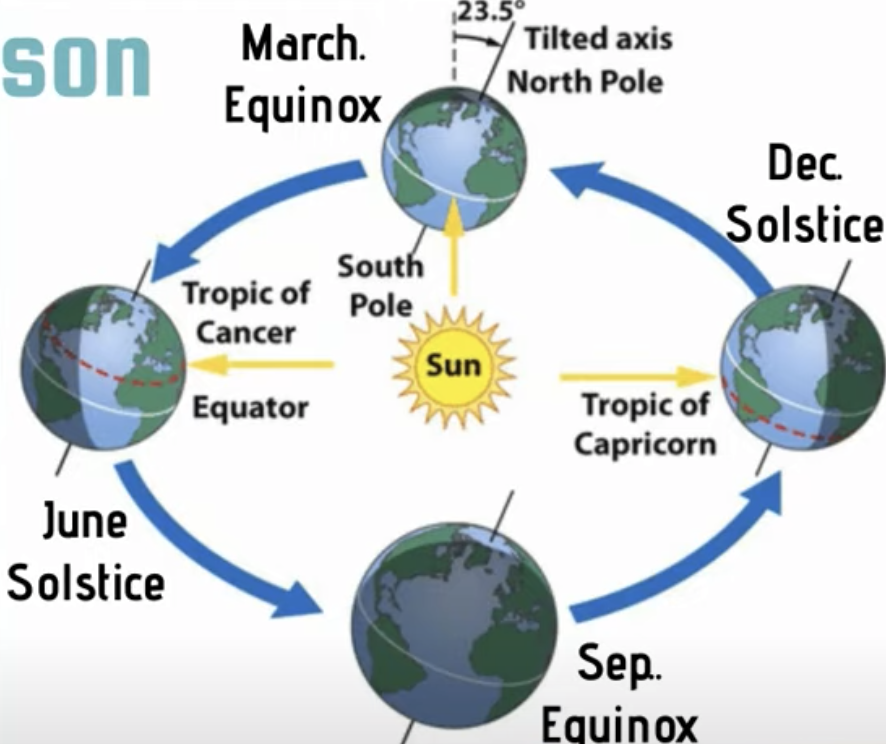
How the Earths rotation and tilt around the sun determines the intensity of solar radiation on Earths surface
Orbit of Earth around the sun and tilt on aces changes the angles of the sun’s rays
this causes varying insolation, varying length of day, and seasons
tilt of Earth’s axis stays fixed during orbit
June and Dec Solstice: N or S hemisphere is maximally tiled towards the sun (summer/winter)
March and Sep Equinox: N and S hemispheres equally facing the sun
How mountains can influence the micro climate of a given region
Mountains influence the microclimate of a region through the rain shadow effect. As moist air rises up the windward side, it cools and condenses, causing precipitation. On the leeward side, the air descends, warms, and becomes dry, creating arid conditions. Mountains can also affect temperature, wind patterns, and humidity, creating distinct climate zones on either side.
Rain shadow: Leeward, Wayward
The rain shadow effect occurs when mountains block the passage of moist air, creating different climates on each side.
- The windward side (wayward side) is where moist air rises, cools, and releases precipitation, making it wetter.
- The leeward side (rain shadow side) is dry, as the air descends, warms, and loses moisture, leading to arid conditions.
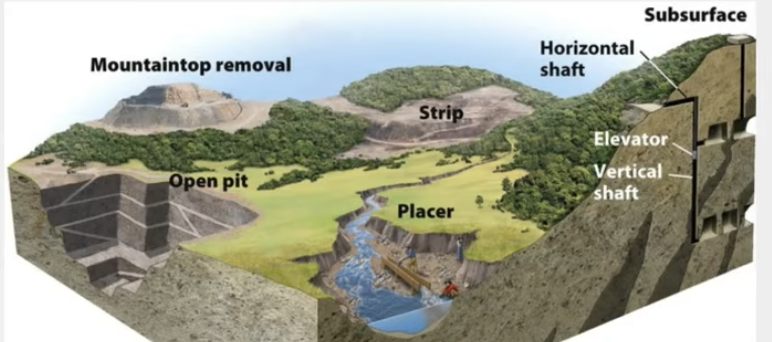
4 major types of surface mining
1. Strip Mining: Removing strips of soil and rock to expose ore, typically used for coal.
2. Open-Pit Mining: Digging large pits to extract ore and minerals near the surface.
3. Mountaintop Removal: Blasting the top off a mountain to access underlying resources.
4. Placer Mining: Extracting minerals from river sediments, often using water to separate heavy minerals like gold.
Define overburden and tailings in mining
- Overburden: The soil, rock, and other material removed to access the desired ore or mineral deposit.
- Tailings: The leftover waste material after extracting valuable minerals from the ore, often stored in tailing ponds.
List four environmental consequences of surface mining
1. Habitat destruction: Removal of vegetation and topsoil disrupts ecosystems.
2. Soil erosion: Loose soil increases erosion and sedimentation in waterways.
3. Water pollution: Chemicals and sediments contaminate nearby water sources.
4. Air pollution: Dust and emissions from machinery degrade air quality.
Subsurface mining (Environmental Impact, Human health risks)
Subsurface mining involves extracting minerals or ores from underground deposits using tunnels or shafts. This method is used for resources like coal, gold, and diamonds located deep below the surface.
### Key Features:
- Less surface disturbance compared to surface mining.
- Environmental Impacts: Can cause subsidence (ground collapse), water contamination (acid mine drainage), and methane release.
- Risks: Dangerous for workers due to collapses, explosions, and poor air quality.
Why subsurface mining is more expensive that surface mining
Subsurface mining is more expensive because it requires constructing tunnels or shafts, specialized equipment, and higher safety measures to protect workers in hazardous underground conditions.
Why subsurface mining is likely to increase in the future
Subsurface mining is likely to increase as surface deposits become depleted and demand for minerals rises, requiring extraction from deeper underground reserves. Additionally, it can access high-value resources with less surface environmental impact.
How subsurface mining leads to acid drainage
Subsurface mining exposes sulfide minerals to air and water, causing a chemical reaction that forms sulfuric acid. This acid can leach heavy metals from rocks, creating acid mine drainage that contaminates nearby water sources.
Environmental consequences of acid drainage
1. Water pollution: Acidic water lowers pH and contaminates water sources with heavy metals.
2. Aquatic ecosystem damage: Acidic conditions harm aquatic life by disrupting biological processes.
3. Soil degradation: Contaminated water can reduce soil fertility.
4. Vegetation loss: Toxic metals and low pH inhibit plant growth.
Mine Reclamation
Mine reclamation is the process of restoring land disturbed by mining to its natural or usable state.
It includes reshaping land
replacing topsoil
replanting vegetation
ensuring water quality
Reclamation helps reduce erosion, restore habitats, and mitigate environmental damage.
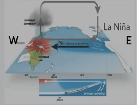
La Niña
Stronger than normal trade winds (W ← ← E)
Increased upwelling of South Am coast brings cooler than normal conditions (improved fisheries)
In South E Asia and Australia temp much higher, (increase in monsoons and flooding)
Worse tornado activity in US and Hurricane in Atlantic Ocean
4 ecosystem services that intact soil provides
filters water
habitat for variety of organisms
medium for plant growth
breaks down organic material and recycles nutrients
How soil filters groundwater
When water runs through soil the pores of the soil will hold on to any pollutants so that CLEAN water can run through and recharge groundwater and aquifers
What is physical weathering and how does it relate to soil formation
Breakdown of rocks into smaller pieces, physical (wind, rain, freezing/thawing of ice)
Weathering of rocks = soil formation
Broken into smaller and smaller pieces
Carried away and deposited by erosion
Soil Degradation
loss of topsoil: tilling, dries out soil, removes nutrients + soil organisms that recycle nutrients
Compaction: forces soil closer together, cant support plant life
nutrient depletion: farming same land over and over removes nutrients and cant support plant growth as well.
Tests of Soil Quality
Texture: let soil settle in a jar of water, measure 3 layers that form
% of sand, silt, and clay
how porous or permeable soil is
Permeability: Drain through column of soil
How easily water drains through soil
too high, soil dries out
too low, roots don’t get water and drown
medium = optimal
pH: pH strip - H* ion concentration
How acidic (low pH) or basic/alkaline (high pH) the soil is
more acidic soil = less nutrient availability
Nutrient Levels: Higher nutrient level = more plant growth
low level could indicate acidic soil depletion
Color: Compare w soil book color chart
Exosphere
outermost layer where atm. merges with space 🤯
Thermosphere
Therm = hottest temp
absorbs X rays and UV rays
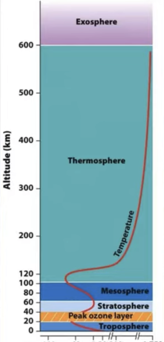
Temperature Gradient of Earths Atms
Trophosphere: temp decreases as air gets further from warmth of earths sun rays
Stratosphere: Temp increases because top layer of stratosphere is warmed by UV rays
Mesosphere: Temp decreases because density decreases, leaving fewer molecules to absorb sun
Thermosphere: temp increases due to absorption of highly energetic solar radiation
Air Properties
Warm air rises
Warm air holds more moisture than cold air
Rising air expands and cools
Cool air cant hold as much H2O vapor (condenses —> rain)
After cooling and expanding, air sinks
Coriolous Effect
Air at 30 degrees moves back to L pressure of equator
Wind between 30 - 60 degrees moves W—> E
bc Earth spins faster at 30 than 60 degrees
Wind between 0-30 degrees moves from E—> W
bc Earth is spinning W—> E
Reserve
The known amount of a resource left that can be mined, usually measured in years left of extraction