Wetlands Test 2
1/172
There's no tags or description
Looks like no tags are added yet.
Name | Mastery | Learn | Test | Matching | Spaced | Call with Kai | Chat |
|---|
No analytics yet
Send a link to your students to track their progress
173 Terms
Factors that influence tree response to flooding
species flood tolerance
time of flooding (dormant season vs growing season)
temperature/ oxygen content of water
velocity/ oxygen content of water
duration of flooding
tree age
mature trees
can tolerate more flooding
very flood tolerant trees
bald cypress
black mangrove
water tupelo
black willow
button bush
flood tolerant trees
willow oak
moderately flood tolerant trees
water oak
sweet gum
flood intolerant trees
loblolly pine
American sycamore
cottonwood
why plants must adapt to flooding
limited gas exchange when flooded
must be able to selectively acquire nutrients
must be able to avoid toxic effects of flooding
Physiological processes for flood response
Non-woody plants
alter end products of glycolysis
substitute NO3- for O2 in cellular reactions
Morphological Adaptations to flooding
Trees
Carbon allocation patterns
rapid early shoot growth
stem and lenticel hypertrophy
buttress stems
cypress knees
pneumatophores
adventitious root systems
Carbon allocation patterns
root wads
can use rhizotrons to test carbon root allocation
hypertrophy
slow and uniform around the stem
for gas exchange
cypress knees
uncertain of true purpose
most likely for gas exchange
high knees = high water table
pneumataphores
mangroves
gas exchange
air roots
adventitious roots
roots grow out into water to get oxygen
anatomical adaptations to flooding
aerenchymas root systems
leaking oxygen
Regeneration adaptations for flood tolerance
seed germination
seed longevity
seed floating dispersal
sprouting/ rapid growth
vivipary
seed germination
button bush
black willow
underwater
seed banks
seed longevity
ability to survive in buried state
oxbows
bald cypress
viviparity
mangroves
produces embryonic tree on the tree
drops when ripe → instant tree
sharpened end
falls straight into mud
management considerations to plant adaptations
species flood tolerance
genetic variability
some species may require beds or mounds
green tree reservoirs may require drought yews
fertilization (particularly P)
large or containerized planting stock
green tree resevior
levee around bottomland sites
allow to flood in winter
can create beaver pond
fire
some species require this for regeneration or must be adapted to this for survival
cross sectional area of a tree
0.005454(DBH)²
trees per acre
Basal area/ cross sectional area
basin
broadest scale of hydrology
watershed level
4, 5, 6th order streams typically
even 0 order/ ephemeral streams
sinuoisity
based on how wide and long the stream is
measures meandering
ratio of measnder distance and straight line distance
larger meander
lower energy
greater distance for same change in elavation
hydrology affects
elevation/gradients
topography
soils
vegetation
wildlife
transformation
imports and exports
fluvial geomorphology
watersheds
floodplains
stream reach
stream habitat
stream microhabitat
factors that influence stream geomorphology
climate
geology
organisms
relief
time
humans
human influence of geomorphology
land use
manipulation of vegetation
channelization/dams
greater hill
faster gradient
stream reach
pools
riffles
thalweg
erosion
depositing
river continuum concept (headwater vs lower reach)
water velocity
bedload
carbon input and size class
macroinvertebrate population
fish communities
river quality rating 4-10
poor water quality
river quality rating 11-18
mid to good water quality
river quality rating 19-30
good to excellent water quality
top urban pollutants
hot water (removes O2)
oil
fertilizer
construction sediment
reasons why water quality increases as Strouble’s Creek flows away from the Duck Pond
the water is shaded
riparian buffers are present
rocky bottom increases turbulence (increases O2)
larger watershed allows cooler ground water to enter creek
Bioindicies
fish
macroinvertebrates
algae
salamanders
aquatic vegetation
canary in coal mine
why use bioindicies?
they have a range of sensitivity
they are cheaper and faster than lab sampling
they are in our foodchain
perennial streams
doesn’t flow all the time, but at least 90% of the year
solid blue line
intermittent stream
flows during wet times of year
dashed line
ephemeral stream
only flows immediately after rainfall
stream order
two first order streams make a second order when they connect
two second order streams make a third order when they connect
ect…
bedloads
can be measured from pebble count
sediments traveling along the stream bed
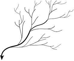
dendritic river
rectangular (trellis)

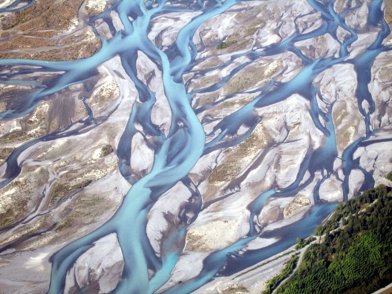
braided
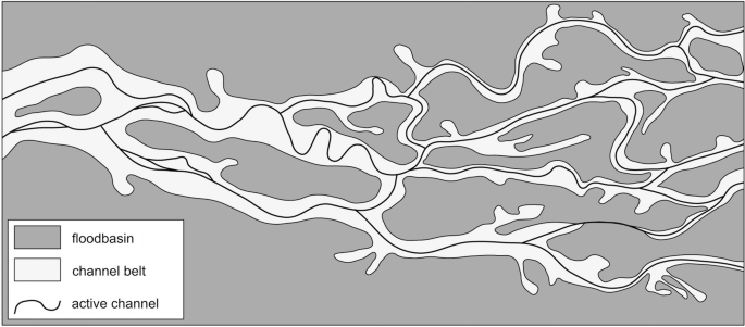
anastomosis (deranged)
karst (sinkhole)

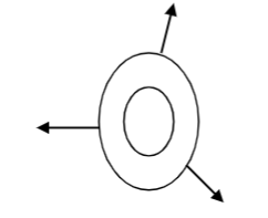
annular (radial)
stream channel classification system
evaluate relative stream health
evaluate recovery potential
rank areas for restoration potential
recommend stream improvements
use geomorphology characteristics to predict water yeild
development’s impact on stream shape
stream gets deeper and wider
Rosgen classification system
looks at stream stability
channel type: single or multiple
entrenchment ratio: floodplain/channel width
sinuosity
stream slope
bed material
Rosgen system type A
many mountain and Piedmont intermittents
4-10% slope
steep
entrenched
confined
Rosgen system type B
Mountain large intermittents, small perennials
2-4% slope
moderately entrenched
relatively stable
Rosgen system type C
Many riparian areas
less than 2% slope
slightly entrenched
meandering with well developed floodplain
stable
Rosgen system type D
multiple channel
less than 4% slope
typically does not have bedrock or boulder bed load
maybe deltaic
Rosgen system type E
Marsh streams
less than 2% slope
low width/depth ratio
Why are soils important?
support vegetation/water/support/air
store groundwater
store carbon
habitat
food/fiber
construction
mining
why is hydrology important?
supply of water for habitat and us
shapes landscapes/soils
soil water
nutrient cycles/pollution
energy supply
recreation
components of hydrology
water quantity
water quality
biological
why are forests important?
influence air
influence water quality
source of shade
carbon storage
habitat
timber
recreation
climate control
soil stability
food/fiber/medicine
primary source of pollution in stroubles
non-point source pollution
Rosgen system type F
degraded C/failing C
less than 2% slope
entrenched
boulder and bedrock systems are stable
sand and gravel channels are deeply incised
high bank erosion rates
primary source of pollution in stroubles
non-point source pollution
water chemistry
toxins
salts
nutrients/chemicals
sediments
physiography
drainage patterns
sheet flow
subsurface flow
vegetation feedback
peat building
sediment trapping
nutrient retention
water shading
transpiration
effects on channel morphology
Rosgen system type G
2-4% slope
deeply entrenched
often failing system or erosion gully
major effects of hydrology on wetlands
species composition and diversity
primary productivity
organic accumulation and exports
nutrient cycling
hydrology effects on wetland species and diversity
flooding water tolerant species
flooding reduces diversity
flooding increases number or rare species
highest net primary productivity is neither wettest or driest sites
flooding may result in an abbreviated successional pattern
flooding favors large trees over sapplings
pebble counts
choose representative riffle
count and size class 100 pebbles
use to evaluate stream energy, sedimentation, habitat relative to other streams in area
size of material can be used to evaluate habitat
bigger grain size in river
higher energy
hydrology modifies:
substrate (soil)
vegetation
flowing water
favors export
microfauna access
increased nutrients
aerobic and anaerobic populations
increased leaching
drainage
round ditches
agriculture
fire control by altering hydrology
for silviculture
causes of net primary productivity patterns
nutrient inputs
oxygen replenishment
toxin removals
species adapted to consistent environment
pulses
favor decomposition
stillwater
favors accumulation
limits production
why do society and landowners often disagree regarding management
what is profitable for society may not be best for landowner
landowners need economic return on land
Wetland policies usually target these
exploitation (swamplands act)
conservation (permits)
preservation (refuges)
(Siegal and Haines, Downing et al.)
rivers and harbors act of 1899
made navigable waters authority of COE
prohibited discharge into water
shovel logging and structures in LA
federal water pollution control act of 1948
first federal legislation to protect water quality
lacked funding and water quality standards
skidders
common for harvesting
pulls wood
how to measure site recovery
wildlife population
nutrient transportation
succession
soil compaction
vegetation controls
mechanical
fire
chemical
national environmental policy act of 1969
required environmental impacts statements
federal water pollution control act of 1972 (clean water act)
first federal program designed to improve water quality
permits for point source pollution
“restore and maintain the chemical, physical and biological integrity of water”
was reinterpreted to include waters connected to navigable waters
Thorton vs US
animal crossing state lines are interstate commerce
overturned
federal water pollution control act 1972 (1977 amendment)
wetlands are included
federal water pollution control act of 1972 (1987 amendment)
addressed non point source pollution
section 208
required states manage non point source pollution
silvicultural activities must be addresses
made BMP’s
flowing water
favors export
microfauna access
increased nutrients
aerobic and anaerobic populations
increased leaching
silvicultural manipulations of water
drainage
irrigation
species
harvest
site preparation
vegetative controls
litter layers
SMZ’s
BMP’s
Bailey vs US and Swanson vs US
artificial created wetlands are also subject to COE jurisdiction
Avoyelles sportsmen’s league vs Marsh
bottomland hardwoods are wetlands
3 criteria for wetlands
Bayou Marcus vs US
must show evidence of on-going operations and planning