Land Nav RC
1/18
There's no tags or description
Looks like no tags are added yet.
Name | Mastery | Learn | Test | Matching | Spaced | Call with Kai |
|---|
No analytics yet
Send a link to your students to track their progress
19 Terms
1. What color is used on a map to identify cultural features, all relief features, non-surveyed spot elevations, and elevation such as contour lines?
Red-Brown
Black
Blue
Green
Red-Brown
2. What type of lines are the most common method of showing relief and elevation on a map?
Hachures line
Contour line
Form line
Langley line
Contour line
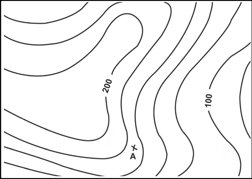
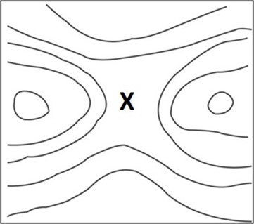
What is the elevation of point ‘A’ on the image?
170
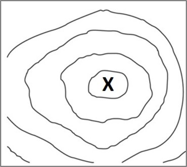
Identify this terrain feature.
Hill
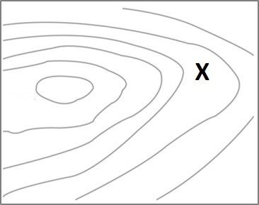
Identify this terrain feature.
Ridge
Identify this terrain feature.
Depression
Identify this terrain feature.
Saddle
Identify this terrain feature.
Valley
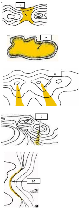
Identify this terrain feature. (8)
Spur

Identify this terrain feature. (9)
draw

Identify this terrain feature. 11 and 12
Fill and cut
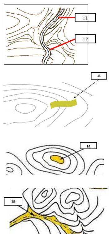
Identify this terrain feature.13 and 15
Ridgeline and valley
If your azimuth is 70°, what is your back azimuth?
250
If your azimuth is 270°, what is your back azimuth?
90
Indicates man-made features such as buildings, roads, trails, railroads, and boundaries.
black
Represents water features — rivers, lakes, swamps, streams, and other bodies of water.
blue
Indicates vegetation, such as woods, orchards, or other areas of dense foliage.
green
If you are traveling uphill and the contour lines become closer together, what does that indicate about the slope?
steeper terrain
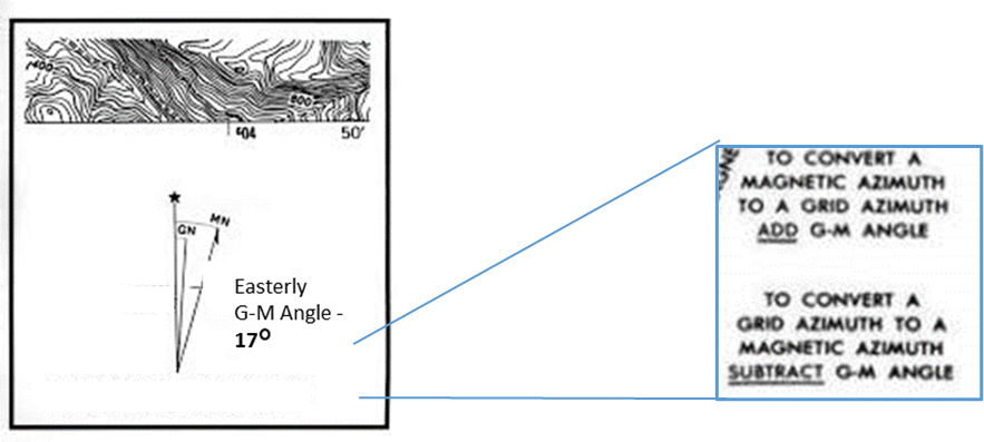
Convert a grid azimuth of 264° to a magnetic azimuth. The Easterly G-M angle is 17°.
17
281
264
247
247