Geological maps
1/14
There's no tags or description
Looks like no tags are added yet.
Name | Mastery | Learn | Test | Matching | Spaced | Call with Kai |
|---|
No analytics yet
Send a link to your students to track their progress
15 Terms
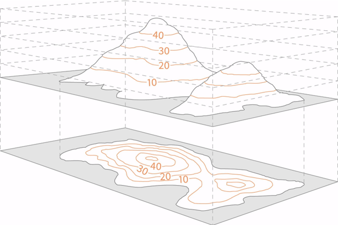
What are contour lines?
Lines connecting points of equal elevation - the intersection b/w a 3D object and horizontal plane with a given elevation(m)
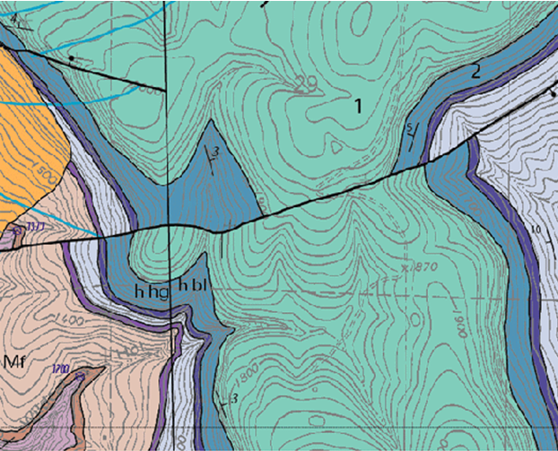
What are unit boundaries?
Lines dividing areas of different colour in geological maps which are planes
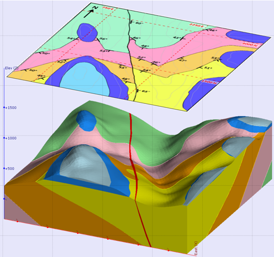
What is shape/geometry/unit boundaries controlled by?
dip of planes
topography profile - erosional surface
Where is true thickness of rock units visable?
Along a section perpendicular to its layering/bedding
What is apparent thickness?
Larger than true thickness
What is apparent thickness controlled by?
By the angle at which the topographic surface cut the beds
Where is true dip observed?
Along a section normal to the strike; other sections show the apparent dip which is shallower
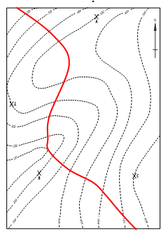
How are vertical planes represented in geological maps?
Straight line cutting across contour lines
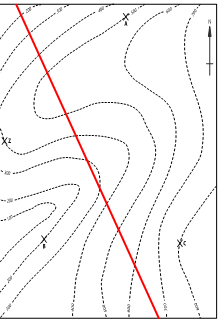
How are horizontal planes represented in geological maps?
Curved lines running parallel to a specific contour line
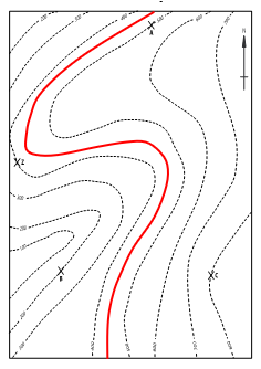
How are inclined planes represented in geological maps?
Curved line cutting across contour lines
How are folds shown in maps?
Marked by repetition of units which are symmetric with respect to the hinge line?
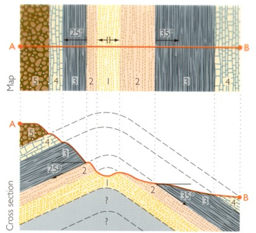
What shape unit boundaries do plunging folds produce?
V-shaped - the 2 limbs of plunging fold have diff. strike
What is the V-rule?
If plunging folds form chevron-shaped unit boundaries:
Plunging antiform - plunge is in the direction of the chevron
Plunging synform: plunge towards the core of the chevron
How are faults represented in maps?
Faults cut and offset unit boundaries