Metadata 9/25
1/13
There's no tags or description
Looks like no tags are added yet.
Name | Mastery | Learn | Test | Matching | Spaced | Call with Kai |
|---|
No analytics yet
Send a link to your students to track their progress
14 Terms
standards
definitions of what different colors, shapes, units, ect. are for a map
Metadata
Used to describe how geospatial & attribute data was collected & processed into its final form
(describe the content, quality, condition, and other characteristics of data)
It’s estimated that _____% of the cost of using a GIS is associated with developing & maintaining data.
Critical that procedures are in place to protect….
80%
organization’s investment in data
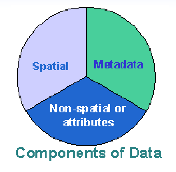
3 Components of geospatial data
Where: spatial - location and relationships (coordinates, topology)
What: attributes - descriptive info about geographic features in database
Metadata: description of geospatial data
Content Standard for Digital Geospatial Metadata (CSDGM)
established/maintains GIS metadata standards
◼ Used for locating geographic related data
◼ Federal Agencies mandated to use
◼ 10 sections; multiple elements
designed to describe all possible geospatial data
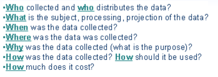
Metadata describes the....
who what when where how
Metadata allows the user to determine the dataset’s __________.
“fitness-for-use”
e.g. is it appropriate & of sufficient quality/detail
Metadata categories
Description
-Abstract: brief description of the dataset
-Purpose: a summary of why the dataset was developed
Spatial
-Coordinate system: map projection, datum
-Spatial extent: min and max X-Ys
-Data model
Attributes
-Field names and their meanings
VERY IMportant slide
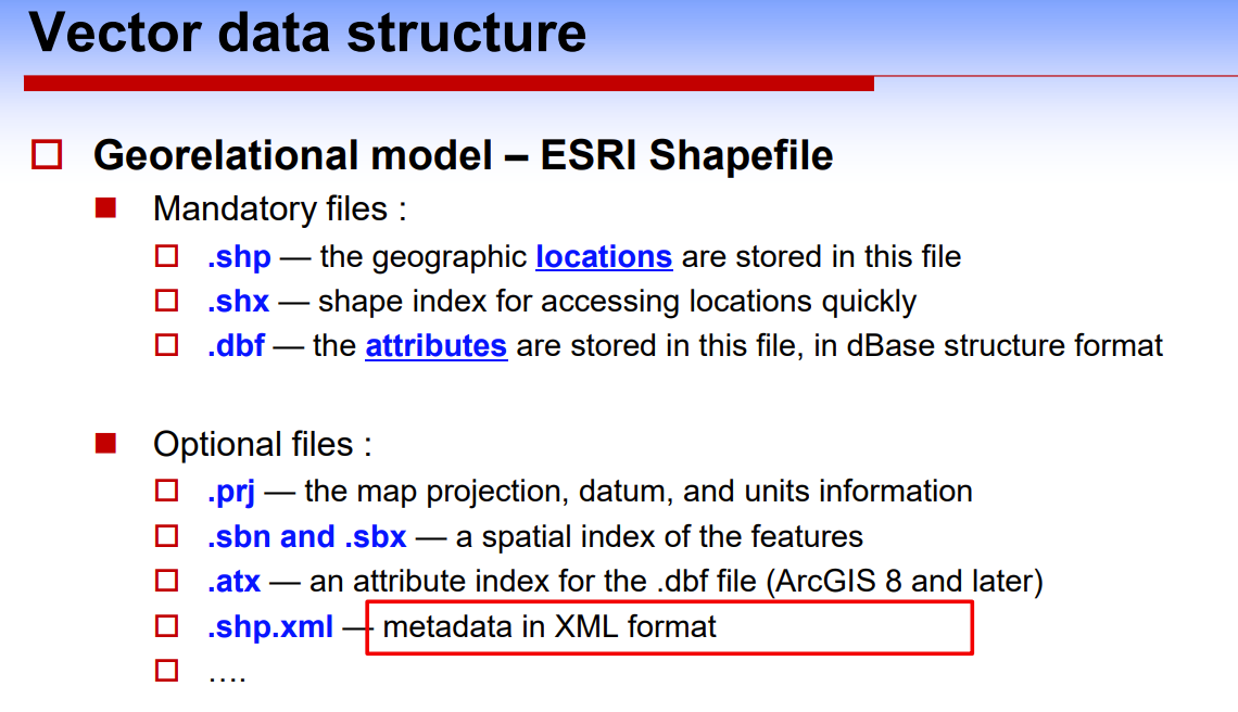
Only metadata in the ______ format can be viewed, edited, published, and exported in ArcGIS Pro.
Metadata in other formats can only be ______ unless it is __________.
ArcGIS
viewed, upgraded to ArcGIS metadata format