introduction to gis - 9.10.24
1/27
There's no tags or description
Looks like no tags are added yet.
Name | Mastery | Learn | Test | Matching | Spaced |
|---|
No study sessions yet.
28 Terms
GIS
Geographical Information Systems for spatial data analysis.
QGIS
Free, open-source GIS software for mapping.
Raster Data
Pixel-based data format representing continuous values.
Vector Data
Data format using points, lines, and polygons.
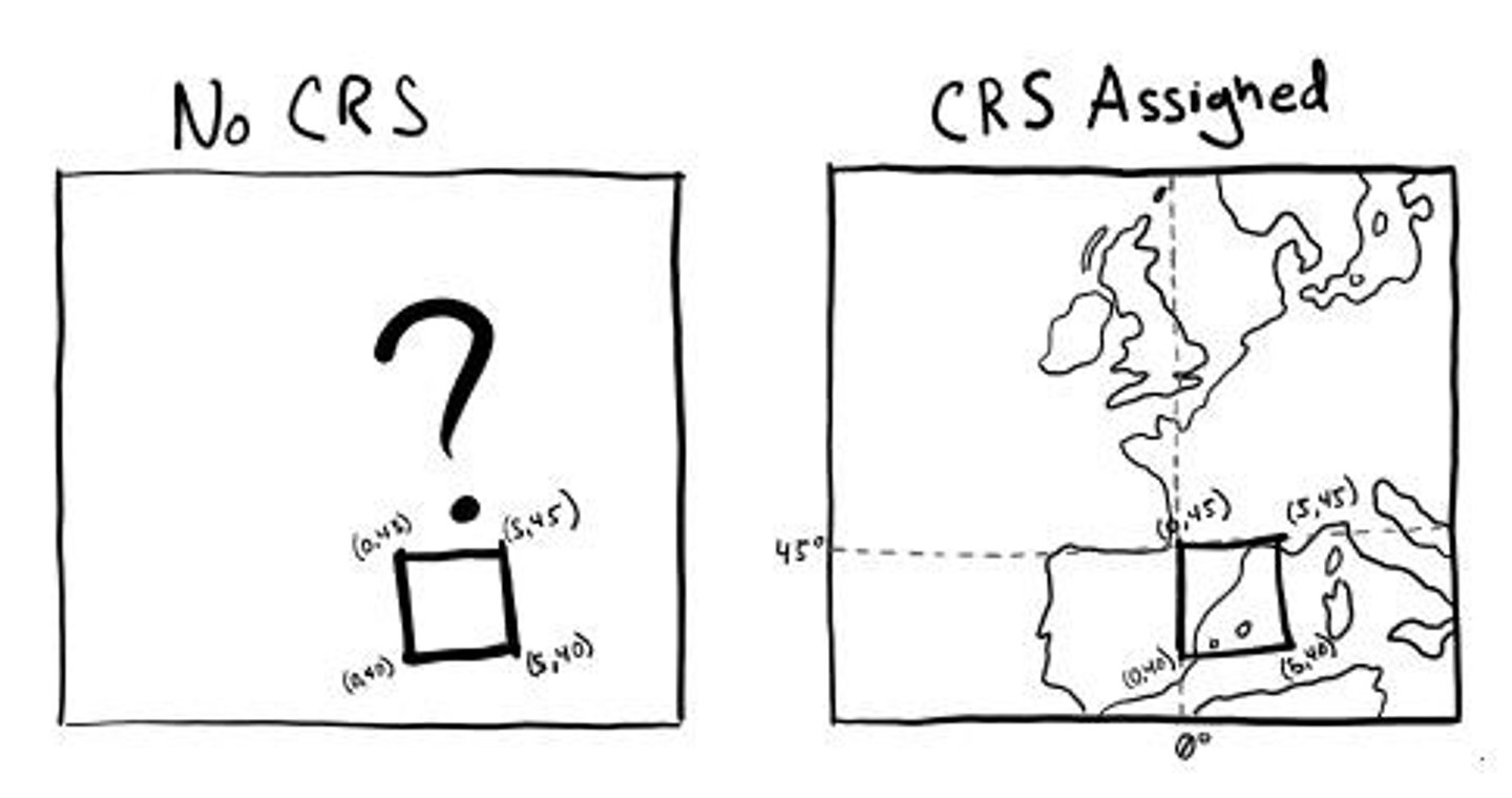
Coordinate Reference System (CRS)
Defines how map points relate to Earth.
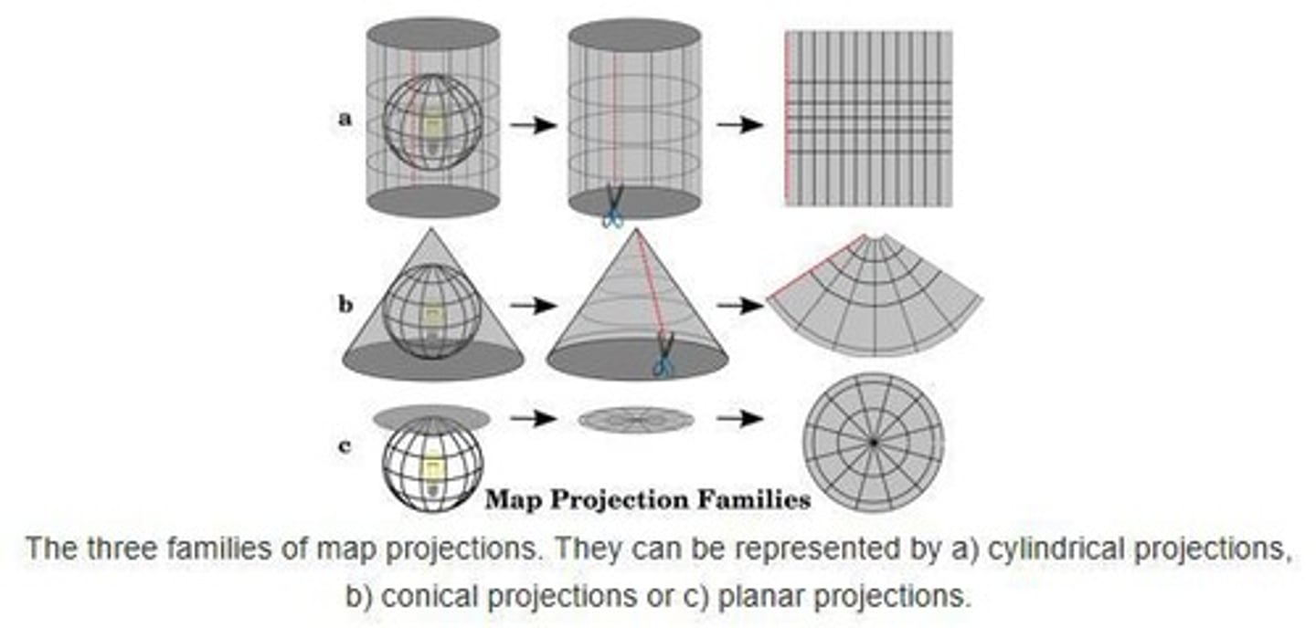
Projection
Method to convert 3D Earth to 2D maps.
Shapefile
Vector format for storing geometric location.
Attribute Table
Contains descriptive information for vector features.
Resolution
Size of raster cells affecting detail level.
Metadata
Data providing information about GIS datasets.
GIS Layers
Different data types stacked for analysis.
North Arrow
Indicates map orientation and direction.
Scale Bar
Shows the relationship between map distance and real distance.
Legend
Explains symbols and colors used on a map.
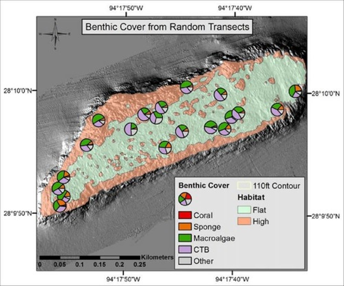
Sampling Stations
Locations for data collection in field studies.
Data Analyst
Professionals analyzing spatial data for insights.
ArcGIS
License-based GIS software for advanced analysis.
CSV File
Comma-separated values format for tabular data.
Geotiff
Raster format with geographic metadata embedded.
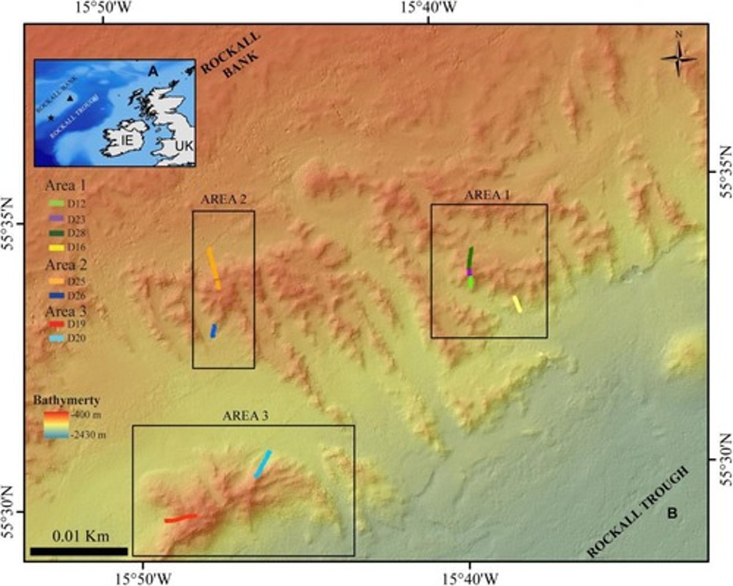
Bathymetry
Study of underwater depth of ocean floors.
Marine Protected Areas
Regions designated for conservation of marine resources.
Cold-water Corals
Coral species thriving in deep, cold ocean waters.

GIS Software Programs
Various tools available for geographic data manipulation.
Job Market
Opportunities in GIS-related fields and positions.
Online Data Sources
Websites providing access to GIS datasets.
Spatial Analysis
Techniques to analyze spatial relationships in data.
Transects
Lines along which data is collected in surveys.
Natural Earth
Source for simple base layers of global maps.