Gleim Unit 9: Navigation: Charts and Publications
1/34
There's no tags or description
Looks like no tags are added yet.
Name | Mastery | Learn | Test | Matching | Spaced | Call with Kai |
|---|
No analytics yet
Send a link to your students to track their progress
35 Terms
Lines of Longitude and Latitude
- An airports location can be found by the intersection of the lines of longitude and latitude
- The lines of longitude/latitude are printed on sectionals w/ each degree subdivided into 60 equal segments called minutes (') (Ex. 1/2° is 30')
Lines of Latitude
- Run laterally
- Parallel to the Equator
*Those north of the Equator are numbered from 0° to 90° north latitude
Lines of Longitude
- Extend lengthwise from the north pole to the south pole
- The prime meridian is 0° longitude with 180° on both east and west sides of the prime meridian
Class A Airspace
- Begins at 18,000 ft MSL
- Extends to about 60,000 ft MSL
*NOT depicted on sectional charts
Class B Airspace
- Begins at the surface of the airport
- Extends to 10,000 ft MSL
*Vertical limits are shown in hundreds of ft
- Depicted by heavy blue line on a sectional chart
- Extends outwards 30 NM
*Within the 30-NM veil, an altitude reporting transponder (Mode C) is required
Class C Airspace
Inner surface area:
- Extends from the surface (SFC) to 4,000 ft MSL (40)
- Extends outwards 5 NM from the airport
- Depicted by solid magenta lines on a sectional
Shelf area:
- Extends from 1,200 ft MSL (12) to 4,000 ft MSL
*Two-way radio communications and a transponder with encoding altimeter is required (Class A, B, and C)
Class D Airspace
- Begins at the surface
- Extends to 2,500 ft MSL
- Depicted by dashed blue lines on a sectional chart
Class E Airspace
- Class E Airspace is any airspace that is not Class A, B, C, or D
Class E begins at:
- The surface area marked by DASHED MAGENTA lines
- 700 ft AGL inside of areas marked by SHADED MAGENTA lines
- 1,200 ft AGL outside of areas marked by SHADED BLUE lines
*If shaded blue lines are not present, Class E begins at 1,200 ft AGL
-Extends up to, but not including, 18,000ft MSL, i.e., the floor of Class A airspace
Class G Airspace
Class G is not depicted on sectional charts and is implied to exist everywhere controlled airspace does not exist
Weather minimums
Class C, Class D, and Class E:
- 3 statue miles of visibility
- 500 feet below the clouds
- 1,000 feet above the clouds
- 2,000 feet horizontally from the clouds
Class G:
- 1 statue mile of invisibility
- Clear of clouds
What minimum radio equipment is required to land and takeoff in Class C airspace?
A Mode C transponder and two-way radio
Prohibited Areas
- Areas where flight of aircraft is prohibited
- Depicted by blue hashed lines with a "P" followed by a number (ex. P-40)
Restricted Areas
- Areas where unusual, often invisible, hazards to aircraft exist
- While not wholly prohibited, flight within these areas are subject to restrictions
- Depicted by blue hashed lines labeled with an "R" followed by a number (Ex. R-4009)
Warning Areas
- Contains activity that may be hazardous to nonparticipating aircraft
- Depicted by blue hashed lines labeled with a "W" followed by a number (Ex. W-103)
*Warning areas extend from 3 NM outward from the US Coast
Military Operations Areas
- Consists of airspace established to separate certain military training activities from IFR traffic
- Depicted by magenta hashed lines
- VFR Pilots should exercise extreme caution when flying within MOAs and should contact controlling agencies for traffic advisories prior
Alert Area
- Airspace within which there is a high volume of pilot training or an unusual type of aerial activity
- Depicted by hashed magenta lines and labeled with an "A" followed by numbers (Ex. A-293)
Military Training Routes
- Established below 10,000 ft MSL for both VFR and IFR at speeds over 250 knots
- Depicted by a thin gray line
*IR refers to IFR. VR refers to VFR.
*Military flight routes below 1,500 ft AGL have 4 numbers. Conversely, routes above 1,500 ft AGL have 3 numbers.
(Ex. IR 644 is above 1,500 ft and uses IFR)
Blue airport symbols indicate...
...that the airport has a control tower on the field
Magenta airport symbols indicate...
...non-towered airports
Magenta circles with nothing on the inside indicate...
...that airport is not hard-surfaced
Airport data on sectional charts include:
- Name of the airport
- Elevation of the airport, followed by the length of the longest hard-surfaced runway (Ex. 1008 L 70 means 1,008 ft MSL airport elevation and the longest runway is 7,000 ft)
- Private (PVT) if nonpublic-use
- UNICOM frequency (if assigned) shown after/underneath runway length (Ex. 122.8)
- Tower frequency at controlled airports (preceded by CT)
- Small, star-shaped symbol immediately above the airport, indicating a rotating beacon from sunset to sunrise
- The notation "NO SVFR" above the airport name, indicating that fixed-wing special VFR operations are prohibited
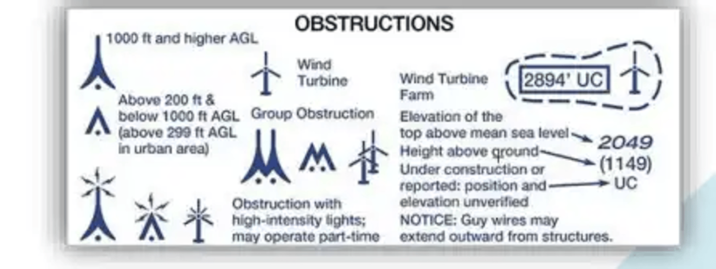
Obstructions symbols
*You must maintain at least 1,000 ft above obstructions in congested areas and 500 ft above obstructions in other areas

Maximum Elevation Figure (MEF)
- Represents the highest elevation within a quadrant
- Shown in hundreds
*A quadrant on a sectional is an area bound by ticked lines every 30 minutes of latitude and 30 minutes of longitude


VORTAC, VOR/DME, VOR
Magenta red flags
- Denote prominent landmarks that may be used as visual reporting checkpoints for VFR traffic when contacting ATC
At airports without operating control towers...
...you should use the CTAF frequency, marked with a letter C
- CT frequency is used instead when controll tower is closed
- FSS is usually also the CTAF
*At airports without a control tower, FSS, or Unicom, the CTAF is MULTICOM (122.9)
Inbound and outbound traffic...
...should communicate position and monitor CTAF within a 10-NM radius of the airport and give position reports when in the traffic pattern
Flight Service Stations (FSS)
- Specifically provide en route aircraft with current weather along with their route of flight
*Flight Service is available throughout the country on 122.2 MHz or the frequencies listed on aeronautical charts
FAA Advisory Circulars
- Issued by the FAA in a numbered system of general subject matter areas to correspond with the subject traffic areas in Federal Aviation Regulations (Ex. 60 Airman, 70 Airspace, 90 Air Traffic and General Operating Rules, etc.)
- Provides a systematic means for the issuance of non-regulatory material of interest to the aviation public
- Available on www.faa.gov
How often are U.S. Chart Supplements published and distributed?
Every 56 days for each of seven geographical districts of the US (Two extra for Alaska and Pacific Island Territories)
Notice to Air Missions (NOTAMs)
Includes information such as:
- airport or primary run way disclosures
- changes in navigational aids/ radar service availability
- other information essential to planned en route, terminal, or landing operations
- airport taxiways, aprons, ramp areas, and associated lighting
When flying over a national wildlife refuge...
...pilots are asked to maintain a minimum altitude of 2,000 ft above the surface.
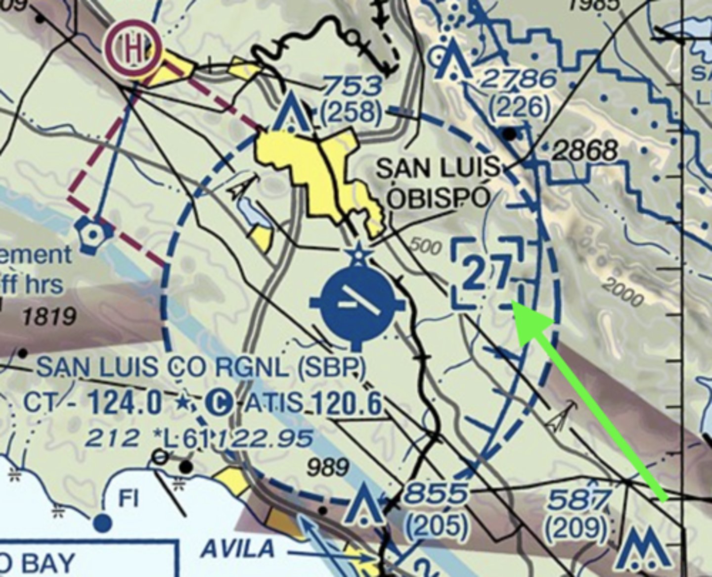
Ceiling of airspace on a sectional (example)
The blue box with "27" implies the ceiling of the Class B Airspace is at 2,700ft

Under what conditions, if any, may pilots fly through a restricted area?
With the controlling agency's authorization
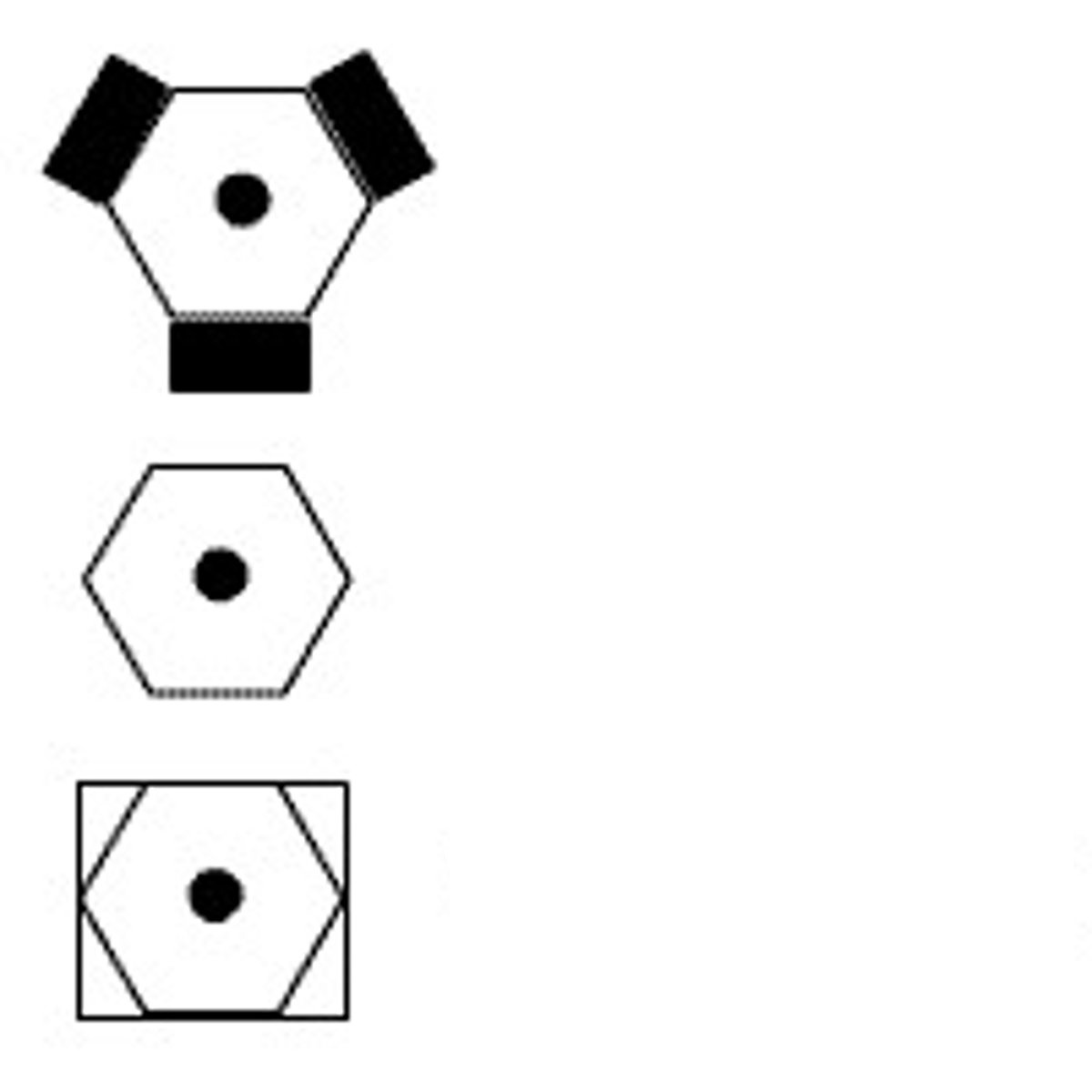
Airports that have fuel are indicated by...
...small squares extending from the top, bottom, and sides of the airport symbol