10) Storm Hazards
1/36
There's no tags or description
Looks like no tags are added yet.
Name | Mastery | Learn | Test | Matching | Spaced |
|---|
No study sessions yet.
37 Terms
tropical cyclone
= a rotating, organised, intense circular storm
... originates over tropical or subtropical water
... has organised deep convection
... a closed surface wind circulation about a well-defined centre
(15-30 degrees N & S of equator)
Tropical cyclone characteristics
- large scale (500km in diameter)
- low pressure atmospheric weather system
- high wind speeds
- high levels of precipitation/torrential rain
- storm surge
(also called revolving
tropical storms)
3 stages of development
1. tropical depression
= a tropical cyclone in which the maximum sustained wind speed is 62 km/h or less
2. tropical storm
= a tropical cyclone in which the maximum sustained surface wind is 63-118 km/h
3. officially devlops in a hurricane/typhoon/cyclone...
= when maximum sustained surface wind is 119 km/h or more
factors affecting the distribution of a storm
- oceans
- high temperature
- atmospheric instability
- rotation of the earth
- uniform wind directions at all levels
- a trigger
*Conditions must be present for tropical storms to form, explaining why the majority form in the tropics
factors affecting the distribution of a storm: oceans
... tropical storms derive moisture through evaporation and energy in the form of latent heat from oceans
...must be at least 50m deep
factors affecting the distribution of a storm: high temperature
... a sea-surface temperature of over 27°C is required to provide energy for tropical storm formation
(form in summer at low latitudes)
factors affecting the distribution of a storm: atmospheric instability
... tropical storms are most likely to form in regions of intense atmospheric instability where warm air if forced to rise
= the Intertropical Convergence Zone (ITCZ) where the earths surface receives the most concentrated solar radiation and 2 limbs of the Hadley cell with high pressure and low pressure converge to form low pressure on the ground
... warm air rises more readily because it is less dense, and clouds can form
factors affecting the distribution of a storm: uniform wind direction at all levels
... gentle winds in the upper atmosphere and winds blowing in the same direction are required for storms to form
... high wind speeds rip apart the vertical column of rising warm air as are multidirectional + prevent storm from attaining height and intensity (wind shear)
factors affecting the distribution of a storm: rotation of the earth
... this rotation creates the Coriolis effect which increases with distance away from the equator and causes the air to spin
... explains why storms don't form in regions between 5° N & 5° S as there is no spinning
factors affecting the distribution of a storm: a trigger
... a pre-existing thunderstorm, a spot of very high sea surface temperature, an area of low pressure and many other factors can act as a trigger
... triggers only further develop when conditions are present
The formation of tropical storms
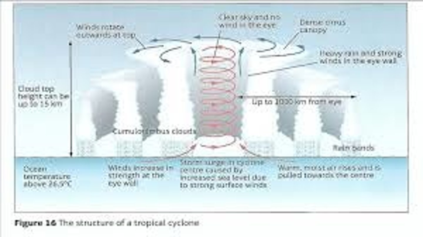
1. warm, moist air rises from the ocean creating a rising column of water that leaves an area of low pressure below
... this causes warm air from surrounding areas of higher pressure to move into this low-pressure area and rise to, forming a central vortex with constantly rising warm air
2. the water vapour in the rising column of warm air cools and condenses in the upper atmosphere to create water droplets and thunderstorm clouds
3. the warm, moist air and clouds spin due to the Coriolis effect, spinning clockwise in the southern hemisphere and anticlockwise in the northern
4. the constant additions of energy from the continuous column of warm air causes the storm to spin faster and generate higher wind speeds
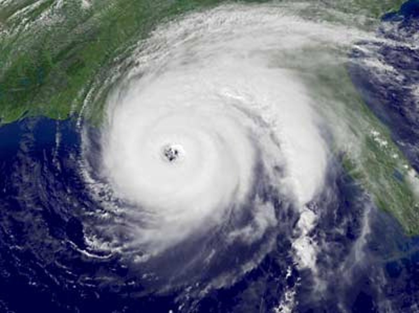
5. the eye of the storm is in the centre and is an area spanning around 30 miles wide that is extremely low pressure. Cool dry air from higher altitudes descends in the eye, causing the weather to be calmer and cloud free
*the more intense the storm, the clearer the eye
6. surrounding the eye is the eyewall, which is the most intense and powerful area of the storm.
... warm moist air rises rapidly with extremely high winds and torrential rain
7. when the tropical storm reaches a coast, the low-pressure and high winds will cause a large amount of sea water to be taken into the system and then released as a storm surge
8. when the storm reaches land, it no longer has a supply of energy (warm, moist air from the sea) and the eye eventually collapses, causing heavy rain to persist for days
Prevailing winds - formation of tropical storms
drive storms across oceans and help them continue to grow and develop
when do tropical storms stop
... only when they reach land, and their supply of energy and water is cut off will the storm start to decay
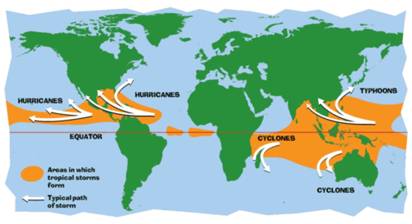
Spatial distribution of tropical storms
Hurricanes redistribute heat across the world + transfer warm conditions from the tropics towards the poles
... can causes extensive damage and the loss of life in coastal regions in many parts of the tropics
15° - 30° N & S of equator due to Coriolis effect
Near equator for ocean temperatures of 27°c
ITCZ = unstable air
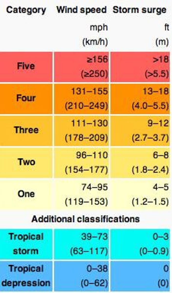
Saffir Simpson scale
developed in 1971 as a means of enabling storms of different magnitudes to be compared
· an absolute scale based on sustained wind speeds and has 5 separate categories
limited value in assessing impact as it doesn't consider rainfall or area affected by storm
e.g., a low category cyclone that hits a densely populated area can be far more damaging than a high category storm that makes landfall in a remote region
Frequency of tropical storms
tropical storms form from June-November in the Northern Hemisphere and from November-April in the Southern Hemisphere
· the majority of tropical storms do not develop into strong storms and do not reach land
· tropical storms that are higher magnitude and are reaching and are thought to be increasing in frequency
Regularity of tropical storms
tropical storms are irregular
· paths don't follow set route
· the route taken is dependent on the storm and the climatic conditions
(However, often occur in the same areas)
Predictability of tropical storms
tropical storms form away from land meaning satellite tracking of cloud formations + movement can be tracked
· general route can be predicted
· can estimate hour the hurricane will hit
...tracking may change within the 24 hours
· the closer the hurricane gets, the easier it is to predict
... storm surges can also be predicted based on the pressure and intensity of the storm
· probability can also be predicted based off of past storms and climatic trends
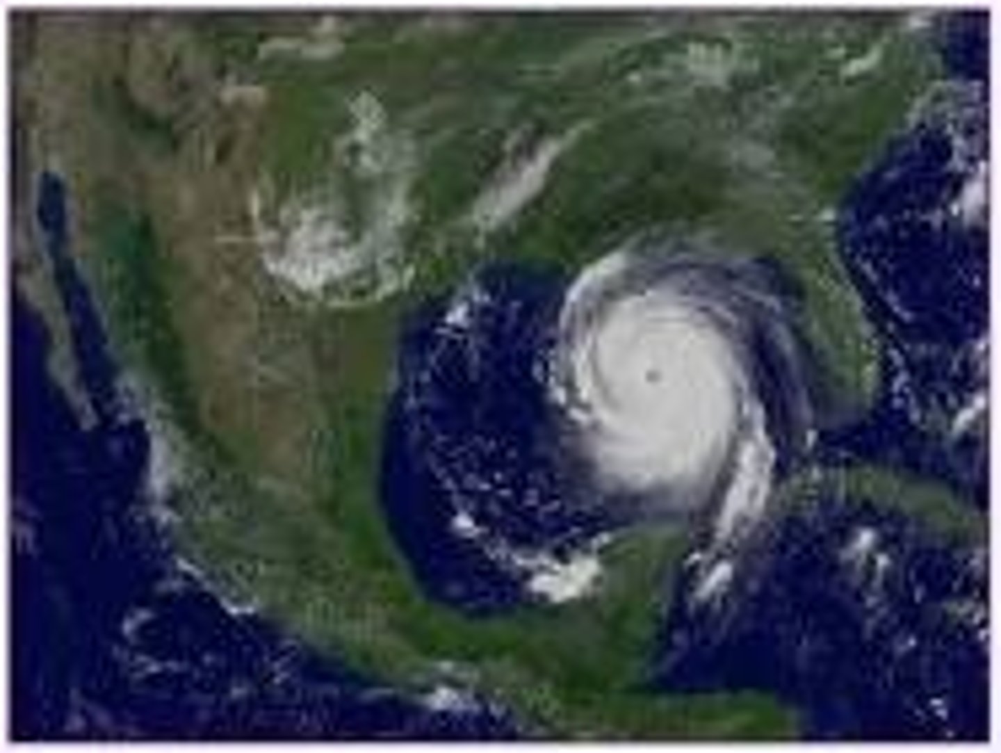
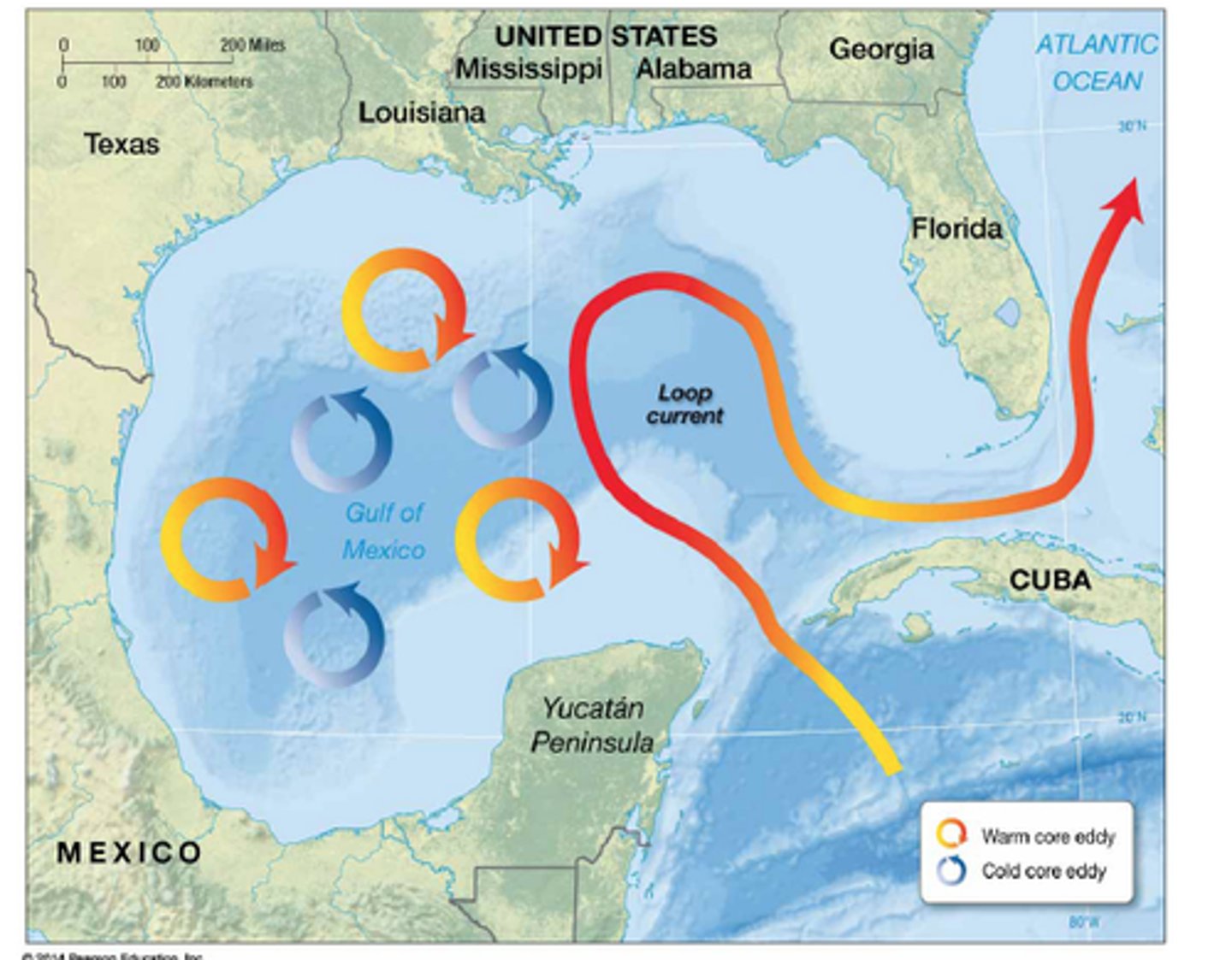
The Loop Current
2 of the most damaging hurricanes in history were intensified by the Loop Current in the Gulf of Mexico
- Hurricane Opal (1995) = category 4
- Hurricane Katrina (2005) = category 5
= an ocean current that protrudes through the Yucatan Channel into the belly of the gulf before exiting through the straits of Florida
... an eddy current (from the Loop Current) powered Hurricane Katrina up from a tropical cyclone as it passed through the Straits of Florida into a category 5 hurricane that ultimately flooded much of New Orleans and caused $125bn in damage
- for the 7th year in a row NOAA has forecast an above average hurricane season (2022)
... 2024 = "explosive atlantic hurricane season" with 20-25 named storms
... in 2022 the Loop Current pushed much farther north than usual
· Meteorologists fear that if one of these tropical storms was to pass over the deep warm waters of the Loop Current, they could strengthen into extremely powerful hurricanes and do so almost overnight
Factors that affect the vulnerability tor tropical revolving storms
o intensity/magnitude of the storm (Category 1-5)
o Speed of movement + how long it spends over the area
o The distance the place is from the sea
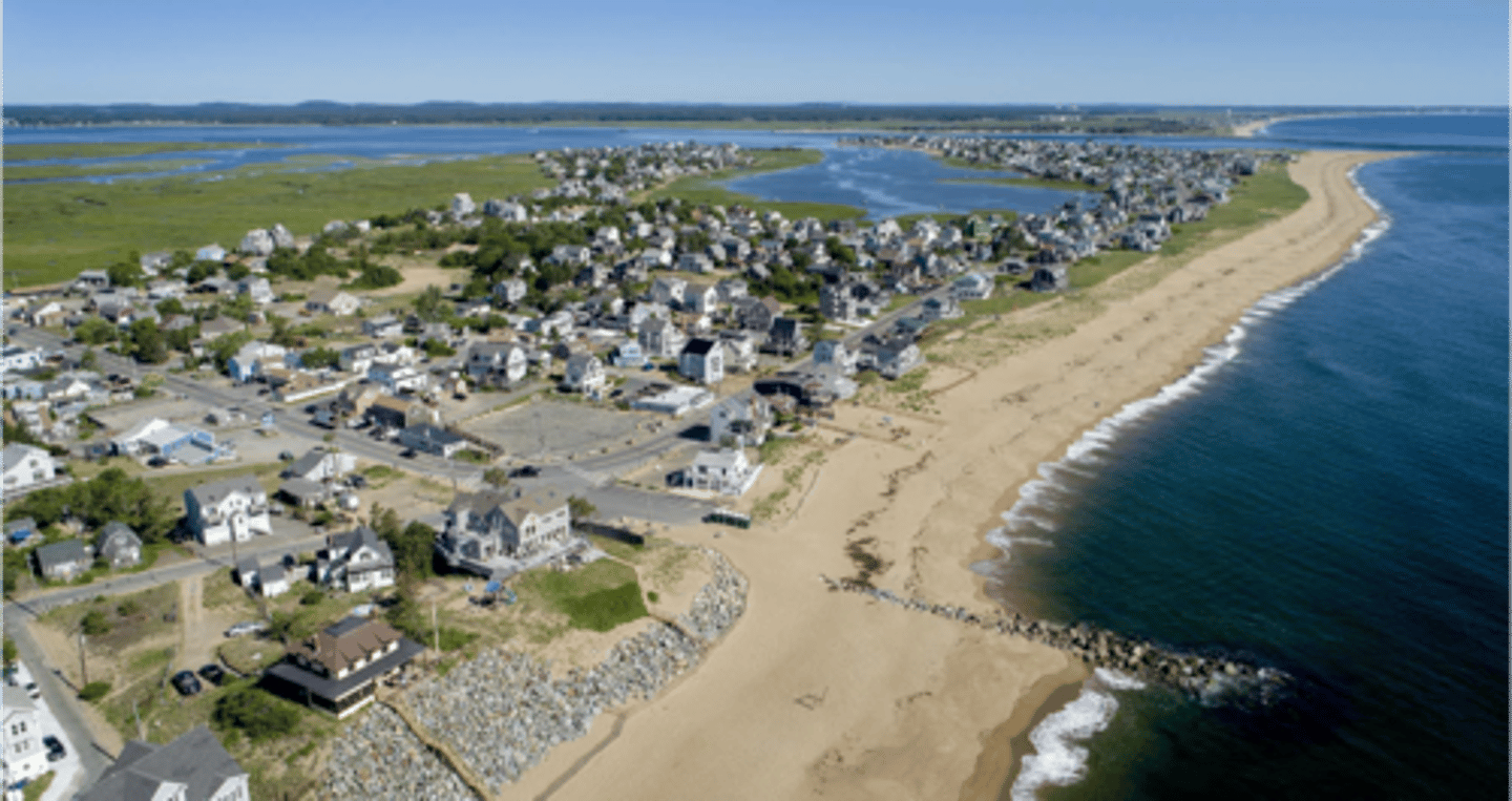
o The topography of the coastal area - low lying relief = most vulnerable (bays + estuaries)
o The preparations made by the community (warnings and response)
Hazards of tropical storms
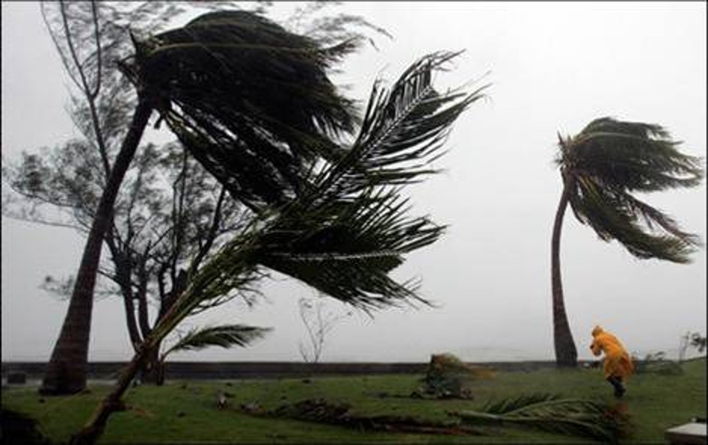
- strong winds + flying debris
- storm surges and coastal flooding
- river flooding
- landslides
Hazards of tropical storms: strong winds
= a continuous constant blast of air
... often exceed 150km/h
· Causes structural damage to roads, bridges, buildings, etc. (may even collapse)
· Bring down electricity power lines and devastate agricultural areas
· Flying debris is a serious threat to human life
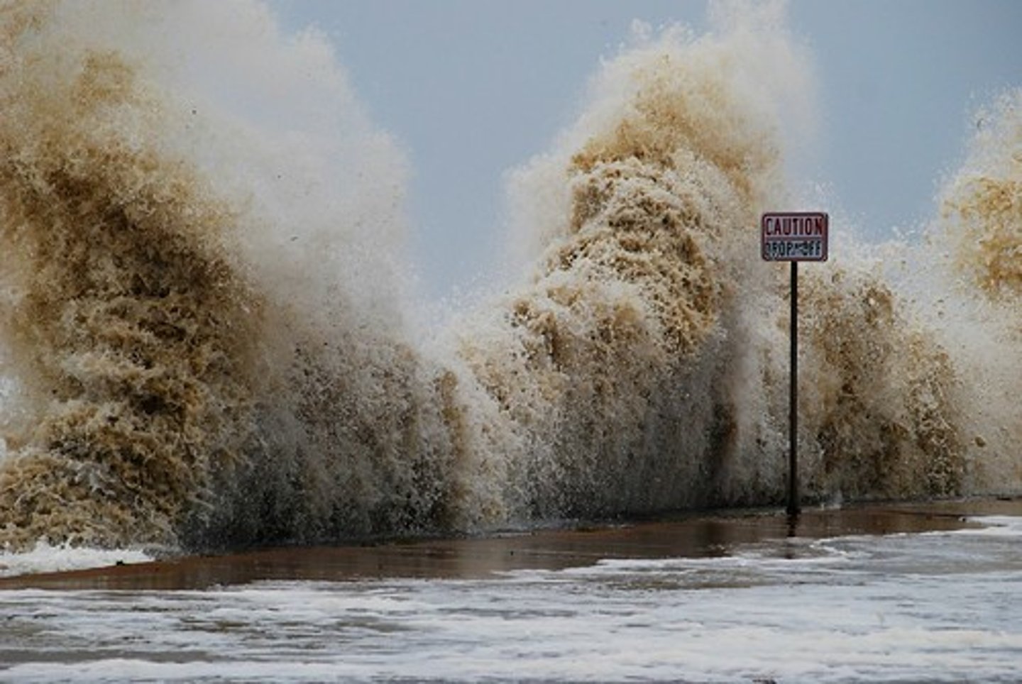
Hazards of tropical storms: storm surges
= a temporary sea level rise above the normal tidal level
... usually last for 24 hours or less
· Occur when there is very low atmospheric pressure over the sea which allows the sea's surface to rise as there is less weight of atmosphere above pushing it down
· Weight on the atmosphere is lifted due to rising air, reducing the pressure on the surface of the ocean
· Water molecules are free to move more, causing a dome shaped bulge to form underneath the storms and move in relation to it
· High wind speeds can also create larger waves which help push the water onto the land
... storm surges are much worse when the tidal water is funnelled into narrow coastal areas (bays + estuaries) as there is less space to accommodate the extra water which then flows onto the land
... storm surges account for 90% of all tropical storm fatalities and can reach up to 150km inland
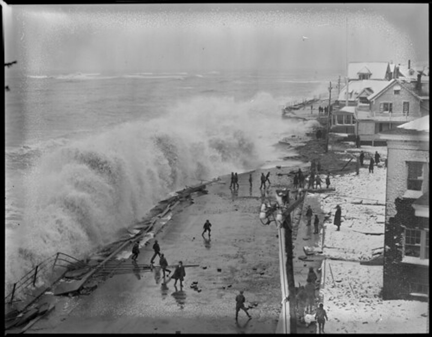
Hazards of tropical storms: river flooding
1953 North Sea Flood
· Combination of wind, high tide, and low pressure caused the sea to flood land up to 5.6 metres above sea level
· In the Netherlands 20% of the land was below sea level
- 307 people were killed in 4 British counties
- 28 people were killed in Belgium
- 19 people were killed in Eastern Scotland
- 230 deaths occurred at sea
... triggered the Thames flood barrier
... protects east coast locations from flooding
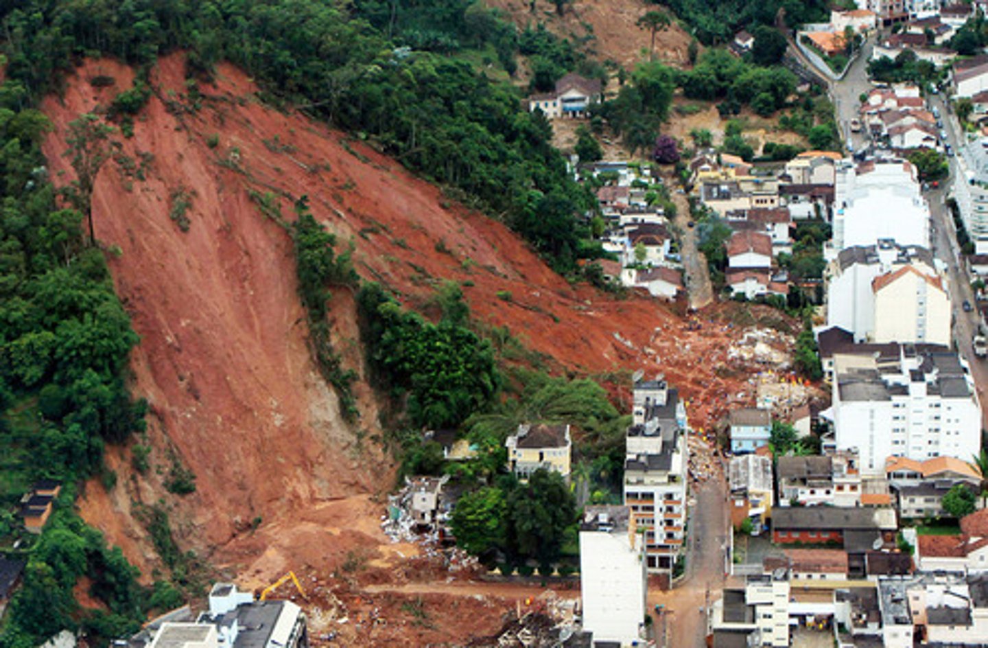
Hazards of tropical storms: heavy rainfall and landslides
· Not uncommon for rainfall to exceed 200-300 mm/day
· Cause severe flooding, landslides, and mudflows
· If there is high relief at the coast rainfall can be up to 500mm/day
Prediction of Tropical storms
= depends on the state of the monitoring and warning systems
NOAA, Maryland
National Hurricane Centre, Florida
Monitoring storms
If a country is wealthy enough to afford these systems...
- Storms form over oceans so there is more time to monitor them and warn people
- round the clock monitoring can be used
- use of aircraft/drones to fly into the storms to collect real time data
- sophisticated computer modelling of probability of intensity, track, storm surge elevation, etc.
National Hurricane Centre in Florida, USA = able to access data from geostationary satellites as well as sea-based recording centres on buoys
The prediction of the path/intensity/duration of a storm all rely on the level of sophistication of the technology and resources used or available
Prediction of the path of a storm
... a path can be predicted, and people can be warned to evacuate certain areas
· A forecast has to be accurate
· As tropical storms follow an erratic path, accuracy is limited to 12-18 hours warnings
- It costs the US $1 million per km of coastline to evacuate due to losses in business + repairs
- In areas with poor communication, there is often not enough time for evacuations
successful warning systems for storms
there are ways of creating successful warning systems in developing countries
e.g., Bangladesh storm preparedness
1977, in the approach of a cyclone a successful evacuation of over 300,000 took place of Cox's bazaar refugee camp in Bangladesh
... death toll was less than 100
Typical patterns of variation between HICs and LICs - storm preparedness
· 1991 Bangladesh, 131,000 deaths + $1.7 billion cost
· 1992 Florida (Hurricane Andrew), 60 deaths + $20 billion cost
(Despite Bangladesh building 4,000 cyclone shelter, 1,500 more were still needed
Technology used in prediction
o Weather satellites
o Buoys
o Drones
o Crewed aircraft
can whereabouts of storms be predicted....
· Usually restricted to the tropics
. Mostly occur from late summer into autumn with a peak from August through to October
NOAA
published a prediction of hurricane activity for the forthcoming season every year
· Used sea surface temperatures, atmospheric conditions, and short-term climatic cycles as indicators of number of hurricanes expected
Hurricane return period
the frequency at which a certain intensity of hurricane can be expected within a given distance of a given location
e.g., a return period of 20 years for a major hurricane means that on average during the previous 100 years, a category 3 or greater hurricane passed within 100km of that location around 5 times
Frequency and magnitude of storms
... no clear evidence that the numbers or intensity or storms are increasing as global temperatures increase
However...
... scientist would argue a longer time period is necessary to study the effects of global warming on tropical storms form a clear trend to form
· Some logic is expecting a warmer atmosphere to hold more moisture and therefore result in more powerful storms, but this could be countered by increased wind shear that acts as a negative feedback
Prevention of storms
= cannot be prevented
... experiments have been tried with cloud seeding* to force more rainfall earlier, but research discontinued as it could potentially significantly disrupt the important global energy redistribution which tropical storms facilitate
*Charged silver ions are dropped which attract water particles, causing droplets to fall back to the ocean and prevent humidity
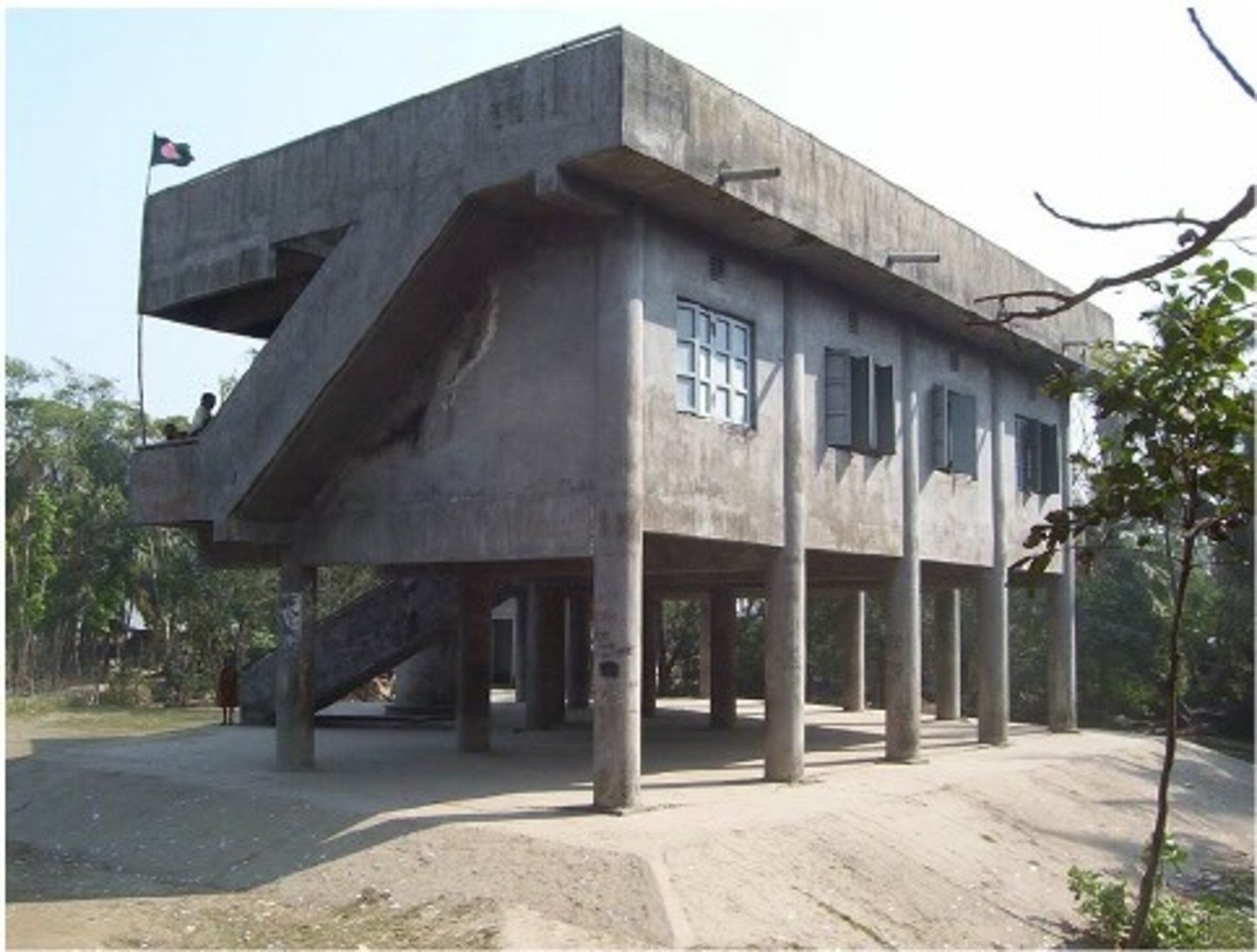
Protection from storms
1. National guard in the US oversea evacuation and protect abandoned settlements from looting
2. Cyclone/hurricane drills encourage safe evacuation and awareness of tropical storms in schools
- National Hurricane preparedness week
- Project Safeside, Florida
3. Land use planning, afforestation, and coastal mangrove restoration to absorb energy
4. Sea walls, breakwater, and coastal defences
5. Houses built on stilts to protect them from flooding
6. Cyclone shelters
Local communities tend to create plans
e.g., North Carolina, USA, the Outer Banks Islands have mitigation plans, aim of saving lives, money, and property
... rapid recovery with post disaster funding, risk sharing and insurance