Earth 102 Final Exam
1/54
There's no tags or description
Looks like no tags are added yet.
Name | Mastery | Learn | Test | Matching | Spaced | Call with Kai |
|---|
No analytics yet
Send a link to your students to track their progress
55 Terms
Porosity
Percentage of open spaces between grains in a rock.
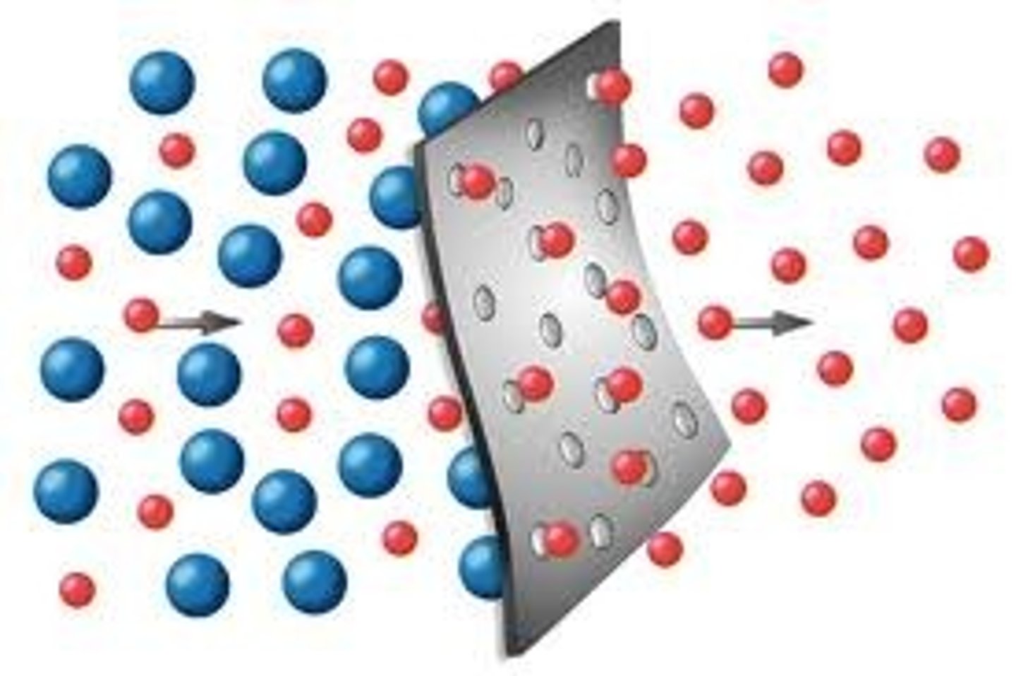
Permeability
Ability of rock or soil to allow water to flow through it
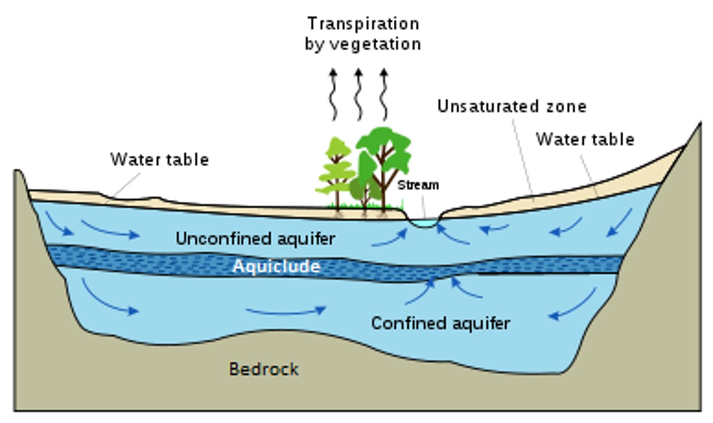
zone of aeration
upper soil layers that hold both air and water
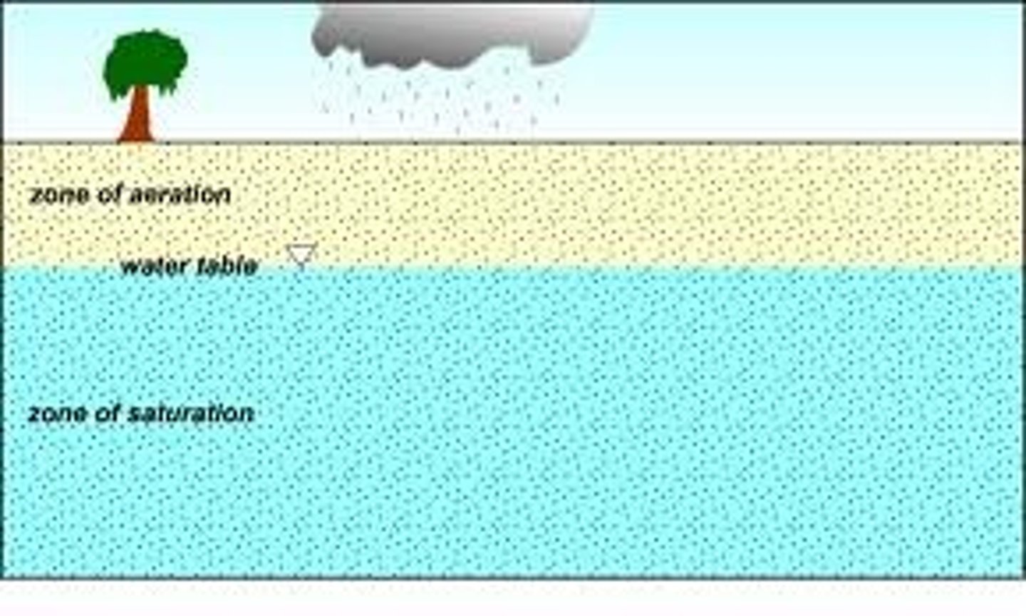
zone of saturation
The lower zone where water accumilates between small rock particles.
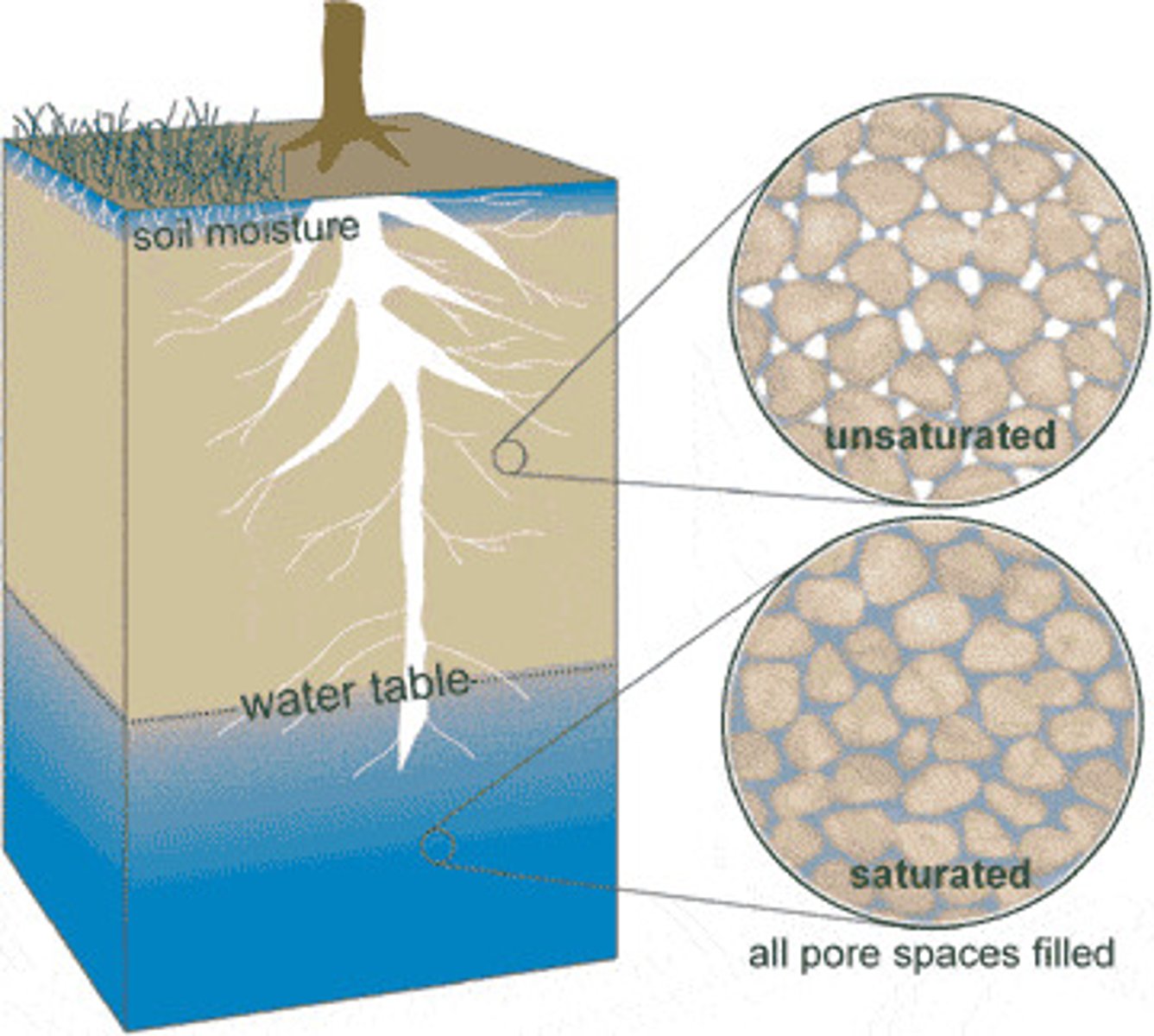
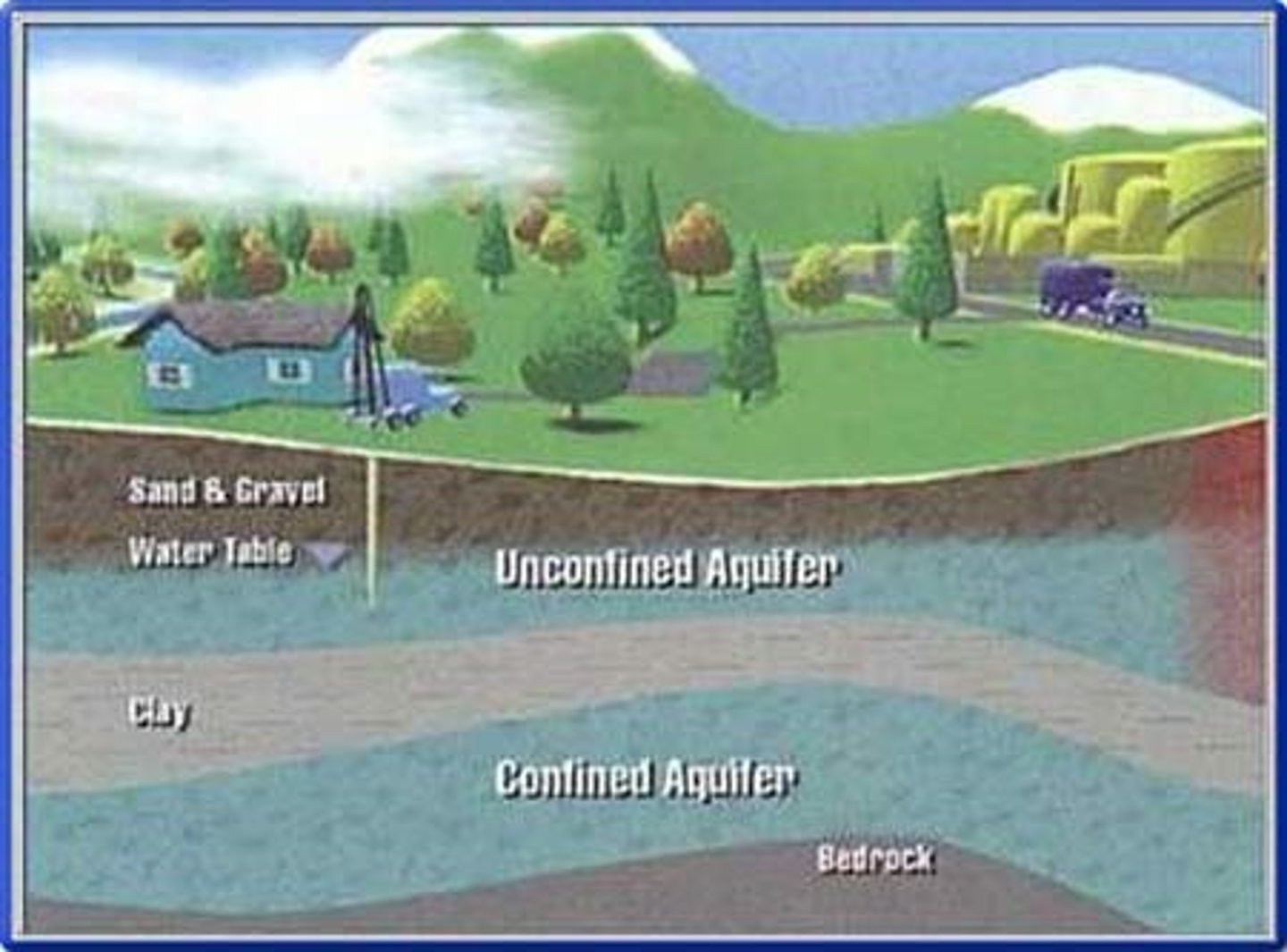
water table
The upper level of the saturated zone of groundwater

discharge
the quantity of water in a stream that passes a given point in a period of time
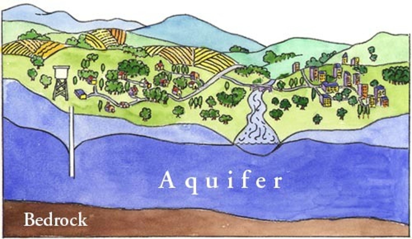
Aquifers
Subterranean, porous, water-holding rocks that provide millions of wells with steady flows of water.
Aquiclude
A body of rock that will absorb water slowly, but will not transmit it fast enough to supply a well.
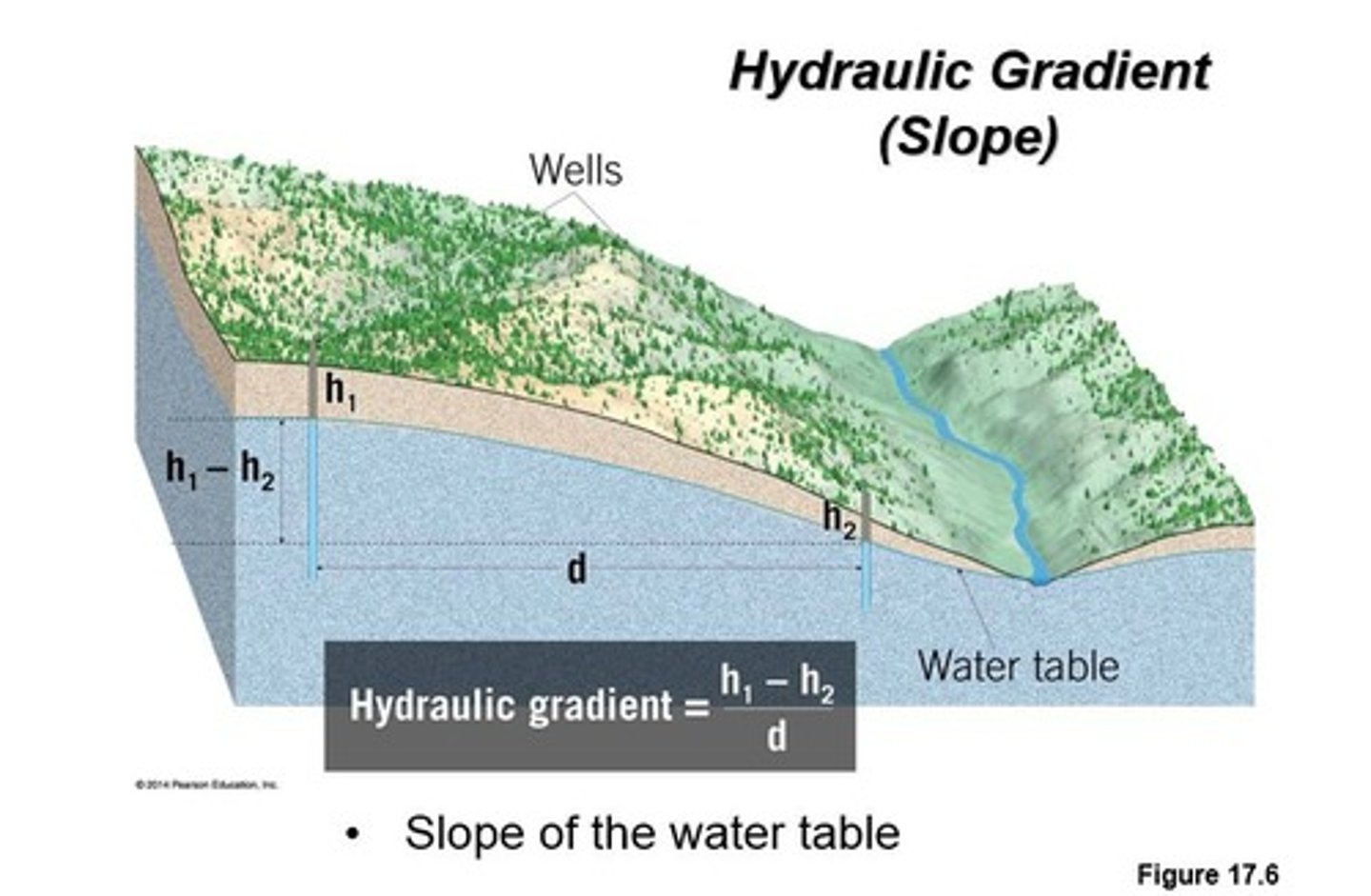
hydraulic gradient
the slope of the water table
confined aquifer
A groundwater storage area trapped between two impermeable layers of rock.
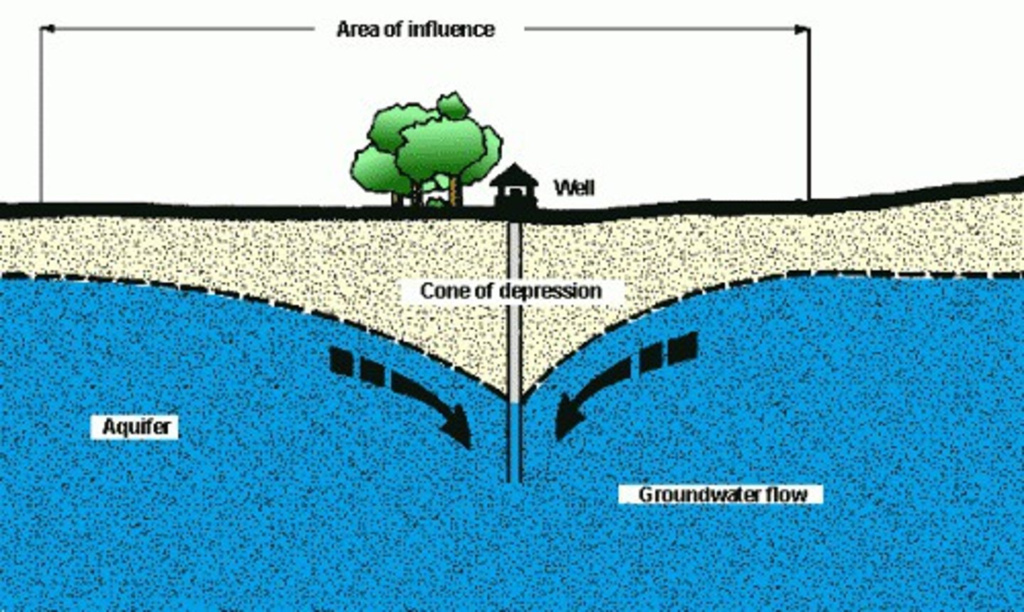
cone of depression
lowering of the water table around a pumping well
artesian system
a confined aquifer system in which ground water can rise above its aquifer under its own pressure
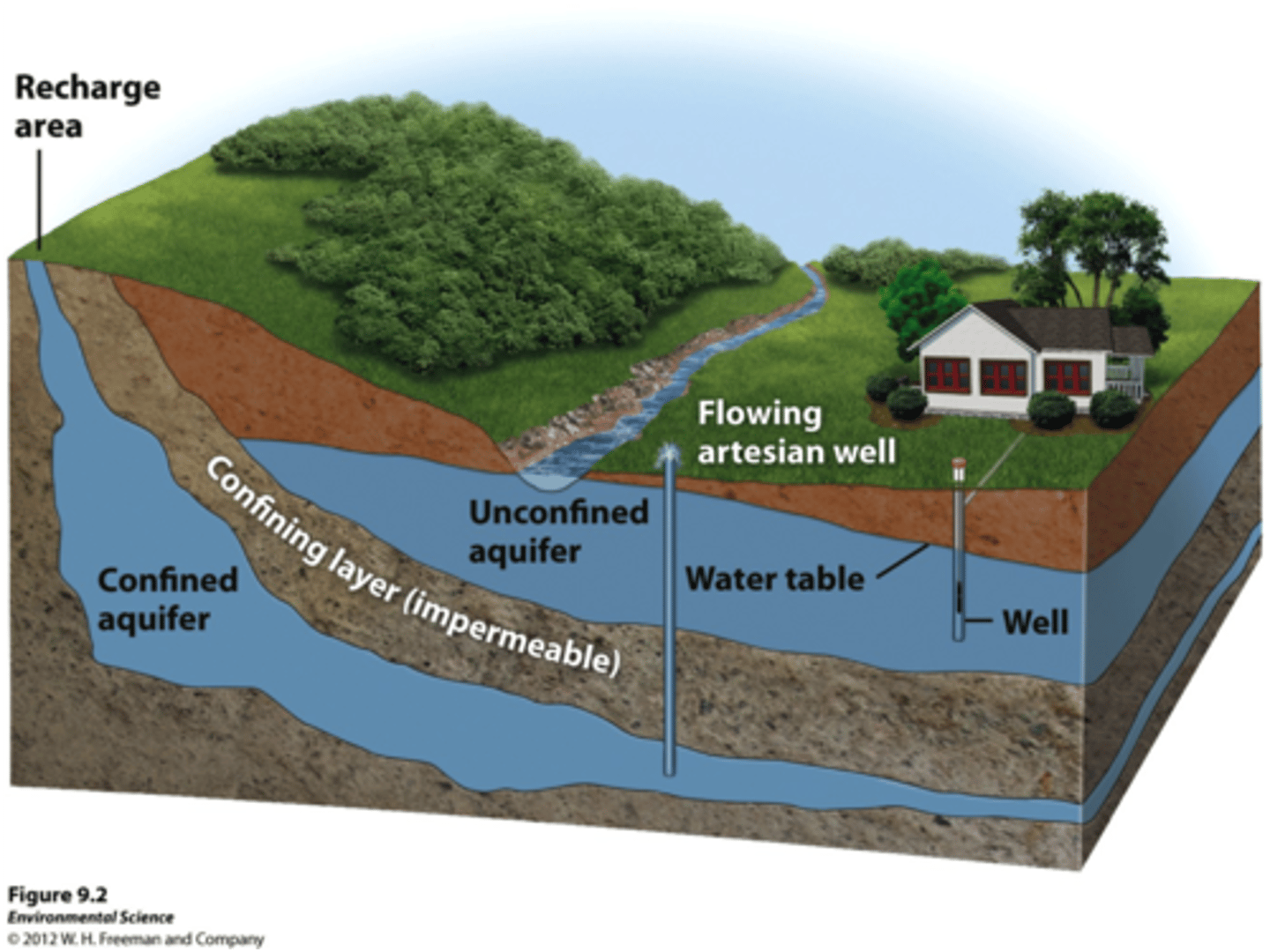
conditions necessary to form an artesian system
an inclined aquifer sandwiched between impervious rock layers above and below that trap water in it
Is the water table a fixed line or does it vary
The water table level can vary in different areas and even within the same area. Fluctuations in the water table level are caused by changes in precipitation between seasons and years. During late winter and spring, when snow melts and precipitation is high, the water table rises.
salt water intrusions of aquifers occur
when storm surges or high tides overtop areas low in elevation.
Oasis
a fertile spot in a desert where water is found.
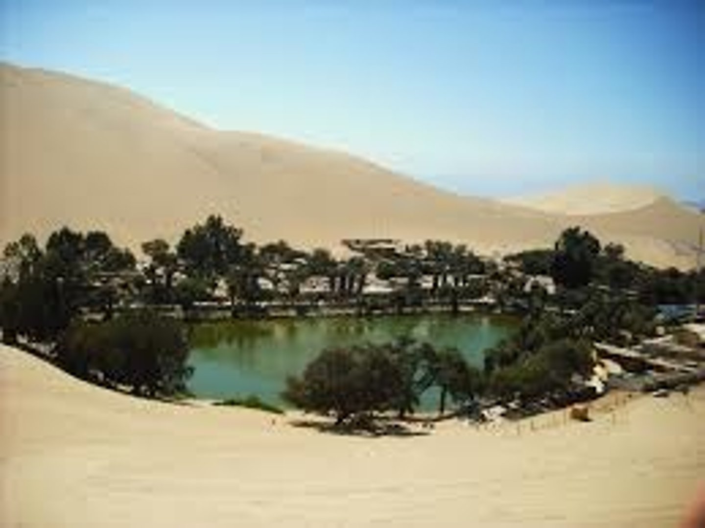
how are oasis formed
an underground aquifer or river that creates enough pressure for water to seep to the surface
where does the City of Chico get its water
Butte Basin + groundwater
How can global climate affect sea level
glaciers and ice sheets worldwide are melting and adding water to the ocean.
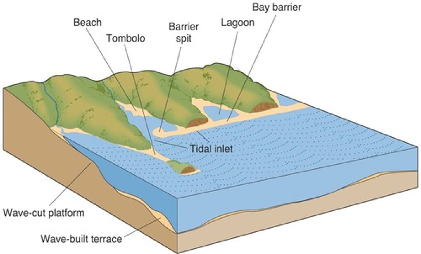
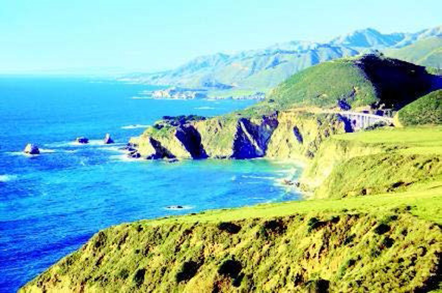
major coastline features
headlands, cliffs, bays, spits, salt marshes, and beaches.
emergent coastline
coastline where sea level is dropping or the land is rising
Submerging coastline
As sea levels rise, the land is covered
factors contribute to coastal retreat
Depressions have stronger winds resulting in rapid rates of recession
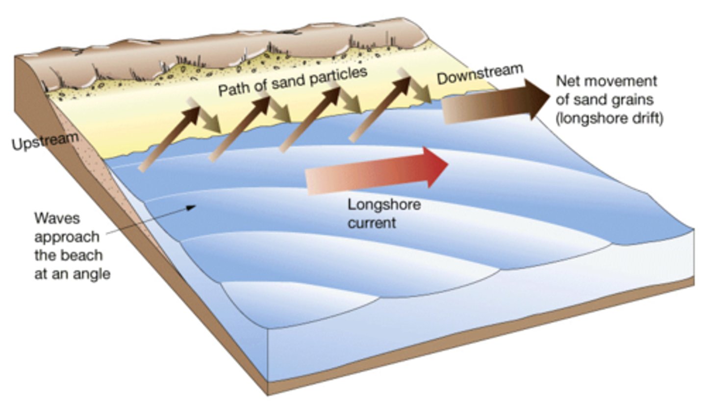
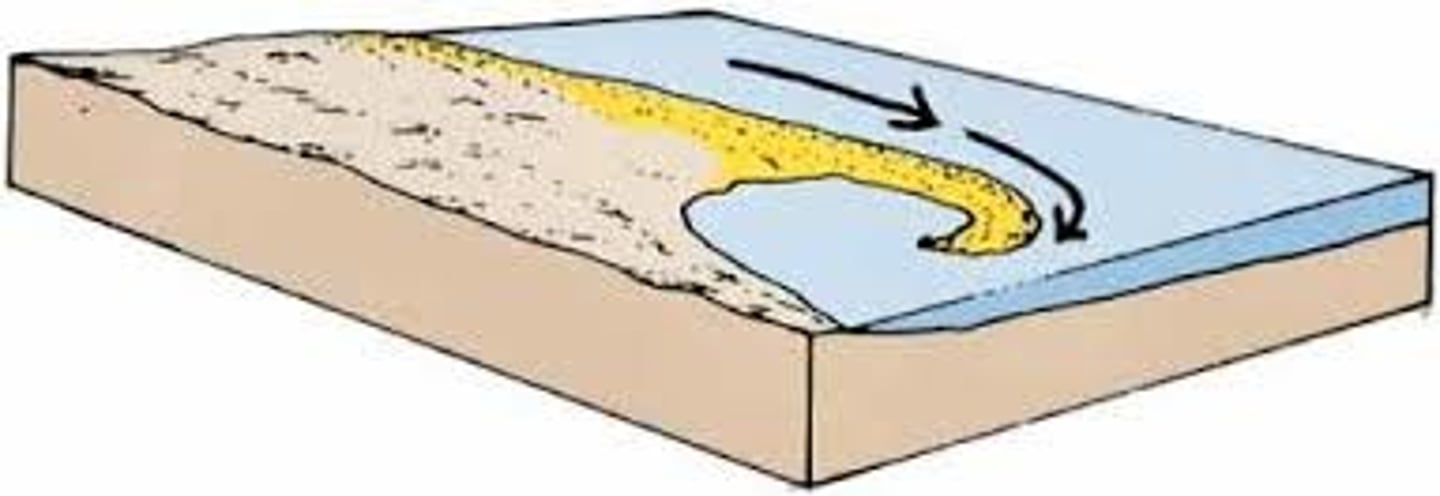
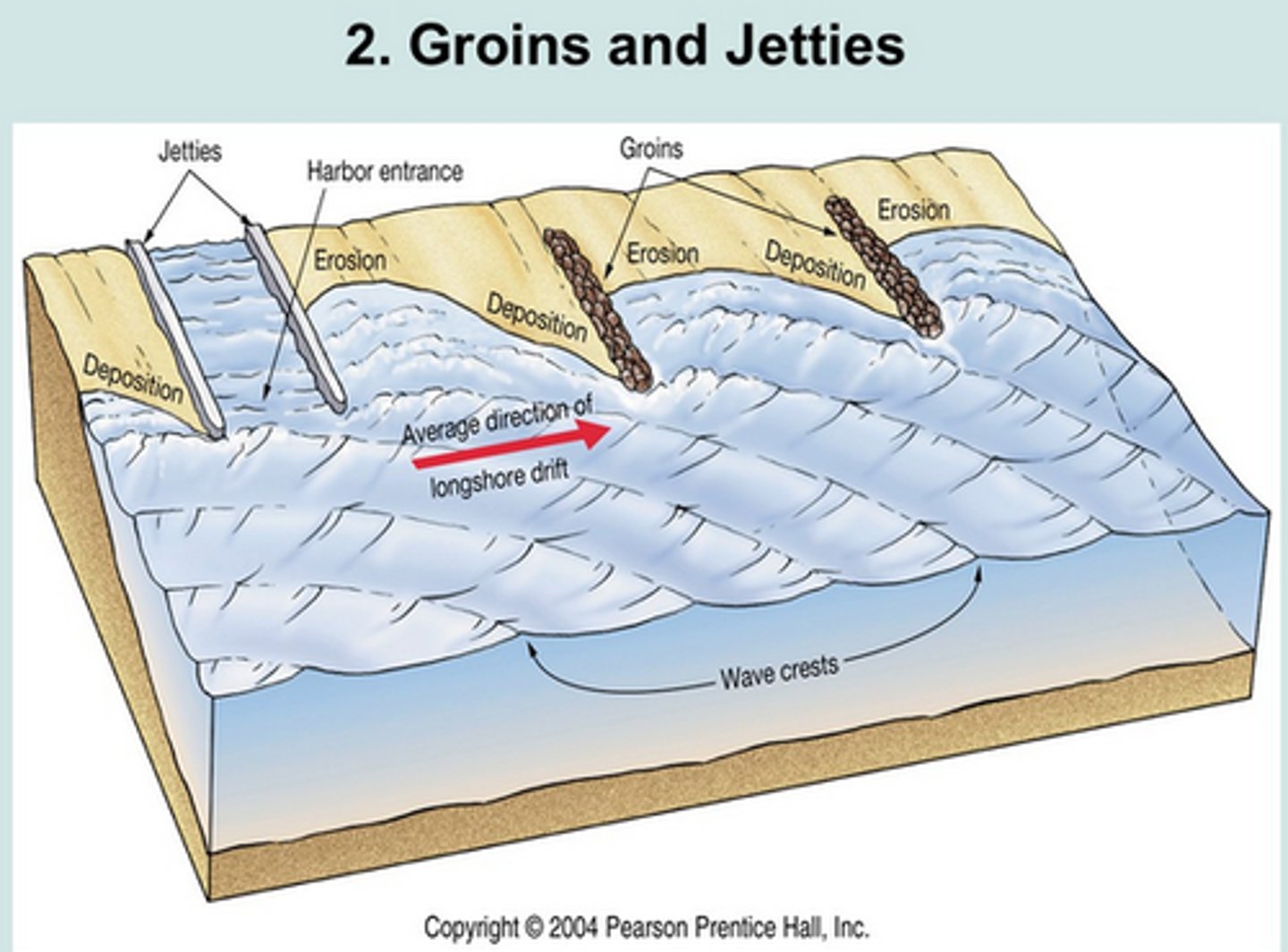
longshore drift
The movement of water and sediment down a beach caused by waves coming in to shore at an angle
Headlands
points of high land that stick out into a body of water
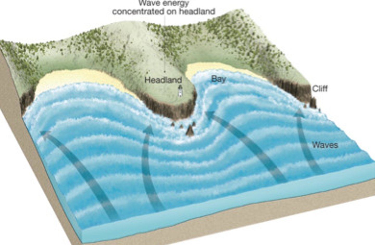
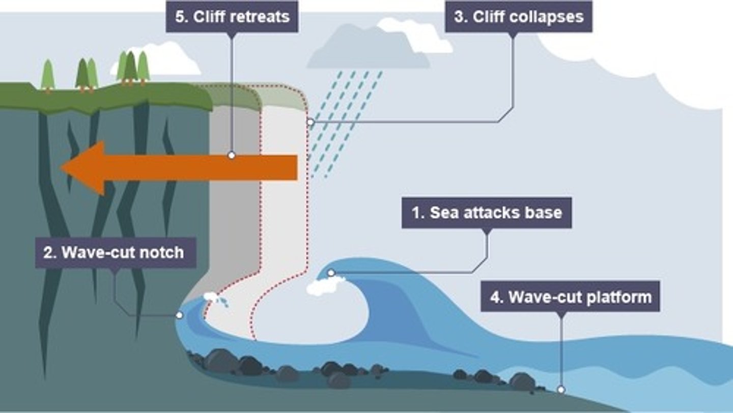
cliffs
steep rock faces, like those at the edge of the sea
Bays
bodies of water, smaller than a gulf and nearly surrounded by land.

Spits
Thin lines of sand deposited by long shore transport
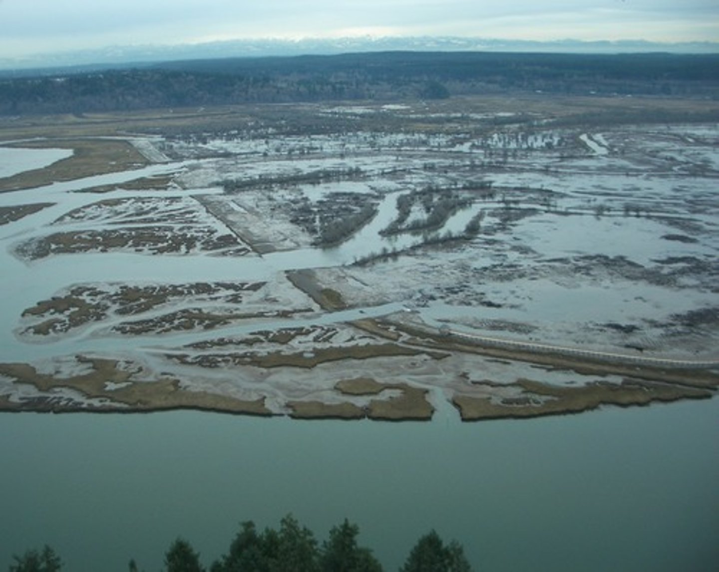
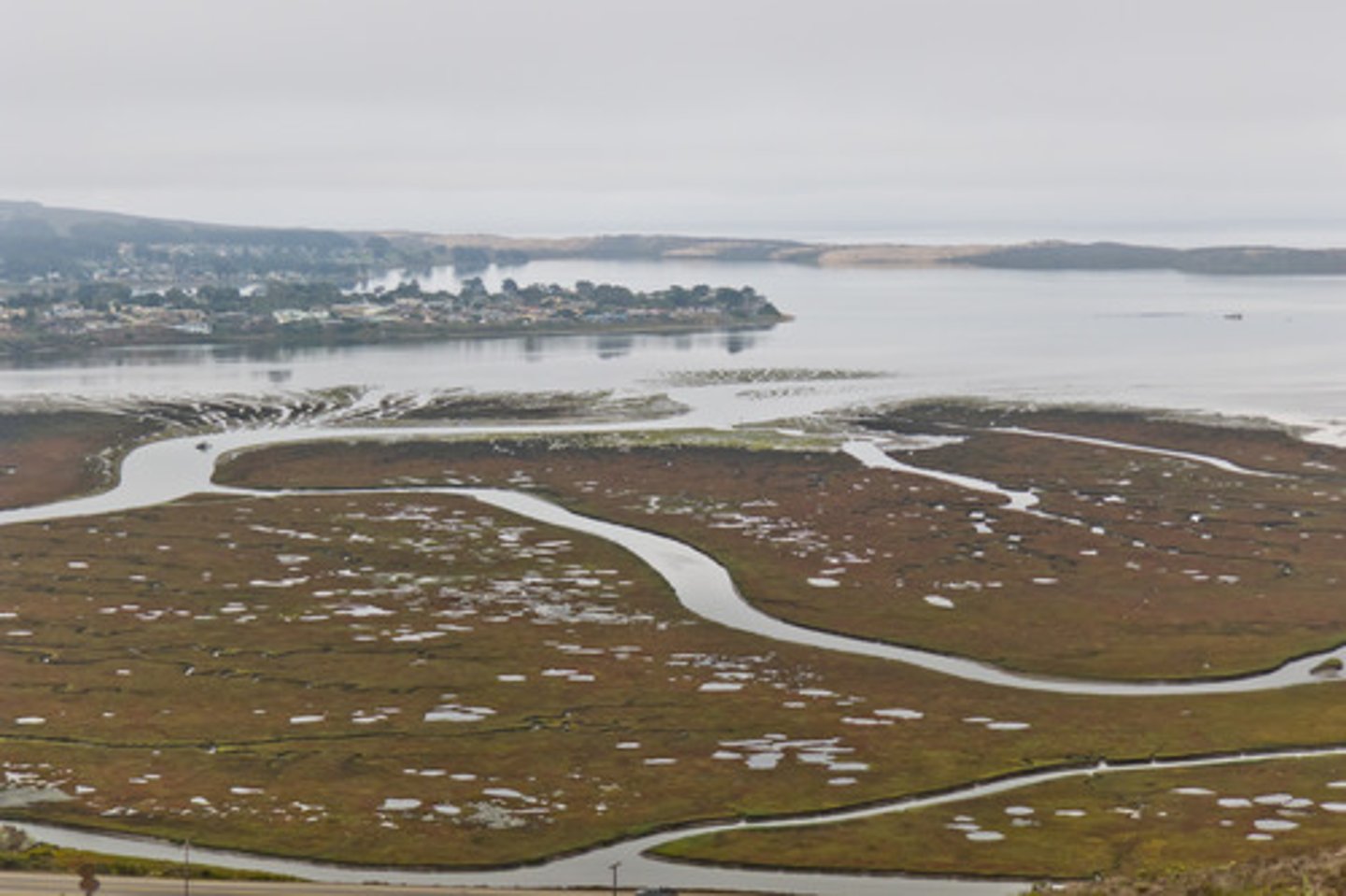
Salt Marshes/Estuaries
a saltwater biome that contains non-woody emergent vegetation
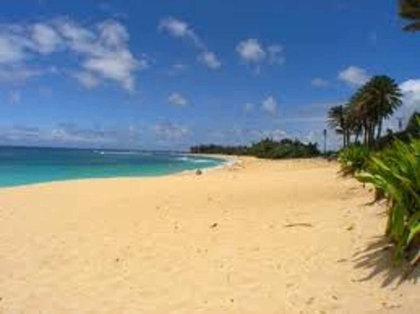
beaches
deposits of sand and other fragments of rock left along the shoreline boundary
How do humans attempt to halt beach erosion?
Seawalls, revetments, bulkheads, groins and breakwaters may reduce erosion in the short-term
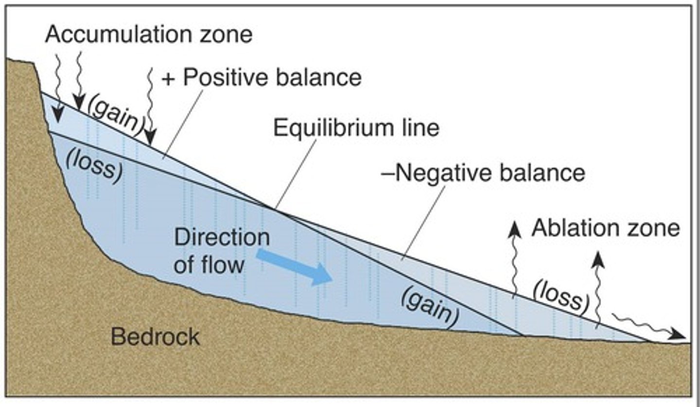
zone of accumulation
the area where a glacier forms
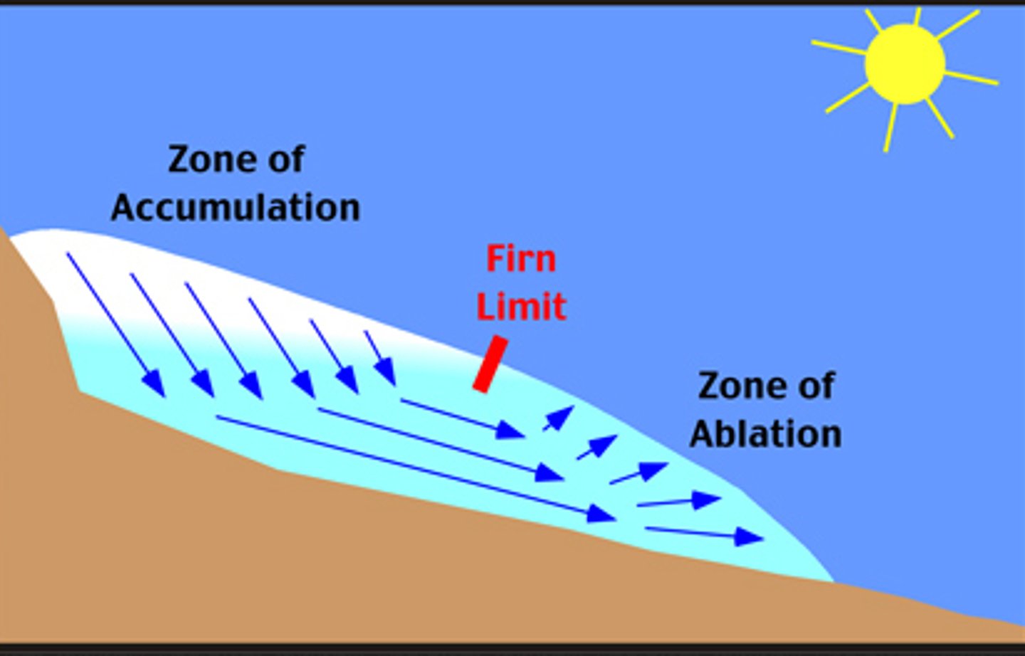
Zone of wastage (ablation)
Region in lower part of glacier where more snow/ice melts than accumulates resulting in loss of glacial ice.
Firn
A dense, icy pack of old snow

Valley glaciers
glaciers that form in valleys in high, mountainous areas
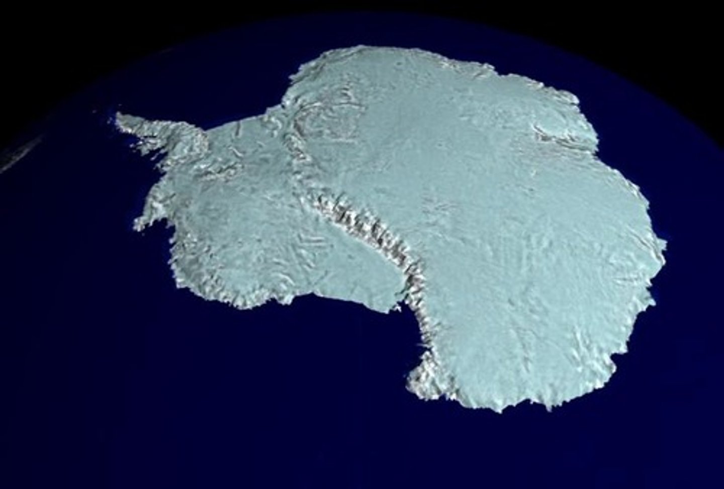
continental glaciers (ice sheets)
flow out from where the ice is thickest, are on flat ground
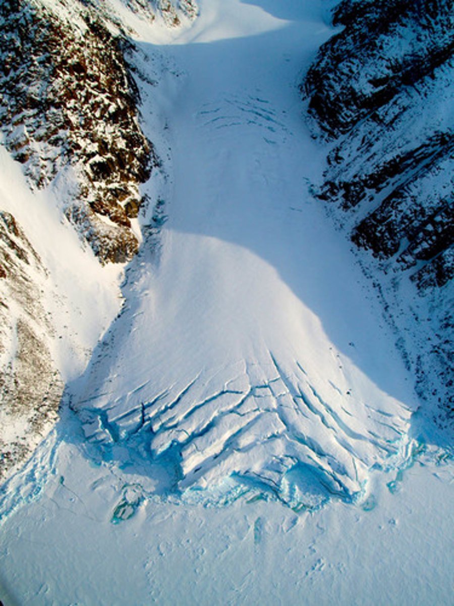
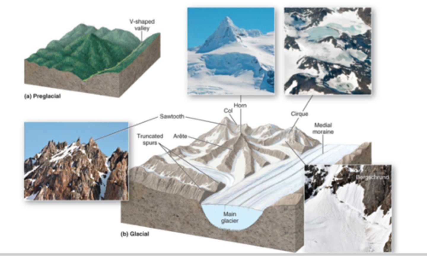
glacial erosional features
Cirque, U-Shaped Valleys, Glacial Striations, Arete, Trim Line, Hanging Valley
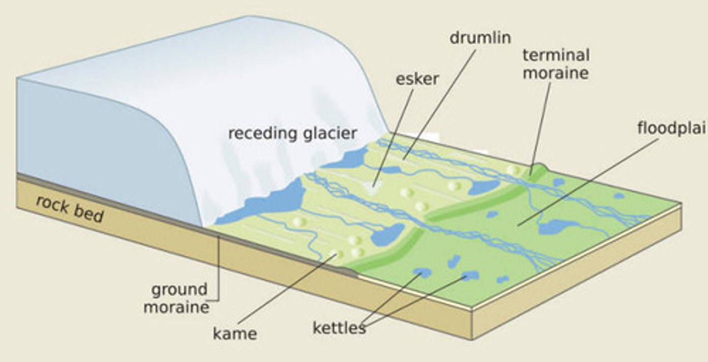
Glacial depositional features
outwash plains
eskers
kettle lakes
drumlins
kames
When did the last ice age end?
10,000 years ago
inter-glacial period
A period of warmer climate that is characterized by the retreat of glaciers
consequences of the last period of continental glaciation
Melting glacial water runs off into the ocean and sea-level worldwide will rise.
What are playas
Interior evaporite basins. Salt flats.
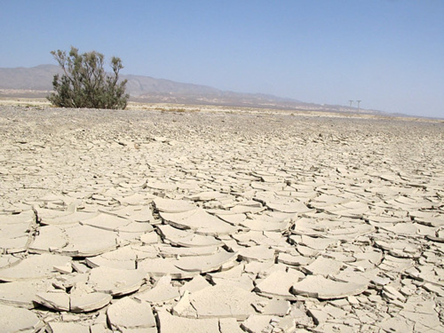
What occupies these arid basins in wet climate periods
plants
What occupies many of these basins now?
nothing
How do those rocks move across Racetrack Playa in Death Valley N.P.?
Ice, and wind
alluvial fans
Fan-shaped deposits of sediments dropped by streams flowing out of mountains
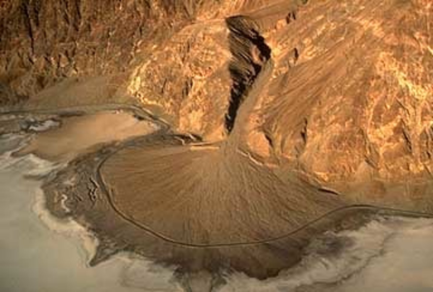
hazards of alluvial fans
inundation by flood water, debris flow and debris flood deposits, channel migration, deposition, and erosion.
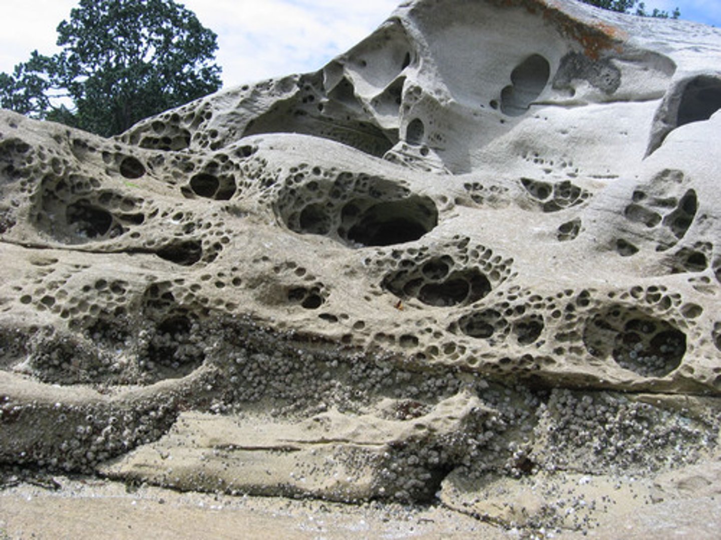
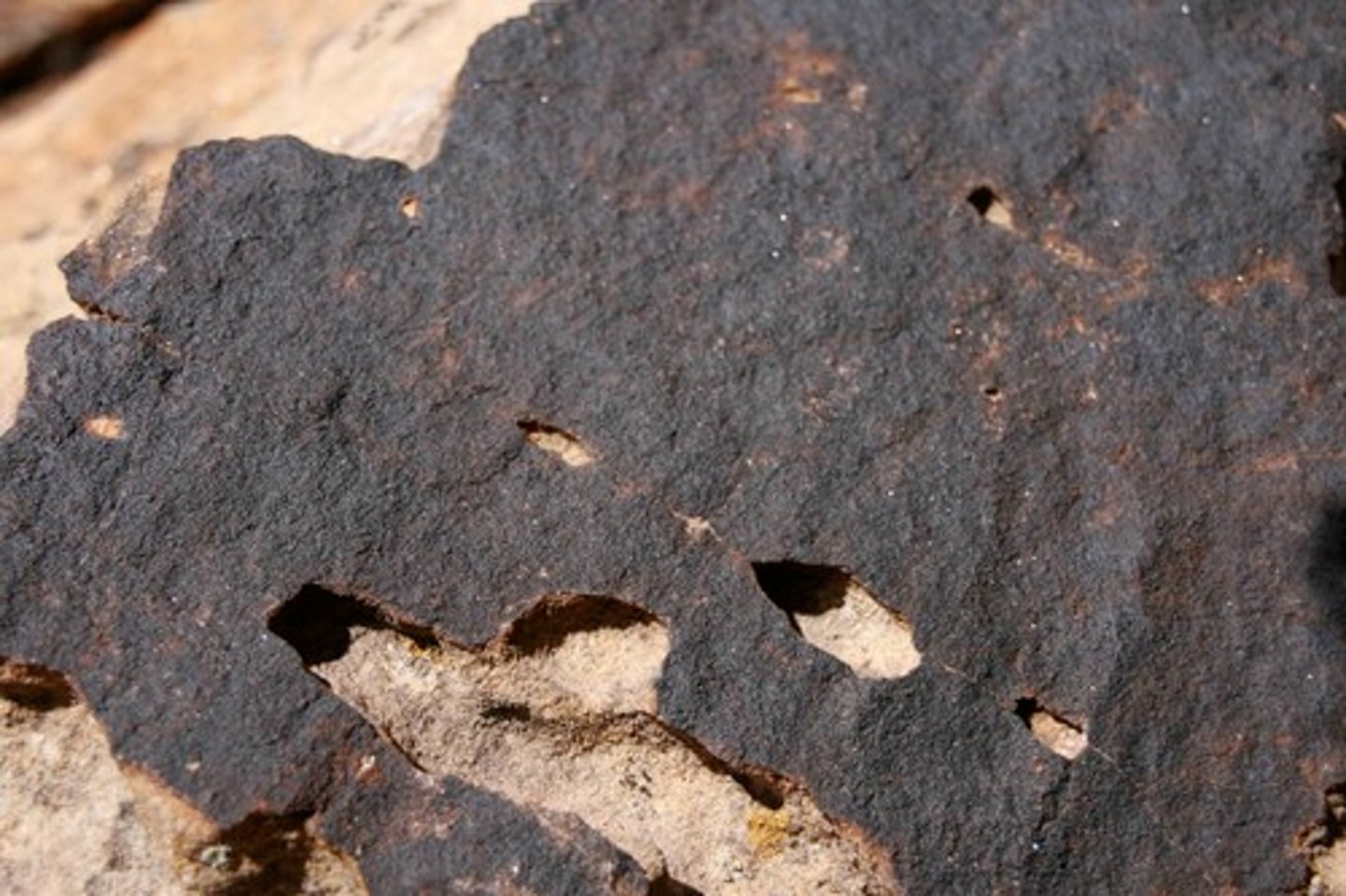
desert varnish
A dark, rusty-brown coating of iron oxide and magnesium oxide that accumulates on the surface of the rock.
Ventifacts
rocks shaped by wind blown sediments
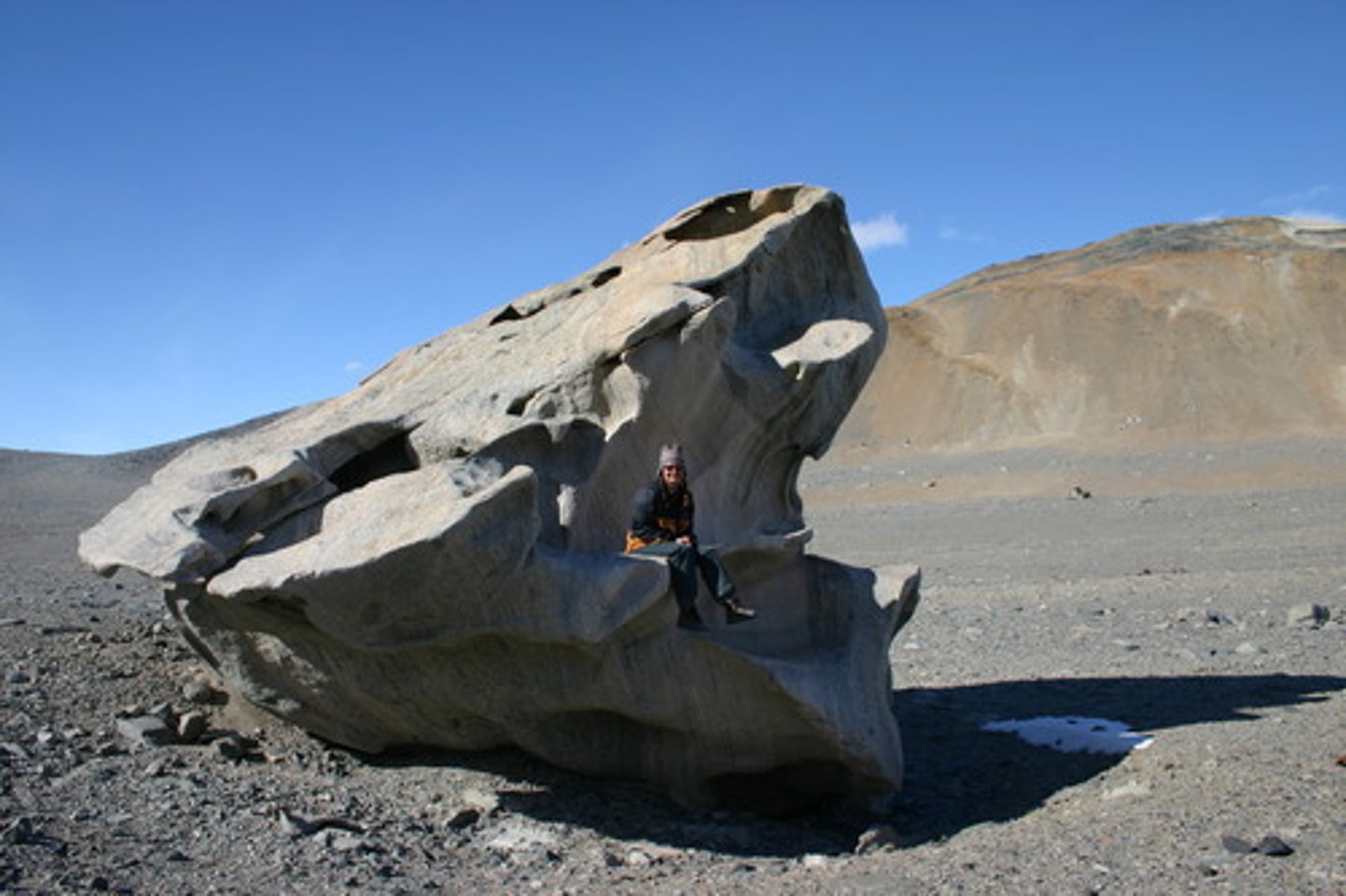
Why are most deserts rocky
the wind has stripped of all debris produced by meteoric degradation
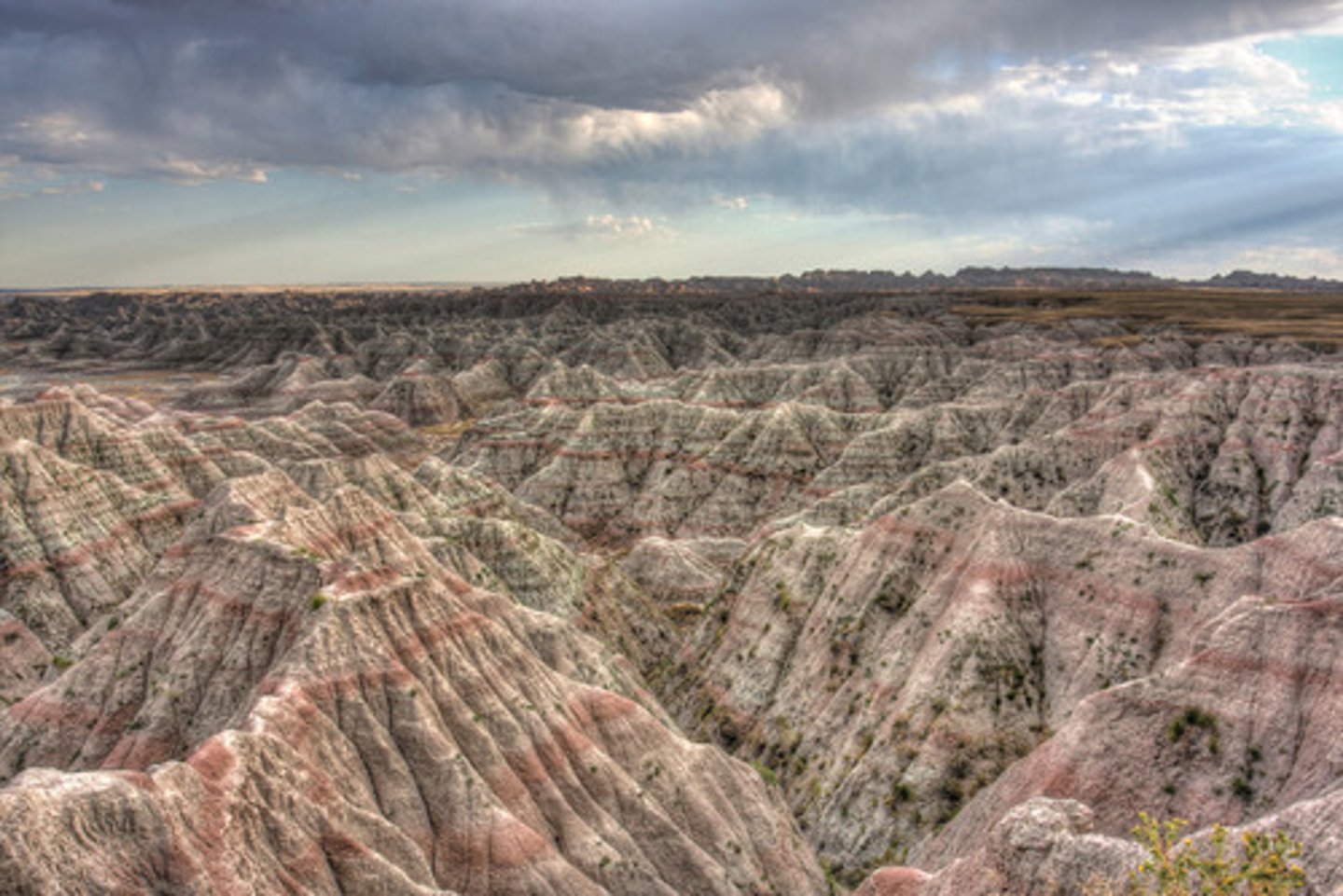
Badlands
Wasteland that has been carved into unusual shapes by wind and water
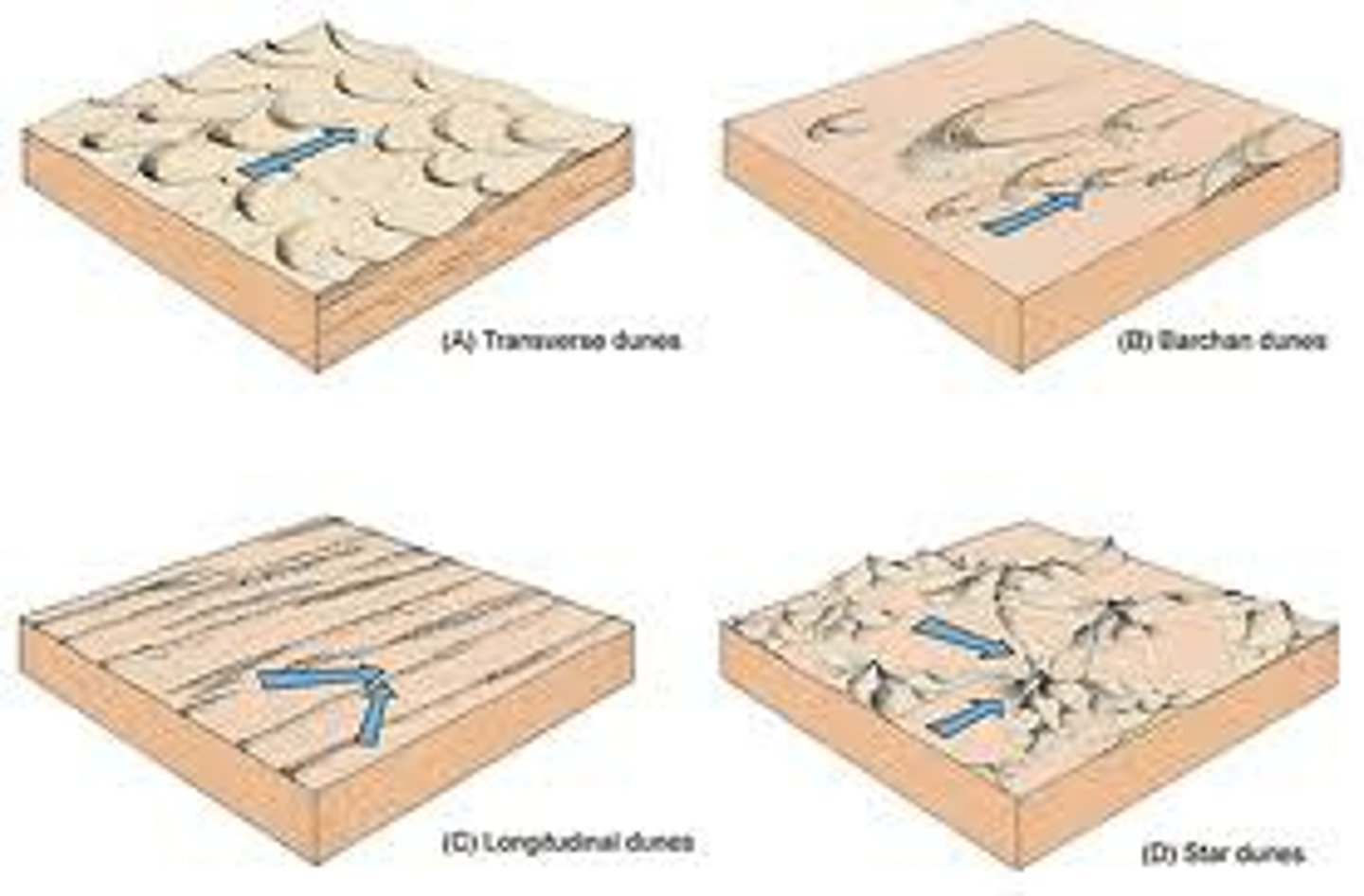
Types of sand dunes
barchan, parabolic, transverse, longitudinal, star
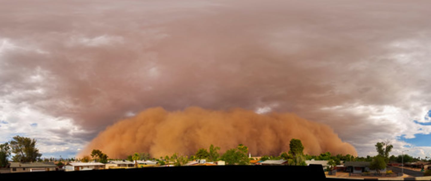
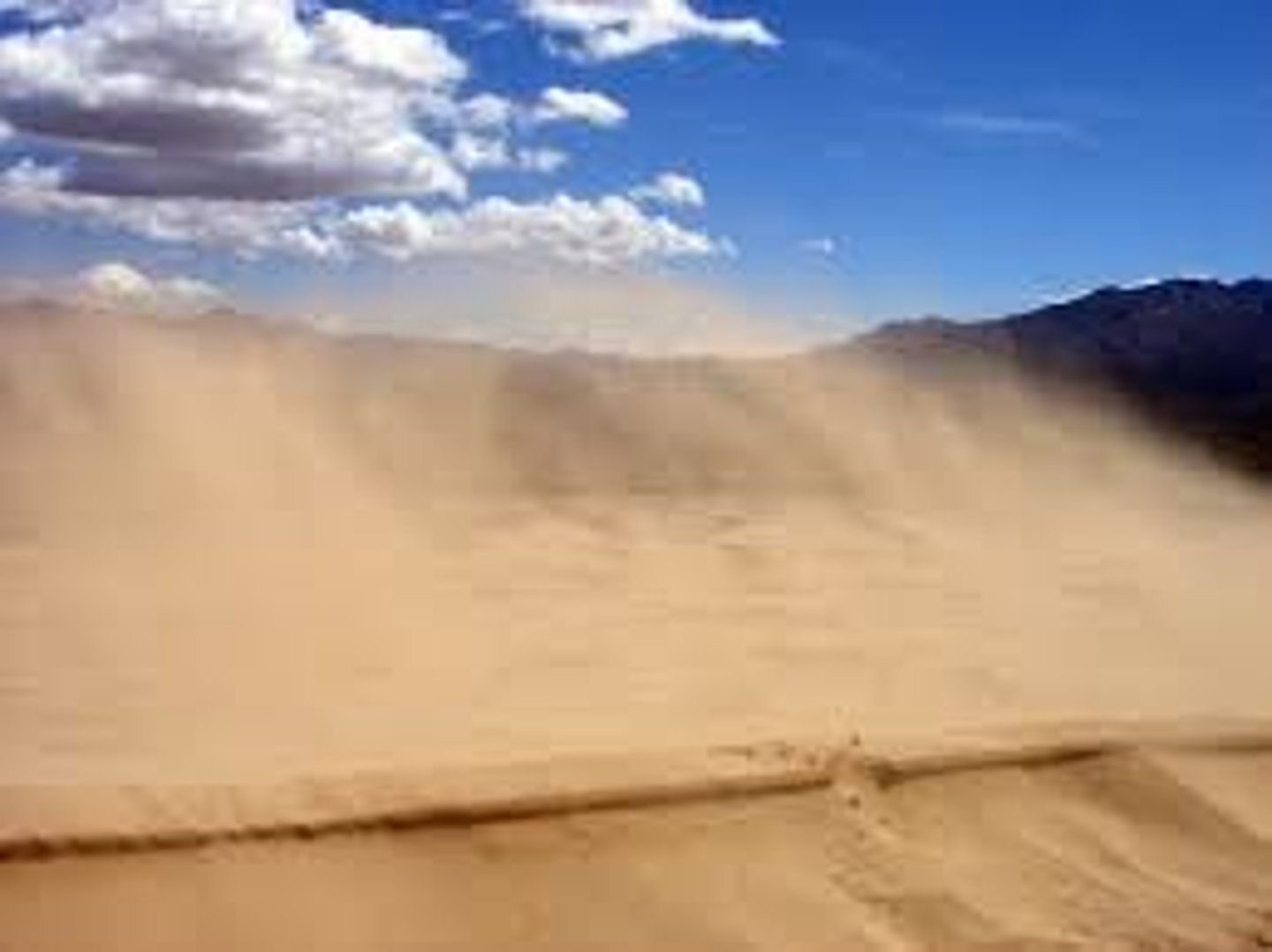
Haboob
Desert sandstorms that form in the downdrafts of a thunderstorm.
wind transport
Usually small grains, sand sized or smaller; Sand dunes and loess deposits
water transport
Conducted in plants through root pressure, capillary action, and transpiration.