AP Human Geography: Types of Maps
1/10
There's no tags or description
Looks like no tags are added yet.
Name | Mastery | Learn | Test | Matching | Spaced | Call with Kai |
|---|
No analytics yet
Send a link to your students to track their progress
11 Terms
reference map
map type that shows reference information for a particular place, making it useful for finding landmarks and for navigating. emphasis on location
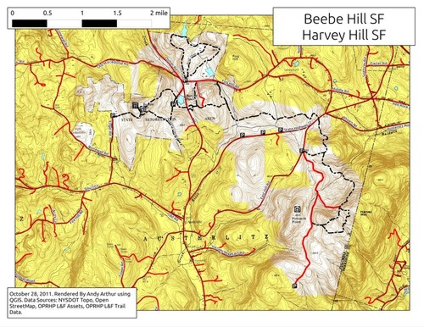
topographic maps
maps that use isolines to represent constant elevations
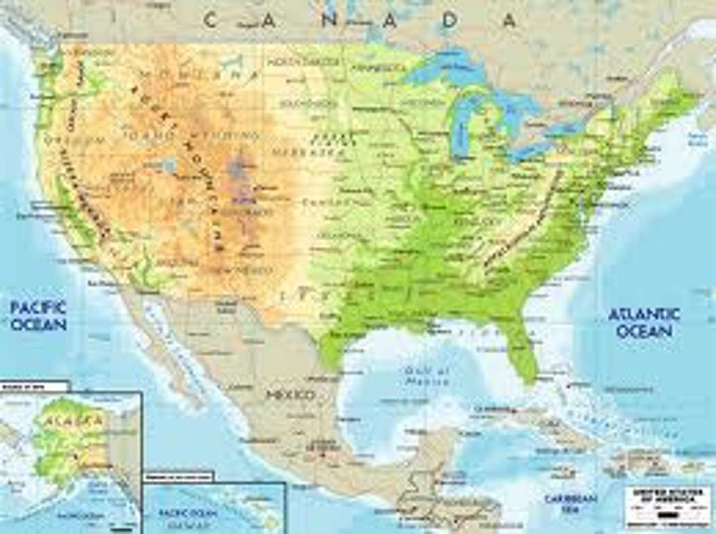
atlas/physical maps
maps that often include much of the same data found on a political map, but their primary purpose is to show landforms like deserts, mountains, and plains. their topography style presents an overall better picture of local terrain.
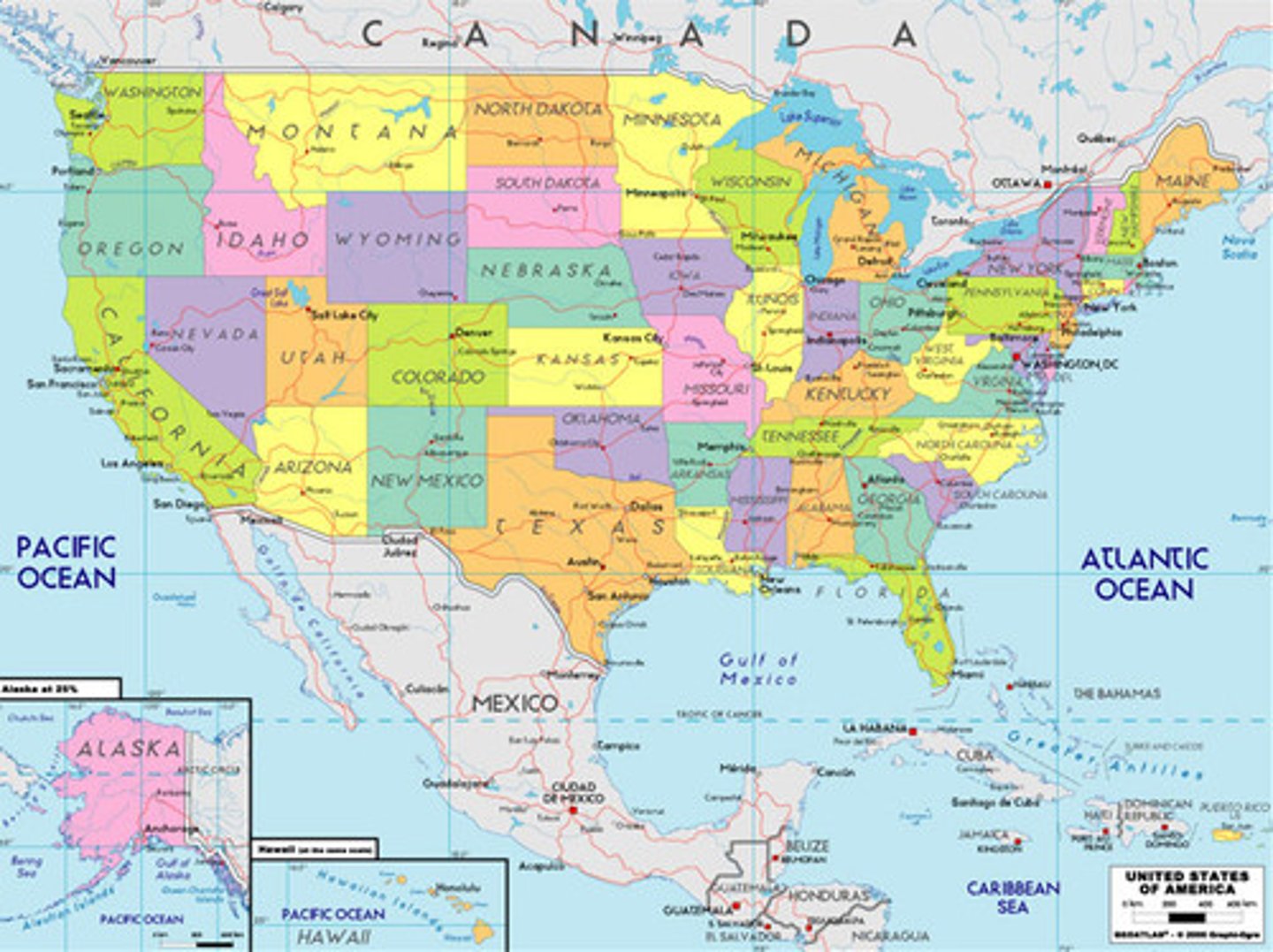
political map
maps that are designed to show governmental boundaries of countries and states
thematic map
type of map that displays one or more variables such as population, or income level- within a specific area
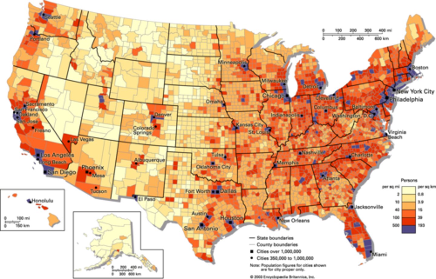
choropleth map
thematic map that uses tones or colors to represent spatial data as average values per unit of data
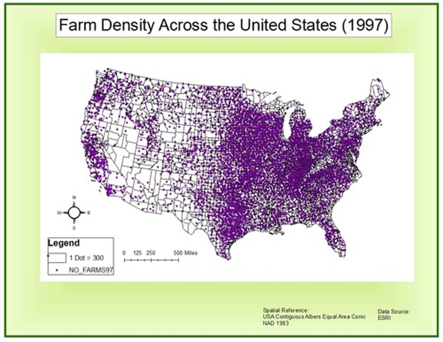
dot maps
thematic maps that use points to show the precise locations of specific observations or occurrences, such as crimes, car accidents, or births
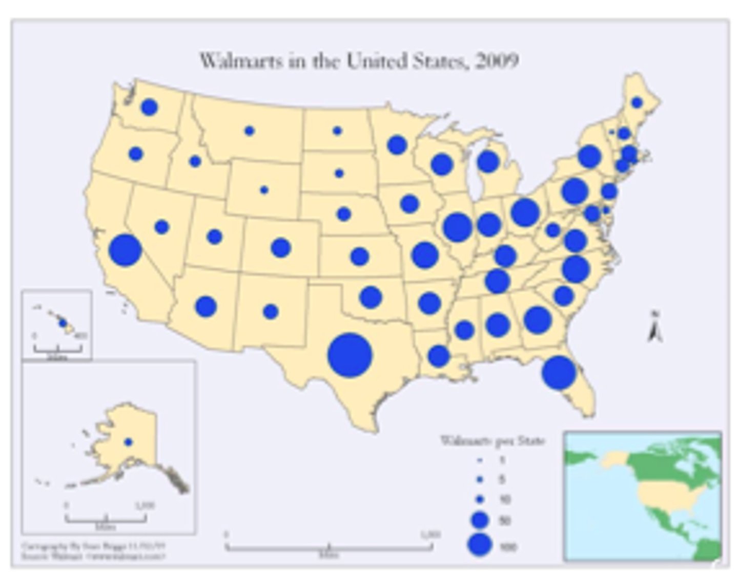
graduated symbol map
a map with symbols that change in size according to the value of the attribute they represent
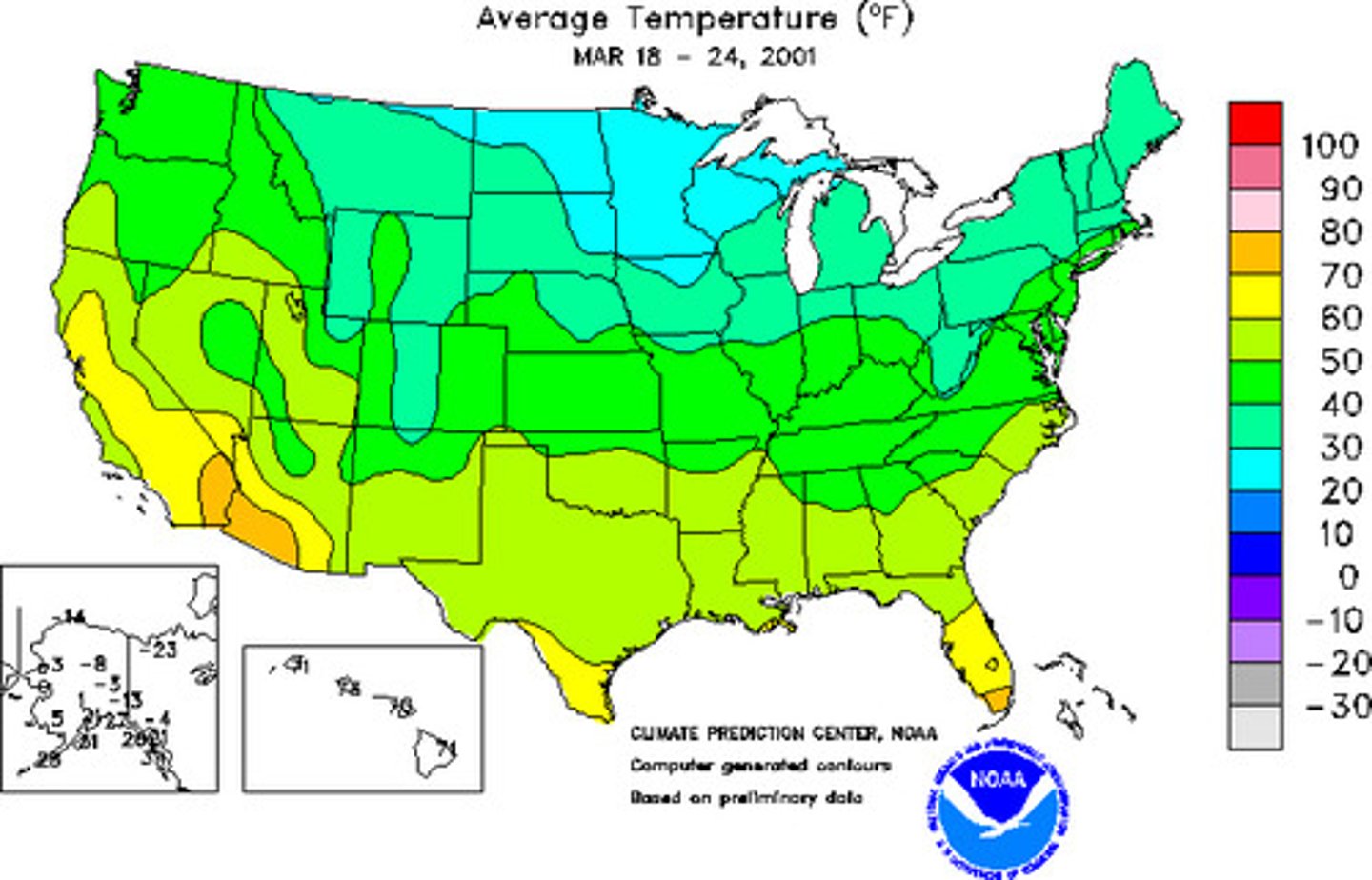
isoline map
map with continuous lines joining points of the same value examples would be equal altitude (contour lines), temperature (isotherms), barometric pressure (isobars), etc.
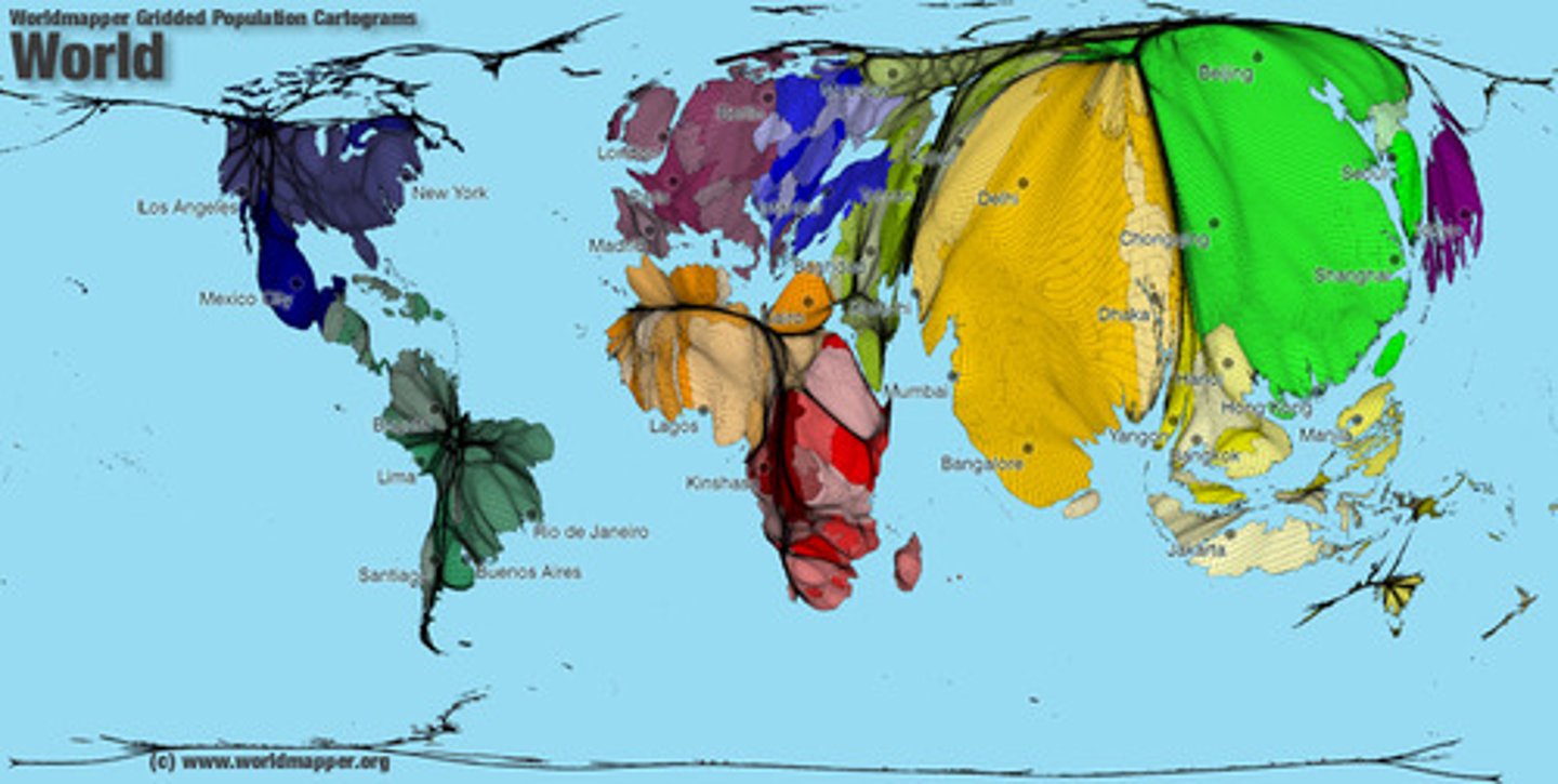
cartogram map
map in which some thematic mapping variable- such as travel time, population, gross national product, is substituted for land area or distance. the geometry or space of the map is distorted in order to convey the information of this alternate variable
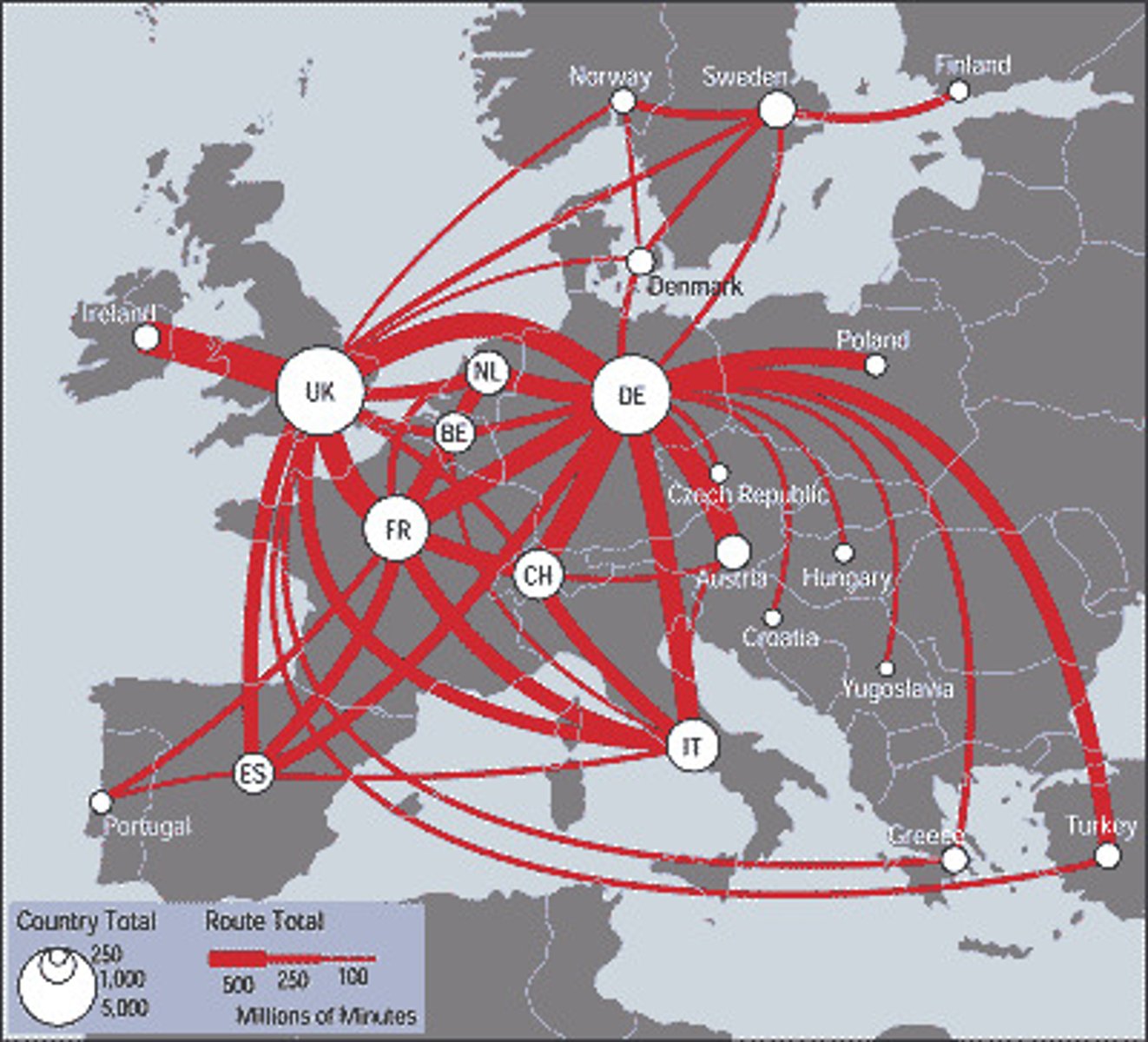
flow map
mix of maps and flow charts that show the movement of objects from one location to another