Comprehensive Geography and Oceanography: Landforms, Climate, and Map Skills
1/54
There's no tags or description
Looks like no tags are added yet.
Name | Mastery | Learn | Test | Matching | Spaced | Call with Kai |
|---|
No analytics yet
Send a link to your students to track their progress
55 Terms
Oceans
Large bodies of water that cover 71% of the Earth's surface.
Coast
An area of land near the ocean.
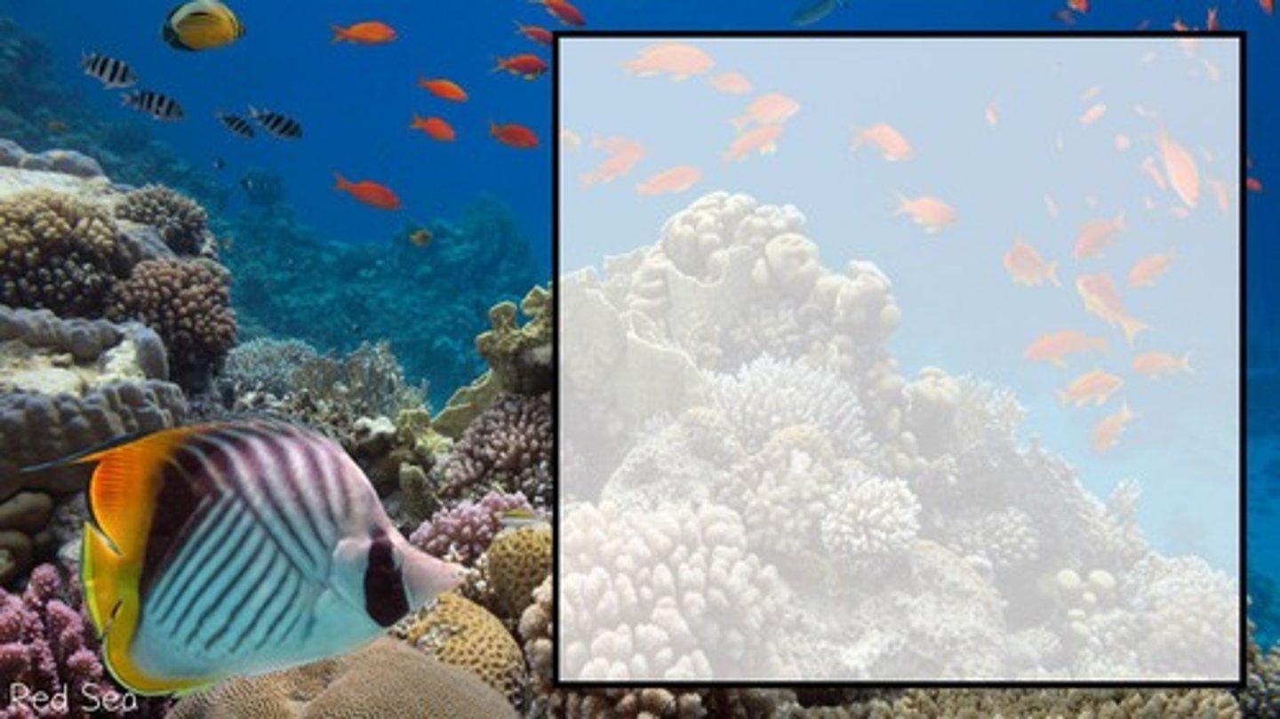
Coral Reef
An ocean ridge made up of skeletal remains of tiny sea animals.
Gulf
A deep inlet of the sea almost completely surrounded by land.
Bay
An inlet of the sea that is smaller than a gulf.
River
A natural stream of water flowing in a channel into another body of water.
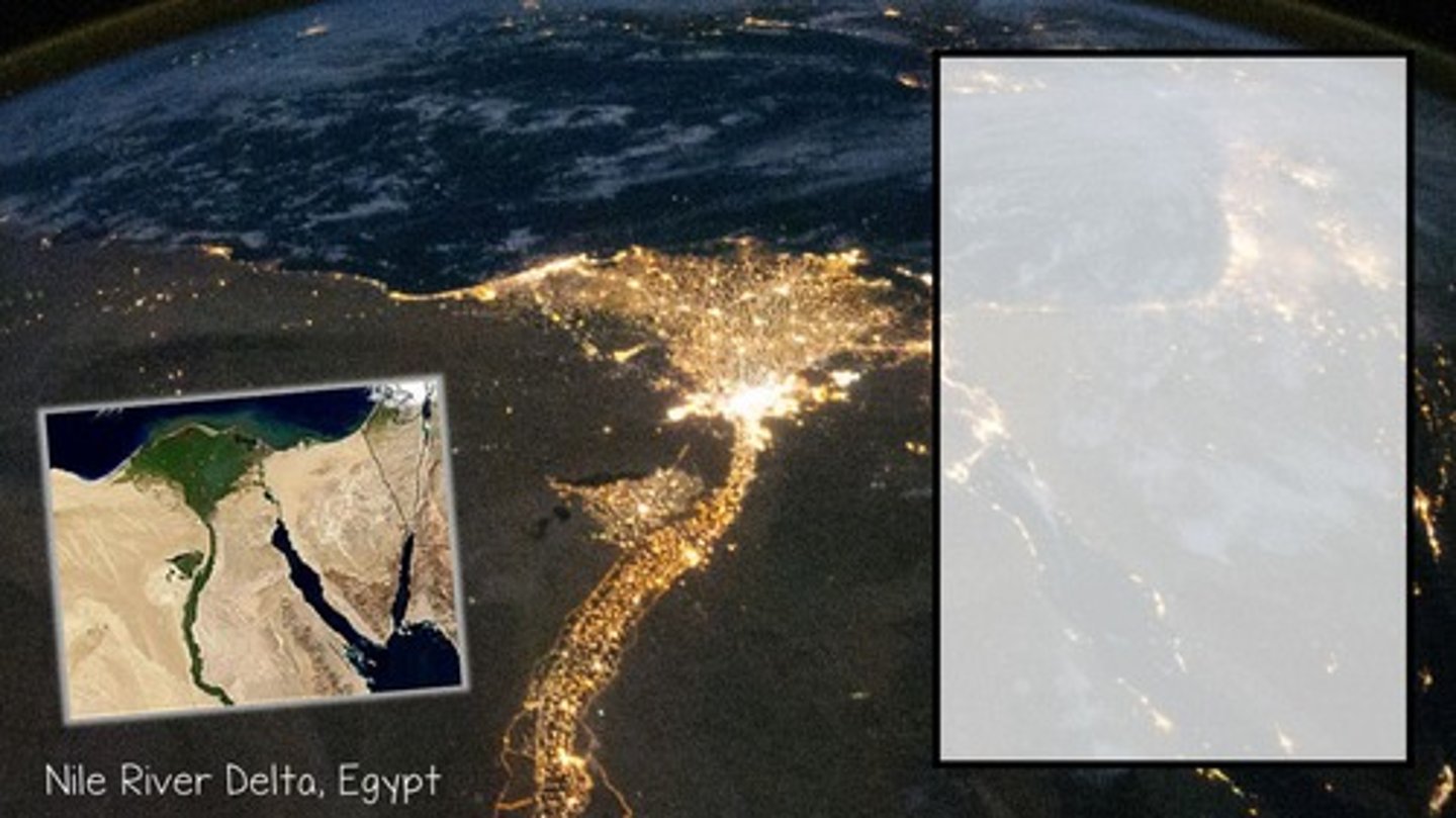
Delta
Deltas are located at the mouth of a river and are typically fan shaped.
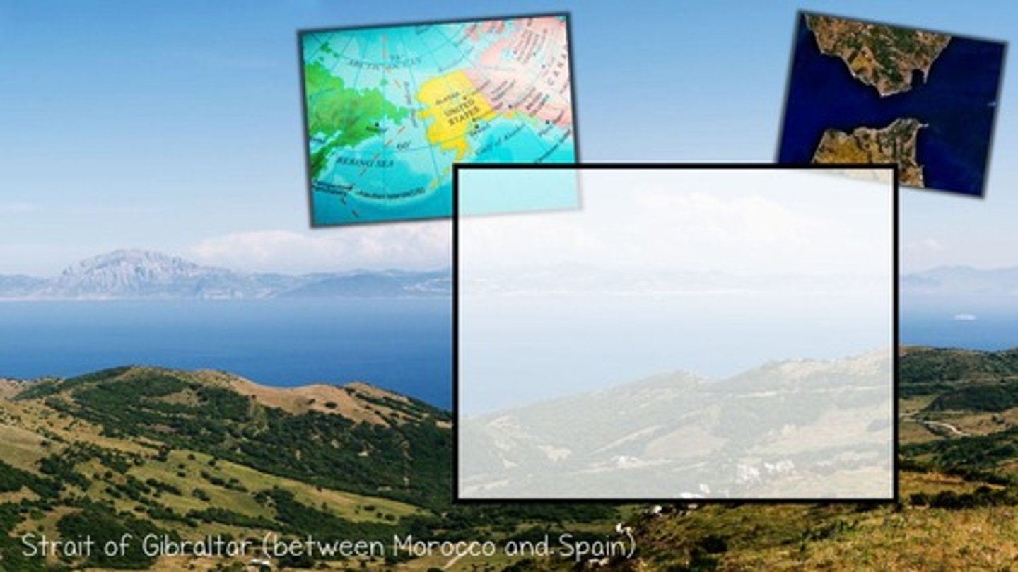
Strait
A narrow body of water connecting two larger bodies of water.
Lake
An inland body of water.
Wetland
An area of land covered by shallow water.
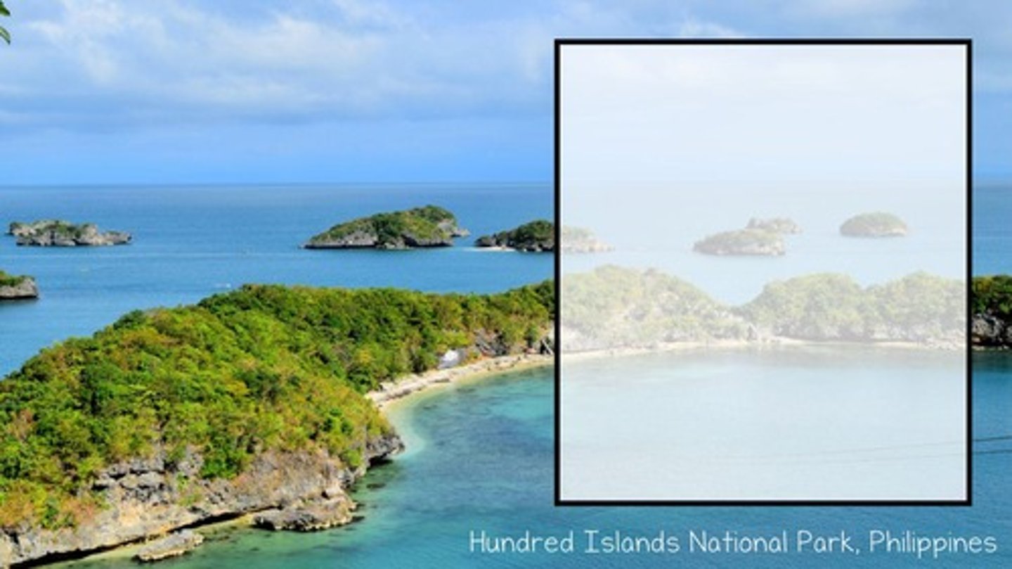
Island
An area of land surrounded entirely by water.
Isthmus
A narrow piece of land, bordered by water, that connects two larger land areas.
Forest
An area with many trees.
Plain
A nearly flat area of land.
Hill
A rounded, elevated area of land smaller and less steep than a mountain.
Dune
A hill of sand shaped by wind.
Peninsula
An area of land that sticks out into a lake or ocean, almost completely surrounded by water, usually on three sides.
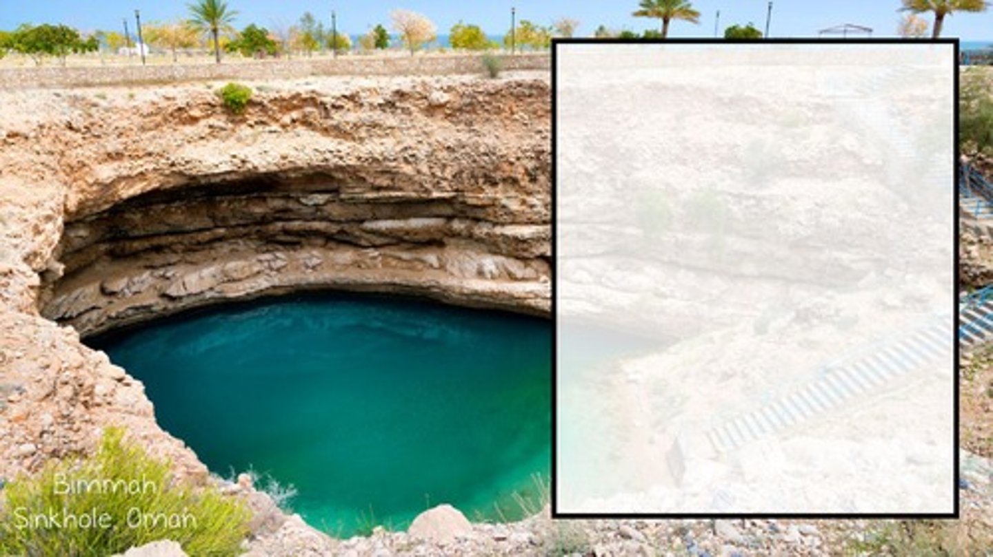
Sinkhole
A circular depression formed due to erosion
Desert
An extremely dry area with little water and few plants.
Oasis
An area in the desert with a water source.
Plateau
A large, flat, elevated area of land.
Valley
Low-lying areas between mountains or hills, usually U or V shaped.
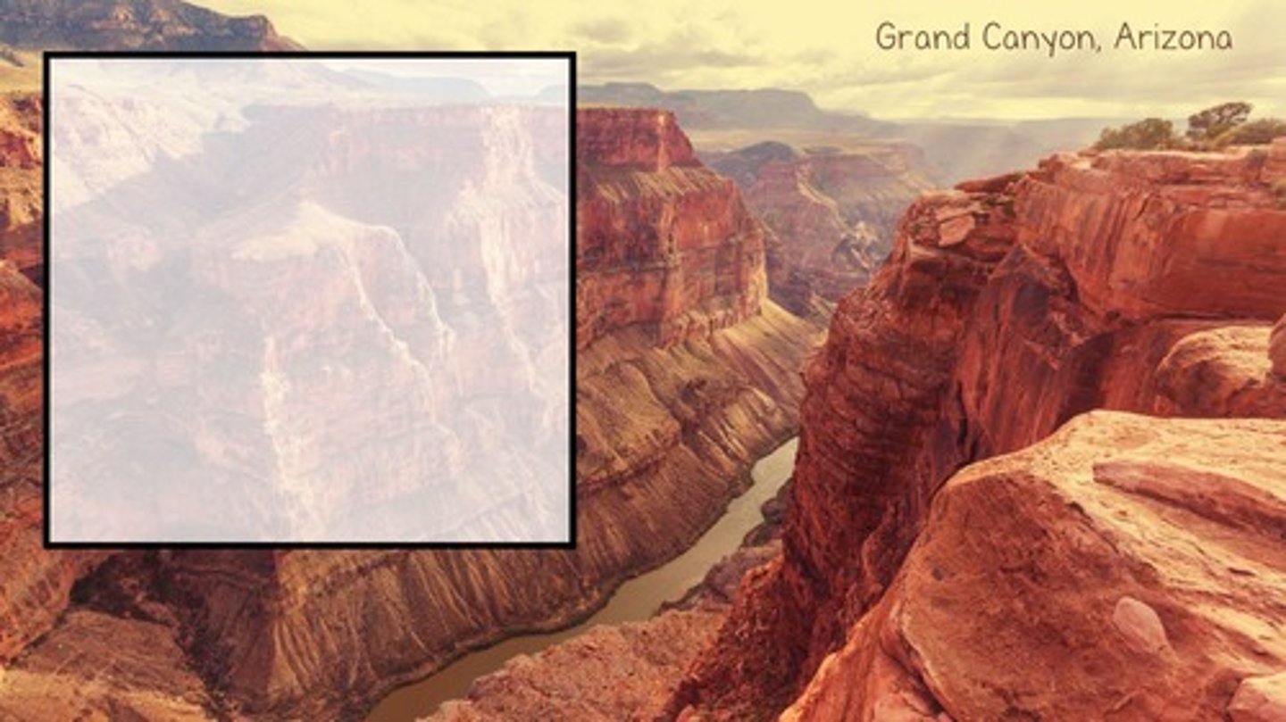
Canyon
A deep, narrow valley with steep sides, more steep and narrow than a valley.
Mountain
An area of rugged land that generally rises higher than 2,000 feet.
Volcano
An opening in Earth's crust where lava, ash, and gases erupt.
Glacier
A large area of slow-moving ice.
Geography
the study of Earth's physical and cultural features
Landforms
the natural features of the land's surface
Climate
the average weather conditions in a certain area over a long period of time
Environment
all the living and nonliving things that affect life in an area
Region
an area with one or more features that make it different from other surrounding areas
Map Key
box that explains the meaning of different symbols used on the map
Map Scale
tool that measures the relationship between the distance of locations on the map and the distance of locations in real life
Compass Rose
a circle that shows the key directions on a map
Hemispheres
halves of the Earth
Continent
one of seven large landmasses on Earth
Latitude
imaginary horizontal lines that measure distance north and south of the Equator
Parallels
another name for lines of latitude
Arctic Circle
major line of latitude that runs 66° N of the Equator
Tropic of Cancer
major line of latitude that runs 23.5° N of the Equator
Equator
central line of latitude that is measured at 0°
Tropic of Capricorn
major line of latitude that runs 23.5° S of the Equator
Antarctic Circle
major line of latitude that runs 66° S of the Equator
Climate Zones
specific areas of the globe that have consistent weather patterns
Tropical Zone
hot climate zone between the Tropic of Cancer and Tropic of Capricorn
Temperate Zones
mild climate zones between the Tropic of Cancer and Arctic Circle in the N. Hemisphere, and the Tropic of Capricorn and Antarctic Circle in the S. Hemisphere
Polar Zones
cold climate zones north of the Arctic Circle and south of the Antarctic Circle
Longitude
imaginary vertical lines that measure distance east and west of the Prime Meridian
Meridians
another name for lines of longitude
Prime Meridian
the central line of longitude, which is measured at 0° and runs through Greenwich, United Kingdom
Map
illustration of a specific area on Earth that is often portrayed on a flat surface
Physical Map
a type of map that shows the natural landforms and terrain of a location
Political Map
a type of map that identifies cities, states, and countries
Globe
a spherical model that is the most accurate representation of Earth
Distortion
the misrepresentation of Earth's features on a map, such as the area and shape of continents, compared to their actual measurements