APHG Unit 1 (tprosk)
1/80
There's no tags or description
Looks like no tags are added yet.
Name | Mastery | Learn | Test | Matching | Spaced | Call with Kai |
|---|
No analytics yet
Send a link to your students to track their progress
81 Terms
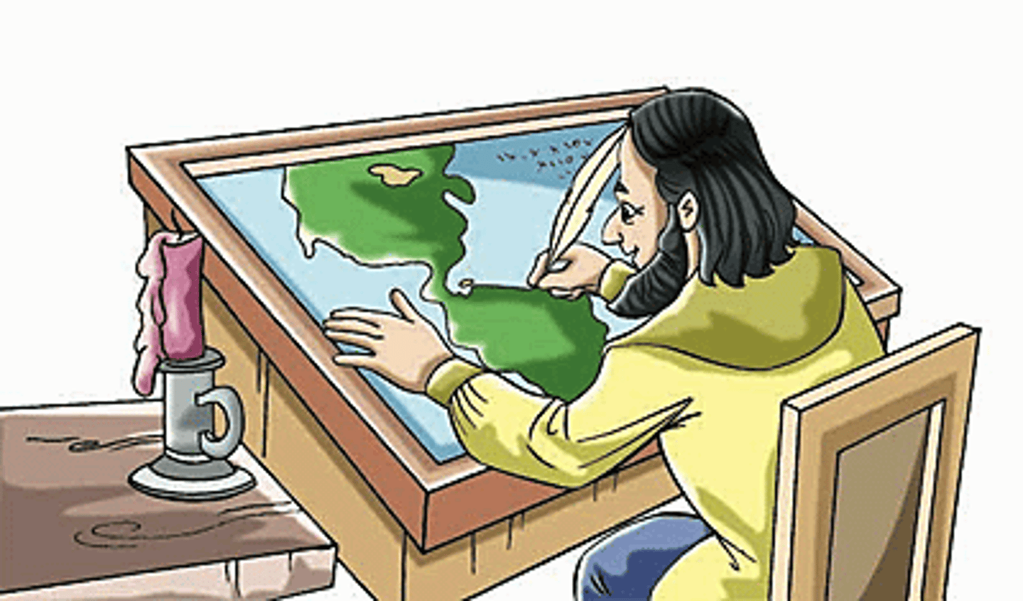
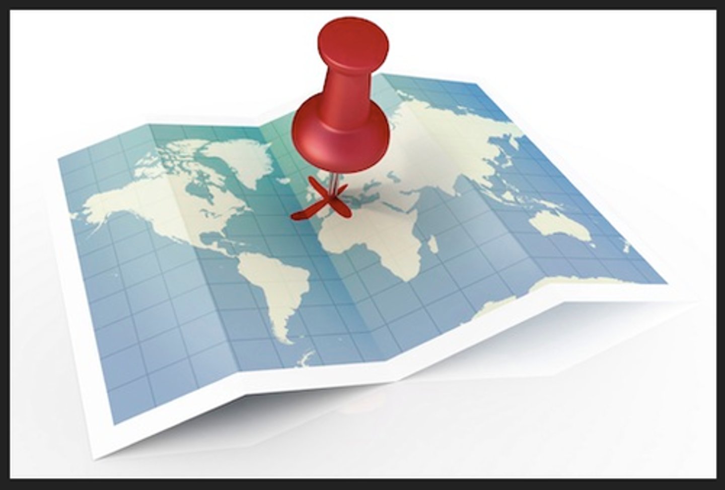
Cartography
the science and art of drawing maps
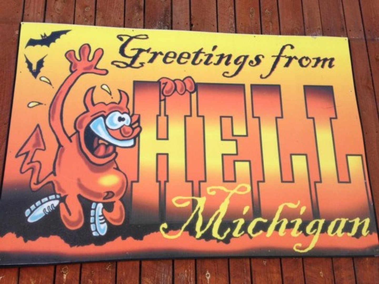
Toponym
a place name
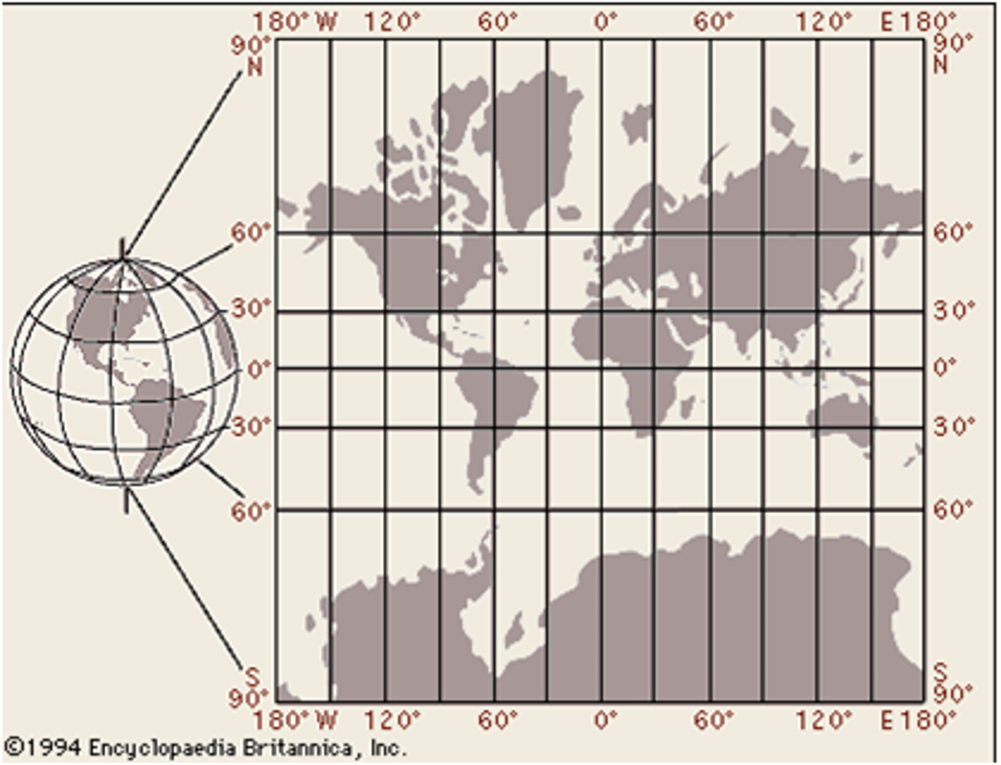
Global Grid System
a pattern formed on a map or globe, by lines of latitude (parallels) and lines of latitude (meridians)
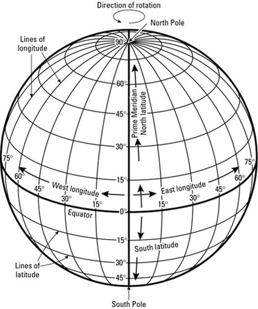
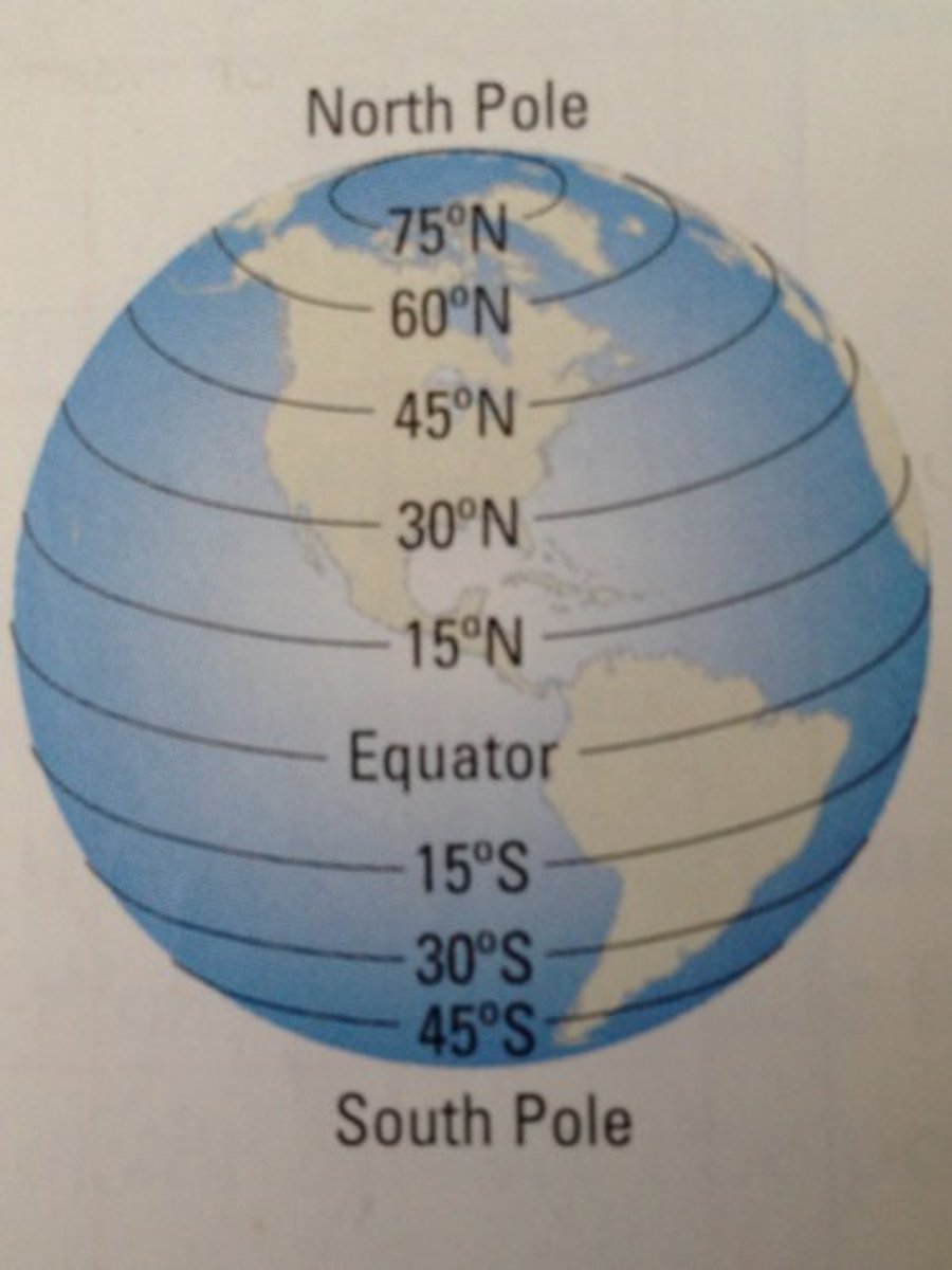
Latitude / Parallels
distance north or south of the Equator, measured in degrees
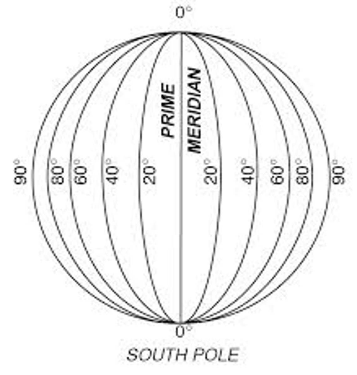
Longitude / meridians
Distance east or west of the prime meridian, measured in degrees
Equator
an imaginary line drawn around the earth equally distant from both poles, dividing the earth into northern and southern hemispheres and constituting the parallel of latitude 0°.
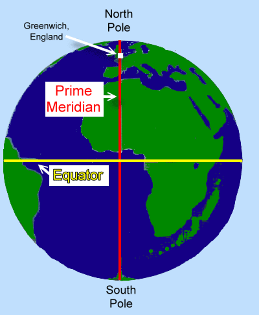
Prime Meridian
The meridian, designated at 0° longitude, which passes through the Royal Observatory at Greenwich, England.
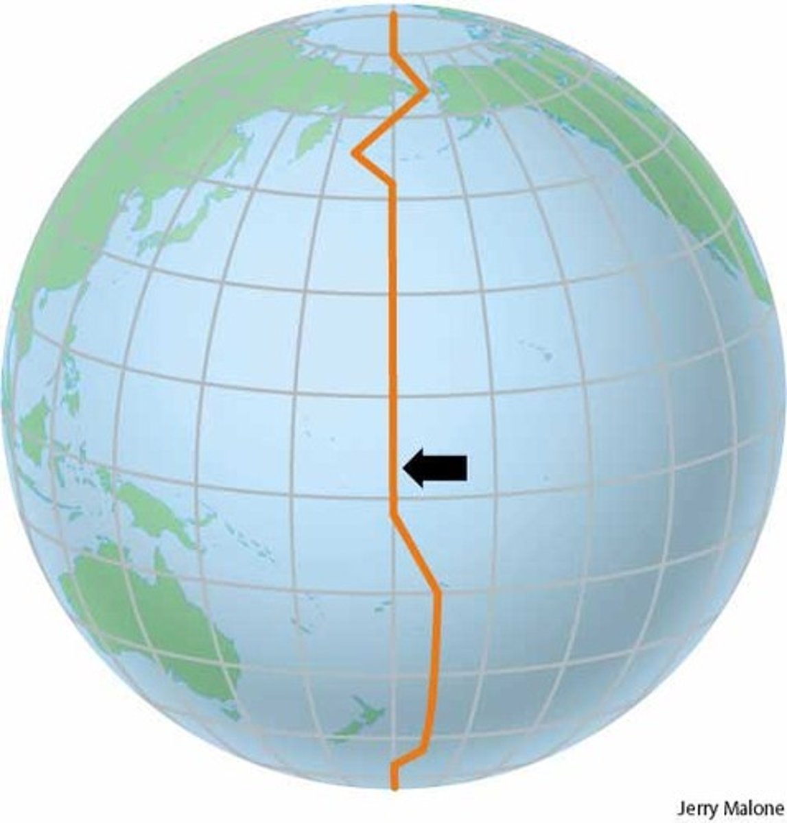
International Date Line
the line of longitude that marks where each new day begins, centered on the 180th meridian
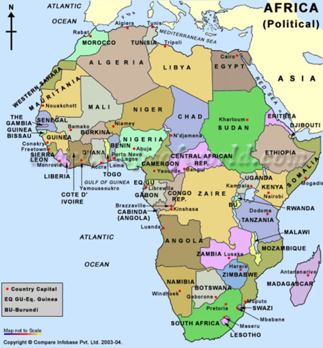
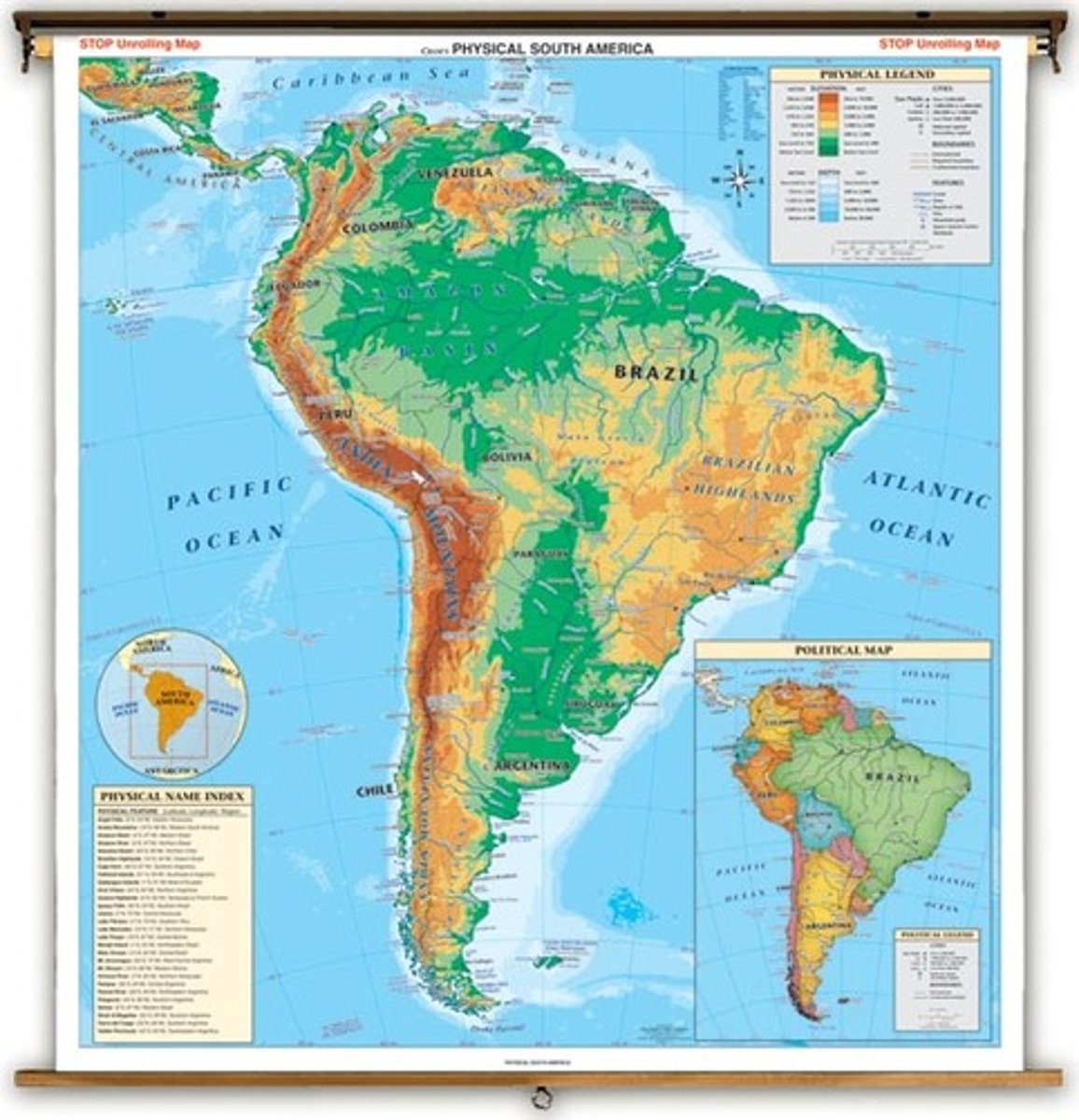
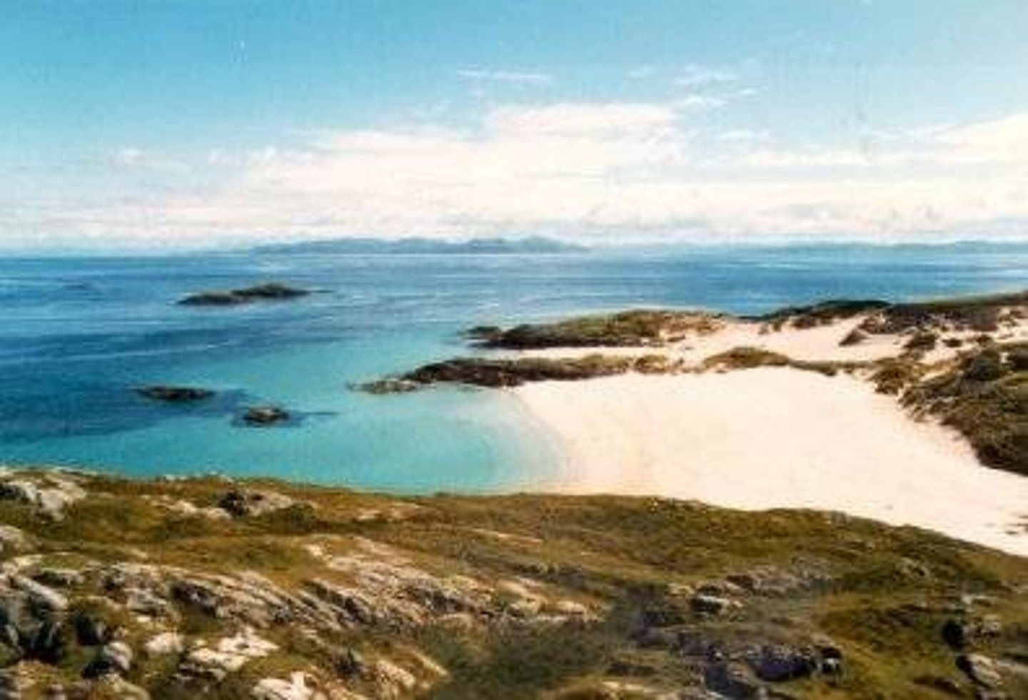
Reference map
maps that emphasizes the location of places (without data attached).
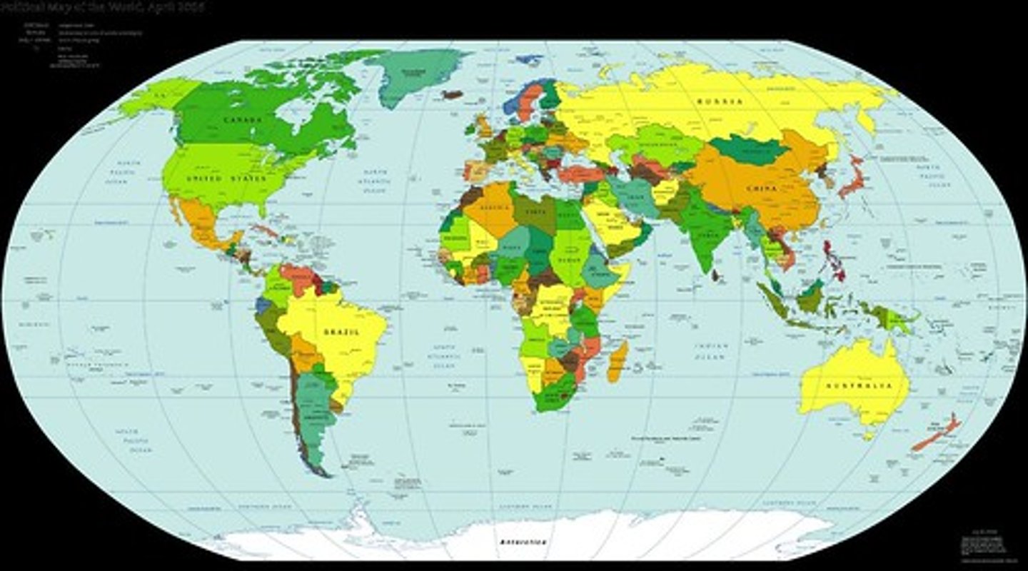
Examples of reference maps
Political map, Physical map, Road Map
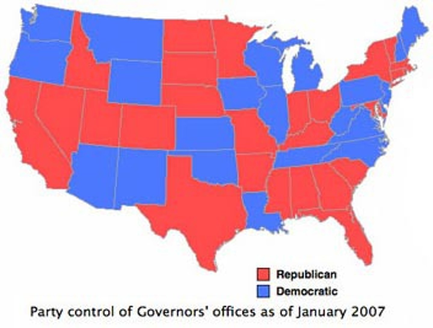
Political map
a map that shows the names and borders of countries
physical map
a reference map that shows land and water features
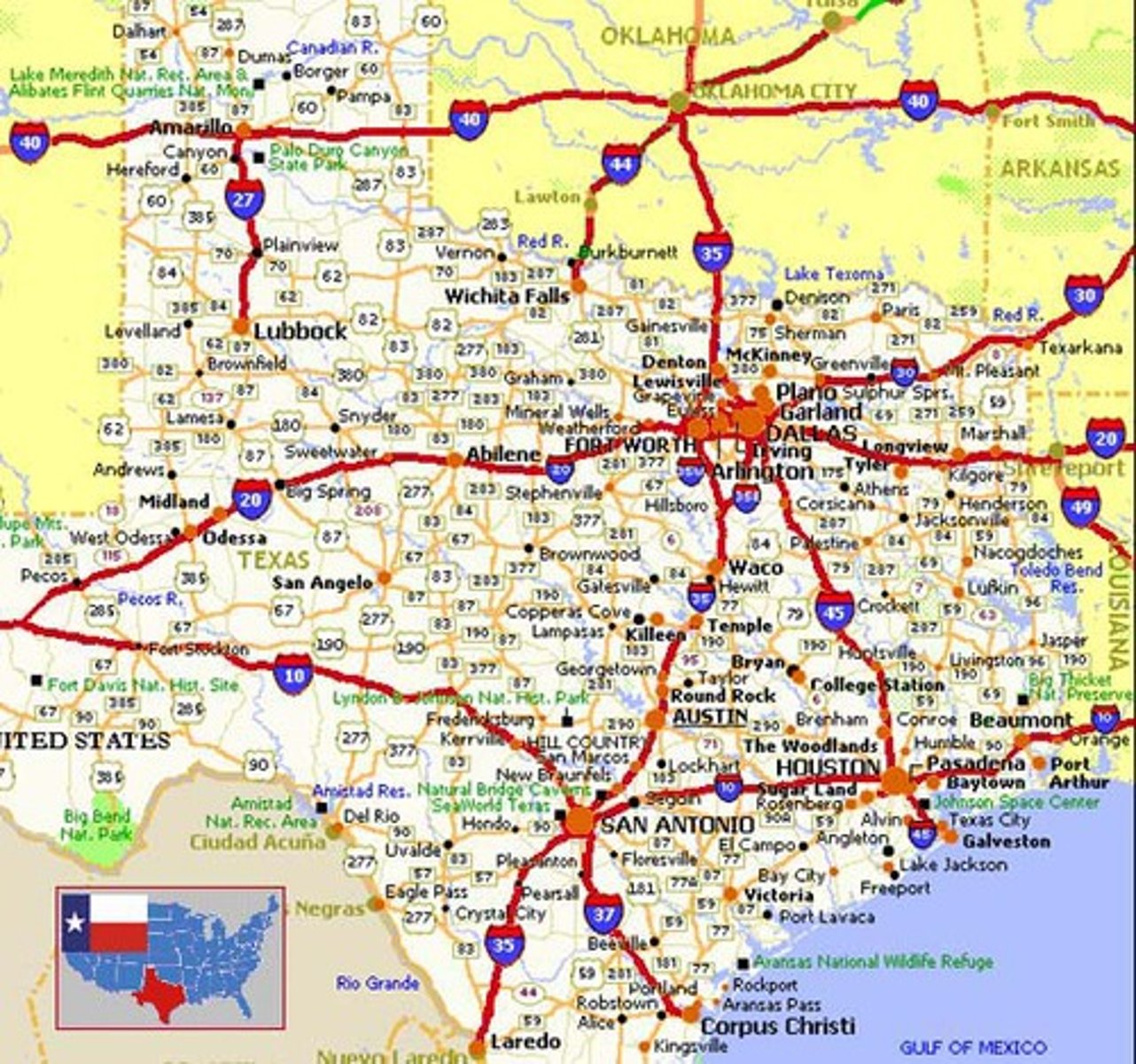
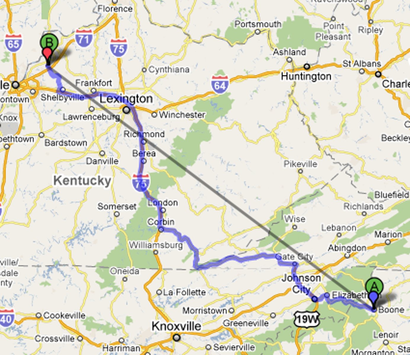
road map
before Google Maps, a map for drivers that showed the highways of an area. Boomers like them.
Thematic maps
a map that displays not only locations but maps a topic or theme of information with the location
types of thematic maps
Isoline, Chloropleth, Dot Distribution, cartogram, graduated symbol
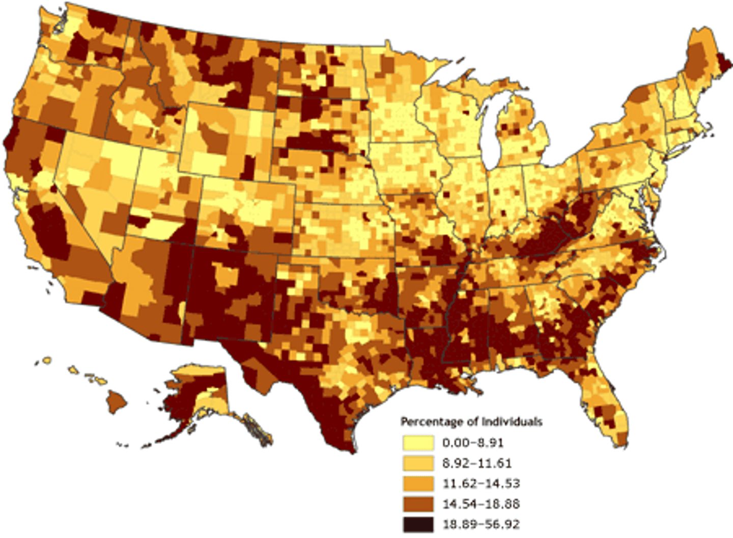
Chloropleth Map
A thematic map that uses tones or colors to represent spatial data as average values per unit area.
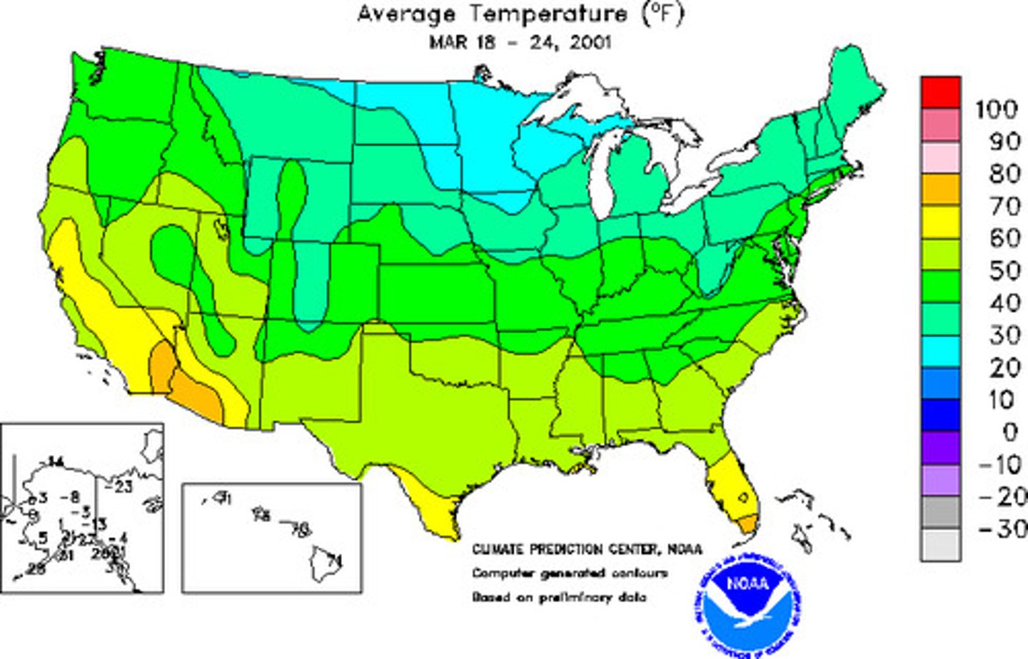
Isoline Map
A thematic map with lines that connect points of equal value.
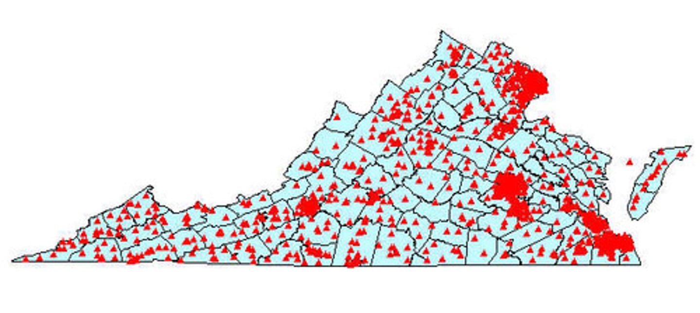
Dot Distribution Map
A map where dots are used to demonstrate the frequency or intensity of a particular phenomena
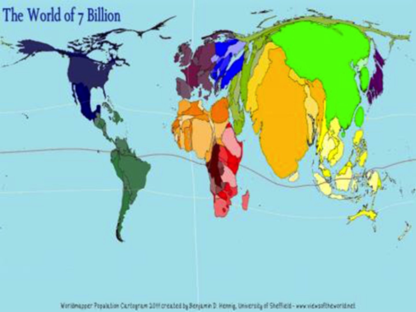
Cartogram Map
A map in which the shape or size is distorted in order to demonstrate a variable such as travel, population or economic production
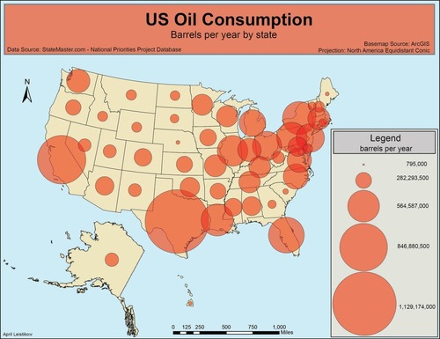
graduated symbol map
A map with symbols that change in size according to the value of the attribute they represent.
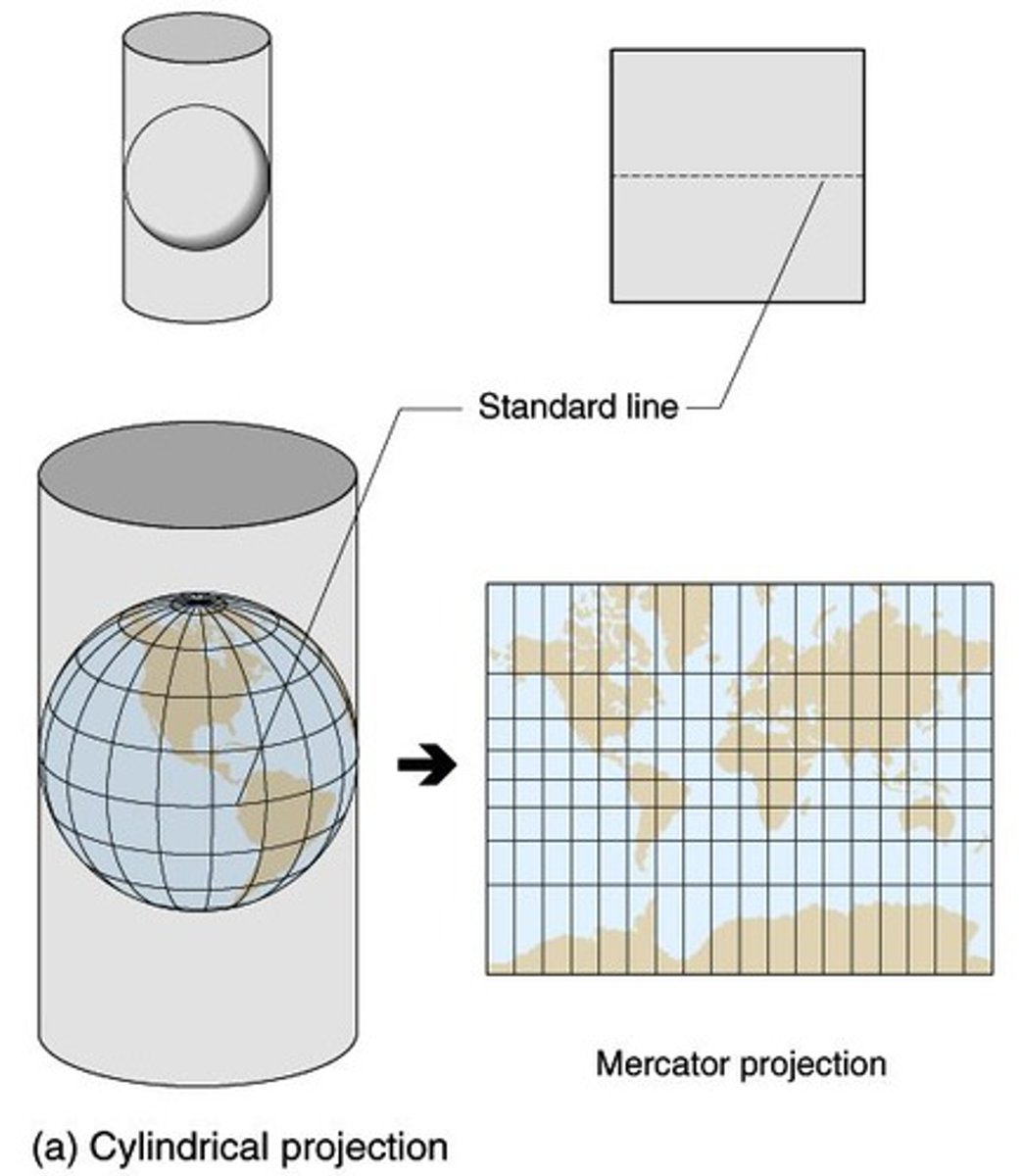
Projection
a method of taking a 3D object and putting in on a 2D plane
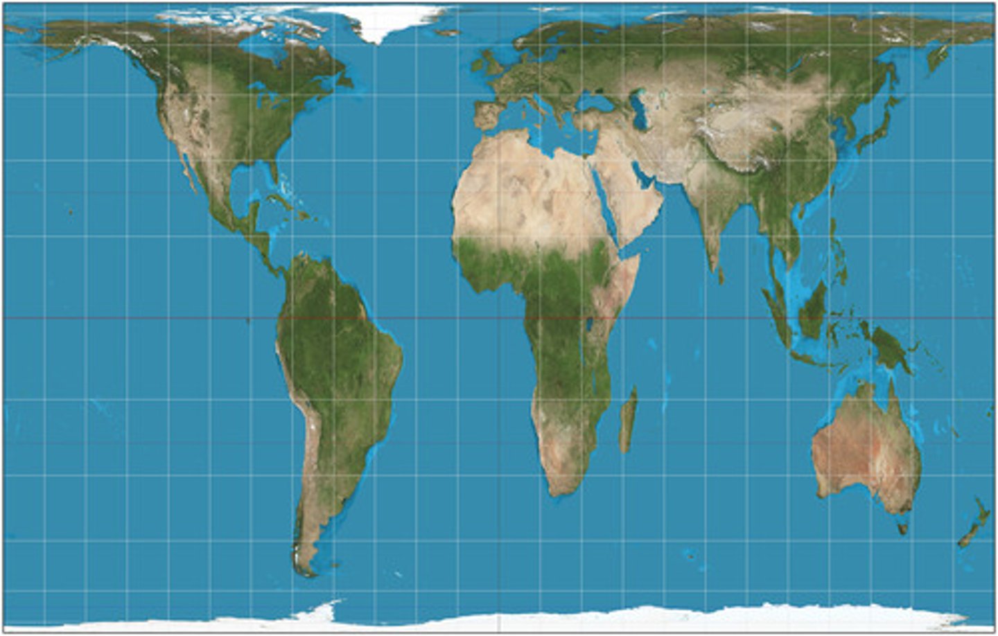
Mercator Projection
a map projection of the earth onto a cylinder. Distorts the land area at the poles
Gall-Peters Projection
equal area projection that distorts the shape of land masses (looks stretched out)
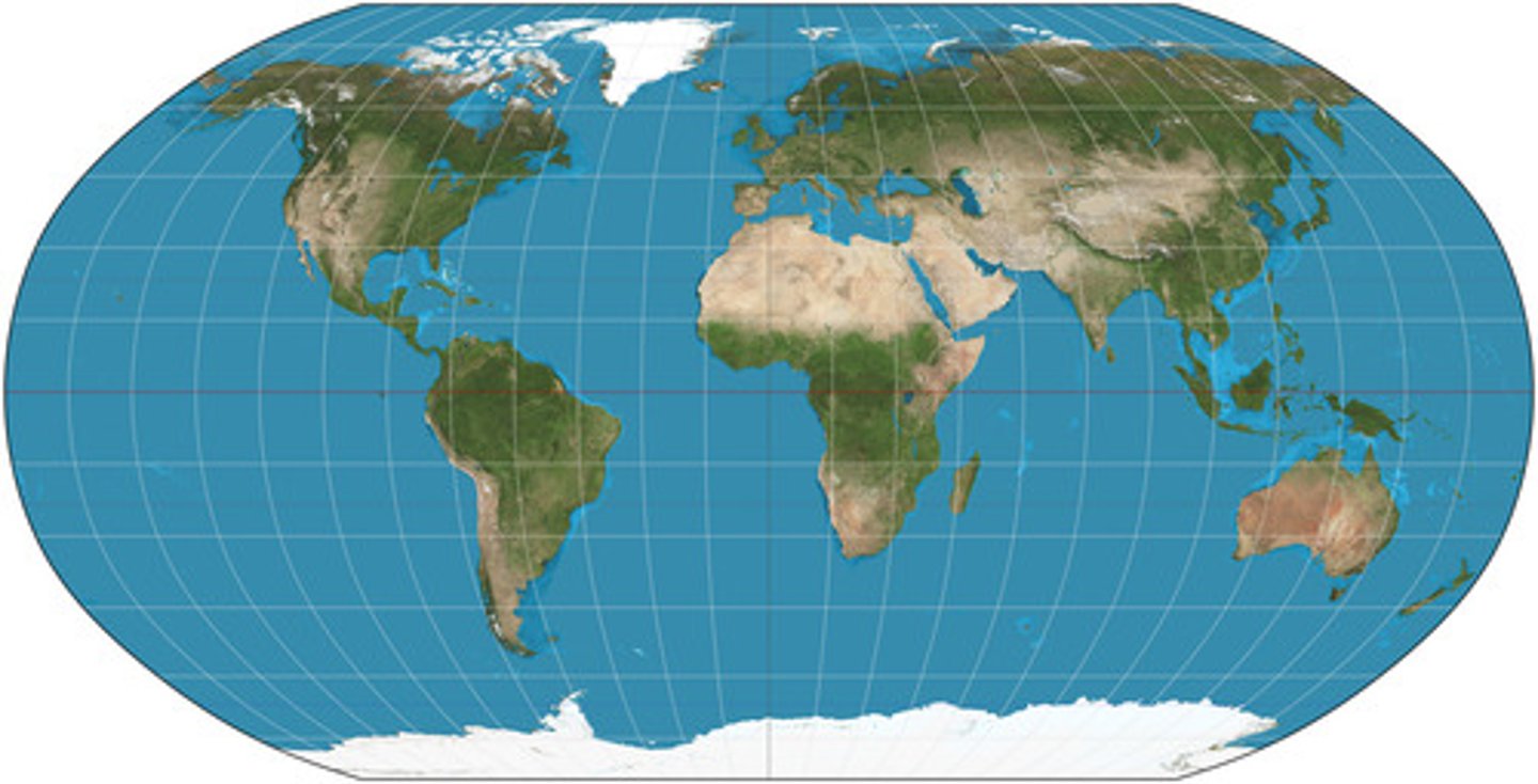
Robinson Projection
A projection that maintains overall shapes and relative positions without extreme distortion. Most classrooms use this projection.
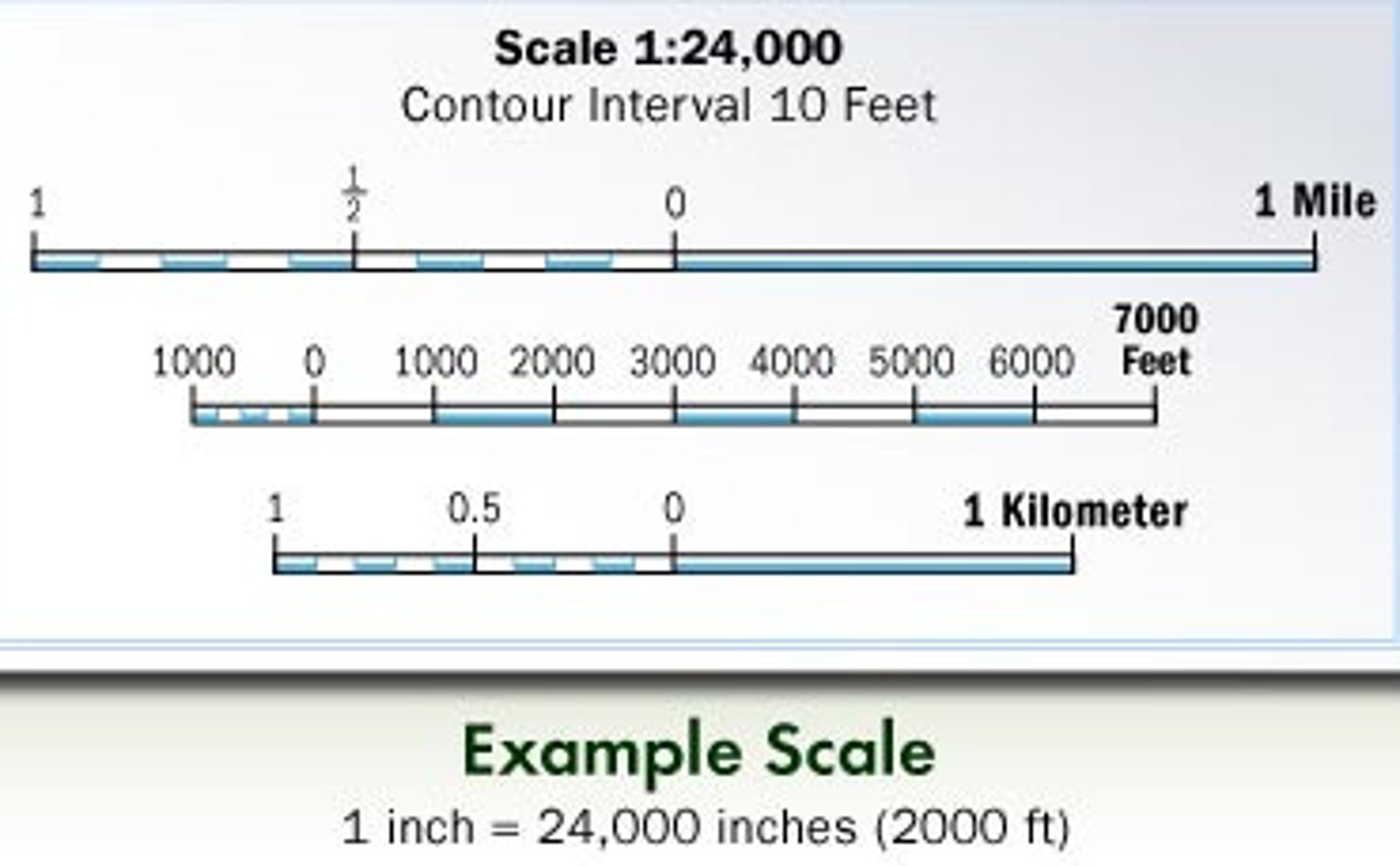
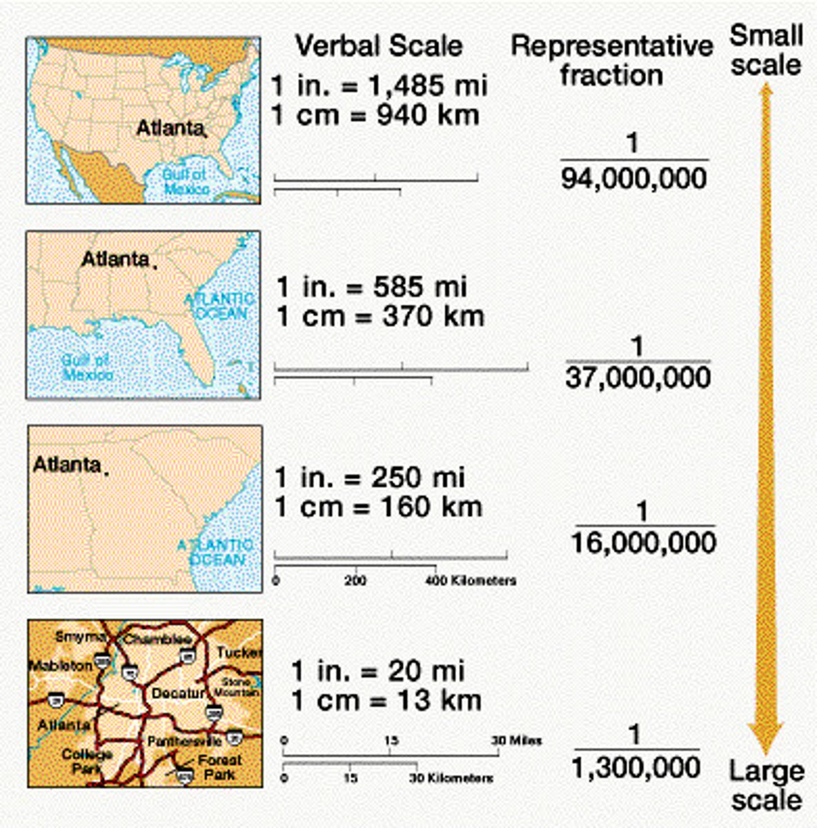
Scale
the relationship between the distance on the ground and the corresponding distance on a specific map
Absolute location
describing where something is using the exact site on an objective coordinate system
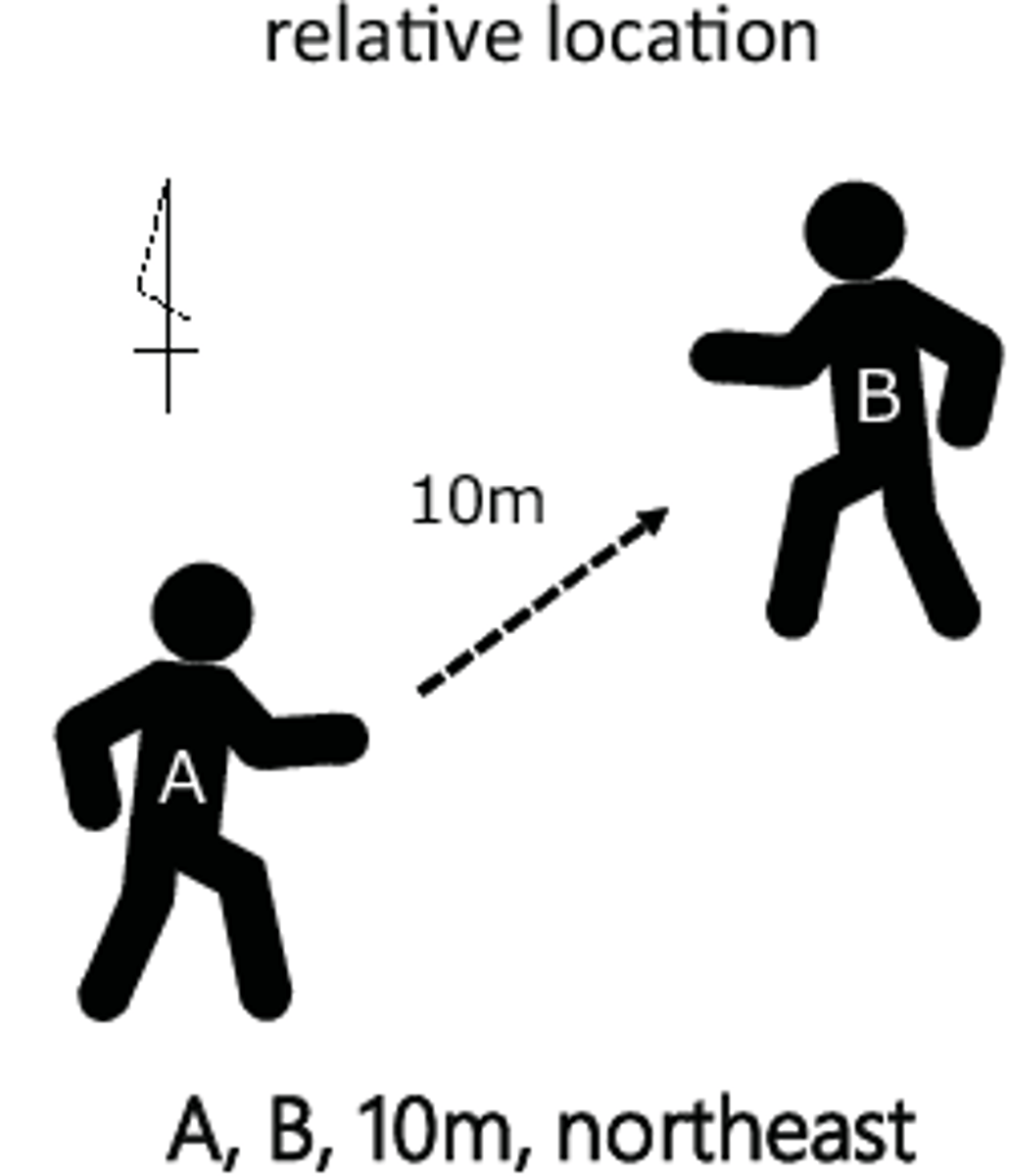
Relative location
describing the position of a place as compared to (or relative to!) another landmark
Absolute distance
describing how far a distance is quantitative units of distance (miles, kilometers, etc.)
Relative distance
describing the distance between locations using qualitative terms or non-traditional measurements of distance (one hour north of)
place
A specific point on Earth distinguished by particular characteristics.
location, site, and situation
the three different aspects of a place
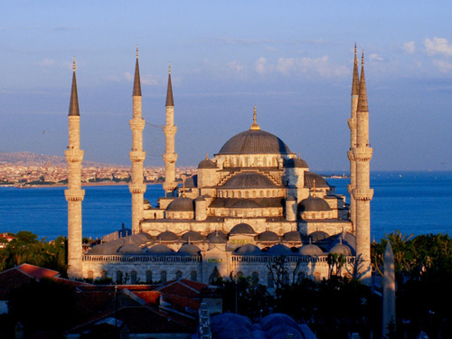
site
The physical character of a place, including its geographic characteristics. For example the site of Istanbul includes the fact that it is on a land bridge connecting Asia and Europe, and also a water bridge (strait) connecting the Black Sea and the Mediterranean
location
the specific position of a place on Earth's surface

situation
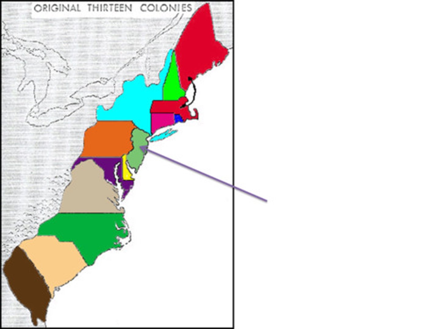
the location of a place relative to the places that are around it- example: the situation of New Jersey is that it is part of a highly populated and connected area on the East Coast of the US
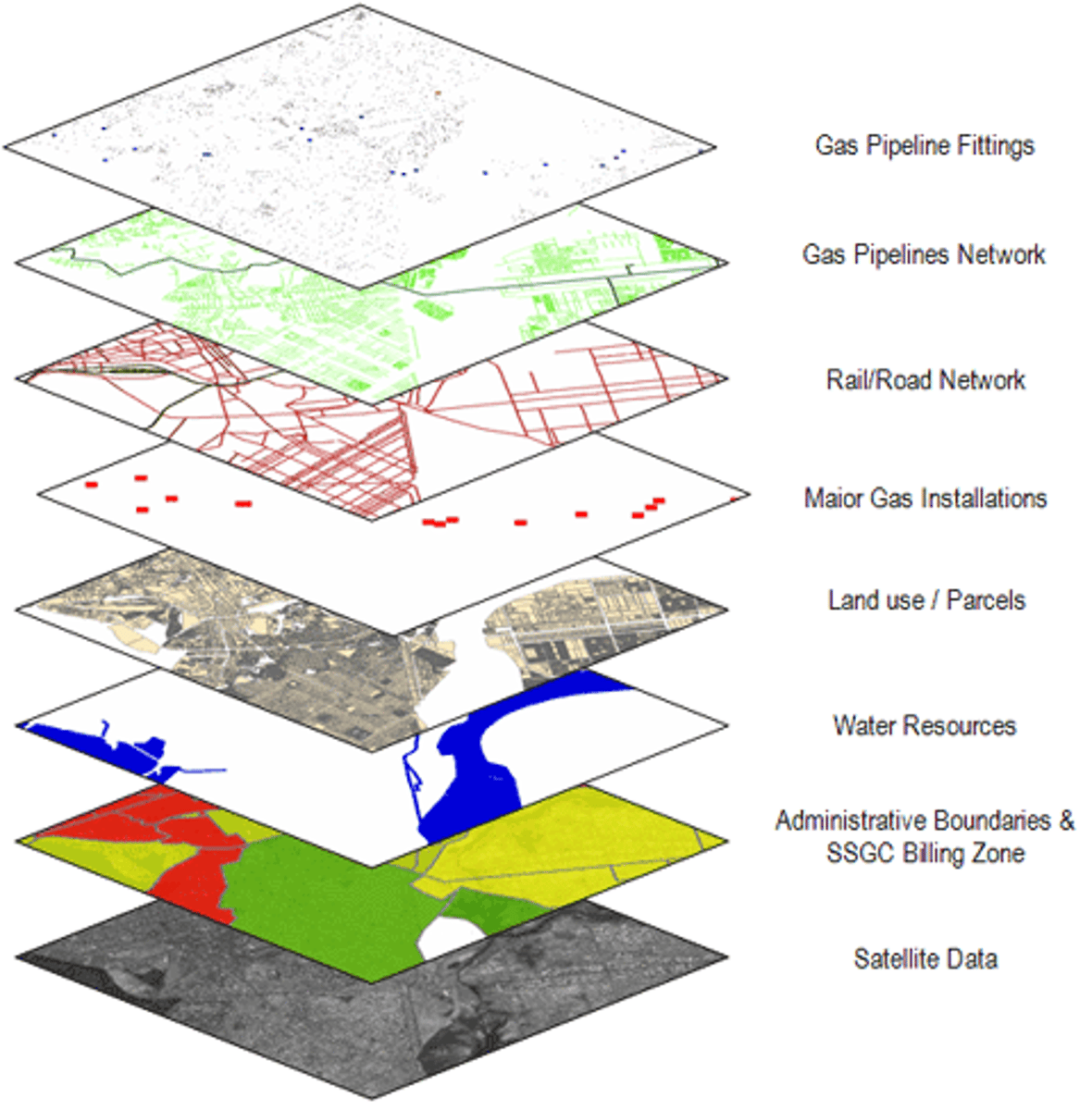
GIS (Geographic Information Systems)
software that captures, manages, analyzes, and displays data that is collected geographically
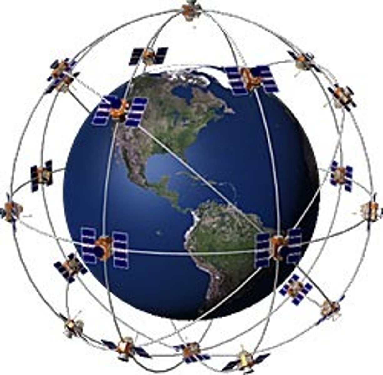
GPS (Global Positioning System)
a system that measures distance from a series of satellites to determine location on the planet
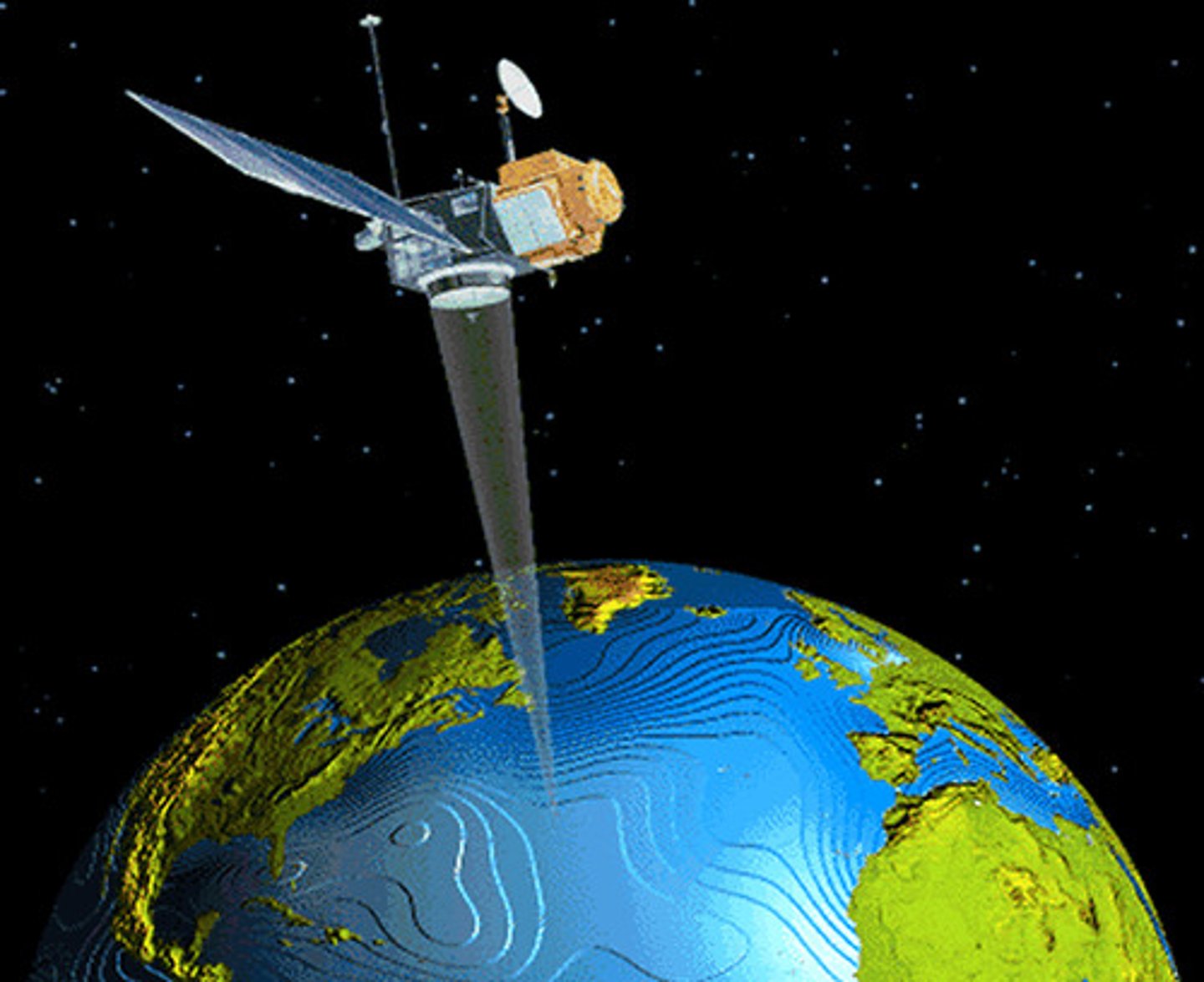
Remote sensing
the science of making measurements of the earth using sensors on airplanes or satellites
Geospatial
relating to data that is specific to one location
Quantitative data
objective data that is fact based, usually measurable and usually expressed in numbers
Census
an official count of individuals in a population (in the USA, it happens every 10 years)
Qualitative data
subjective information that is opinion based, is usually descriptive, and often expressed as text
Case study
detailed observations that provide insight into a group of people in a specific area

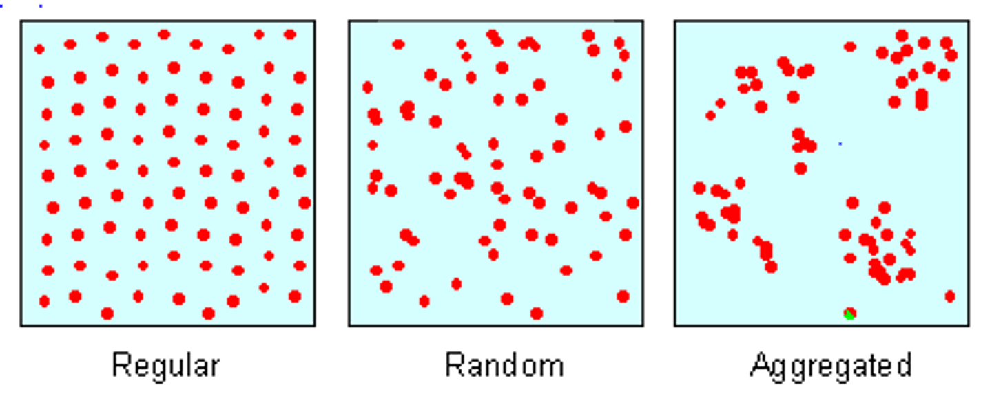
3 Types of Distribution
density, concentration, and pattern
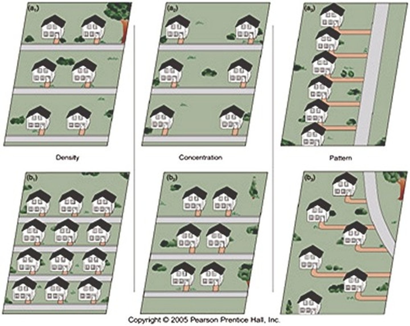
Density
the number of things divided by the measurement of area
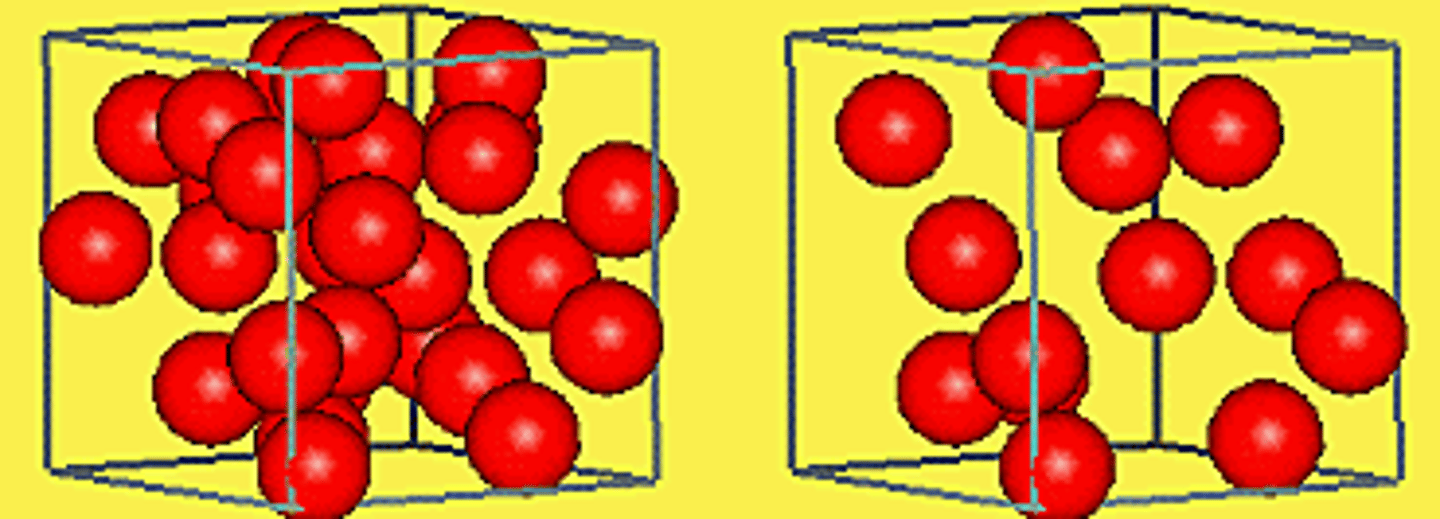
Concentration
how closely packed together objects are
pattern
any regular geometric arrangement that a geographer can identify to how a characteristic is distributed
Cultural Landscape
the title of our textbook and more importantly, the visible changes that humans make to the enviroment including buildings, crops, and signs
Culture
the social heritage of a group or their way of life - major components are language, religion, ethnicity, food, and roles
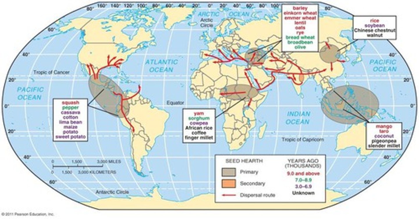
Hearth
a source of culture (where a culture began). For example, the US is the hearth of fast food
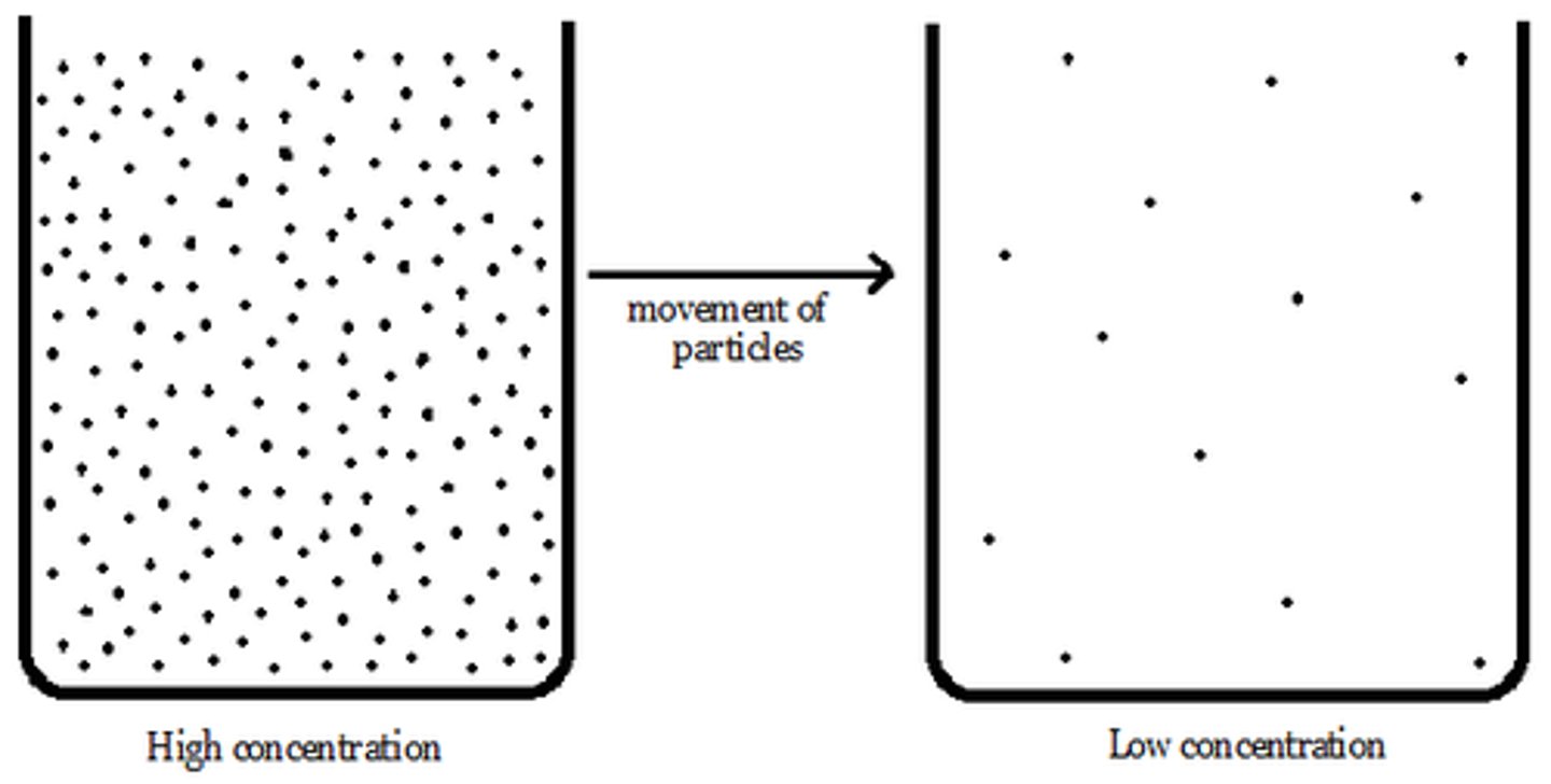
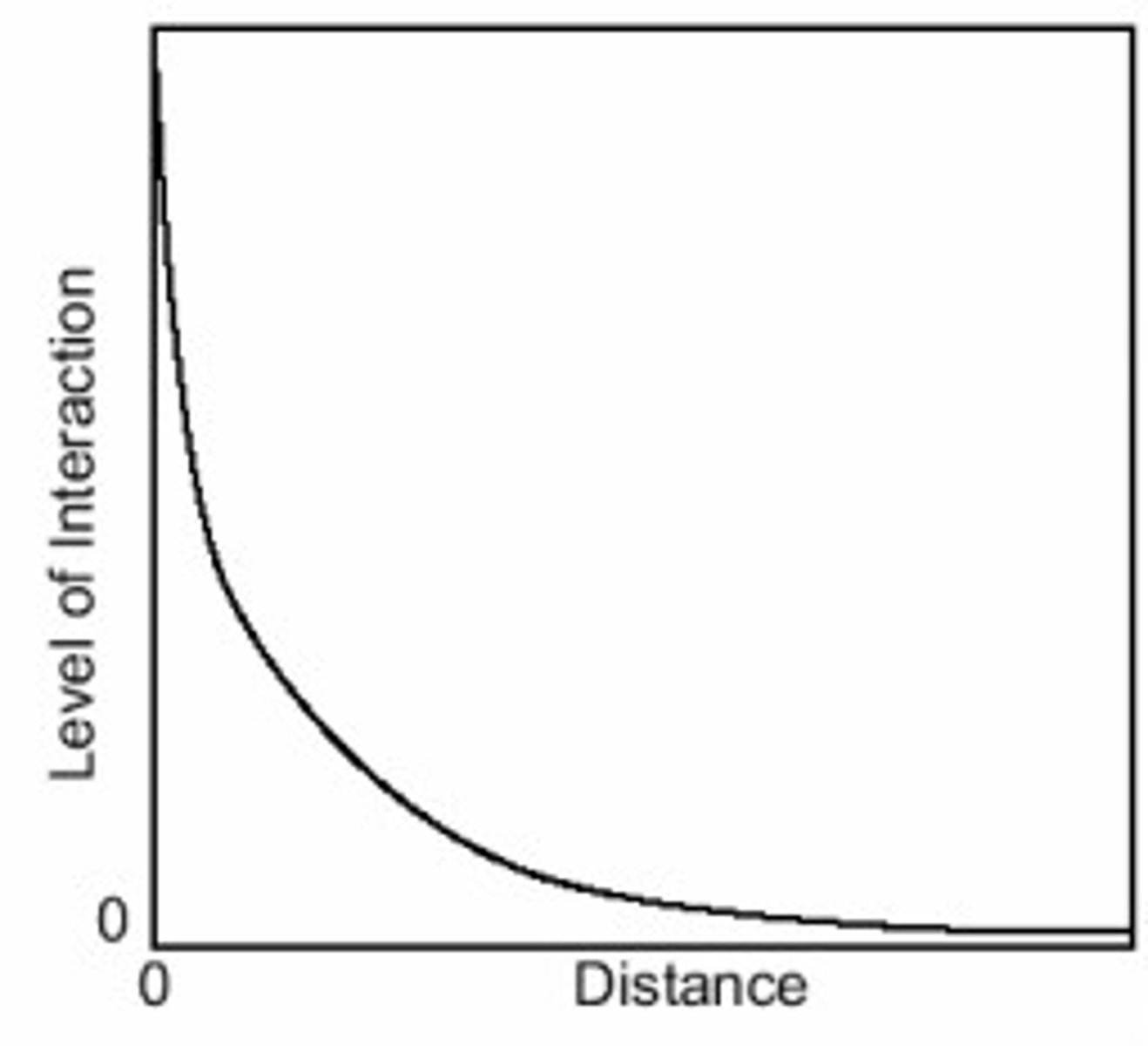
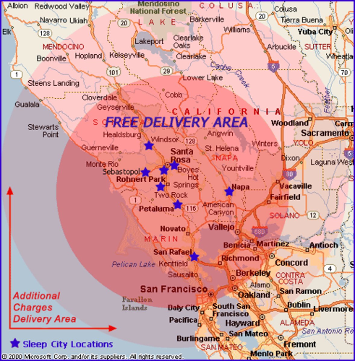
Distance decay
the idea that the interaction between two places declines as the distance between them increases
Region
a place larger than a point and smaller than a planet that is grouped together because of a measurable or perceived common feature
Formal region
a region that is based entirely on something that can be identified and documented or measured - all government areas are this because they share a government
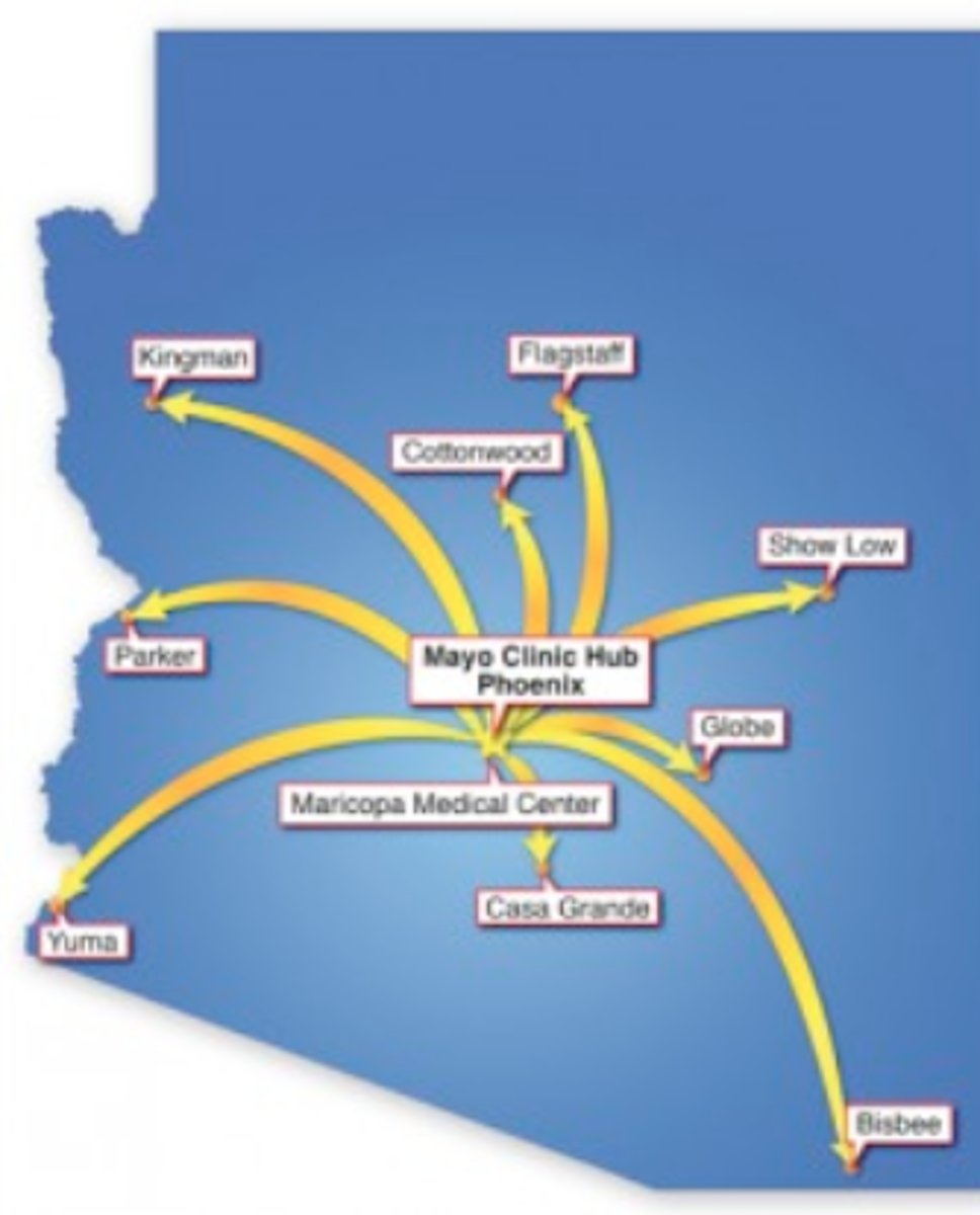
Functional region
a region based around a node or focal point - terrestrial radio broadcasts are an example of this
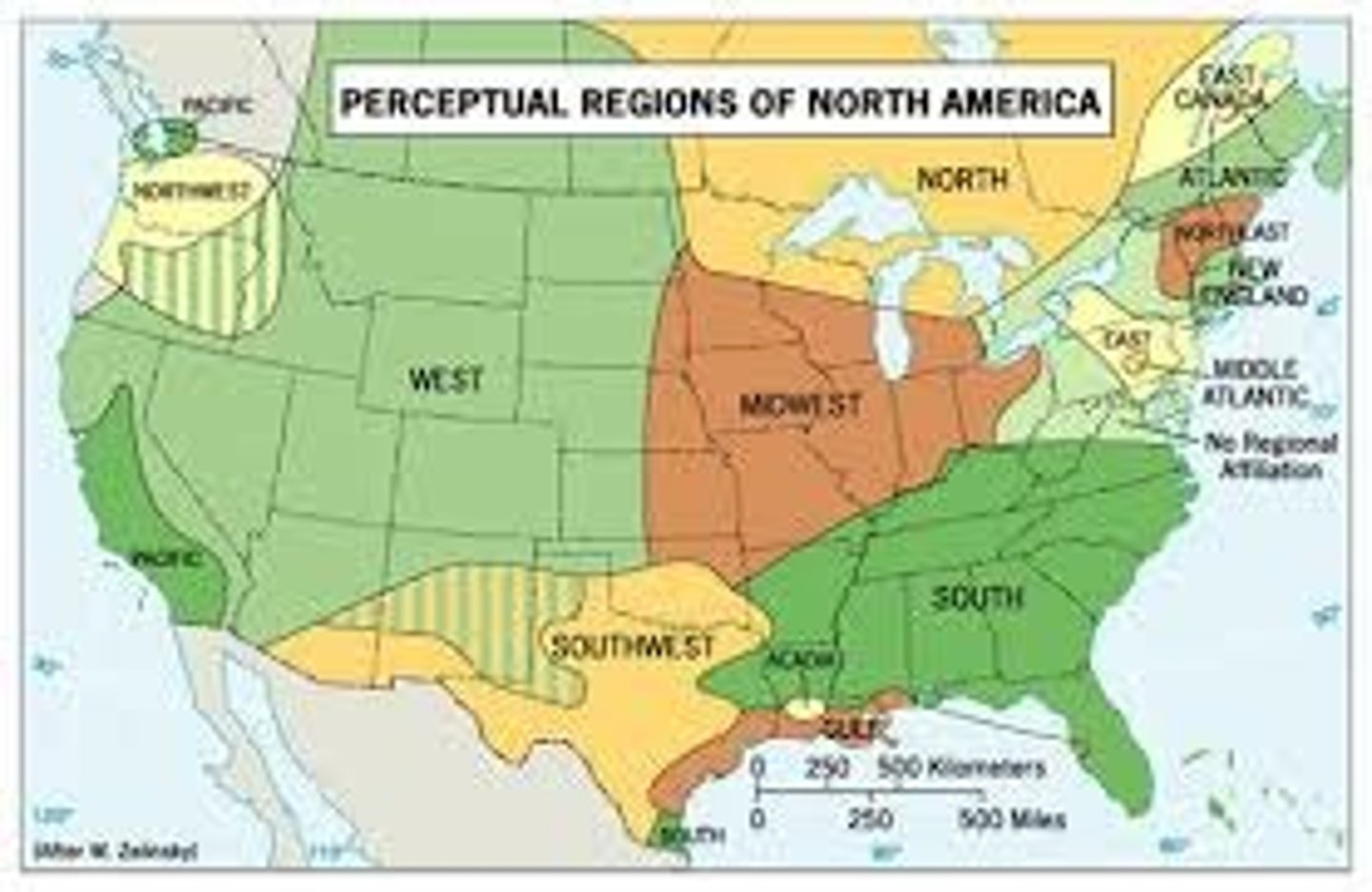
Vernacular/perceptual region
an area that shares a common qualitative characteristic, it's only a region because people believe it's a region
Friction of distance
a metaphor that explains that effort must be used to overcome distance
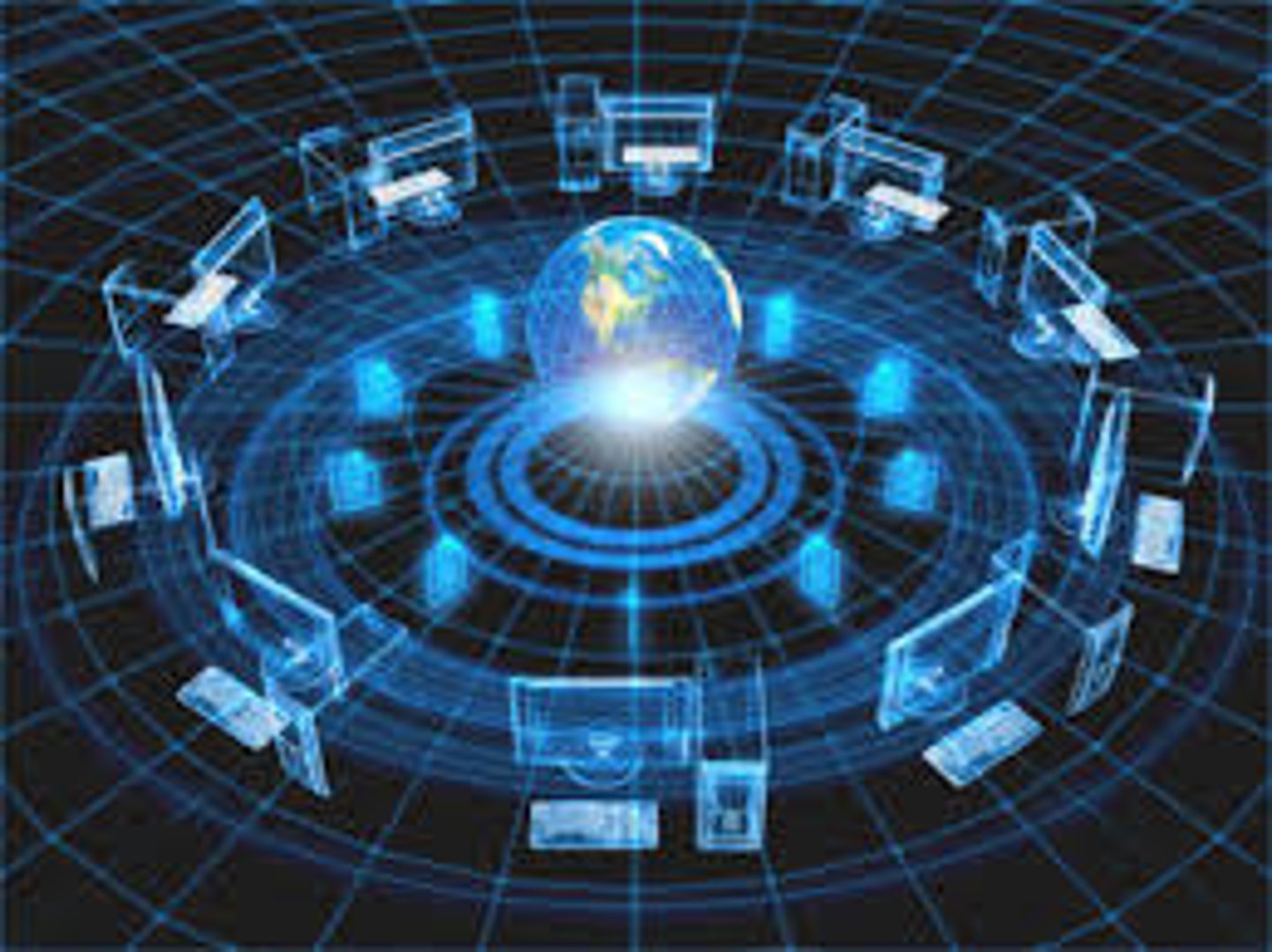
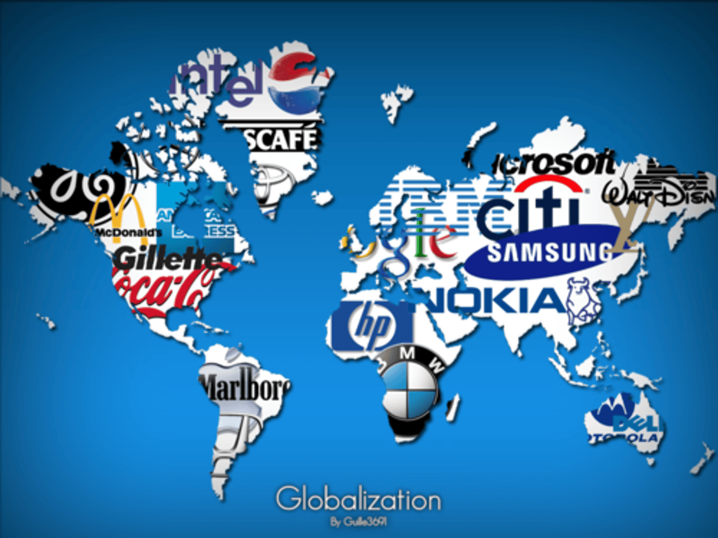
Globalization
worldwide integration and development which results in the expansion of international cultural, economic, and political activities
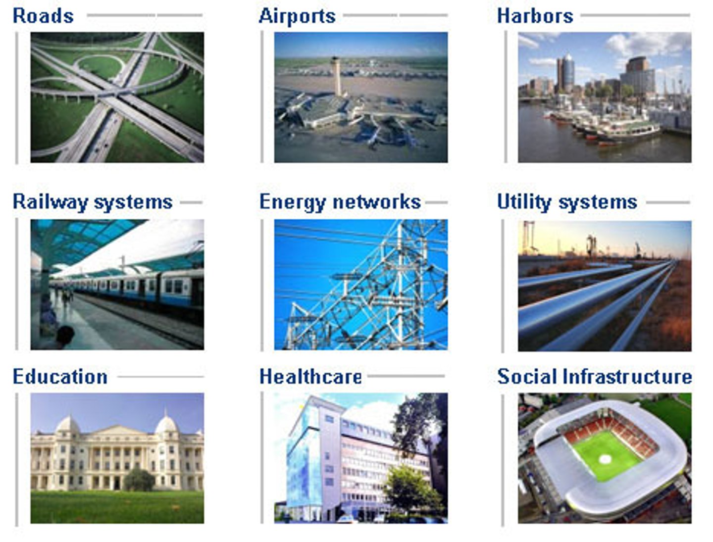
Infrastructure
the basic facilities and installations that help a government or community run, including roads, schools, phone lines, sewage treatment plants and power generation
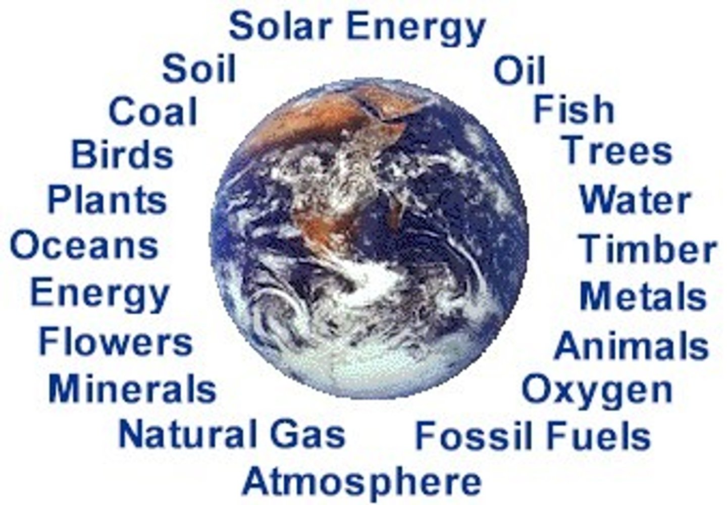
Natural resource
a physical material constituting part of Earth that people need and value
Scale of analysis
how zoomed in or out you are when looking at geographic data
Spatial
it's not as complicated as it sounds - a fancy word for describing how things are organized in space
Spatial distribution
arrangement of a phenomenon across the Earth's surface
Spatial Interaction
the flow of goods, people, or information among places, in response to localized supply and demand
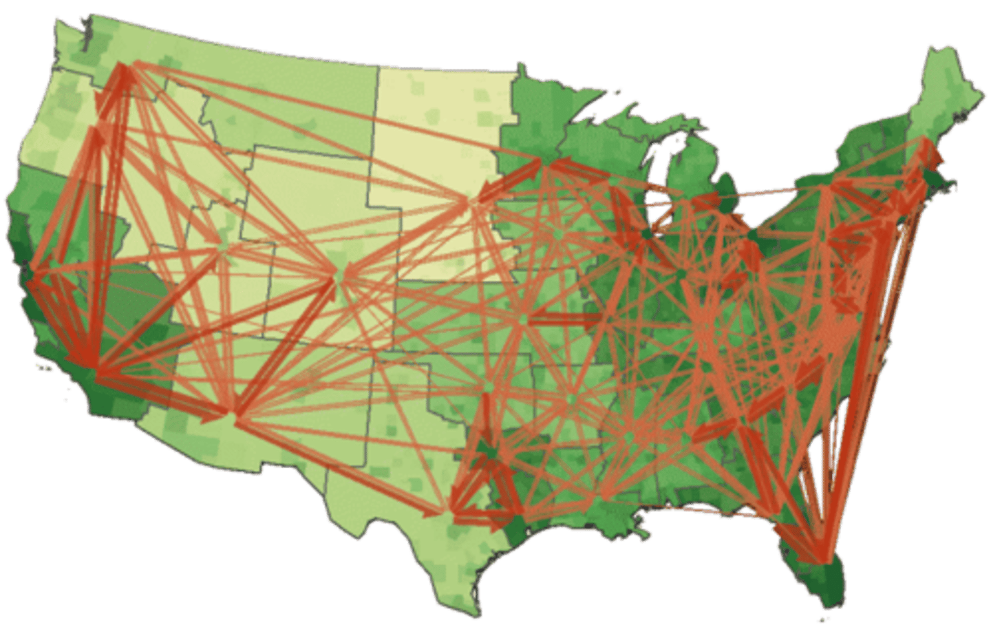
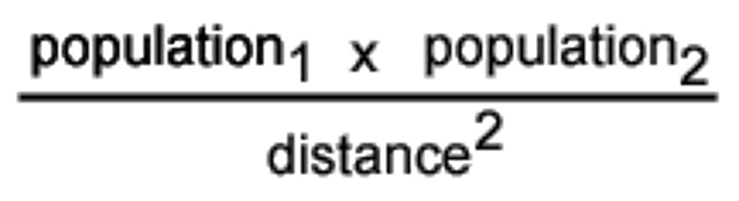
Gravity Model of Spatial Interaction
the most important model in geography - (population1 x population2)/distance squared - the interconnectedness of 2 places depends on their distance and population
Temporal
relating to time

Sustainability
the goal of the human race reaching equilibrium with the environment; meeting the needs of the present without while also leaving resources for future generations
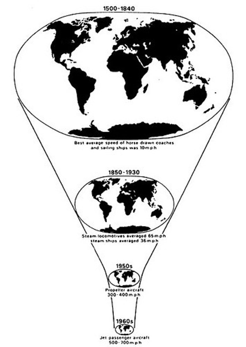
Time-space compression
the idea that the world feels smaller than it used to because of increased technology in transportation and communication
Environmental determinism
the belief that a physical environment is THE reason that some societies are strong while others are weaker
Environmental possibilism
the belief that a physical environment plays a role in the development of a society, but is NOT the ONLY factor at work
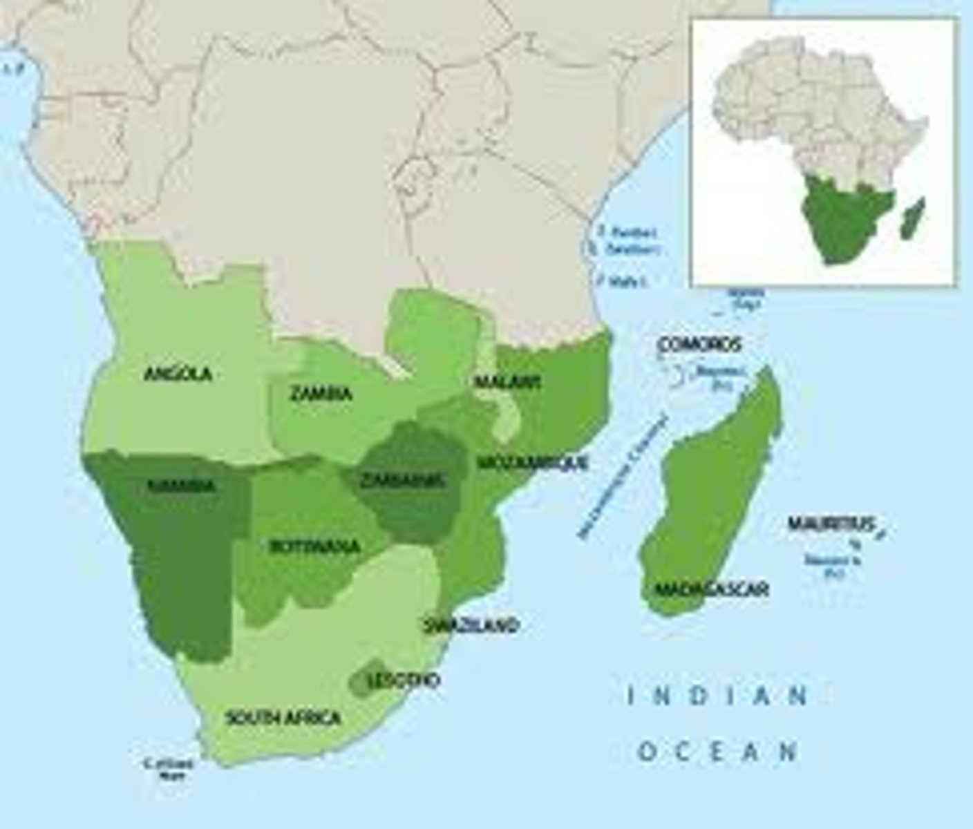
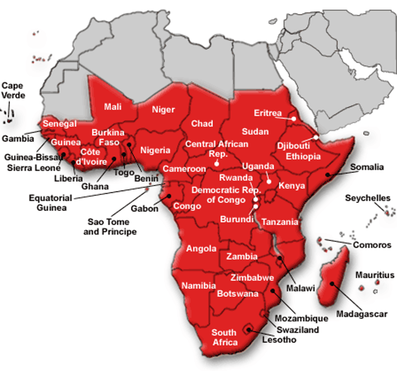
Sub-Saharan Africa
a geographic and cultural region located to the south of the world's largest desert
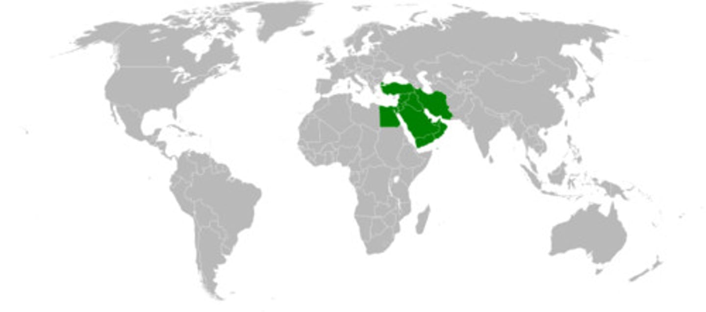
Middle East
the historical name for Southwest Asia, including Iran, Iraq, the Eastern Mediterranean (Turkey, Syria, Lebanon, Israel) and the Arabian Peninsula
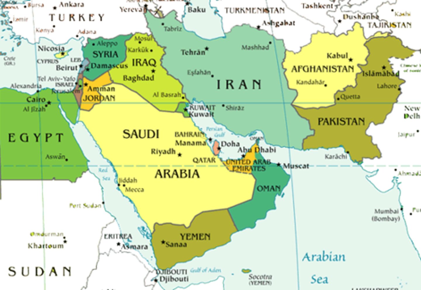
Southwest Asia
previously known as "the Middle East", it includes Iran, Iraq, the Eastern Mediterranean (Turkey, Syria, Lebanon, Israel) and the Arabian Peninsula
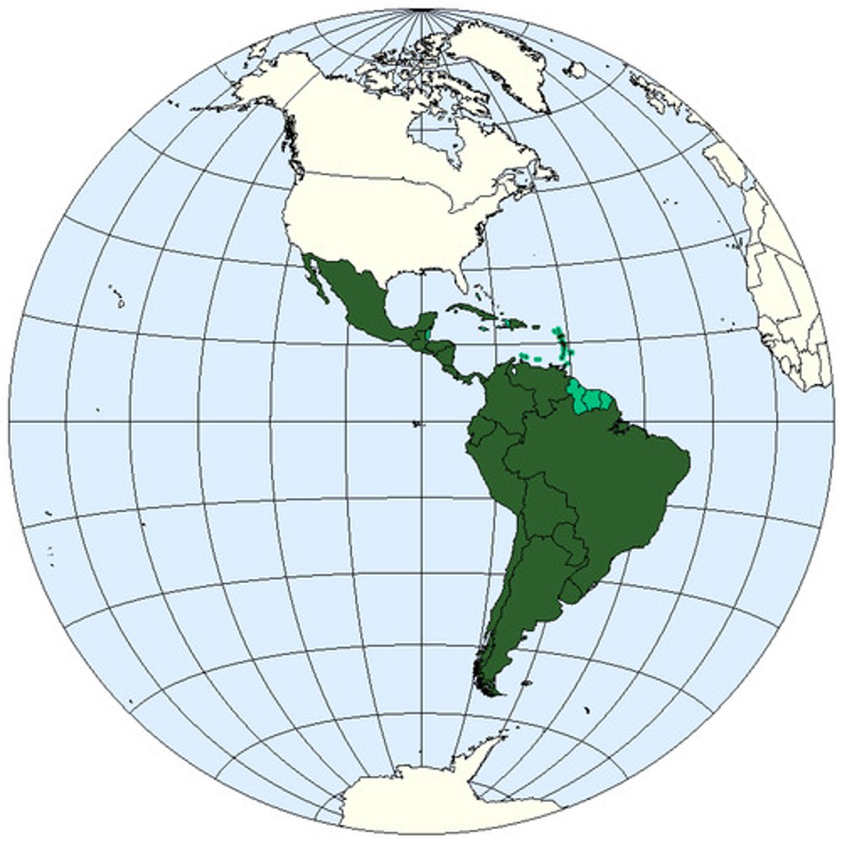
Latin America
a geographic and cultural region that includes South America, Central America, and Mexico, as well as the Spanish-speaking Caribbean. Generally Spanish or Portuguese speaking and predominantly Catholic
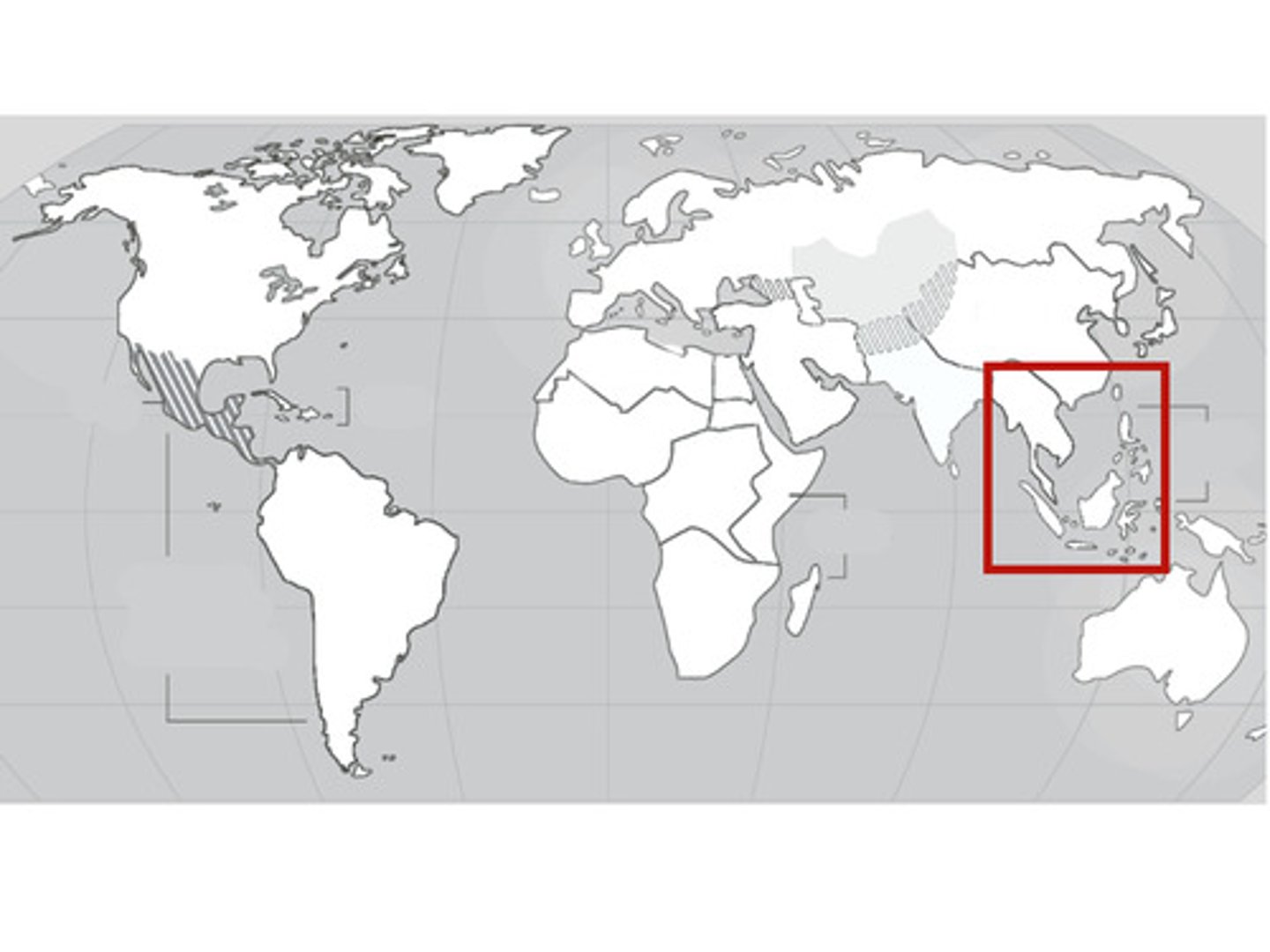
Southeast Asia
the region south of China and east of India, composed of islands and peninsulas. Some Buddhist countries but also influenced by Islam
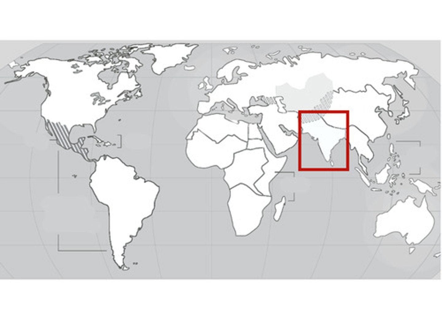
South Asia
the region south of the Himalayas, composed of India, Pakistan, and Bangladesh. Primarily Hindu and Muslim. Nepal and Bhutan are Buddhist
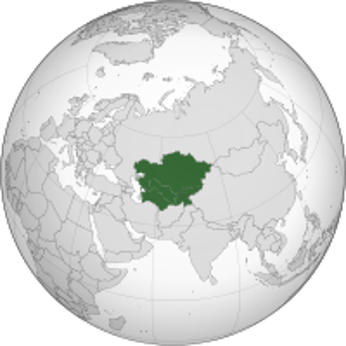
Central Asia
the "stans". Many are predominantly Muslim and many are former republics of the Soviet Union
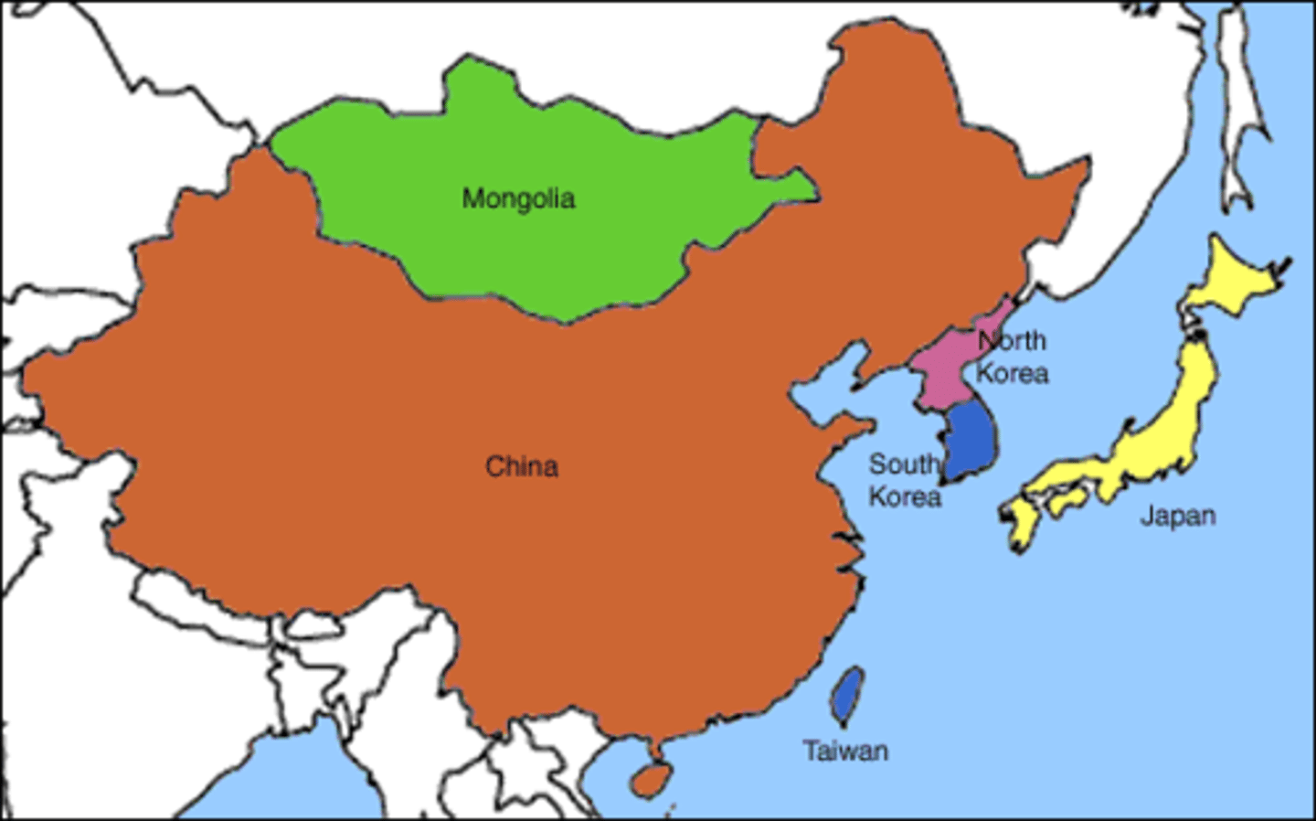
East Asia
Contains China, Japan, Korea, Mongolia
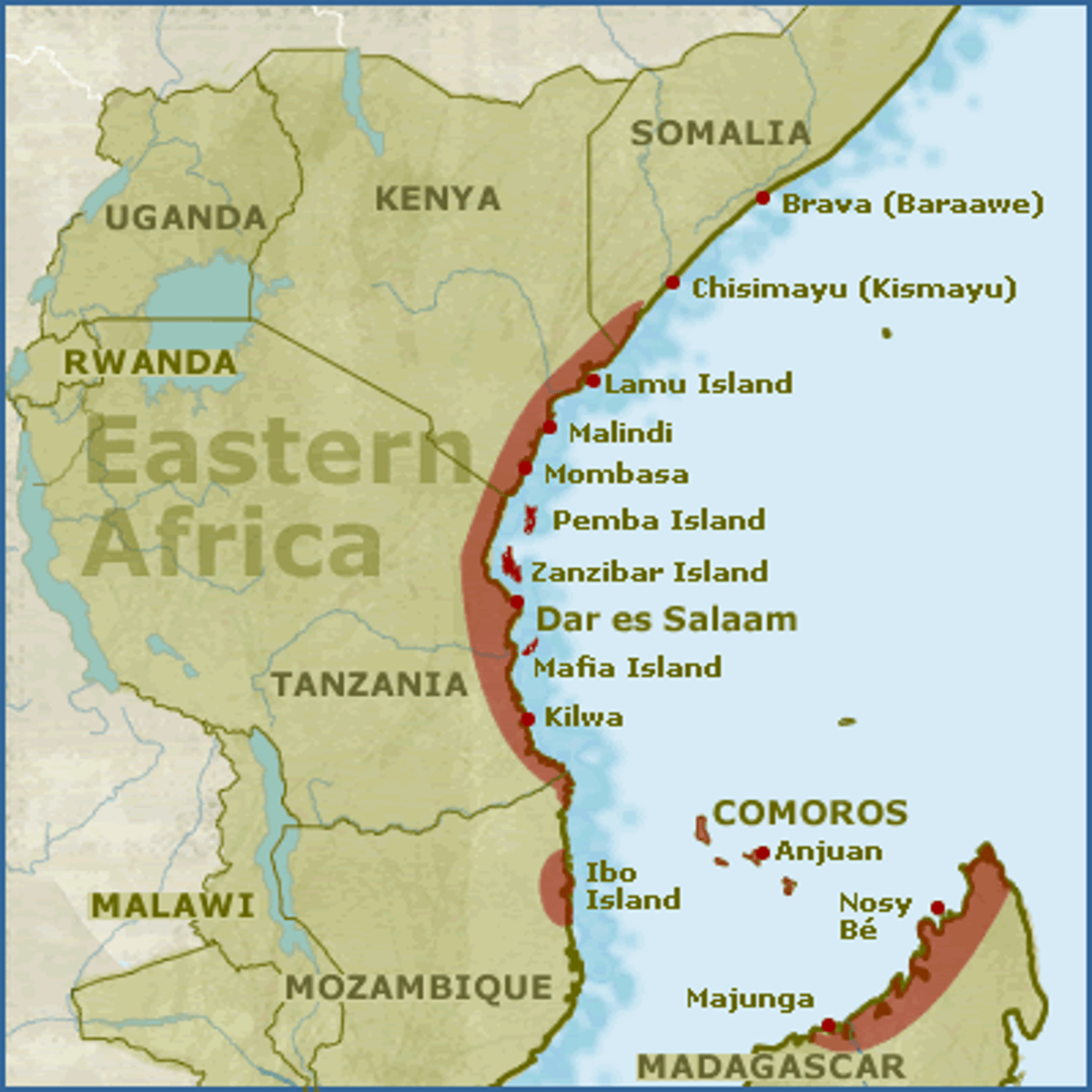
East Africa
Region of Africa considered to include Tanzania, Kenya, Uganda, Rwanda, Burundi,Ethiopia & Somalia.
West Africa
a region of Africa that is close to the coast and includes Nigeria, Ghana, Ivory Coast, Senegal among other countries

North Africa
Region of Africa comprising the modern countries of Morocco, Algeria, Tunisia, and Libya. Culturally Muslim and ethnically Arab

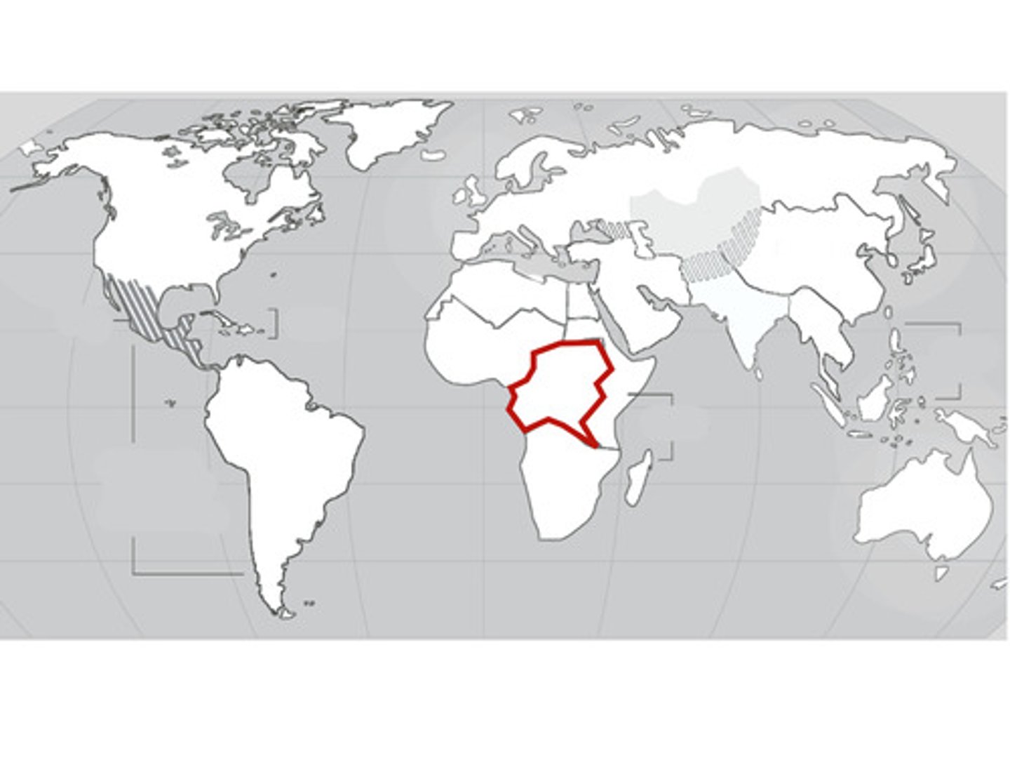
Central Africa
Region of Africa that straddles the Equator and is drained largely by the Congo River system. Includes, the Republic of the Congo, the Central African Republic, and the Democratic Republic of the Congo among others
Southern Africa
A region including Namibia, Botswana Angola, Republic of South Africa, Zimbabwe