CLOUDS REPL
1/16
There's no tags or description
Looks like no tags are added yet.
Name | Mastery | Learn | Test | Matching | Spaced | Call with Kai |
|---|
No analytics yet
Send a link to your students to track their progress
17 Terms
Cirrus, Cirrostratus, Cirocumulus
Upper-Level Clouds (Above 20,000 feet):
Altostratus, Altocumulus
Mid-Level Clouds (6,500 to 20,000 feet)
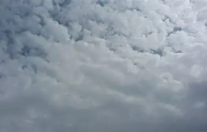
Nimbostratus Stratocumulus Stratus Cumulus Cumulonimbus
Low-Level Clouds (Below 6,500 feet)
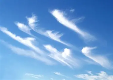
Cirrus Cloud
A type of upper-level cloud characterized by thin, wispy strands that often indicate fair weather but can also signify an approaching storm.

Cirrostratus Cloud
A type of upper-level cloud that forms a thin, ice-crystal layer covering the sky and often creates a halo effect around the sun or moon.
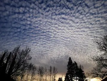
Cirrocumulus Cloud
Clouds that appear as small, white patches or ripples in the sky, often indicating fair weather, but can also suggest a change in weather.
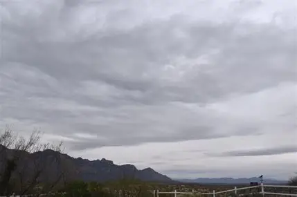
Altostratus Cloud
Thin, grey or blue clouds covering the sky, associated with widespread and continuous precipitation (mid level)

Altocumulus
Rippled, white or grey clouds indicating potential for thunderstorms if appearing in the morning. (middle)
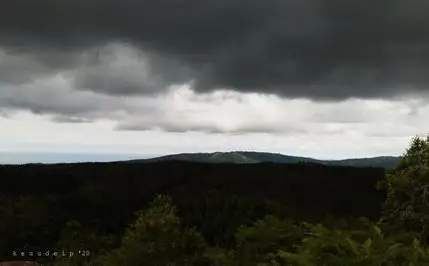
Nimbostratus
Thick, grey clouds causing continuous rain or snow (lower Level)

Stratocumulus
Low, voluminous clouds causing drizzle or light rain, often found in stable atmospheric conditions. They generally indicate overcast but relatively stable weather. (low Level)
Stratus
Blanket-like grey or white clouds causing light rain or drizzle, associated with calm weather but can reduce visibility and ceiling levels.
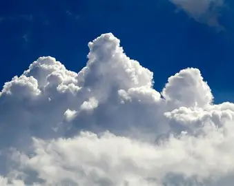
Cumulus
Fluffy, white clouds with dark bases causing showers or rain, indicating fair weather if isolated but potential for thunderstorms if towering. These clouds can cause turbulence due to rising warm air. (low level)
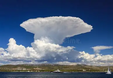
Cumulonimbus
Tall, dark clouds with potential for severe weather including thunderstorms, hail, and tornadoes. These clouds are hazardous for all types of aircraft due to severe turbulence, lightning, and intense precipitation.
Katabatic Winds
Downslope winds occurring at night when the ground cools rapidly, causing the overlying air to become denser and flow downhill.
Anabatic Winds
Upslope winds occurring during the day when the ground warms up, causing the air to rise along the slope. Generally weaker than katabatic winds.
Pressure Systems
The closer the isobars (lines of equal pressure) are to each other on a weather map, the steeper the pressure gradient and the faster the wind will blow.
What clouds are likely to cause precipitation
Nimbostratus, Stratocumulus, Cumulus