North American Geography Quiz 7
0.0(0)
Card Sorting
1/48
Earn XP
Description and Tags
Study Analytics
Name | Mastery | Learn | Test | Matching | Spaced |
|---|
No study sessions yet.
49 Terms
1
New cards
Grasslands
\-Biome consisting of grass covered landscapes
\-Habitat for birds, bison, and rodents
\-Habitat for birds, bison, and rodents
2
New cards
“Prairie Potholes”
\-Depressional wetlands
\-Mostly found in Northern Prairie region (Manitoba, Canada)
\-Mostly found in Northern Prairie region (Manitoba, Canada)
3
New cards
Aeolian landforms
\-Eroded sediments from the Rockies
\-Aeolian (wind processes) created
\--Nebraska sand hills
\--Monahan’s sand hills
\-Aeolian (wind processes) created
\--Nebraska sand hills
\--Monahan’s sand hills
4
New cards
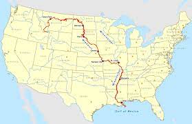
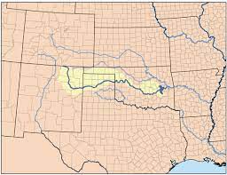
Major rivers of the Great Plains
\-Missouri
\-Platte
\-Arkansas
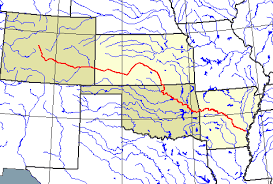
\-Canadian
\-Red
\-Platte
\-Arkansas
\-Canadian
\-Red
5
New cards
Blue northers
\-”Polar Vortex”
\-Outbreaks of polar air from Canada, can bring blizzard conditions to the nothern plains and freesing temperatures as far as Texas
\-Outbreaks of polar air from Canada, can bring blizzard conditions to the nothern plains and freesing temperatures as far as Texas
6
New cards
Chinook winds
Warm, dry, downslope air flow causing extreme changes in local temperatures common in the Rocky Mountains
7
New cards
Tornado alley
\-The area where tornadoes most frequently occur
\-Includes Texas, Oklahoma, Kansas, and Nebraska.
\-Includes Texas, Oklahoma, Kansas, and Nebraska.
8
New cards
Bison hunting
\-60 to 100 million bison before 1800
\-About 1000 remained by 1900
\-Now conservation is slowly increasing population
\-Many native peoples relied on hunting bison & other large animals
\-About 1000 remained by 1900
\-Now conservation is slowly increasing population
\-Many native peoples relied on hunting bison & other large animals
9
New cards
Agriculture
-Wheat, cotton, sorghum, flax, oats, barley, canola, and sunflowers
\-Agriculture is dependent on irrigation
\-Agriculture is dependent on irrigation
10
New cards
Dust bowl
\-1930s (coincided with the Great Depression)
\-Severe drought, massive dust storms
\-Worse in the south
\-Kansas, Oklahoma, and Texas
\-Many residents migrated to California
\-Severe drought, massive dust storms
\-Worse in the south
\-Kansas, Oklahoma, and Texas
\-Many residents migrated to California
11
New cards
Crop Rotation Program (CRP)
Government program to rotate crops to replenish nutrients in the soil and hold the soil in place
12
New cards
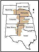
Ogallala Aquifer
\-Extremely important t to agriculture in this region
\-Irrigation is lowering water tables
\-Depleting aquifers
\-Ogallala irrigates ¼ of all U.S. cropland
\-Water levels have dropped by 100 ft in some places
\-Pollution seeping into the aquifer
\-Irrigation is lowering water tables
\-Depleting aquifers
\-Ogallala irrigates ¼ of all U.S. cropland
\-Water levels have dropped by 100 ft in some places
\-Pollution seeping into the aquifer
13
New cards
Population losses in the Great Plains
\-0 to 9.7% of change in rural population
\-Not a lot of people live there anymore
\-Not a lot of people live there anymore
14
New cards
Aging in place
\-Many communities have a large % of older residents
\-Also, housing is older
\-Also, housing is older
15
New cards
Cities of the Great Plains
\-Calgary, Alberta
\-Oklahoma City, OK
\-Grand Forks, ND
\-Bismark, ND
\-Wounded Knee, SD
\-Lincoln, NE
\-Topeka, KS
\-Wichita, KS
\-Amarillo, TX
\-Lubbock, TX
\-Oklahoma City, OK
\-Grand Forks, ND
\-Bismark, ND
\-Wounded Knee, SD
\-Lincoln, NE
\-Topeka, KS
\-Wichita, KS
\-Amarillo, TX
\-Lubbock, TX
16
New cards
Calgary, Canada
\-Oil town
\-Cowboy culture
\-Calgary Stampede (every July)
\-Cowboy culture
\-Calgary Stampede (every July)
17
New cards
Hudson Bay Company
Prevented Canadian prairies being settled, making them settle late
18
New cards
1862 Homestead Act
160 Acre given to settlers who agreed to live upon, cultivate and improve the property
19
New cards
Railroad expansions
\-1869 Transcontinental Railroad
\-1885 Canadian Pacific Railroad
\-1885 Canadian Pacific Railroad
20
New cards
Native resistance
\-Rapid settlement led to conflict with native groups
\-Many natives died from diseases, fighting
\-Many resisted forced resettlement
\-More than 200 Dakota men, women, and children killed at Wounded Knee, 1890
\-Many natives died from diseases, fighting
\-Many resisted forced resettlement
\-More than 200 Dakota men, women, and children killed at Wounded Knee, 1890
21
New cards
Indian reservation/ territories
\-Dakota Sioux
\-High levels of poverty and unemployment on reservations
\-Significant discrimination
\-Dispute w/ U.S. government over mineral rights
\-High levels of poverty and unemployment on reservations
\-Significant discrimination
\-Dispute w/ U.S. government over mineral rights
22
New cards
Energy production and mining
\-Gas production on S. Plains
\-Oil production in state/providences near the border
\-Coal in Wyoming & Montana
\-Wind energy a developing sector
\-Oil, natural gas, and coal
\-Oil sands in Alberta, Canada
\-Texas wind farms
\-Oil production in state/providences near the border
\-Coal in Wyoming & Montana
\-Wind energy a developing sector
\-Oil, natural gas, and coal
\-Oil sands in Alberta, Canada
\-Texas wind farms
23
New cards
Sand hills
\- An inland habitat type characterized by rolling hills capped by deep coarse sands
\-Nebraska and Moahan’s
\-Nebraska and Moahan’s
24
New cards
Fracking
A drilling method used to extract petroleum (oil) or natural gas from deep in the Earth
25
New cards
Wind farms
\-Getting the Power where it is needed the most:
\--Transmission lines
\-Amarillo and Lubbock area
\--Transmission lines
\-Amarillo and Lubbock area
26
New cards
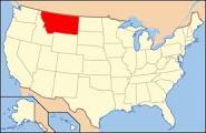
Montana
27
New cards
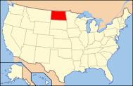
North Dakota
28
New cards
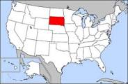
South Dakota
29
New cards
Nebraska
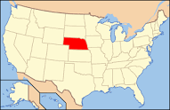
30
New cards
Colorado
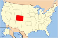
31
New cards
Kansas
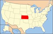
32
New cards
Oklahoma
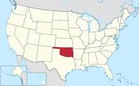
33
New cards
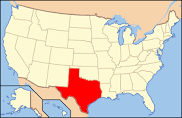
Texas
34
New cards
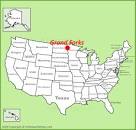
Grand forks, ND
35
New cards
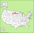
Bismark, ND
36
New cards
Wounded Knee, SD
37
New cards
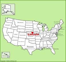
Lincoln, NE
38
New cards
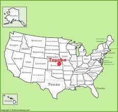
Topeka, KS
39
New cards
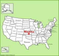
Wichita, KS
40
New cards
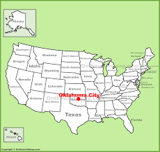
Oklahoma City, OK
41
New cards
Amarillo, TX
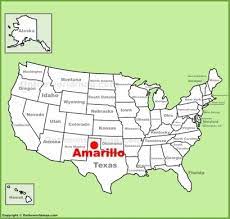
42
New cards
Lubbock, TX
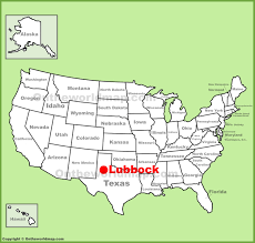
43
New cards
Ogallala Formation/ Aquifer (on map)
44
New cards
Missouri River
45
New cards
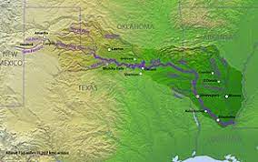
Arkansas River
46
New cards
Canadian River
47
New cards
Red River
48
New cards
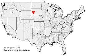
Nebraska Sand Hills (on map)
49
New cards
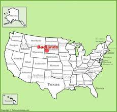
Badlands (ND)