Meteorology Keynotes
1/185
Earn XP
Description and Tags
Name | Mastery | Learn | Test | Matching | Spaced | Call with Kai |
|---|
No analytics yet
Send a link to your students to track their progress
186 Terms
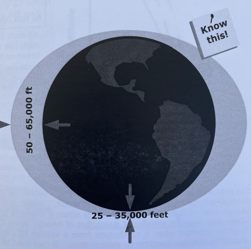
how does the height of the troposphere change and what are the alt
varies drastically with latitude and with the seasons. In the polar region its between 25 000 - 35 000ft while in the equatorial regions its from 50 000 - 60 000ft
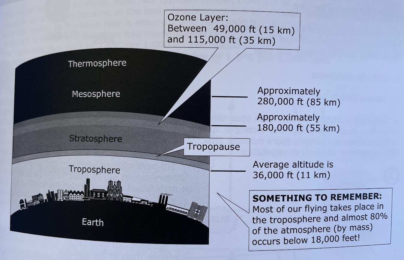
what are the four layers of the atmosphere
1. how does the earth absorb the suns heat
2. is the heat short wave or long wave
1. through the surface of the earth
2. short wave
this heats the earth which in turn re-radiates the heat at a much longer wave length which is absorbed by the atmoshphere
1. seasonal variations
2. latitude variations
3. diurnal (day/night) variations
4. Different surfaces of the earth, such as rock collects heat more than trees
1. travels through more atmosphere
2. spreads out over larger area and is therefore less intense than at the equator
3. strikes the surface at a more oblique angle
all this results in less heating at high alt
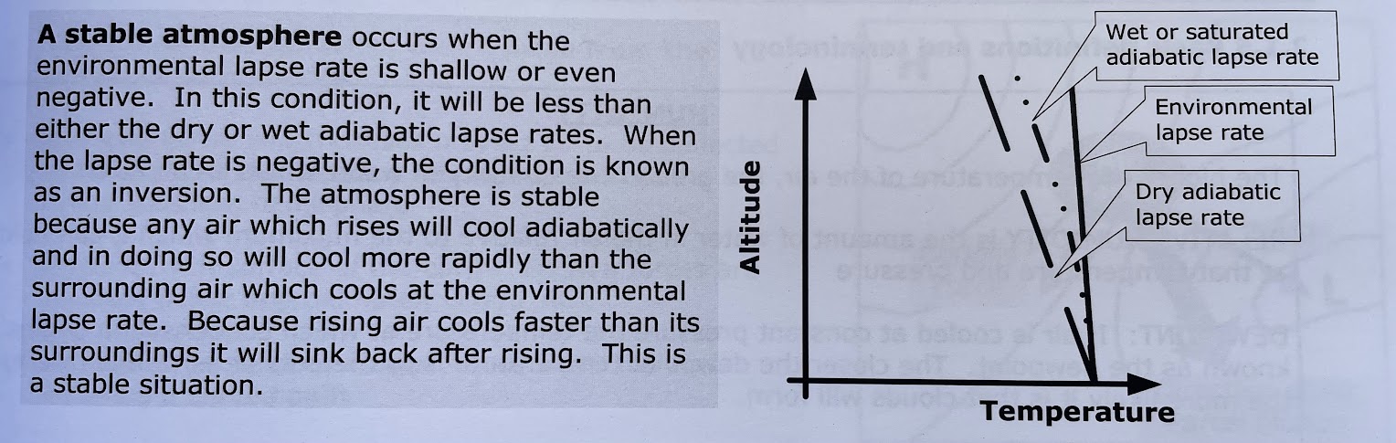
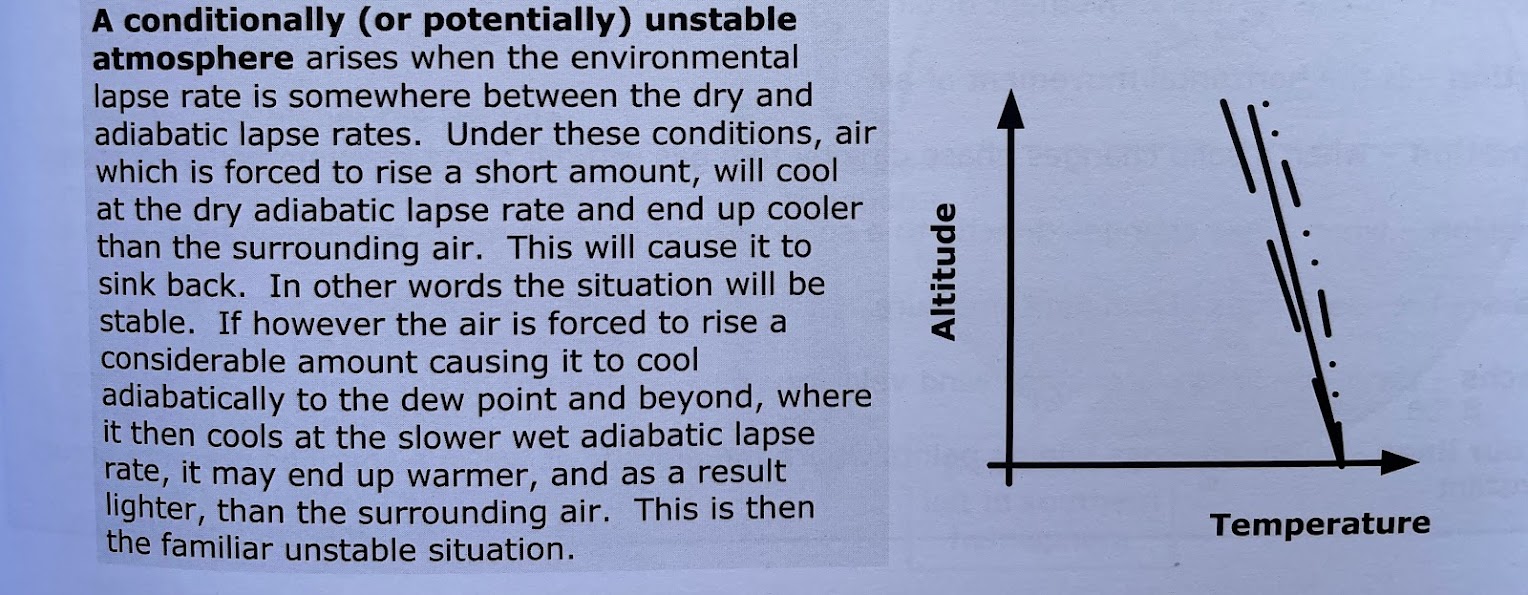
what is a stable atmosphere
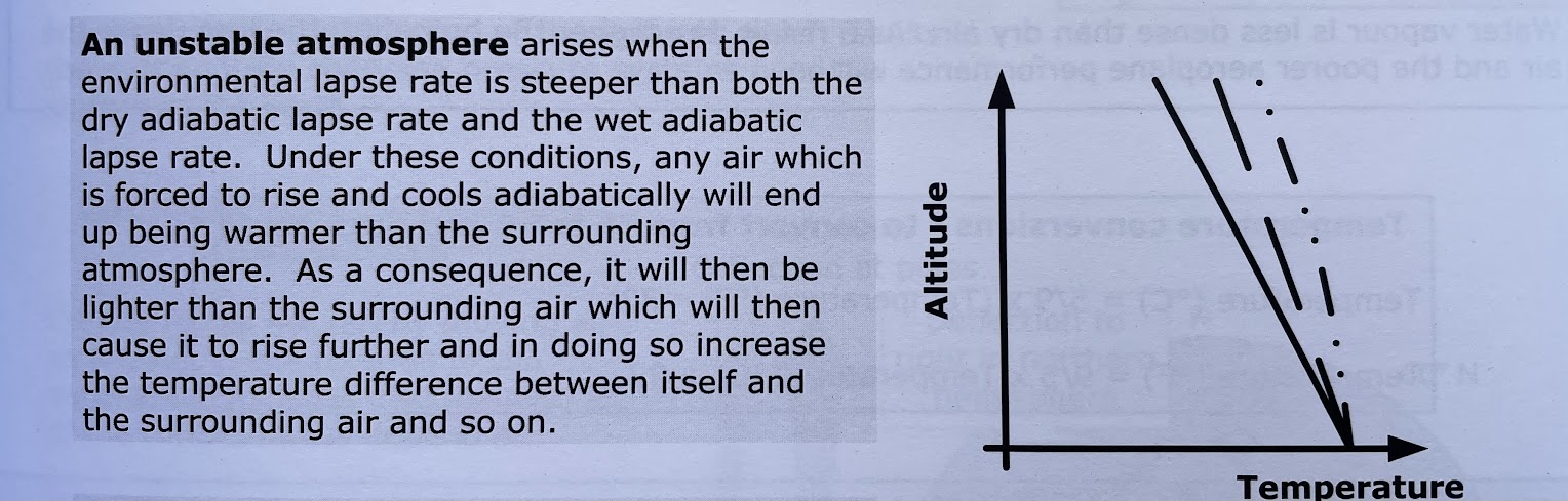
what is an unstable atmosphere
poorer airplane performance will be
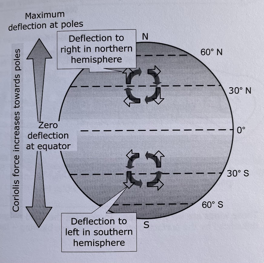
1. coriolis force which causes moving air to be deflected to the right in the northern hemisphere and to the left in the southern hemisphere
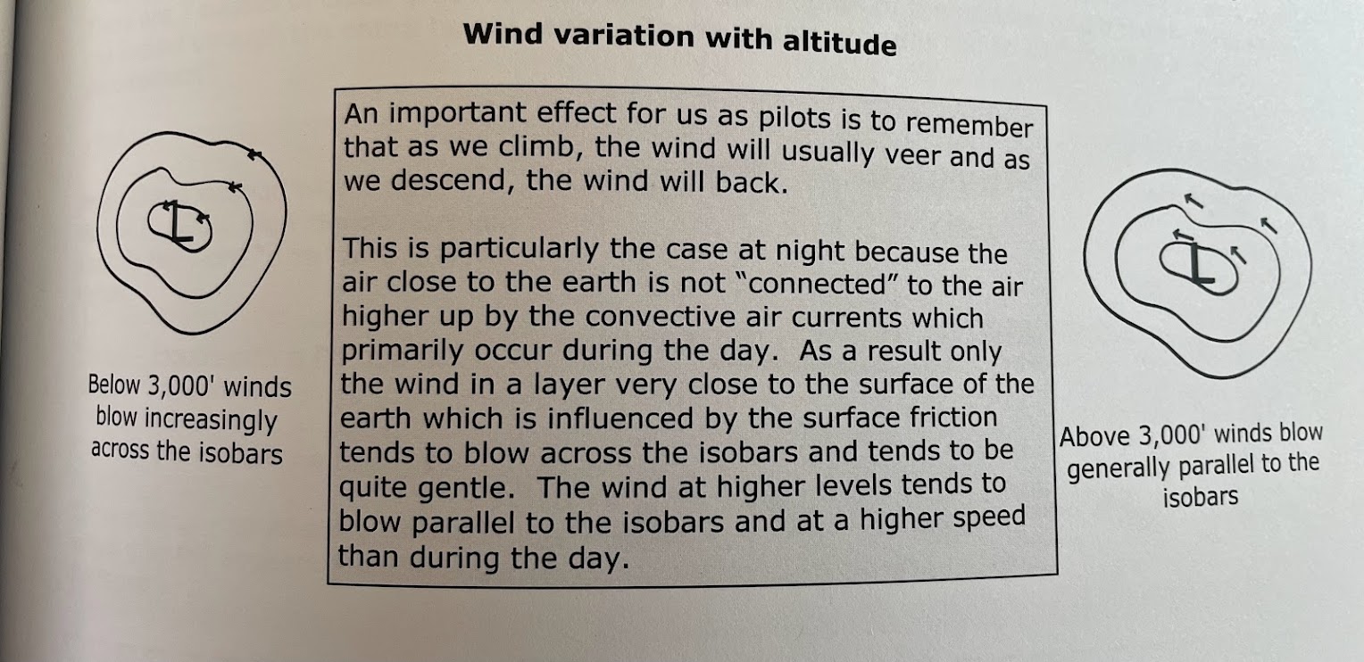
2. friction with the surface of the earth. Friction forces are greatest below aprox 3 000 AGL
3. acceleration or centrifugal forces when the air is following a curved path
what’s a coriolis force and how do they behave:
what are the two factors that affect coriolis (2)
what direction does it deflect to on the northern and southern hemisphere?
are felt by moving air as a result of the rotation of the earth about its axis. It depends on:
wind speed: the higher the wind speed, the higher the coriolis force
latitude: the higher the latitude, the higher the coriolis force. At equator, the coriolis forces are zero. at the poles they are max
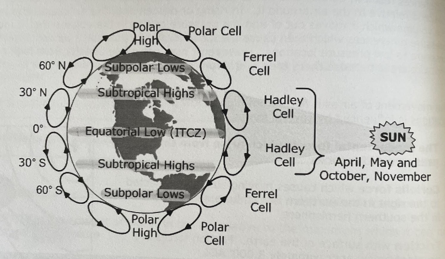
1. polar cell
2. hadley cell
3. ferrel cell
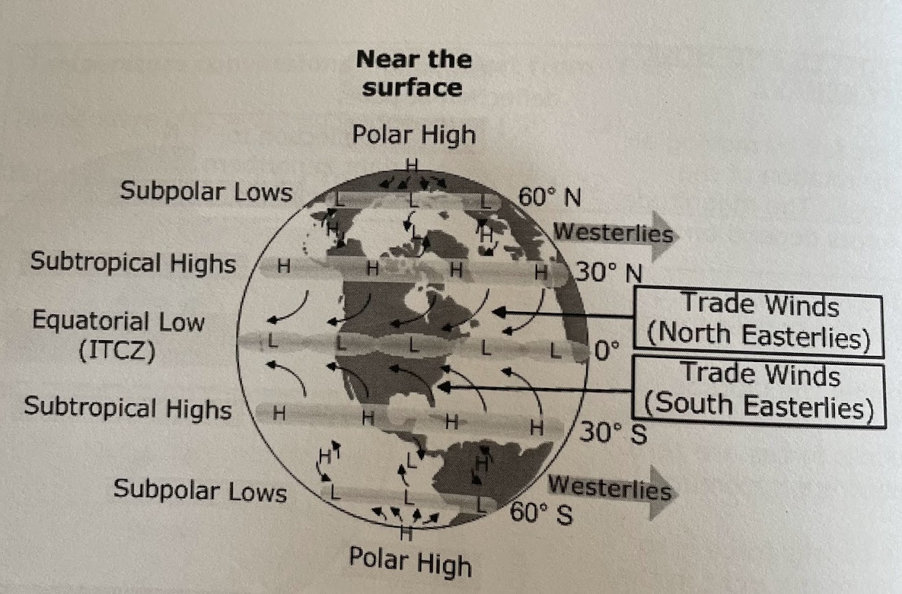
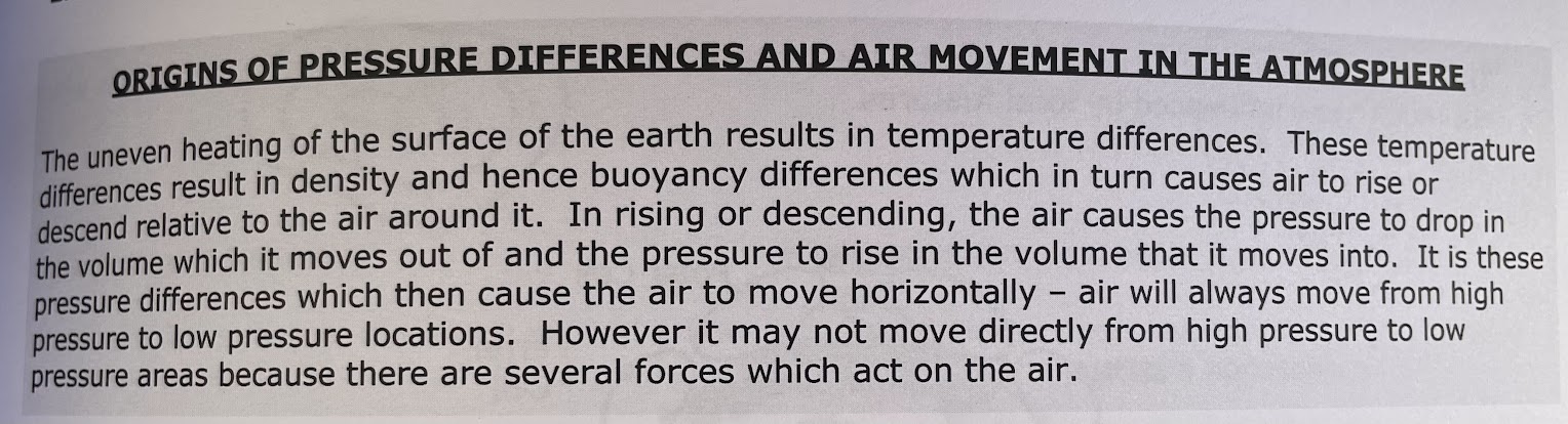
low pressure systems:
what direction does it circulate
trough or ridge?
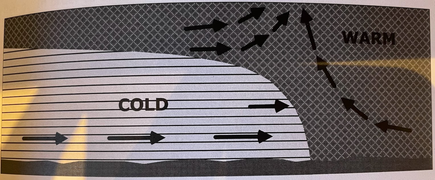
associated with (blank) air and the arrival of (blank) weather and precip
air circulates counter-clowckwise in the northern hemisphere
known as troughs, especially when they have an elongated shape
surface lows are usually associated with rising (or ascending) air and the arrival of cloudy weather and precip
high pressure systems:
air circulates what direction
ridge or trough
associated with (blank) air, with what type of weather
air circulates clockwise
if high pressure system is elongated is shape then it is referred to as a ridge of high pressure
associated with descending (or subsiding) air, clear weather and gentle wind
1. veer
2. back
3. not connected
may also be caused by a line of thunderstorms which often occur along a front in which case they are known as line squalls
1. adiabatic expansion resulting from lifting air
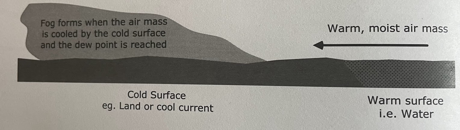
2. advection (horizontal movement) of air over a colder surface
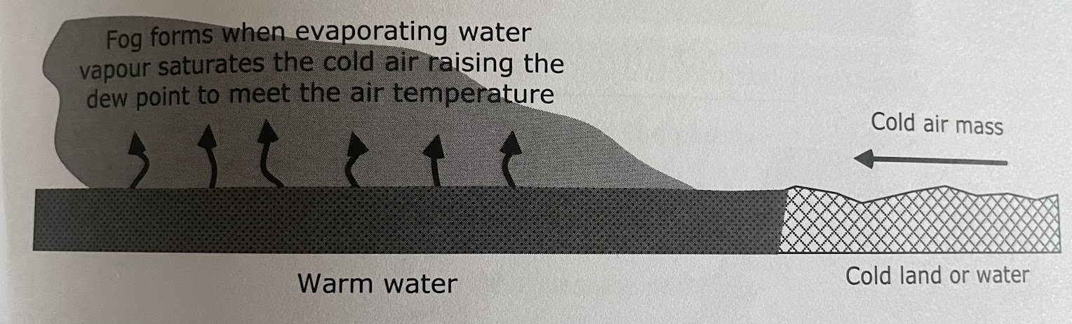
3. evaporative cooling
1. the primary cause of the cooling is adiabatic expansion resulting from lifting of the air. Lifting can occur because of:
a. atmosphere convergence - where air masses clash horizontally and the air is left with no place to go other than up
b. orographic features - where air travels over orograpihc features such as mountains and is forced to rise
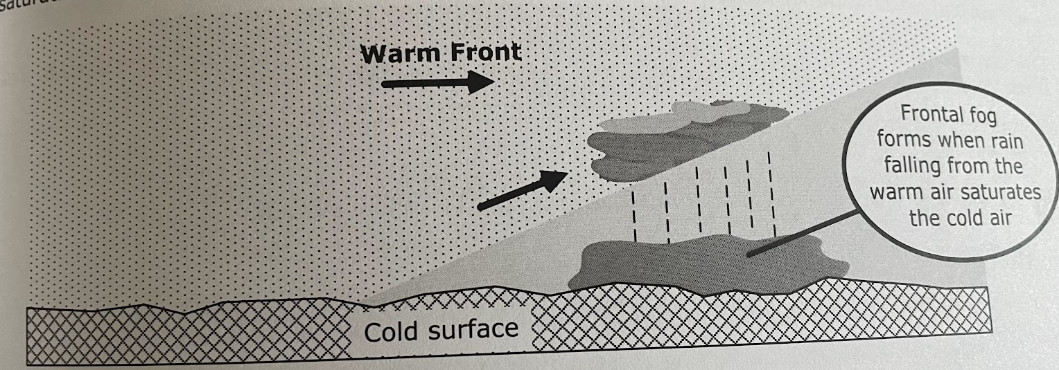
c. frontal action - where one air mass undercuts forcing the second air mass to rise or one mass rides over the top of another air mass
d. mechanical turbulence - similar in nature to lifting cause by orographic features
e. convection - where adjacent bodies of air are warmed (or cooled) differently usually by different ground surfaces. The body of air which is warmed more rises while the other body sinks
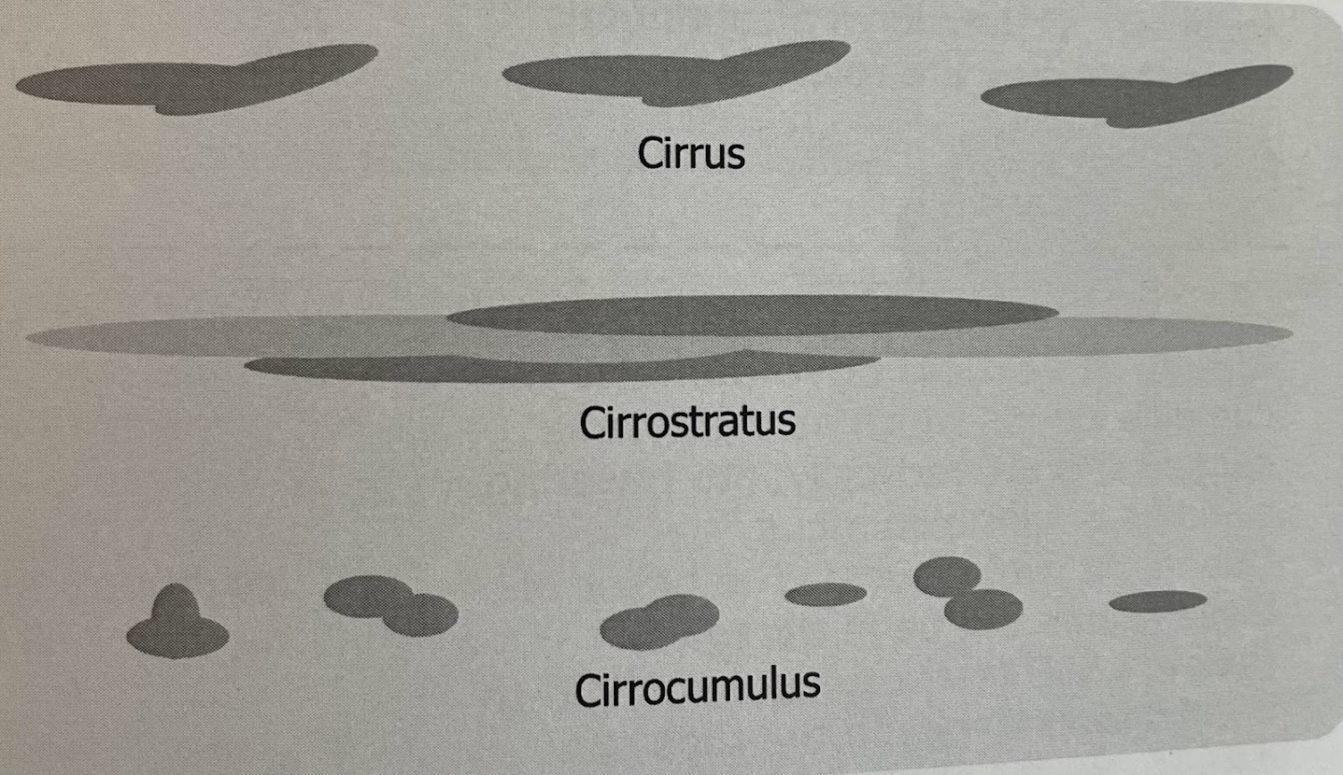
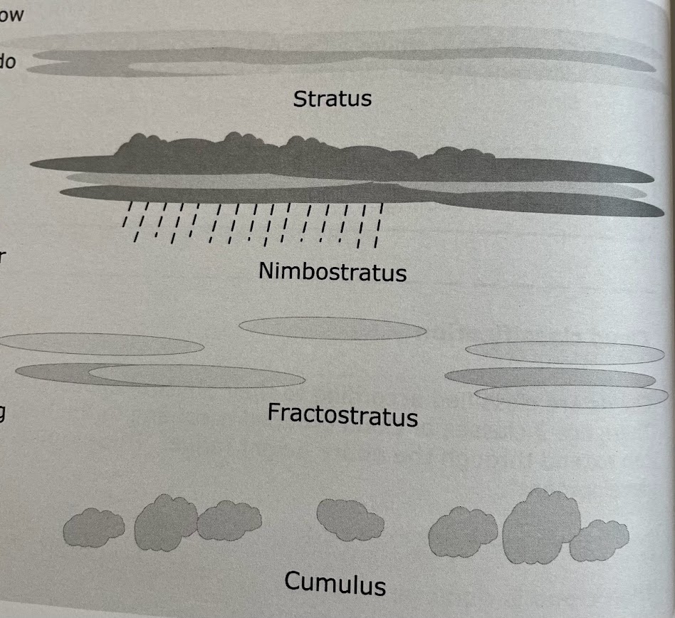
1. high cloud
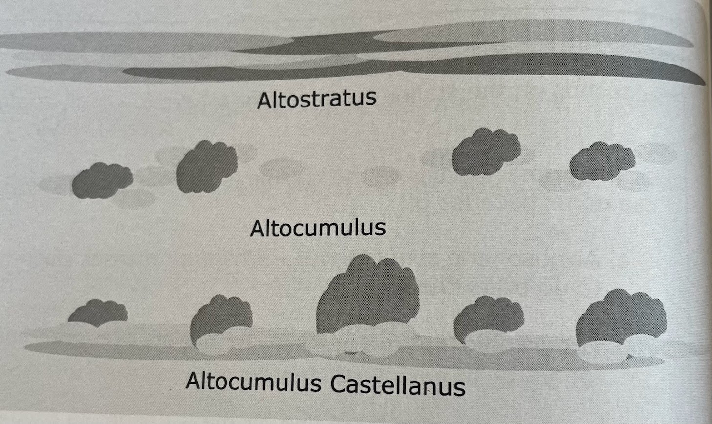
2. middle cloud
3. low cloud
4. clouds of vertical development
normally contain the word “cirro” or cirrus
cirrus = clouds with a fibrous or streaky appearance
cirrostratus = usually a thin layer
cirrocumulus = small puffy clouds which give the appearance of being flattened
altostratus = uniform layered cloud
altocumulus = puffy clouds usually patchy in their coverage
altocumulus castellanus = puffy clouds which grow to a significant height
stratus = uniform layered cloud
nimbostratus = a dark layer cloud which usually produces continuous precip, be it rain, sleet, snow, freezing rain
fractostratus = (sometimes called stratus fractus)/ this is a stratus cloud with gaps in the layer which gives the appearance of the layered cloud having been torn apart or fractured
cumulus = puffy clouds often grouped together. If they form a continuous layer then they are referred to as stratocumulus
fog =
fog = vis is less than 5/8
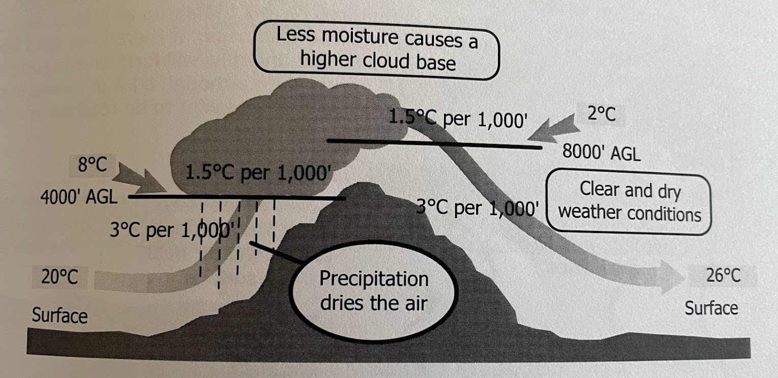
surf temp. 20 degrees C/ Dew point 5 C. what’s the height of the base of the convective cloud?
divide 15/3=5
height of the base of the convective cloud will be 5 000ft AGL
(3 degrees C per 1000ft) calculation for cloud base for TC exam
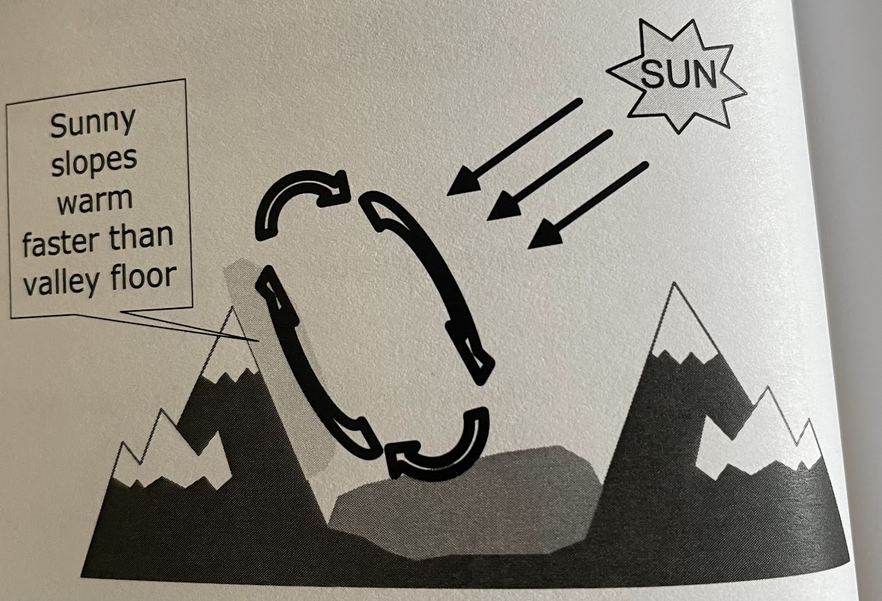
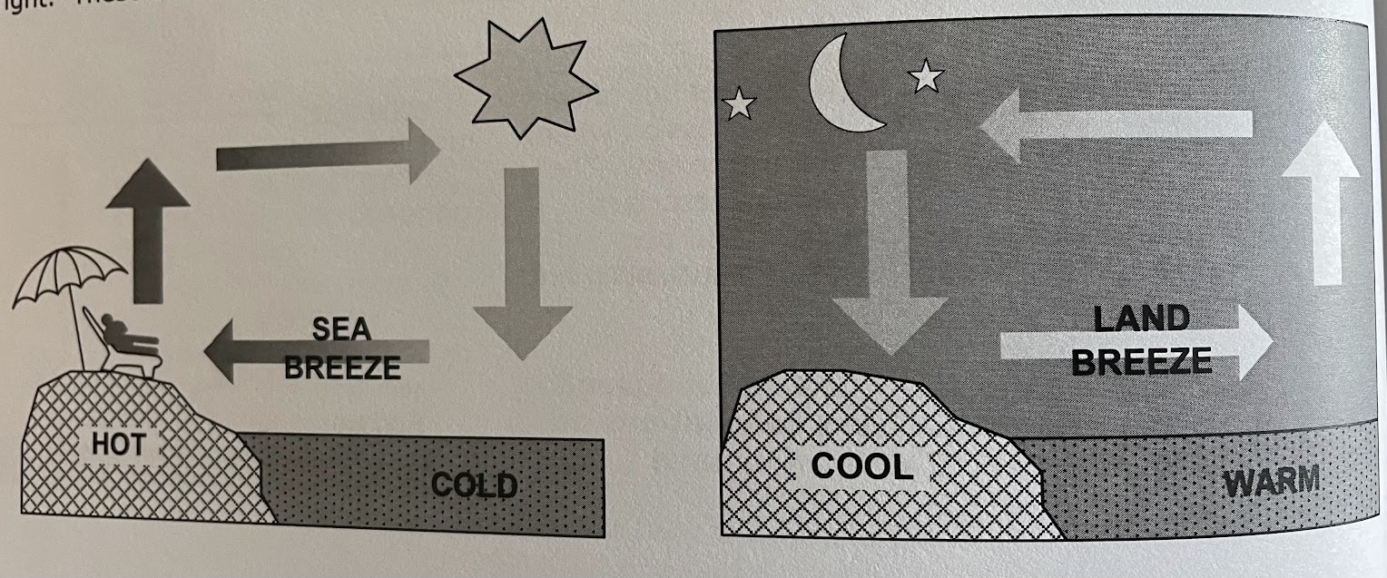
arise during the day because land masses warm up and much more rapidly than adjoining water masses. as land warms, it warms the air in contact causing the air density to drop. the lower density air is more buoyont than the surrounding air and thus rises. As the warmed air rises, its place is taken by the cooler air from over the eater setting up a circulation pattern.
land breezes:
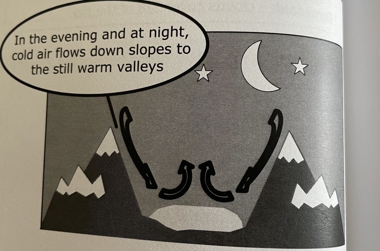
at night land will cool off more rapidly than water. This cools the air in contact with it, increasing its density and causing it to sink. these are known as land breezes and are usually more gentle than sea breezes
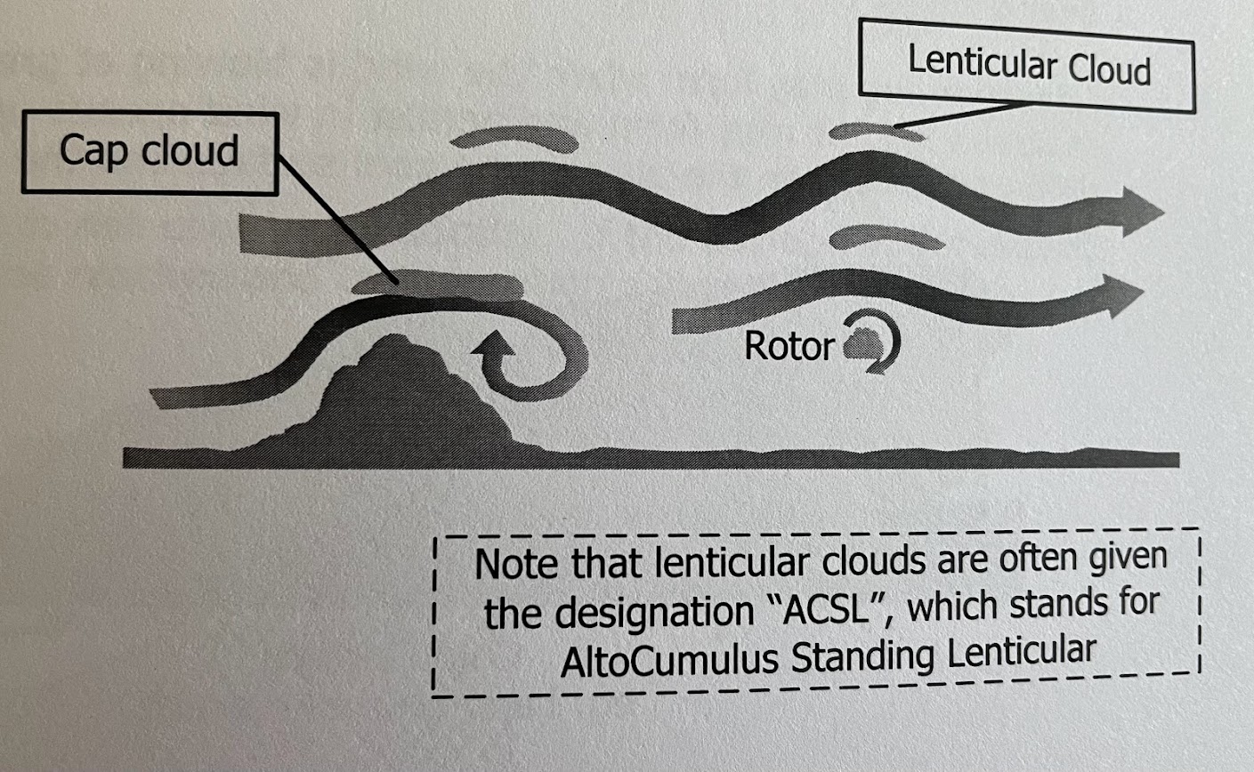
what flying hazards are there associated with mountain waves
(blank) can reach speeds of up to (blank) ft pre min
downdrafts, severe or extreme turbulence and the windshear. Downdrafts can reach speeds of up to 5000 ft per min and the most severe are usually found at the same height as the mountain ridge
altimeter may read incorrectly due to the pressure increasing and decreasing as the air oscillates like a spring
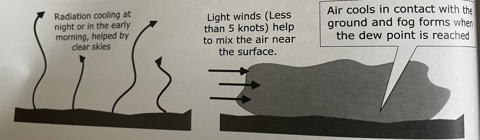
forms usually a few hours before dawn cause thats when the radiation cooling of the surface has been sufficient to cause condensation. a little wind is necessary to mix the air up as it flows over the surface so as to enable to surface to cool a layer of air for some thickness. if no wind only dew, no cloud. too much wind then there will be insufficient temp drop for the DP to be reached and for condensation to occur
ex. air flows from where it is located over a warm water current to a cool one, or where air flows from over a warm land mass to over a colder one
may form when the wind is blowing at greater speeds , up to 15kts depending on the temp difference between the air and the cool surface and the moisture content of the air

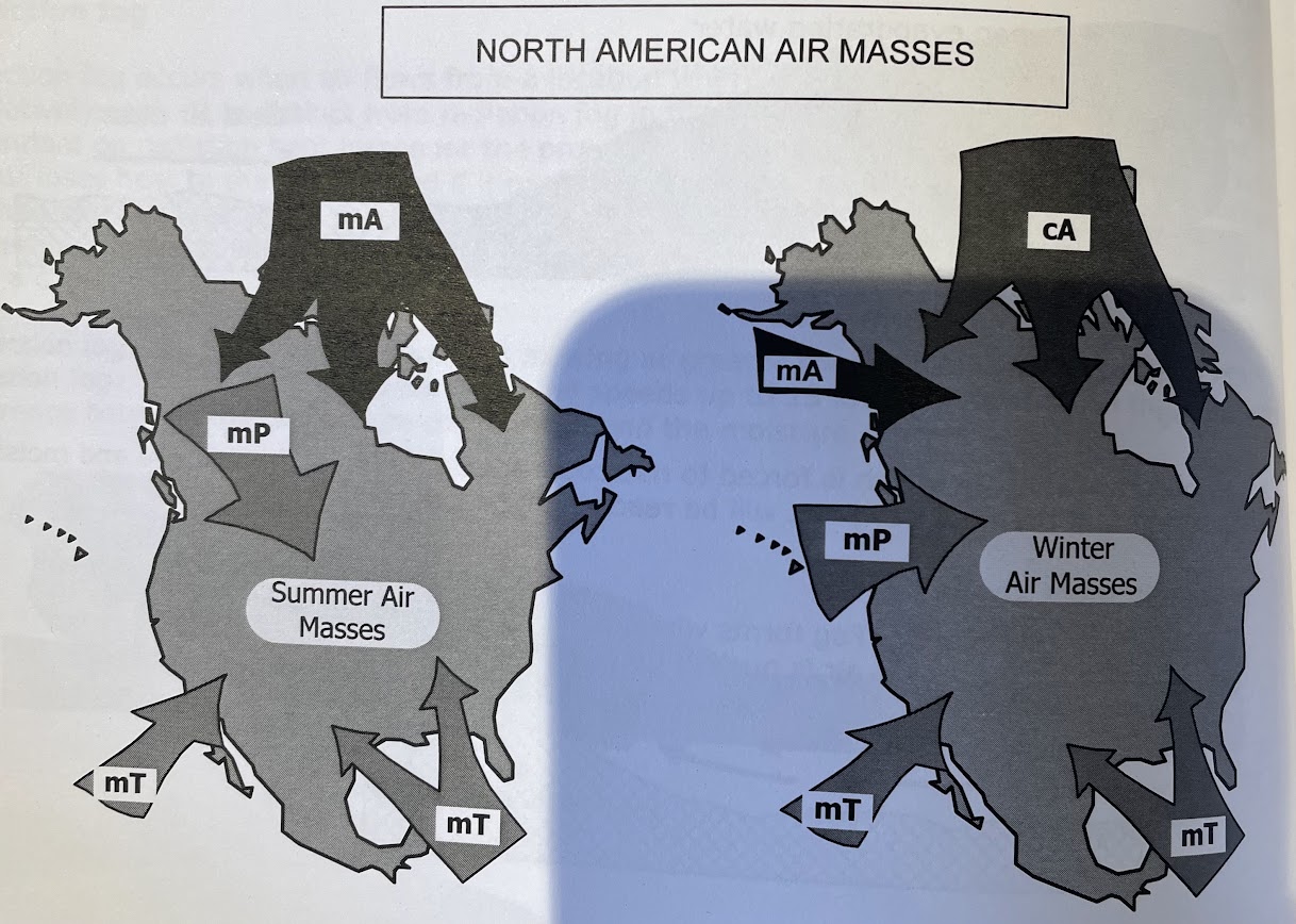
1. continental arctic -cA
2. maritime arctic - mA
3. maritime polar - mP
4. Maritime tropical - mT
1. continental arctic -cA
2. Maritime Arctic - mA
3. Maritime polar - mP
4. Maritime tropical - mT
1. generally dry, very cold and stable with the tropopause at low alt
2. moist, cold, unstable in the lower layers with the tropopause at low alt
3. moist, unstable throughout with the tropopause somewhat higher
4. generally moist, hot, very unstable with a high tropopause
ex. if a maritime polar and a maritime tropical airmass were to meet, with the warmer airmass (mT) advancing, then the front formed would be a mP warm front
warm fronts tend to be more (blank) than cold fronts
gradual
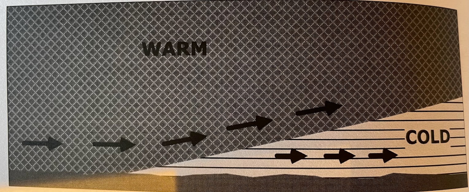
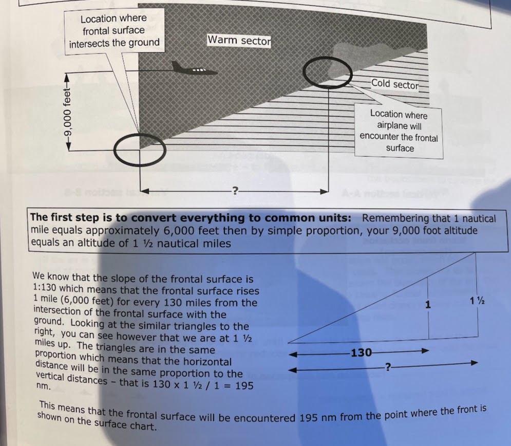
estimating the position of a frontal surface:
ex. you are planning a flight at 9,000 ft. The surface analysis chart shows a warm front along your route which you will be approaching from the warm sector. How far from the surface position of the front will you intercept the frontal surface if the frontal surface has a slope of 1:130
195 NM
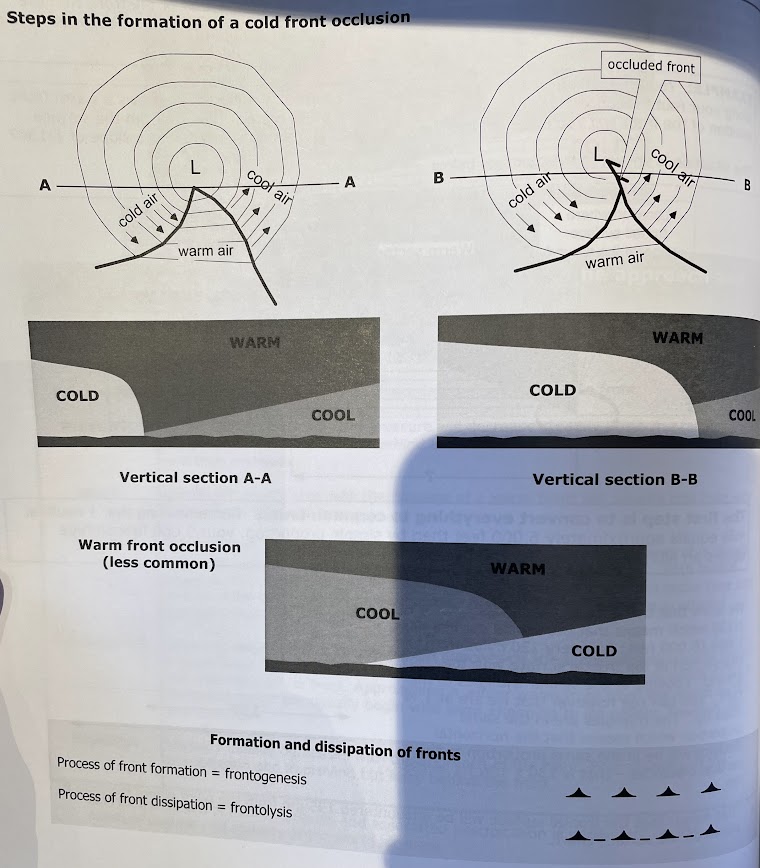
warm front occlusion (less common)
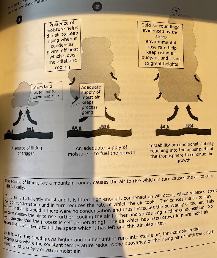
1. source of lifting agent or trigger
2. an adequate supply of moisture (to fuel the growth)
3. instability reaching the upper parts of the tropospher
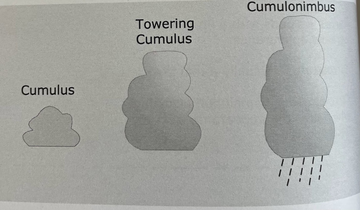
1. developing or cumulus stage
2. mature stage
3. dissipating stage
\-as the air rises and the temp drop, condensation occurs and small drops become large raindrops
above the freezing level, ice will begin to form
once the raindrops reach a size where the updrafts are not capable of supporting them, they start to fall dragging some of the air with them
cloud contains both up and downdrafts: updrafts can reach speeds up to 6000ft per min/ downdrafts up to 2500ft per min
\-lightning and turbulence
\-as the rain falls, evaporation will slow the compression heating
\-updrafts can cause tops of clouds to reach 5000-6000ft into the stratosphere
\-when downdraft first hits the surface it will spread out creating a gust front sometimes known as a plow wind
1. air mass: form within a warm, moist airmass which is not associated with a front. are generally isolated and scattered over a wide area
2. frontal: the initial source of lifting is cold air undercutting warm air at a cold front or warm air riding up over cold air at a warm front
what are the 4 types of air mass thunderstorm
form within a warm, moist airmass which is not associated with a front. are generally isolated and scattered over a wide area
orographic: where the initial source of lifting is provided by an orographic feature such as a mountain range
Convective: The initial source of lifting is convective heating associated with uneven heating of the surface of the earth
Nocturnal: form at night and where the initial source of lifting is convective heating of air by a warm body of water, land breeze action or cooling or a moist layer of air aloft at night