earth science regents review
1/193
Earn XP
Description and Tags
made before the 2023 earth science regents exam
Name | Mastery | Learn | Test | Matching | Spaced | Call with Kai |
|---|
No analytics yet
Send a link to your students to track their progress
194 Terms
An observation...
uses your senses
An instrument...
extends your senses
An inference/prediction...
is a conclusion based on observations
What is classification?
grouping by observable properties
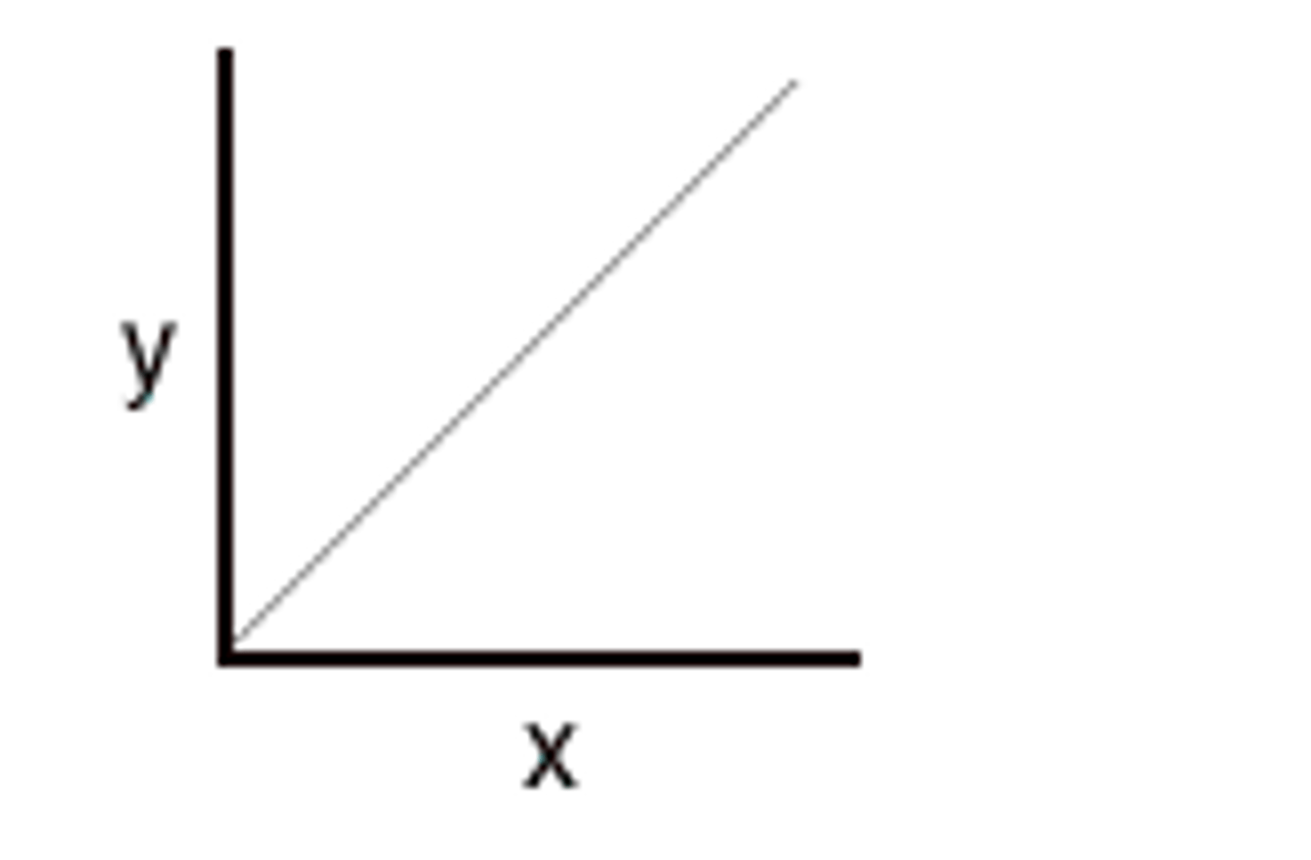
A direct relationship
as the x-axis increases, the y-axis increases
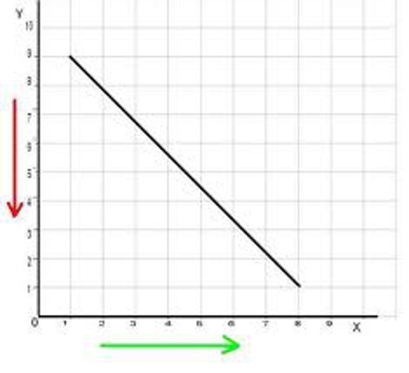
A indirect relationship
As the x-axis increases, y-axis decreases
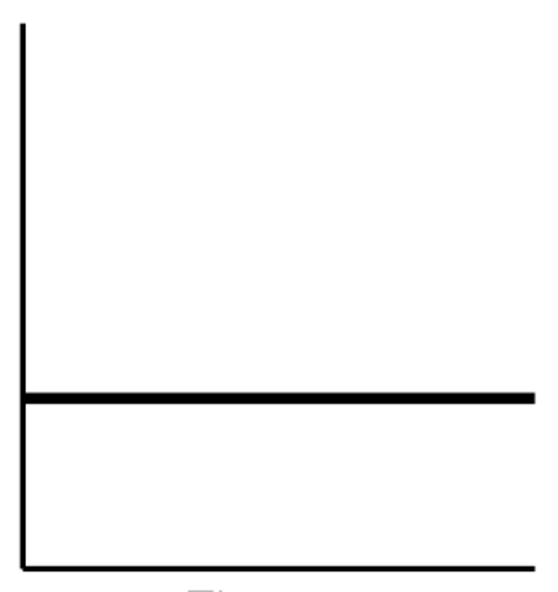
No relationship/Static
as the x-axis increases, y remains the same
Most changes in the environment are
cyclic and predictable
What is dynamic equilibrium?
Balance
What is the formula for percent error?
difference/accepted x 100
The accepted/"real" value is
the correct answer
What in a substance stays the same no matter how many pieces you break it into?
The same density at the same tempature
As pressure increases
density increases
As temperature increases
density decreases
Volume of a regular solid
length x width x height
Magic Triangle
D = M/V
M = D x V
V = M/D
Water expands when it
freezes
water is most dense at
4°C when it's a liquid
Anything with a density greater than 1 will
sink
An interface is...
A boundary across which energy is exchanged
The shape of the Earth is
an oblate spheroid (slightly flattened at the poles and slightly wider at the equator)
The best model of the Earth is
a billiard ball - a perfectly
smooth sphere.
What are the evidences that the Earth is round
1) "sinking ship" observation; 2) photographs from space; 3) Earth's shadow on the Moon; 4) stars shift relative to the horizon as you move North and South 5) Eratosthenes's measurements and 6) sunrise and sunset (sun hits tops of mountains first.).
A good map should have
Both scale and direction
Latitude lines measure
distances north and south of the equator
Latitude is expressed as
0-90 degrees north or south
The altitude of polaris equals
Your latitude (only in the northern hemisphere)
Longitude lines measure
east and west of the prime meridian
Longitude is expressed as
0-180 degrees east or west
What is the international dateline?
180* east or west of the Meridian
Longitude is based on
Observations of the sun
The earth rotates on its axis from
west to east (counterclockwise)
1 full rotation of the earth is
360 = 24 hours
Earth's rate of rotation (on its axis)
15 ̊/hr
As you go east time will
increase
As you go west time will
decrease
Isolines never
cross
Isolines must
connect to each other or run off the map
The closer the isolines
the steeper the slope
Contour lines go the ___ direct of a stream flowing across them
opposite
The maximum elevation is
higher than the highest contour line but less than the
height of the next (hypothetical) line.
A profile is
a vertical cutaway section or side view
Gradient formula
change in field value/distance
Sedimentary rocks
may have flat layers and are most likely to have fossils
Igneous rocks
have visible crystals.
cools very fast with a glassy texture
no crystals
cools fast and is usually extrusive
small crystals
cools slowly and is usually intrusive
large crystals
Metamorphic rocks
Banded, distorted structure. Recrystallization
Contact metamorphism is caused by
an igneous intrusion
Mineral properties depend on
internal arrangement of the atoms
What are the ways of identifying a mineral
color, streak, hardness, luster, cleavage & fracture
Calcite fizzes with
acid
What other rocks fizz with acid
Other rocks made of calcite - marble, limestone, and dolostone
The 3 basic types of crustal boundaries
Divergent, Convergent, and Transform
evidence of plate tectonic theory
1) the fit of the continents; 2) the rock, mineral and fossil correlation; 3) evidence of ancient glaciers and tropical forests; and 4) alignment of the North Pole with the magnetism of different ages of rock.
Earthquakes and Volcanoes usually occur along
crustal plate boundaries
Mid-Ocean ridge
new crust being created- sea floor spreading
evidence of sea floor spreading
1) the reversal of magnetic polarity; and 2) the farther from the mid-ocean ridge, the older the rock (basalt).
Convection
The movement of matter due to differences in density - works best in liquid and gas
convection currents in the mantle
move plates
Ridges create
Crust; area of divergence.
Trenches destroy
Crust; subduction zone
Uplift causes
mountains
Hotspots are
not at plate boundaries
Ocean crust is
thin and made of basalt
Continential crust is
thick and made of granite
Mountains form by
uplift, folding and faulting
which is faster; P-waves or S-waves
P-waves
P waves can pass through
solids and liquids
S waves can only travel through
solids
You need at least ____ to plot an earthquake
3 seismometer stations
The focus is
the underground position of the earthquake
the epicenter is
Point on Earth's surface directly above an earthquake's focus
scientists infer earth's properties from
earthquakes (seismic data) and meteorites
a shadow zone is caused by
S waves not passing through the liquid outer core and P waves being bent as they go through the earth
Porosity is
the amount of empty space
Porosity does not depend on
particle size
If you have the same shape & sorted
porosity is the same
Permeability is
ability of a liquid to pass through
Permeability increases as
particle size increases
Rate increases as
Time decreases
If soil is highly permeable
water passes through very quickly
Capillarity is
the movement of a liquid upward against gravity
Weathering is
breaking things down
Erosion is
moving things
Deposition is
dropping things
Physical weathering occurs mostly in
Cold, humid climates
Physical weathering is
A process that doesn't change the chemical composition
Chemical Weathering is
A process that changes the chemical composition
Chemical weathering occurs mostly in
warm, humid climates
Humid
wet
when a rock is broken into smaller pieces
surface area increases and weathering rate increases
Gravity is
the force behind all erosion
Running water is
the number one agent of erosion
Stream velocity depends on
slope and discharge
Stream Velocity is
the speed of the water in a stream
Stream velocity is the fastest on
the outside of the meander bend
Fast stream velocity causes
erosion
Stream Velocity is the slowest at
the inside edge