Aeronautical Charts
1/109
There's no tags or description
Looks like no tags are added yet.
Name | Mastery | Learn | Test | Matching | Spaced | Call with Kai |
|---|
No analytics yet
Send a link to your students to track their progress
110 Terms
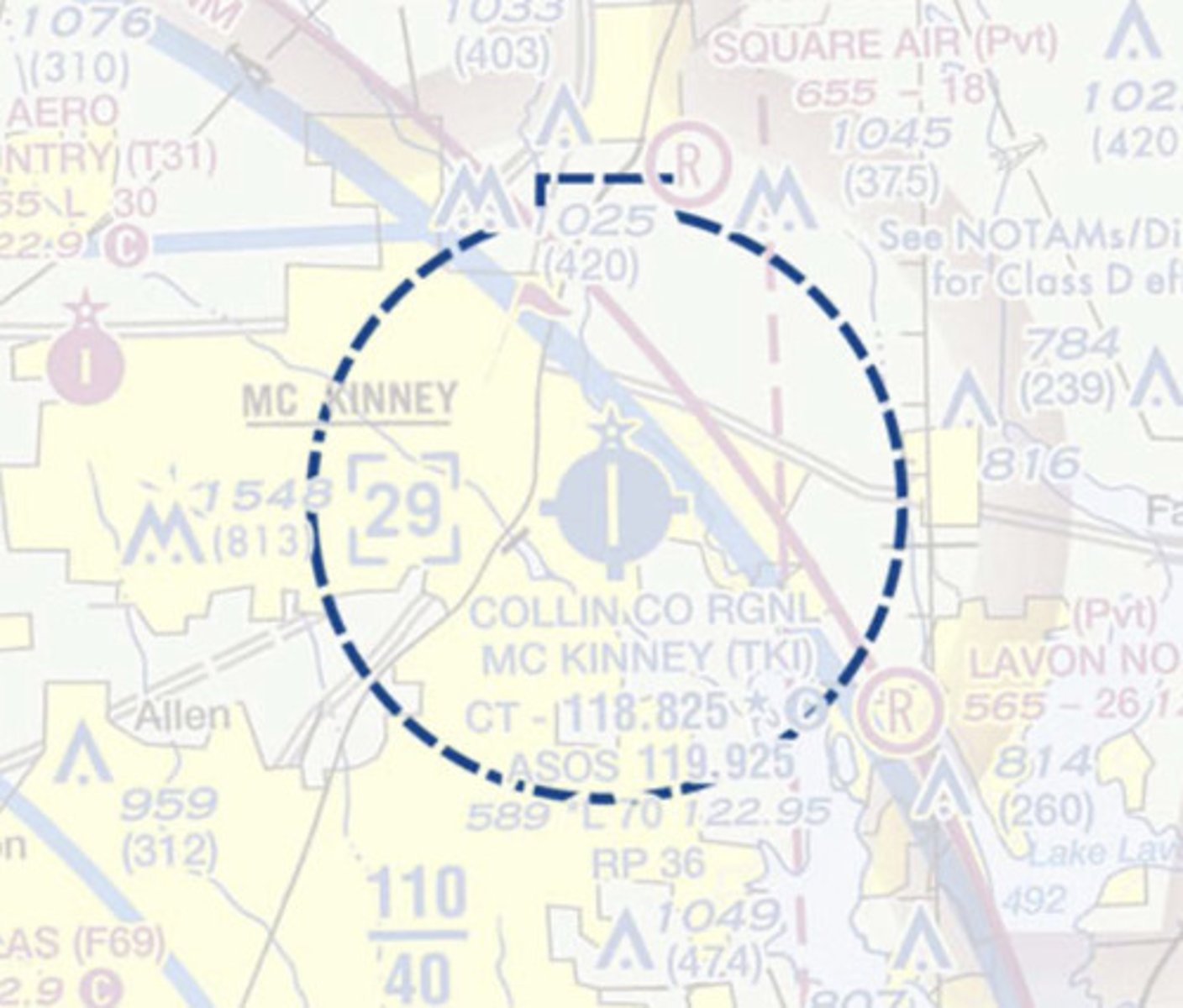
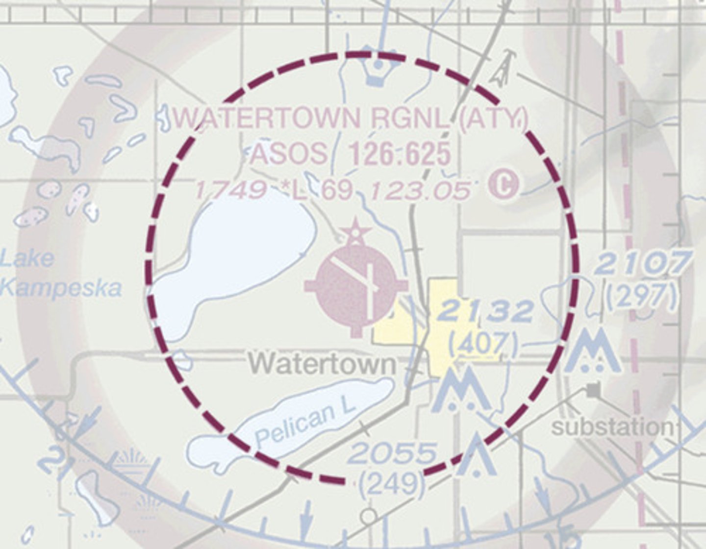
Class D aircraft boundary
Scale 1:1,000,000 - Used for flight planning and by higher flying faster aircraft. Some detail lost.
Word Aeronautical Chart (WAC)
Scale 1:500,000 - Most common VFR chart
Sectional
scale 1:250,000 - published for select terminal areas where increased detail is necessary
Terminal Area Chart (TAC)
Class C aircraft boundary
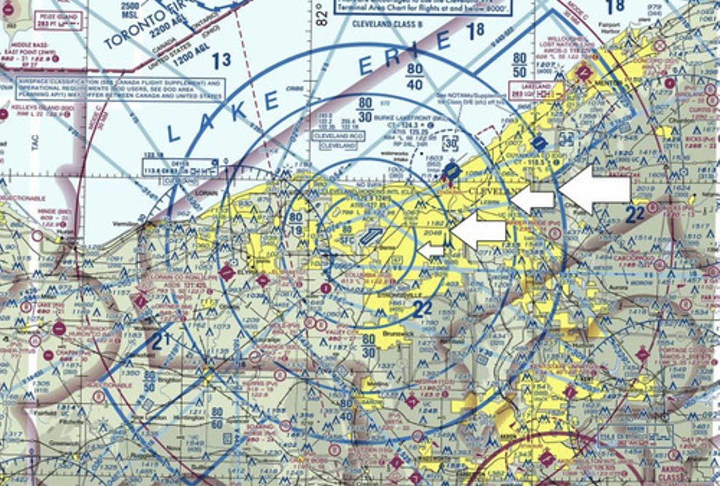
Class B aircraft boundary
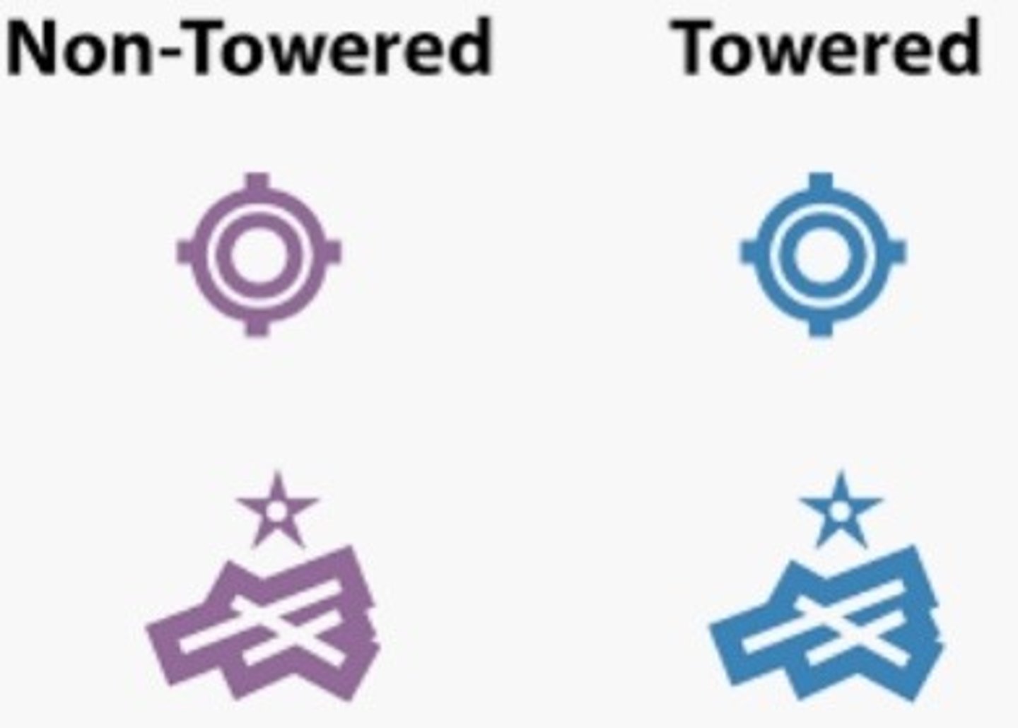
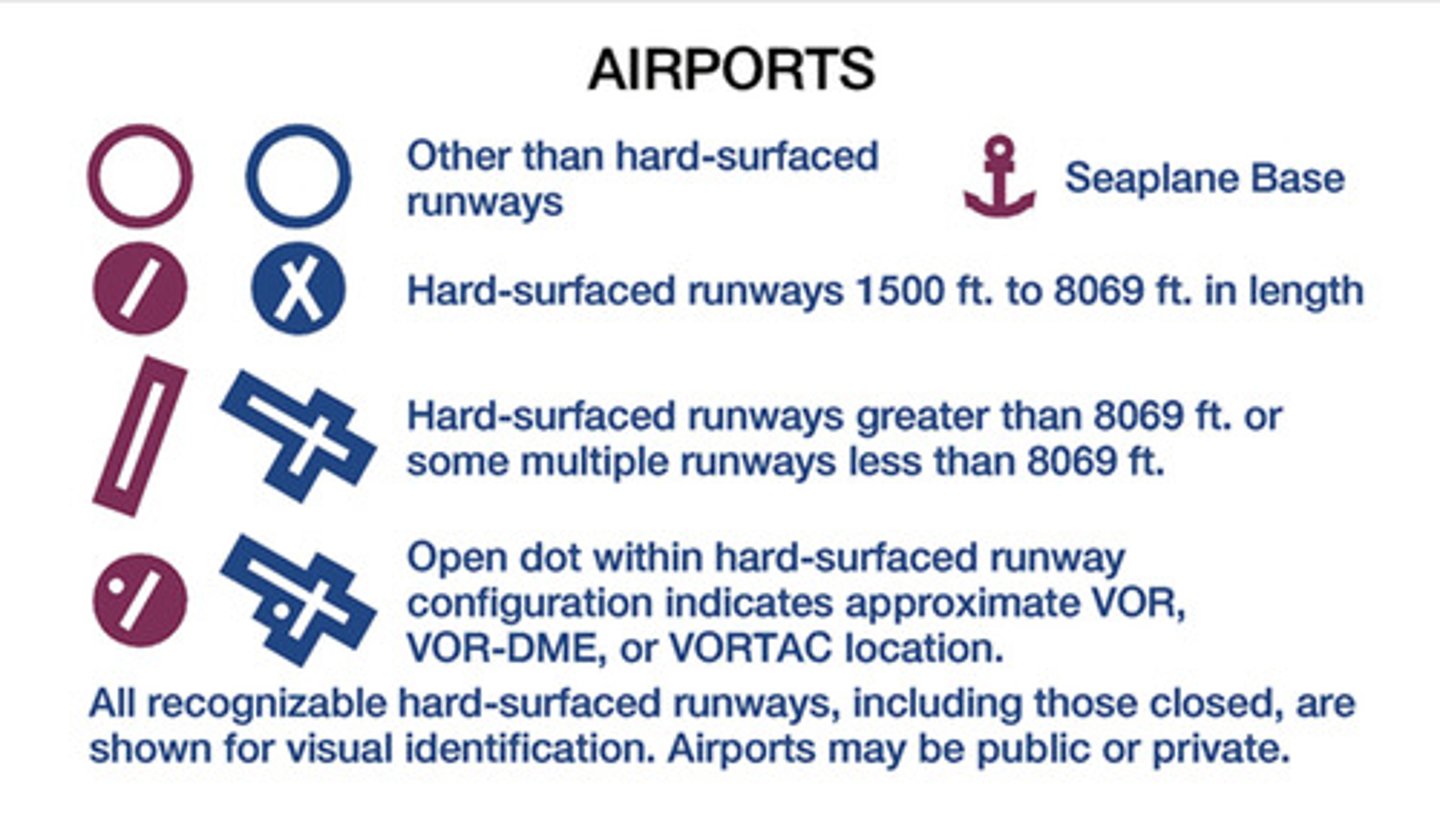
Blue vs. Magenta airports
Airport shapes
Class E at 700'

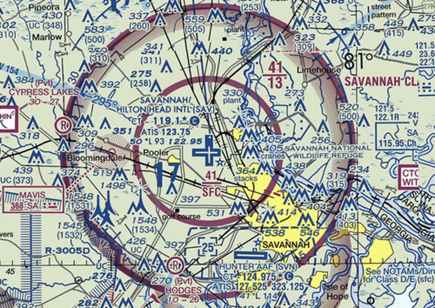
Class E at surface
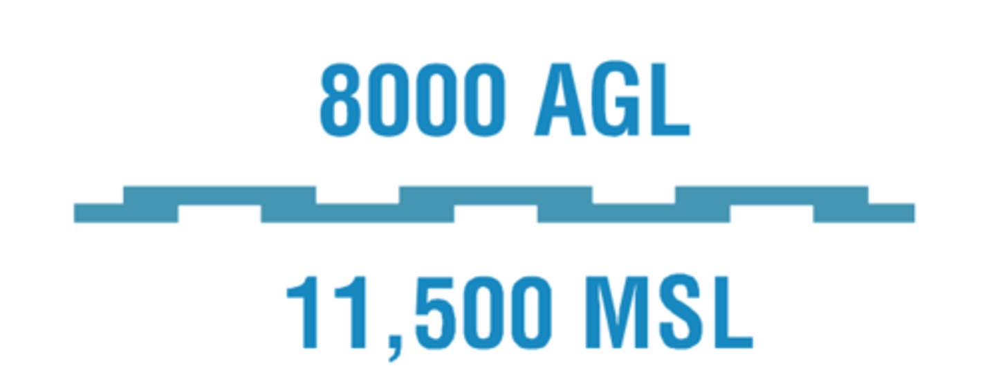
Differentiates floors of airspace greater than 700 feet above the surface
Class G airspace beginning at 1200 feet AGL or greater

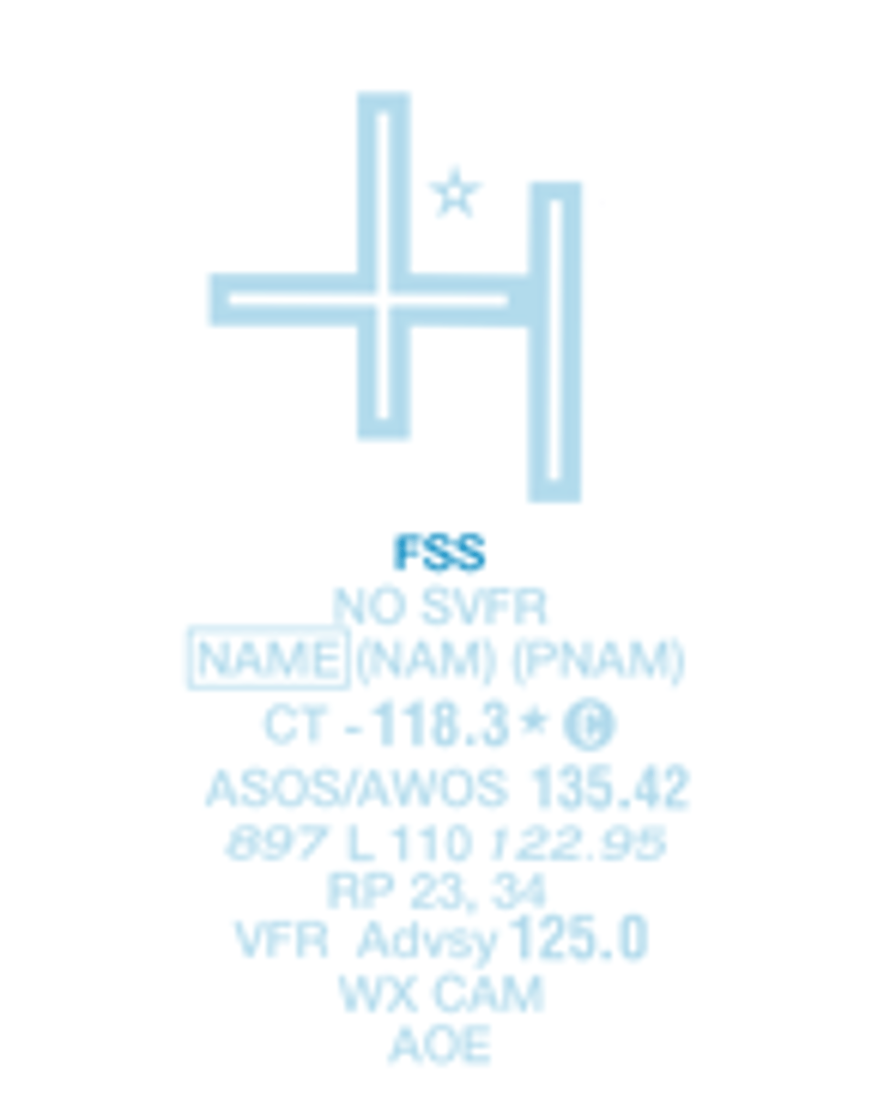
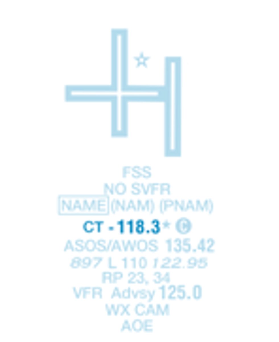
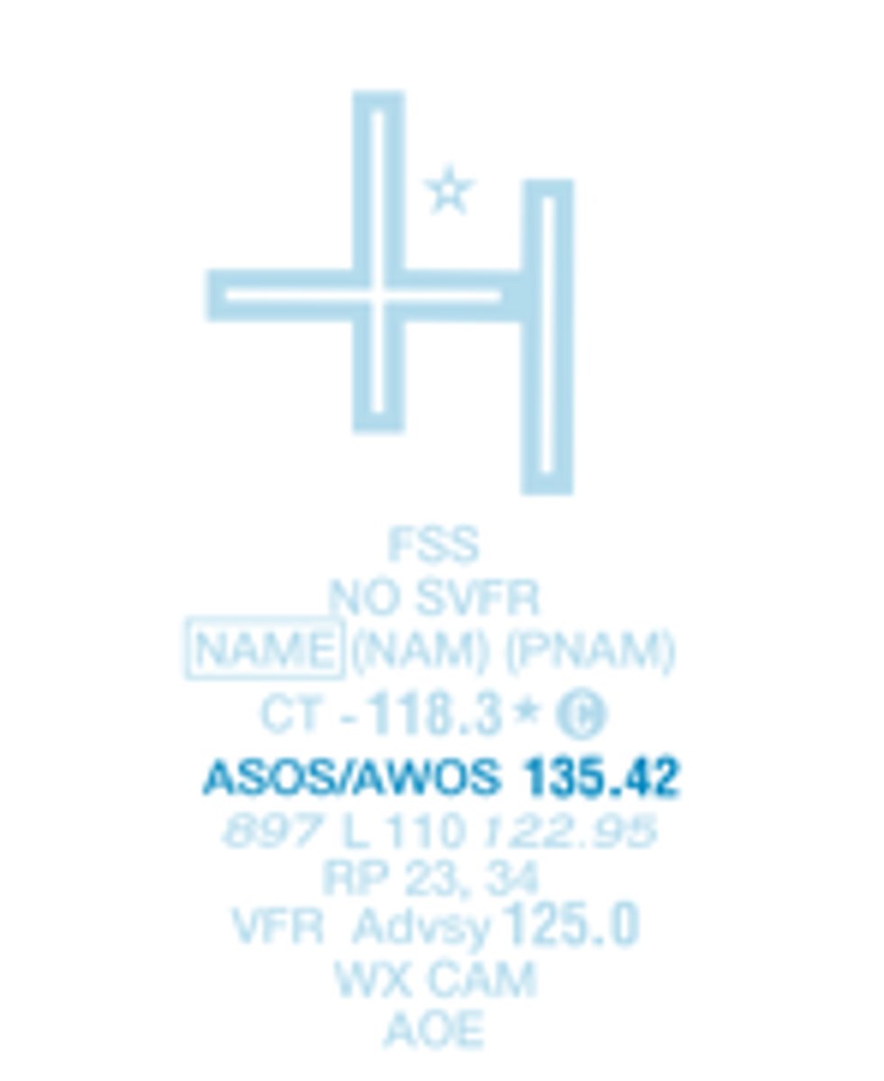
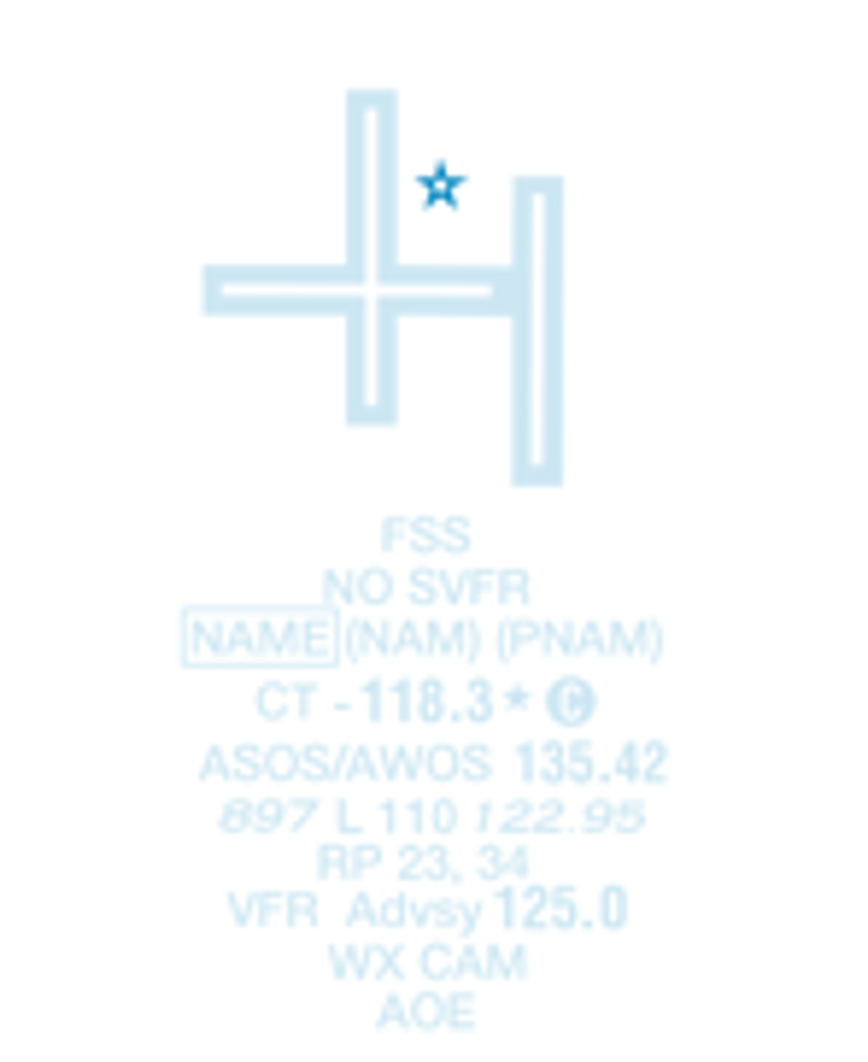
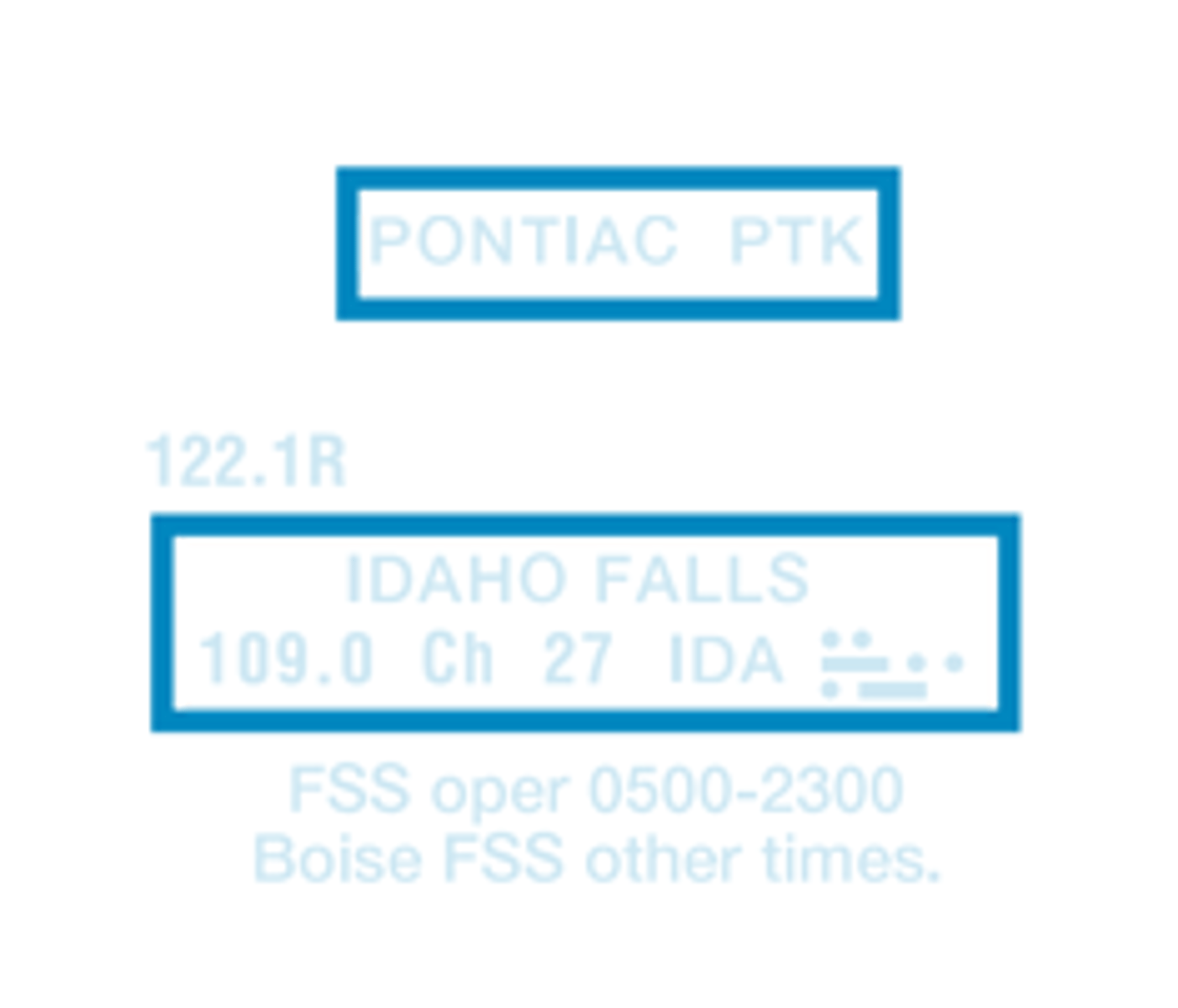
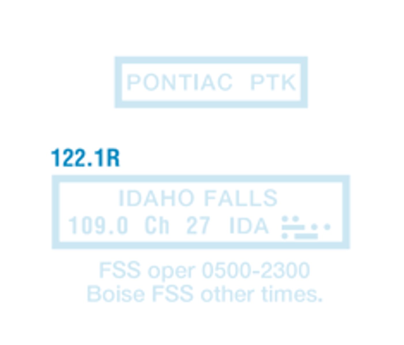
Flight Service Station on field
Indicates FAR 93 Special Air Traffic Rules and Airport Traffic Patterns
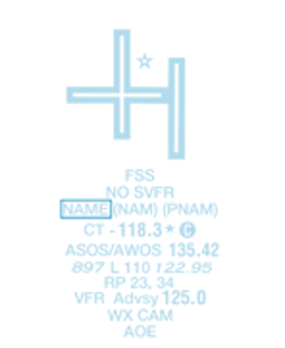
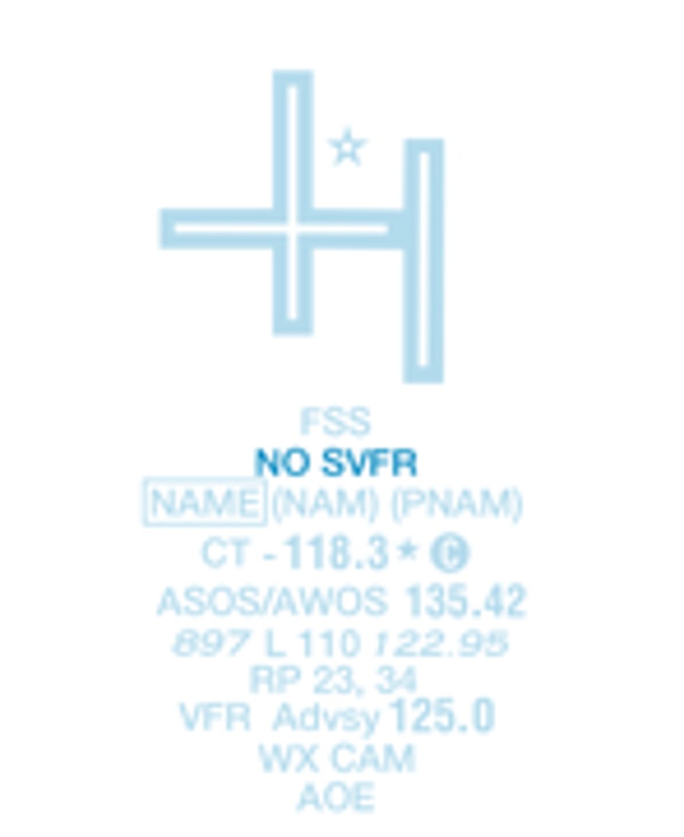
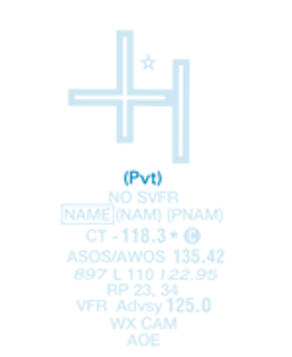
Airports where fixed wing special visual flight rules operations are prohibited by FAR 91 (Shown above airport name)
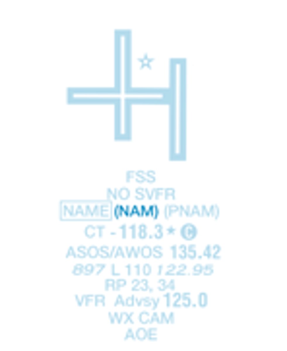
Location Identifier
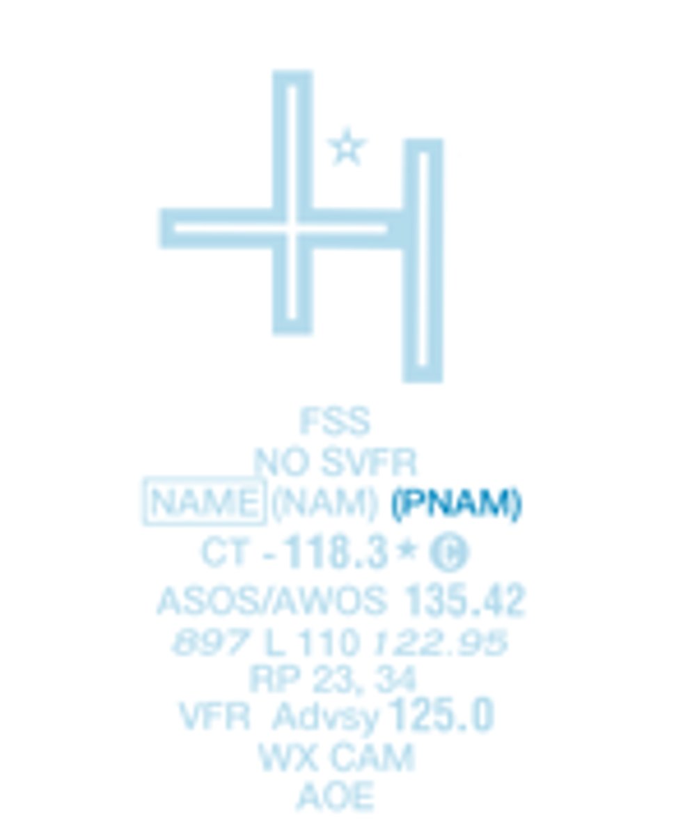
ICAO Location Indicator
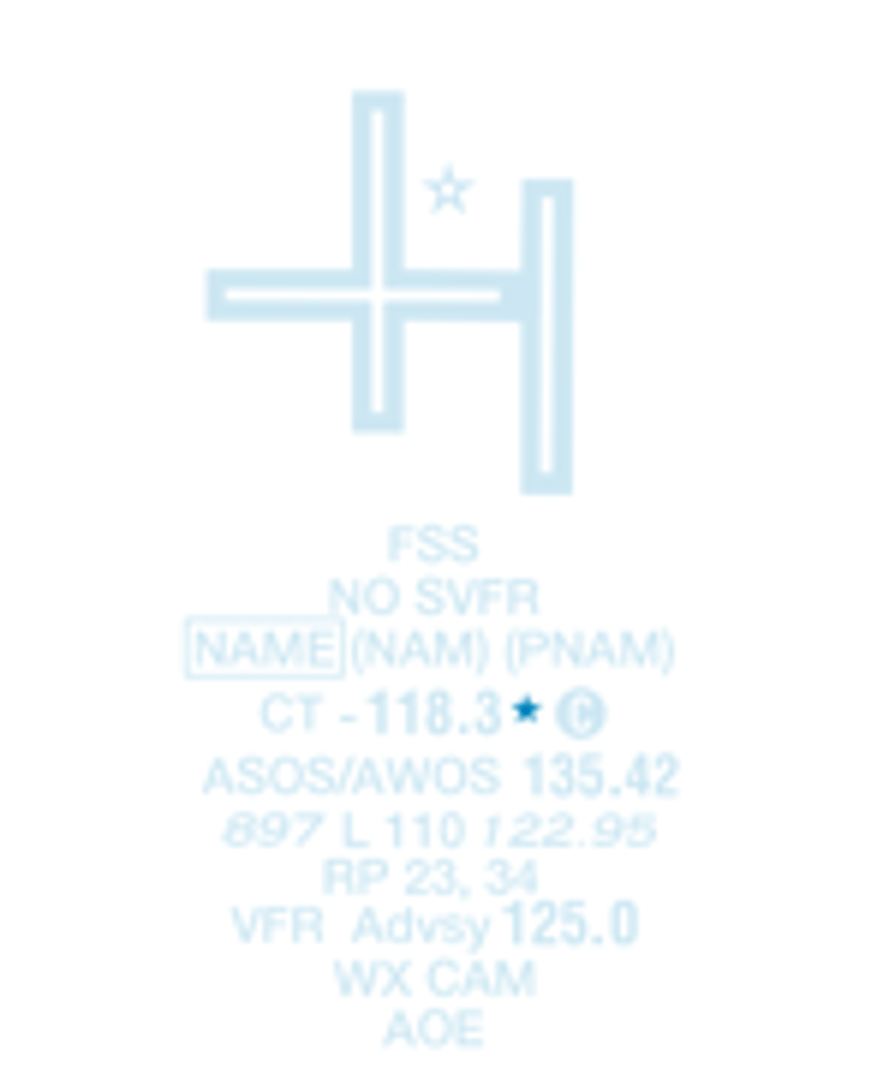
Control Tower (CT) - Primary Frequency
Part-time operation. See tower frequencies tabulation for hours of operation
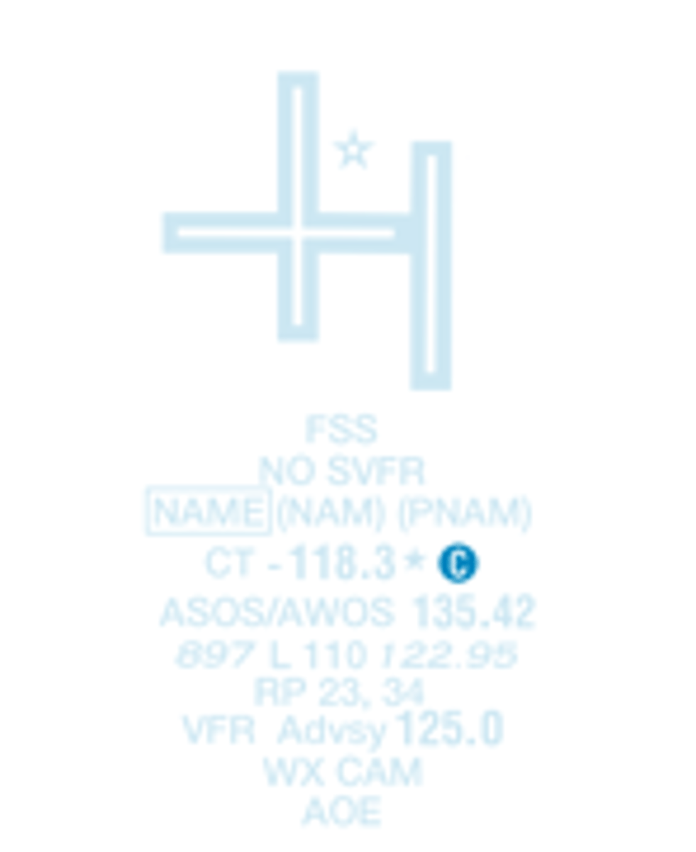
Follows the Common Traffic Advisory Frequency (CTAF)
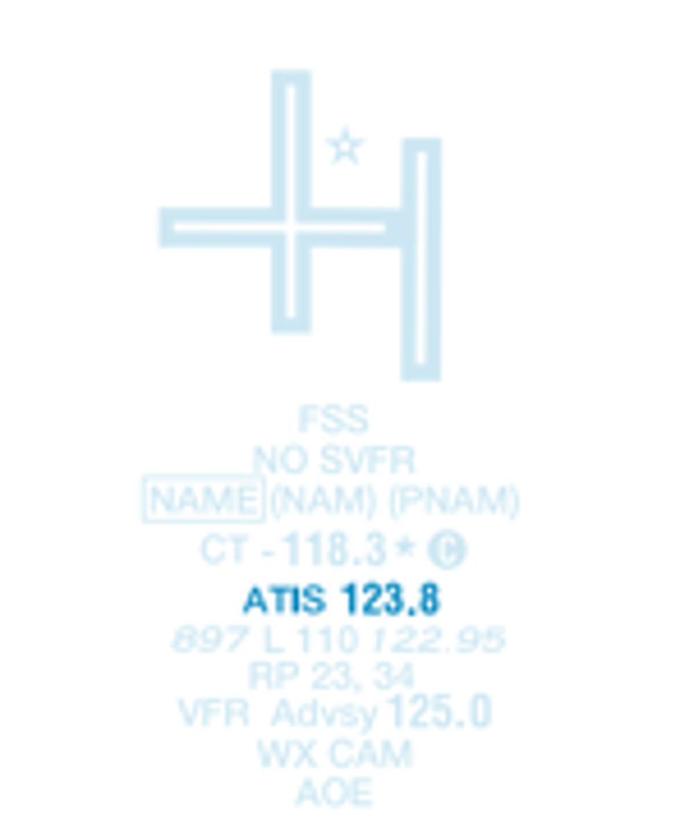
Automatic Terminal Information Service Frequency
Automated Surface/Weather Observing System; Shown when fulltime ATIS is not available. Some ASOS/AWOS facilities may not be located at airport.
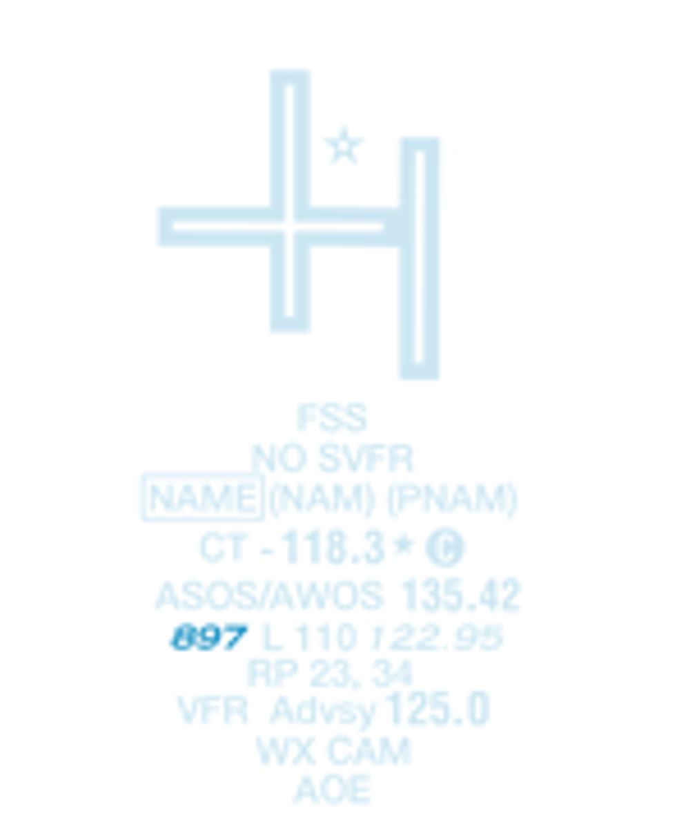
Field elevation
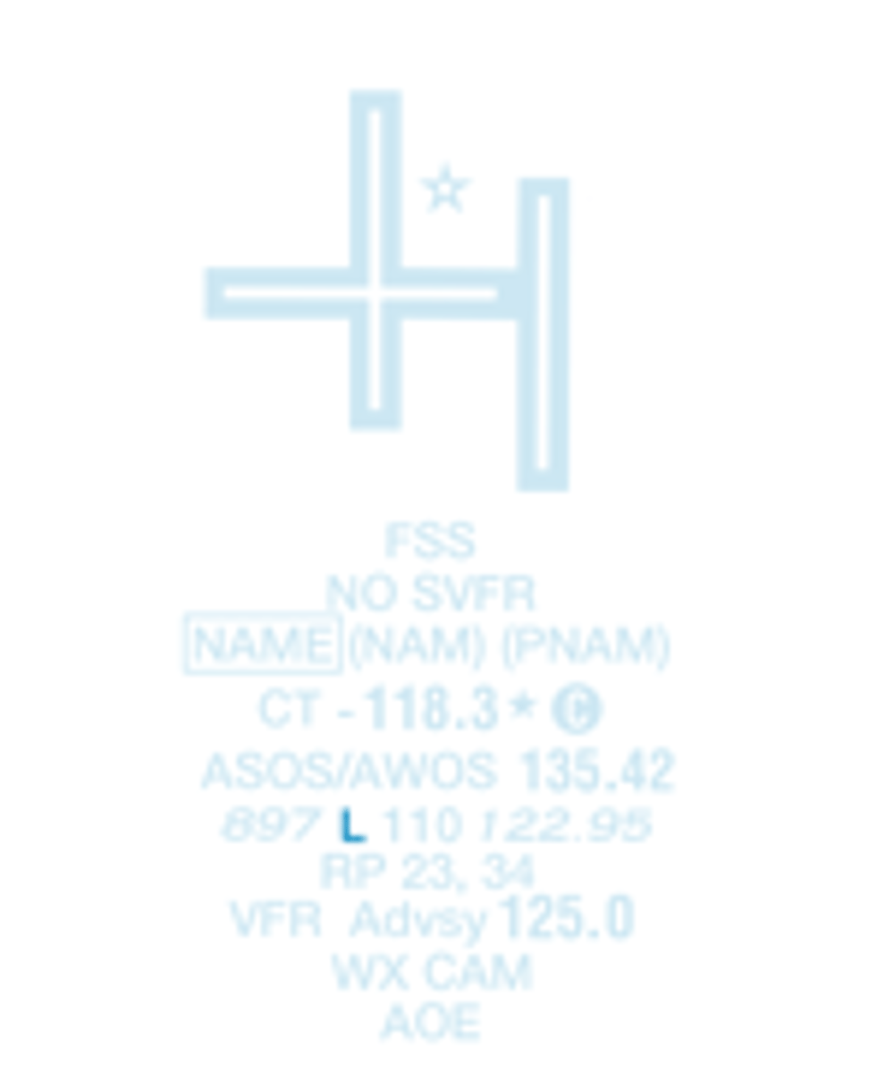
Lighting in operation from sunset to sunrise
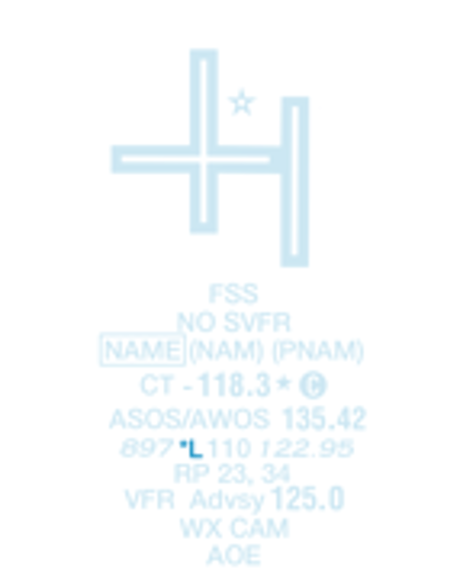
Lighting limitations exist; refer to Chart Supplement
Length of longest runway in hundreds of feet; usable length may be less
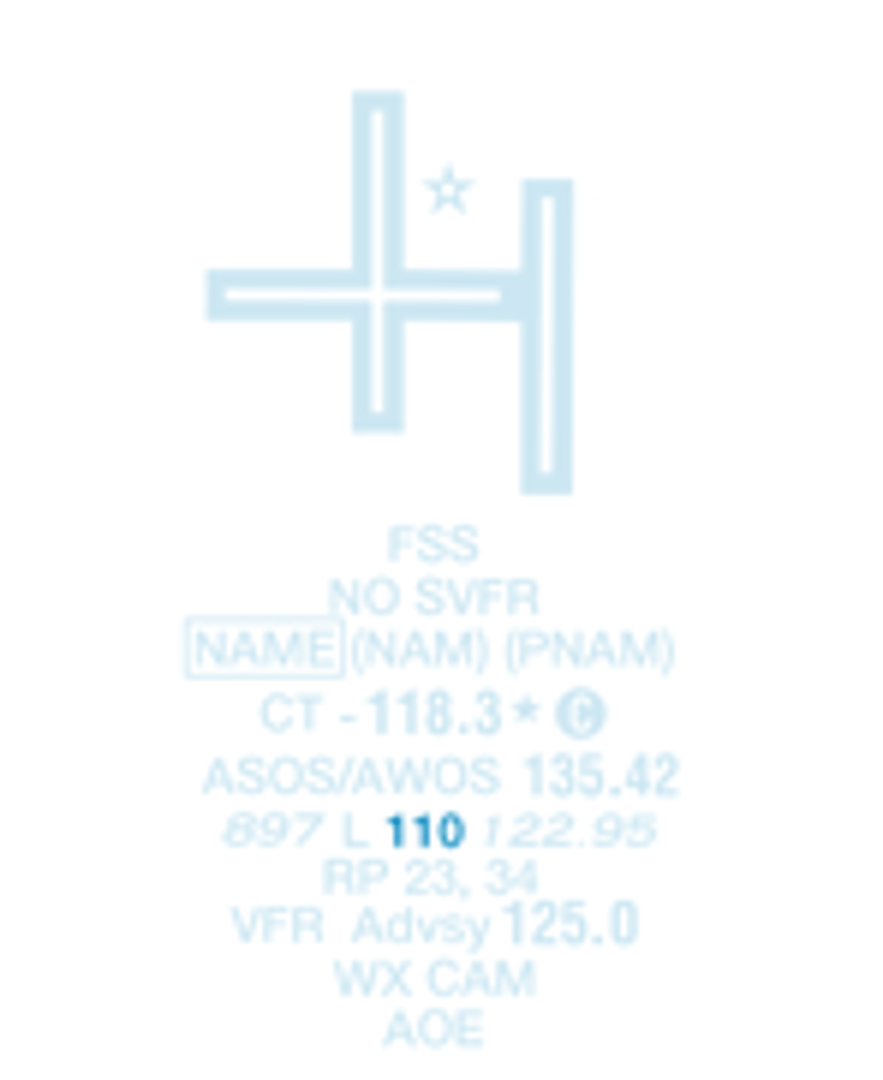
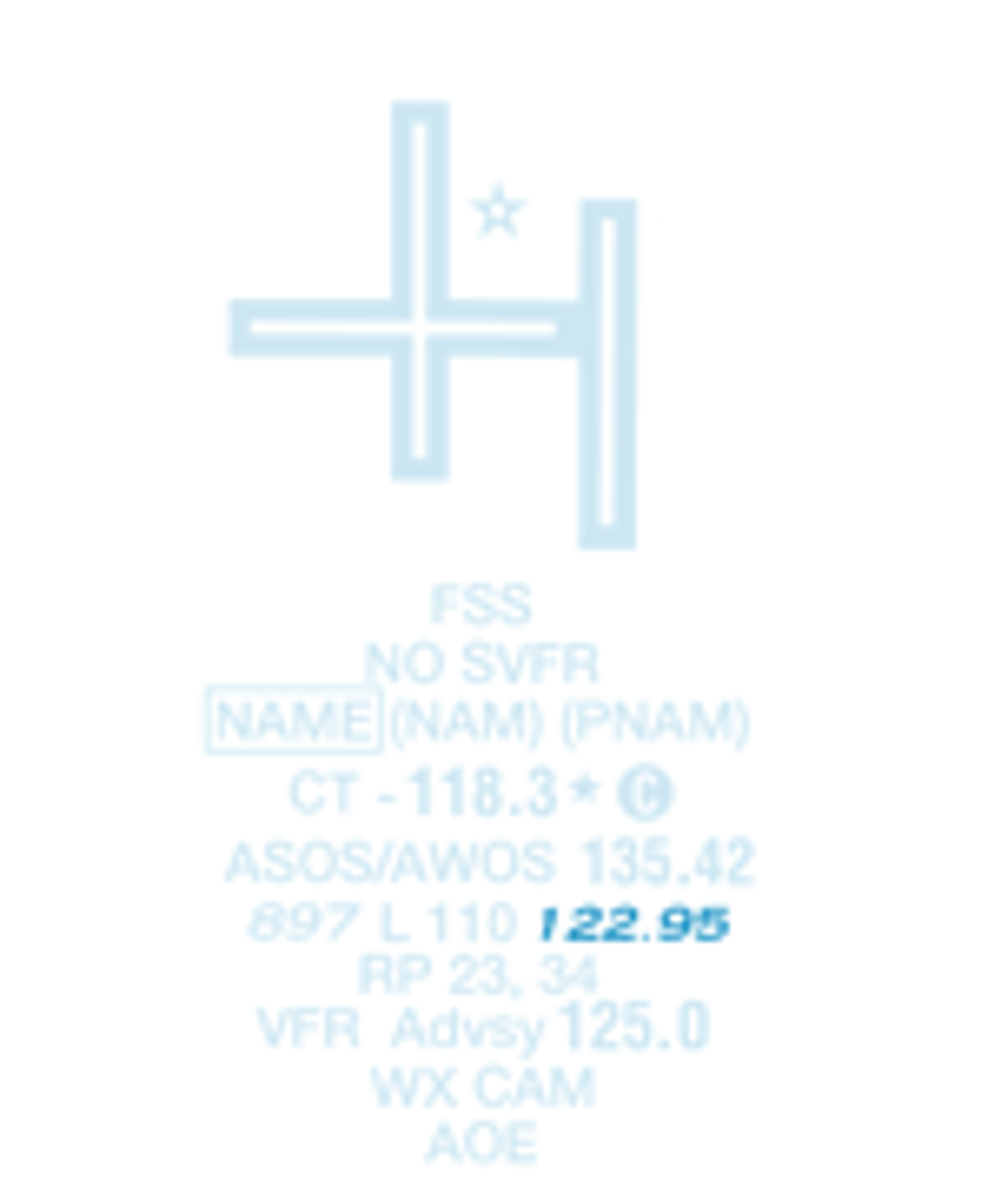
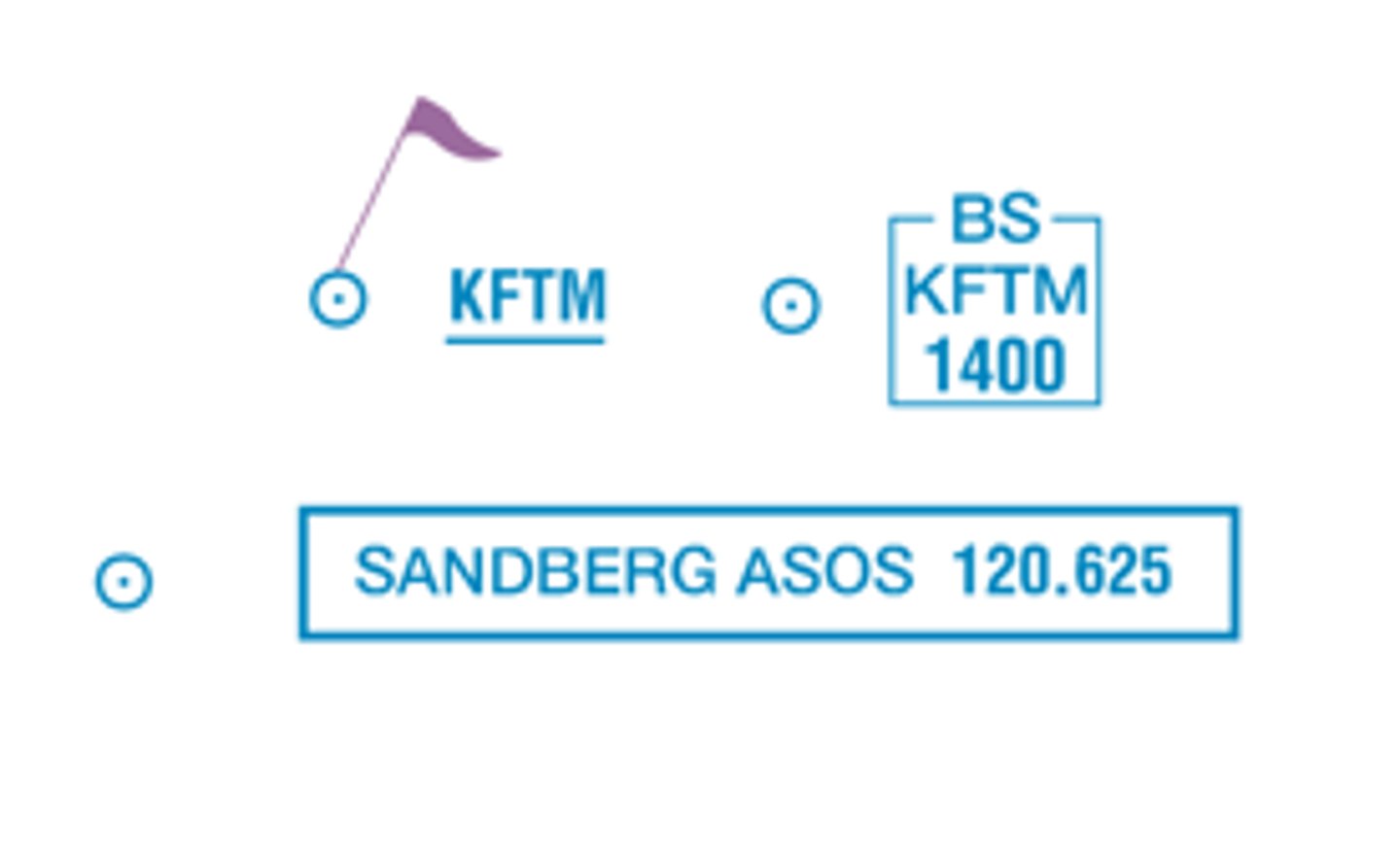
UNICOM - Aeronautical advisory station
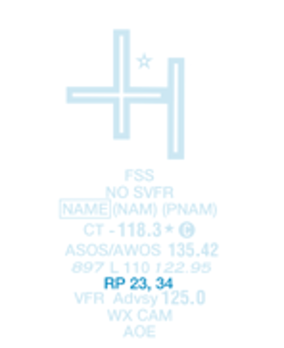
Runways with right traffic patterns (if star exists here see chart supplement for specifics)
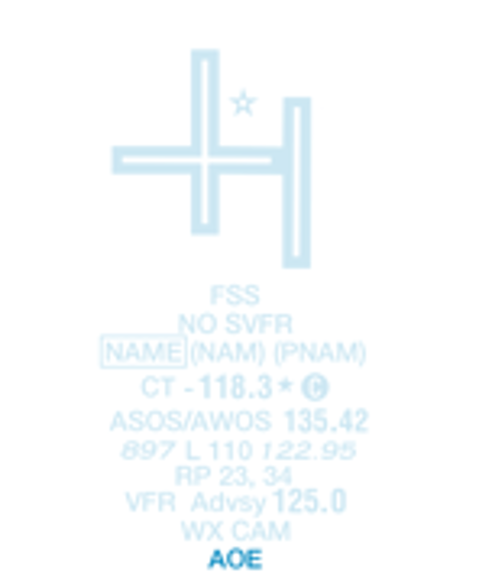
Airport of entry for international flights
Non-Public use having emergency or landmark value
Rotating beacon
VHF Omni-Directional Radio (VOR) Range
compass rose oriented towards magnetic north
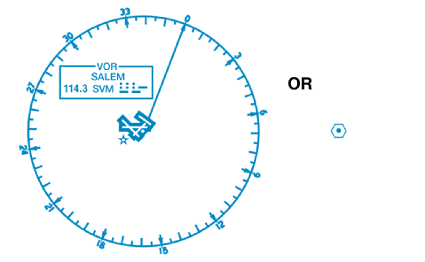
VOR - operates less than continuous or on-request

Underline indicates no voice on this frequency

Non-Directional Beacon (NDB)

NDB DME

Other radio transmitters
frequency and type of transmission marked on sectional chart
VORTAC

VORTAC - has ASOS/AWOS

VORTAC - morse code

VORTAC - morse code

VORTAC - channel

VORTAC - frequency

VORTAC - NDB frequency

VOR DME - Hazardous Inflight Weather Advisory Service (HIWAS)

VOR DME - Shut down

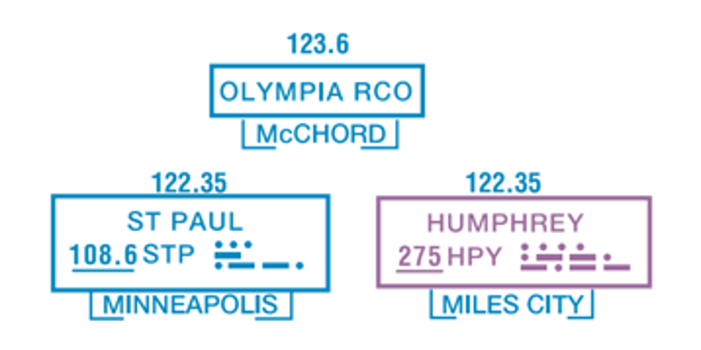
Flight Service Station (heavy line)
FSS - Receive only
Pilot will transmit on this frequency, and FSS will respond via the NAVAID frequency
Remote Communications Outlet (RCO)
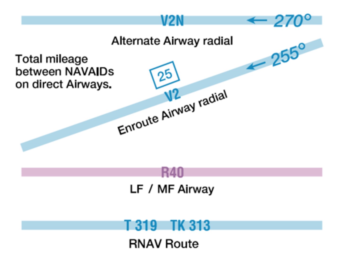
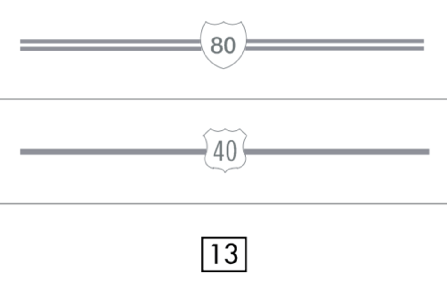
Low Altitude Airways
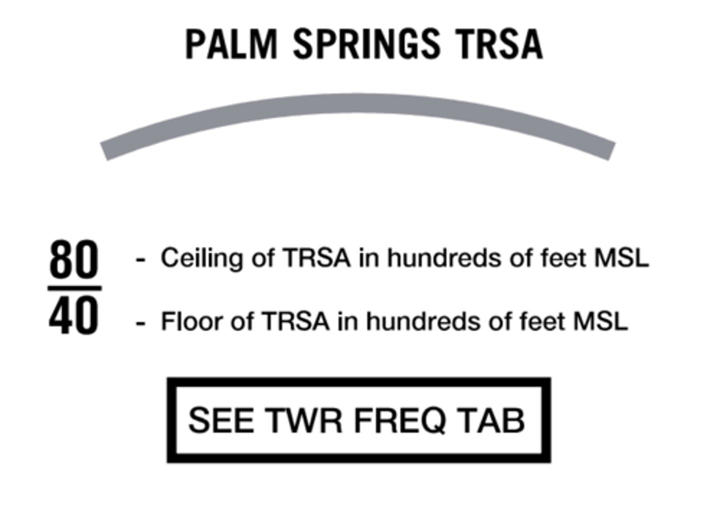
Terminal Radar Service Area (TRSA)
IFR routes
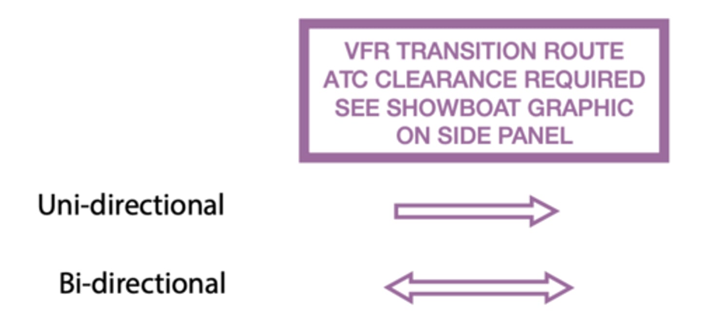
VFR Transition Routes
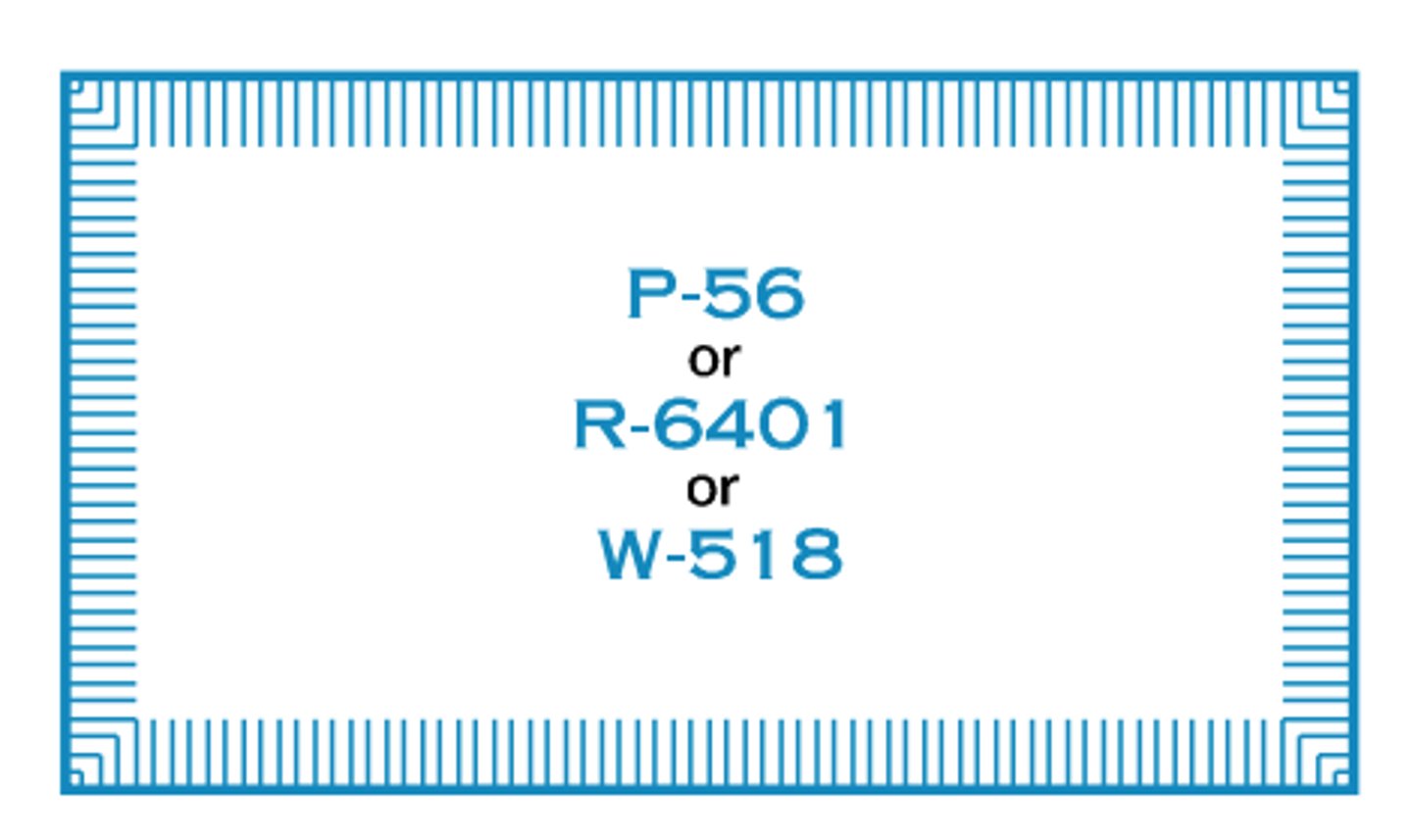
Prohibited, Restricted or Warning Area
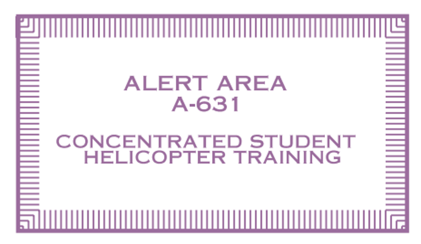
Alert Area
Military Operations Area (MOA)

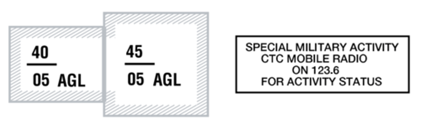
Special Military Activity Routes (SMAR)
Special Air Traffic Rules / Airport Patterns (FAR 93)

Mode C Veil

Glider Operating Area

Ultralight Activity

Hang Glider Activity

Unmanned Activity Area

Parachute Jumping Area w/ Frequency

Special Conservation Area

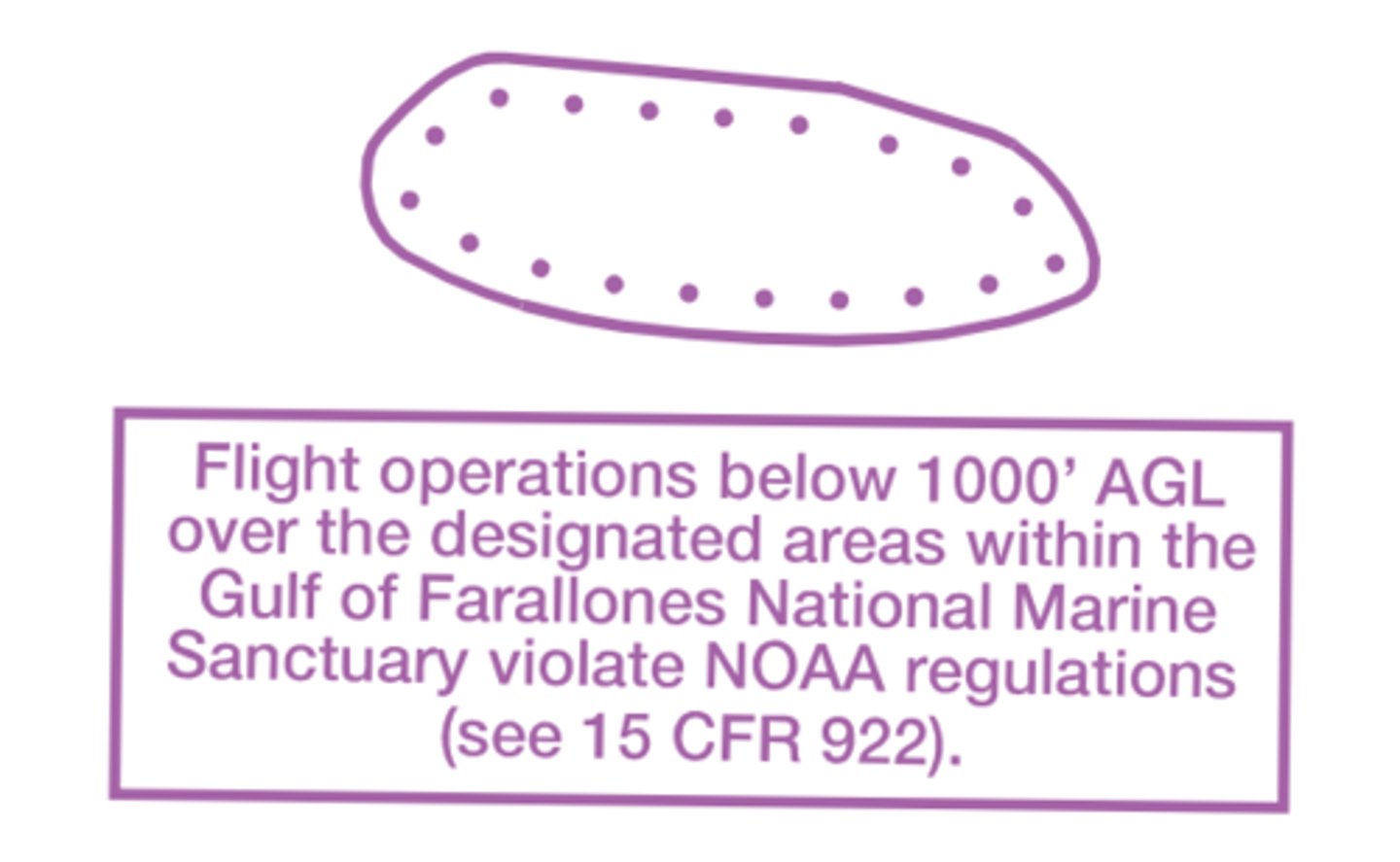
NOAA Regulated National Marine Sanctuary Designated Areas
Special Flight Rules Area (SFRA)
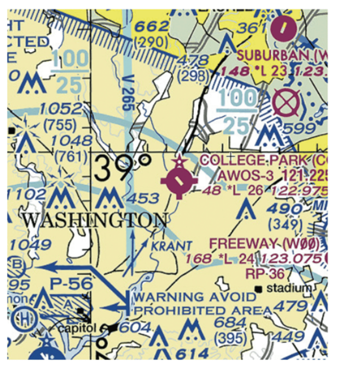
Flight Restricted Zone (FRZ)
Air Defense Identification Zone (ADIZ)

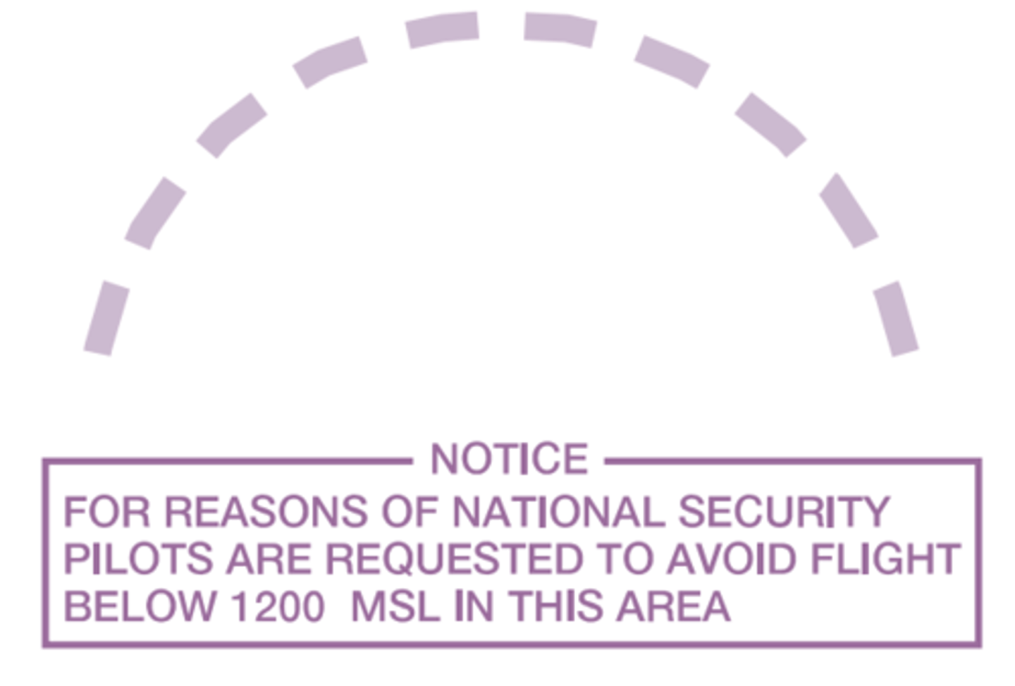
National Security Area
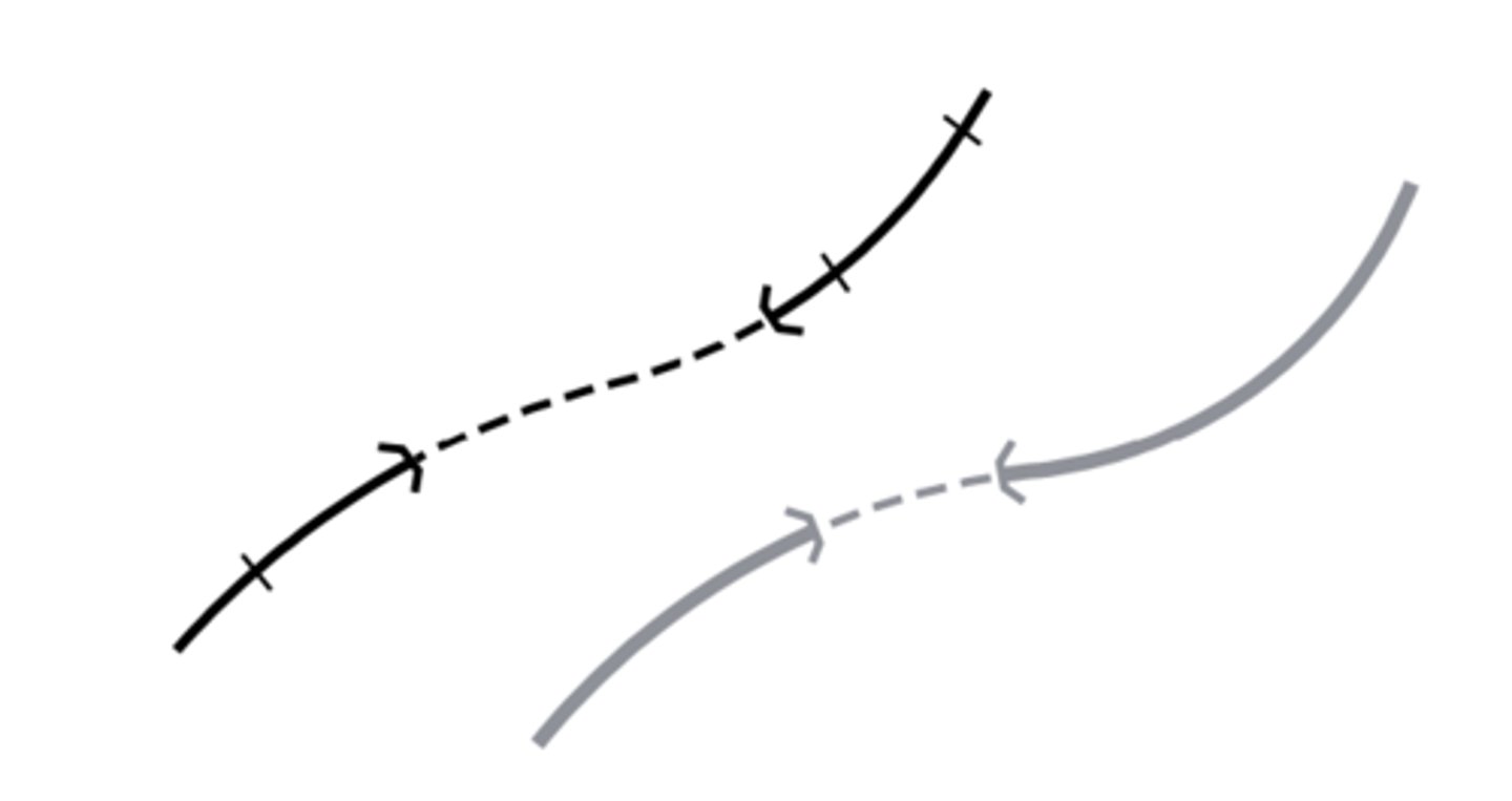
Isogonic Line & Value

Named Intersection (for reporting)

VFR Checkpoint
VFR waypoint

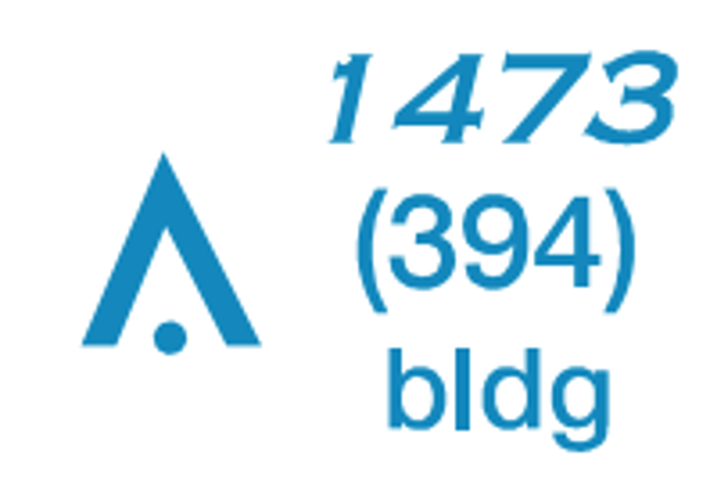
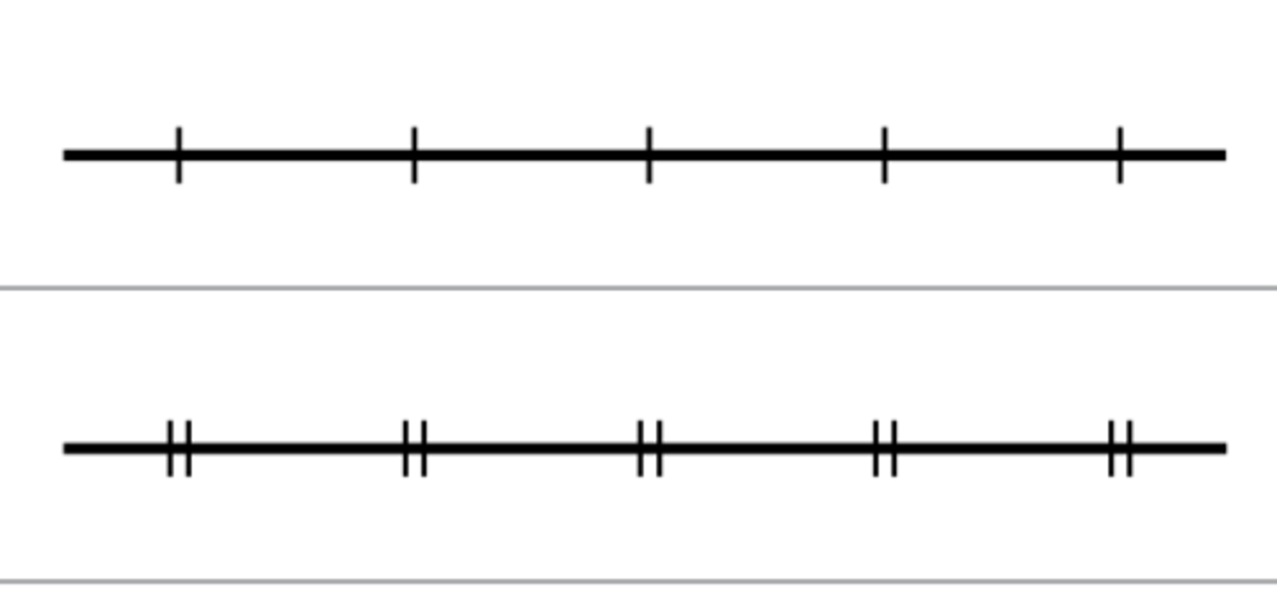
Obstruction less than 1,000' AGL
Obstruction under construction (unconfirmed elevation)

Obstruction 1,000' AGL and higher

Wind Turbine

Obstruction with high-intensity lights

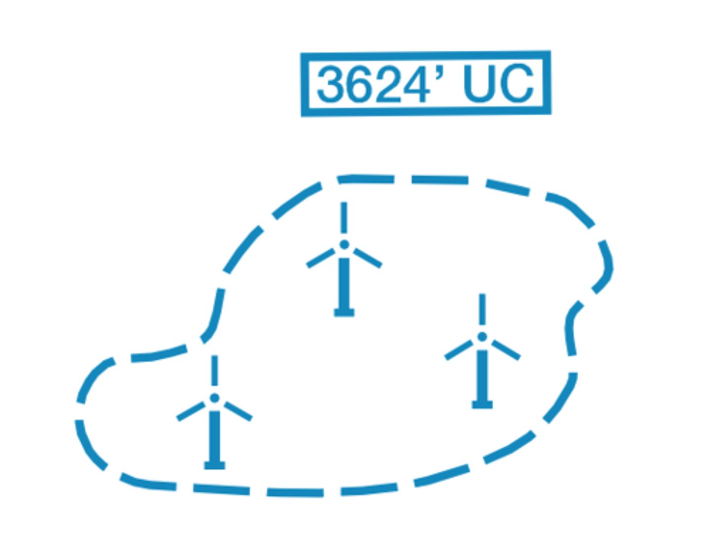
Wind Turbine Farm
Maximum Elevation Figure (MEF)
Shows clearance over the highest object in the quadrant

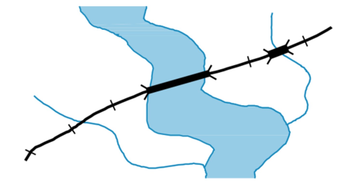
Railroads
Roads

Trail

Road Marker
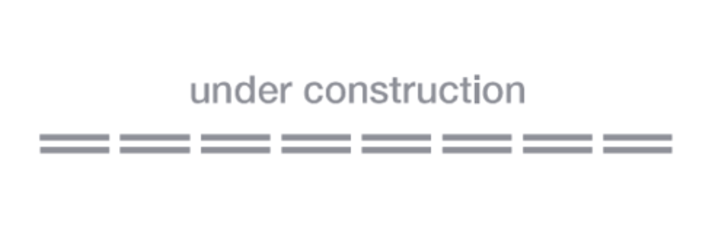
Roads under construction
Tunnels-Road & Railroad
Bridges & Viaducts
Large Cities
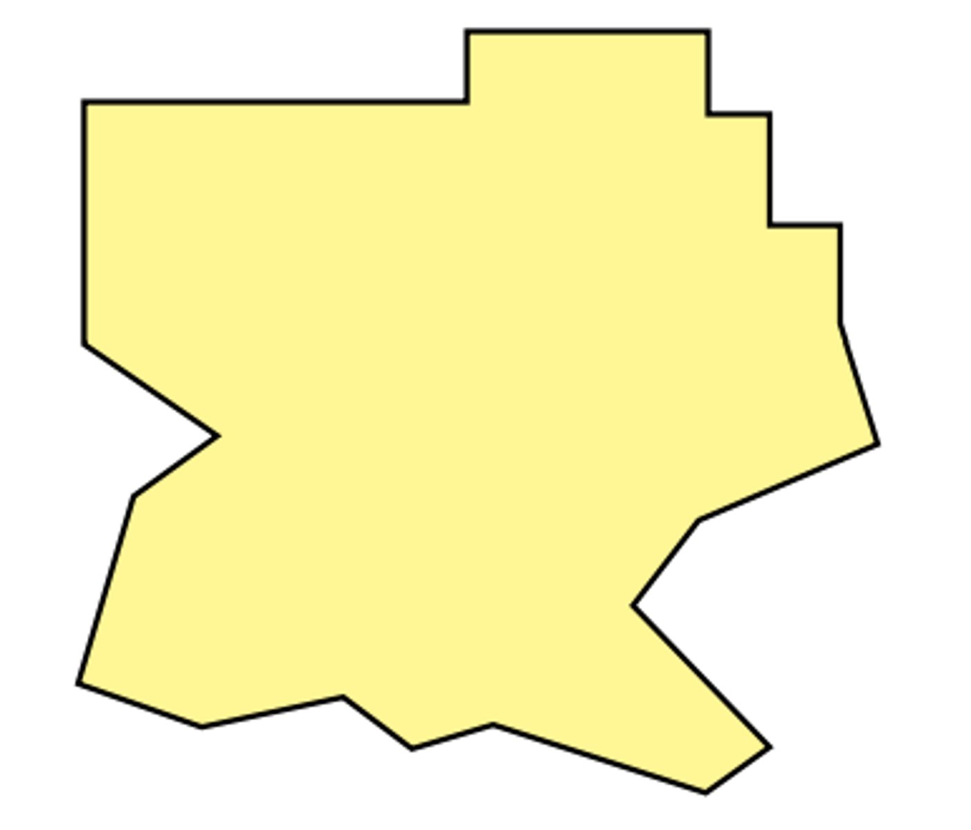
International Boundary

State Boundary

Convention or Mandate Line

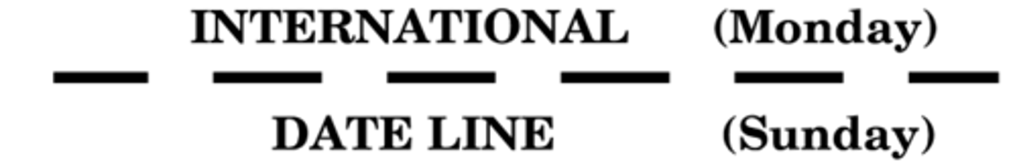
International Date Line
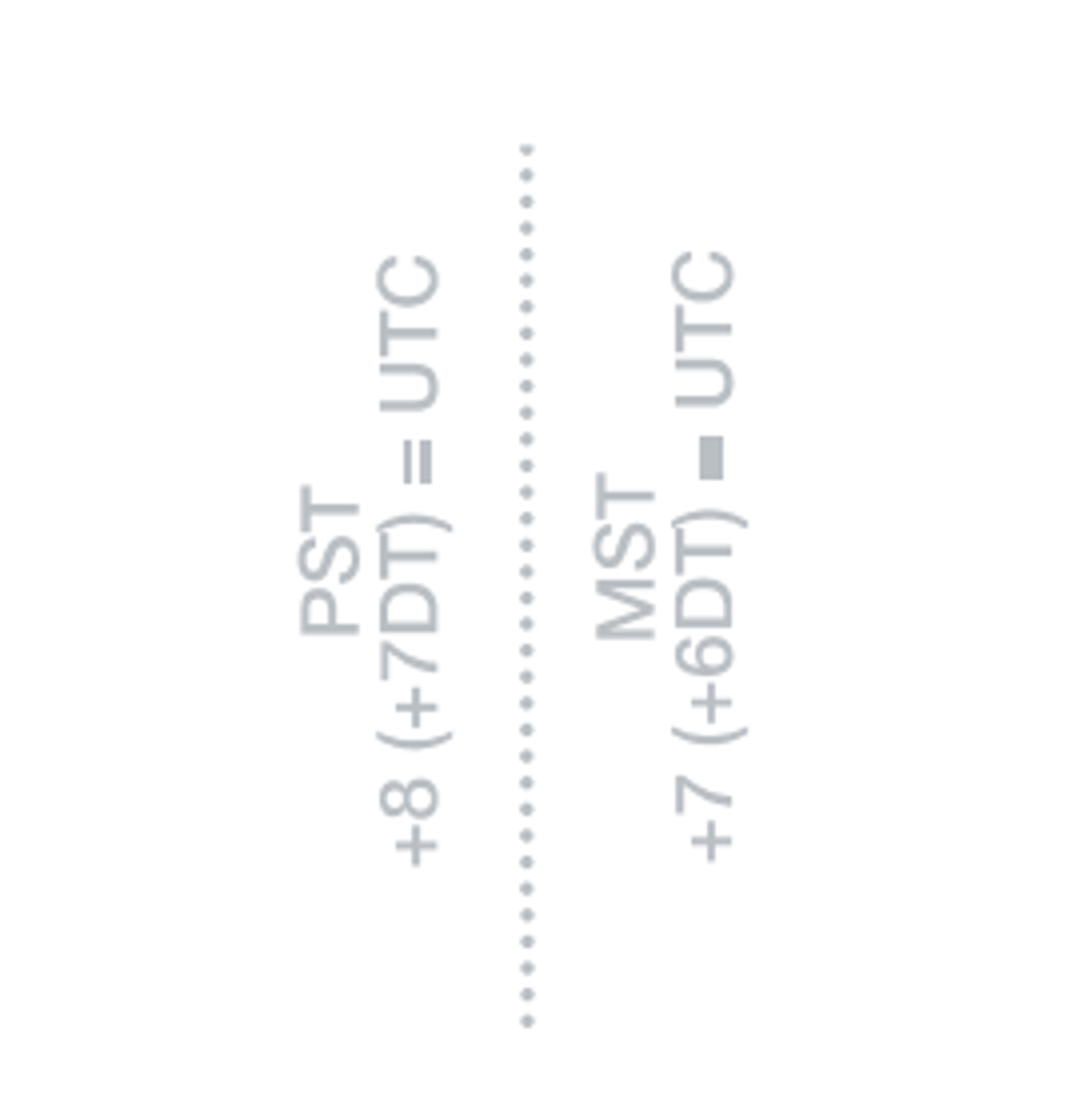
Time Zones
Power Transmission & Telecommunication Lines
Dam
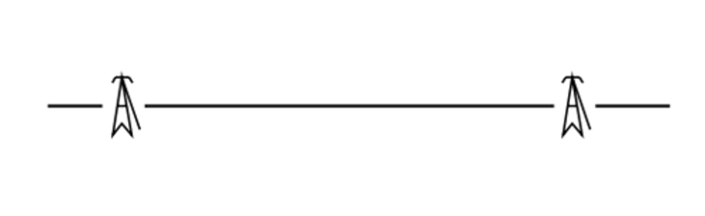
Lookout Tower

Coast Guard Station

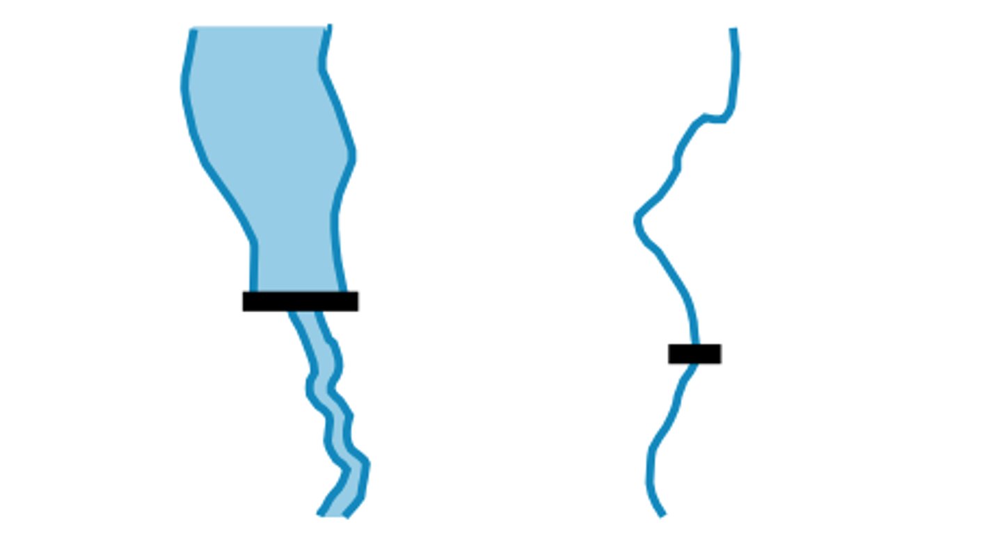
Open Water

Inland Water