Mass Movement
1/15
Earn XP
Name | Mastery | Learn | Test | Matching | Spaced | Call with Kai |
|---|
No analytics yet
Send a link to your students to track their progress
16 Terms
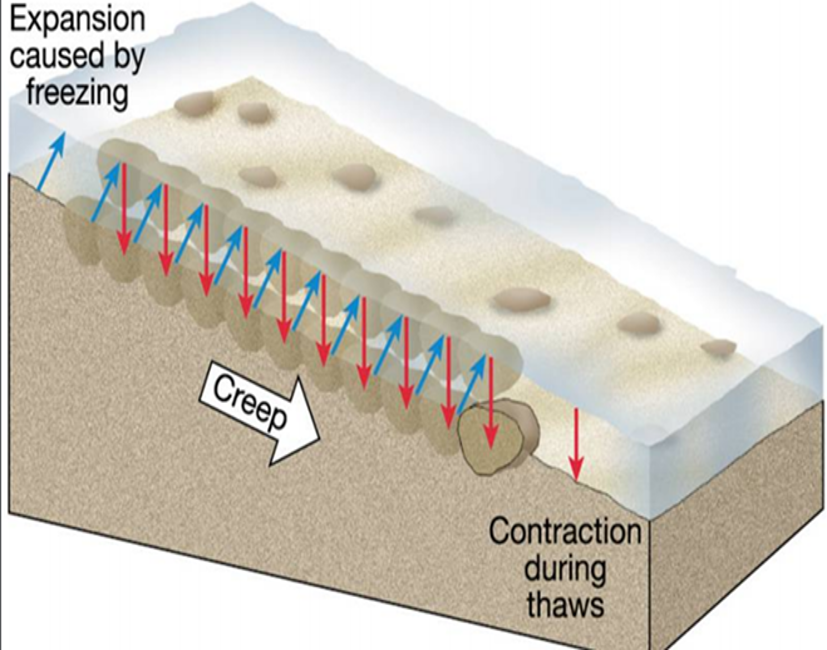
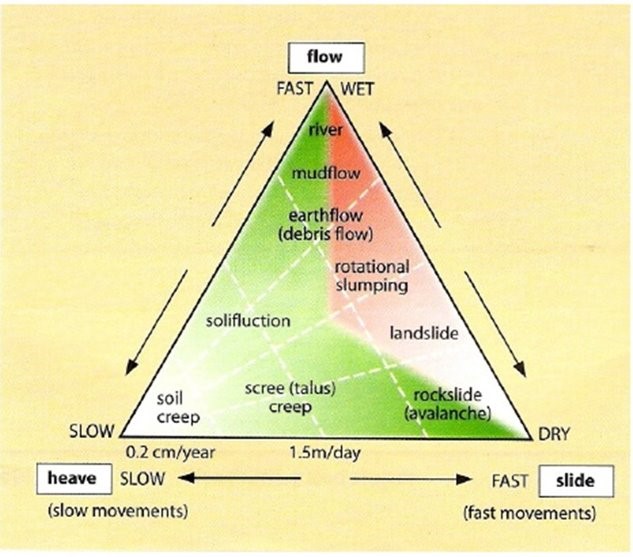
Heave
Heave is the slowest of all mass movements and refers to the slow lifting of soil particles perpendicular to the slope due to wetting/drying (soil expands and lifts when wet and contracts and falls back vertically when dry) or freezing/thawing (ice crystals expand forcing soil particles closer to surface of slope, when thawed the displaced material falls back vertically, gravity, moving down slope).
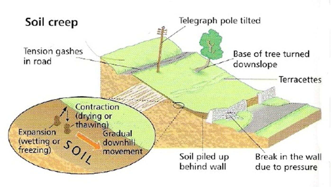
Soil creep
The slow downhill movement of dry unconsolidated material or soft rocks results in soil creep. Movement is less than 1cm/year. It occurs on vegetated slopes of more than 5 degrees.
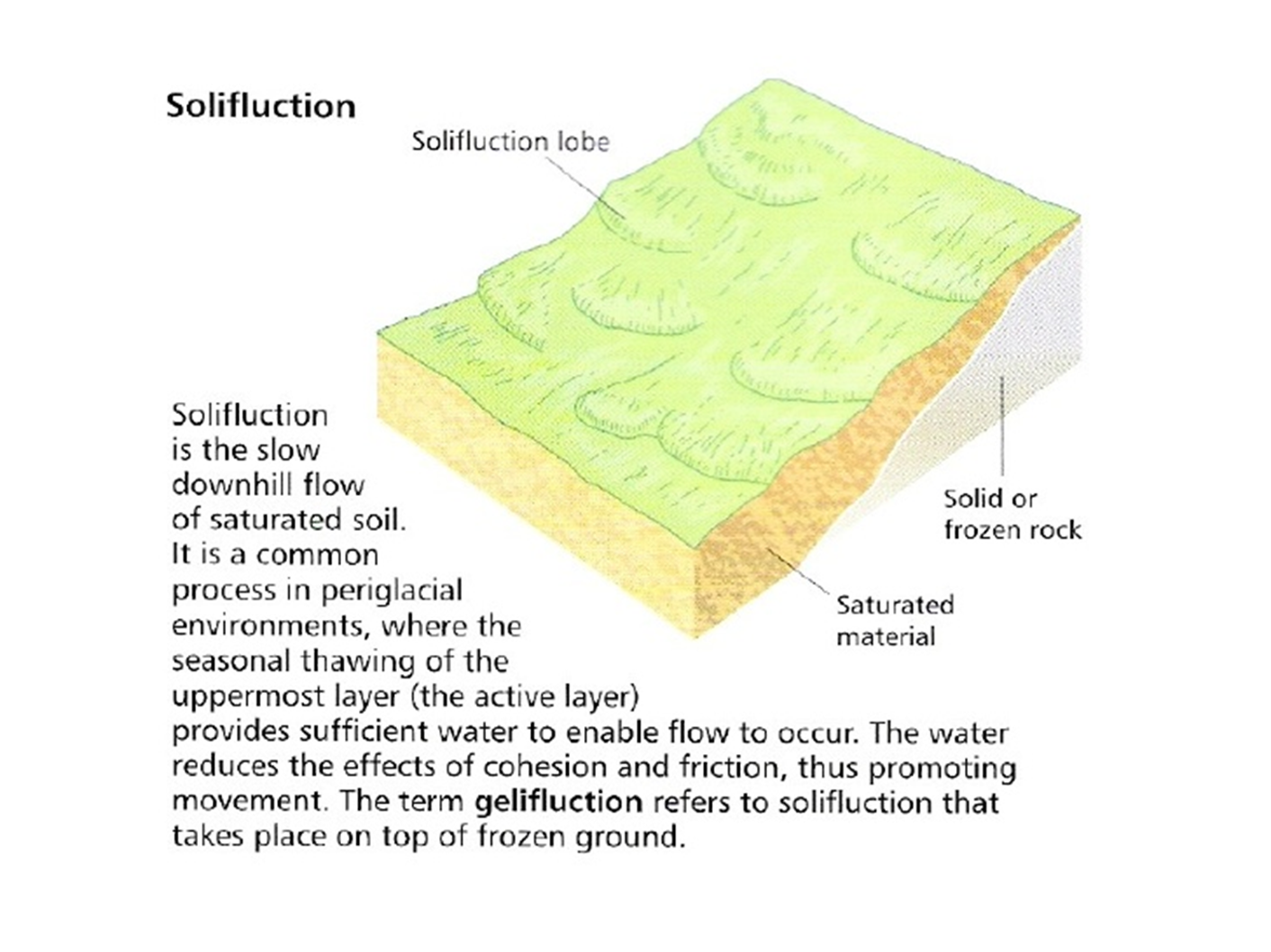
Solifluction
Solifluction is the slow downhill flow of saturated soil. It is a common process in periglacial environments, where the seasonal thawing of the uppermost layer (the active layer) provides sufficient water to enable flow to occur. The water reduces the effects of cohesion and friction, thus promoting movement. The term gelifluction refers to solifluction that takes place on top of frozen ground.
Earth/debris flows
When regolith on slopes of 5-15 degrees becomes saturated with water, it begins to flow.
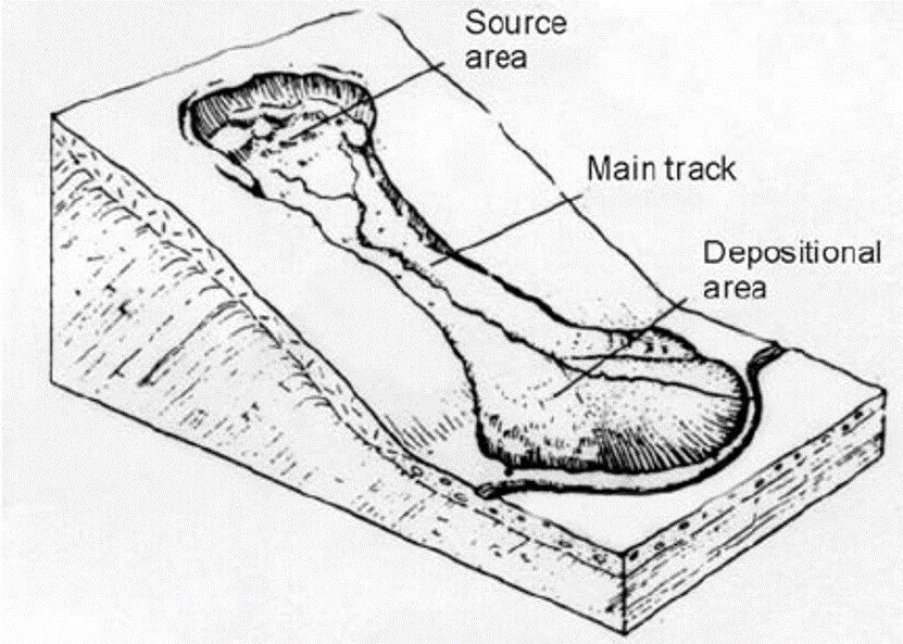
Mudflows
These involve the rapid movement of rock and weathered debris mixed with water down valleys - a turbulent, structureless mixture of sediment and water. They occur on steeper slopes and are much more rapid movements, exceeding 1km/hour.
Causes of mudflows
Steep slopes
Narrow valleys
Deforestation/removal of vegetation
A thick regolith
Slope vibration (traffic, construction etc)
Addition of water to slope
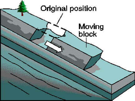
Landslide
Landslides are single dramatic events when a section of a hillside becomes unstable, shears away and moves downhill. The shear stresses in the slope exceed the shear strength of the soil or rock.
Causes of landslides
Slope angle (steeper)
Geological structure (fractures)
Rock type
Amount of water present (increase weight of slope)
Removal of the toe of the landslip, basal undercutting
Tectonic processes
Alignment of the strata (especially if it is parallel to the slope surface)
Loading of the head of the slope
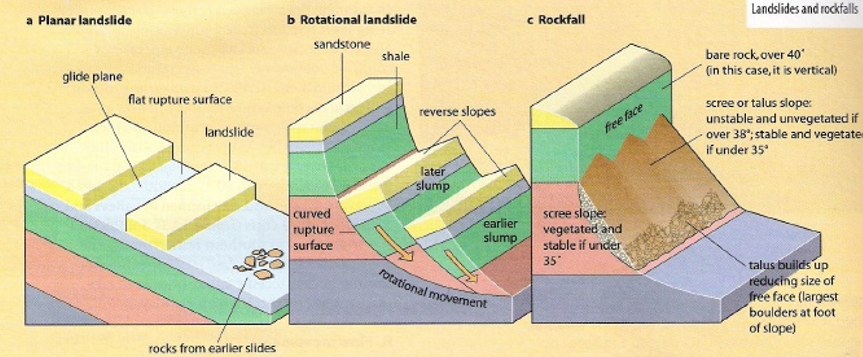
Planar landslides
These are caused when weathered rock becomes detached from the parent rock usually along a bedding plane or joint. As a result, the break is often clean and straight. Gravity pulls the material as one down the slope along the surface of the rupture. The exposed upper cliff is known as the scarp.
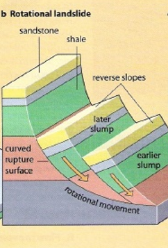
Rotational slides
“Slumping”
As movement occurs along a curved failed surface causing the upper surface to tilt back. This often occurs when saturated, weaker rocks (clay) slide over stronger or impermeable rocks (granite). This can often be seen in coastal cliffs.
Rock fall
Sudden movements of debris on slopes of more than 40 degrees. Once material has broken from the rock surface, it will bounce or fall vertically and collect at the bottom of the slope as scree or talus.
Causes of rock falls
Intense physical or chemical weathering
Tectonic processes
Slope angle (steeper)
Geological structure (fractures etc)
Alignment of strata - especially if vertical
Basal undercutting (sea/river or human activity)
Classification
Carson and Kirby - 1972
Po Shan Road - facts
18th June 1972
16th-18th 650mm
May-June 1400mm
67 deaths
Upper slopes up to 30 degrees
Granite and volcanic rocks (hydrolysis)
Po Shan Road - causes
Rainfall
Lack of vegetation
Basal undercutting
Construction site - loading of slope
High population density
Po Shan Road - management
Geotechnical Engineering Office of the Civil Engineering Development
Hazard maps
Piezometers
Groundwater drainage (90m long, 20 y/o)
Gabions
Retaining wall
Slope reinforcement
Afforestation
Slope regrading
Land use zoning