7: Erosional landscape development
1/38
There's no tags or description
Looks like no tags are added yet.
Name | Mastery | Learn | Test | Matching | Spaced |
|---|
No study sessions yet.
39 Terms
What are erosional landscapes generated by?
Uplift, weathering and erosion
What common features do erosional landscapes tend to have?
topographic relief
surfaces covered in weathering products (regolith)
or bare eroding rock
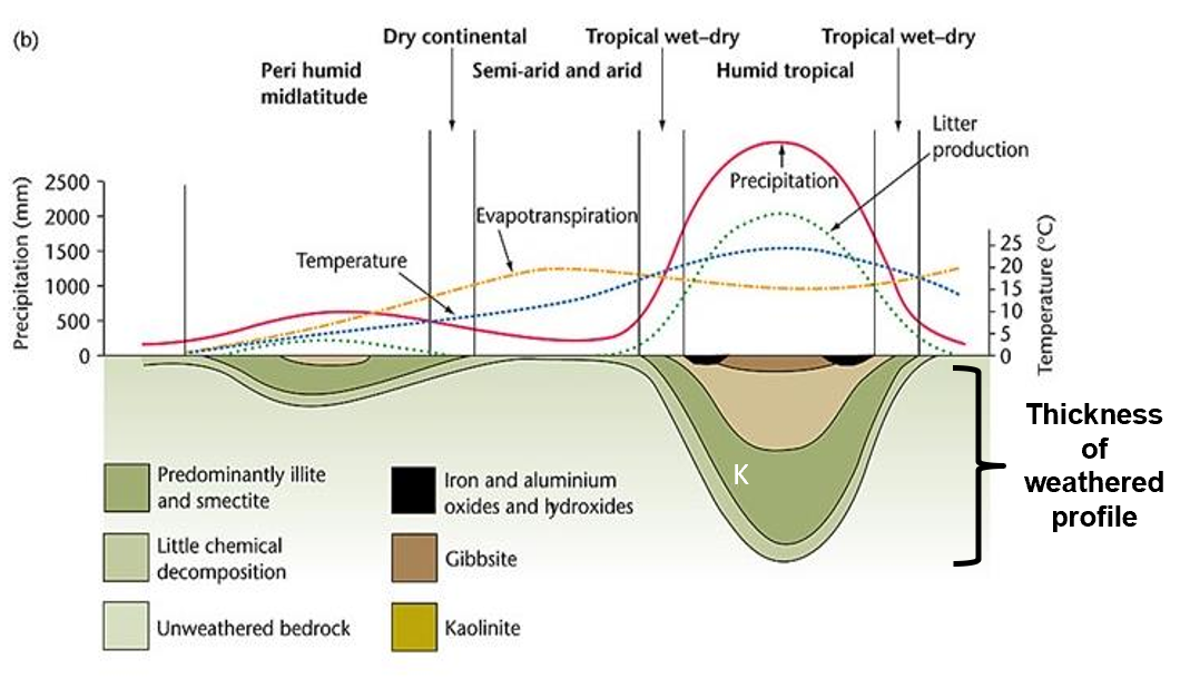
Describe how rates of weathering are climate controlled
areas of high rasinfall provide water that is necessary for chem weathering
cold areas - water is in solid plase so cannot mediate chemical reactions
hot areas - higher temp speeds up the rate of chem weathering reactions
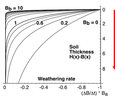
Describe how rates of weathering are slope controlled
regolith growth is self-limiting
→ reduction in grainsize and formation of clays reduces permeability, and limits access of water for chemical weathering
→ weathering rate decreases downward in the regolith profilehowever, if readily removed, water can access the reaction front
so rapid (or continuous) removal of regolith increases weathering rates
How is the rate of removal of regolith related to slope gradient?
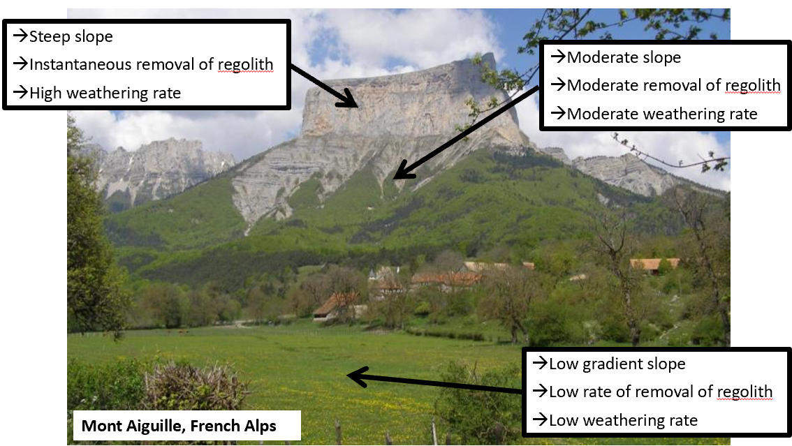
weathering and transport limited slopes
weathering limited slopes:
transport processes are so efficient that debris is removed more quickly than it can be generated
Transport limited slopes:
occur where weathering processes are efficient at producing debris byt where transport processes are inefficient at removing it from the slope
describe how weathering and transport limited slopes look
Weathering limited:
thin regolith
transport processes are efficient so debris is removed more quickly than it can be generated by further weathering
Transport limited:
weathering processes are efficient at producing depris but where transport processes are inefficient at removing it from the slope
What is erosion?
the process of removal of the regolith that was generated through weathering, and its transport to a new location
Erosion due to gravity
movement of material under its own gravitational potential in areas of steep slope
can also happen in submarine settings
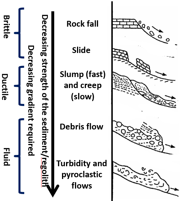
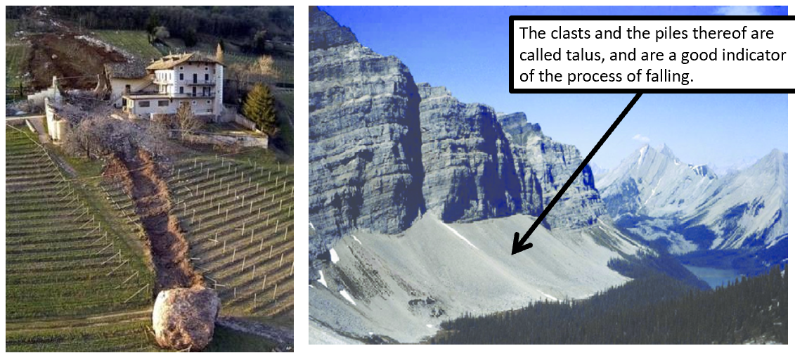
erosion: ‘Fall’
Detachment that occurs with little or no shear movement occurs through free-fall, bouncing or rolling
→ common in glacial, canyon and sea-cliff geomorphic terranes with steep valley walls
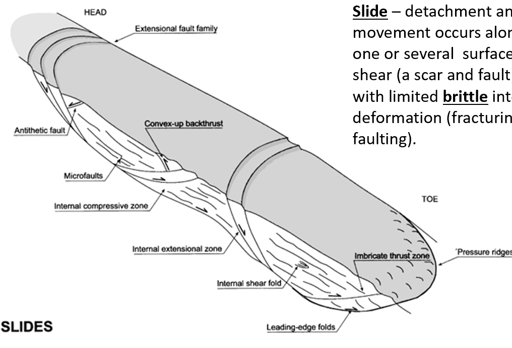
erosion: ‘slide’
Detachment and movement occurs along one or several surfaces of shear with limited brittle internal deformation (fracturing or faulting)
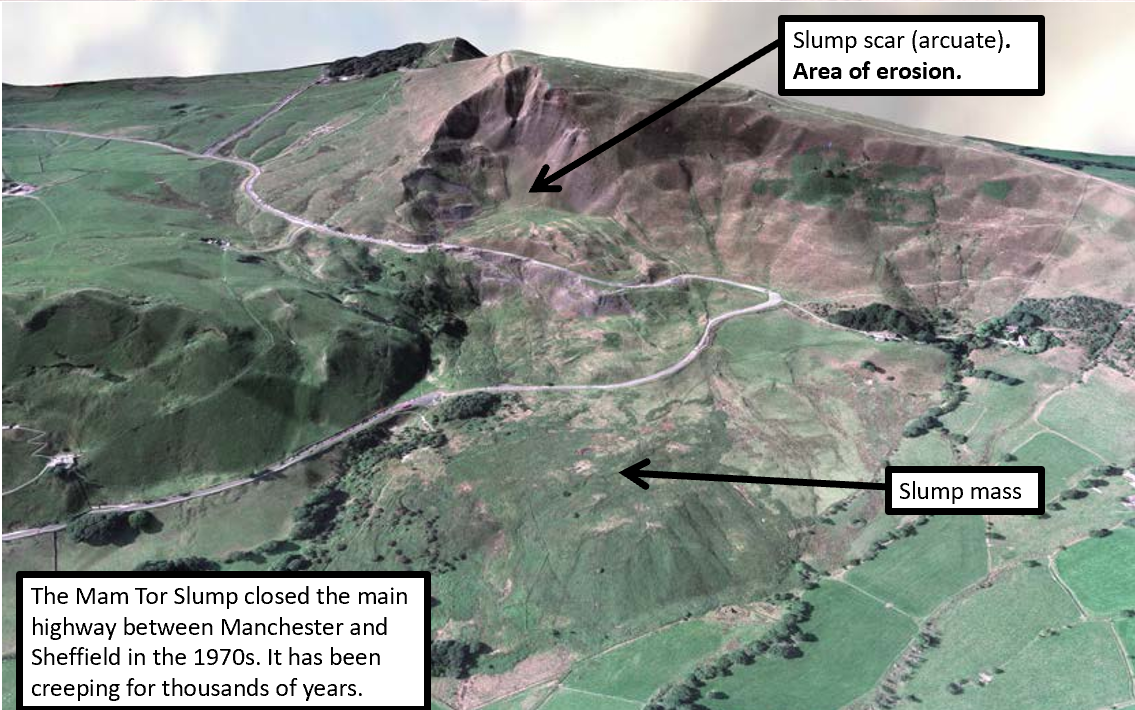
erosion: ‘slump’
detachment and movement that occurs along one or several surfaces of shear, with brittle and ductile internal deformation (faulting and folding)
What are debris flows?
form where water saturated sopil, sediment or regolith fails - usually via slumping
the Ek imparted by the mass movement, causes grains to collide and bounce apart, allowing to flow freely between the grains, so that the material behaves as a fluid
Fluid flow erosion
Exerts shear stress which moves material from one place to the next
→ flow of water in streams and rivers (fluvial processes), which entrains sediment (gravity driven)
How does water cause erosion?
rainfall flows downalope
its viscocity imparts a shear stress on particles
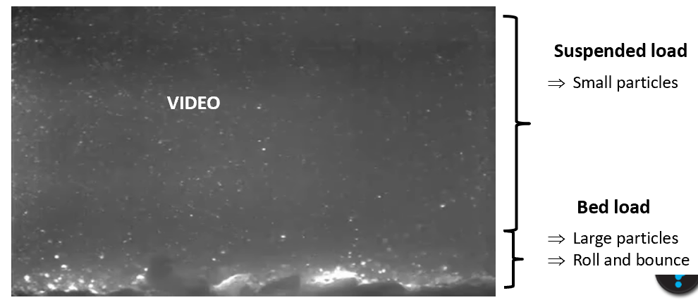
moves grains as bedload and suspended load
acts as universal solvent, it dissolves and transports solute minerals
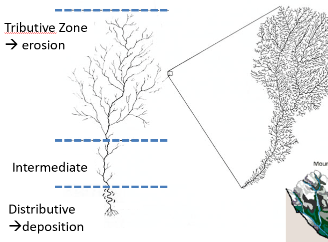
decribe the tributive plan of river systems
as water flows downslope, rivulets and streams join together
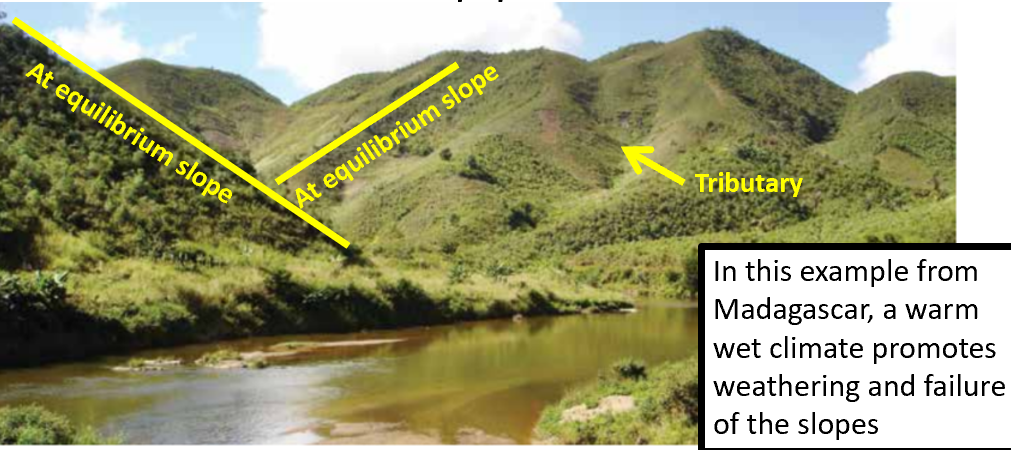
How and where do rivers form valleys?
Through erosion, rivers incise uplifted land to form valleys
where rocks are soft and weathering rates are high, steepened valley walls fail which results in at-equilibrium slopes
associated processes: slumps and debris flows
this leads to the v-shape profile of fluvial environments
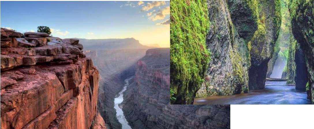
How and where do rivers form canyons/gorges?
where rocks are hard and weathering rates are low, the steepened valley walls do not fail, they remain steep as the river carves deeper
associated processes: falls
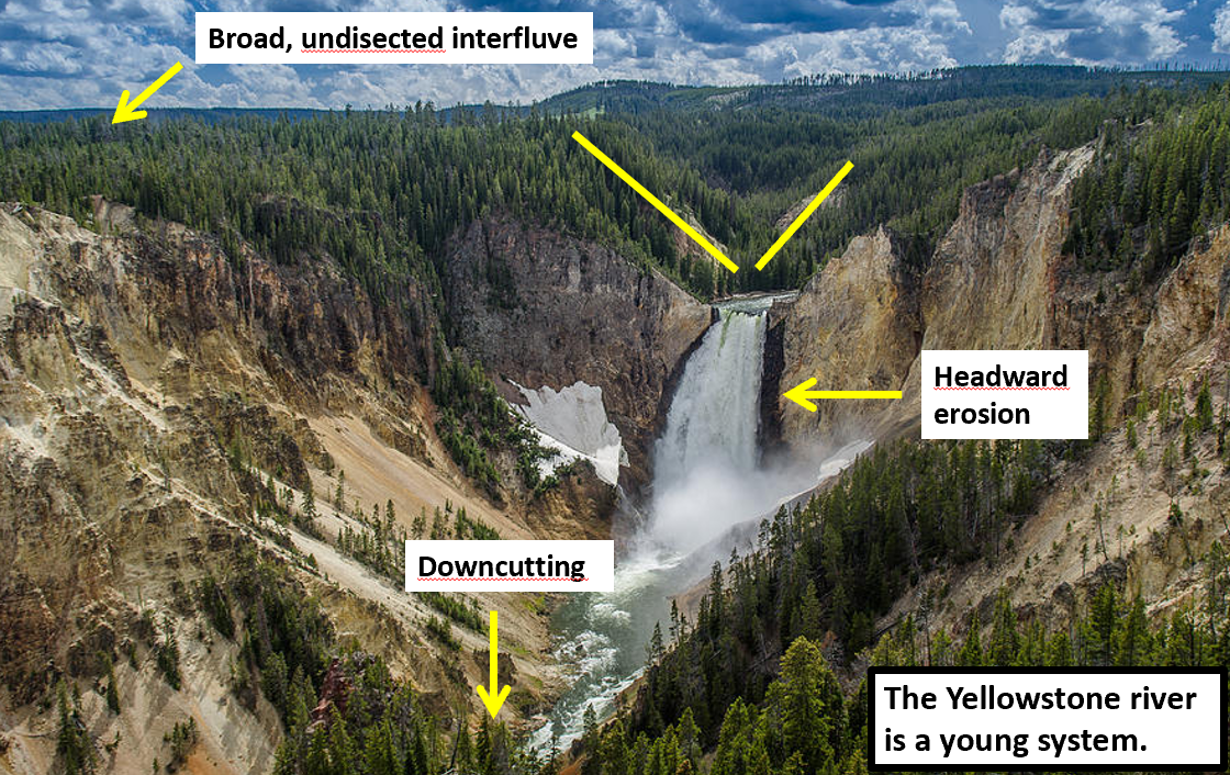
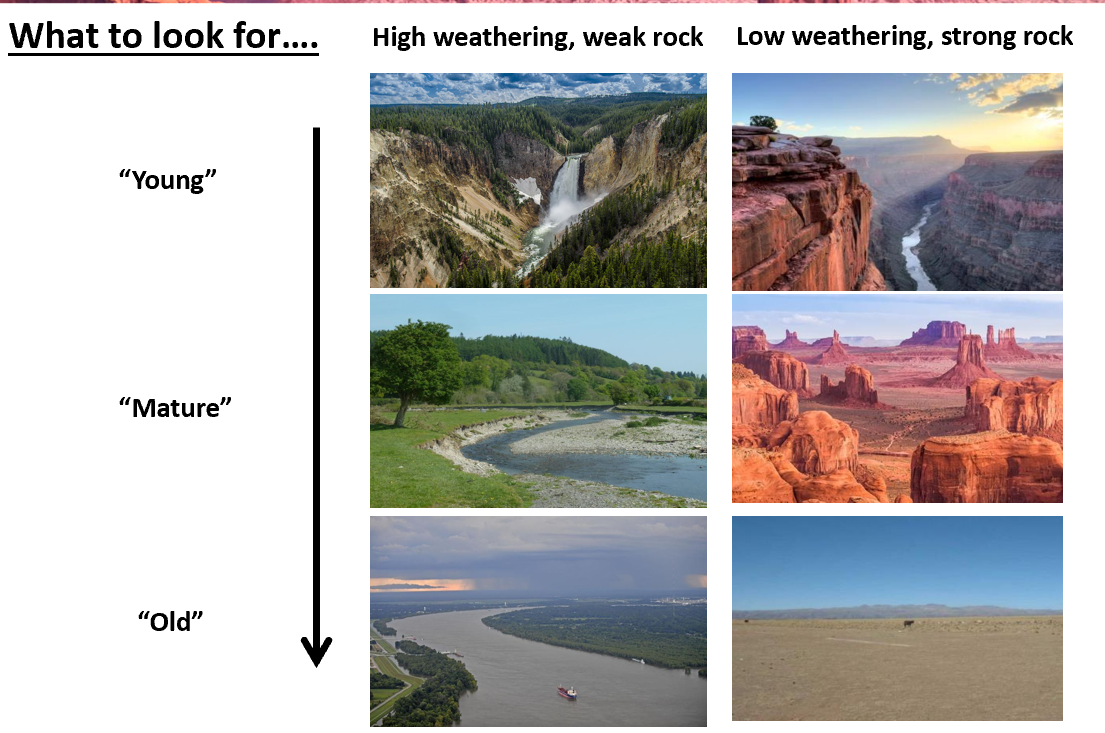
Describe young river systems
Steep gradients
mostly erodes by downcutting and headward erosion (nickpoints)
divide between rivers are broad and undisected because tributaries have little time to form
Describe the intermediate state of river systems
streams have fully dissected the former highlands
whole area covered by am extensive drainage network
river erodes through horizontal sweeping and develops a flood plain (and meanders)
slopes retreat and interfluves become narrower
rolling hills
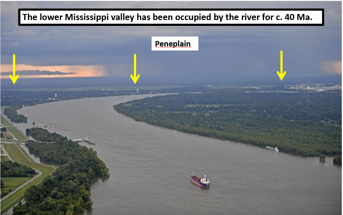
Describe the mature stage of river systems
flood plain widens further
slopes retreat until they meet forming a flat featureless landscape
PENEPLAIN
young,mature, old in different environments
Glacial erosion
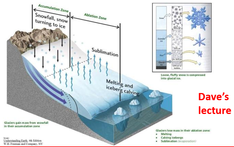
•Ice caps and associated glaciers form because an excess of snow falls (relative to melting).
•Compaction of the snow forms ice which behaves in a ductile to brittle manner, and can flow downhill, over timescales of years to 100s years.
•Ice is less dense than water, but it has a much higher viscosity, so its capacity to erode and transport material is enormous.
•Typically, valley glaciers form in, and re-excavate major fluvial trunk river valleys.
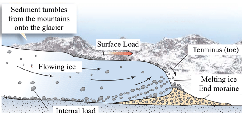
How do glaciers erode and transport materials?
They can transport virtually and grainsize
→ as material that has fallen via gravity processes on to the top of the glacier
→ by melting anf freezing then ‘plucking’ rocks from the interface of the glacier
→ pulverising rock
→ pushing sediment infront of the glacier during growth episodes
How do glaciers affect valleys?
Deepen and widen pre-existing valleys
base of glacier is flat and the sides are steep
At the front of the glacier, the transported material is melted out in SITU
sediment is dumped in an unsorted manner
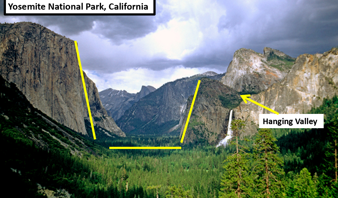
What does ice retreat reveal geomorphologically?
over-deepened trunk valleys with flat bottoms and steep sides (U shape)
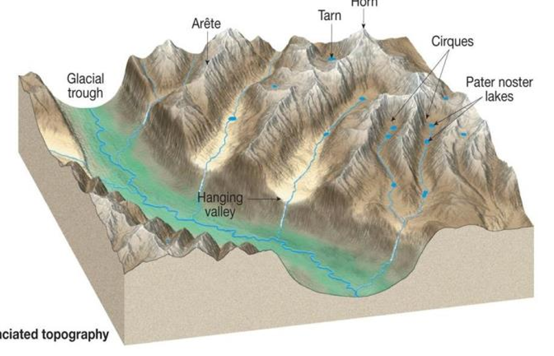
Hanging valleys
where glaciers have eroded down only to the level of the top of the valley glacier
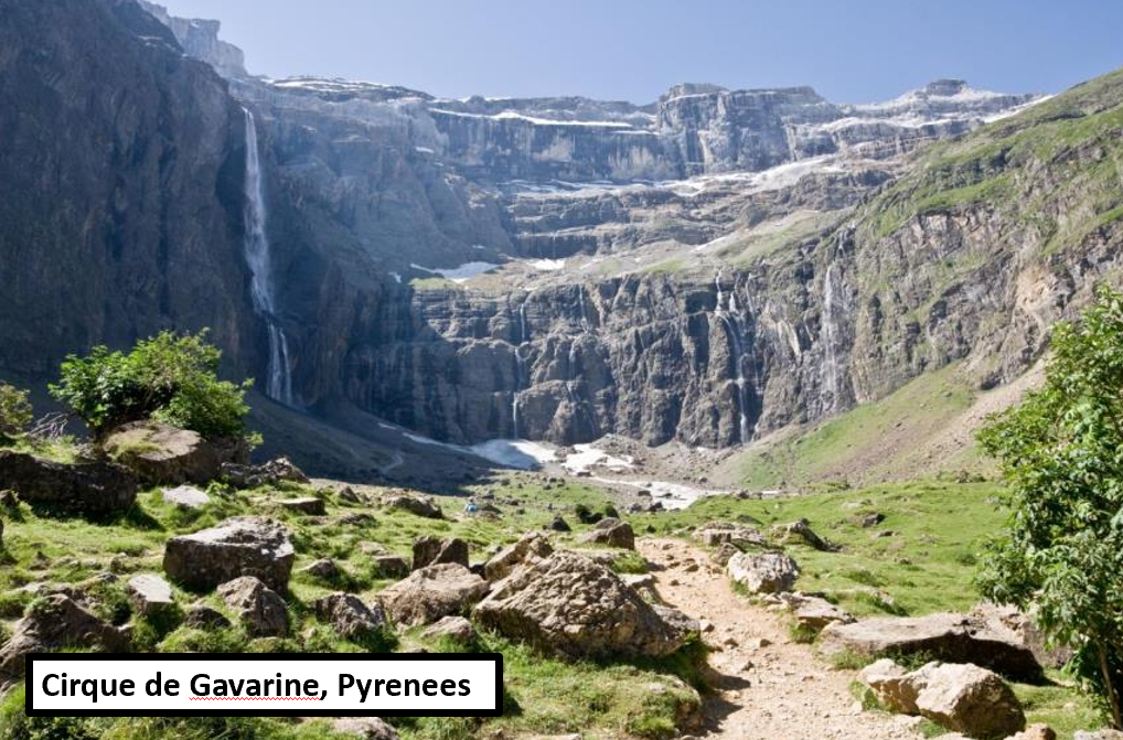
Cirques
like amphitheatres, often filled with and quasi-circular lakes (“tarns”) at the headwells of valley glaciers
Arretes and horns
extremely narrow, steep ridges or pyramidal peaks
where the steep margins of glacial valleys have retreated towards one another

Which climatic regimes experience the highest weathering rates?
Warm and wet
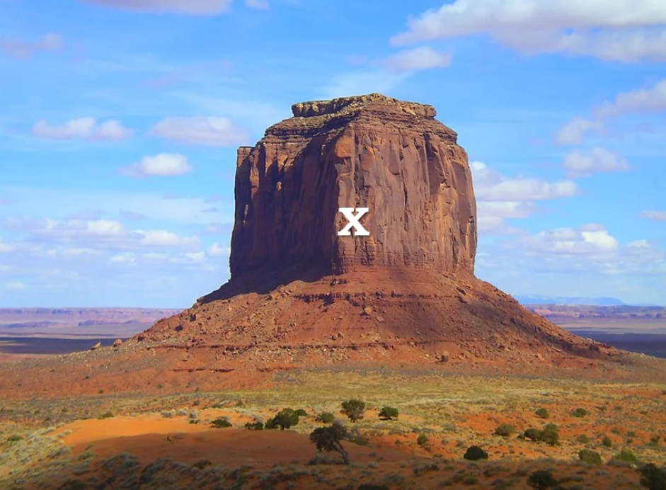
At X
The slope is weathering limited
Which of the following is NOT an example of sediment transport/erosion via fluid flow
A river
A glacier
A rockfall
Wind
A rockfall
Which of the following hillslope processes usually occurs in the weakest material
Fall
slump
slide
debris flow
Debris flow
Which of the following hillslope processes requires the steepest gradient?
fall
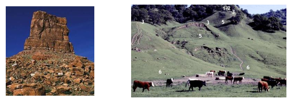
Which of the following is characteristic of hillslope erosion dominated terranes?
amphitheatre-like excavation scar
Classic v-shaped river valleys are most likely to form where
the substrate is soft and weathering rates are high
“Young" fluvial geomorphologies are characterised by
plateaus, deeply channels incised into bedrock, waterfalls
Which of the following is not uniquely a glacial geomorphic element?
steep valley walls
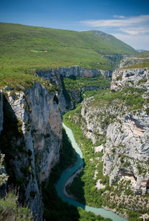
The Verdon gorge is an example of...
fluvial geomorohology