Weather & Climate Exam 3
1/48
There's no tags or description
Looks like no tags are added yet.
Name | Mastery | Learn | Test | Matching | Spaced | Call with Kai |
|---|
No analytics yet
Send a link to your students to track their progress
49 Terms
Fog
A cloud with its base at or very close to the ground surface
The same as a cloud but different method and plan of formation
Forms by cooling or additional of water vapor
Fog formed by cooling
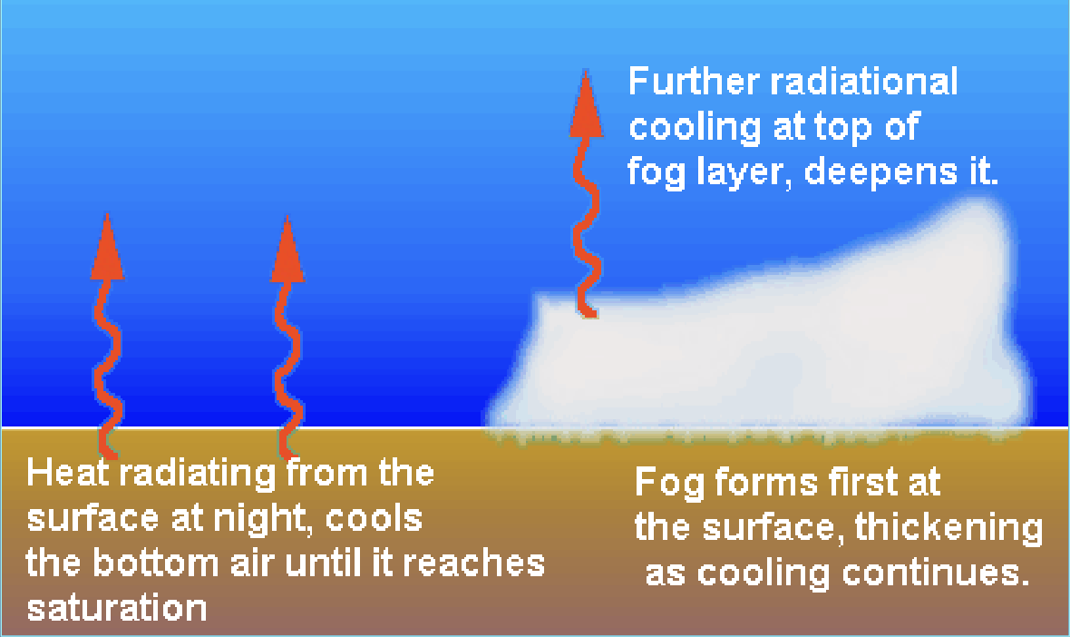
Radiation fog
Advection fog
Upslope fog
Fog formed by the addition of water vapor
Steam fog
Frontal fog
Radiation Fog
Results from rapid cooling of the ground which causes surrounding air to cool to its dew point and condensation occurs
Nighttime phenomena with clear skies and high relative humidity
Early morning phenomena that dissipates with sunrise (which warms ground and decreases humidity)
Found downslope in hilly terrain
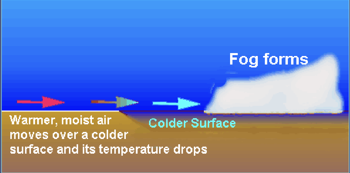
Advection Fog
Warm, moist air blown over a cold surface. This chills the air to its dew point and fog forms (thick)
Need winds to provide turbulence
Common in summer/fall along west coast
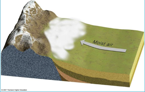
Upslope Fog
Humid air moves upslope and cools adiabatically
Forms when dew point reached
Steam Fog
Occurs when cool air moves over warm water and moisture evaporates from the water
Common over lakes and rivers
Fall phenomena on clear, crisp mornings
Winter phenomena when arctic air blows over warm ocean currents
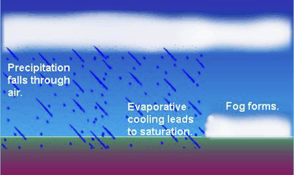
Frontal / Precipitation Fog
Warm air lifts over cold air which produces clouds. When the cold air below is near the dew point and rain evaporates, fog is produced.
Dew
Condensation of water vapor on objects that have radiated sufficient heat to lower temperatures to the dew point of surrounding air
Frost
Forms when dew points is below freezing and water vapor changes directly from the gas to solid phase without entering liquid state (deposition) (not frozen dew)
Sleet
Frozen rain drops
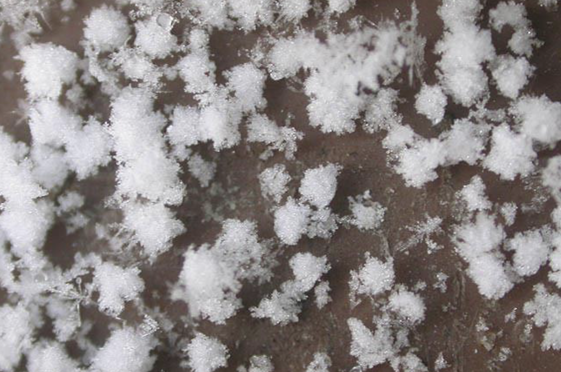
Graupel
Snow pellets with no crystalline shape
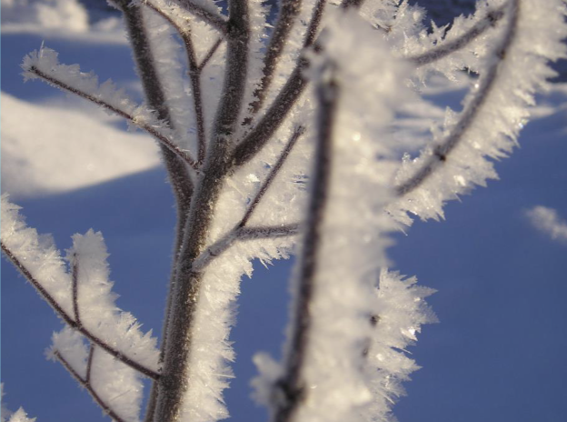
Rime
Water droplets in fog freeze on cold surfaces
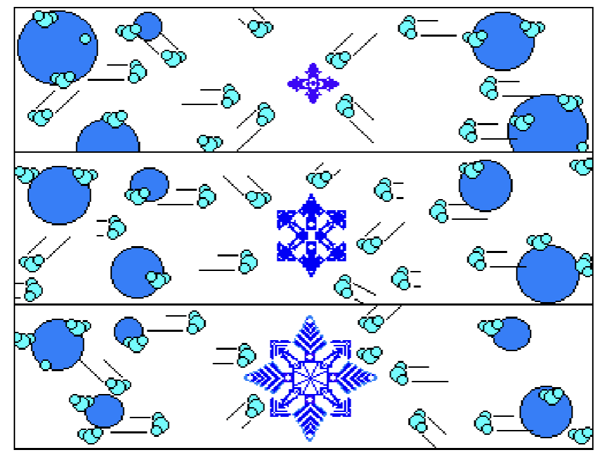
Ice-Crystal (Bergeron) Process
Temperature is below 0
Super cooled water droplets sublimate to ice, forming snowflakes
Most precipitation in mid latitudes
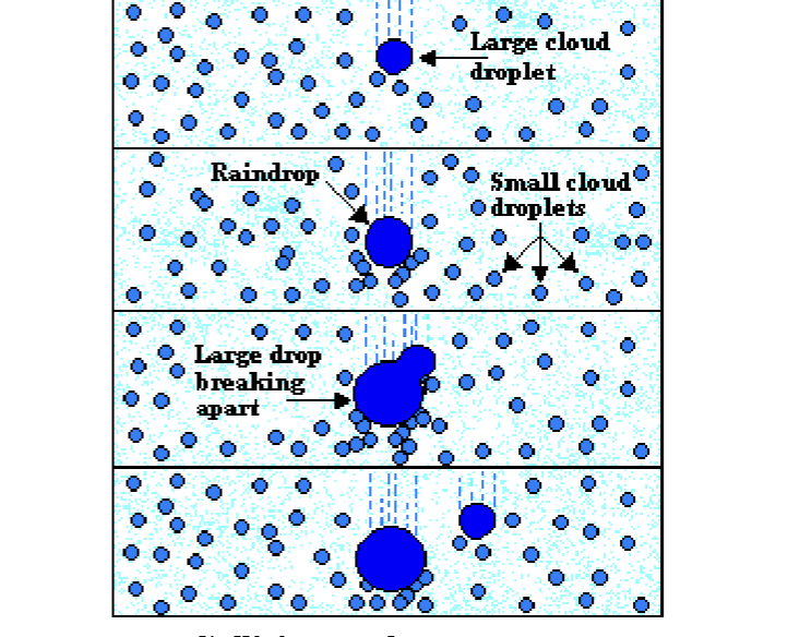
Collision-Coalescense Process
Large water droplets function as condensation nuclei
Most tropical precipitation
Virga
Small raindrops that evaporate while falling through dry air
Air Mass
Large body of air characterized by a homogenous temperature and moisture content
Loses original identity as it moves from its source region
Air Mas 2 Letter Code
1st letter (lower case)
m (maritime; humid; water source)
c (continental; dry; land source)
2nd letter (upper case)
P (polar)
A (artic)
T (tropical)
Cold front is collision of mT and cP
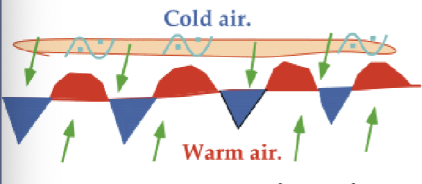
Front
Boundaries that separate air masses of different densities
Greater difference in air masses → more severe weather
Move west → east
Changes caused by passage of a front
Temperature
Humidity
Pressure
Speed/direction
Cloud cover
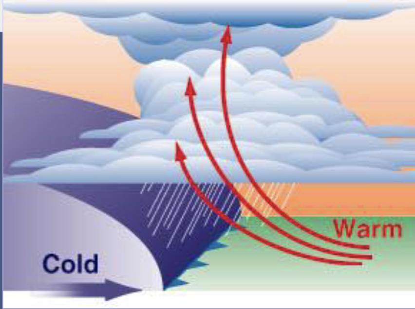
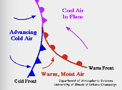
Cold Front
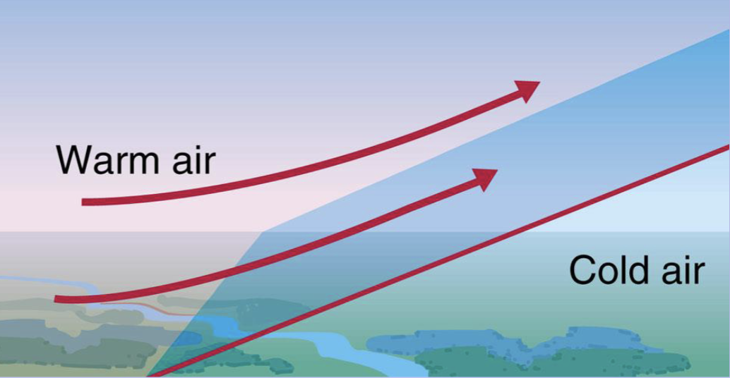
Warm Front
Stationary Front
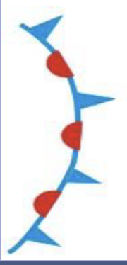
Occluded Front

faster, steeper, cold
Cold fronts move ___ than warm fronts
The frontal boundary of a cold front is ____ relative to a warm front
Usually more severe storms associate with a ___ front
Cold Front Weather
Air pressure drops
Cloudiness increases
cirrus, cumulus, cumulonimbus
May have severe storms
Temperature and humidity drop
Warm Front Weather
Air pressure drops
Cloudiness increases
cirrus, altostratus, nimbostratus
Temperature and humidity increases
Stationary Front
Develops when a front shows no appreciable movement
2 Conditions of Stationary Fronts
Momentum equal
Barrier
Momentum Equal (stationary front)
Cold air mass is far enough south that it loses its identity
Warm air mass is far enough north that it loses its identity
Barrier (stationary front)
Mountain ranges may prevent an advancing front from moving
Cloudiness and precipitation occurs for several days
Occluded Front
Cold front overtakes a warm front
Cold occlusion - air behind the moving occluded front is colder than the air ahead
Warm occlusion - air behind the moving occluded front is warmer than the air ahead
Overcast skies and periods of rain and snow
Commonly associated with latter stage of frontal cyclones (hurricanes)
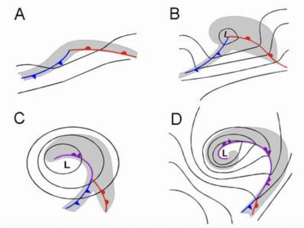
Cyclogenesis
Develops at boundary between cold polar air and warm subtropical air
Upper air flow causes cyclonic surface conditions
Difficult to predict more than a week in advance
Nor’easters
Cyclonic storms that affect the East Coast from October-April
Low pressure system forms in Gulf of Mexico
Upper air jet stream’s trough carries system up East Coast
Very difficult to predict
Nor’easters Impacts
Massive precipitation
High winds
Large waves and storm surge
Airports shut down and power outages
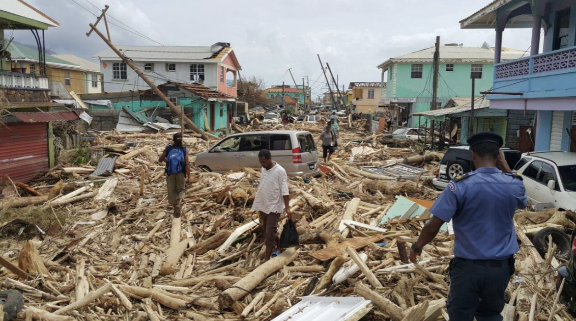
Hurricane
Most destructive natural disaster on Earth
Steep pressure gradient generates inward spiral and draws in warm, moist air
Fueled by release of latent heat when huge quantities of water vapor condense
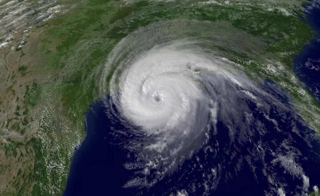
Eye Wall
Hurricane’s greatest wind and heaviest rain
Eye
Center of the hurricane
Air descends, precipitation and winds slow/cease
Formation of a Hurricane
Tropical Disturbance - moves with trade winds, low pressure
Tropical Depression - low pressure drops, faster winds
Tropical Storm - pressure continues to drop
Hurricane - winds greater than 119 kph
Saffir-Simpson Index
Ranks intensity of a hurricane on a scale of 1 to 5
Storm Surge
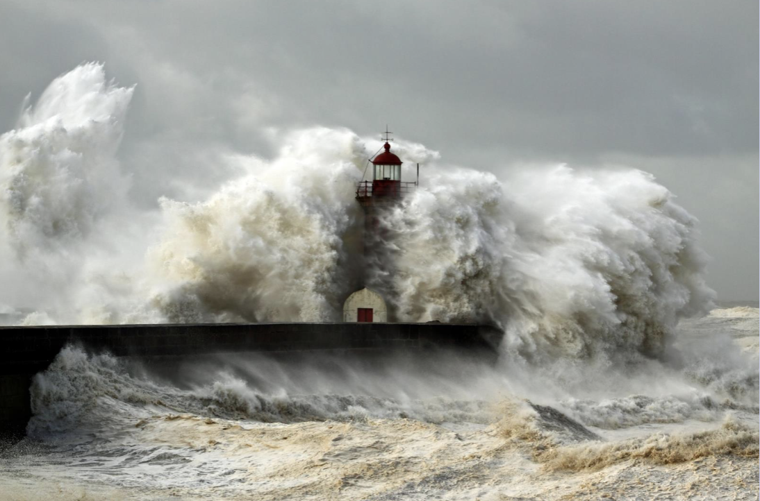
Wind Damage
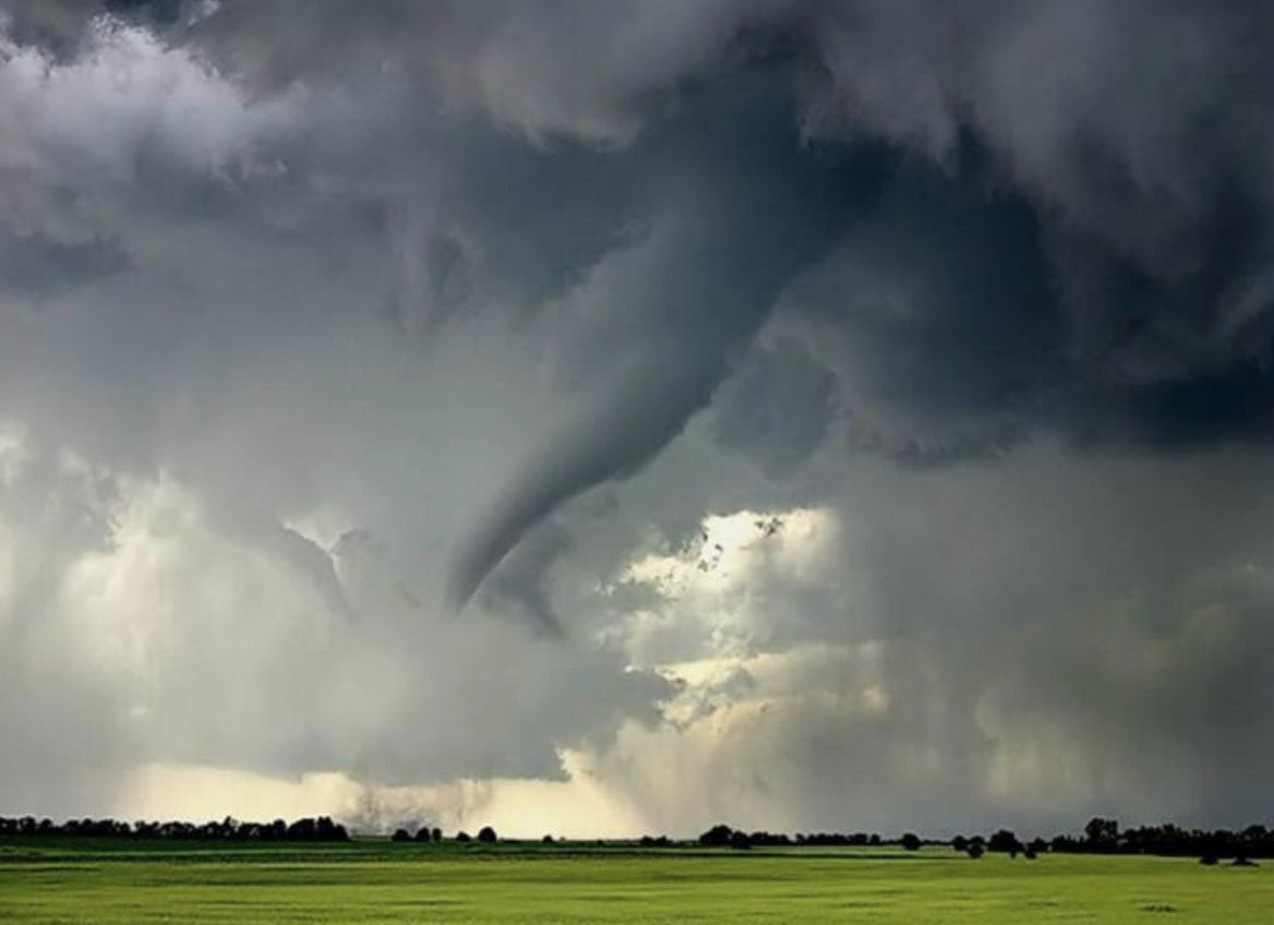
Tornado
Violently rotating column of air usually in contact with the base of a cumulonimbus cloud and the ground
Associated with cold fronts, spring, mid-latitudes
Spiral counter-clockwise in Northern Hemisphere
Mesocyclone
Rotating column of air in a cumulonimbus cloud
Early stage of a tornado
“Comma shape” called hook echo
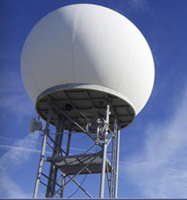
Doppler Radar
Can detect rotation of mesocyclones
Radar emits radio waves that reflect off raindrops in a cloud
Fujita Intensity Scale
Measures tornado intensity from F0 - F5
Lightning
Highly visible form of energy transfer
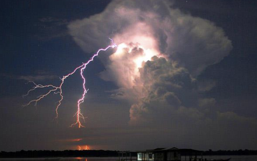
Mature Thunderstorm
Warm updrafts and cold downdrafts function as polarization mechanisms; electrical charge separation
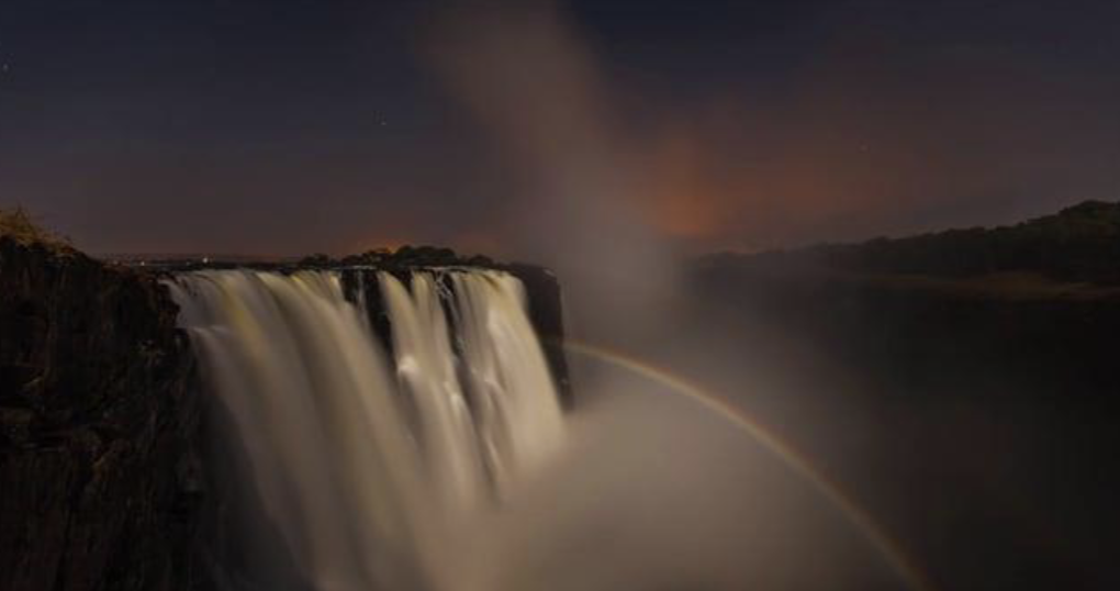
Moonbow