Looks like no one added any tags here yet for you.
Reference map
The map displays the boundaries, names and unique identifiers of standard geographic areas, as well as major cultural and physical features. Ex. Map of Louisville or World
A thematic map is a map that emphasizes a particular theme or a special topic
Thematic map
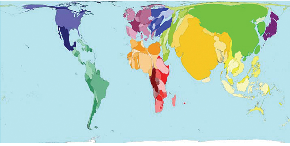
Cartogram
This map distorts land area to show changes in value.
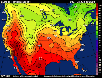
Choropleth Map
This map uses different shades to show the variation of the values.
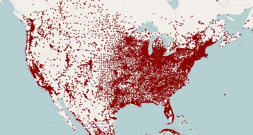
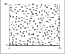
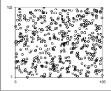
Dot Map
Uses dots to show different values
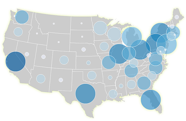
Graduated Symbol
This map uses a symbol to represent a certain value. The larger the symbol, the higher the value, and vice versa.
lsoline Maps
Maps with lines drawn to link different places that share a common value.
Relative space
Space that is created and defined by humans
Absolute location
With an QUANTITATIVE (numerical) measure (meaning location location, distance, and direction)
EX:
location: 30°N, 25°W (longitude/latitude)
distance: in mi., km., etc.
direction: north, south, east, west (directions on a compass)
Relative Location
With a QUALITATIVE (descriptive) measure that is represented by comparing it to a known geographical feature.
EX:
location: near the Washington Monument
distance: 30 minutes South
direction: left, right, front, etc.
Distance and Direction
Absolute and relative
Dispersal/Scattered
Appears to be distributed over a wide area
Sinuous
Shown in a wavy configuration
Uniform
Evenly spaced
Elevation
Using levels of how high/low something is located on the Earth’s surface
Random
Configured in no specific pattern
Clustering/Clumped
Grouped/bunched together
Agglomeration
Grouped together purposely
Linear
Shown in a line configuration
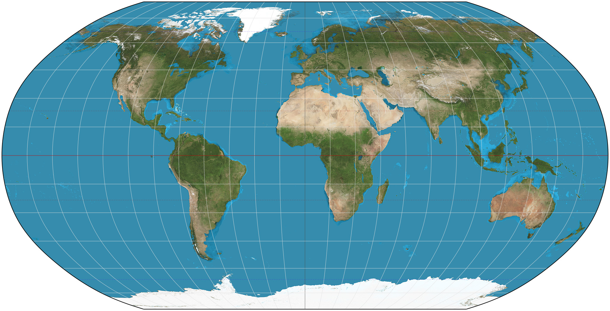
MERCATOR PROJECTION
Type & Creator: Conformal 1569 - Gerardus Mercator
Distortion: Poles appear much larger than they are (areas become larger with latitude)
Purpose: Best map for nautical use to help ship captains
Benefits: Preserves 90° angles and straight lines of longitude and latitude Shows true direction
ROBINSON PROJECTION
Type & Creator: Compromise 1963 - Arthur Robinson
Distortion: Distorts poles
Purpose: Commonly used by schools
Benefits: Shows accurate shapes and sizes (area) of land masses
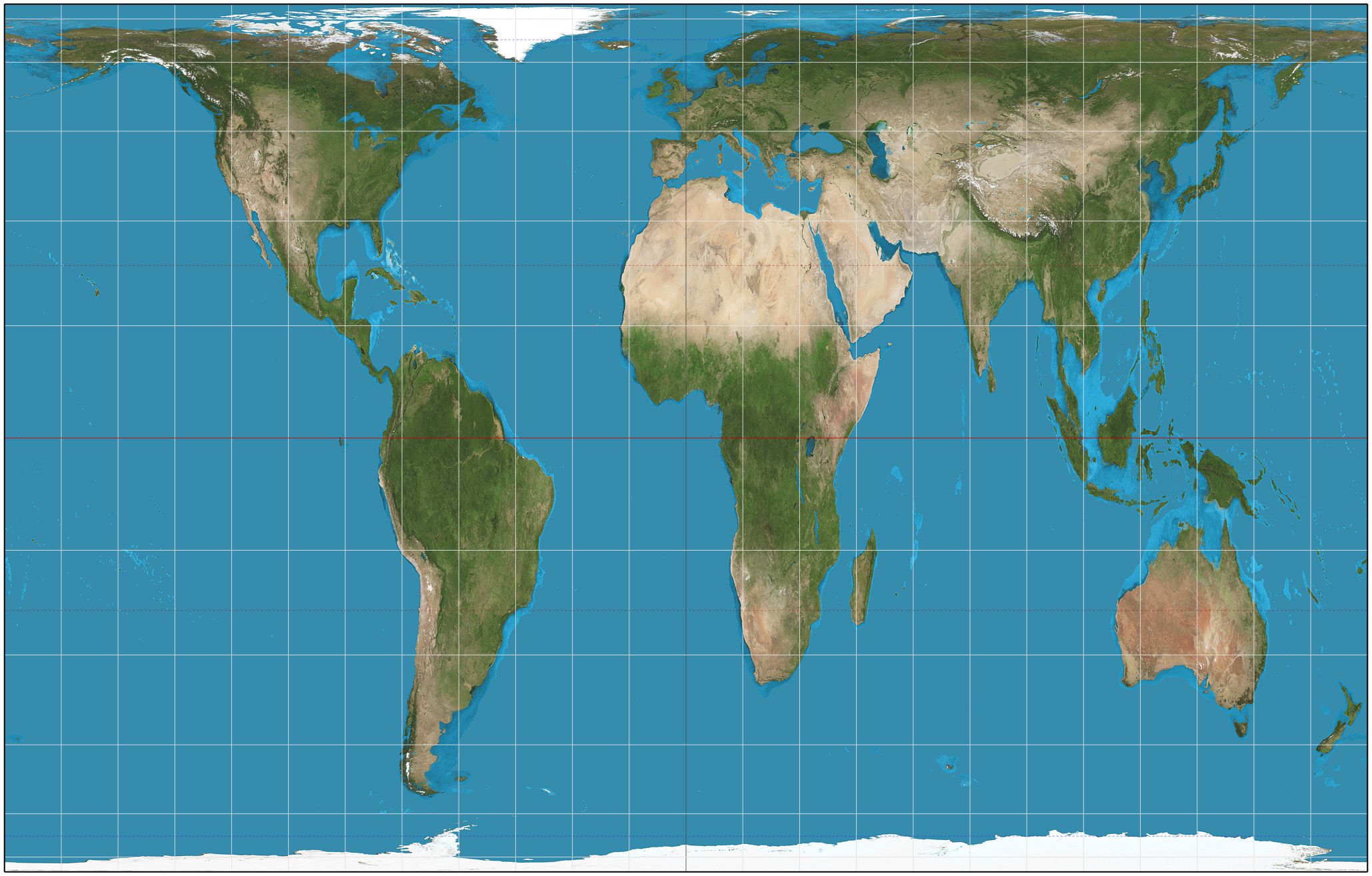
PETERS PROJECTION
Type & Creator: Equal-Area 1967 - Arno Peters
Distortion: Distorts oceans
Purpose: Used for navigation & Used in world maps
Benefits: Not much distortion of continents (size is preserved) Superior alternative to Mercator
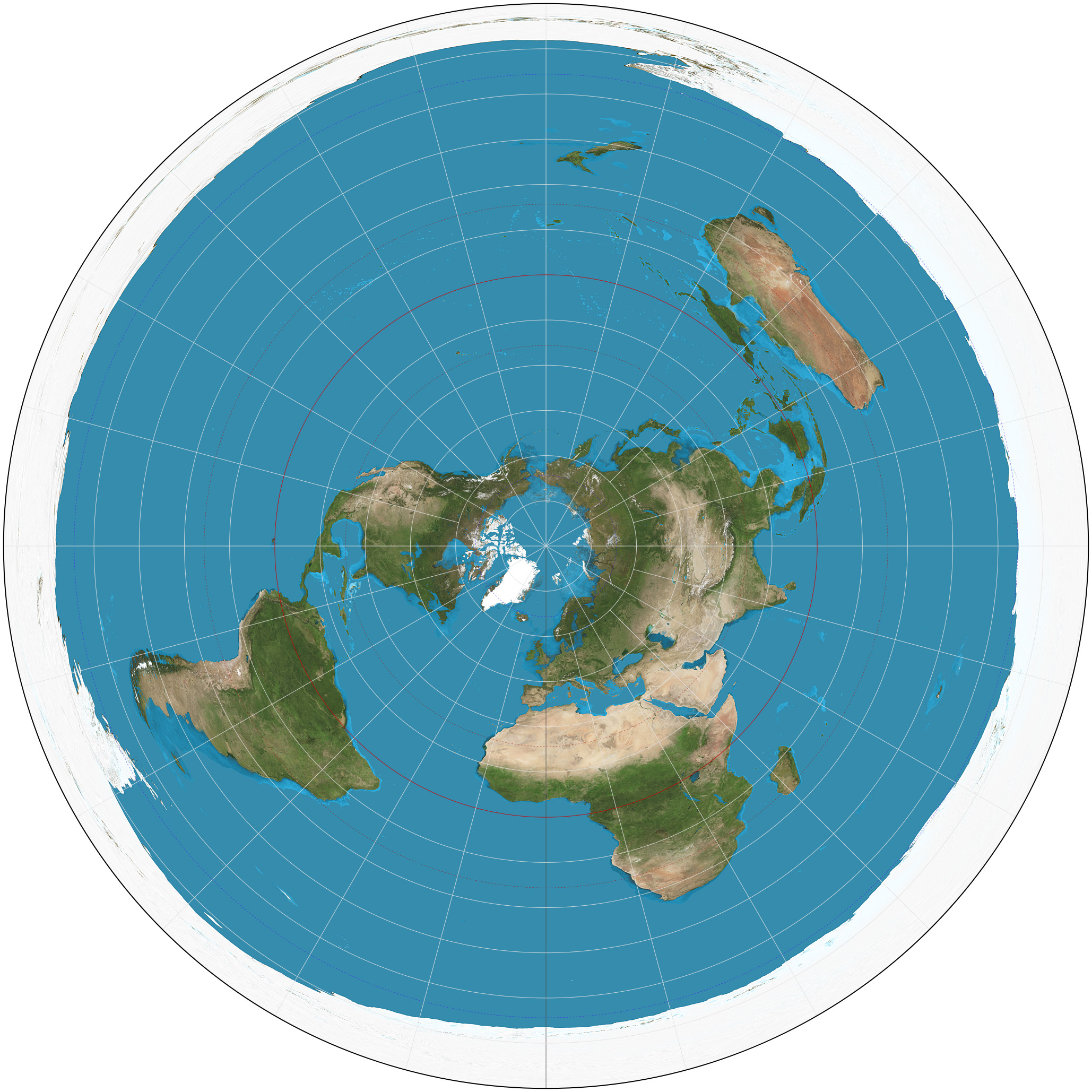
POLAR PROJECTION
Type & Creator: Azimuthal Equidistant 1581- Guillaume Postel
Distortion: Distorts land size & Distorts parallels of latitude
Purpose: Used by airline pilots to navigate best routes around the Earth
Benefits: Distances from the center (poles) are preserved
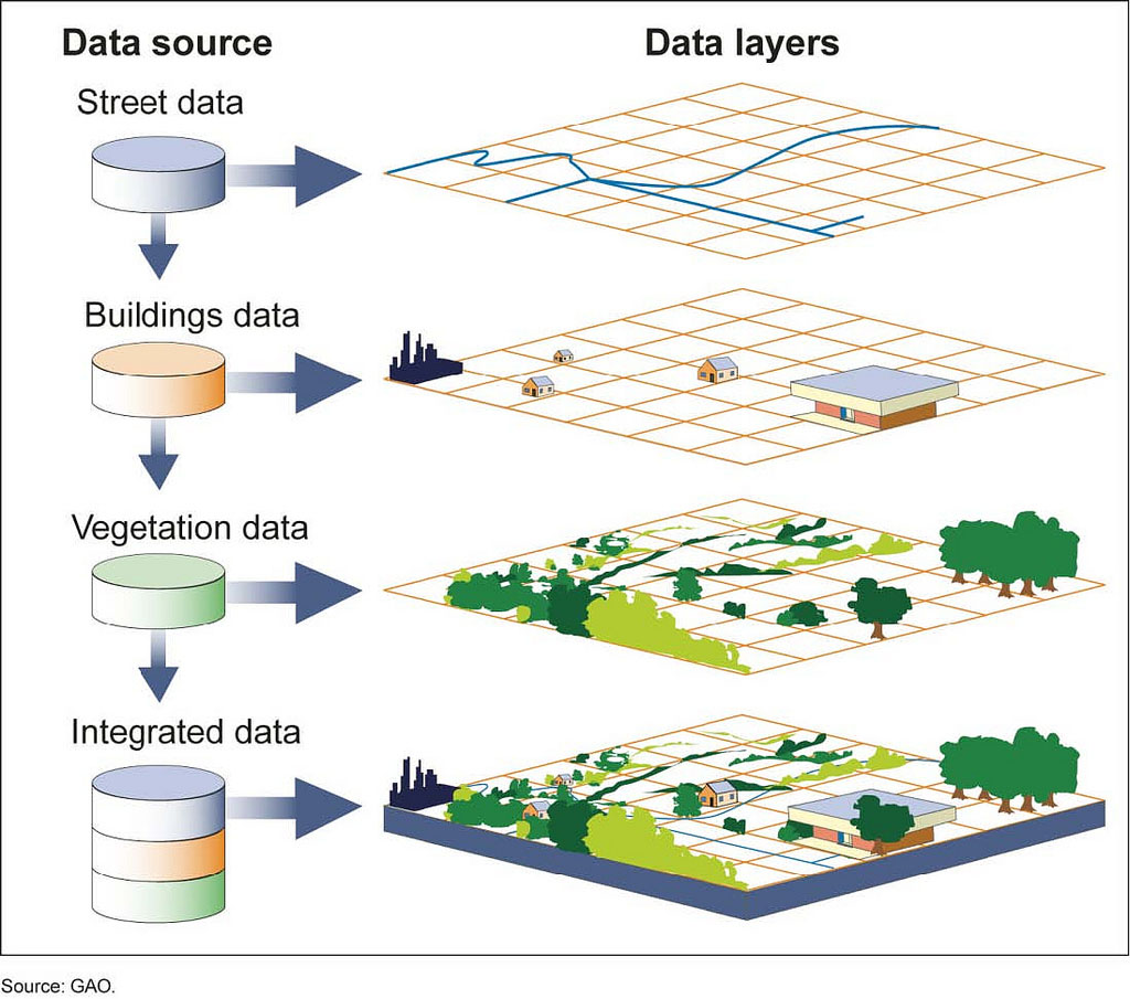
Geographic Information System (GIS)-
A system designed to collect, store, analyze, and present georeferenced data
(Data tied to locations on Earth)
Built around spatial and attribute information
Criticized for being too expensive, creating a power divide, and promoting a strongly Western view of the world.
Used in all fields of study to make maps that communicate, perform analysis, share information, and solve problems around the world.
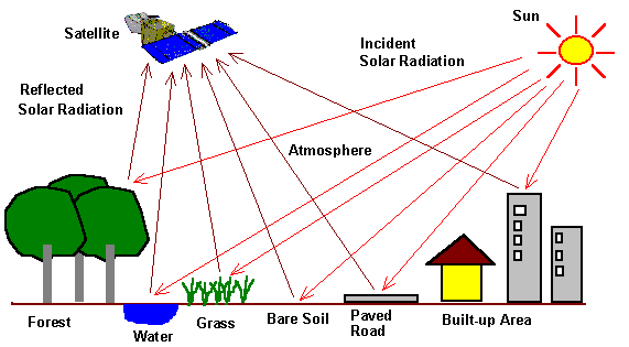
Remote Sensing
Gathers information on Earth by using sensors on aircrafts and satellites without making any physical contact with the object (giving it the name remote sensing).
Has applications in many fields including natural resource management, hazard assessment, and coastal and ocean applications.
Satellite Navigational Systems
System of satellites that provide geospatial positioning.
Allows electronic receivers (Ex: phone) to determine their location with precision.
Ex: - Russia’s Global Navigation Satellite System (GLONASS) - China’s BeiDou Navigation Satellite System (BDS) - United States’ Global Positioning System (GPS)
Field Observations
Where you observe people in absolute space and situations
Media Reports
Communication from media companies about different human interactions
Travel Narratives
Written first hand accounts from people visiting a place
Policy Documents
Official papers that define the rules, guidelines, and regulations of a place
Personal Interviews
Someone explaining their observations or opinions
Landscape Analysis
A study of how the land is being used and of the human environment interactions
Photographic Interpretation
The studying of a photograph
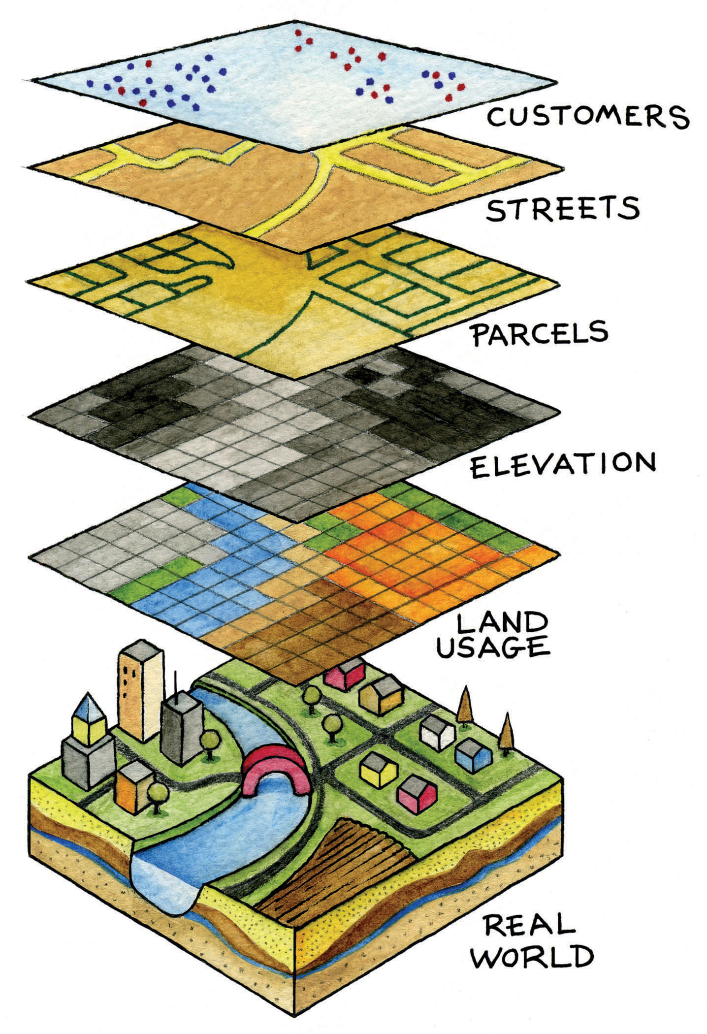
Geospatial Data
Is any data with a geographic aspect that refers to a position on the earth: a house, building, landmark, etc.
Processed and analyzed by geographical tools
Ex: Remote Sensing, GPS, and GIS
Categorized as either vector or raster data
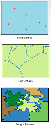
Vector data
Uses points, lines, and polygons.
Represents spatial features like cities, roads, and streams.
Raster data
Made up of grid cells and pixels. Each pixel has a value.
Shows elevation, satellite images, or paper maps
Uses of Geospatial Data
Businesses incorporate geospatial data into their analysis reporting, and forecasting to exceed competitors through smarter use of their data.
Governments use geospatial data from censuses to show who people are, where they live, and to draw out congressional and state legislative districts.
Governments also use geographical tools like remote sensing, GIS, and GPS for satellite imagery
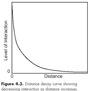
Distance Decay
The tapering off of a process, pattern, or event because of distance
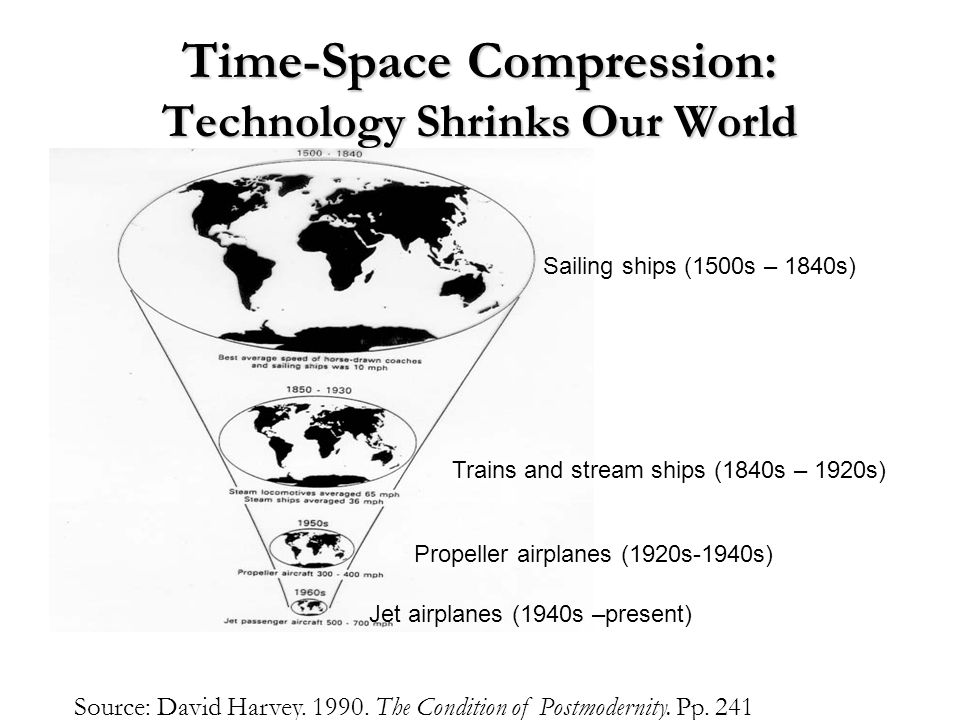
Time-Space Compression
The process of when advances in transportation and communication lessen the effect of distance
Place
Locality distinguished by specific physical and social characteristics
Places can be identified by their absolute or relative location as well as their site and situation
Contributes to the social, political, and economic functioning of our world
Absolute space
Refers to an area whose dimensions can be precisely measured
Often compared to a container \
A formal cultural region is a good example of absolute space
Relative Space
Created and defined by human interactions
Can be represented by a network of linked nodes
Sustainability
Development that benefits the present generation without compromising natural resources and the environment in future generations
Crop rotation
Rotating different types of crops around a field each year
[Sustainable because]⤵
No chemicals or pesticides
No fallow period (period where soil isn't used)
Land use
Changing the natural environment to make a more advanced environment made up of settlements, buildings, fields, etc.
Five types of land use
Recreational (sports fields, playgrounds)
Transportation (highways, railroads)
Residential (housing)
Determinism
The view that natural factors solely control the development of human qualities
[Basic Concept]⤵
How humans think, behave, and act is determined by the natural climate they are in
Criticisms of Determinism
Cultures could say they are superior to others, based only on the climate that they live in
It was a very simple, cause-and-effect relationship, and other nonenvironmental factors also diversify us
Similar climate settings have been proven not to produce the same cultures or behaviors
Possibilism
The view that people, instead of bowing to the conditions of the environment they live in, use their creativity to adapt, respond and overcome them
[Basic Concept]
Humans have choices and their decision-making is the main factor in determining their success
The natural environment is still a factor that develops human culture and can make success more or less challenging
Scale
The relationship of the size of a map to the amount of area it represents on the earth
Large scale
Shows less area in greater detail
Small scale
Shows larger area in less detail
Scale of analysis
The level at which the data is displayed.
Global Scale
Shows the world at one level of data
Ex: World
This level of analysis is usually not that useful
(Small Scale)
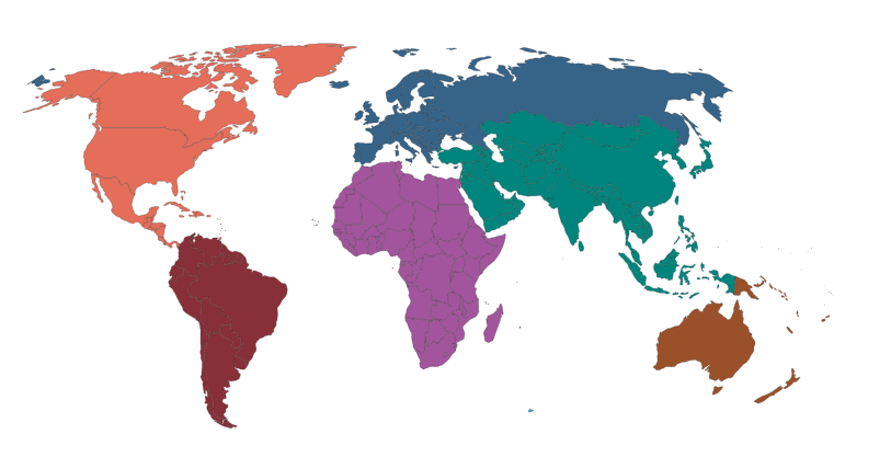
Regional Scale
Shows data by continents or world regions
Ex: In this map Australia has the highest GDP per capita (PPP)
(Small Scale)
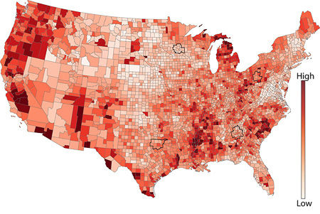
National Scale
Shows data for one or more countries
Ex: In this map India has a high population density
(Large Scale)
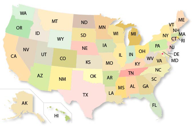
Local Scale
Shows subnational data
Ex: the states within the United States (could also show even more localized like counties, zip codes)
(Large Scale)
Formal Region
Region described by having unifying cultural or physical characteristics
Traits that can characterize a formal region: o Religion o Language o Political Boundaries o Ethnicity
Functional Region
Region defined by a political, social, or economic characteristic. The area must also have a center of activity (a node), like a corporation, entity, or business that organizes the activity.
Perceptual Region (Vernacular Region)
Region characterized by a population's sense of identity and attraction towards an area, and tend to have less defined boundaries. Boundaries are subject to individual interpretation