Unit 1: Thinking Geographically pt. 1
1/39
Earn XP
Description and Tags
How to understand and interpret geographic data
Name | Mastery | Learn | Test | Matching | Spaced | Call with Kai |
|---|
No analytics yet
Send a link to your students to track their progress
40 Terms
Spatial Pattern
Where things are located on the earth
One significant tool to find spatial patterns?
Maps!!
Absolute Distance
An exact measure of the separation between two points, using a standard, such such as inches, feet, or miles
Relative Distance
A measure of social, cultural, or political differences or similarities between two locations (social class, richer or poorer difference)
Absolute Direction
Indicates North, South, East, and West
Relative Direction
Describes the location of one thing in relation to another
Clustered
They are close together
Dispersed
They are spread a part
Elevation
Measures the height of geographic features relative to sea level
A scale on a map
Explains how distance on a map relates to distance in the real world; Tells you how much smaller the map is than the real world - Often represented by a ration “1in:1000mi”
Large Scale Map
Focused on a particular feature and the details on the map are larger
Small Scale Map
Zoomed out to a national or global level, the details are smaller
Road Map
The locations of roads and highways
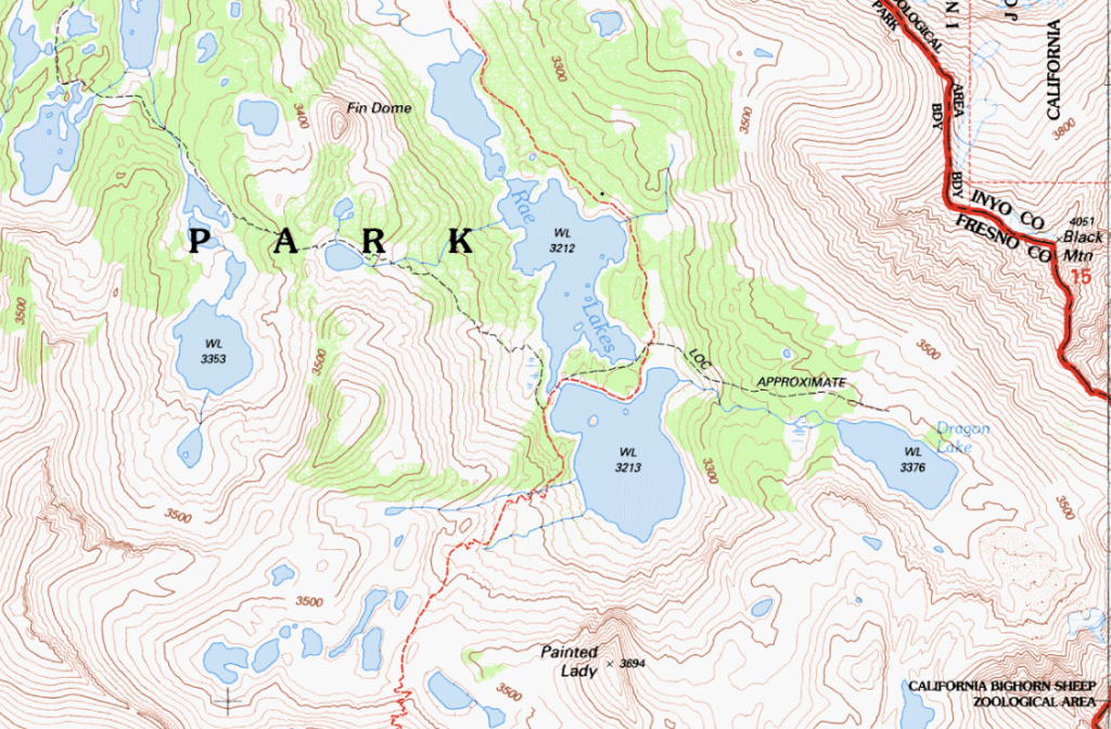
Topographical Map
Shows mountains and valleys - Depicts changes in elevation
Political Map
Shows the boundaries or provinces of states and countries
Reference Maps
Used to display geographic locations
Thematic Maps
Used to display geographic information
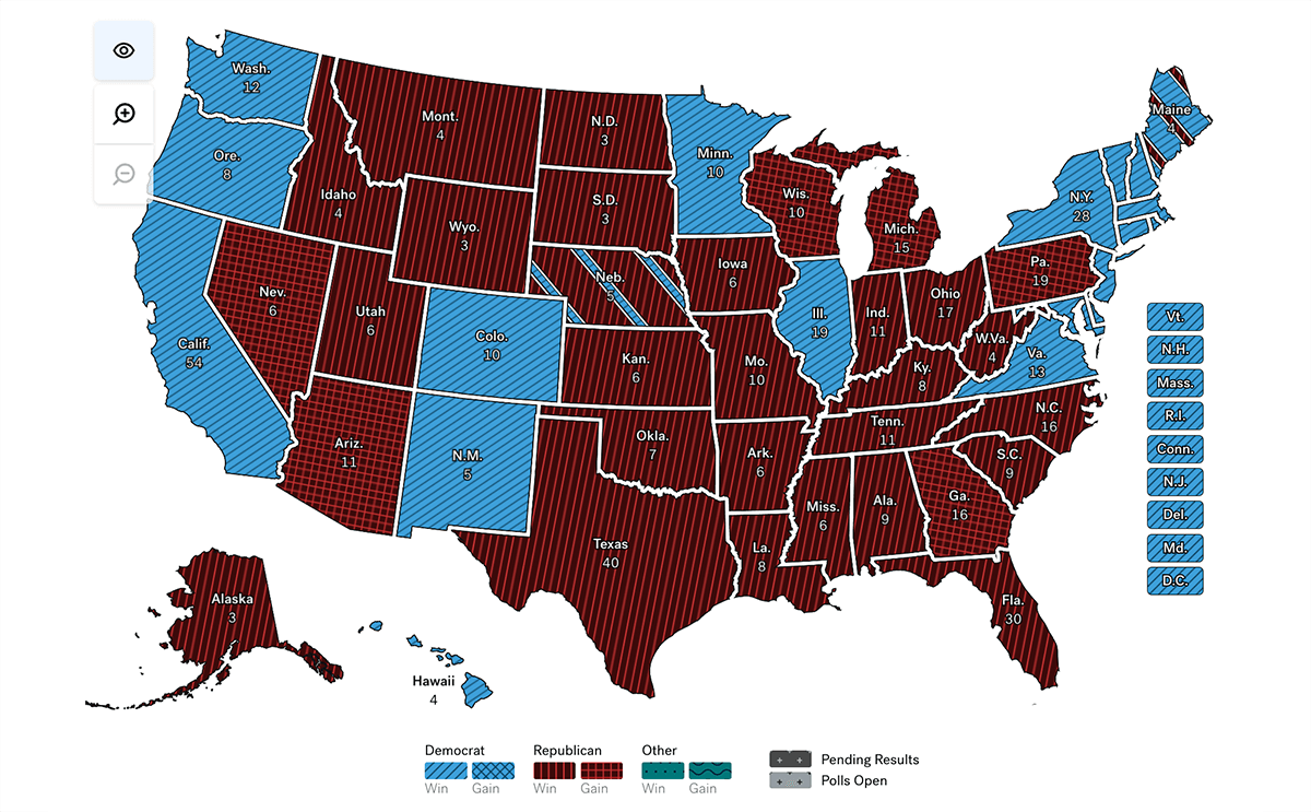
Choropleth Map
Visualizes data with different colors (Often used for presidential elections)
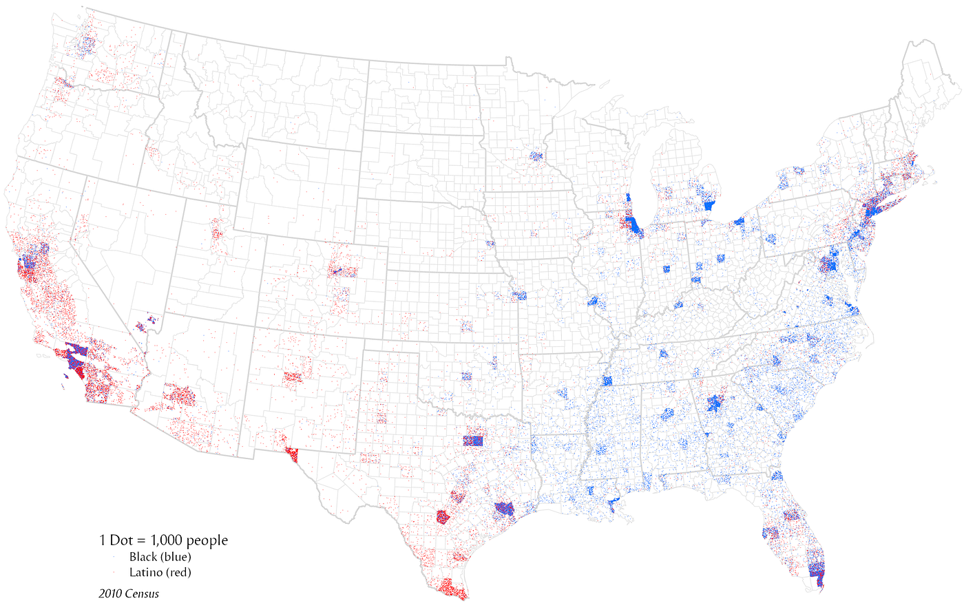
Dot Distribution Map
Uses dots to visualize the location of certain data points (Often used for census maps)
One-to-One Dot Distribution Map
One dot equals one unit of data
One-to-Many Dot Distribution Map
One dot represents a group
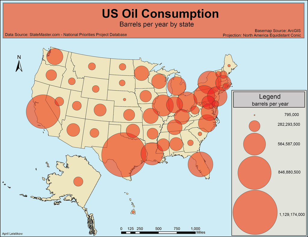
Graduated Symbol Map
Uses symbols to visualize data (Graduated = Smaller and Bigger)
Isoline Map
Uses line to depict data
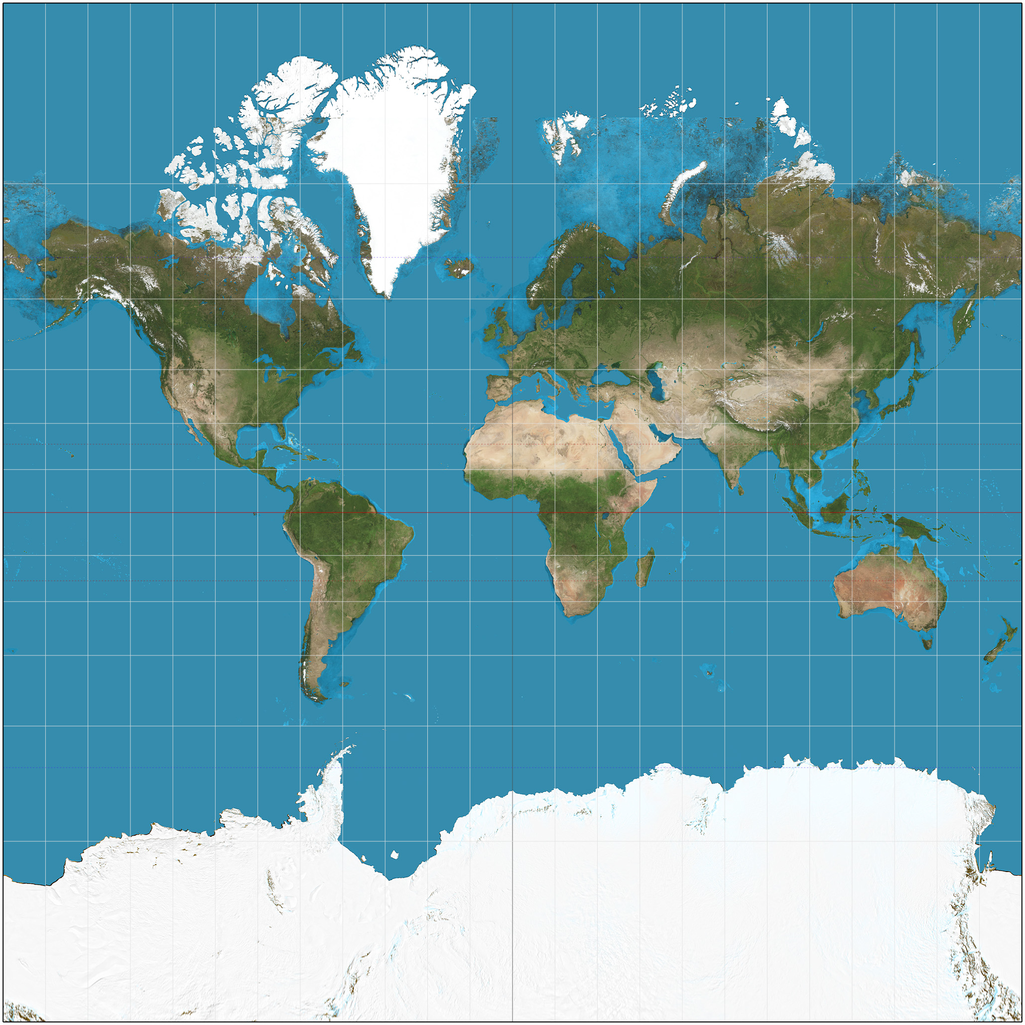
Mercator Map Projection
The standard for naval expedition because it preserves accurate shapes and directions, but it is notoriously inaccurate regarding the size of landmasses, particularly near the poles.
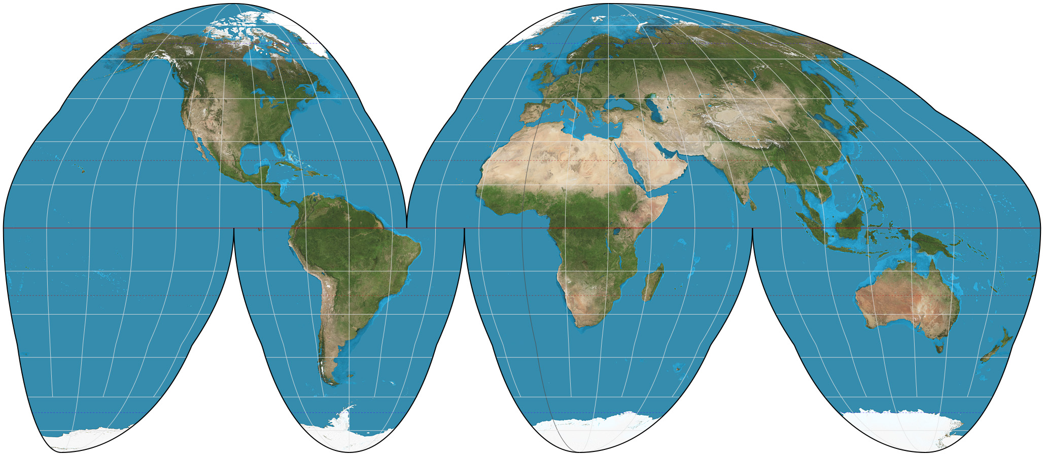
Goode Homolosine Projection
An equal-area (equivalent) projection. Shapes, directions, angles, and distances are generally distorted
Quantitative Data
Numbers based - “There are a hundred houses here.” “ Eight million people live there.”
Qualitative Data
Descriptive and language based “This community feels unsatisfied with the traffic in their area”
Geospatial technologies
Any technology that uses hardware or software to examine and measure geographical features on the earth
GIS
Geographic Information Systems
What is GIS
Software that can manipulate geospatial data that can be used for research or problem solving
GPS
Global Positioning system
What is GPS used for?
Finding locations
What is GIS used for?
Finding answers to research based problems
Remote Sensing
A method of data collection that gather info about geographic locations through satellite imagery - Further helping visualize population patterns and other geospatial information
Census Data Collection
Place of Residence
Race
Gender
Income
Absolute Location
The precise geographical coordinates of a particular place on the earth’s surface
Latitude Directions
West to East
Longitude Directions
North to South
Relative Location
Describing one place in reference to another, usually measured in distance or time