world geo quiz #1 pt 2
1/15
There's no tags or description
Looks like no tags are added yet.
Name | Mastery | Learn | Test | Matching | Spaced | Call with Kai |
|---|
No analytics yet
Send a link to your students to track their progress
16 Terms
______ is the science of making maps
cartography
A map's directional indicator
Displays the cardinal directions (north east south and West) and their immediate points
compass rose
Defines distance on a map
Map scale
Scale can be shown as:
_____ scale
_____ scale ( bar or line), or
____ scale
Written
Graphic
fractional
The horizontal imagery lines that give the location north or south of the equator
Latitude
The vertical imagery lines that give location east or West of the prime meridian
Longitude
A map legend shows any _____ or ______ on the map and what they mean (Could also show as a map key)
Symbols: colors
These show the topography or natural features of an area
include mountains valleys rivers and lakes
also known as topographic or elevation maps
Physical maps
Show human made:
features country borders local boundaries roads cities towns roads et cetera
countries to show political boundaries
Political map
Tell something specific about the area
show a specific topic theme or spatial distribution of an activity
also known as special purpose maps
Thematic map
one of the most common projections
Straightline and angles
heavy distortion in size at the top and bottom
Mercator projections
aims to minimize distortions
slightly more realistic
Robinson projection
also known as an interrupted projection
minimizes distortion
interrupted oceans makes measuring distance between continents difficult
Goodes’s Homolosine projections
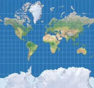
mercator projection
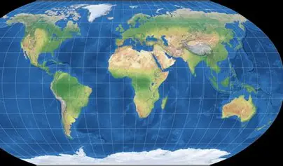
robinson projection
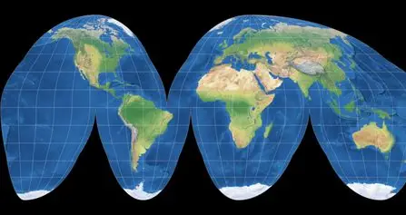
goode’s homolosine proj