APHG Unit 6 CED Vocabulary - Cities + Urban Land-Use
1/60
There's no tags or description
Looks like no tags are added yet.
Name | Mastery | Learn | Test | Matching | Spaced | Call with Kai |
|---|
No analytics yet
Send a link to your students to track their progress
61 Terms
urbanization
refers to the movement of people to towns/cities and the resulting expansion of the rural countryside
influences on urbanization
changes in transportation and communication, population growth, migration, economic development, and government policies
site
the actual physical qualities of the place that a city occupies which can influence origin, function, and growth, e.g. coastal plain, valley, mountains
situation
the relative location of a city (what is it near) which can influence origin, function, and growth, e.g. located near shipping routes (Hong Kong, Singapore)
megacity
a large city with over 10 million people and found increasingly in the periphery and semi-periphery
meta-city
a large city with over 20 million people and found increasingly in the periphery and semi-periphery
suburbanization
the transformation of large areas of rural land to urban uses
suburb
a residential area located on the periphery of a city
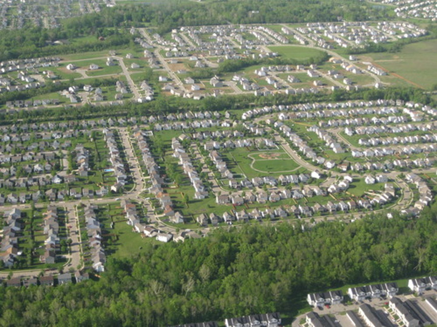
suburban sprawl
unrestricted suburban growth and development over large areas spreading out from a city in which cars provide primary source of transportation
edge city
a concentration of residential and economic (business, shopping, entertainment) activity located in the suburbs
exurb
a residential area beyond the suburbs, often in more rural areas
boomburb
residential and economic urban area that is not the largest city in their metropolitan area, but has a large population (100,000+) and tends to be spread along highways (e.g. Irvine, CA)
world city
city that functions as a service center of the world economy driving globalization at the top of the urban hierarchy (hamlet, village, town, city, world city), e.g. New York City, London, Tokyo
network
a system of interconnected people, goods, information, transportation, communication, finance
globalization
the process of increased interconnectedness among countries most notably in the areas of economics, politics, and culture
urban hierarchy
settlements ranked by population, number of services and sphere of influence, e.g. hamlet, village, town, city
rank-size rule
the idea that the population of a city or town will be inversely proportional to its rank in the urban hierarchy if the largest city in a country contained 1 million citizens then the - 2nd largest city would contain 500,00 (1 million/2), 3rd largest city would contain 333,333 (1 million/3), 4th largest city would contain 250,000 (1 million/4), etc.
primate city
a country's largest city, at least twice as large as the next largest city and more than twice as significant (usually the capital city) and represents national culture, e.g. Paris, France and London, England
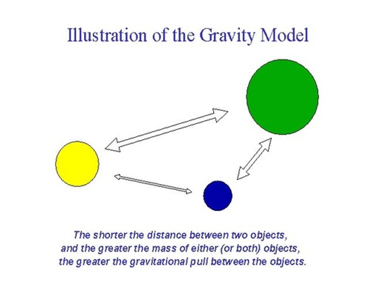
gravity model
a measure of the interaction of places used to predict the movement of people
Christaller's Central Place Theory
(early 1933) explains the distribution, size, location, and interaction of settlements in an urban system, settlements provide a set of goods and services to their hinterland, which is the surrounding market area, larger settlements are fewer and farther apart and serve a large market area, providing low order goods as well as high-order goods, smaller centers serve smaller market areas generally providing low order goods, low-order goods include products that are replenished frequently such as food and other routine household items, high-order goods include specialized items such as cars, furniture, fine jewelry, and household appliances that are bought less often
threshold
the minimum number of people needed for a business to prosper
range
the maximum distance people will travel to purchase goods and services
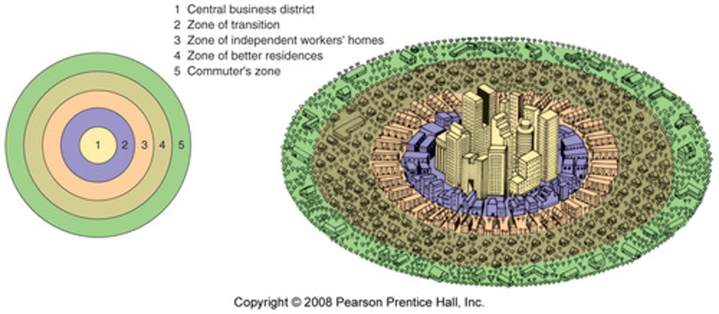
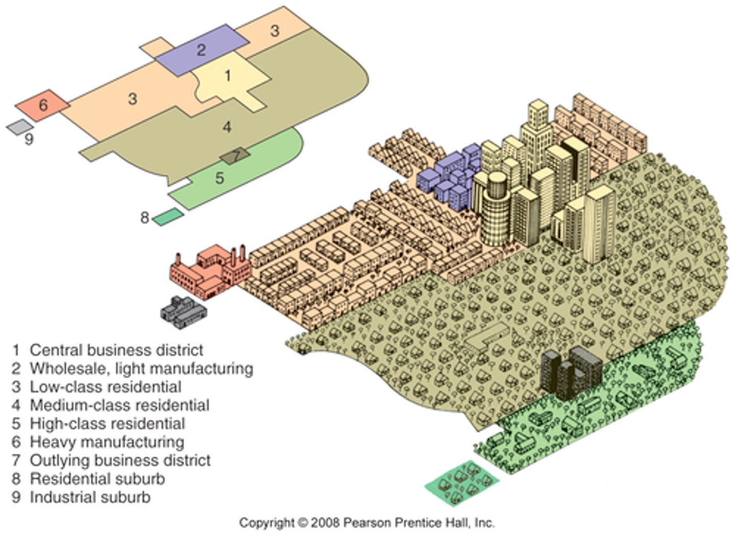
Burgess Concentric Zone Model
a spatial model of the American city that suggests the existence of five concentric rings around a CBD (Central Business District)
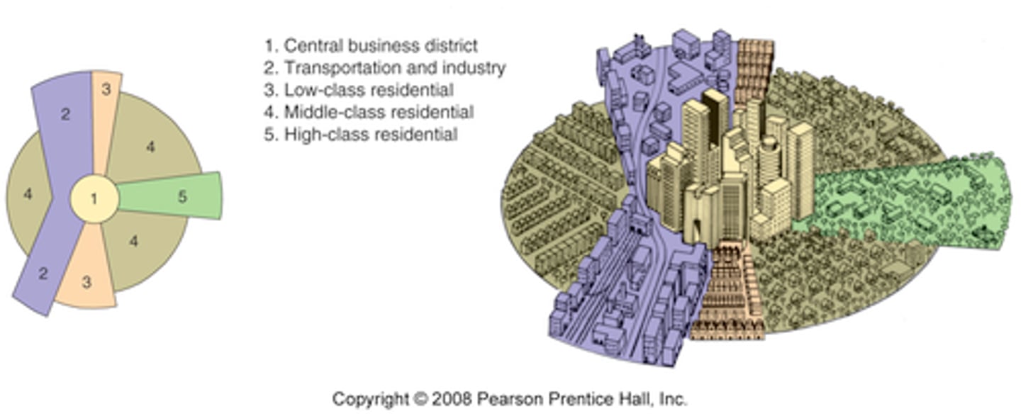
Hoyt Sector Model
a spatial model of the American city that suggests that land-use areas conform to a wedge-shaped pattern focused on the downtown core (CBD)
Harris and Ullman Multiple Nuclei Model
a spatial model that shows the mid 20th century American city consisting of several land-use zones (nodes) arranged around a CBD (Central Business District)
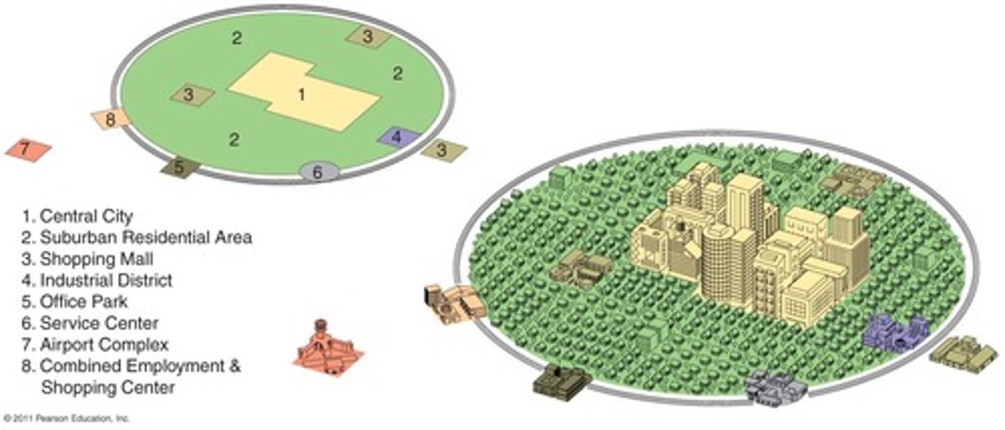
Galactic City Model (Peripheral Model)
a spatial model in which American urban areas consist of a central city surrounded by a large suburban area, shopping malls, office parks, industrial areas, and service complexes tied together by a beltway, or ring road
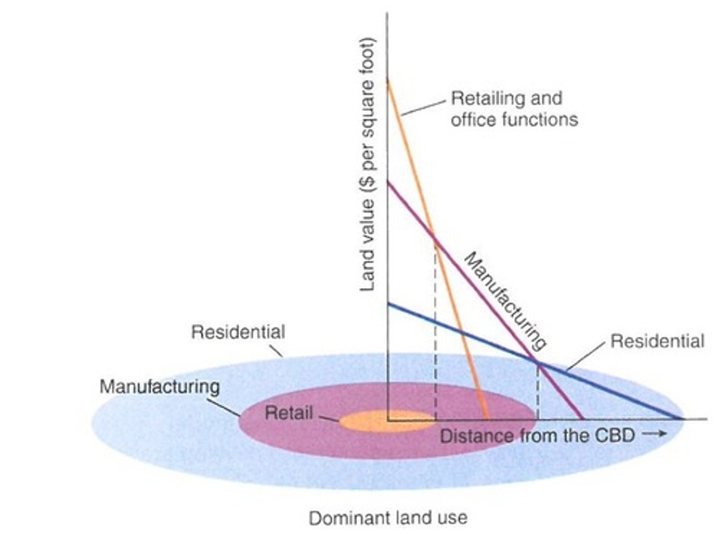
bid-rent theory
extension of the von Thünen model that implies that rent is equal to the value of the product minus production and transportation costs, shows what various land users are prepared and able to pay for access to the center market (CBD), the further from the center market (CBD), the lower the cost for a site, intensive and extensive farming practices are in part by land costs (bid-rent theory)
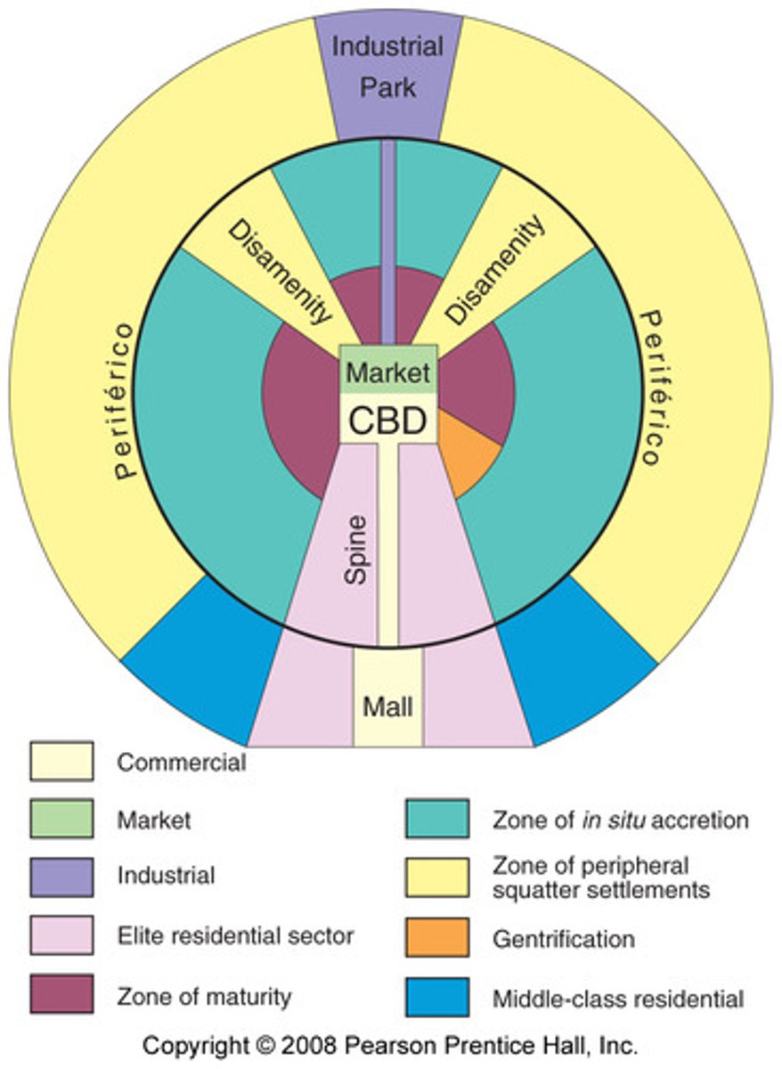
Latin American City Model
a spatial city model that includes a prestigious, commercial axis (spine) which emanates outward from the CBD and is surrounded by a peripheral area containing squatter settlements; the city structure can be attributed to colonialism, the rapid rise of industrialization, and rapid population increase
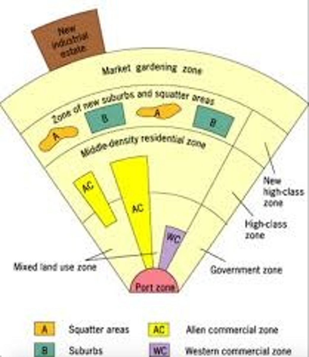
Southeast Asian City Model
a spatial city model that includes an old colonial port zone that is the focal point of the city reflecting a city oriented around exports, and radiating outward from the port zone are the Western commercial zone and Alien commercial zone
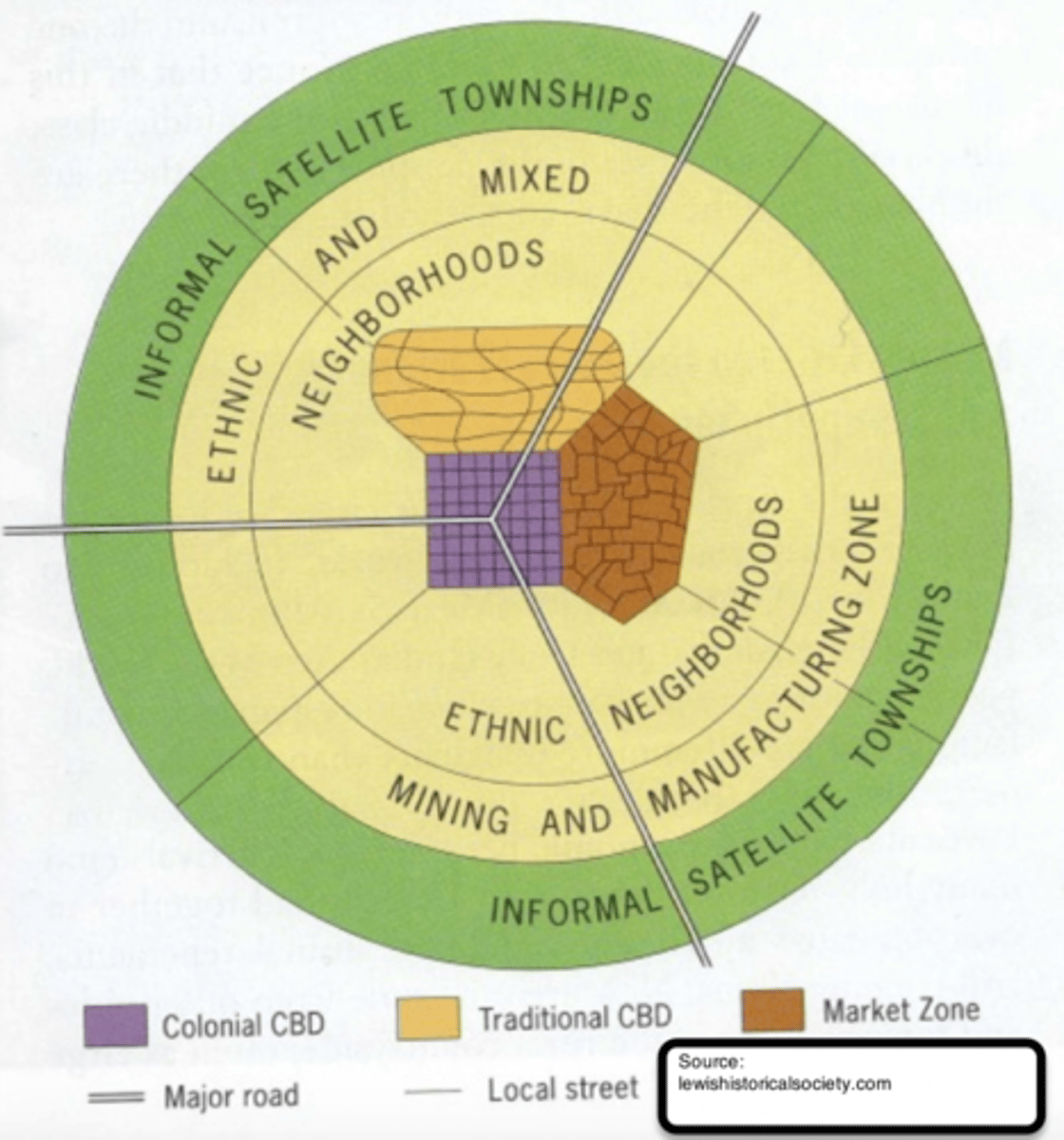
Sub-Saharan African City Model
a spatial city model that is difficult to formulate due to the imprint of European colonialism, but often consists of a colonial CBD as well as a traditional CBD, and a market zone that is surrounded by squatter settlements (informal satellite townships)
housing discrimination
discrimination in the purchase or rental of housing on the basis of race, gender, ethnicity, age, national origin, sexual orientation, gender identity, marital status, or veteran status
red-lining
a discriminatory real estate practice in North America in which members of minority groups are prevented from obtaining money to purchase homes or property in predominately white neighborhoods
blockbusting
a real estate technique used to encourage people to sell their property at a very low price by giving the impression that the neighborhood was changing for the worse, especially in reference to minorities moving in and led to a significant turnover in housing which benefited real estate agents and led to the "white flight" to the suburbs
affordable housing
residential units that are economical for the section of society whose income is below the median household income
access to services
measure of people's ability to pay for services without financial hardship (health services, infrastructure)
high crime rates
contributing factors include lack of job availability, less access to quality schools, and real or perceived lack of opportunity
environmental injustice
disproportionate exposure to communities of color and the poor to pollution and its effects on health and the environment; includes inadequate access to healthy food, inadequate transportation, unsafe neighborhoods with poor air and water quality
disamenity zone
area located within the city characterized by slums and the homeless and in extreme cases are controlled by gangs or drug lords
zones of abandonment
areas with lack of jobs, declining land values and falling demand that cause people to leave and businesses to close
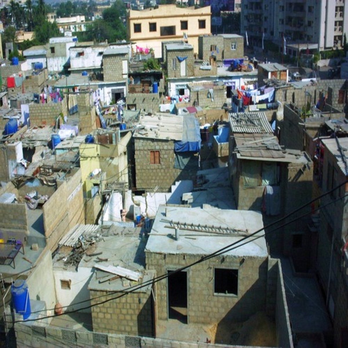
squatter settlements (slum/favela/barrio/shantytown)
residential areas characterized by extreme poverty with shelters constructed of found materials (scrap wood, etc.) that usually exist on land just outside of cities that is neither owned or rented by its occupants with little or no access to water, sewage, garbage removal, or education
land tenure
system regulating the rights to ownership and control and usage of land
inclusionary zoning
planning ordinances that provide affordable housing to people with low to moderate incomes
local food movements
food that is produced within a short distance of where it is consumed, often accompanied by a social structure and supply chain different from the large-scale supermarket system
urban renewal
the redevelopment of areas within an urban area, typically neighborhoods in economic decline
gentrification
the restoration of deteriorated urban areas by wealthier (mostly middle-income) people who move into, renovate, and restore housing and sometimes businesses
functional fragmentation of government
refers to the way governmental institutions are dispersed between many local agencies including state, county, city and neighborhood levels
urban sustainability
the idea that a city can meet the needs of the present without compromising the ability of future generations to meet theirs in terms of economic, environmental and social impact
low density housing
land use pattern meant for a small number of residential homes that include a lot of open space and contain the fewest people per geographic unit
medium density housing
land use pattern in which residential units include multi-unit housing, such as townhomes as well as single-unit housing
high density housing
land use pattern in which land is occupied by residential units that include multi-unit housing such as high-rise buildings and contain the highest people per geographic unit
sustainable development
meeting human development goals while sustaining the natural systems that provide the natural resources upon which the economy and society depend
zoning
classifying land and identifying the types of activities that are permitted, e.g. residential, industrial, commercial, agricultural
mixed land use
land development that blends a combination of residential, commercial, cultural, institutional and/or industrial uses
walkability
a measure of how friendly an urban area is to walking
transportation-oriented development
land use pattern that includes a mix of commercial, residential, office and entertainment space centered around or located near public transport; dense, walkable, mixed use development near transit that attracts people to connect communities
smart growth policies
urban planning that avoids urban sprawl and focuses on long term implications with sustainable design initiatives and guides development into more convenient patterns and into areas where infrastructure allows growth to be sustained over the long term
new urbanism
smart growth policy that creates walk-able, mixed land use neighborhoods with commercial and residential areas
green belt
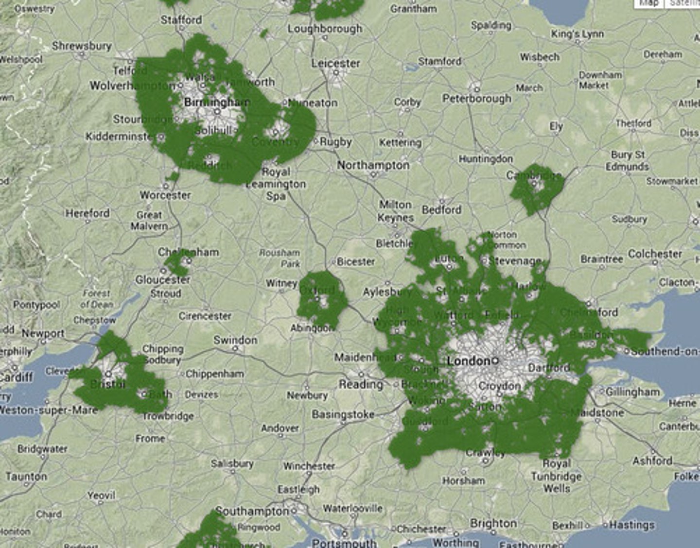
an area of natural land on which building is restricted and whose main purpose is to curb the outward expansion of a large urban area , e.g. London
slow growth cities
smart growth policies that concentrate growth in walkable urban centers to decrease sprawl
quantitative data (cities)
census and survey data provide information about changes in population composition and size
qualitative data (cities)
field studies and narratives provide information about individual attitudes toward urban change