Looks like no one added any tags here yet for you.
water vapor, carbon dioxide, ozone
variable gases in the atmosphere
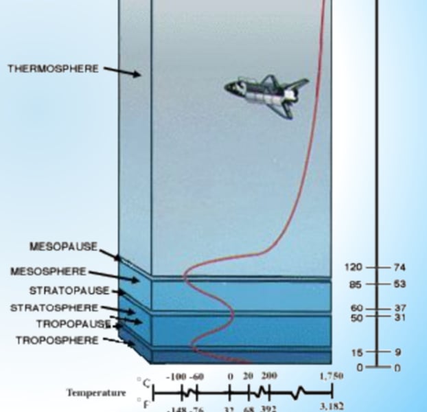
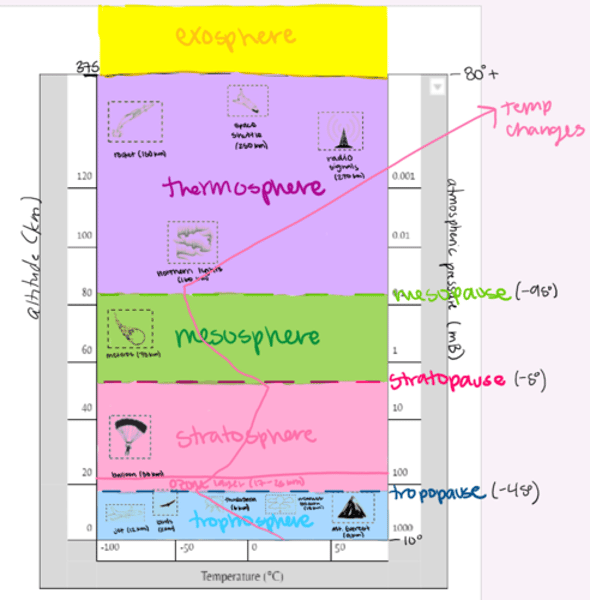
troposphere, stratosphere, mesosphere, thermosphere, exosphere
List the layers of the atmosphere from lowest to highest
temperature
the layers of the atmosphere are arranged according to ____
pauses
the ____ in the layers are the transition zones between temperature changes
troposphere, stratosphere, thermosphere
all weather occurs in the ____, the ozone layer is in the ____, and glowing gases (auroras/northern lights) occur in the ____
teacher says memorize this early
what phrase can you use to memorize the layers of the atmosphere?
thermosphere
temperature _____ in the thermosphere because of high energy UV and X-ray radiation is absorbed (closer to sun), but it feels cold because the molecules are so sparse and far apart
decreases
temperature ____ in the mesopause because air becomes thinner again
increases
temperature ____ in the stratopause because of the ozone layer, which traps heat
decreases
temperature ____ in the tropopause because the air becomes thinner (molecules are farther apart)
troposphere
birds, personal jets, thunderstorms, weather balloons, and Mt. Everest are in the _____
stratosphere
Baumgartner's balloon and the ozone layer are in the ____
mesosphere
meteors burning up are in the ____
thermosphere
rockets, space shuttles, radio signals, and the northern lights are in the ____
100
space begins at ____km
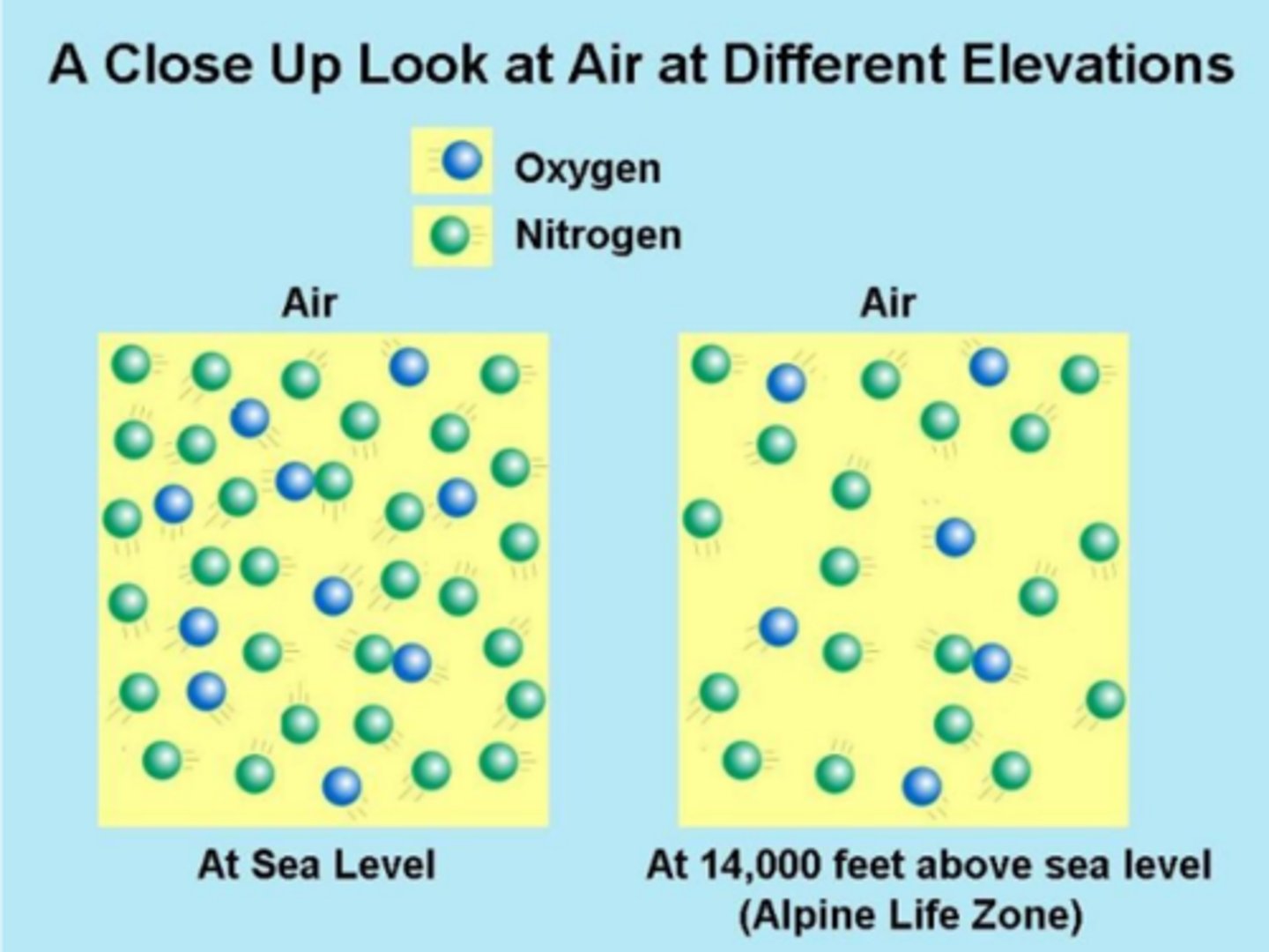
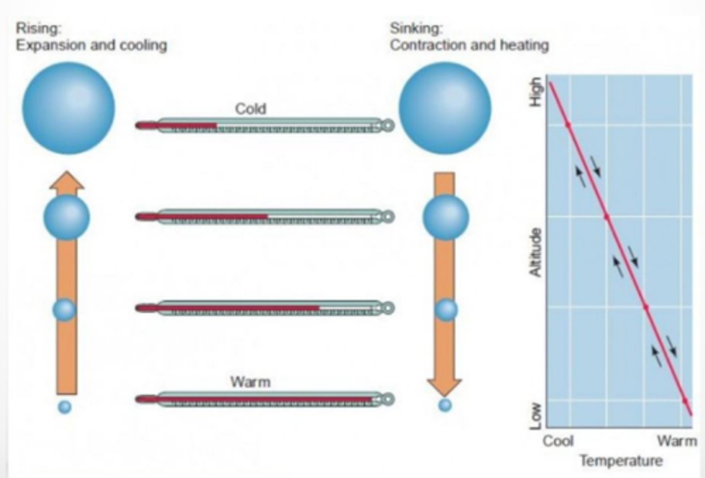
air density
determines air circulation pattern, less air dense = warmer air rises
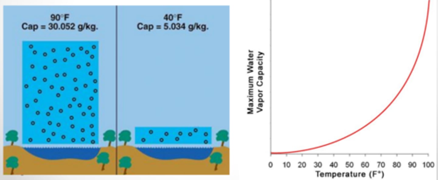
water vapor capacity
determines air circulation pattern, warm air has a higher ____ ____ ____ (humidity) and saturation point
adiabatic heating/cooling
determines air circulation pattern, response to change in pressure, air rises = low pressure = volume expands = cooler (molecules spread out = not as many collisions)
latent heat release
determines air circulation pattern, release of energy as heat when water vapor condenses into precipitation (clouds)
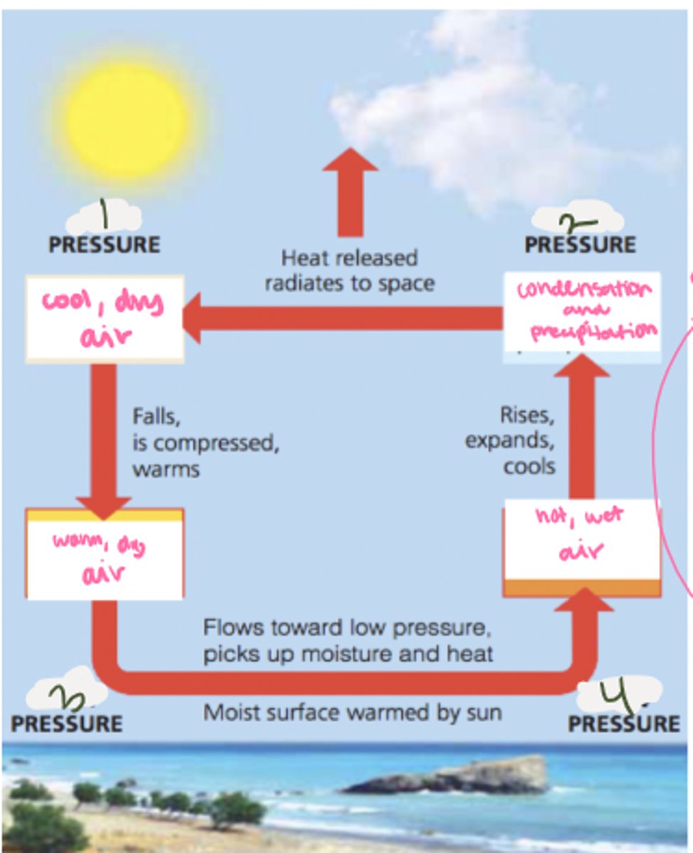
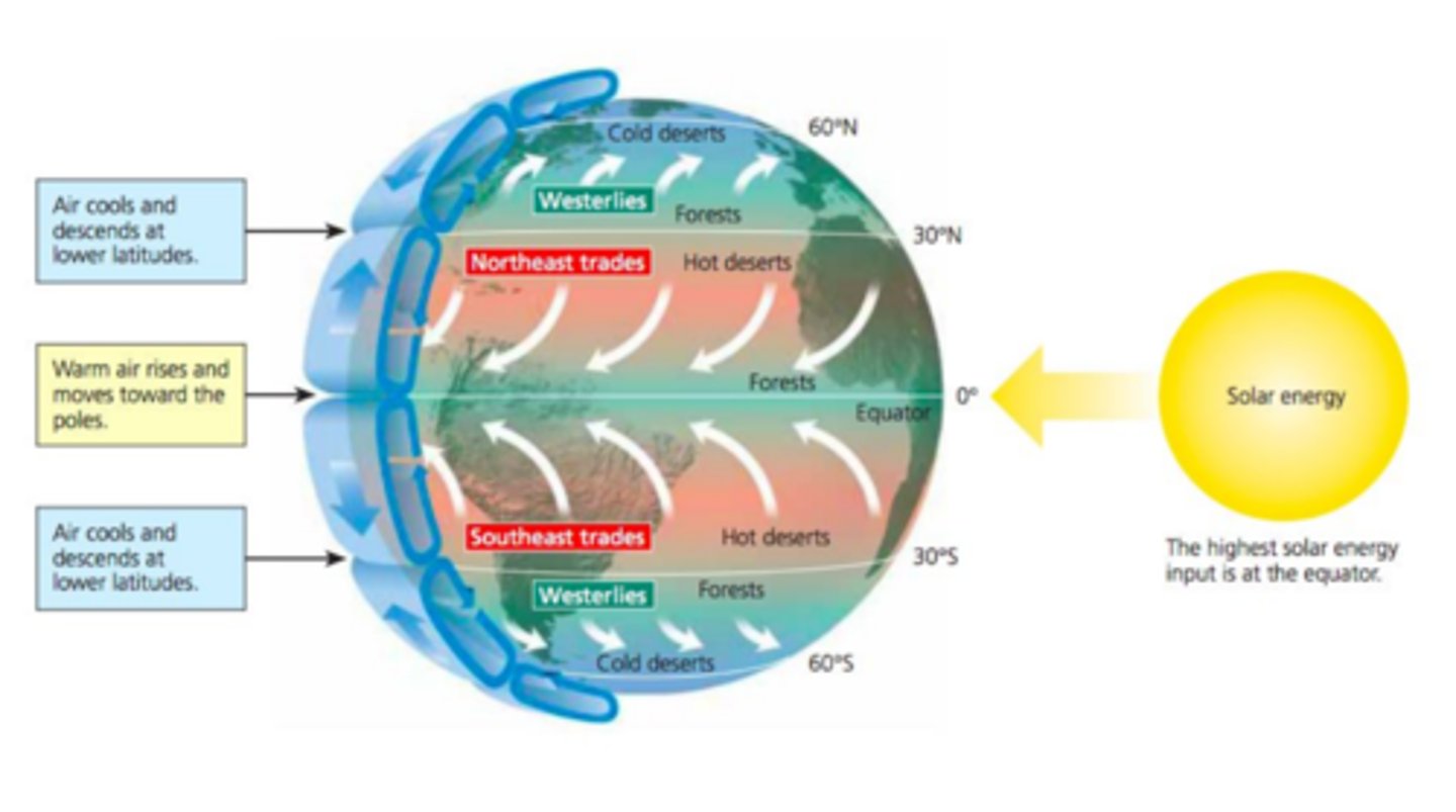
low, high, high, low
fill in the blanks
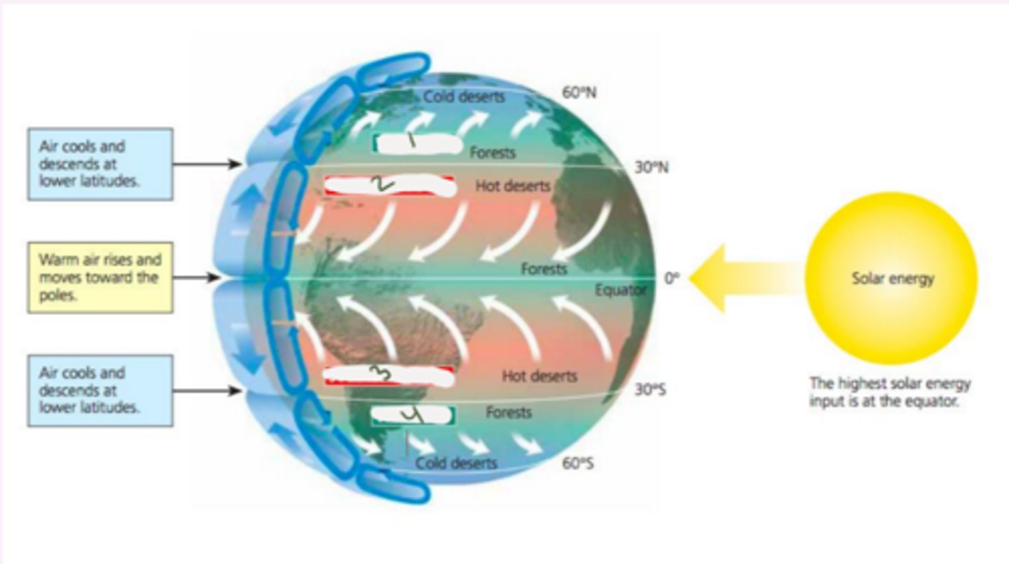
westerlies, northeast trades, southeast trades, westerlies
label the winds
westerlies, trades
air cools and descend at lower latitudes between the ____ and northeast/southeast ____
northeast, southeast
warm air rises and moves toward the poles between the _____ trades and the _____ trades
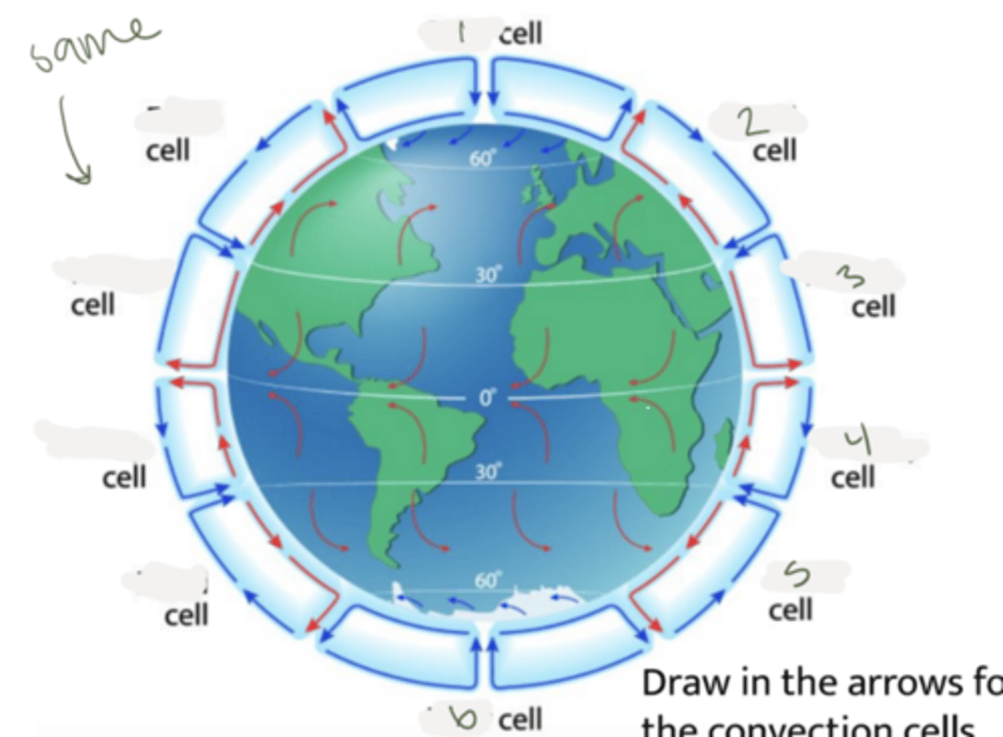
polar, ferrel, hadley, hadley, ferrel, polar
label the cells
pressure, precipitation, coriolos effect, opposite
wind goes from high to low ____ always, in the equator, warm air rises, which means more ____, curves of the wind are caused by the ____ _____, wind moves in the _____ direction of its name
location
global wind patterns determine the ____ of climates and biomes
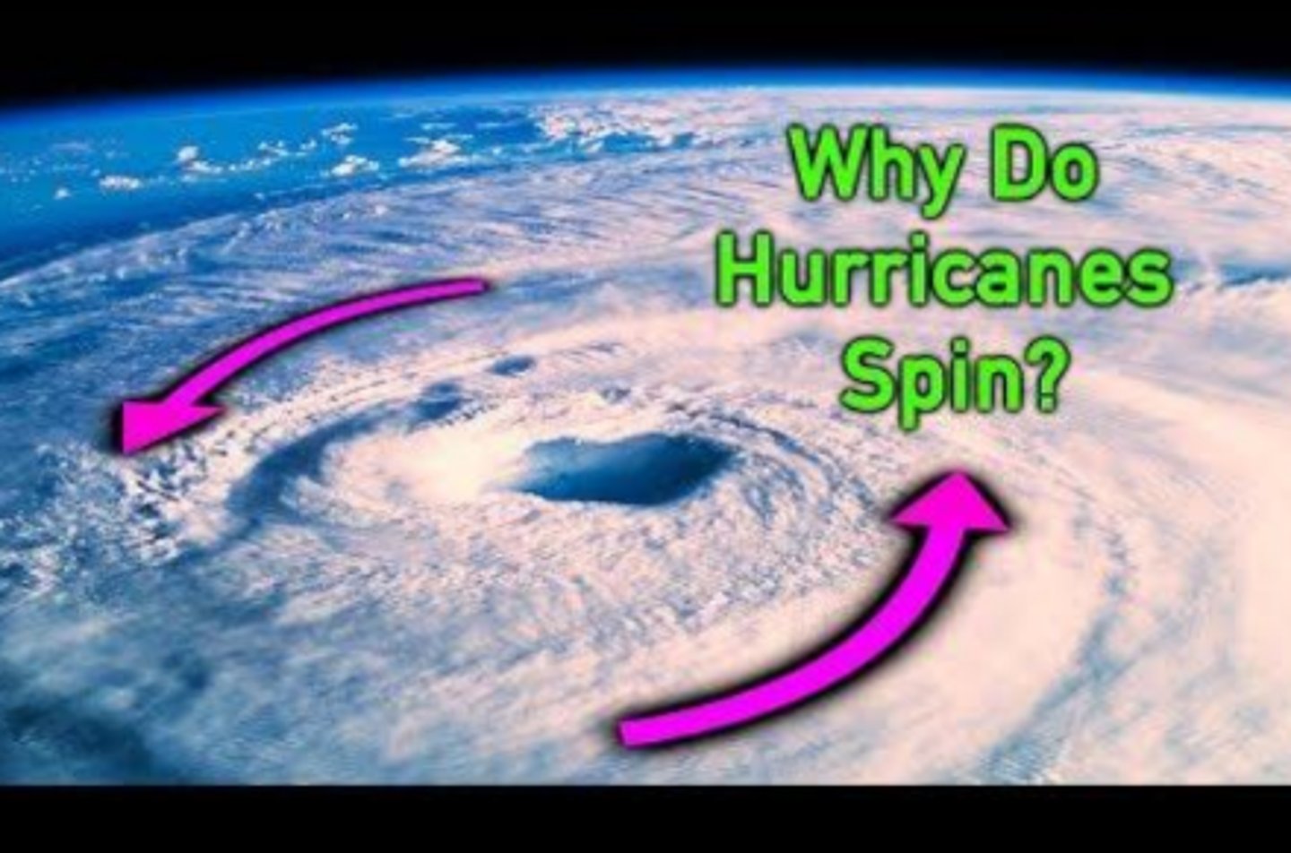
Coriolis effect
the deflection of objects (wind, water) to the right of the Northern Hemisphere and to the left of the Southern Hemisphere, causes hurricanes to spin (air rushes into a low pressure region), not a real force, only a peprspective
high, low
___ pressure = denser air, less water vapor
___ pressure = thinner air, more water vapor
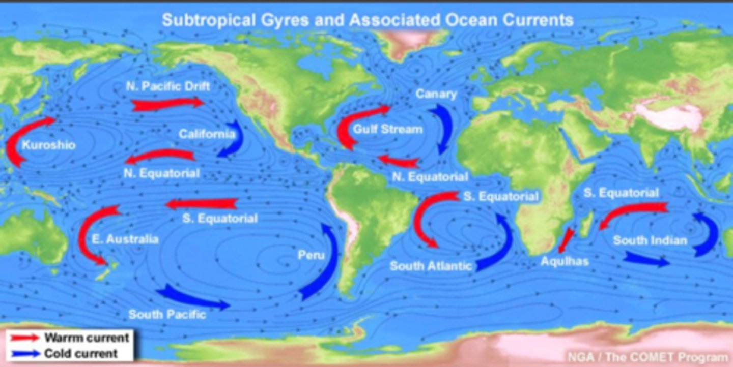
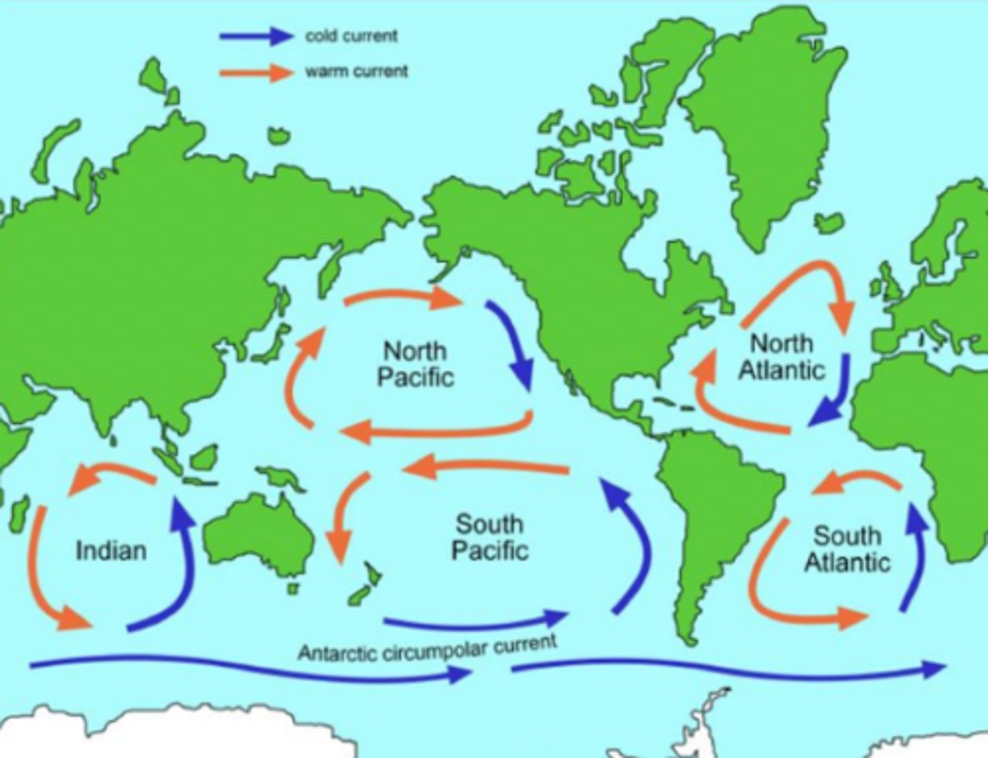
oceanic gyres
formed dur to rotation and wind patterns, massive, circular current systems, 5 major ones, impact temperature, salinity, nutrient distribution globally
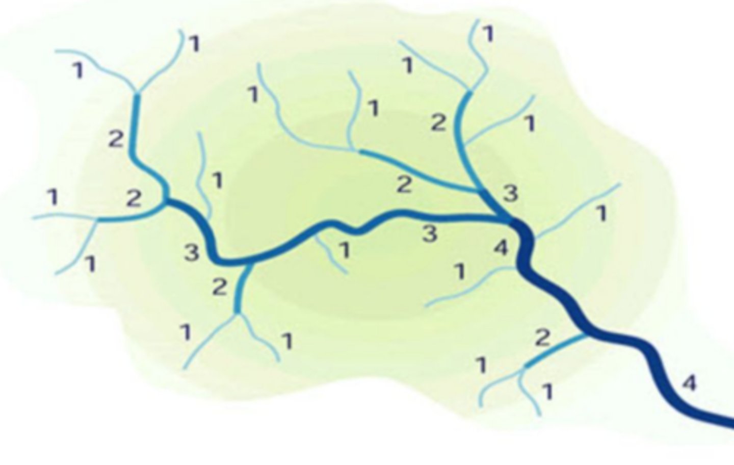
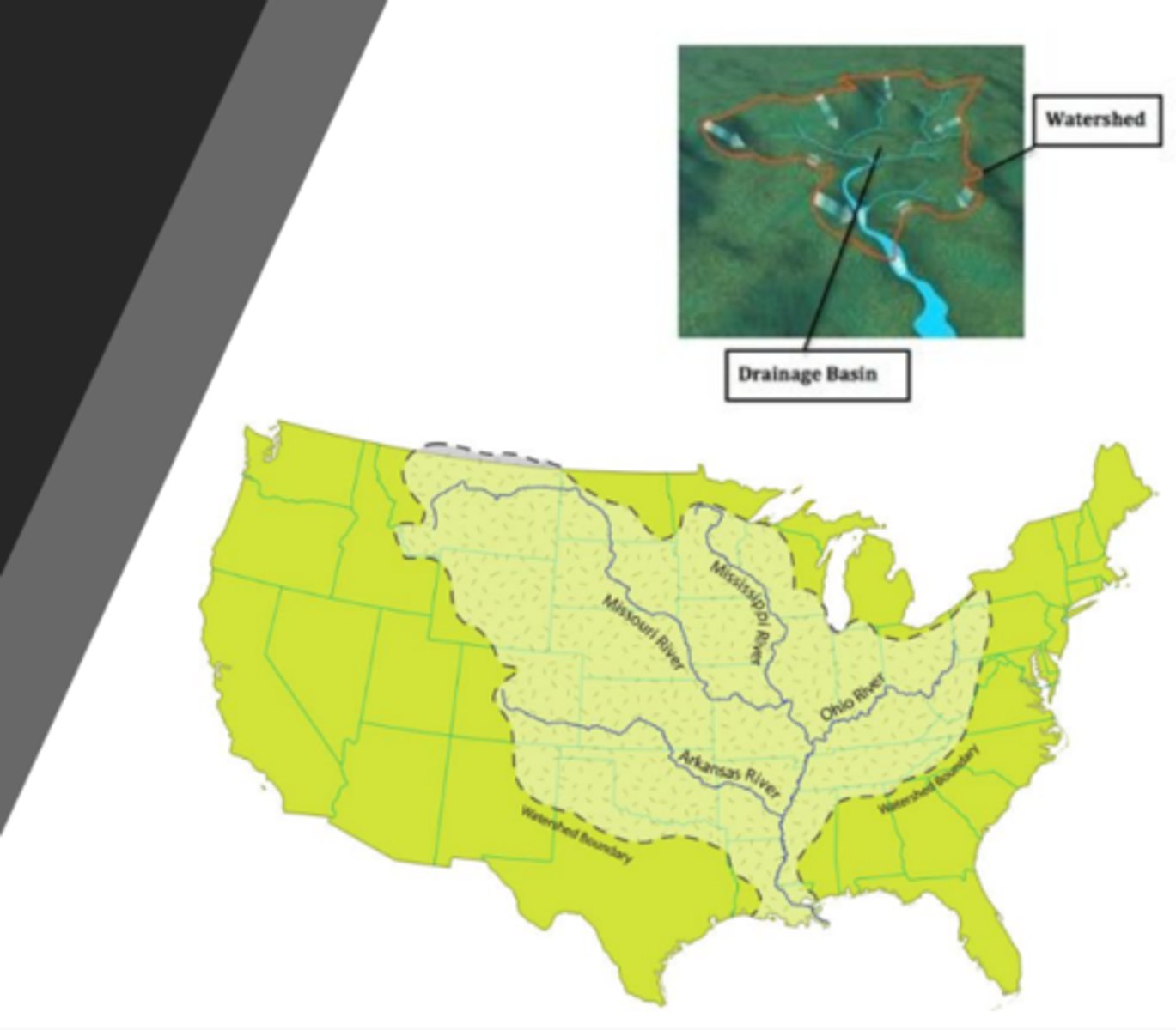
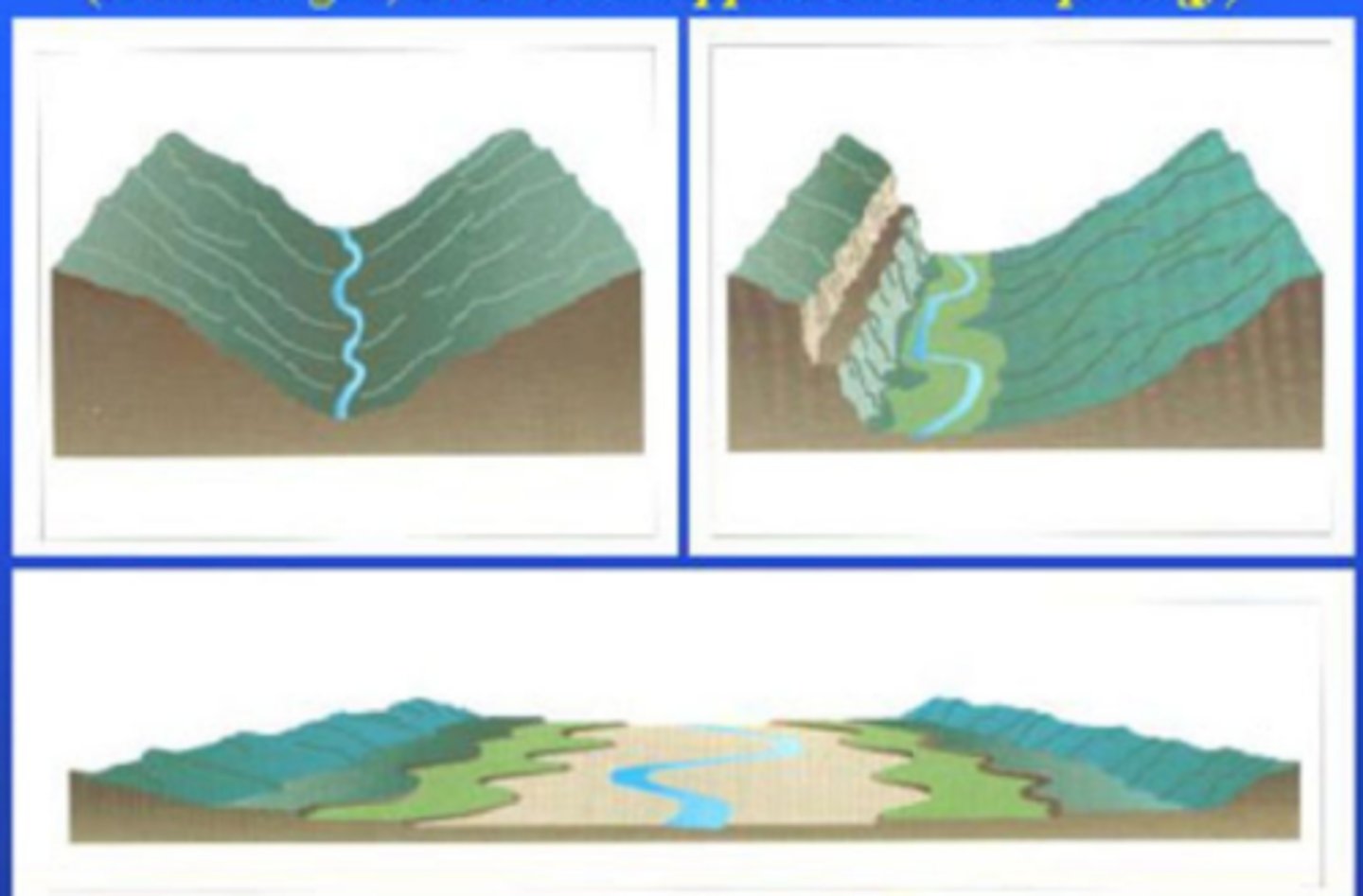
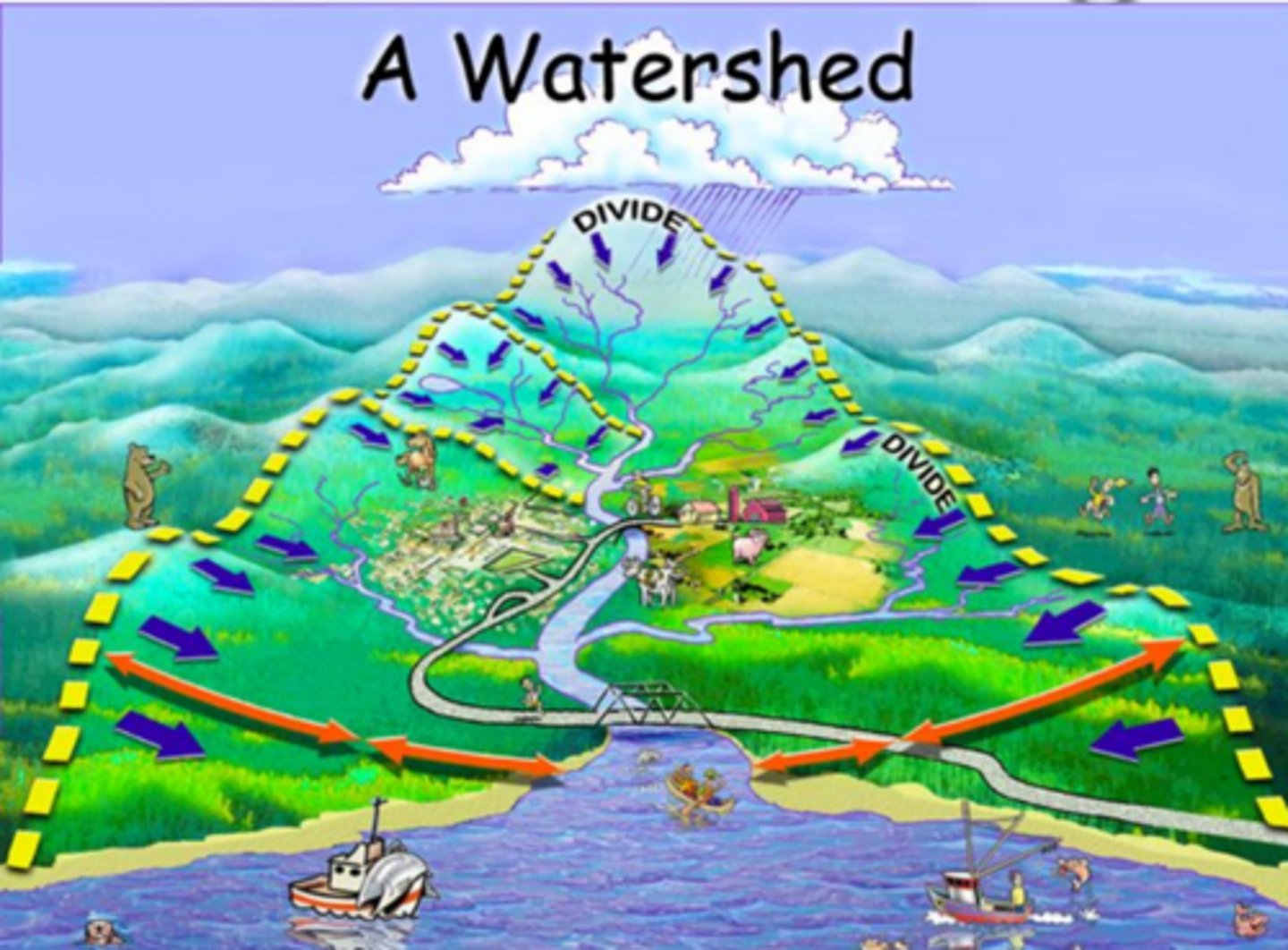
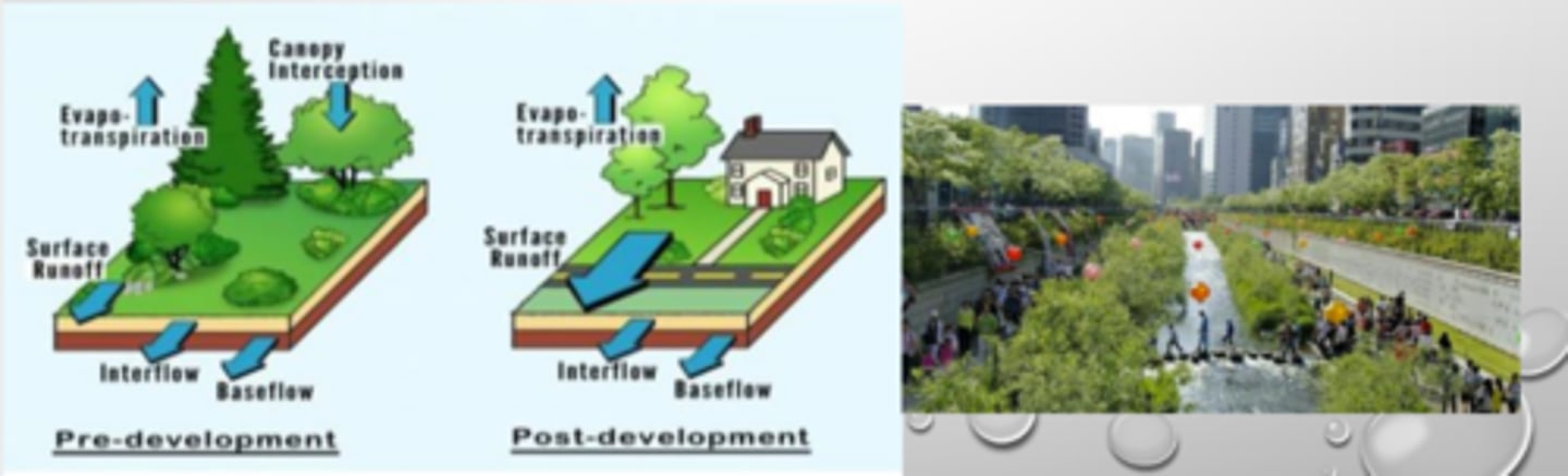
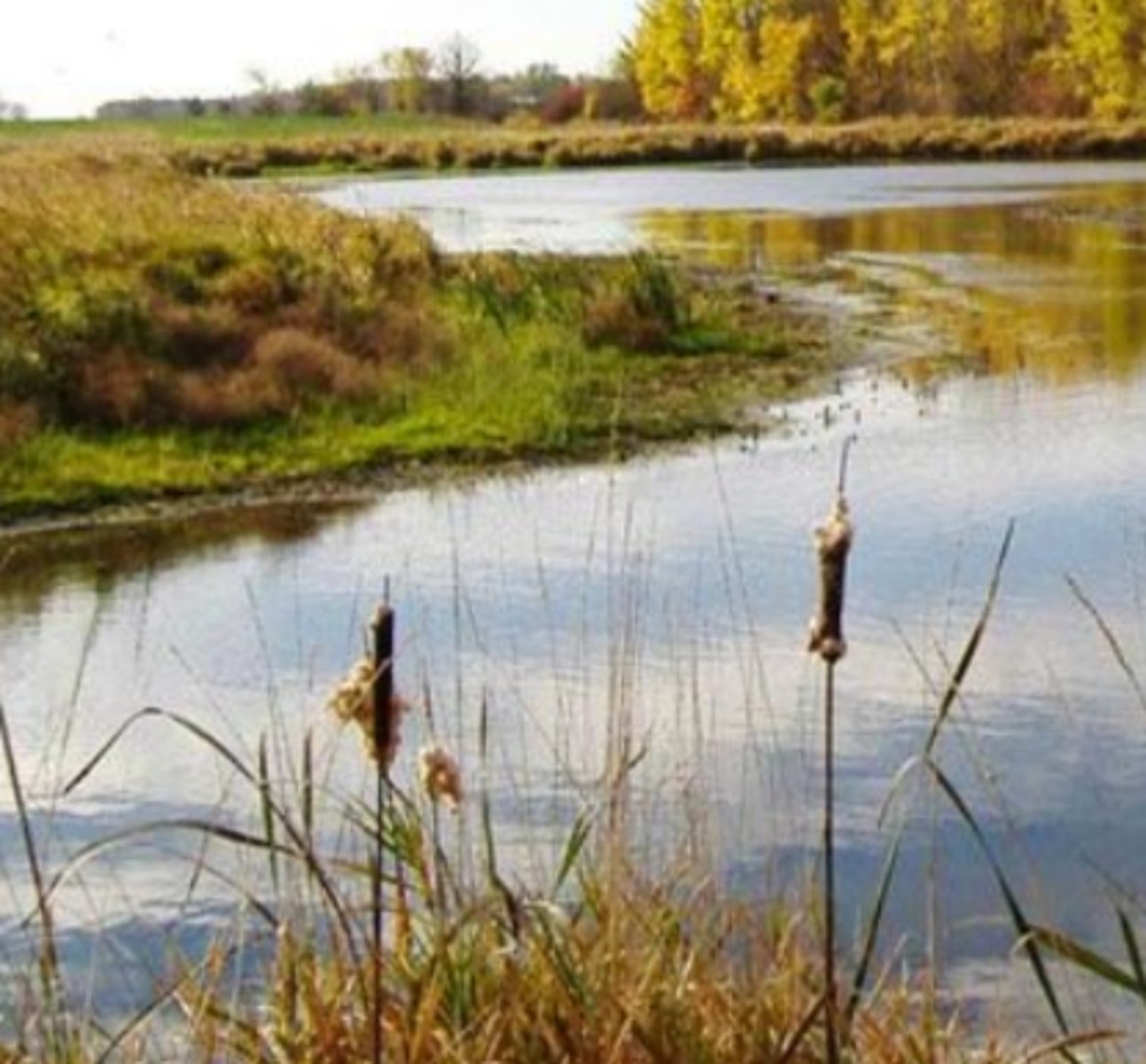
watershed
smaller streams lead to larger streams, which lead to larger streams, then to the main waterway
area
characteristic of watersheds, affects volume of water that can be generated from rainfall (drainage basin)
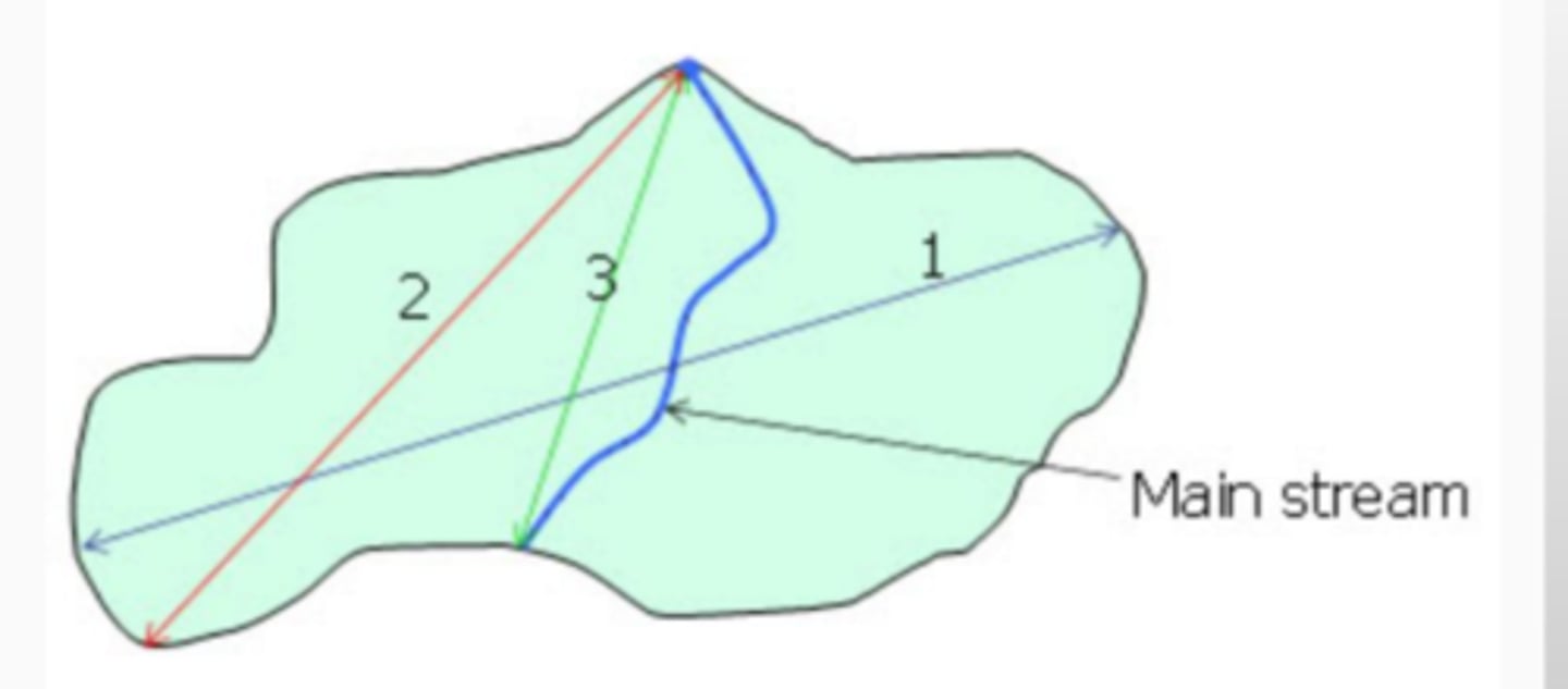
length
characteristic of watersheds, can be measured in different ways, generally considered the principal flowpath
slope
characteristic of watersheds, will affect momentum of runoff, velocity of overland flow, watershed erosion potential, and local wind systems
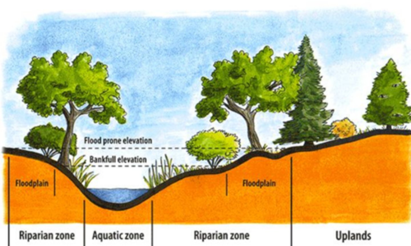
vegetation
characteristic of watersheds, adds organic matter to the soil, tree litter protects soils surface, roots prevent erosion, canopy keeps water cool to prevent thermal pollution and reduced force of rain and wind velocity, plant cover provides food and protection for organisms, riparian zone
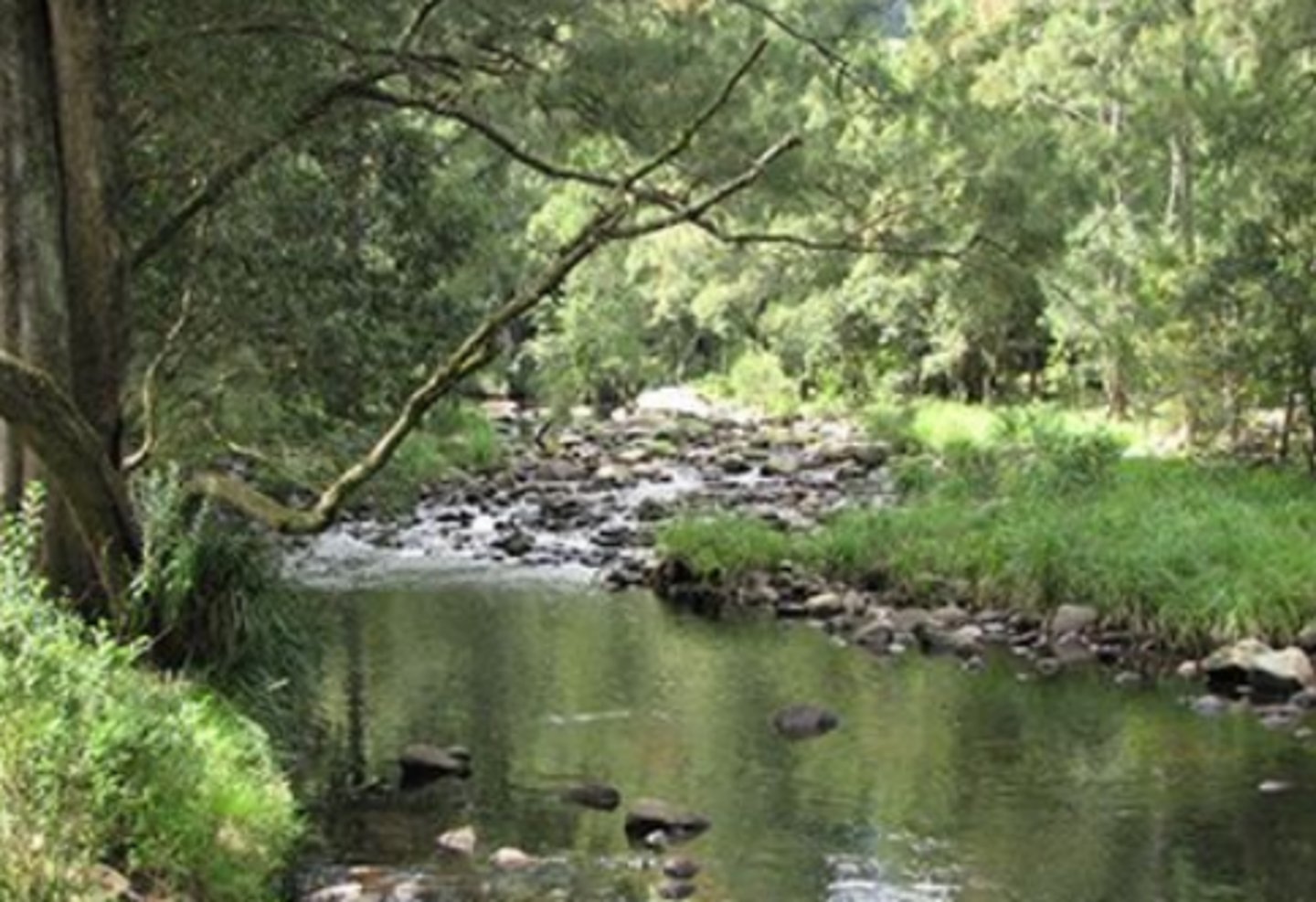
riparian zone
buffers waters from runoff (sediments, chemicals, nutrients)
divides
characteristic of watersheds, peaks and ridgelines with lines connecting highest points
agricultural
watershed classification, barren fields, compact soil, less infiltration, fewer streams, application of fertilizers and manure changes structure
urban
watershed classification, natural water flow pattern greatly altered, high runoff, vulnerable to flooding, fixed land use (precipitation changes all that matter(
moutainous
watershed classification, steep gradient, less porous soil (more rocky), less infiltration, high runoff, downstream areas vulnerable to flooding
forest
watershed classification, evapotranspiration dominant, high infiltration, little runoff
wetland
watershed classification, water is not a limiting factor, high rainfall, high runoff, dominant evaporation
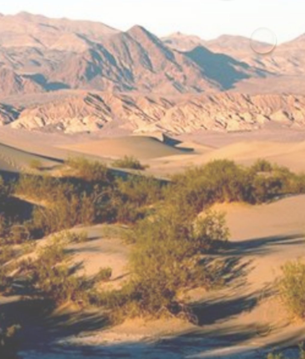
desert
watershed classification, sandy, porous soil, little rainfall, no stream development, limited groundwater recharge
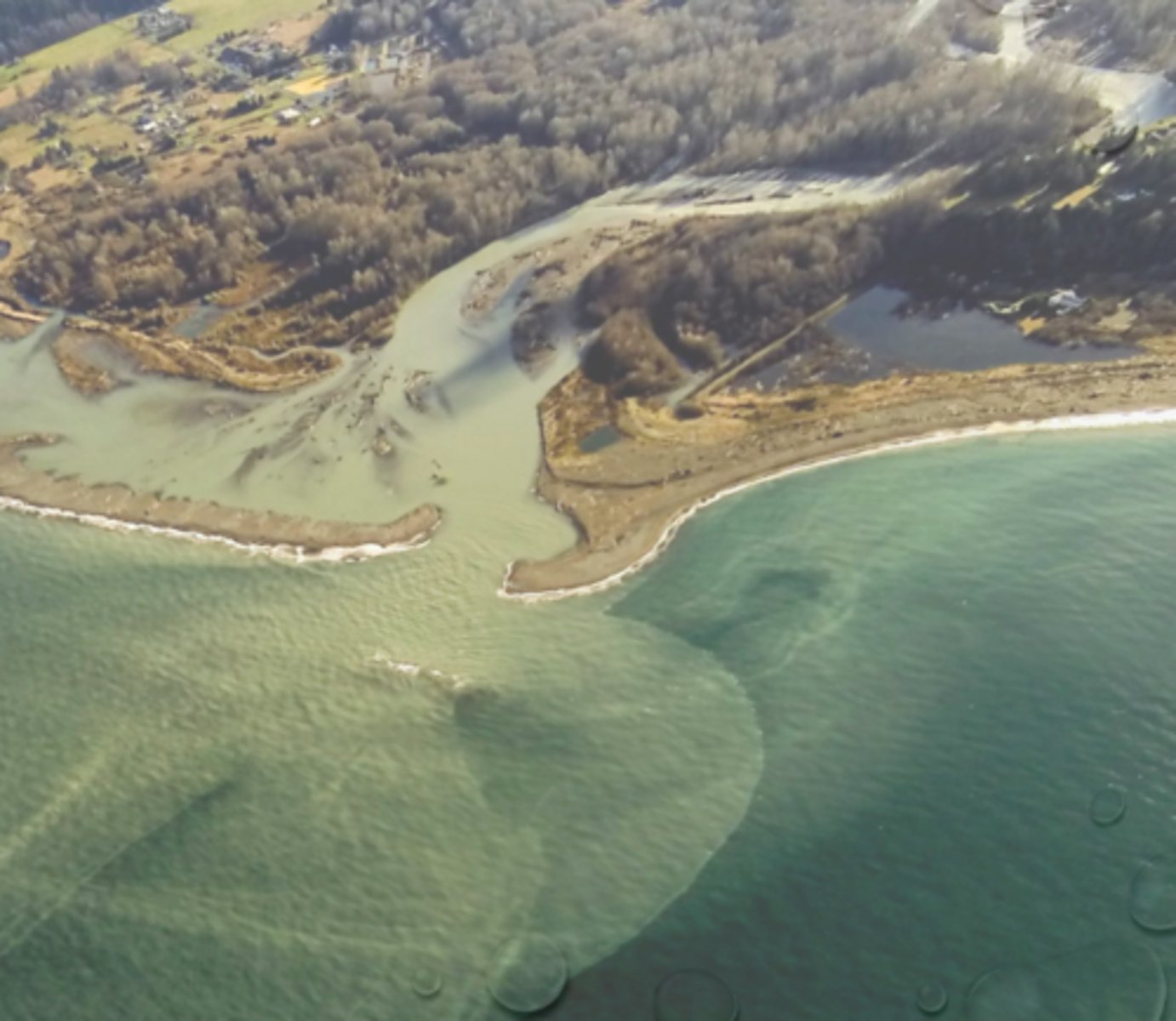
coastal
watershed classification, high rainfall, no channel control, local flooding, high water table, saltwater intrusion
upstream, downstream, fish migration
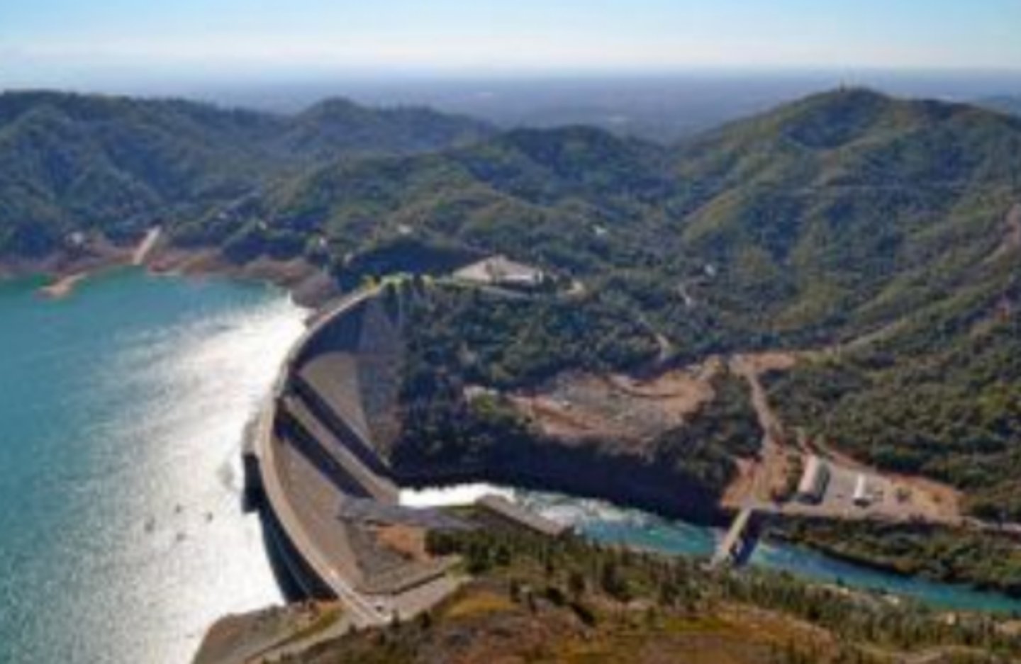
effects of dams on watersheds:
1. ____= flooding
2. ____= reduced water flow, less sediment, temperature changes affect growth of organisms
3. prevent ____ ____ (salmon canon)
fertile soil, flat terrain, transportation (close to rivers)
what 3 things make floodplains popular areas for human settlement?
land, quality
factors that need to be considered when building housing on a waterway: ___ use upstream and effects on water ____ downstream
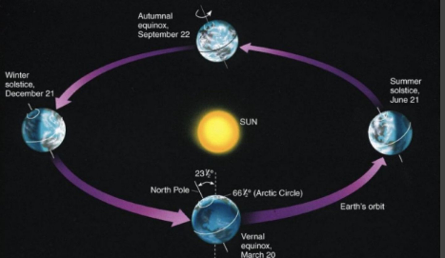
rotation, revolution, tilt of axis
3 ways the earth moves
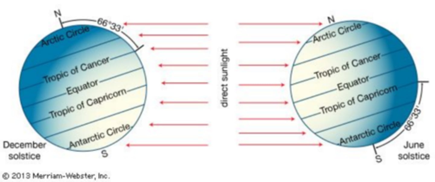
summer
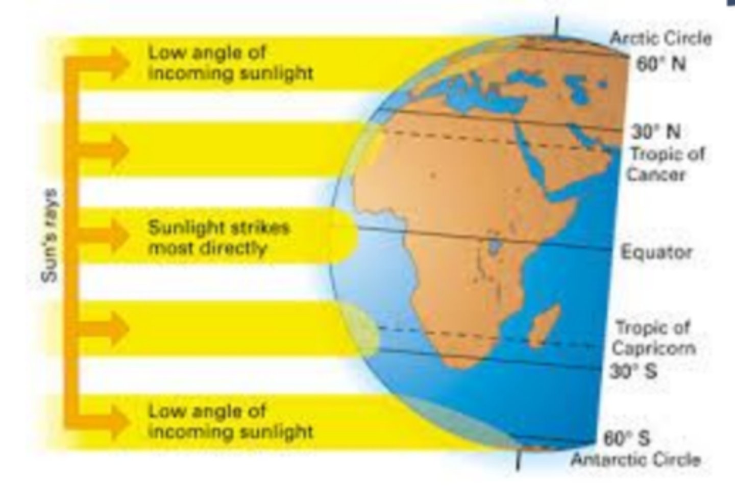
____ (period of greatest solar radiation) occurs in the Northern Hemisphere when the earth is tilted toward the sun, sun rises higher and stays above horizon longer, rays strike ground most directly (less of an angle)
winter
earth is closest to the sun in ____ (January) not summer (July)
tilt
seasons are caused by the ___ of the earth, NOT the distance from the sun
poles, equator
temperature is colder at the ____ because the sun barely hits them while it is warmer at the ____ because the sun hits it straight on
weather
the set of short-term atmospheric conditions, typically those occurring over hours or days, for a particular area
temperature, pressure, moisture content, precipitation, sunshine, cloud cover, and wind direction and speed
examples of short-term atmospheric conditions
climate
an area's general pattern of atmospheric or weather conditions measured over long periods of time ranging from decades to thousands of years
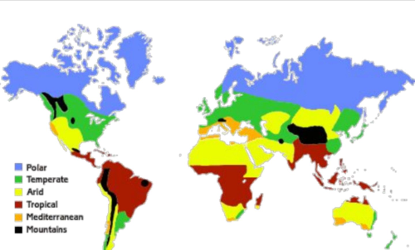
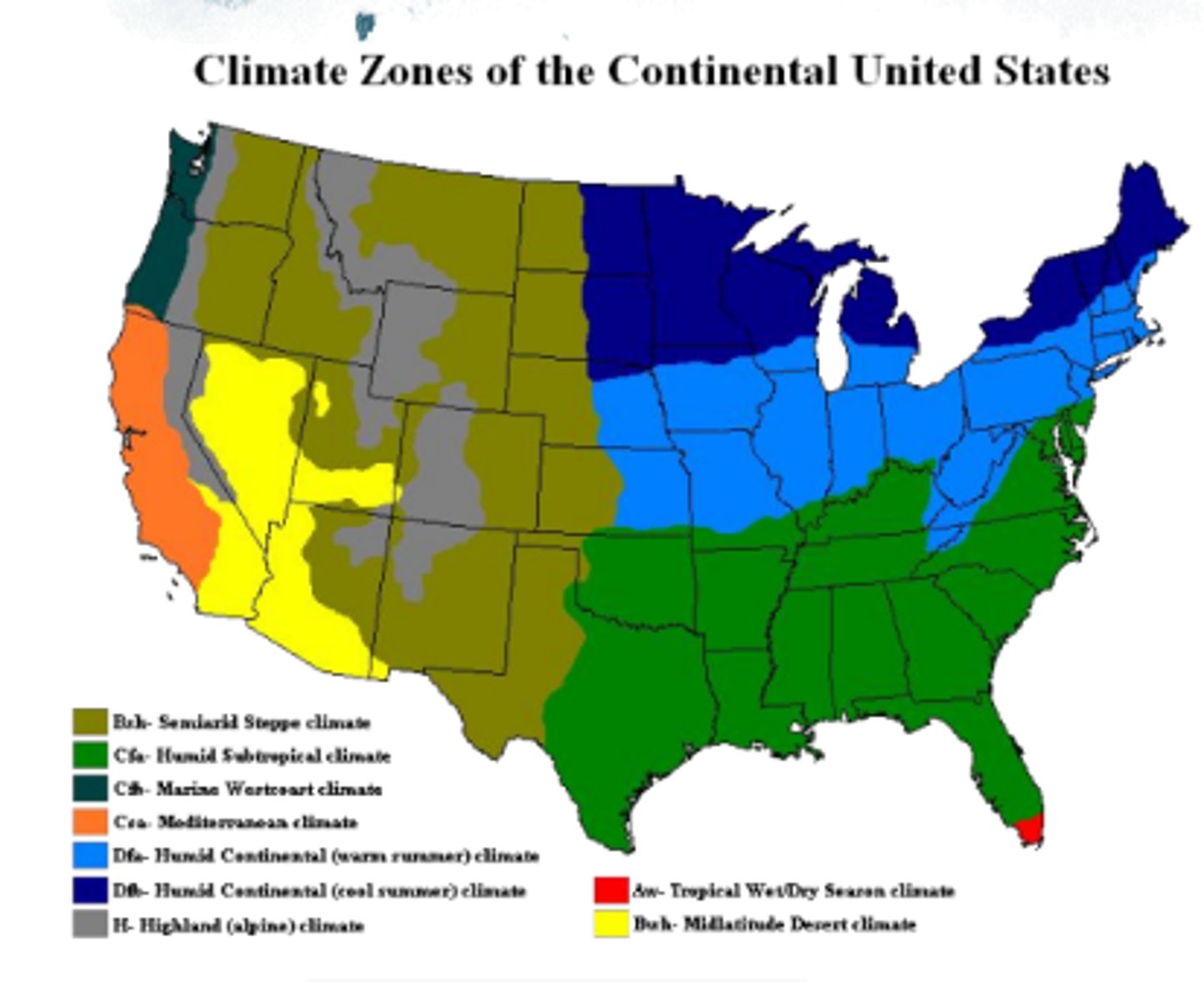
polar, subpolar, temperate, subtropical, tropical
label the earth's climate zones (top to middle)
air, ocean, sun's rays
climate patterns are determined by:
1. global ____ circulation
2. ____ currents
3. angle of ____ ____ (tilt)
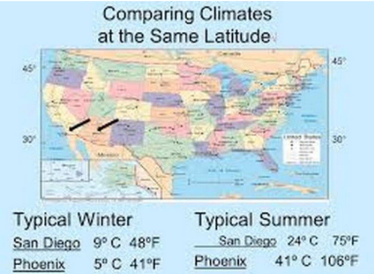
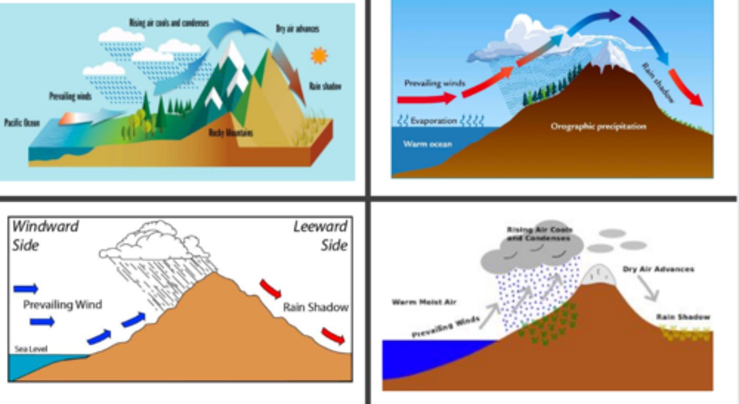
mountain ranges
topographic features can affect local/regional climate:
1. _____ ranges
2. proximity to _____
rain shadow effect
what is this called?
gyre
large-scale water circulation that moves clockwise in the Northern Hemisphere and counter-clockwise in the Southern
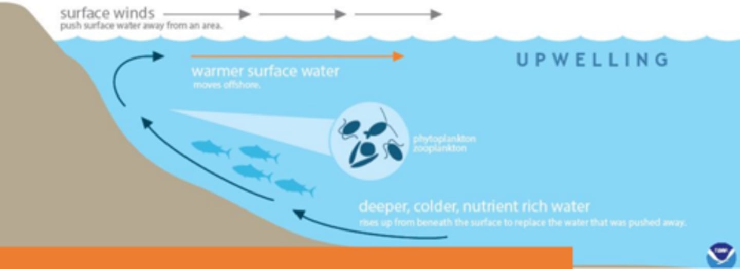
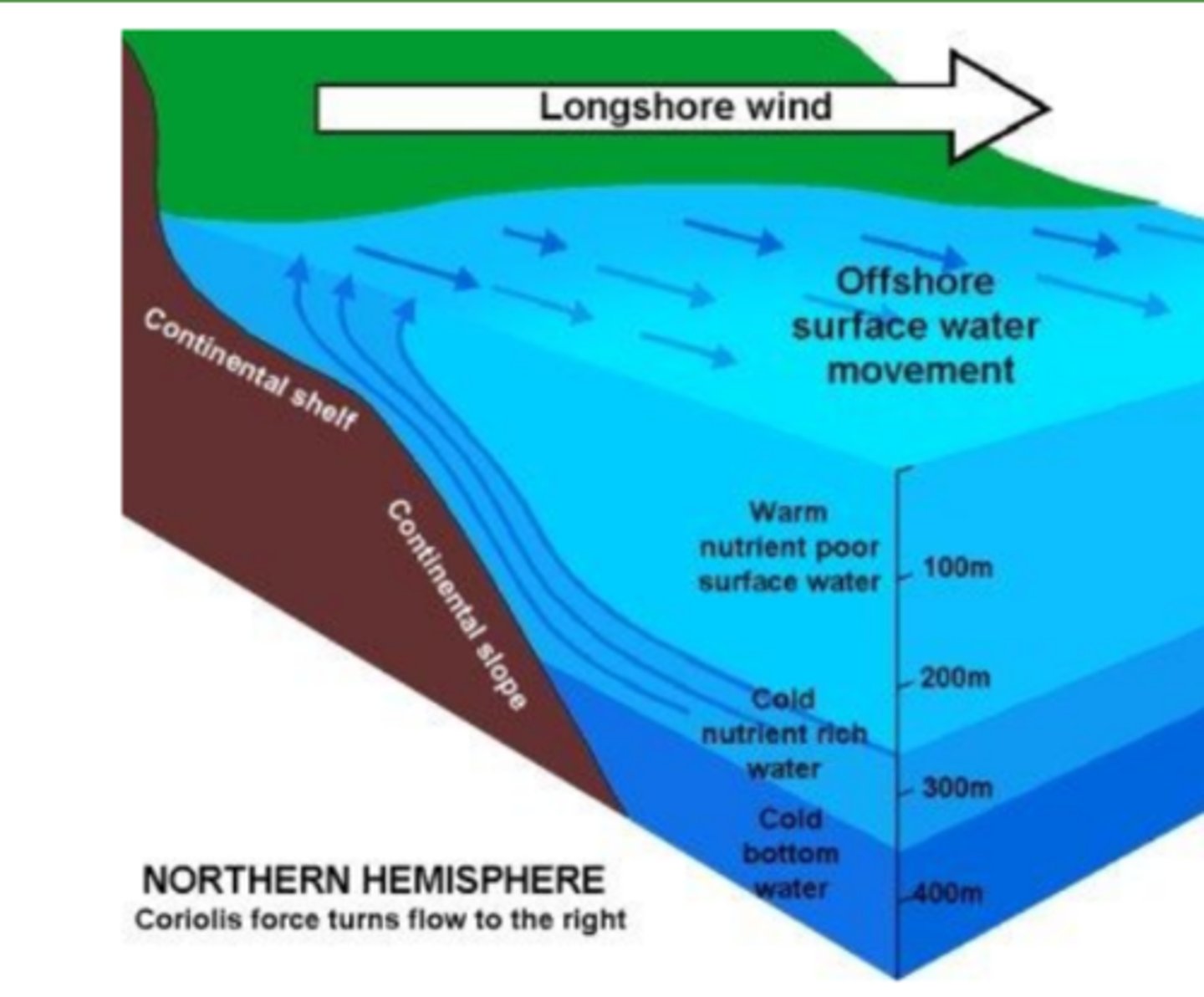
upwelling
upward movement of ocean water causes mixing, bringing cool and nutrient-rich water from the surface of the ocean to the surface, the warm water supports large population of phytoplankton, zooplankton, fish, fish-eating seabirds
upwelling
_____ occur along the steep western coasts of some continents, winds blowing along the coasts push surface water away from land and draw water up
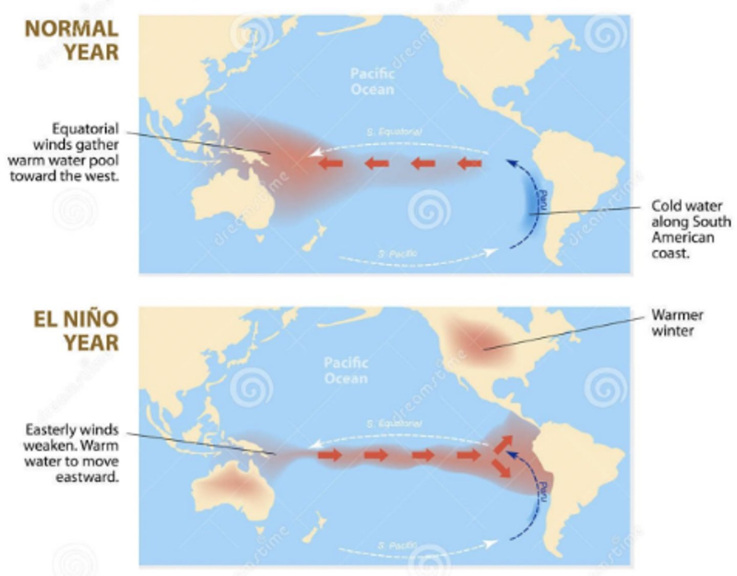
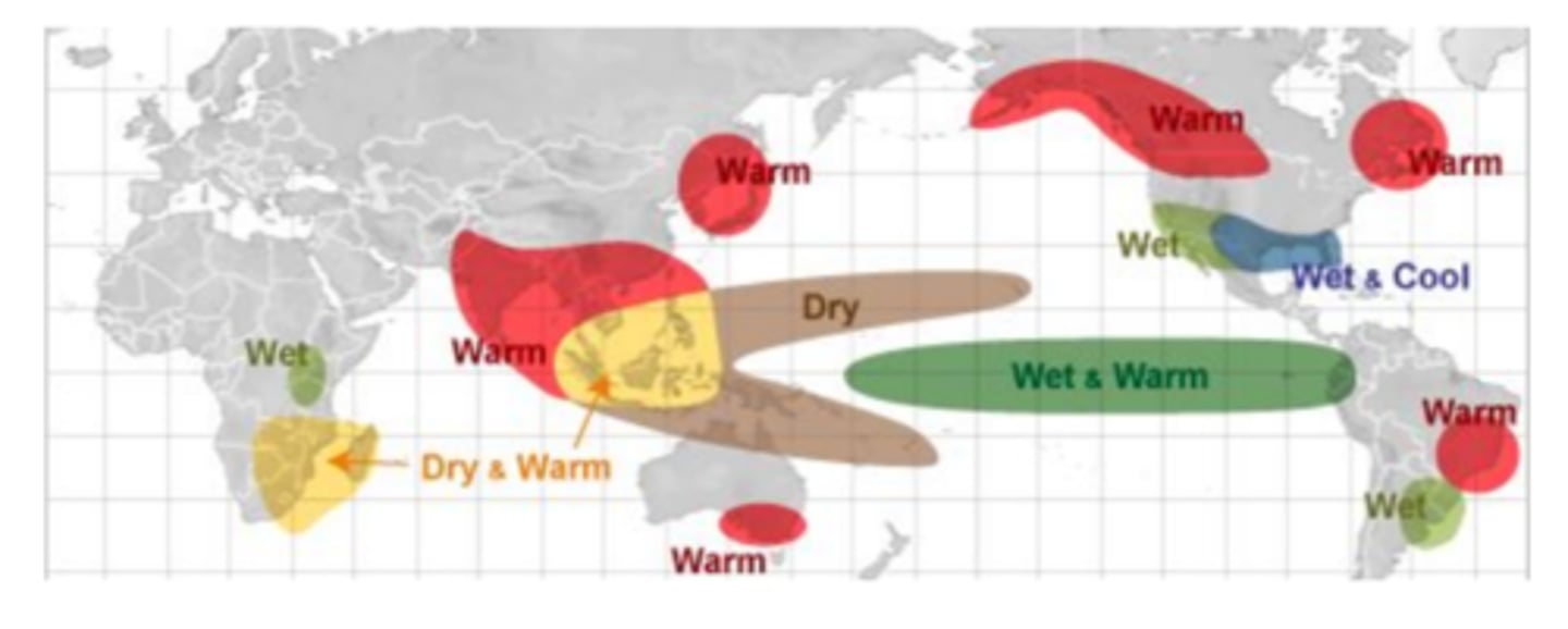
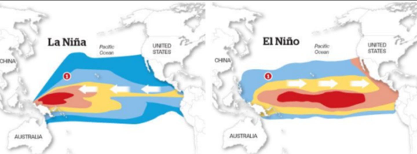
el nino
occurs every few years on the Pacific Ocean, normal shore upwellings are affected by changes in weather patterns, prevailing tropical winds (E->W) weaken or reverse direction, western pacific warmer waters move toward South America, suppress the normal upselling of cold, nutrient-rich water
effects
possible ____ of el nino: decrease in nutrients (reduces primary productivity, causes decline in fish populations), can alter the weather of at least 2/3 of the globe especially in lands along the Pacific and Indian Ocean
la nina
cools some coastal surface waters & brings back coastal upwelling (includes more Atlantic hurricanes, colder winters in Canada and NE US, warmer/drier winters in the SE and SW US, more wildfires, wetter winters in the Pacific NW, torrential rains in SE Asia, lower wheat yields in Argentina