APHG Map Projections (+ strengths n weaknesses)
1/20
There's no tags or description
Looks like no tags are added yet.
Name | Mastery | Learn | Test | Matching | Spaced | Call with Kai |
|---|
No analytics yet
Send a link to your students to track their progress
21 Terms
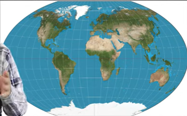
Mercator Map Projection strength
accurate direction
Mercator Map Projection weakness
distorts size and location at the poles.
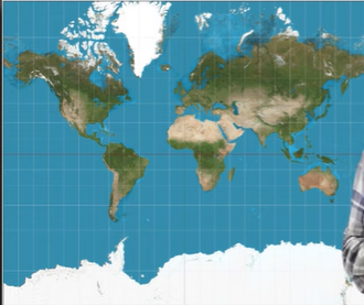
used for naval expedition
Mercator Map Projection
equal area pseudo-cylindrical projection
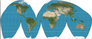
Goode Homolosine Projection
Goode Homolosine Projection strength
Minimizes most distortion
shows true size and shape
Goode Homolosine Projection weakness
Hard to present information easily
Bad for direction
distortions in distance in ends of map
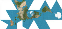
Fuller Projection
Fuller Projection strength
maintains size and shape of landmasses
Fuller Projection weakness
bad for presenting information
does not use cardinal directions
Robinson Projection
Robinson Projection strength
distortion near pole helps preserve size and shape
Robinson Projection strength weakness
spreads distortion across map for all aspects
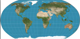
Winkel Tripel Projection
Winkel Tripel Projection strength
Minimizes distortion in land, distance, and direction
Winkel Tripel Projection weakness
distorted pole
longtitude and latitude is curved
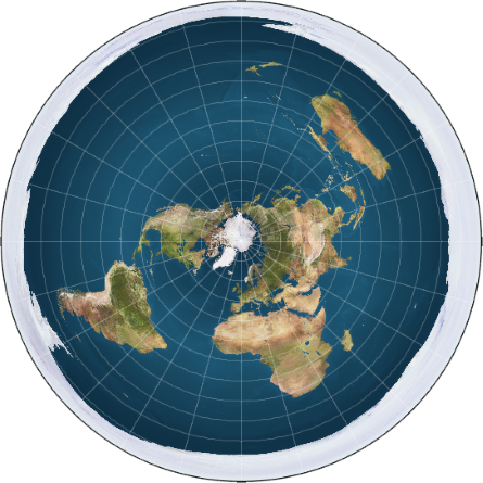
Polar/Azimuthal Projection
Polar/Azimuthal Projection strengths
Correctly represents distance to and from the center
Polar/Azimuthal Projection weakness
distance between other points are distorted
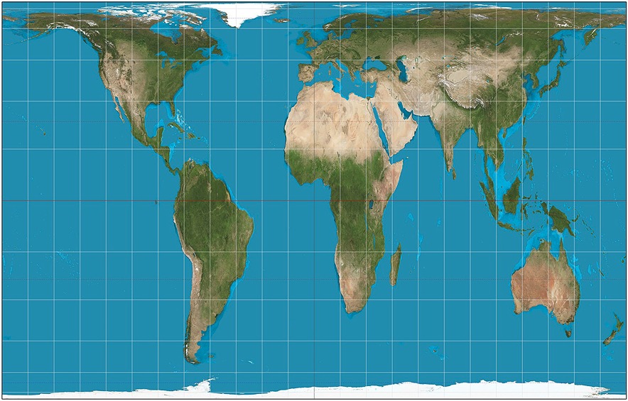
Gall-Peters Projection
Gall-Peters Projection strength
countries are all the correct sizes
Gall-Peters Projection weakness
less accurate towards the poles
distortion with shape and direction in land masses