coasts
1/20
There's no tags or description
Looks like no tags are added yet.
Name | Mastery | Learn | Test | Matching | Spaced | Call with Kai |
|---|
No analytics yet
Send a link to your students to track their progress
21 Terms
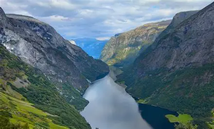
Submergent landform FJORD
norway
a drowned glacial valley with long steep cliff shapes
as sea levels rise deep glacial troughs in the shape of a V are submerged by the rise in sea levels
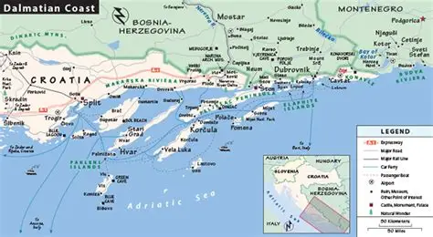
SUBMERGENT LANDFORM-
DALMATION COASTLINE - CROATIA
landscape of risges and submerged valleys parallel to the coastline
when the sea levels rise the valley floods and the tops of the ridges remain
forming a series of offshore islands
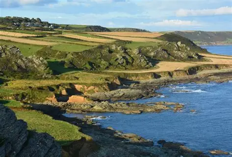
Emergent coastline landform and where? what do the other features such as wave cut notches and caves show
ISLE OD ARRAN, SCOTLAND
RAISED BEACHES
isostatic change uplifts the land forcing coastal feautures like beaches to rise above their previous level
wave cut notches and caves can show evidence of past erosion
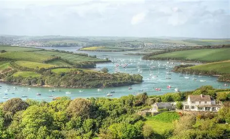
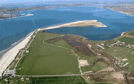
SUBMERGENT LANFORM- RIA
meaning and where
RIAS ARE DROWNED RIVER VALLEYS
KNIGHTSBRIDGE ESTUARY ,DEVON
river creates a v-shaped valley with high upland aeras on either side
as sea levels rise they flood the river valley leaving only the high land visible
bangladesh and climate change
say the pressures the causes of flooding and an effect of climate change
46% of the population is below sea level, low levels of development
lies on a major floodplain of 3 rivers
causes- deforestation for firewood- the roots bind sediment and prevent erosion
Bay of Bengal is funnel shaped, so waves increase in height, depth adn width
Land subsidence- Islands have sunk by 1.5 meters in 50 years- ISOSTAIC CHANGE
why does vegetation removal increase flood risk- LOCAL FACTORS
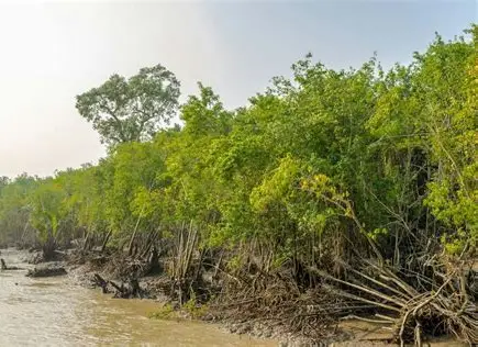
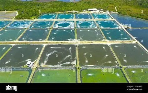
what types reduce the risk and explain w sttastic for magroves and where the loss is then used for
salt marshes, mangroves
stabilised existing sediment by trapping new sediment and raising height above sea level
1km belt of mangrove forest reduces height of storm surge by 0.5m
50% of the world mangrove forests have been deforested -1/4 for the creating of shrimp farms and tourist beaches
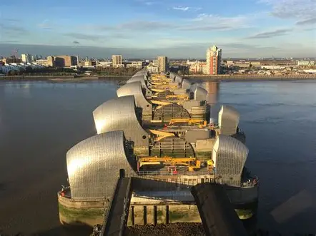
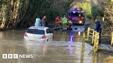
Uk storm surge in 2013 case study and compare to 1953 and what did the netherlands do
caused by high seasonal tides and depressions
funnel shape in the north sea
thames barrier closed to protect london
in 1953 around 2000 deaths between netherladns and the uk and in 2013 none
the netherlands created dams to protect them from flooding
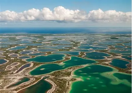
how is kiribati coastline at risk from contempory sea level change
one meter or less above sea level
purchased land in fiji for fish farming projects to protect thier food security
allows people to find jobs in neighbouring countries like NZ
why is subsidence a local factor increasing flood risk an dhuman
low lying coastlines in estuaries deltas have natural subsidence because of settling and compaction of deposited sediment
deltas experience periodic isostatic subsidence as when the weight of the delta reaches its limit it causes the crust to depress leading to flooding
human activity- drainage of soil /sediment for agriculture reduces the sediment volume such as groundwater abstraction to supply cities like venice
and the weight of cities can compress sediment leading to subsidence
holistic managemnt of coast explain for the maldives who are the players involved
environmental NGOs( against degredatin of coast) vs Tourist sector ( removal of the mangrove for tourist beaches)
Fishers( removal of mangrove to create shrimp farms) vs Farmers ( need to protect mangorves to protect erosion of farmland)
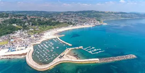
Lyme Regis- Dorset
sustainability
management/ alternatives
stability and the futuer
35 million sea wall built, sustainable for 50-60 years
unstbale soft clay
NO OTHER ALTERNATIVES
need to protect job and houses- sale of houses become difficult after 60 years
people can now insure homes but in the future there will be more rainfall so saturates the clays leading to more mass movement
what does holistic management of the coast involve 3
creating alternative livelihoof before existing ones are lost to the sea
educating communities to understand why change is needed and why we need to adapt
manage natural resources like fish farmland and water to ensure productivity
Odisha North East India ICZM project
to protect biodiversity and keeping livelihoods
coast under stress from tourism and cyclones
replanting mangroves and providing funding so people can find alternative work such as ecotourism— sustainable managementConversely, restrictions on coastal development and expansion of mangrove reserves can reduce land available for aquaculture or agriculture. However, ultimately the approach has been seen as good economically and environmentally for the area.
holderness management
how mcuh on defences
what is being done
30 villages lost since roman times
4.5 MILLION ON ROCK ARMOUR to protect gas terminal- 25 % of North sea gas production- National economic productivity influence
cost of coastal protection only justified becuase defence cost is less than the property saved
local building authroties stopped from building 30m from a cliff
main policy to gradually close caravan sites and relocate= maintaisn the economy
local residents feel coastal protection should be maintained to avoid the loss of houses roads and fams BUT local authorites say more protection would disrupt natural processes such as longshore drift
overall not sustainable and causes more social issues than it solves
BLACKWATER ESTUARY, ESSEX
sustianble process, all stakeholders benefit
Wanted to create a sea wall but would need to be replaced in the future= short term idea
natural defence created by creating breaches in the sea wall to allow a new salt marsh to grow - creating of natural flood defence
Losers include farmers and landowners who lost productive agricultural land when former polders were inundated.
POLICY DESCISION- managed realignment- owners recived marker price for home adn hgih cost of hold the line was avoided and water quality has improved
bird and fish species returned to the area
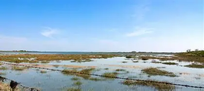
EAST HEAD, CHICHESTER HARBOUR
sustainable managemement
area is being naturally eroded due to sea level rise and increased storms
spit protects the harbour - economic significance
Sand dune habital is a SSSI
in some cases such sustainable approaches do not cause conflicts. The dune regeneration on the Hinge at East Head has not only protected the valuable salt marsh ecosystem behind East Head spit but has also reduced the erosion risk for properties facing East Head across this salt marsh. Furthermore it has encouraged tourism in the area as the spit is now more accessible to tourists from the West Wittering Estate car park.
combination of approaches - managed realignment and removing some defences
hard engineering in strategic locations to reduce loss of land and beach nourishment -soft engineering
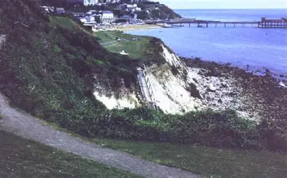
UNDERCLIFF, isle of wight
POLICY DESCISION NO ACTIVE INTERVENTION - due to techincal feasibilietes
rotation slumping occuring due to rainwater infiltration on weak impermeable clays
cost of prevention would be way too high
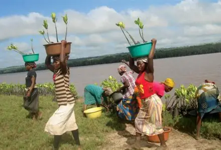
GASI BAY , KENYA
sustainable use of soft engineering
increased carbon sequestration and increase in habitats
educating of importance of environmetnal protection
stopped logging mangroves and began replanting them
meteorogicial factors affecting sea level rise and inpacts on uk and effect on tropical storms
Rising sea levels are not the only physical factor causing flood risk to increase. Climate change will put more energy into the atmosphere and so the conditions for a tropical storm to start (26.5C) will occur more often and so there will be more hurricanes increasing coastal flood risk.
● Higher sea surface temperatures will cause the tropical storms to have lower pressure and so have faster wind speeds and so increase the flood risk of areas affected by such storms.
● More energy in the atmosphere will mean that depressional storms that hit the UK will have lower pressure and so stronger wind speeds as well further increasing flood risk. For example, depressions affecting the North Sea coastline have historically produced severe coastal flooding in eastern England. This suggests that while sea level rise amplifies impacts, meteorological processes often control when flooding actually occurs.
tectonic activity affecting sea levels
Tectonic activity can change the relative sea level with areas in tectonically active areas undergoing displacement and so an increased flood risk.
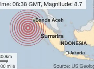
The 2004 Indian Ocean tsunami was triggered by a magnitude 9+ megathrust earthquake along the Sunda Trench, which abruptly uplifted and depressed the seafloor and displaced huge volumes of water across the Indian Ocean
. This generated tsunami waves that caused coastal sea levels to rise temporarily by over 10–20 m in some areas, while tectonic deformation permanently altered relative sea level, with parts of Sumatra subsiding by roughly 0.5–1 m and other nearby islands experiencing uplift of a similar magnitude.
how do policy descidions affect different players involved
Policy decisions within Shoreline Management Plans frequently involve cost–benefit analysis and coastal triage, meaning that governments prioritise protecting urban areas, transport infrastructure or tourism economies while rural or agricultural land may receive limited protection.
● These policy decisions can lead to conflicts between different players (homeowners, local authorities, environmental pressure groups) with perceived winners and losers in countries at different levels of development (developed and developing or emerging countries)