AQA GCSE Geography Rivers
1/73
There's no tags or description
Looks like no tags are added yet.
Name | Mastery | Learn | Test | Matching | Spaced | Call with Kai |
|---|
No analytics yet
Send a link to your students to track their progress
74 Terms
THE PATH OF A RIVER AS IT FLOWS DOWNHILL IS CALLED ITS...
course
RIVERS ERODE THE ......... AND TRANSPORT IT THROUGH ...........
landscape, deposition

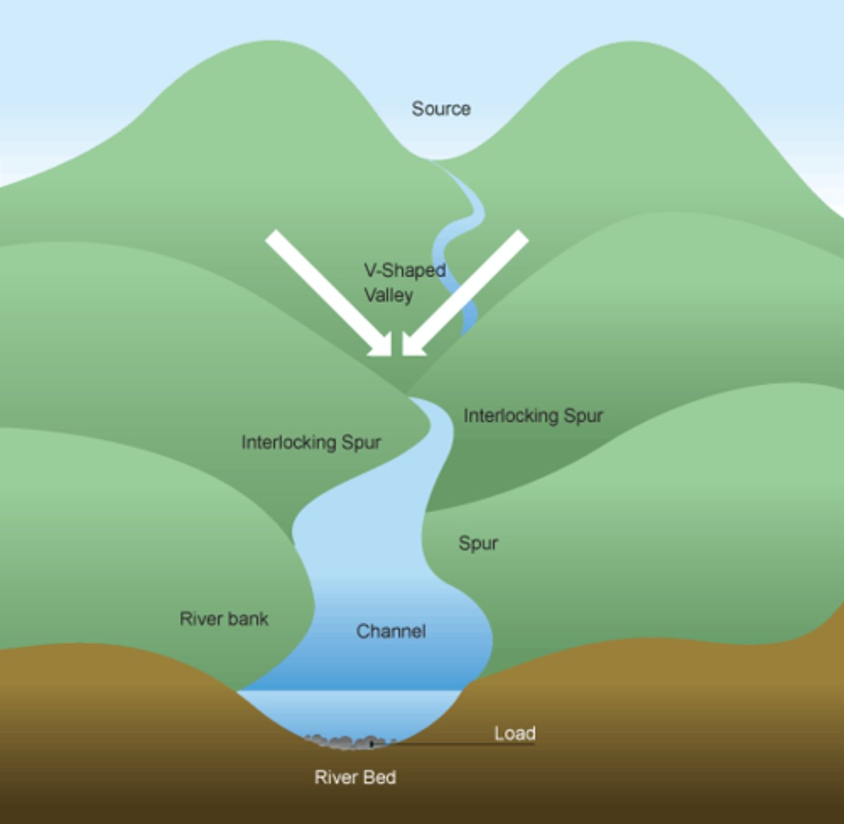
THE UPPER COURSE HAS A STEEP GRADIENT WITH...
V-shaped valleys, narrow and a shallow channel
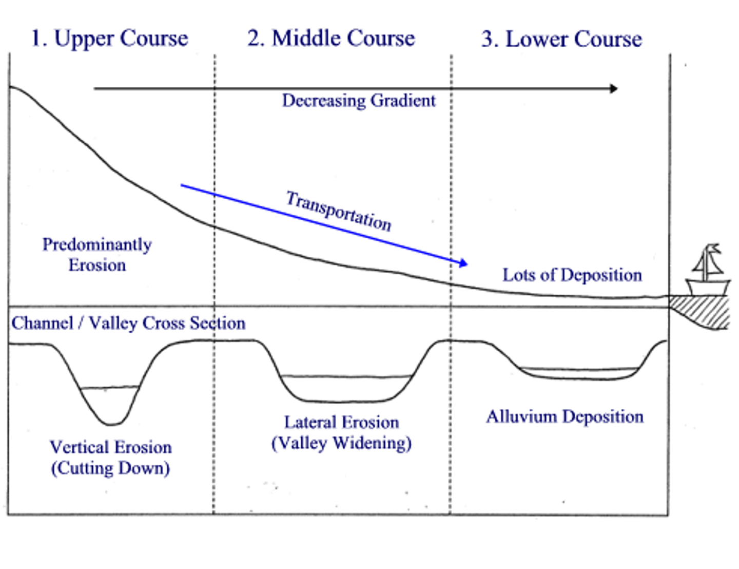
THE MIDDLE COURSE HAS A MEDIUM GRADIENT WITH ...
gently sloping valleys, wider and deeper channels

THE LOWER COURSE HAS AN ALMOST FLAT VALLEY, IT IS...
very wide with a deep channel

VERTICAL EROSION HAPPENS DUE TO...
turbulent water, this causes intense downward erosion

VERTICAL EROSION IS DOMINANT IN THE....
upper course
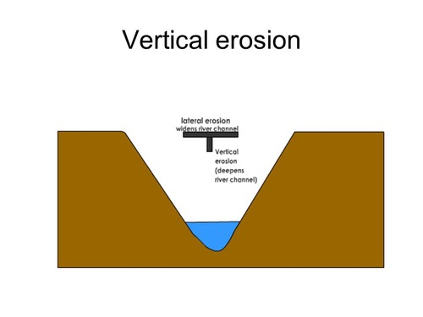
LATERAL EROSION WIDENS THE RIVER VALLEY DURING...
the formation of meanders
LATERAL EROSION IS DOMINANT IN THE...
middle/lower course

HYDRAULIC ACTION
force of water breaking the rock particles apart

ABRASION
rocks picked up and scraped along the channel

ATTRITION
eroded rocks smashed and eventually rounded, get smaller
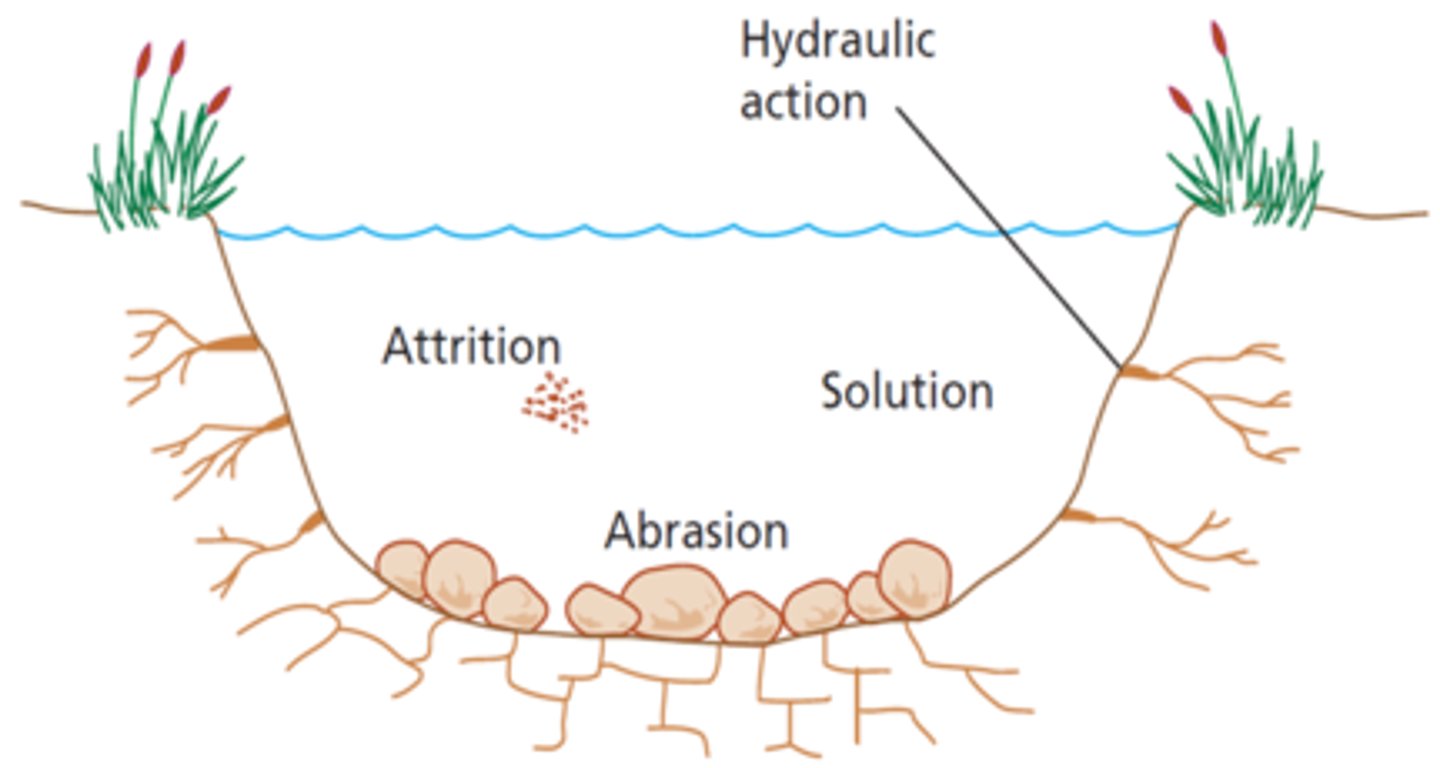
SOLUTION (CORROSION)
river water dissolves rocks such as chalk and limestone

TRACTION(ROLLY-ROLLY)
rolled along the river bed by the current

SALTATION(BOUNCY-BOUNCY)
pebbles bounced along by the force of the water
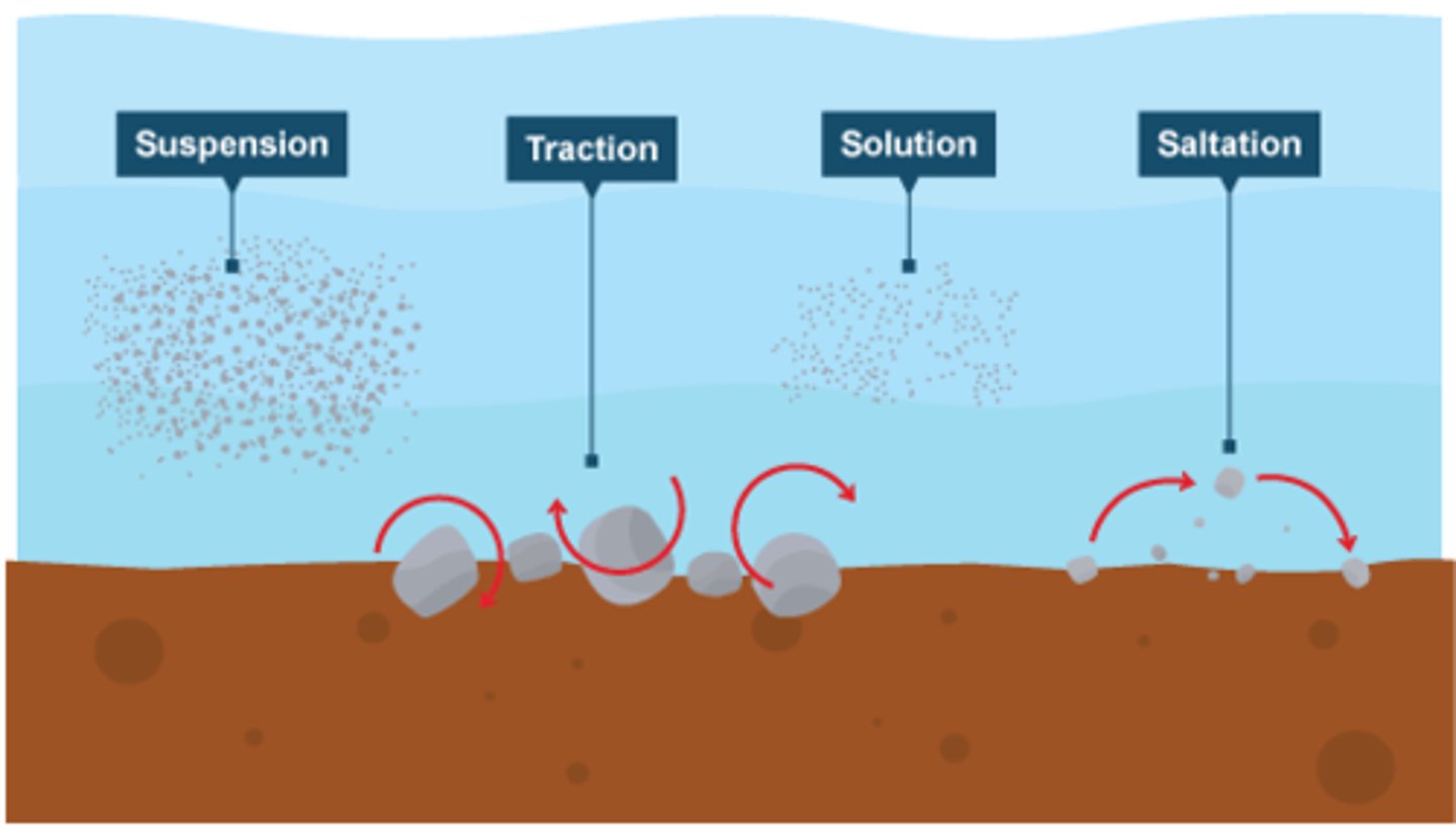
SUSPENSION(FLOATY-FLOATY)
small particles (silt, clay) carried

SOLUTION(FIZZY-FIZZY)
soluble materials dissolve giving a muddy look

DEPOSITION HAPPENS WHEN...
a river looses power, amount of materials increased, shallower water, river reaches the mouth
DEPOSITION IS...
when a river drops materials
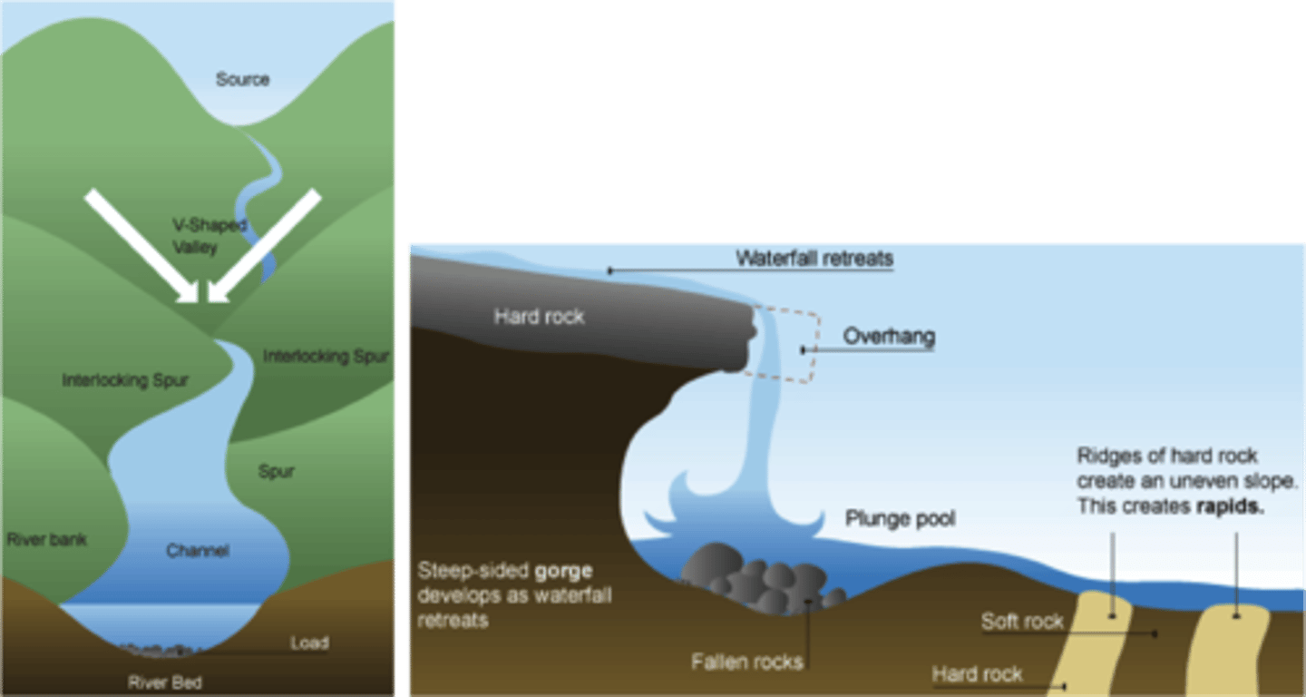
INTER-LOCKING SPURS ARE..
valley land form as rivers don't have enough energy to go through mountains
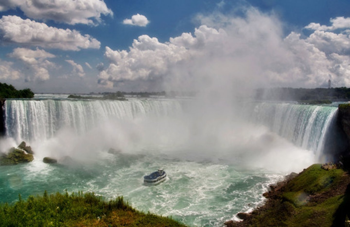
WATERFALLS ARE MADE WHEN...
water flows over hard and soft rock, the soft rock erodes first by hydraulic action and abrasion which forms a step which eventually fall, the fallen rock erodes creating a plunge pool, overtime the waterfall will retreat, making a steep sided gorge
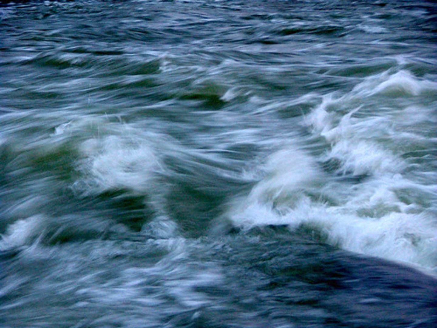
RAPIDS ARE FORMED WHEN...
differential erosion occurs due to a mix of hard and soft rock, the river bed therefore becomes unstable and uneven and creates turbulent water forming rapids
MEANDERS
rivers develop large bands
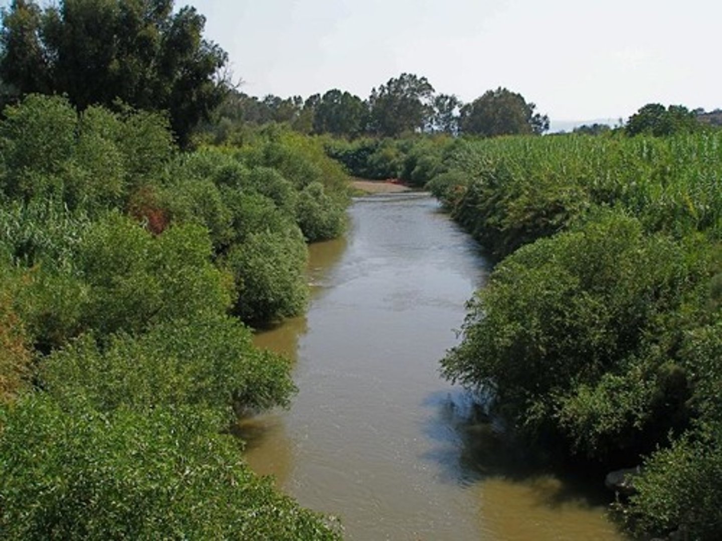
MEANDERS OCCUR IN THE...
middle and lower courses

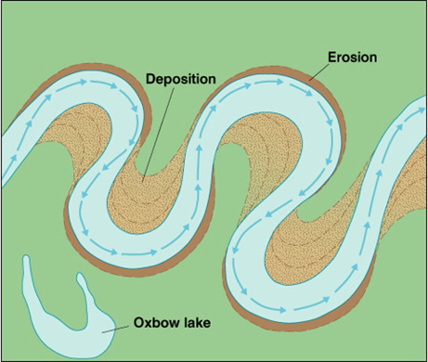
MEANDERS ARE MADE WHEN...
the rivers current is faster on the outside of the bend as the rivers channel is deeper (less friction to slow water down), more erosion takes place on the outside of the bend; forming river cliffs, the current is slower on the inside of the bend as the channels shallower, eroded material is deposited on the inside forming slip-off slopes

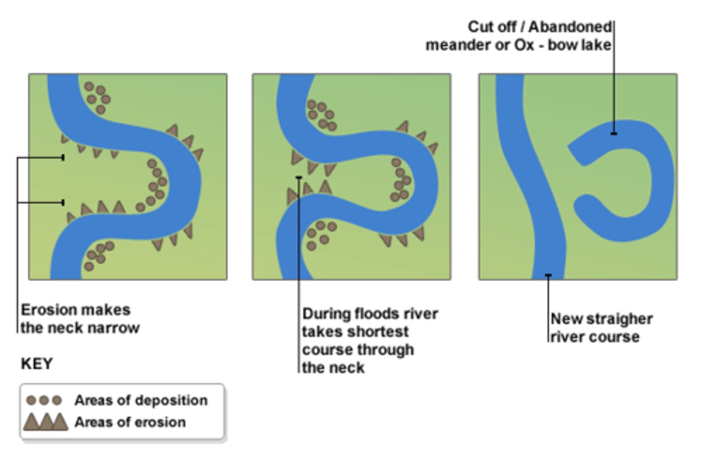
OXBOW LAKES
erosion causes the outside of the bends to nearly meet leaving a neck. A river flood usually brake this and the river picks the shortest route eventually cutting off the oxbow lakes from deposition
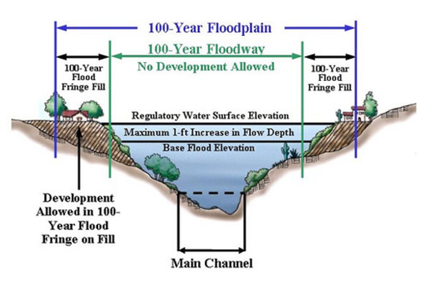
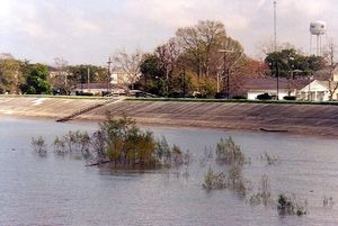
A FLOOD PLAIN IS...
the wide valley floor on each side of a river which occasionally floods; each time t floods it deposits material creating a raised area which is also flat from meanders
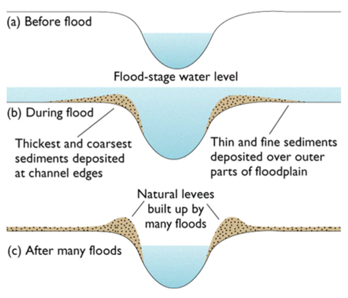
LEVEES ARE
natural embankments caused by deposition of heav materials built up over time
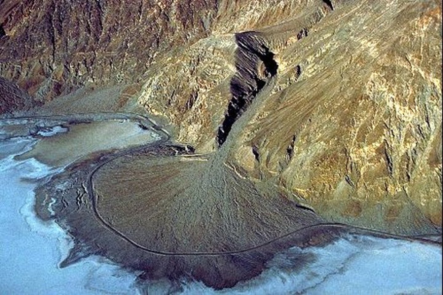
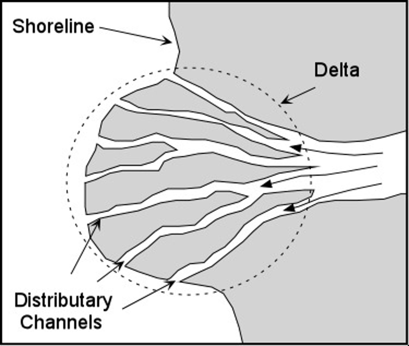
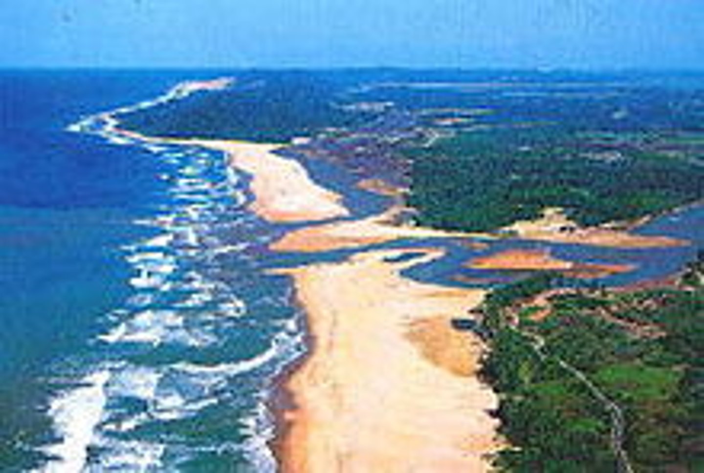
A DELTA IS A...
river mouth split into tributaries which salt and fresh water mix, causing it to fluctuate (joinign together to make something heavier), making the material heavier and deposit. This creates new land
ESTUARIES ARE FOUND IN...
the mouth of a river
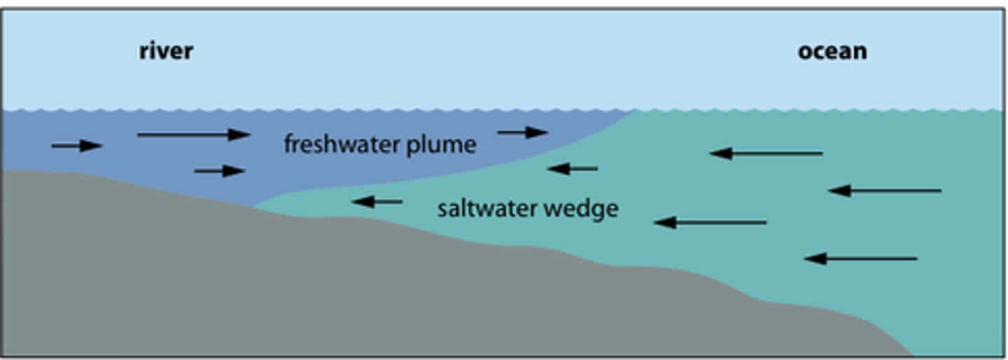
WATER IN ESTUARIES IS...
tidal; it rises and falls each day

THE WATER OF ESTUARIES...
floods over banks depositing silt and sand onto the valley floor. This builds up a mud flat.
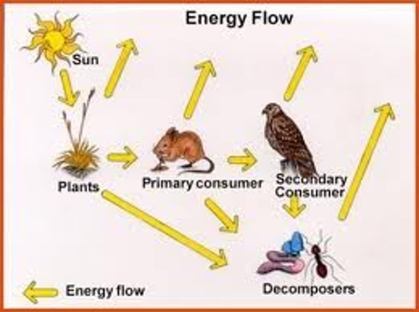
THE MOVEMENT OF WATER INTO A RIVER...
varies

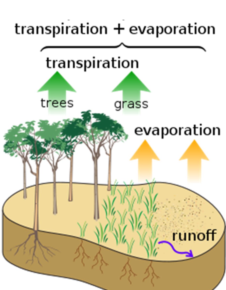
EVAPOTRANSPIRATION
process water is evaporated from soil of transpiration by plants
SOIL STORAGE
infiltrated water by soil
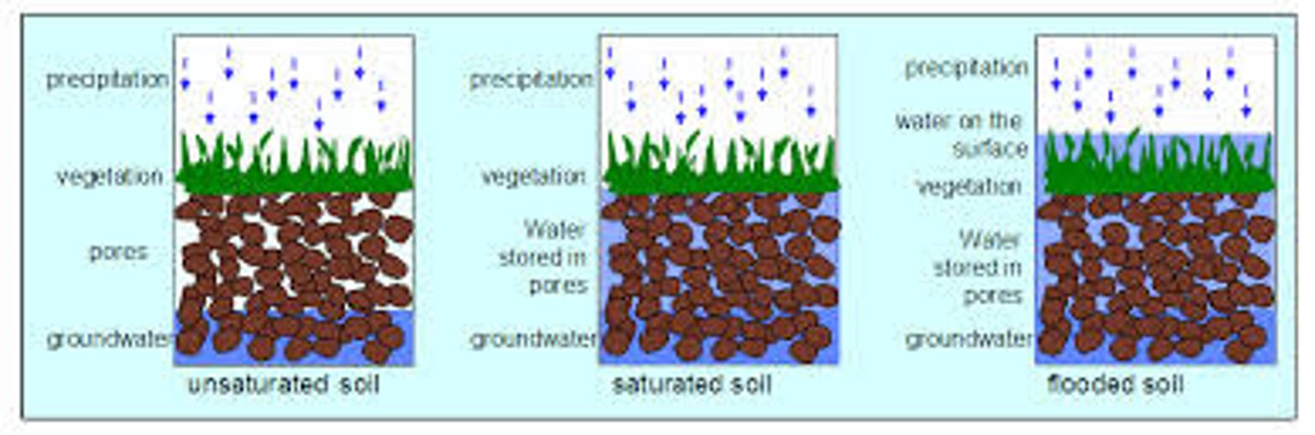
THROUGH FLOW
water flowing through the growth
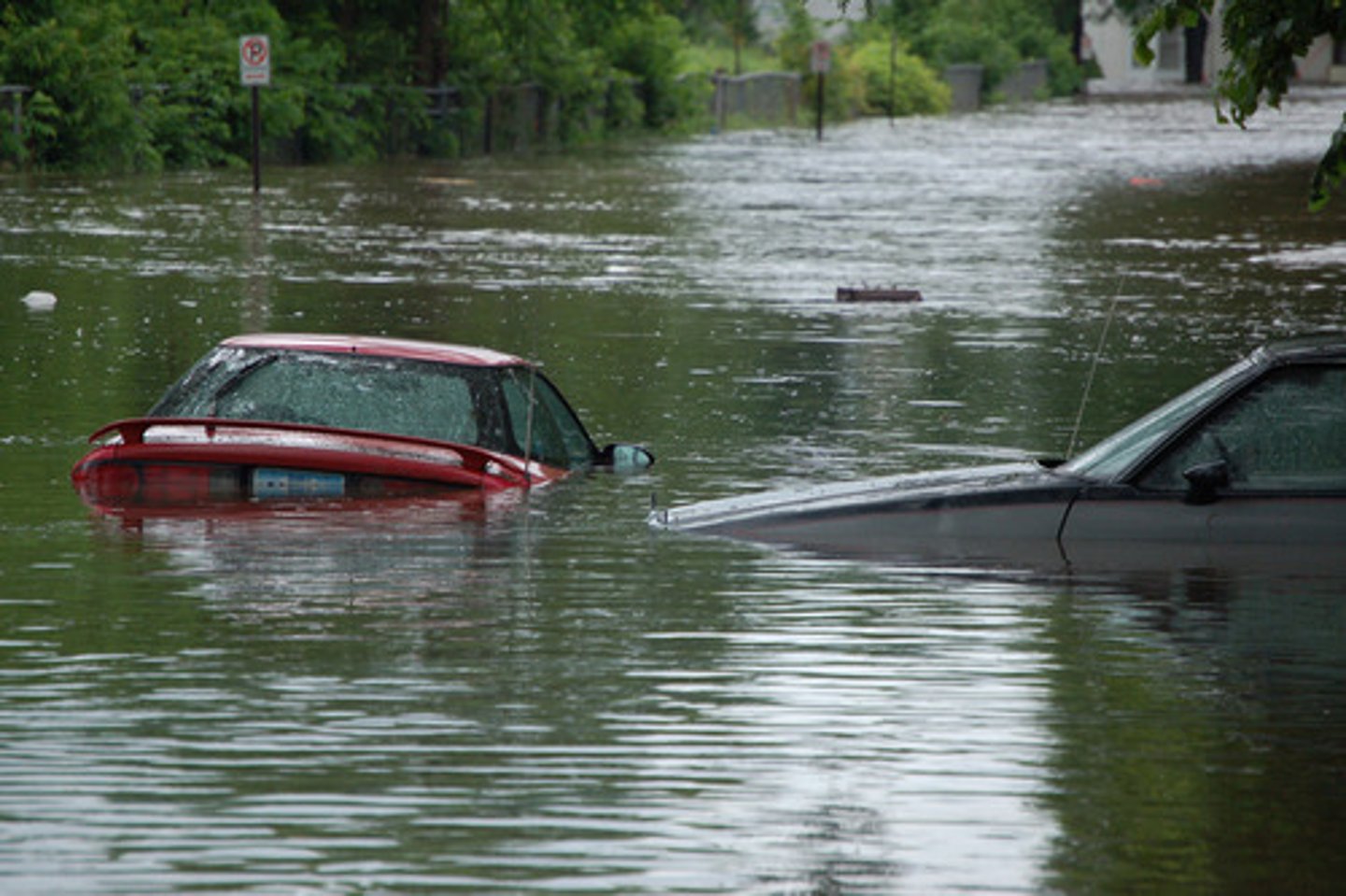
HUMAN CAUSES OF FLOODING
urban land use-impermiabe surface such as tarmac prevent infiltration, deforistation-stops evapotranspiration and interception causes surface run off, bridges-stops waterflow buiding under pressure, restricted channel-water is restricted and causes overflowing (boscastle 2004), farmiing-tractors compress soil to stop infiltration and plastic covering plants stops infiltration

PHYSICAL CAUSES OF FLOODING
intense rainfall-only so much water will infiltrate before causing surface run off, prolonged precipitation-only so much water can infiltrate, snow melt-often occurs as it s steep and cold, hard/dry soil-dry soil becomes more condense as it contains clay which stops infiltration, steep slopes-hills cause water to flow downhill
RIVER MANAGEMENT CAN...
help prevent flooding

RIVER MANAGEMENT-HARD ENGINEERING-DAMNS-EXPLANATION
often built along the course of a river to control the amount of discharge water is helpd back and released in a controlled way

RIVER MANAGEMENT-HARD ENGINEERING-DAMNS-ADVANTAGES
can be used for drinking water, hydro-electricity, new habitats
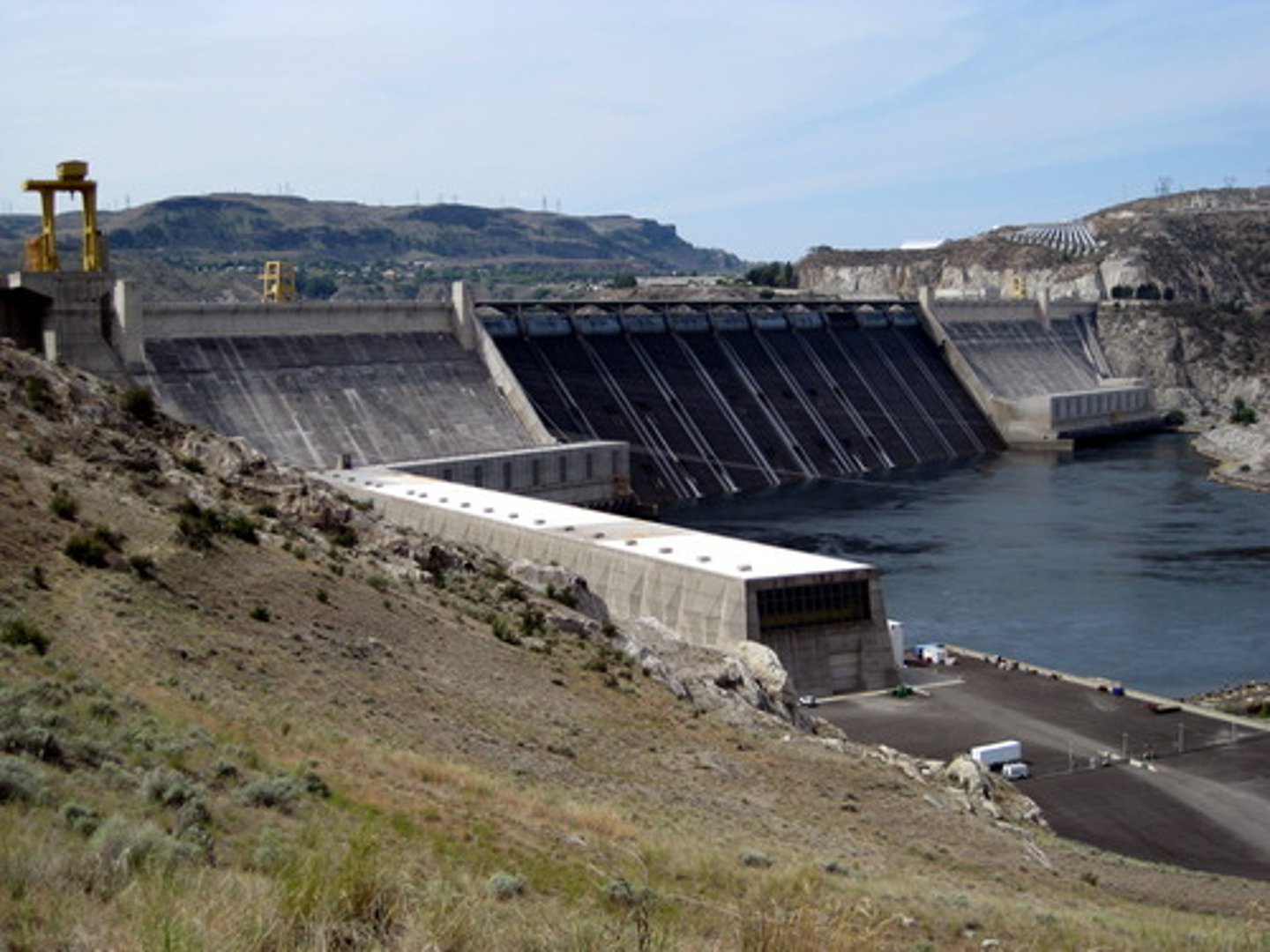
RIVER MANAGEMENT-HARD ENGINEERING-DAMNS-DISADVANTAGES
ruins landscape, expensive, sediment trapped, settlement/agriculture ruined

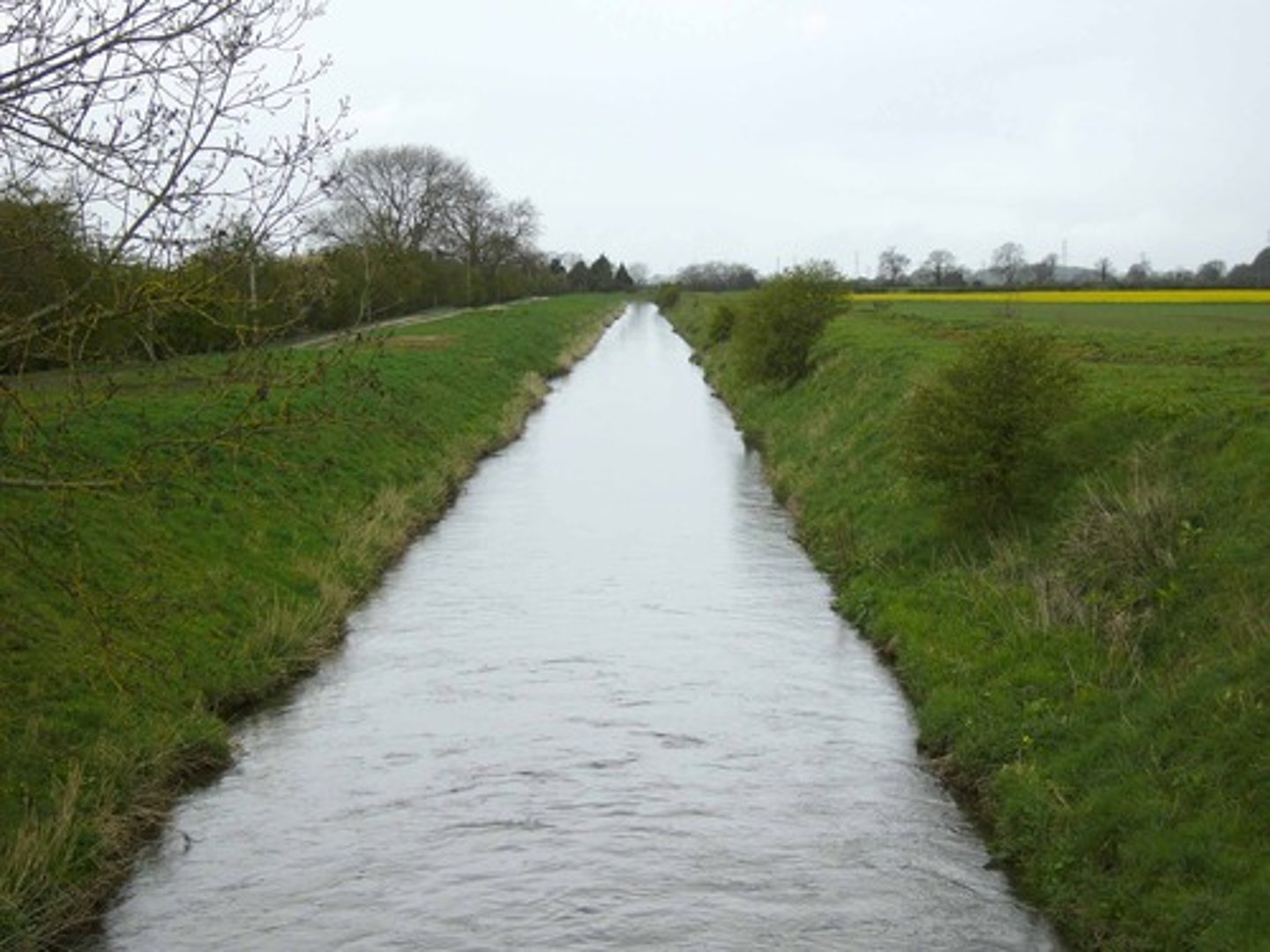
RIVER MANAGEMENT-HARD ENGINEERING-CHANNELISATION-EXPLANATION
river may be widened or deepened to carry more water

RIVER MANAGEMENT-HARD ENGINEERING-CHANNELISATION-ADVANTAGES
protects immediate area, long lasting, residents gain confidence

RIVER MANAGEMENT-HARD ENGINEERING-CHANNELISATION-DISADVANTAGES
destroys habitats, accelerates river=speeds up erosion, unnatural look
RIVER MANAGEMENT-HARD ENGINEERING-ARTIFICIAL LEVEES-EXPLANATION
raised banks along the river
RIVER MANAGEMENT-HARD ENGINEERING-ARTIFICIAL LEVEES-ADVANTAGES
pedestrian path, stop erosion, stop flooding, habitats for plants and animals

RIVER MANAGEMENT-HARD ENGINEERING-ARTIFICIAL LEVEES-DISADVANTAGES
often banks aren't high enough, ugly, don't stop; just prevent, boaters and fishers struggle to get to the river

RIVER MANAGEMENT-HARD ENGINEERING-FLOOD RELIEF CHANNEL-EXPLANATION
changes course of the river, diverts floodwaters from settlements
RIVER MANAGEMENT-HARD ENGINEERING-FLOOD RELIEF CHANNEL-ADVANTAGES
course settlements are safe, can be used for water sports, nature reserves can be made around them, lowers insurance

RIVER MANAGEMENT-HARD ENGINEERING-FLOOD RELIEF CHANNEL-DISADVANTAGES
large land required, extremely expensive, flooding risk increase where they rejoin, has to be maintained, ugly

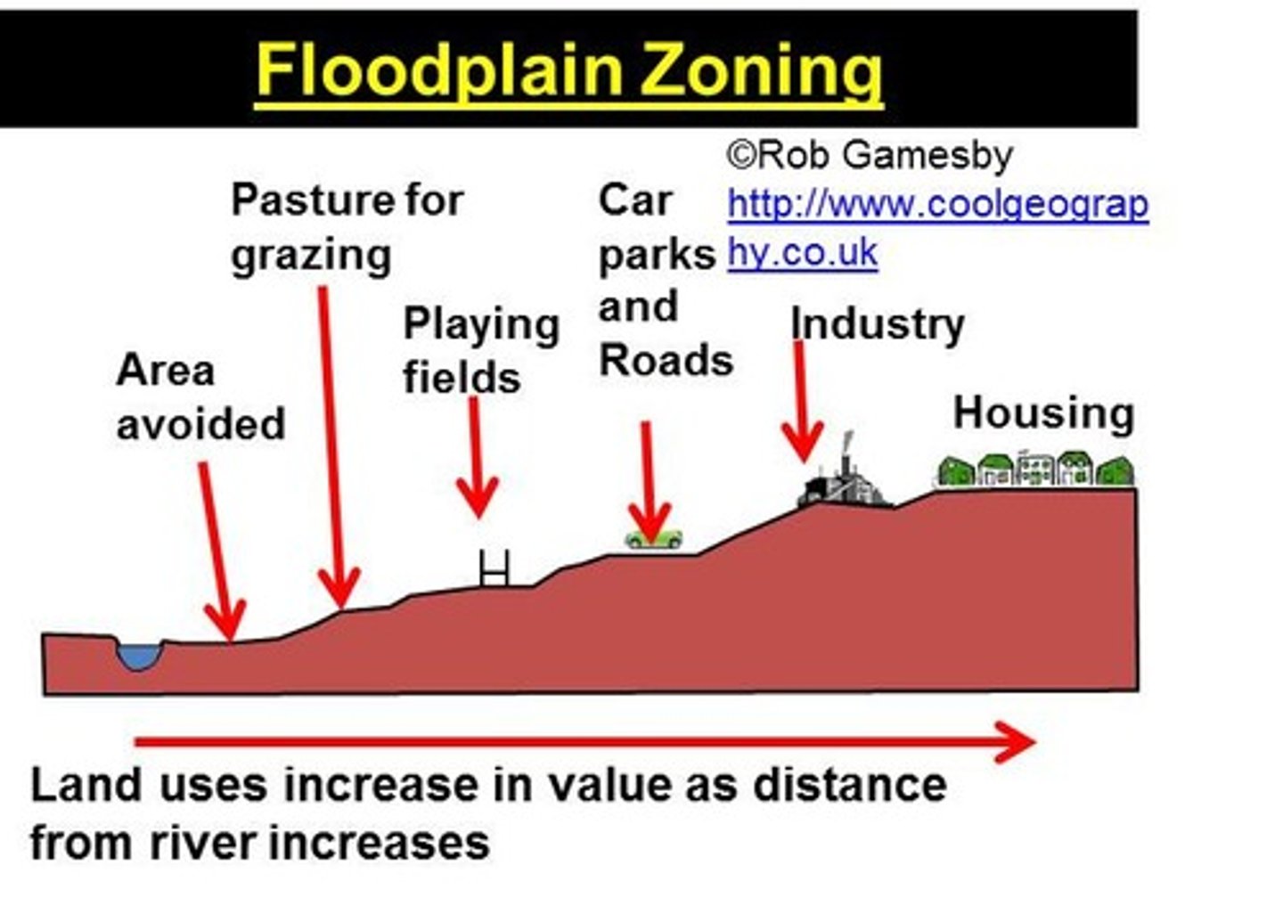
RIVER MANAGEMENT-SOFT ENGINEERING-FLOODPLAIN ZONING-EXPLANATION
urban development is controlled around the floodplain

RIVER MANAGEMENT-SOFT ENGINEERING-FLOODPLAIN ZONING-ADVANTAGES
cheap, risk reduced, reduces impact, no buildings=less surface run-off

RIVER MANAGEMENT-SOFT ENGINEERING-FLOODPLAIN ZONING-DISADVANTAGES
there can be resistance, pressure to build on the countryside, planning regulations and controls are harder
RIVER MANAGEMENT-SOFT ENGINEERING-AFFORESTATION-EXPLANATION
trees are planted in the rivers catchment area to intercept

RIVER MANAGEMENT-SOFT ENGINEERING-AFFORESTATION-ADVANTAGES
cheap, environment quality improved, prevents surface run off, sustainable, absorbs carbon, used for tourism

RIVER MANAGEMENT-SOFT ENGINEERING-AFFORESTATION-DISADVANTAGES
if conifers planted soil becomes acidic, dense trees=unnatural, increase fire risk, less farmland

RIVER MANAGEMENT-SOFT ENGINEERING-RIVER RESTORATION-EXPLANATION
removing hard engineering and let the river flood again
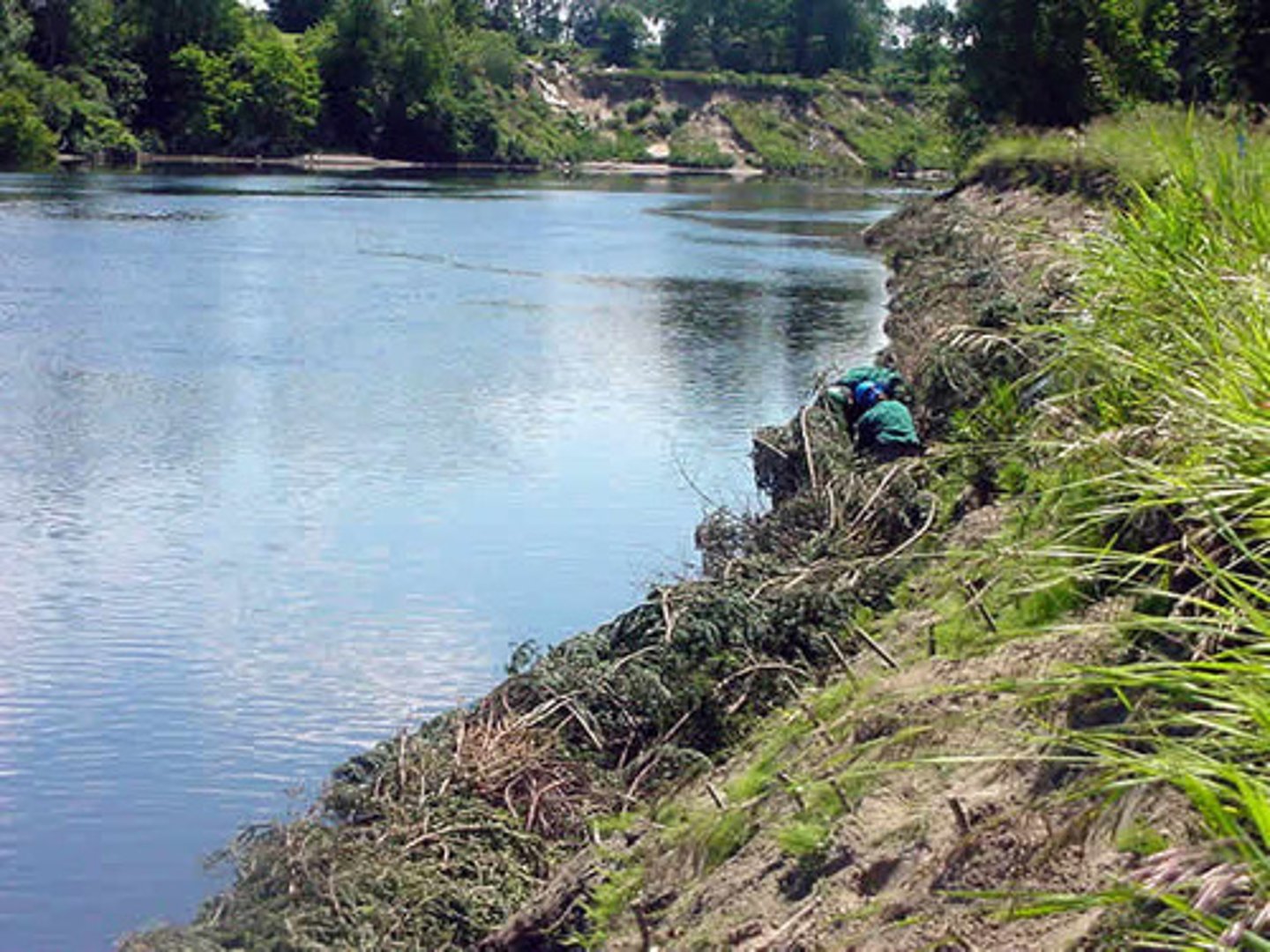
RIVER MANAGEMENT-SOFT ENGINEERING-RIVER RESTORATION-ADVANTAGES
little maintenance, better habitats

RIVER MANAGEMENT-SOFT ENGINEERING-RIVER RESTORATION-DISADVANTAGES
flood risk increase, surrounding area, can't be used for human use, river is not easily navigated

RIVER MANAGEMENT-SOFT ENGINEERING-PREDICTION-EXPLANATION
predicting when or if the river will flood, can help education and forecasting, building plans

RIVER MANAGEMENT-SOFT ENGINEERING-FLOOD WARNING-EXPLANATION
tells people how bad the flood will be

RIVER MANAGEMENT-SOFT ENGINEERING-FLOOD WARNING-TYPES OF FLOOD WARNING
flood alert: flooding is possible; be prepared, flood warning:flooding is expected;immediate action required, severe flood warning: severe flooding; danger to life

RIVER WANSBECK, MORPETH NORTHUMBERLAND, UK-MANAGEMENT STRATEGY-EXPLANATION
completed in 2015, costing £23 m, defences now have 1/137 year floods compared to the previous 1/30
RIVER WANSBECK, MORPETH NORTHUMBERLAND, UK-MANAGEMENT STRATEGY-MITFORD STORAGE AREA
large area with dam upstream, can store 1.5 million meters cubed of water during floods
RIVER WANSBECK, MORPETH NORTHUMBERLAND, UK-MANAGEMENT STRATEGY-NEW FLOOD WALLS AND GATES
high stanners new walls with gates built to contain water and prevent flooding of homes
RIVER WANSBECK, MORPETH NORTHUMBERLAND, UK-MANAGEMENT STRATEGY-TREE CATCHERS
vertical concrete poles upstream to catch debris clogging bridges in morpeth
RIVER WANSBECK, MORPETH NORTHUMBERLAND, UK-MANAGEMENT STRATEGY-CULVERTS
cotting burn (tributary to north) culverts to be made larger to cope
RIVER WANSBECK, MORPETH NORTHUMBERLAND, UK-MANAGEMENT STRATEGY-SOFT ENGINEERING
environment agency puts out flood warning
RIVER WANSBECK, MORPETH NORTHUMBERLAND, UK-ISSUES-ENVIRONMENTAL
scheme has created 17 areas of new habitat upstream and 3,500 endangered white-clawed crayfish have been relocated upstream of the river Wansbeck, new storage area has created a large scale habitat ensuring the survival of the white-clawed crayfish and other endangered species, defences have been clad in stone to make them look nice (Aesthetics)
RIVER WANSBECK, MORPETH NORTHUMBERLAND, UK-ISSUES-ECONOMIC
Morpeth didn't qualify for money form central government so Northumberland council out in £12 million to pay for defences, insurance went up 70% after flood, if business can't get insurance they won't invest, Morpeth MP (Ian Lavey) raise in parliament one woman's case who was quoted between £3000 and £4800 and an excess of £7.5k insurance companies are telling residents that the defences are irrelevant
RIVER WANSBECK, MORPETH NORTHUMBERLAND, UK-ISSUES-SOCIAL
residents are anxious when it rains, affects residents of Morpeth could also affect people doing the flood gates; they are being bullied to do so, environmental agency have educated locals about their work so they will feel safer
RIVER WANSBECK, MORPETH NORTHUMBERLAND, UK-WHY WAS THE SCHEME REQUIRED-PHYSICAL
river has 3 main tributaries; the three combine through three town, most tributaries flow into steep sided wooded valleys, classified as "rapid response" catchments, Friday 6/8/2008-80mm rain and 70mm 7/8/2008-low pressure system over England
RIVER WANSBECK, MORPETH NORTHUMBERLAND, UK-WHY WAS THE SCHEME REQUIRED?-PHYSICAL AND HUMAN FACTORS
severe flood in 1963 over 1500 properties flooded, flood defences designed to contain repeat, 2008 flood was n excess of the 1963 flood and topped defences, studies of 2008 flood concluded greatest flood in 250 years