human Geography unit 1
1/46
There's no tags or description
Looks like no tags are added yet.
Name | Mastery | Learn | Test | Matching | Spaced | Call with Kai |
|---|
No analytics yet
Send a link to your students to track their progress
47 Terms
Place
A specific geographical location defined by its physical and human characteristics. Places have unique identities shaped by cultural, historical, and environmental factors.
Time space compression
The phenomenon where advances in technology and transportation significantly reduce the time and distance between places, altering the perception of space and connectivity.
space
Area we occupy as humans
what is longitude and what does it measure
line is north to south - measures south to west
Name and what it does
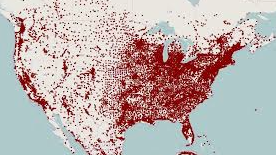
Dot density map - exact location
Geography
Study of where things are found in earth’s surface and reason for their location
Physical Geography
Topography, climate, flora, fauna, soil
Human Geography
Population, Culture, Political and Economic
Five themes of Geography
Location, Place, Region, Human environment interaction, Movement
Name and what it does
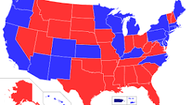
Political Map- Shows boundaries between jurisdiction (cities, states, countries)
Name and what it does
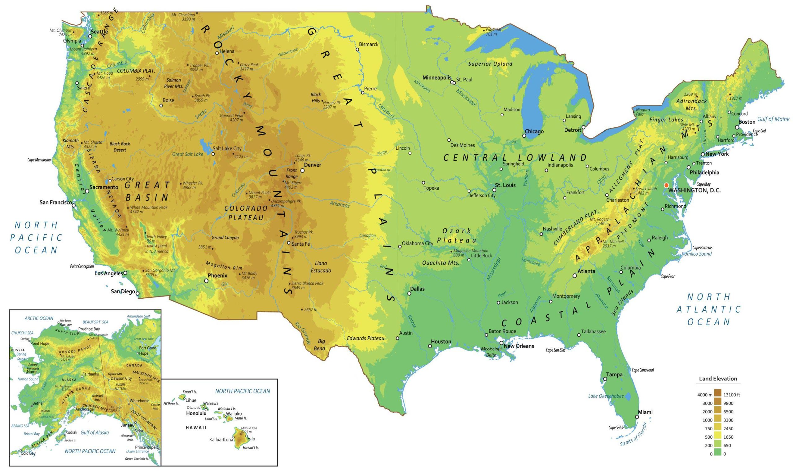
Physical map- Shows features and elevation of certain regions
Name and what it does
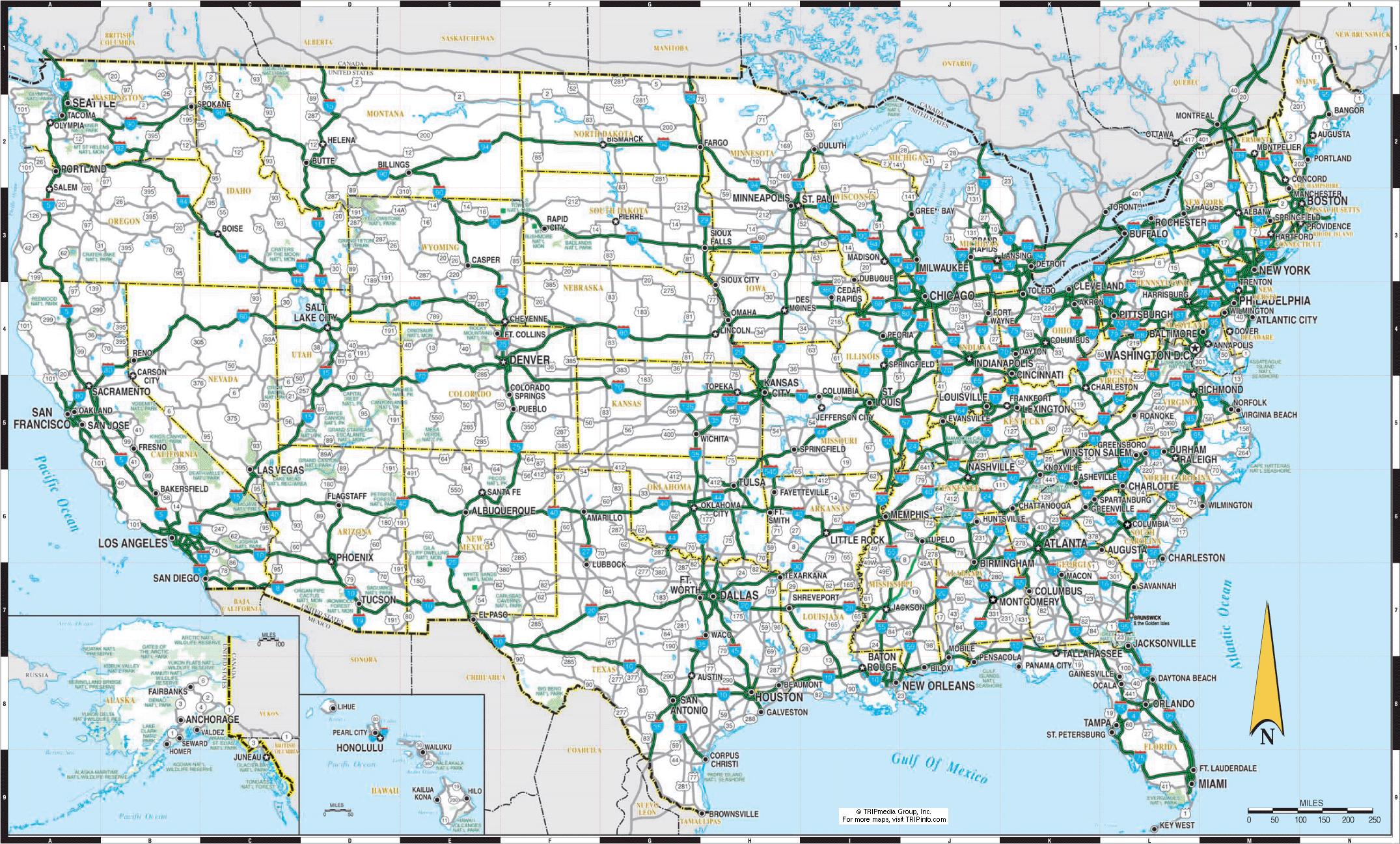
Road map- A plan that shows pathways from one place to another
Name and what it does
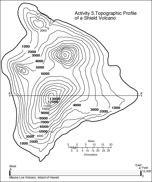
Topographic map- Focuses on the location of elevation levels (mountains, hills, man made objects)
Name and what it does
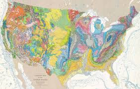
Geologic map- Lays out what kind of rock surface is in a given area
1/94,000,000 - Zoomed out
Small scale
1/130,000 - Zoomed in
Large scale
Reference maps
Focus on location and draws out natural as well as man made features
Cartography
The science and career of map making
Cartogram
Shows amount by altering size - Ex: Texas would be small if the map was about democrats
Choropleth map
Tones, Darker colors = more
absolute location
refers to lines of latitude and longitude
Reflective location
Site and situation - sight: characteristics at the immediate location - Situation: location of a place relative to other places
Geographic information system
Computer system that can store, analyze, and display information from multiple digital maps or geospatial sets
Global positioning system
a satellite and ground
landscape Analysis
Defining and describing land - involves field observation
“Built environments”
Physical artifacts that humans have created and form part of the landscape
Cultural landscape
anything built by humans
Political Map
shows boundaries between jurisdictions
Physical Map
shows features and elevations of certain regions through changes of lines, colors and shapes
Road Map
A plan that shows pathways from 1 place to another
Topographic Map
Focuses on the location of elevation levels from mountains, etc.
Geologic Map
lays out what kind of rock surface is in a given area
Reference Map
Focuses on a location, how to get from point A to point B
Thematic Map
Shows spatial relationships or topic vs what it might actually look like
Key
provides description for illustrations on a map
Geography
The study of where things are found on earth’s surface and the reason for their locations
Physical geography
refers to topography, climate, flora and fauna, soil
Human Geography
Population, culture, political, economic factors, urbanization and agriculture
Proportional Symbol
circles show size or amount of something one area has compared to another
Cartogram
Shows size by altering shape, larger area for more of a variable being produced
Isoline
Connects points of equal or similar values
Coropleth
Changes color to show different data- weather!
Dot Density
uses points to show specific observations
Map Scale
relationship between distance on a map and the actual distance on earth
Map Projection
the process of transferring information from a 3D surface to a 2D surface
Cartography
science and career of making maps