APHUG - Unit 1 - Thinking Geographically
1/37
There's no tags or description
Looks like no tags are added yet.
Name | Mastery | Learn | Test | Matching | Spaced | Call with Kai |
|---|
No analytics yet
Send a link to your students to track their progress
38 Terms
Reference maps
Show the location of geographic areas
Used for locating, navigating
Thematic maps
Displaying one or more variables across an area
Centres around a theme/subject
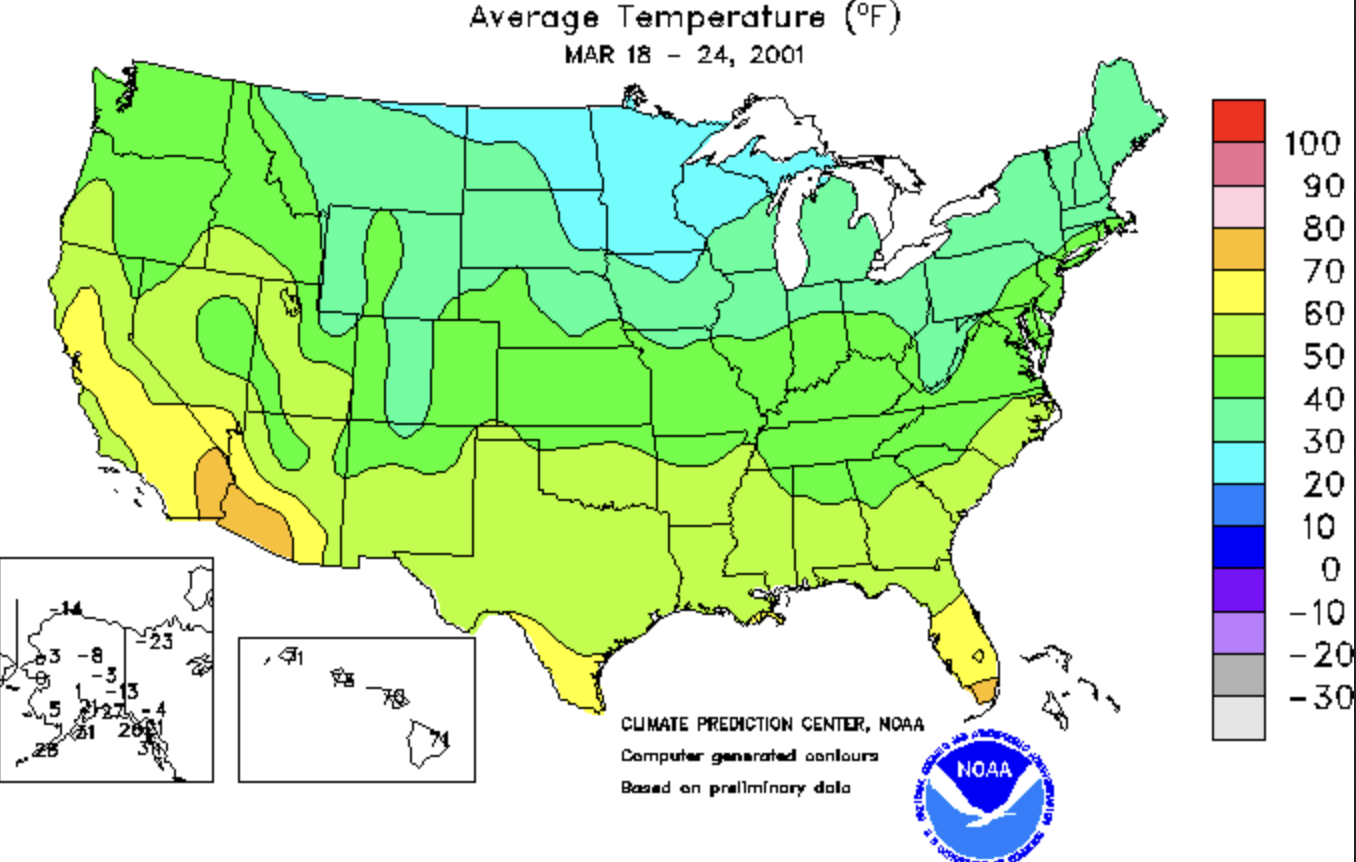
Isoline
Uses lines to connect points of equal value, representing data such as elevation, temperature, or precipitation
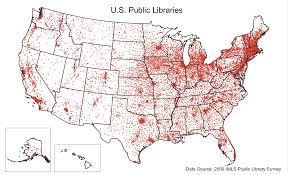
Dot distribution
Depicts data as points and shows how those points are clustered or spread out over an area
To represent the spatial distribution and density of a specific phenomenon
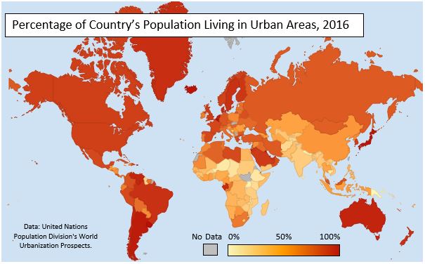
Choropleth
Uses shaded or pattered polygons in proportion to the measurement of the variable
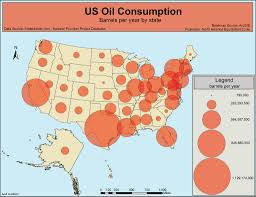
Graduated symbol
Displays quantitative data by varying the size of symbols (e.g., circles) based on magnitude of the variable
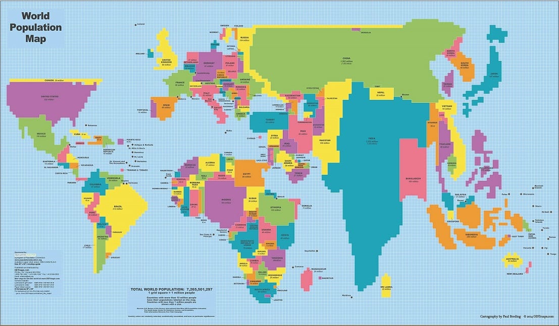
Cartogram
Distorts the size and shape of geographic areas to represent a particular variable, such as population or economic data
All maps distort at least one of…
Shape, area, distance, direction
Projection
Scientific way of transferring locations of Earth’s surface to a flat map
Scale
The relationship of a feature’s size on a map to its actual size on Earth
Small scale maps cover
Large regions
Large scale maps cover
Smaller regions
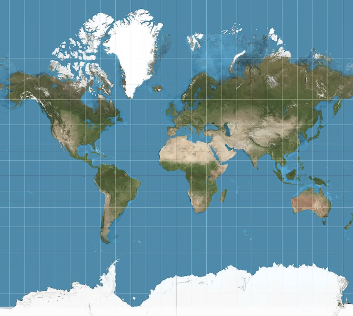
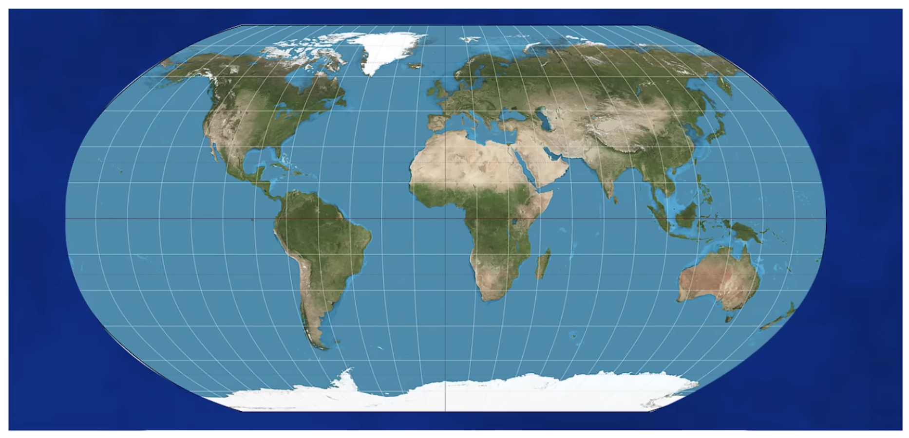
Mercator projection
Preserves direction and angles
Distorts area (landmasses become amplified at the poles)
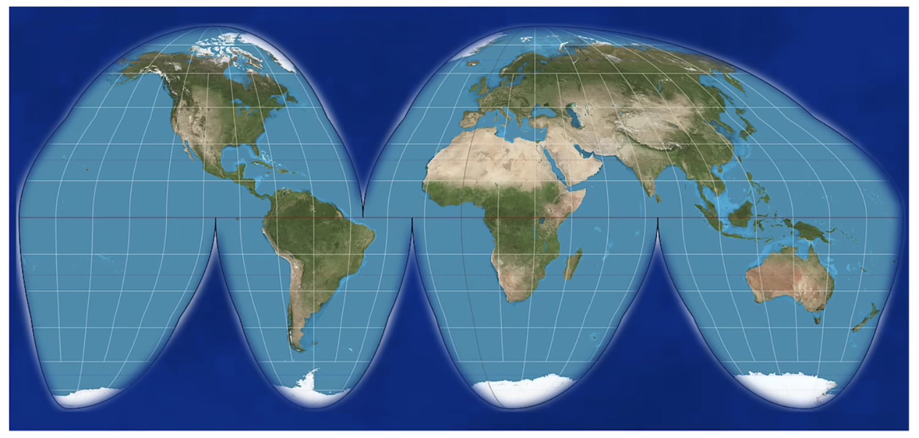
Goode Homolosine projection
Interrupted map
Preserves size and shape
Distorts distance
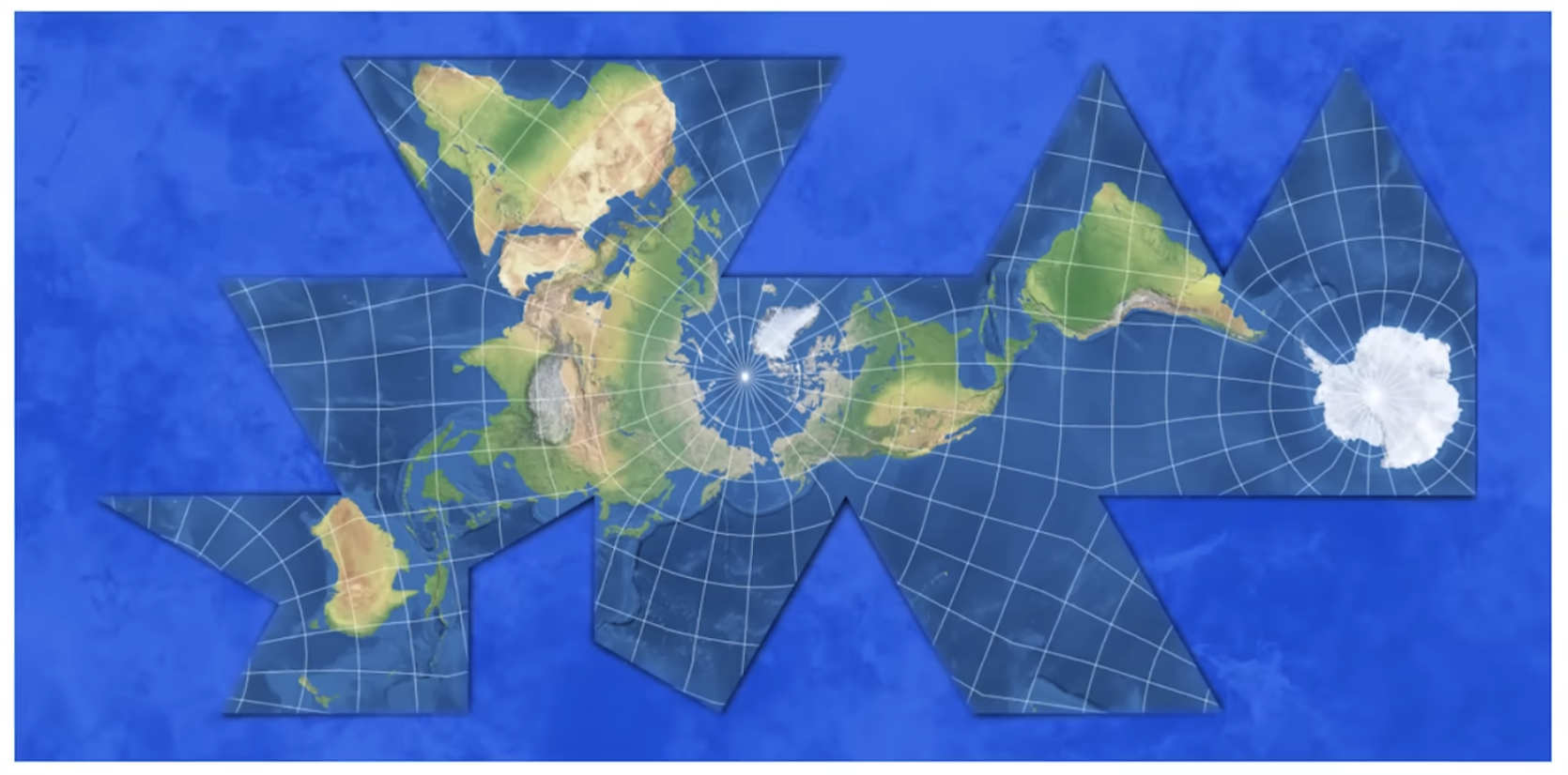
Fuller projection
Preserves shape and size
Distorts direction
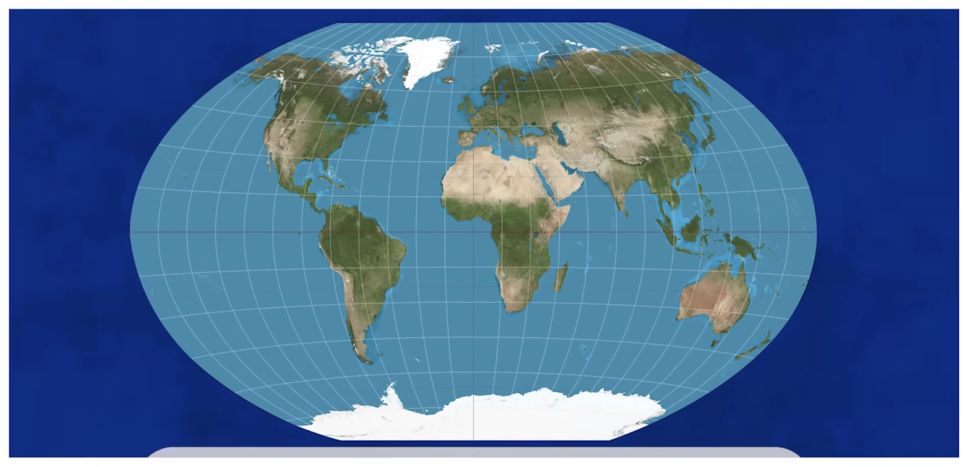
Robinson projection
Doesn’t preserve accurate spatial relationships but minimizes errors in each
Longitude and latitude
Winkel Tripel projection
Doesn’t preserve accurate spatial relationships but minimizes errors in each
Minimizes distortion at the poles
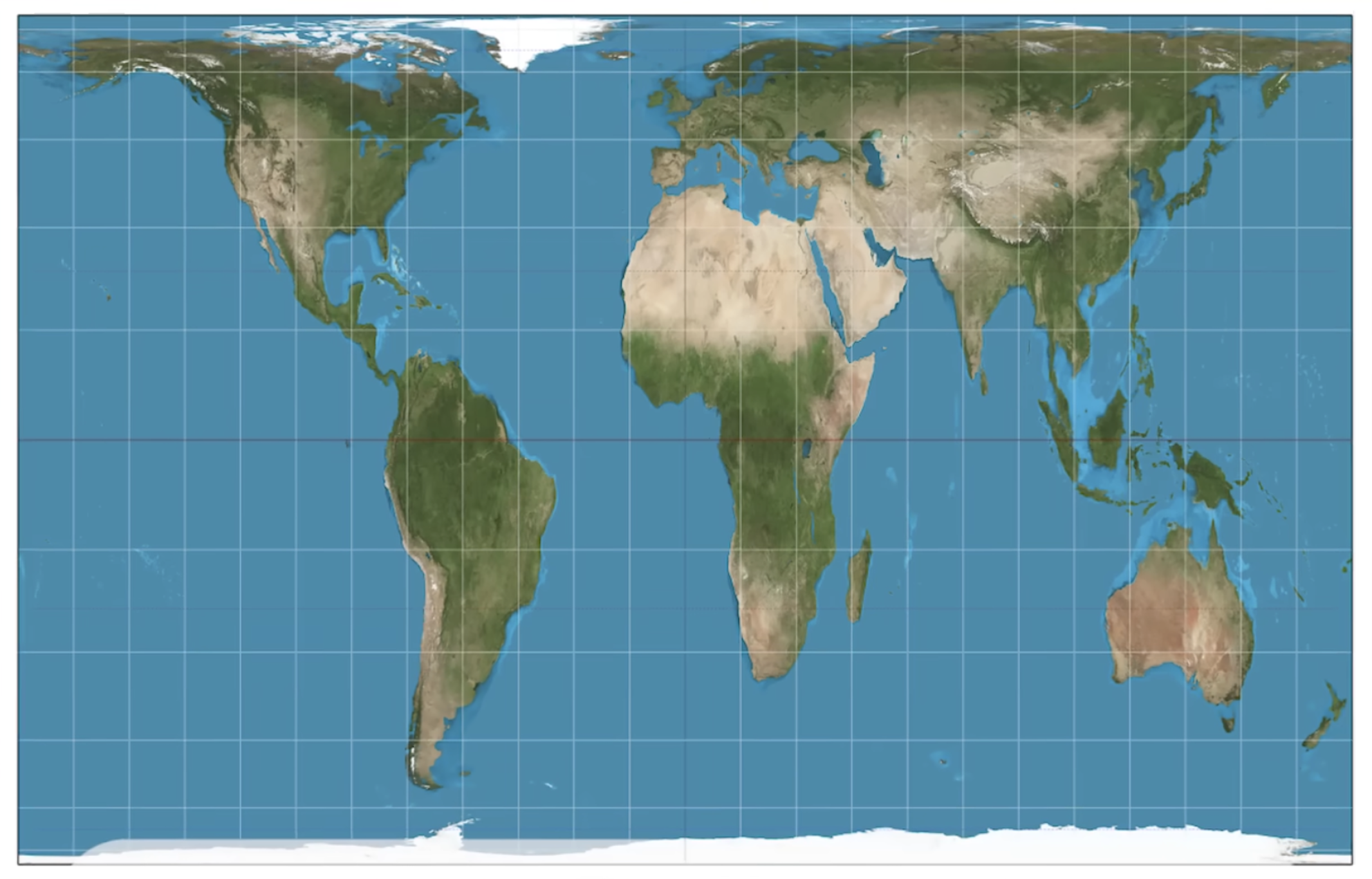
Gall-peters projection
Preserves area and size
Distorts shape and direction
GIS
Geographic Information System
Can capture, store, query, analyze, and display geography data
Remote sensing
Acquisition of data about Earth’s surface from a satellite orbiting Earth or from other long-distance methods (ex. aerial imaging)
GPS
Global positioning system
Accurately determines precise position of something on earth
Latitude and longitude
Census
The systematic, official count of a population, including demographic, economic, and social data
Population’s characteristics (age, s e x, occupation)
May also include information on agricultural and business sectors
Census data can be used for
Research, marketing, planning
Ex. where schools are built, where new bus routes are placed
Relative location
Position of something relative to another landmark rather than exact coordinates
Ex. I’m 50 miles west of Houston; I’m ten minutes away from Panda Express
Absolute location
A fixed position that never changes
Specific coordinates, latitude and longitude
Ex. 41.8268° N, 71.4025° W for Brown University
Space
A general, objective location or area
Can be analyzed at different scales, such as local, regional, or global, which helps to identify spatial patterns and trends
Place
The physical and human aspects of a location
Specific locations with distinct characteristics that give them meaning and identity
Ex. New Orleans’s rich cultural heritage, music scene, historical events, and food
Flow
Interaction and movement of people, goods, and information
Distance decay
Intensity decreases as distance increases
Time-space compression
The reduction in the time it takes to diffuse something (goods, ideas, people) to a distant place, resulting in a "shrinking world" effect
Advancements in transportation (airplanes, high-speed rail) and technology (internet, smartphones)
Increases global connectivity and diminishes the significance of distance
Pattern
The geometric or regular arrangement of something in an area
Sustainability
Development that meets the needs of the present without compromising the ability of future generations to meet their own needs
Natural resources
Materials or substances such as minerals, forests, water, and fertile land
Occur in nature and can be used for economic gain
Environmental determinism
The physical environment, including the climate, sets hard limits on human society
Human behaviours, cultures, and societal developments are shaped and constrained by the physical environment
Possibilism
The environment sets certain constraints or limitations, but culture is otherwise determined by social conditions
People control their own destinies
People deal with these environmental factors in dynamic and contingent ways
Formal/uniform region
An area with high homogeneity, where almost everyone shares one or more distinct, measurable traits
Clearly defined, often have official borders
May include physical features (ex. rolling hills) or cultural traits (ex. religion)
Ex. the Rocky Mountains, Latin America, the Quebecois (French-speaking in Canada), the USA
Functional/nodal region
An area organized around a node or focal point
Ex. pizza delivery zones, metropolitan areas (Chicago, Washington DC), ski resorts
Vernacular/perceptual region
Defined by feelings and prejudices that may or may not be true
It can also be an idea of a person’s mental map
Ex. the American Deep South, Silicon Valley, Little Italy