Map Types- AP Human Geography
1/25
There's no tags or description
Looks like no tags are added yet.
Name | Mastery | Learn | Test | Matching | Spaced | Call with Kai |
|---|
No analytics yet
Send a link to your students to track their progress
26 Terms
Purpose of Reference Maps
- They are designed to give people general information
- Tell us where things are
Examples of Reference Maps
Political Maps, Physical Maps, and Road Maps
Purpose of Thematic Maps
- Show spatial aspects of information and data.
- Tell us characteristics about a place.
Examples of Thematic Maps
Choropleth Maps, Dot Density Maps, Graduated Symbol Maps, Cartogram Maps, and Isoline Maps
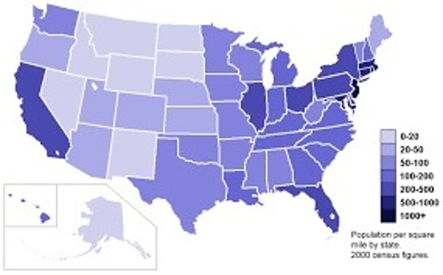
Choropleth Map
- Thematic
- Uses color to show different values of data.
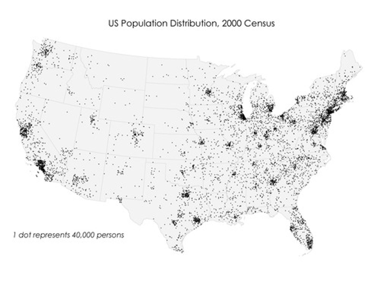
Dot Density Map
- Thematic
- Uses dots of the same size to show density and distribution of data
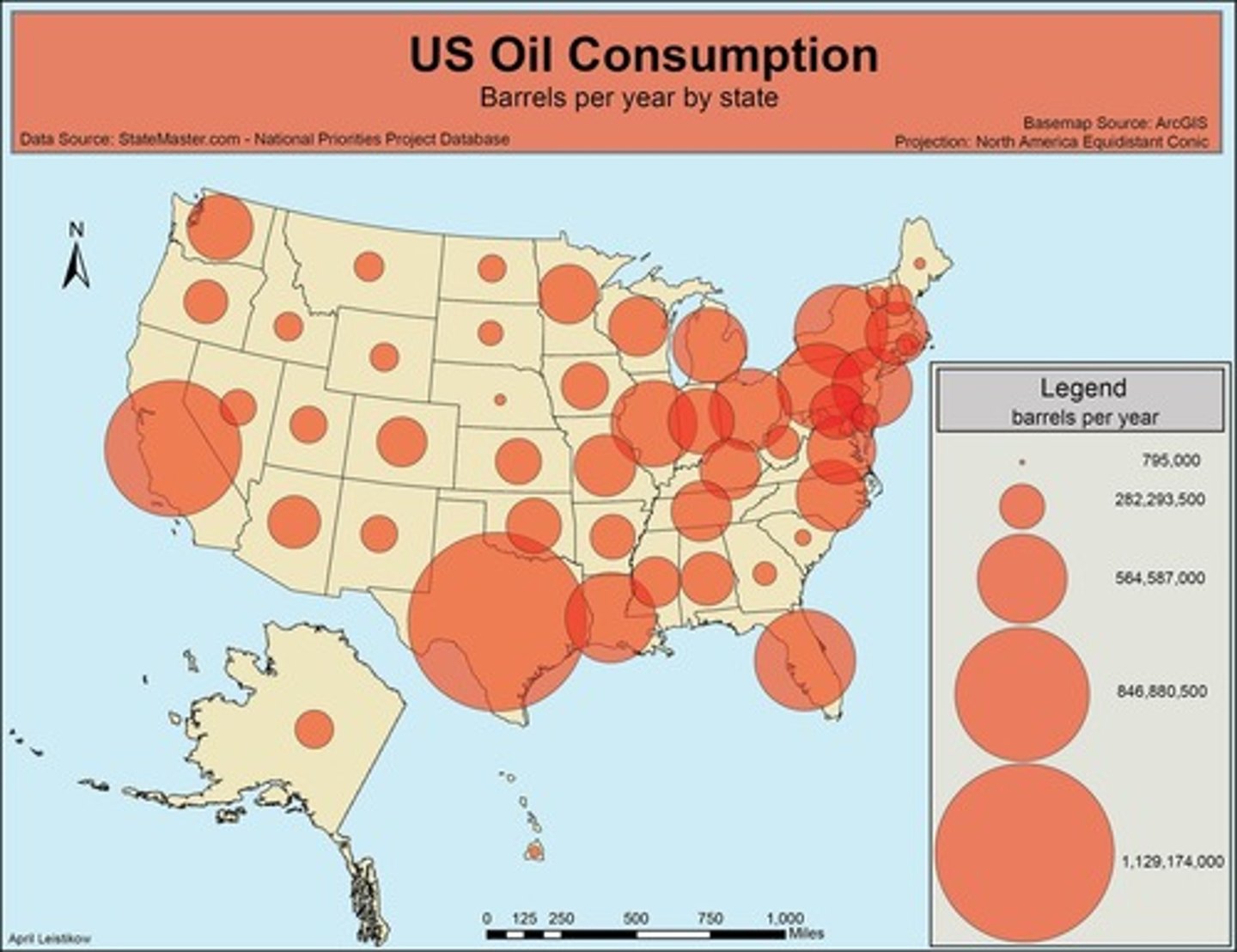
Graduated Symbol Map
- Thematic
- Uses shapes of different sizes (typically a circle) to show values of data. AKA Proportional Symbol Map
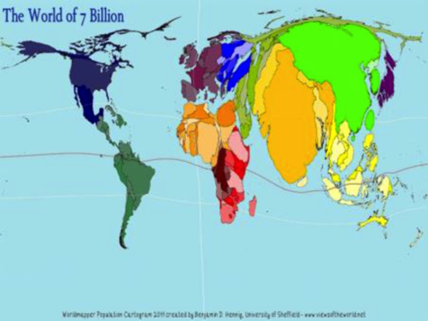
Cartogram Map
- Thematic
- The size of a place (state, country, province) that is shown according to a specific data point.
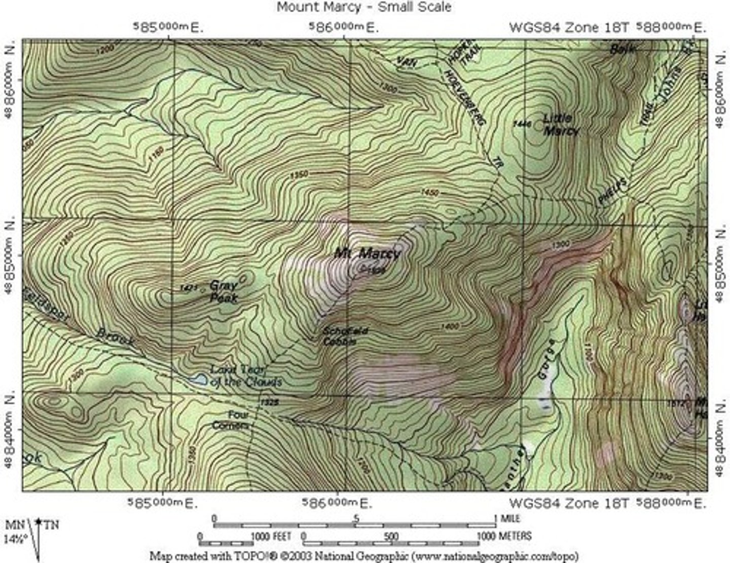
Isometric/Isoline Map
- Thematic
- Uses lines that connect points or areas of equal value to show variations of data across a place.
- Close lines = rapid change
- Lines farther apart = less change
*Topographic Maps are a type of this
Definition of a Map Projection
When a curved surface is shown on a flat surface. Because the earth is a sphere and maps are flat, all maps distort some aspect of reality.
SADD
SADD describes all maps
Shape can be distorted.
Area or size can be distorted.
Distance can be distorted.
Direction can be. distorted.
The most accurate part of a projection is the center.
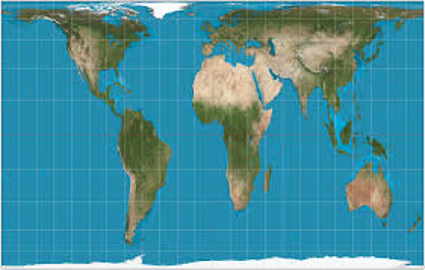
Mercator Map Purpose
Navigation

Mercator Map Strengths
Directions are constant and accurate
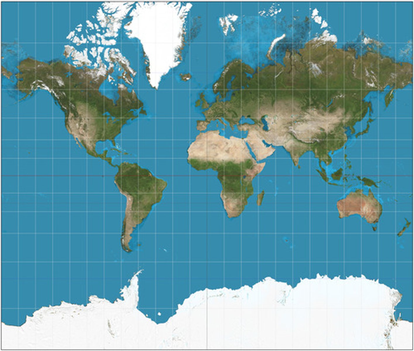
Mercator Map Distortion
Area of places near poles appears much larger than reality

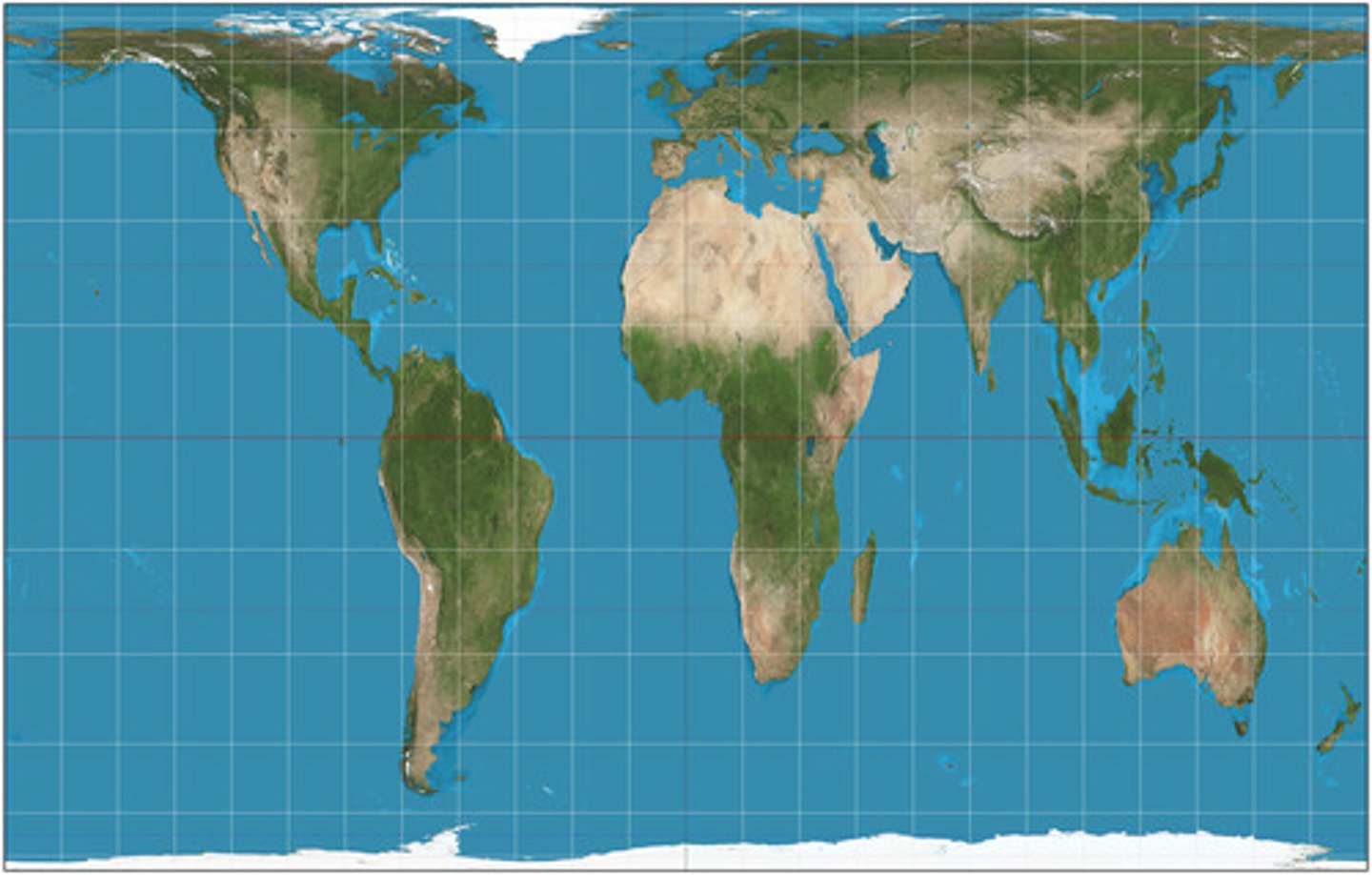
Robinson Map Purpose
General use, like in classrooms

Robinson Map Strengths
No major distortion
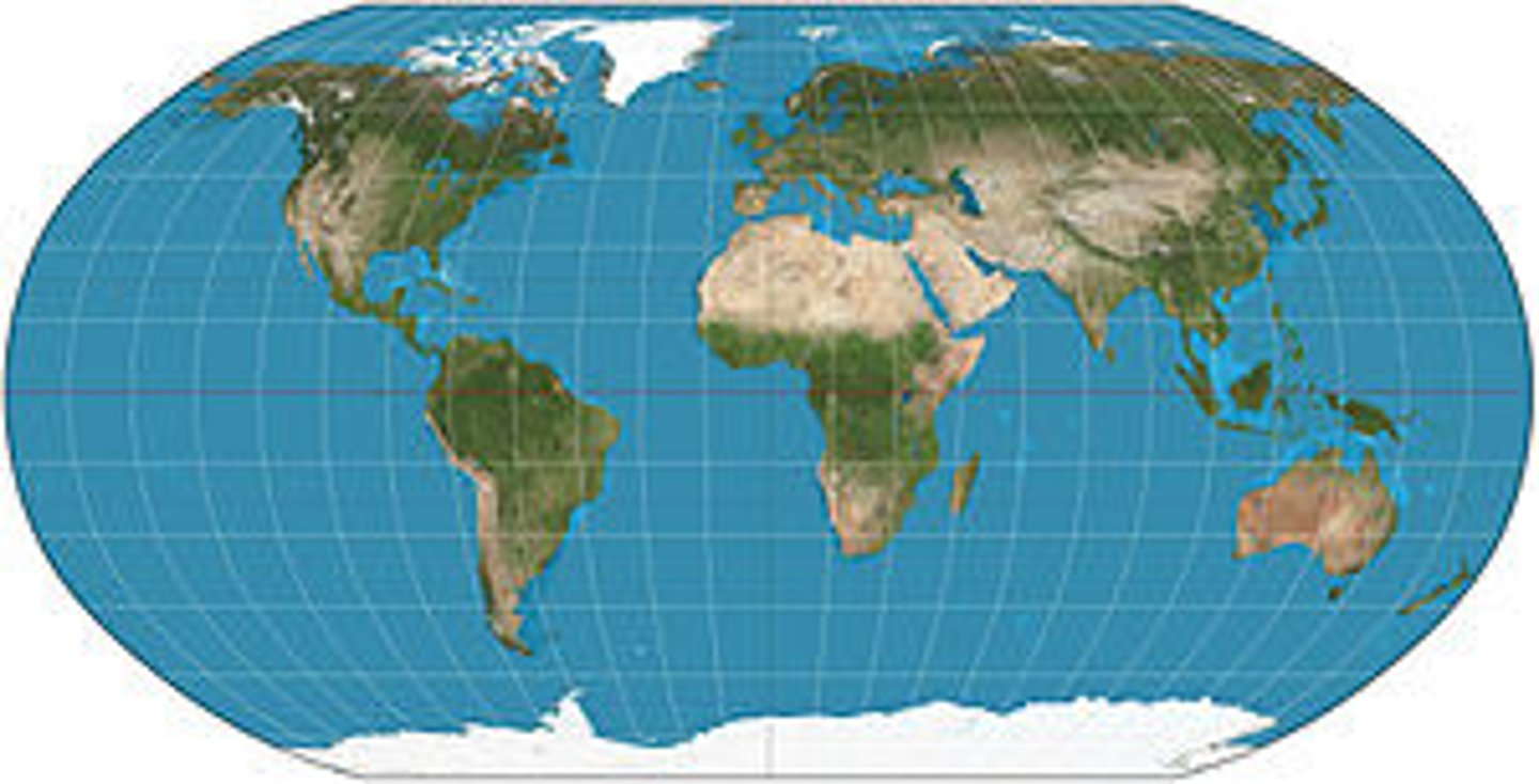
Robinson Map Distortion
Area, shape, size, and direction are all slightly distorted

Peters Map Purpose
Spatial distributions related to area
Peters Map Strength
Size of places are shown accurately
Peters Map Distortion
Shapes are inaccurate, especially near the poles

Equal-Area Map Purpose
General use and data distribution

Equal-Area Map Strengths
Size very close to reality
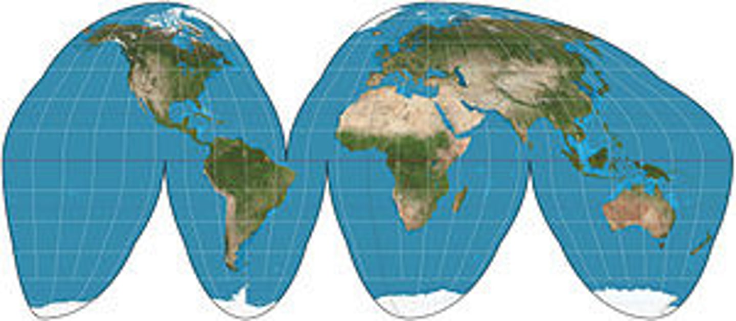
Equal-Area Map Distortion
Shape and Distance are distorted
AKA Orange-Peel Projection

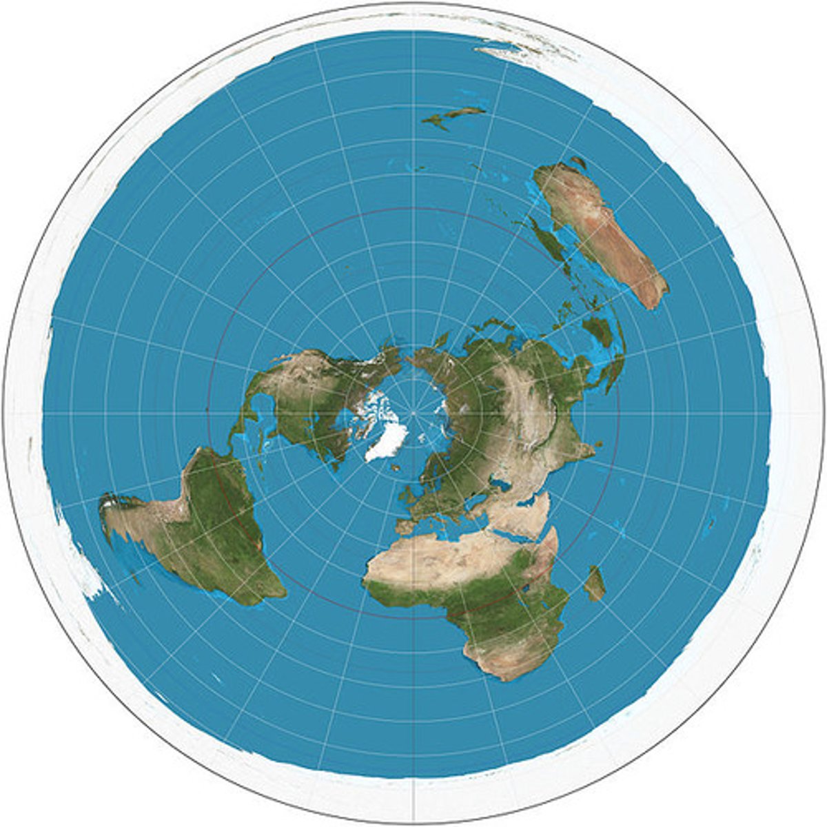
Azimuthal Map Purpose
To show the poles accurately

Azimuthal Map Strengths
Distance from poles shown accurately

Azimuthal Map Distortion
Direction and size are distorted, especially near edges
AKA Polar Projection