Oceanography Quiz 1
 Call Kai
 Learn
Learn Practice Test
 Spaced Repetition
 Match
Match Flashcards
 Knowt Play
1/11

Earn XP
Description and Tags
I am unsure what the quiz is covering but I am assuming since it's right after the instruments demo that it will be on that.
Name | Mastery | Learn | Test | Matching | Spaced | Call with Kai | Chat |
|---|
No analytics yet
Send a link to your students to track their progress
12 Terms
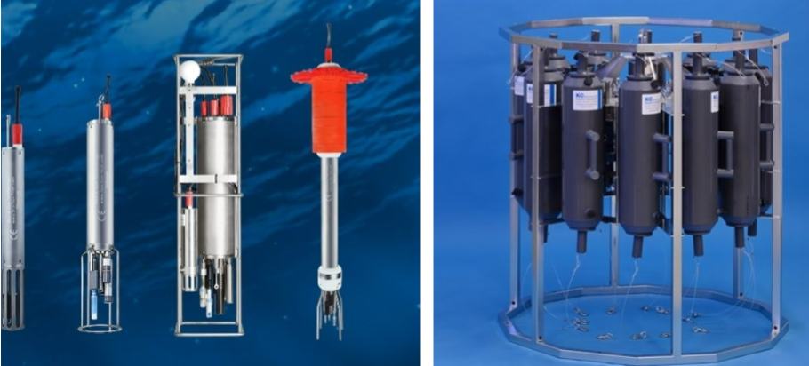
Conductivity-Temperature-Depth (CTD) Sensors
measure the conductivity (related to salinity), temperature, and depth of seawater
recording data as it descends
used for profiling ocean conditions, monitoring thermoclines, haloclines, and understanding ocean circulation patterns
Acoustic Doppler Current Profiler (ADCP)
Measures the velocity of water currents over a range of depths
use sound waves to measure the Doppler shift of backscattered signals from particles in the water. This data is used to calculate water movement
used for mapping ocean currents, tracking sediment transport, and studying tidal currents in estuaries.

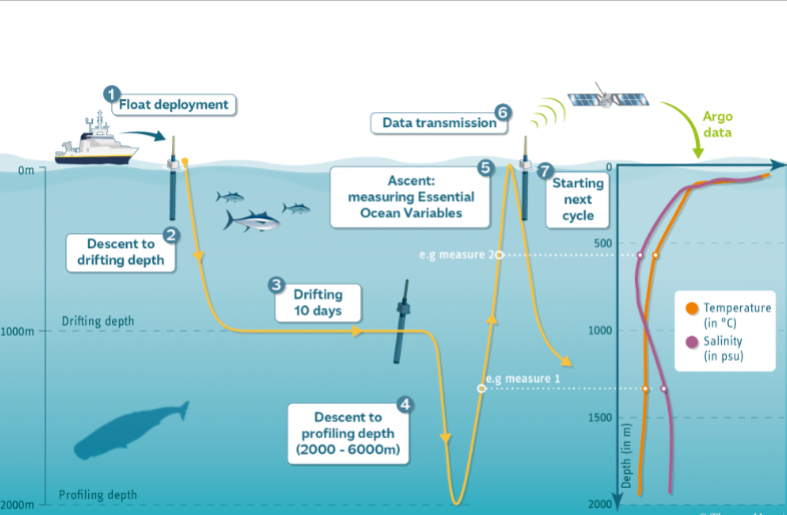
Argo Floats
collect temperature, salinity, and pressure data at various depths
programmed to drift with currents, periodically sinking and rising to the surface to take measurements. Data is transmitted via satellite
Used in long-term ocean monitoring, climate change studies, and improving global climate models
XBT (Expendable Bathythermograph)
Measures temperature profiles of the ocean
descends, a thermistor attached to a fine wire records temperature at different depths. The wire spools out as the device falls
used for quick temperature data for oceanographic surveys and is useful for studies of thermal structure

Satellite Remote Sensing
Collects large-scale data on sea surface height, temperature, winds, and chlorophyll concentration
Satellites equipped with various sensors (e.g., radar altimeters, radiometers) measure different ocean properties from space
Global ocean circulation studies, sea level rise monitoring, and detecting changes in sea surface temperatures for climate studies.
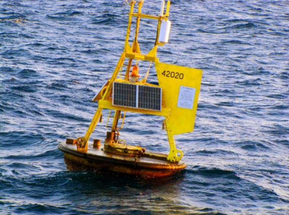
Wave Buoys
Measures wave height, period, and direction.
Floating buoys are equipped with accelerometers and GPS to record their vertical and horizontal movement as waves pass.
Used in monitoring storm surges, tsunami detection, and marine navigation safety.
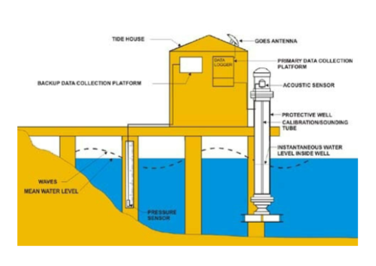
Tide Gauges
Measures the change in sea level relative to a fixed point.
Tide gauges record the rise and fall of water levels with highly sensitive sensors, providing long-term data on tides and sea level trends.
Used for monitoring tidal changes, storm surges, and long-term sea level rise.
Drifters
Measures surface currents by drifting with the ocean's movement.
Drifters float at or near the surface of the ocean, equipped with GPS trackers that allow scientists to map current patterns.
Used for studying ocean circulation, tracking oil spills, and understanding surface transport processes.

Gliders
Autonomous underwater vehicles (AUVs) used for collecting oceanographic data over long distances and durations.
Gliders move in a sawtooth pattern, using changes in buoyancy to ascend and descend. They carry instruments to measure temperature, salinity, and oxygen.
Useful for long-term monitoring, data collection in hard-to-reach areas, and studying ocean circulation.

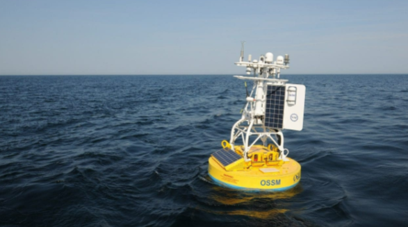
Moorings
Fixed installations anchored to the seafloor, equipped with a variety of sensors for long-term monitoring.
Moorings can be outfitted with CTDs, current meters, and other instruments. Data is either transmitted in real-time or recovered later.
Long-term ocean monitoring, studying water column stability, and tracking seasonal changes in ocean conditions.
Thermosalinograph
Measures surface temperature and salinity from moving ships.
Water is continuously pumped from the ocean's surface into the instrument, which records temperature and salinity data as the vessel moves.
Useful for collecting real-time surface data during oceanographic cruises.
Summary of Key Instruments
• Instruments such as CTDs, ADCPs, and Argo floats are vital for understanding the ocean’s physical properties.
• Satellite data complements in-situ measurements, offering global coverage.
• Emerging technologies like gliders and moorings enable long-term and large-scale data collection.