NCD - P/ENS TO ENSIGN EXAM
1/38
There's no tags or description
Looks like no tags are added yet.
Name | Mastery | Learn | Test | Matching | Spaced | Call with Kai |
|---|
No analytics yet
Send a link to your students to track their progress
39 Terms
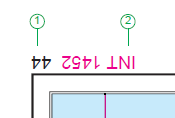
1?
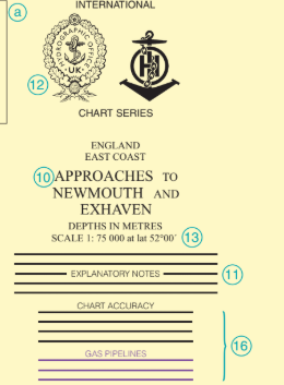
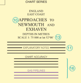
Chart Number

2?
Chart number in international (INT) chart series
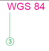
3?
Geodetic Reference System
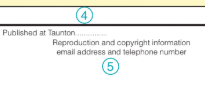
4?
Publication note (imprint) showing the date of publication as a New Chart.
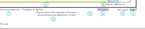
5?
Reproduction and Copyright acknowledgement note (Copyright Note)
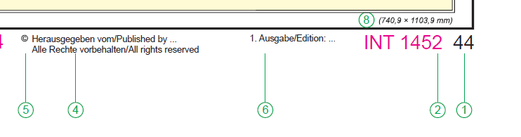
6?
Note of first and current edition
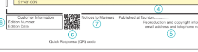
7?
Notices to Mariners
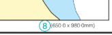
8?
Dimensions of the inner neat-lines of the chart border
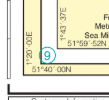
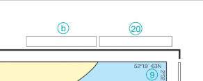
9?
Corner co-ordinates

10?
Chart Title
11?
Explanatory Notes (Provides information on the chart’s construction, datum, etc.)

12?
Seals. Reproductions of other charts have the seals of original producer (left) and publisher
(right); charts which are co-productions carry the seals of the nations involved in their production.
13?
Scale of chart; on Mercator projection, at a stated latitude
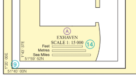
14?
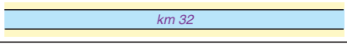
Linear scales on large-scale plan
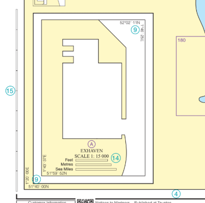
15?
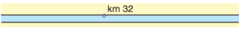
Linear border scales (metres). On smaller scale charts, the latitude border should be used to measure Sea Miles and Cables.
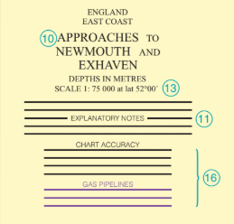
16?
Cautionary notes (if any) on charted detail; to be read before using the chart.
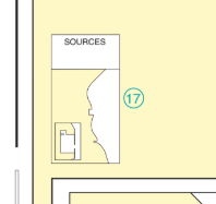
17?
Source Diagram. If a Source Diagram is not shown, details of the sources used in the compilation of the chart are given in the
explanatory notes.The Source Diagram or notes should be studied carefully before using the chart in order to assess
the reliability of the sources.
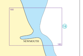
18?
Reference to a larger scale chart or plan (with reference letter if multiple plans on same chart). May also be shown in yellow.
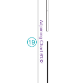
19?
Reference to an adjoining chart of similar scale.
20?
Note ‘IMPORTANT - THE USE OF CHARTS’. References to other publications.

What does this mean?1
Position approximate (not accurately
determined or does not remain fixed)

What does this mean?2
Position doubtful (reported in various
positions)

Triangulation point

Observation spot

Fixed point

Benchmark
Distance along waterway, no visible marker
Distance along waterway, with visible marker

What is the difference between these point symbols?
Emphasis. Fixed point can be displayed in larger circle and text can be capitalized for emphasis.
Convert International Nautical Mile to meters
1 NM = 1852 m

Local Magnetic Anomaly. Within the enclosed area the magnetic variation may deviate from the normal by the value shown.
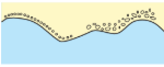
Coastline, surveyed
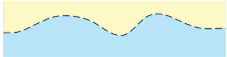
Coastline, unsurveyed
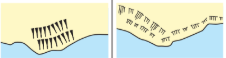
Steep coast, Cliffs

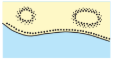
Hillocks
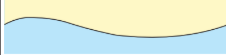
Flat coast, surveyed coastline
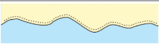
Sandy shore
Stony Shore, Shingly Shore
Sandhills, Dunes