APHG Unit 1 Vocabulary
 AP Practice
 Call Kai
1/79

Earn XP
Description and Tags
Name | Mastery | Learn | Test | Matching | Spaced | Call with Kai | Chat |
|---|
No analytics yet
Send a link to your students to track their progress
80 Terms
Physical Geography
The study of the spatial characteristics of various elements of the physical environment. Physical geographers study topics such as landforms, bodies of water, climate, ecosystems, and erosion.
Human Geography
The study of the spatial characteristics of humans and human activities. Human geographers study topics such as population, culture, politics, urban areas and economics.
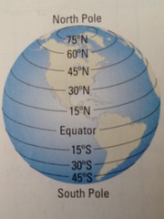
Latitude
Distance north or south of the Equator, measured in degrees
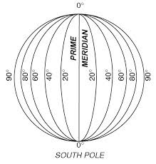
Longitude
Distance east or west of the prime meridian, measured in degrees
Equator
An imaginary line drawn around the earth equally distant from both poles, dividing the earth into northern and southern hemispheres and measuring 0 degrees latitude.
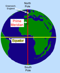
Prime Meridian
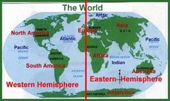
The meridian, designated at 0° longitude, which passes through the Royal Observatory at Greenwich, England. It separates the Eastern and Western Hemispheres.
International Date Line
The line of longitude that marks where each new day begins, centered on the 180th meridian (180 degrees longitude) and deviates slightly to accommodate political and geographical boundaries.

Reference map
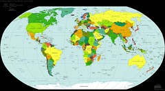
Maps that emphasizes the location of places (without data attached). Examples include Political maps, Physical Maps, Road Maps and Plat Maps.
Thematic maps
A map that emphasizes a specific theme or topic, such as population density or climate, rather than just geographical locations. Examples include Isoline Maps, Chloropleth Maps, Dot Distribution Maps, Cartograms, and Graduated Symbol maps.

Choropleth Map
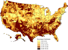
Use various colors, shades of colors, or patterns to show the location and distribution of data.
Isoline Map
A thematic map with lines that connect points of equal value. These maps are often used to represent data such as elevation, temperature, or weather patterns.

Dot Distribution Map
A map where dots are used to demonstrate the frequency or intensity of a particular phenomena across a map. Each dot represents a specified quantity of the phenomenon, allowing for visual comparison of its distribution.

Cartogram
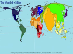
A map in which the size of an area is distorted proportionally, to represent the amount of data in that location. In a cartogram, areas are resized according to a specific variable, such as population or GDP, rather than their actual land area.
Graduated Symbol Map
A map with symbols that vary in size according to the value of the attribute they represent. These symbols might be anything - such as circles, squares or picture icons. Also known as Proportional symbol maps.

Topographic Map
A type of Isoline Map, these depict the physical features of an area, including elevation, terrain relief, and landforms, typically using contour lines to indicate changes in elevation.
Map Projection
a method of taking the 3D Earth and displaying it in on a 2D surface. Because the Earth is a sphere and maps are flat, all maps inevitably involve some distortion of scale, distance, area, and direction. Examples include the Mercator Projection and the Robinson Projection.

Cartographic Scale
the relationship between the distance on the ground and the corresponding distance on a specific map. Usually described as a proportion, ratio, fraction, or visual representation.
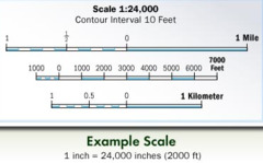
Small Scale Map
A “zoomed-out” map that represents a larger area with less detail, typically used for giving a broad overview rather than precise information.
Large Scale Map
A "zoomed-in" map that represents a more localized area with greater detail, typically used for more accurate and specific information.
Absolute location
describing where something is using the exact site, often defined by coordinates such as latitude and longitude.
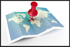
Relative location
describing the location of a place as compared to (or relative to!) something else - using reference points or landmarks, rather than exact coordinates.
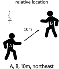
Direction
Used to describe where things are in relation to each other - usually using the Cardinal Directions (North, South, East, West) or intermediate directions (Northeast, Southeast, etc.).
Absolute distance
describing how far a distance is quantitative units of distance (miles, kilometers, etc.)

Relative distance
describing the distance between locations using qualitative terms or non-traditional measurements of distance (one hour north of)

Elevation
The distance of features above sea level, typically measured in feet or meters.
Distribution
The arrangement of features or phenomena across space - the way data or a phenomenon is spread out over a given area.
Clustering
The grouping of features or phenomena within a particular area, resulting in areas of high concentration compared to surrounding regions.
Dispersal
The scattering of features or phenomena across space, leading to lower concentrations in certain areas compared to others.
place
A specific point on Earth distinguished by particular characteristics.
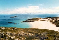
location, site, and situation
the three different aspects of a place

site
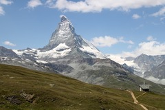
The physical character of a place, including its geographic characteristics. For example the site of Istanbul includes the fact that it is on a land bridge connecting Asia and Europe, and also a water bridge (strait) connecting the Black Sea and the Mediterranean
location
the specific position of a place on Earth's surface

situation
the location of a place relative to the places that are around it- example: the situation of New Jersey is that it is part of a highly populated and connected area on the East Coast of the US

GIS (Geographic Information Systems)
software that captures, manages, analyzes, and displays data that is collected geographically

GPS (Global Positioning System)
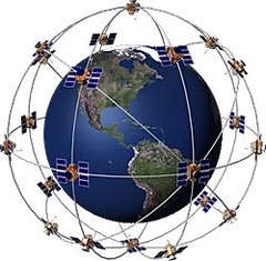
a system that measures distance from a series of satellites to determine location on the planet
Remote sensing
the science of making measurements of the earth using sensors on airplanes or satellites

Geospatial
relating to data that is specific to one location

Quantitative data
objective data that is fact based, usually measurable and usually expressed in numbers

Census
an official count of individuals in a population (in the USA, it happens every 10 years)

Qualitative data
subjective information that is opinion based, is usually descriptive, and often expressed as text
Case study
detailed observations that provide insight into a group of people in a specific area

3 Types of Distribution
density, concentration, and pattern

Density
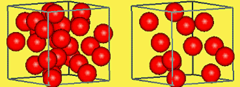
the number of things divided by the measurement of area
Concentration
how closely packed together objects are
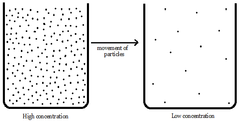
pattern
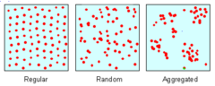
any regular geometric arrangement that a geographer can identify to how a characteristic is distributed
Cultural Landscape
the title of our textbook and more importantly, the visible changes that humans make to the enviroment including buildings, crops, and signs

Culture
the social heritage of a group or their way of life - major components are language, religion, ethnicity, food, and roles

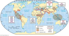
Hearth
a source of culture (where a culture began). For example, the US is the hearth of fast food
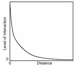
Distance decay
the idea that the interaction between two places declines as the distance between them increases
Region
a place larger than a point and smaller than a planet that is grouped together because of a measurable or perceived common feature
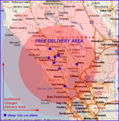
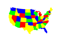
Formal region
a region that is based entirely on something that can be identified and documented or measured - all government areas are this because they share a government
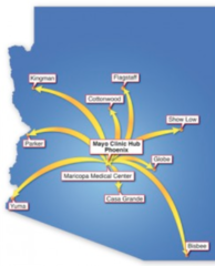
Functional region
a region based around a node or focal point - terrestrial radio broadcasts are an example of this
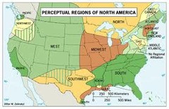
Vernacular/perceptual region
an area that shares a common qualitative characteristic, it's only a region because people believe it's a region
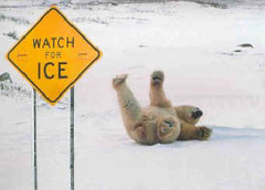
Friction of distance
a metaphor that explains that effort must be used to overcome distance
Globalization
worldwide integration and development which results in the expansion of international cultural, economic, and political activities
Infrastructure
the basic facilities and installations that help a government or community run, including roads, schools, phone lines, sewage treatment plants and power generation

Natural resource
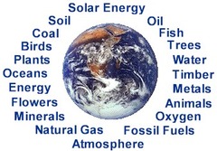
a physical material constituting part of Earth that people need and value
Scale of analysis
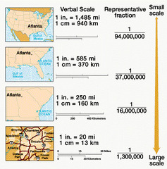
how zoomed in or out you are when looking at geographic data
Spatial
it's not as complicated as it sounds - a fancy word for describing how things are organized in space
Spatial distribution
arrangement of a phenomenon across the Earth's surface
Spatial Interaction
the flow of goods, people, or information among places, in response to localized supply and demand
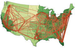
Gravity Model of Spatial Interaction
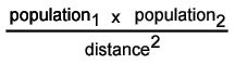
the most important model in geography - (population1 x population2)/distance squared - the interconnectedness of 2 places depends on their distance and population
Temporal
relating to time

Sustainability
the goal of the human race reaching equilibrium with the environment; meeting the needs of the present without while also leaving resources for future generations

Time-space compression
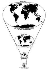
the idea that the world feels smaller than it used to because of increased technology in transportation and communication
Environmental determinism
the belief that a physical environment is THE reason that some societies are strong while others are weaker
Environmental possibilism
the belief that a physical environment plays a role in the development of a society, but is NOT the ONLY factor at work
Sub-Saharan Africa
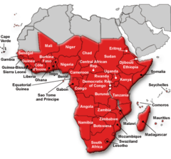
a geographic and cultural region located to the south of the world's largest desert
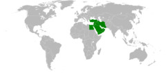
Middle East
the historical name for Southwest Asia, including Iran, Iraq, the Eastern Mediterranean (Turkey, Syria, Lebanon, Israel) and the Arabian Peninsula
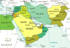
Southwest Asia
previously known as "the Middle East", it includes Iran, Iraq, the Eastern Mediterranean (Turkey, Syria, Lebanon, Israel) and the Arabian Peninsula
Latin America
a geographic and cultural region that includes South America, Central America, and Mexico, as well as the Spanish-speaking Caribbean. Generally Spanish or Portuguese speaking and predominantly Catholic

Southeast Asia
the region south of China and east of India, composed of islands and peninsulas. Some Buddhist countries but also influenced by Islam

South Asia
the region south of the Himalayas, composed of India, Pakistan, and Bangladesh. Primarily Hindu and Muslim. Nepal and Bhutan are Buddhist

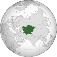
Central Asia
the "stans". Many are predominantly Muslim and many are former republics of the Soviet Union
East Asia
Contains China, Japan, Korea, Mongolia

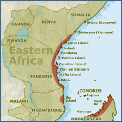
East Africa
Region of Africa considered to include Tanzania, Kenya, Uganda, Rwanda, Burundi,Ethiopia & Somalia.
West Africa
a region of Africa that is close to the coast and includes Nigeria, Ghana, Ivory Coast, Senegal among other countries
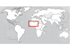
North Africa
Region of Africa comprising the modern countries of Morocco, Algeria, Tunisia, and Libya. Culturally Muslim and ethnically Arab

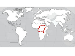
Central Africa
Region of Africa that straddles the Equator and is drained largely by the Congo River system. Includes, the Republic of the Congo, the Central African Republic, and the Democratic Republic of the Congo among others
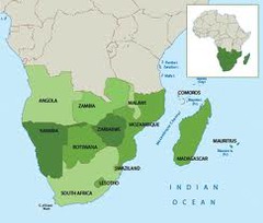
Southern Africa
A region including Namibia, Botswana Angola, Republic of South Africa, Zimbabwe