AP Environmental Science Review
1/270
There's no tags or description
Looks like no tags are added yet.
Name | Mastery | Learn | Test | Matching | Spaced |
|---|
No study sessions yet.
271 Terms
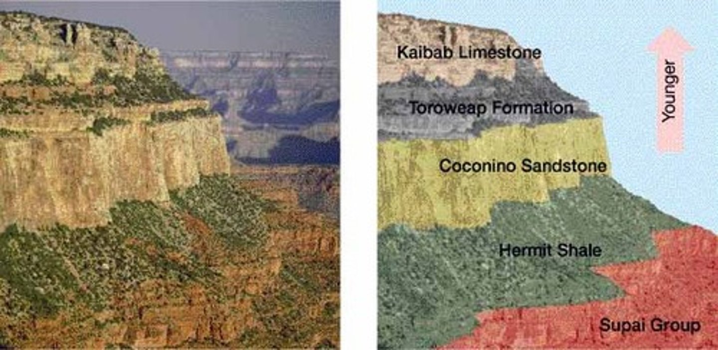
superposition
The principle that any given rock layer is probably older than those above it and younger than those below it
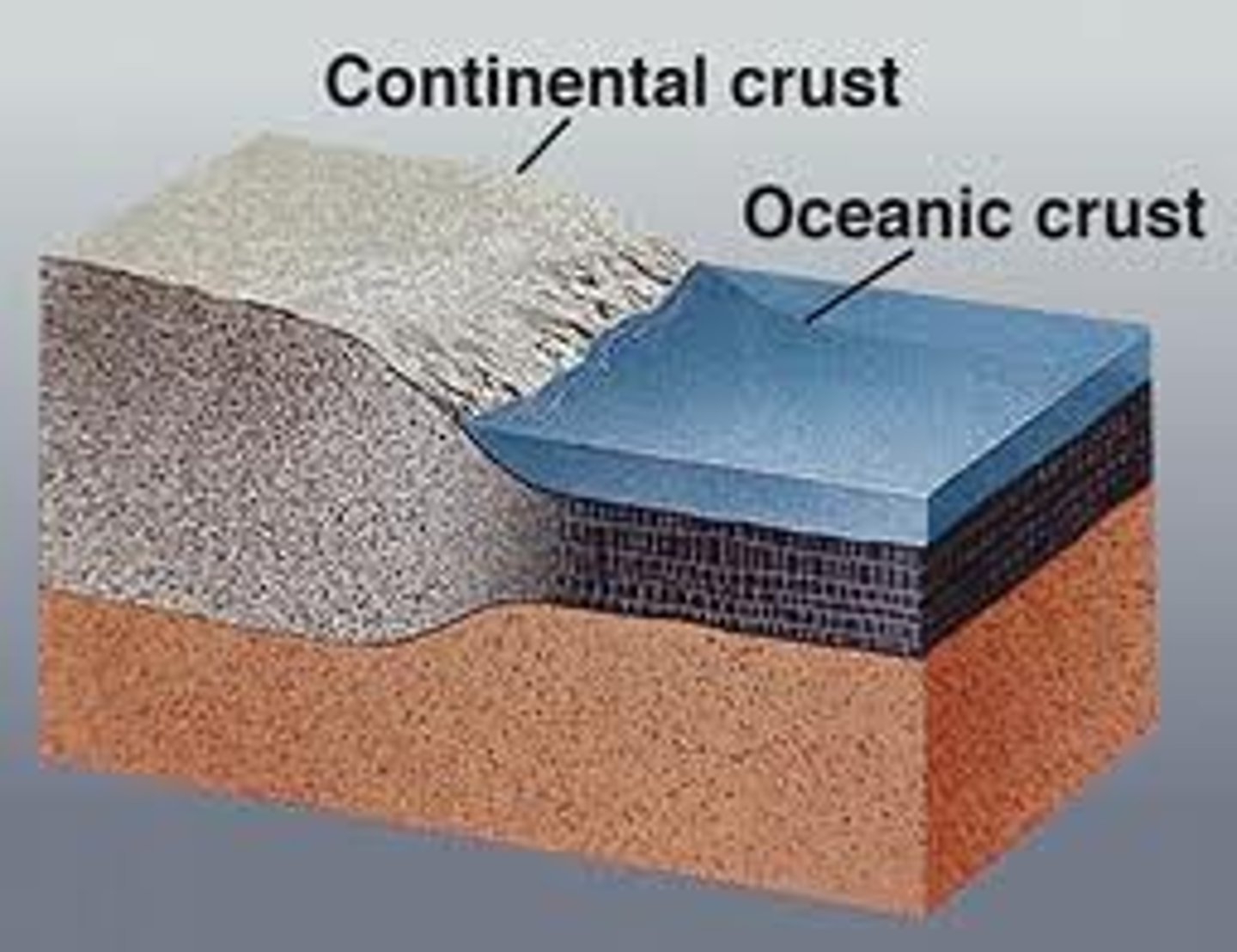
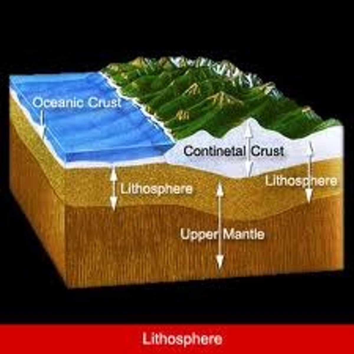
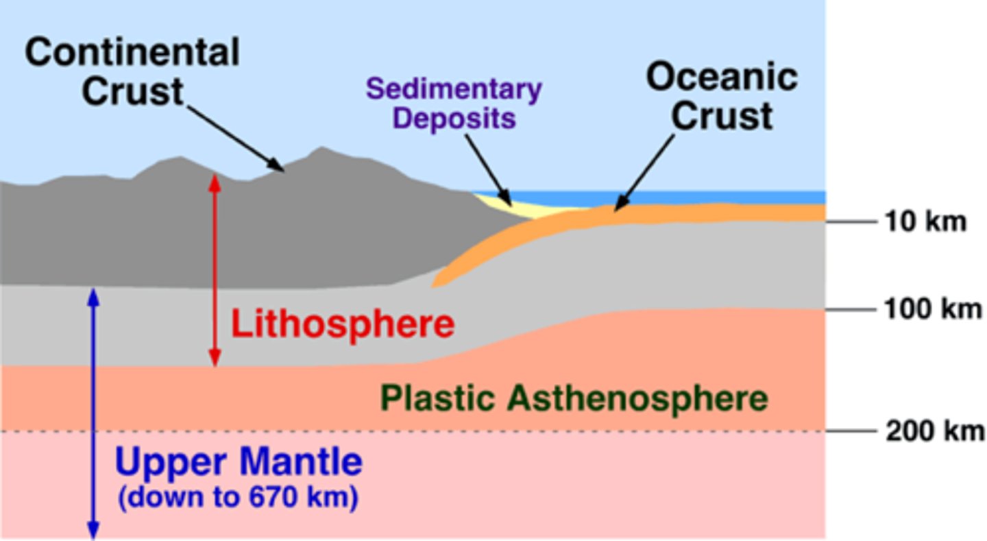
continental crust
Extends from surface of Earth down to 20-30 miles. Continental crust (granite) is less dense then ocean crust (basalt).

oceanic crust
Extends down from the surface of the Earth to 7 miles. Crust is layered and very uniform. Composed of basalt.
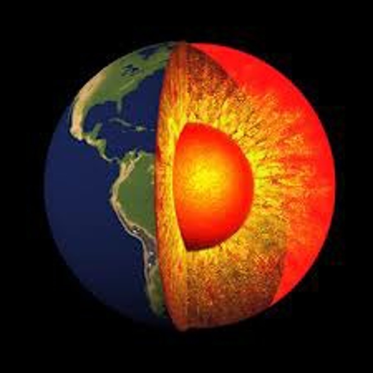
mantle
Contains most of Earth's mass. Composed of iron, magnesium, aluminum, and silicon-oxygen compounds
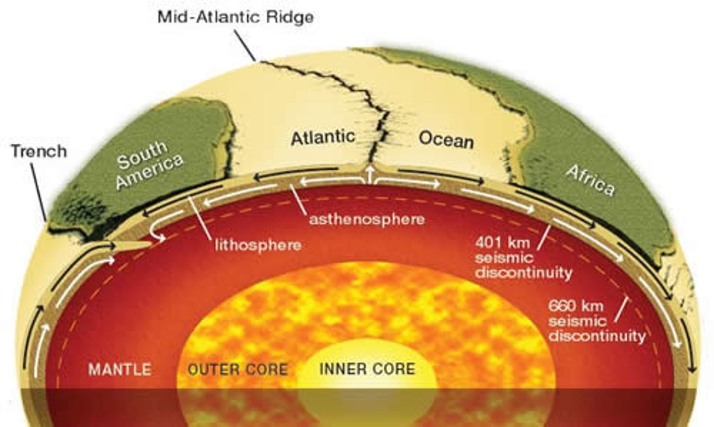
core
Composed mostly of iron and is so hot that the outer core is molten. The inner core is under such extreme pressure that it remains solid.
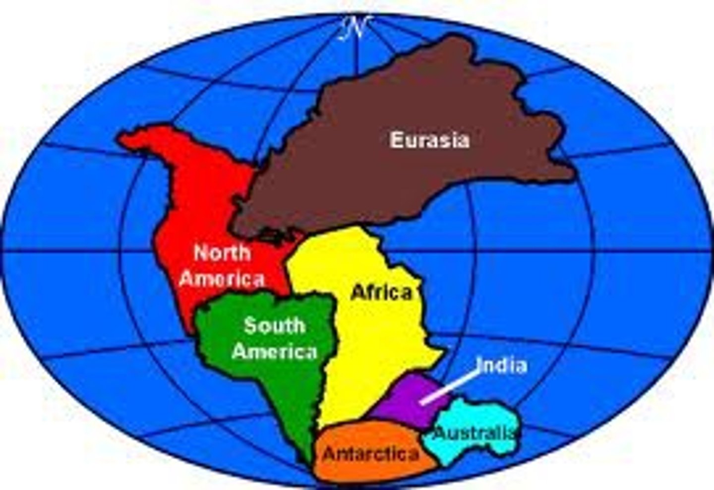
Continental Drift Theory
1915- Alfred Wegener proposed that all present-day continents originally formed one landmass (Pangaea).
lithosphere
Lithosphere (crust and upper mantle) is divided into massive sections known as plates, which float and move on the asthenosphere.
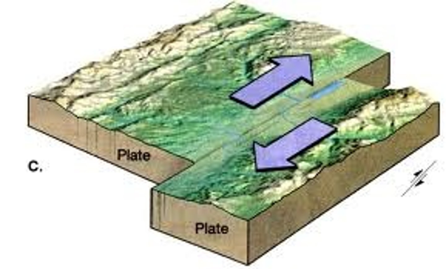
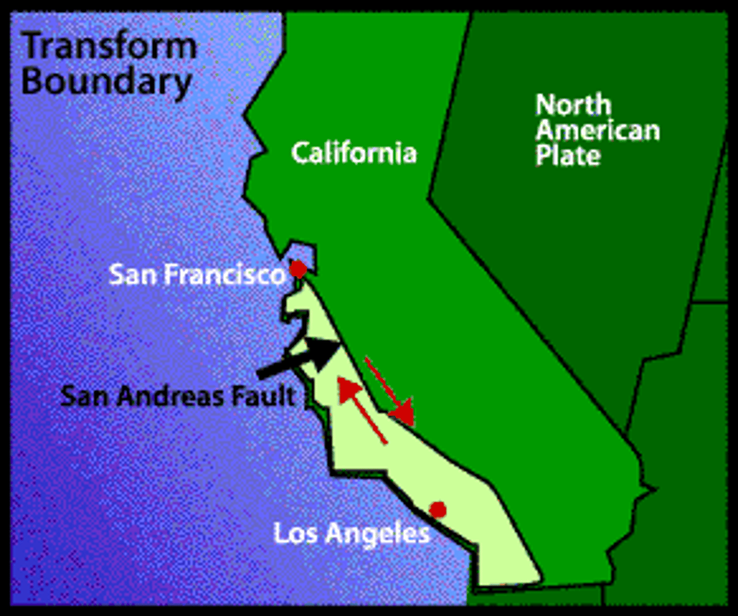
transform boundaries
Occur where plates slide PAST each other.
San Andreas Fault
Found near the western coast of North America. Where the Pacific and North American plates move relative to each other.
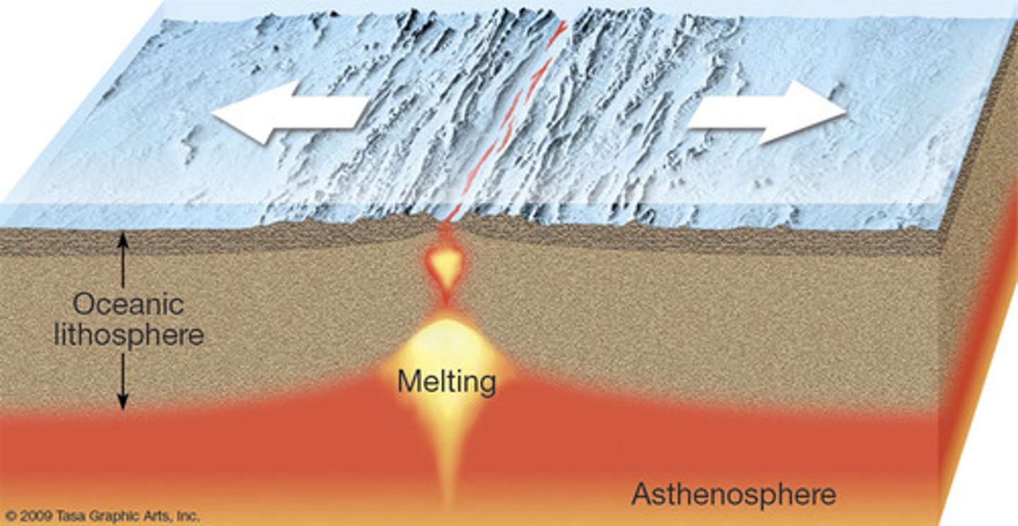
divergent boundaries
Occur where two plates slide APART from each other with the space that was created being filled with molten magma from below.
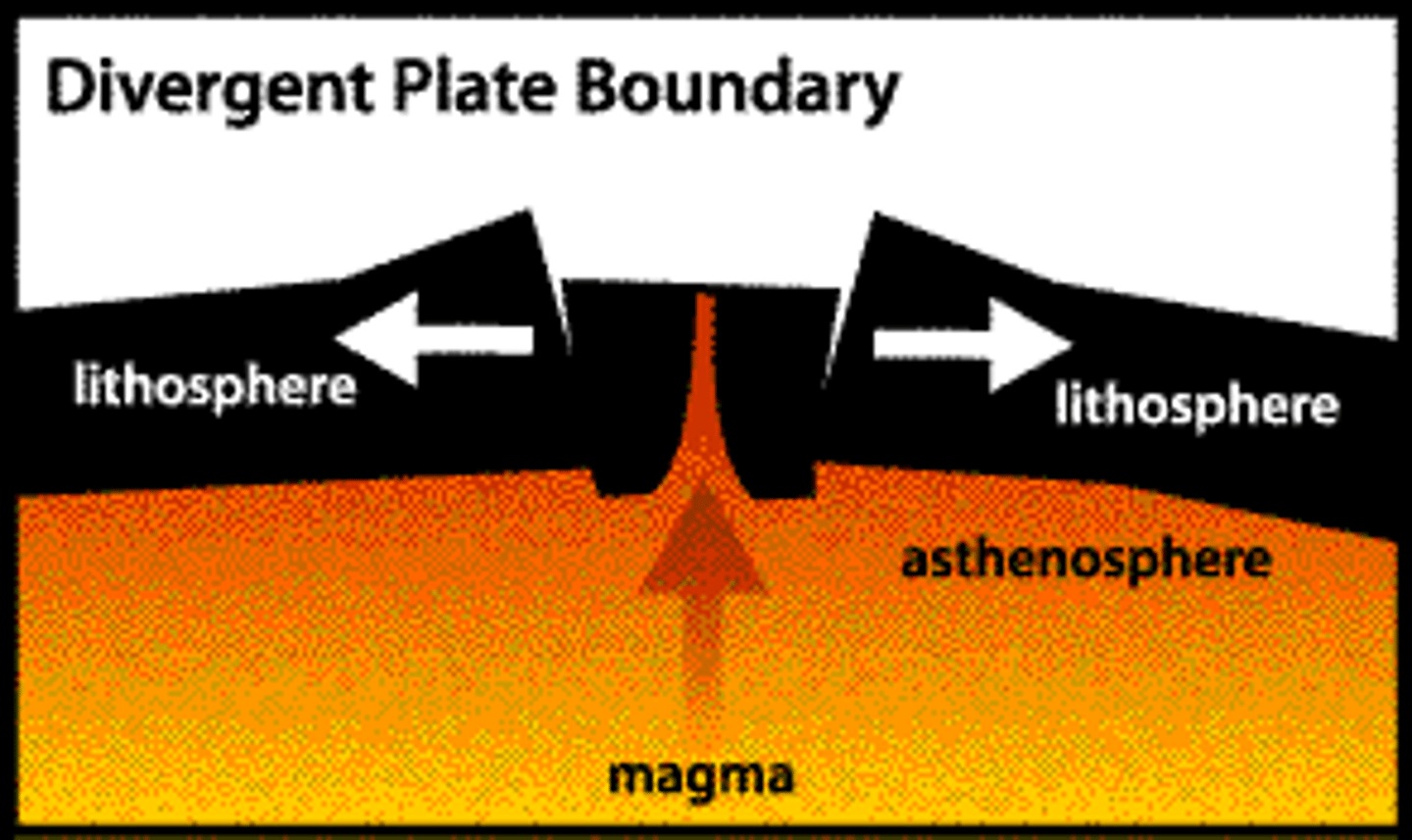
Mid-Atlantic Ridge and Pacific Rise
Examples of oceanic divergent boundaries.
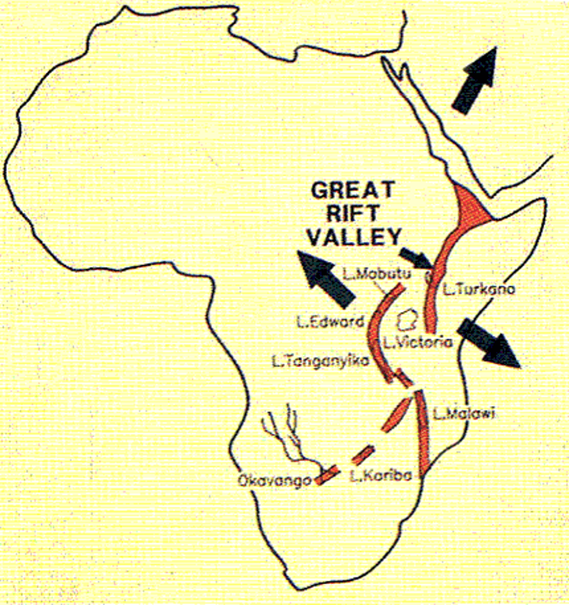
East African Great Rift Valley
Examples of areas of continental divergent boundaries
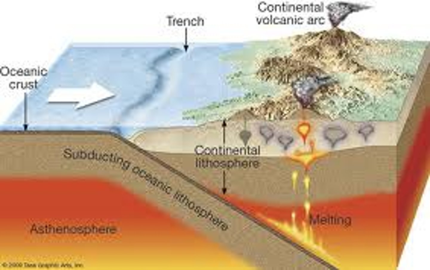
convergent boundaries
Occur where two plates slide TOWARD each other, commonly forming either a subduction zone or orogonic belt.
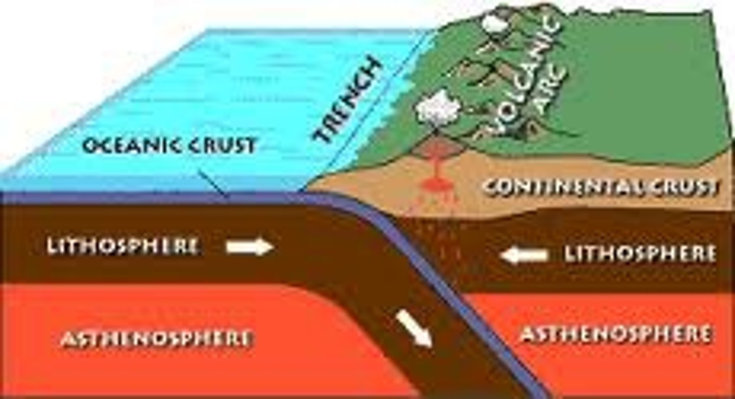
subduction zone
Occurs when a denser oceanic plate moves underneath (subducts) a less-dense continental plate.
e.g. Cascade Mountain range (includes Mount Saint Helens)
island arc
A curved chain of volcanic islands created when two oceanic plates converge.
e.g. Japan and the Aleutian Islands in Alaska
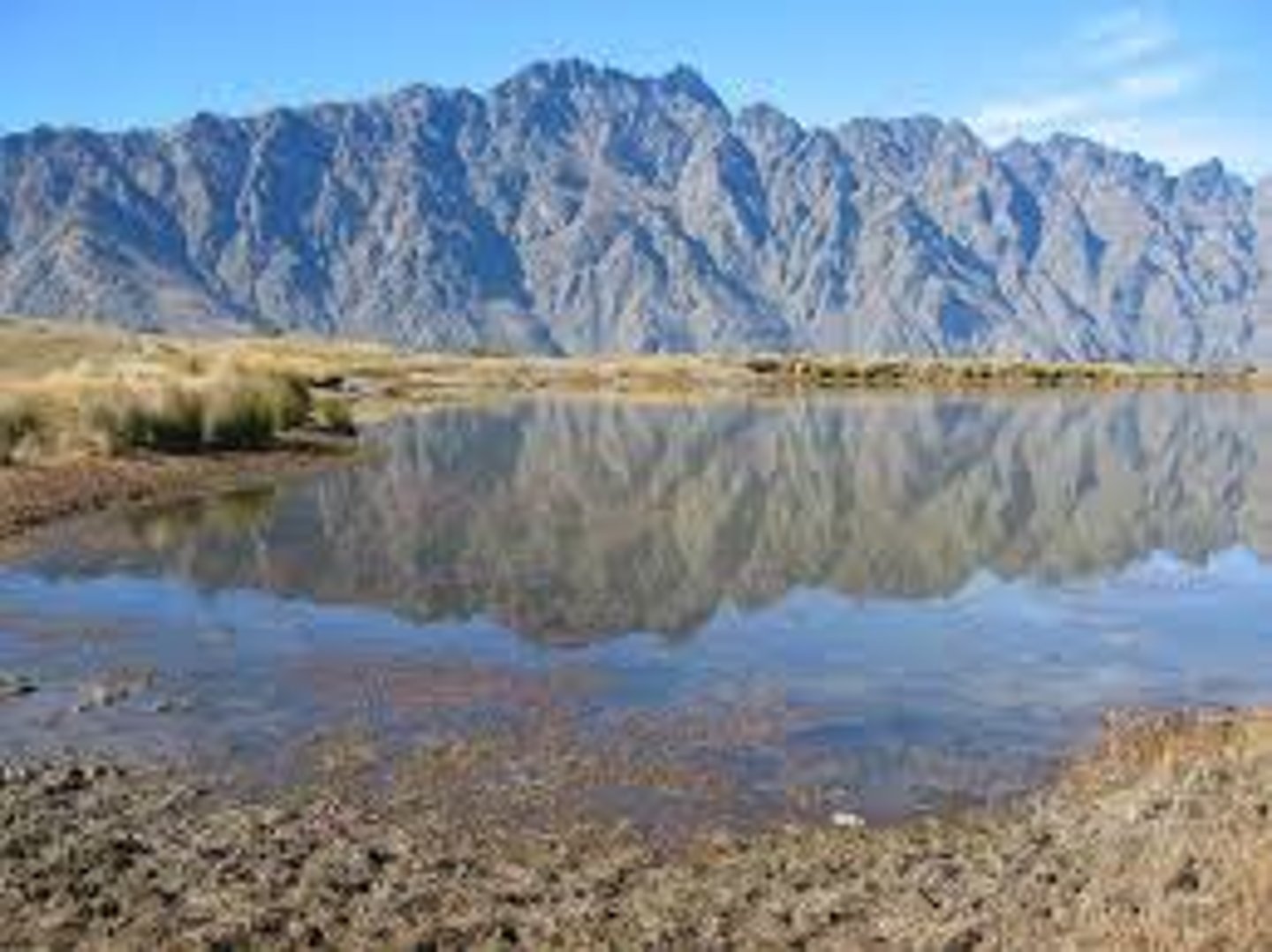
mountain range
Created when two continental plates collide.
e.g. Himalayas (Nepal and China)
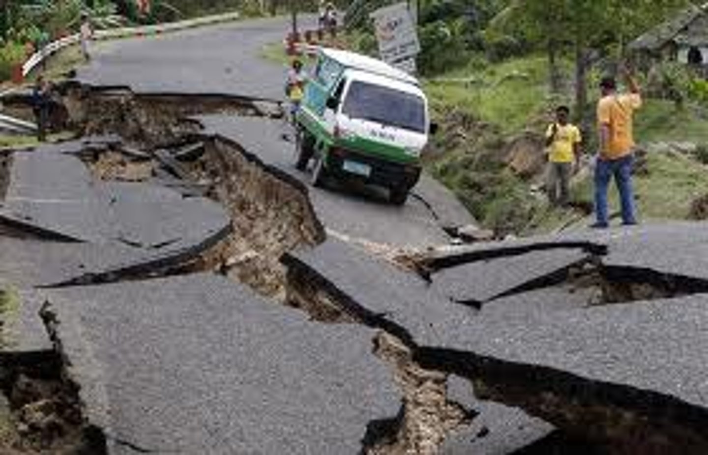
earthquakes
Caused by friction and stress buildup from the sliding plates, a common feature along transform boundaries.
e.g. Haiti Earthquake 2010
seismic waves
energy released in the form of vibrations when there is abrupt movement on an existing fault; they move in all directions through the surround rock
P waves (Primary waves)
Are body waves that travel through the interior of the Earth.
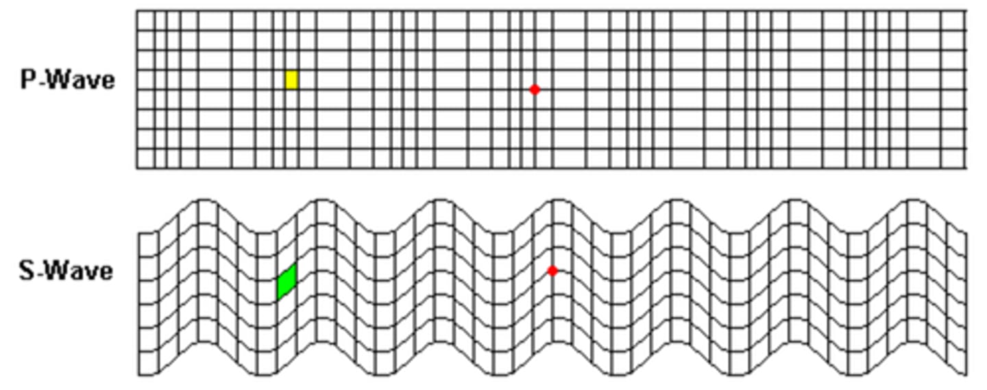
S waves (Secondary waves)
Are produced when material moves either vertically or horizontally and travel only within the uppermost layers of Earth.

The severity of an earthquake depends on:
-The amount of potential energy that had been stored
-The distance the rock mass moved when the energy was released
-How far below the surface the movement occured
-The makeup of the rock material
liquefaction
The process by which an earthquake's violent movement suddenly turns loose soil into liquid mud.
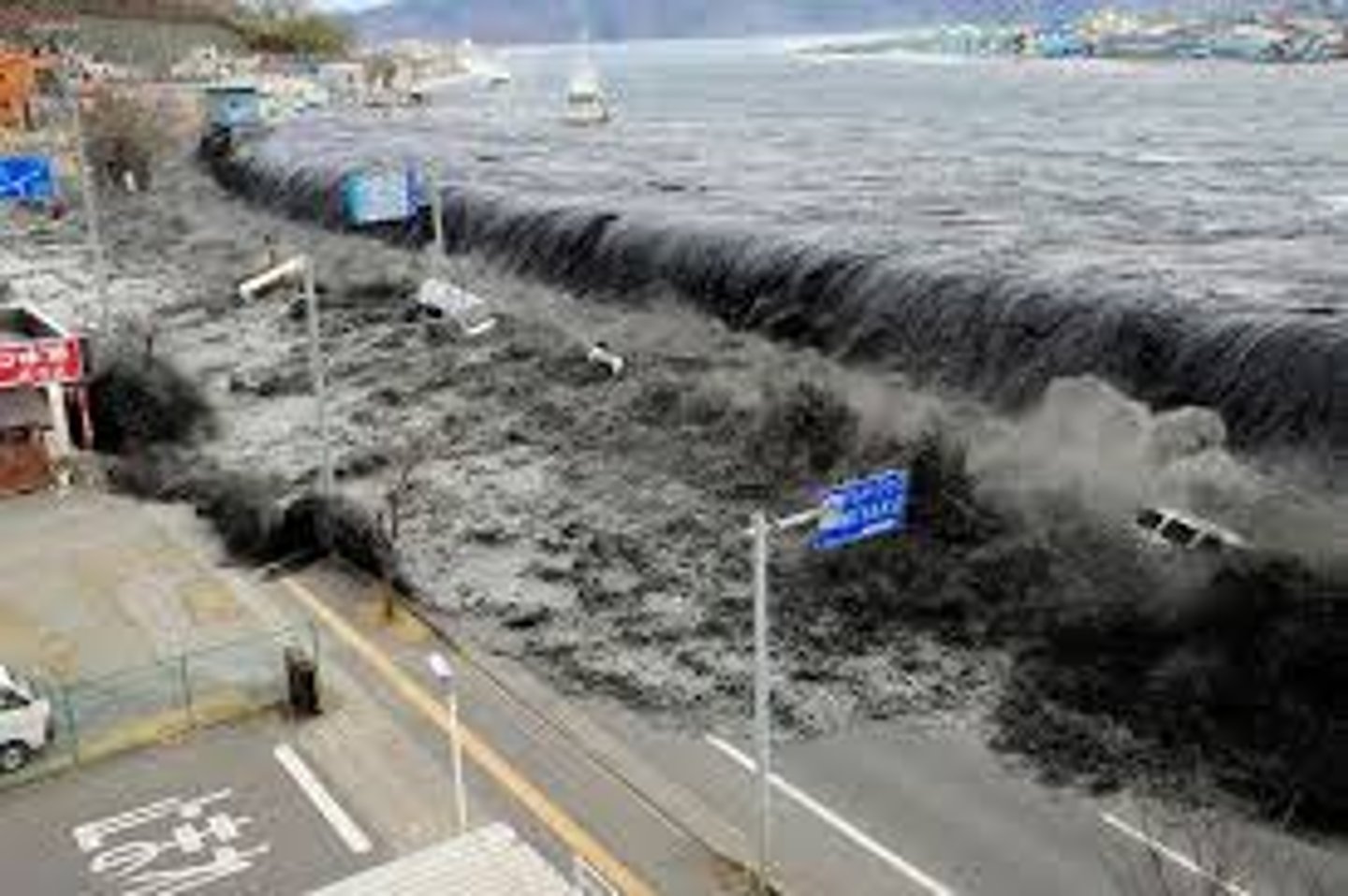
tsunami
A series of waves created when a body of water is rapidly displaced usually be an earthquake.
e.g. Tōhoku, Japan Earthquake and Tsunami 2011 (also led to nuclear meltdown at Fukushima)
volcano
A mountain or hill having a crater or vent through which lava, rock fragments, hot vapor, and gas are being or have been erupted from the earth's crust
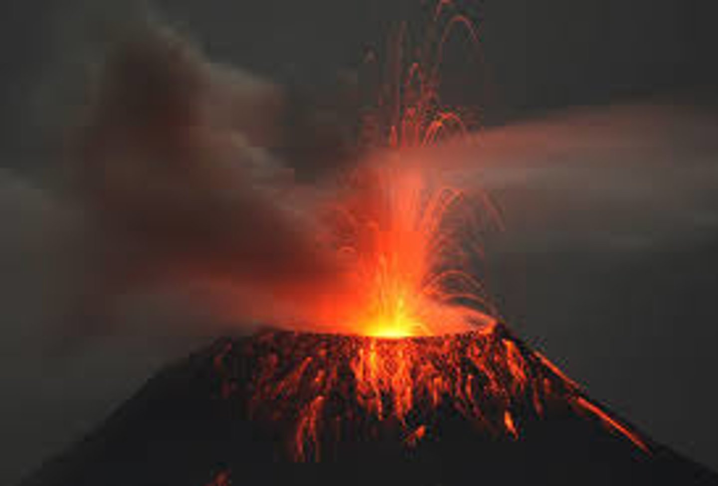
What do volcano eruptions do to our atmosphere?
-Release CO2, SO2, HCl
-debris and particulates can block sunlight, making a cooler climate
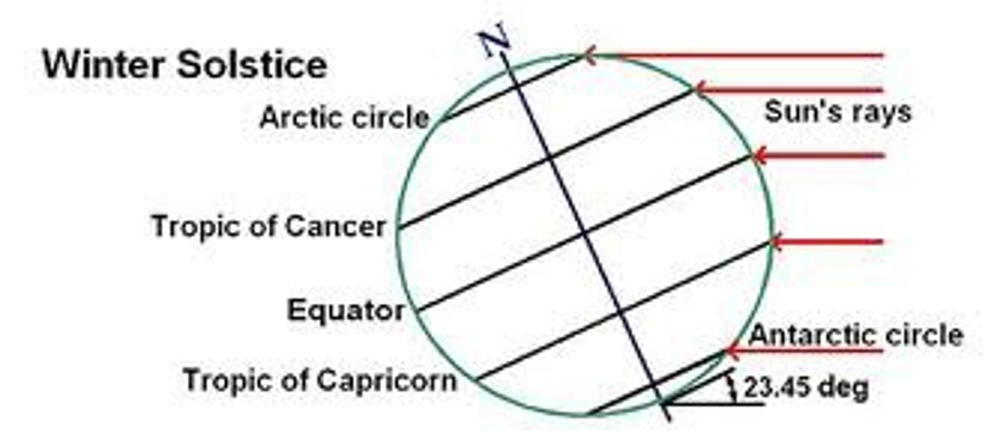
Factors that affect the amount of solar energy at the surface of the Earth:
-Earth's rotation (once every 24 hours)
-tilt of Earth's axis (23.5 degrees)
-revolution around the sun (once per year)
-closest to sun in winter, furthest in summer
O Horizon
Surface litter: leaves and partially decomposed organic debris. Thick in deciduous forests, thin in the tundra.
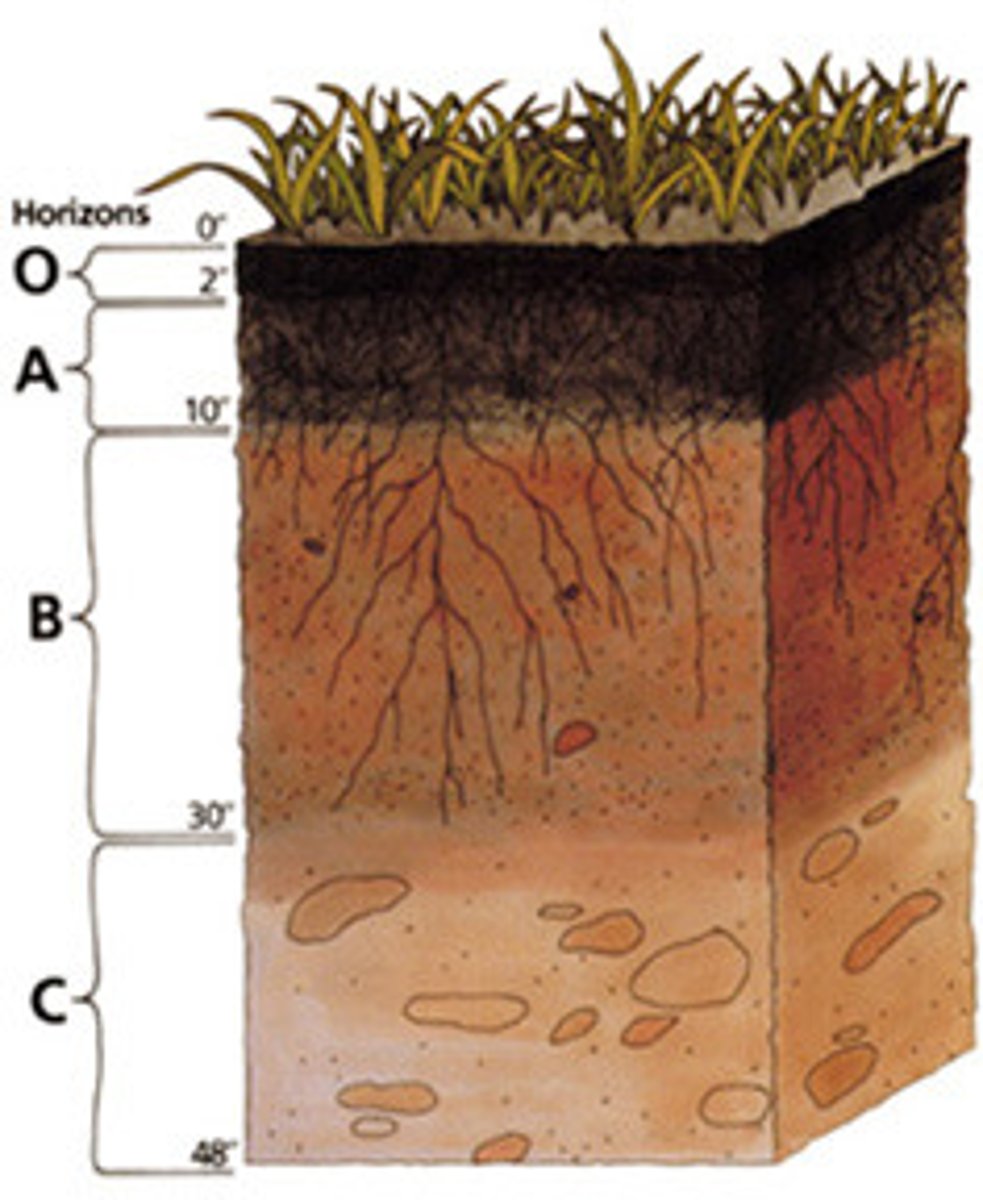
A Horizon
Topsoil: organic matter (humus), living organisms, inorganic minerals. Topsoil is very thick in grasslands.

E Horizon
Zone of leaching: dissolved and suspended materials move downward. In-between A and B horizon.

B Horizon
Subsoil: tends to be yellowish in color due to the accumulation of Fe, Al, humic compounds, and clay leached down from A and E horizons. Can be rich in nutrients in areas with lots of rainwater.

C Horizon
Weathered parent material: partially broken-down inorganic minerals

parent material
The rock and minerals from which the soil derives. Nature of parent rock can be native to the area or transported by wind, water, glaciers, etc.
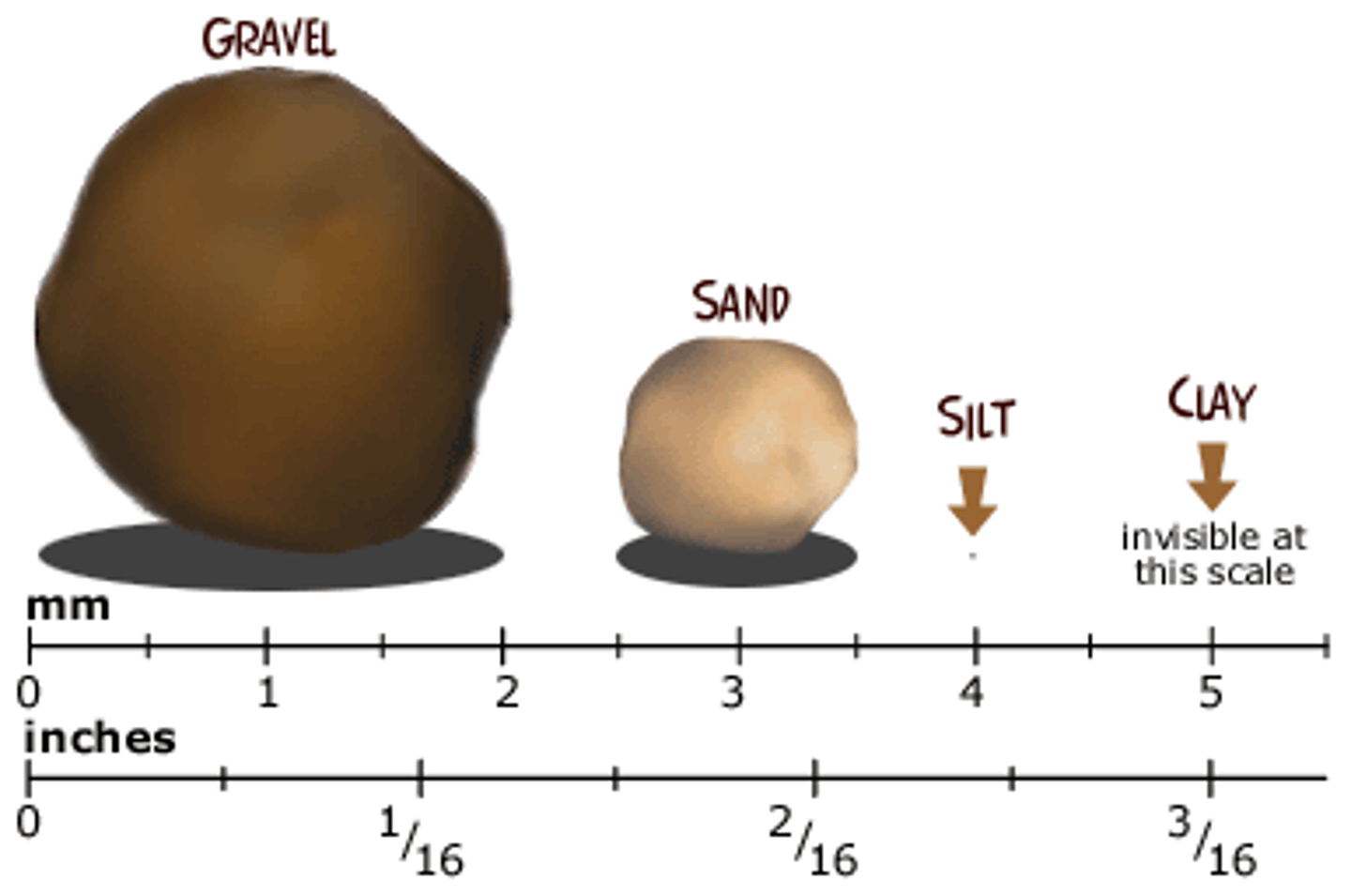
clay
-very fine particles
-compacts easily
-forms large, dense clumps when wet
-low permeability to water, thus upper layers bcome waterlogged

gravel
-coarse particles
-consists of rock fragments

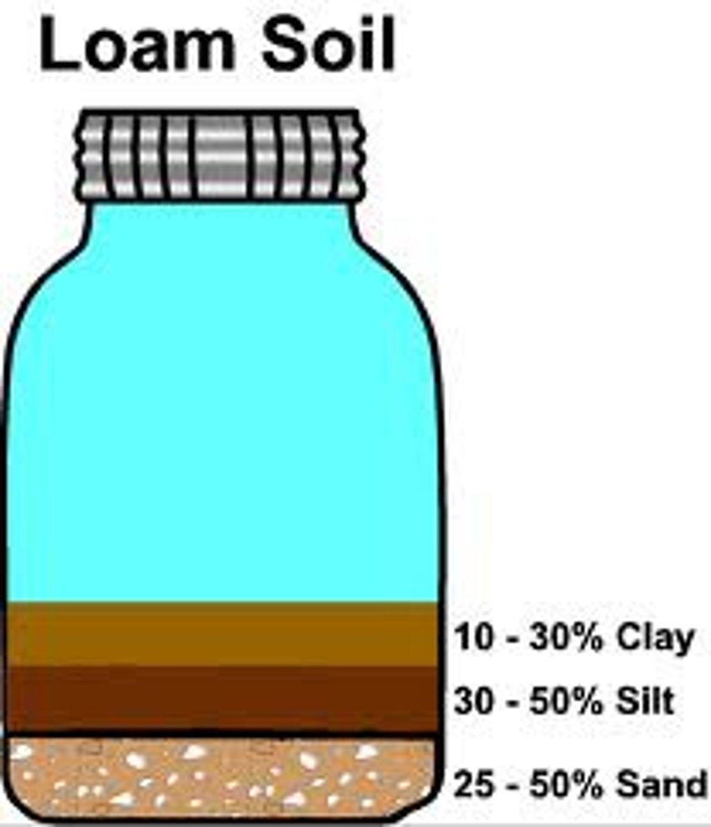
loam
-about equal mixtures of clay, sand, silt, and humus
-rich in nutrients
-holds water but does not become waterlogged
sand
-sedimentary material coarser than silt
-water flow through too quickly for most crops
-good for crops and plants requiring low amounts of water

silt
-sedimentary material consisting of very fine particles between the size of sand and clay
-easily transported by water
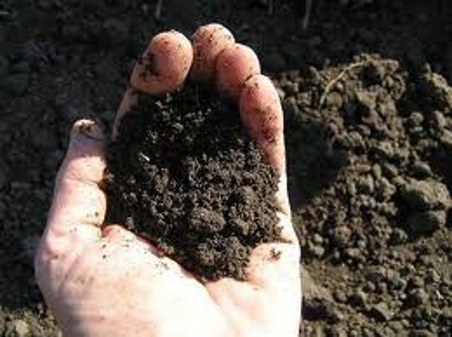
What color soil is most fertile?
a rich dark brown
waterlogging
saturation of soil with water resulting in a rise of the water table
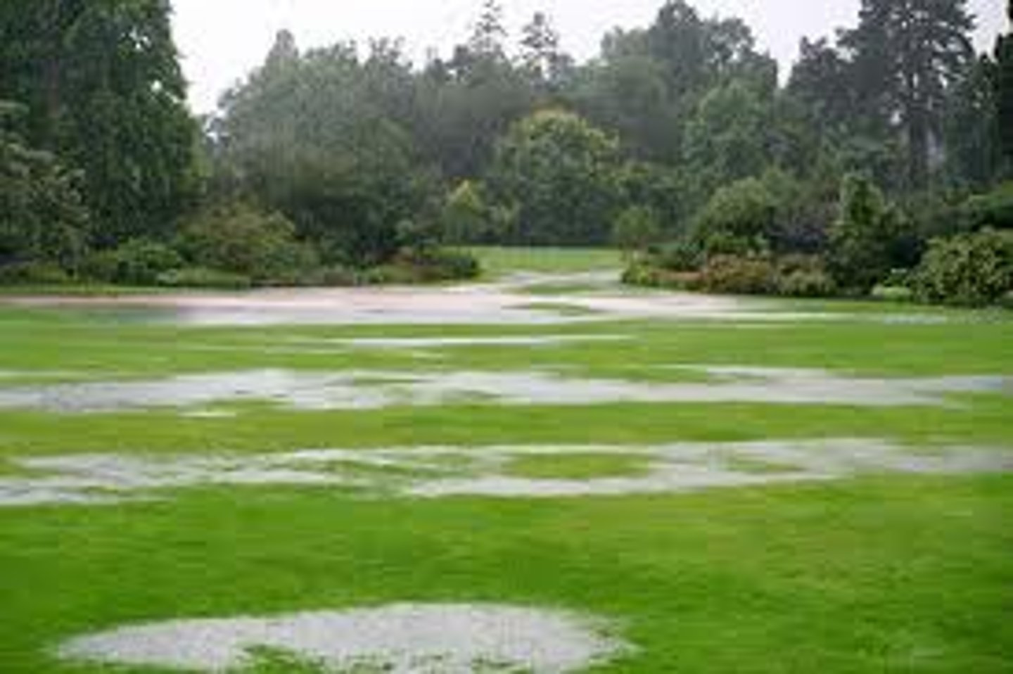
problems of waterlogging
salty water envelops deep roots killing plants; lowers productivity; eventual destruction of plant life
solutions of waterlogging
switch to less water-demanding plants in susceptible areas; utilize conservation-tillage farming; plant waterlog-resistant plants; install drainage popes
salinization
a soil degradation process caused by repeated annual application of irrigation water in dry climates, which leads to the gradual accumulation of salts in the upper soil layers
problems of salinization
stunted crop growth; lower yield; eventual destruction of plant life
solutions of salinization
take land out of production for a while; install drainage pipes; flush soil with freshwater; planted halophytes (salt-loving plants) like barley, cotton, sugar, or wheat
desertification
occurs when the productive potential of soil, especially on arid or semiarid land, falls by 10% or more because of a combination of prolonged drought and human activities that reduce or degrade topsoil
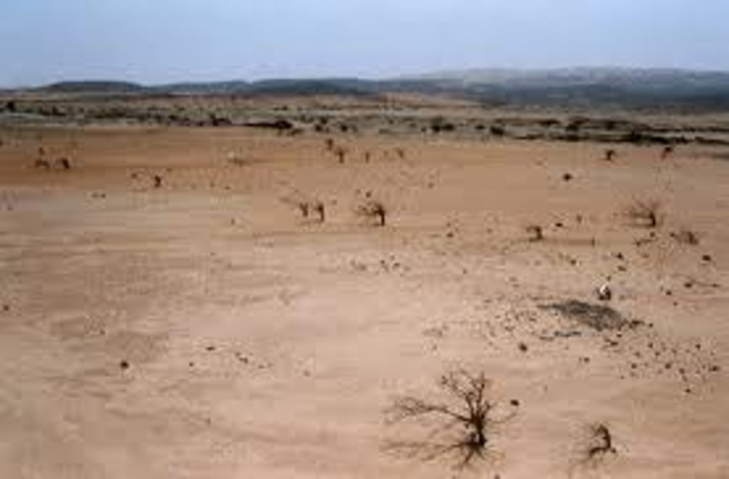
problems of desertification
loss of native vegetation; increased wind erosion; salinization; drop in water table; reduced surface water supply
solutions of desertification
reduce overgrazing; reduce deforestation; reduce destructive forms of planting, irrigation, and mining; plant trees and grasses to hold soil
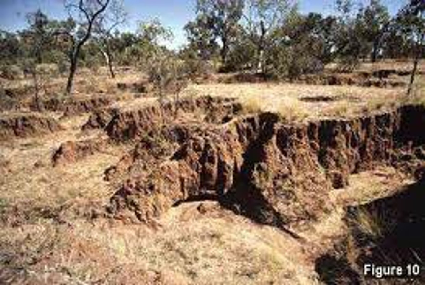
Soil erosion
is the movement of soil components, especially surface litter and topsoil, from one place to another by the actions of wind and water
What is most harmful human activity?
Agriculture has a greater harmful environmental impact than any other human activity
igneous
formed by cooling and classified by their silica content.
-majority of rocks in Earth's crust are igneous
-Intrusive igneous rocks solidify deep underground, cool slowly and have large-grained texture.
-Extrusive igneous rocks solidify on or near the surface, cool quickly, and have fine-grained smooth texture.
-Igneous rocks are broken down by weathering and water transport.
e.g. granite and basalt

metamorphic
formed by intense heat and pressure
e.g. diamond, marble asbestos, slate, anthracite coal
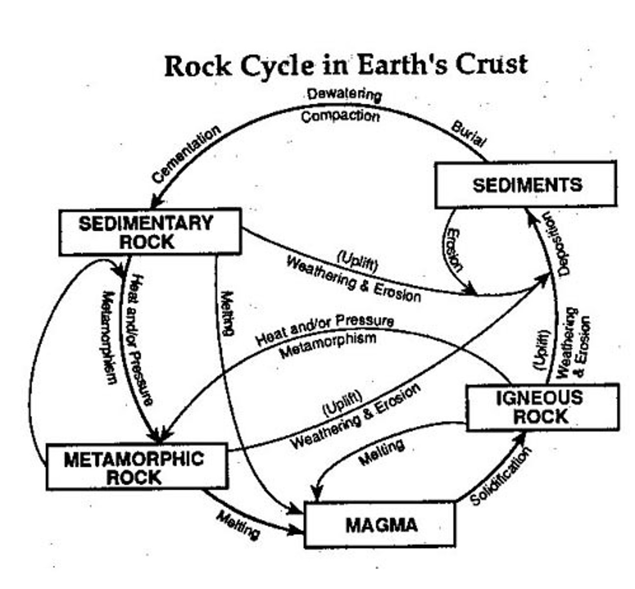
sedimentary
formed by piling and cementing of various materials over time in low-lying areas. Fossils form only in sedimentary rock.
e.g. conglomerate, breccia, sandstone

What seven primary compounds is the Earth's atmosphere composed of?
-nitrogen (78%)
-oxygen (21%)
-water vapor (0-4%)
-carbon dioxide (<<1%)
-methane (<<<1%)
-nitrous oxide (<<<1%)
-ozone (<<<1%)
Nitrogen (N2)
Fundamental nutrient for living organisms. Deposits on Earth through nitrogen fixation and reactions involving lightning and subsequent precipitation. Returns to the atmosphere through combustion of biomass and denitrification.
Oxygen (O2)
Oxygen molecules are produced through photosynthesis and are utilized in cellular respiration.
Water vapor (H2O)
Largest amounts occur near equator, over oceans, and in tropical regions. Areas where atmospheric water vapor can be low are polar areas and deserts.
-most voluminous greenhouse gas, cannot be added or reduced
Carbon dioxide (CO2)
Volume of CO2 has increased about 25% in the last 300 years due to the burning of fossil fuels and deforestation. CO2 is produced during cellular respiration and the decay of organic matter. It is a reactant in photosynthesis. CO2 is also a major greenhouse gas.
-stays in atmosphere 100 years
Methane (CH4)
Methane contributes to the greenhouse effect. Since 1750, methane has increased about 150% due to use of fossil fuels, coal mining, landfills, grazers, etc.
-stays in atmosphere 12 years
Nitrous oxide (NO2)
Concentration increasing about 0.3% per year. Sources include burning of fossil fuels, use of fertilizers, burning biomass, deforestation, etc. Can come from livestock farts.
-stays in atmosphere 120 years
Ozone (O3)
97% of ozone is found in the stratosphere (ozone layer). Ozone absorbs UV radiation. Ozone is produced in the production of photochemical smog. CFC's have contributed to ozone layer depletion. Ozone is a pollutant in the troposphere.
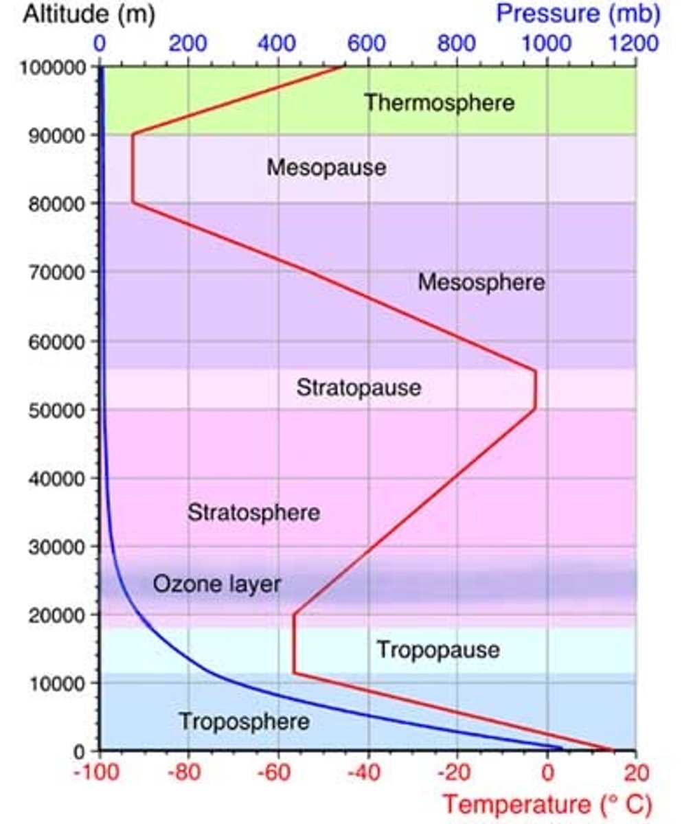
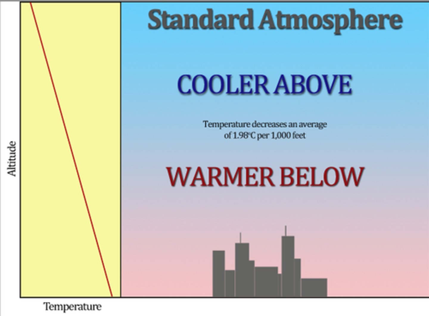
troposphere
-75% of atmosphere's mass is in the troposphere
-temperature decreases with altitude
-weather occurs in this zone

stratosphere
-temperature increases with altitude due to absorption of heat by ozone
-ozone is produced by UV radiation and lightning
-contains the ozone layer
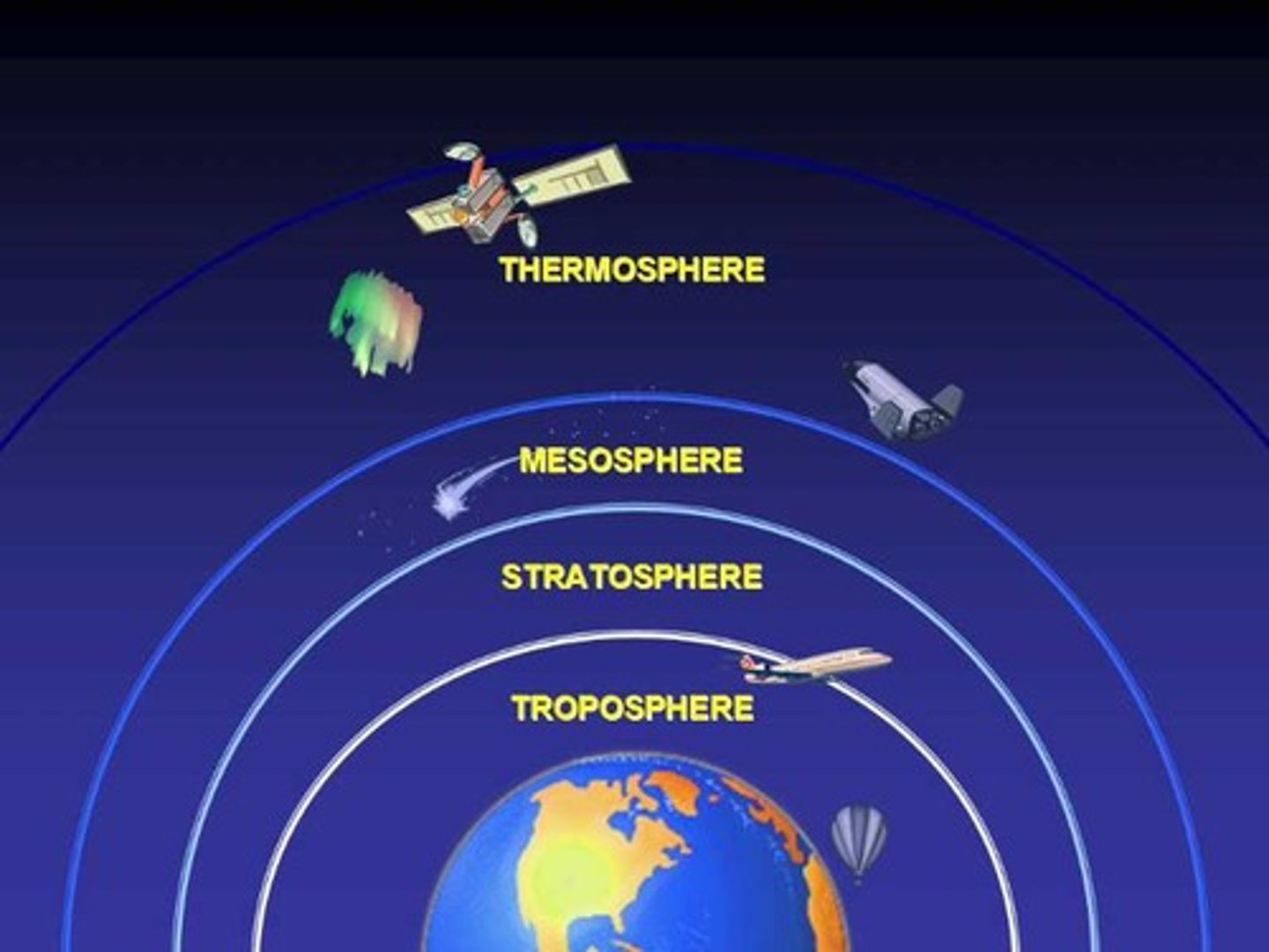
mesosphere
-temperature decreases with altitude
-coldest layer
-ice clouds occur here
-meteors (shooting stars) burn up in this layer

thermosphere (ionosphere)
-temperature increase with height due to gamma rays, X rays, and UV radiation
-molecules are converted into ions
-causes Northern lights

Relationship between altitude, pressure, and temperature within the zones
weather
is a LOCAL area's short-term temperature, precipitation, humidity, wind speed, cloud cover, and other physical conditions of the lower atmosphere as measured over hours or days
-caused by movement of heat energy
climate
is an area's GENERAL pattern of atmospheric of weather conditions measured over long periods of time ranging from decades to thousands of years
radiation
the flow of electromagnetic radiation. Method by which Earth receives solar energy.
conduction
involves transfer of heat through a substance that results from a difference in temperature
convection
is the primary way energy is transferred from hotter to colder regions in the Earth's atmosphere and determines weather patterns
Relationship between cold and hot air
Cold air is more dense, hot air is less dense and more spread out
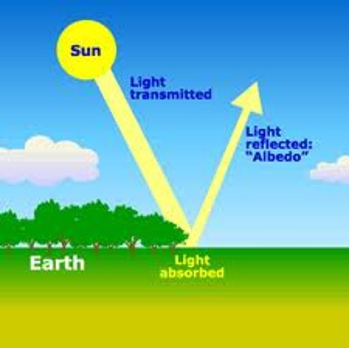
albedo
is the diffuse reflectivity or reflecting power of a surface
specific heat
is the amount of heat per unit mass required to raise the temperature by one degree Celsius (water has a high specific heat)
temperature inversion
stops atmospheric convection (which is normally present) from happening in the affected area and can lead to the air becoming stiller and murky from the collection of dust and pollutants that are no longer able to be lifted from the surface. Worsens pollution.
(COLD air) OVER (WARM air)
formation of clouds
when rising air, through expansion, cools to the point where some of the water vapor molecules "clump together" faster than they are torn apart by their thermal energy. Some of that (invisible) water vapor condenses to form (visible) cloud droplets or ice crystals.

dew point
is the temperature below which the water vapor in a volume of humid air condense into liquid water
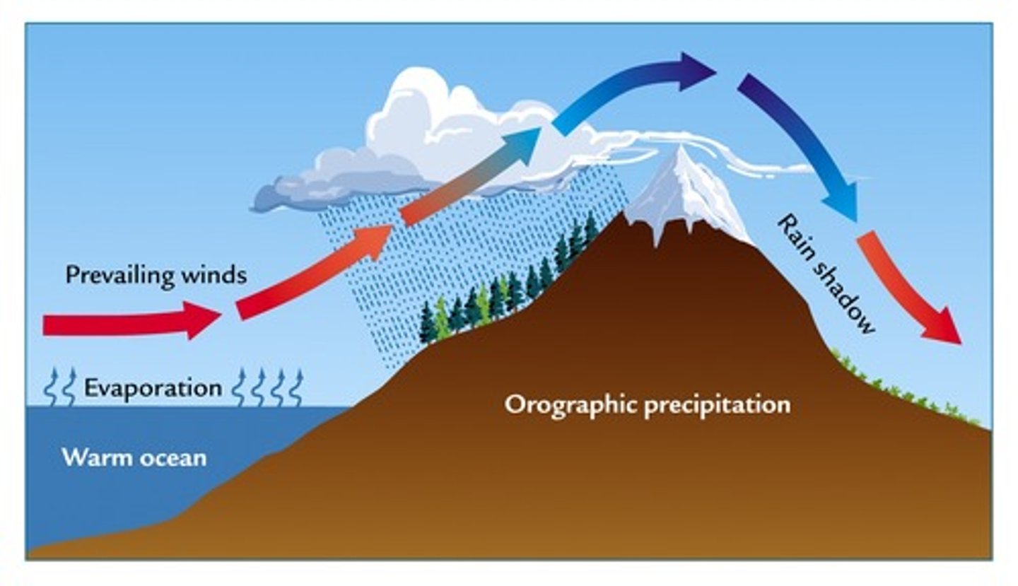
Rain shadow (orographic) effect
the loss of moisture from the landscape and the resulting semiarid or arid conditions on the leeward side of high mountains
-Windward= lush, green, clouds, precipitation, ocean...leedward= deserts, sinking air, dry
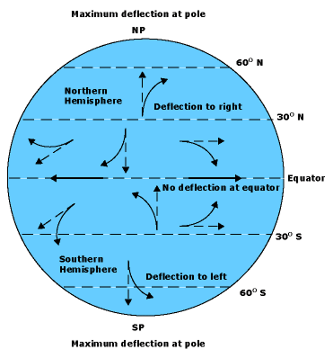
Coriolis Effect
an effect whereby a mass moving in a rotating system experiences a force (the Coriolis force) acting perpendicular to the direction of motion and to the axis of rotation.
monsoons
a seasonal prevailing wind in the region of South and Southeast Asia, blowing from the southwest between May and September and bringing rain (the wet monsoon), or from the northeast between October and April (the dry monsoon)
El Niño and La Niña (Southern Oscillation (ENSO))
large-scale weather phenomenon occurs every few years when prevailing winds in the tropical Pacific Ocean weaken and change direction
o Above-average warming of Pacific waters affects populations of marine species by changing the distribution of plant nutrients, hurting fishing industry
o Low nutrients, low dissolved oxygen (in South America, but in Australia during La Niña)
o Severe flooding, storms, drought, mudslides, $ damage, human health hazards (dehydration, diarrhea, zoonotic diseases [lyme, Hanta])
![<p>large-scale weather phenomenon occurs every few years when prevailing winds in the tropical Pacific Ocean weaken and change direction</p><p>o Above-average warming of Pacific waters affects populations of marine species by changing the distribution of plant nutrients, hurting fishing industry</p><p>o Low nutrients, low dissolved oxygen (in South America, but in Australia during La Niña)</p><p>o Severe flooding, storms, drought, mudslides, $ damage, human health hazards (dehydration, diarrhea, zoonotic diseases [lyme, Hanta])</p>](https://knowt-user-attachments.s3.amazonaws.com/da4d4e97-22c5-4a77-90f2-6fa121683be6.jpg)
Grasshopper effect
occurs when volatile air pollutants are transported by evaporation and winds from tropical and temperate areas though the atmosphere to the earth's polar areas, where they are deposited.
natural sources of pollution
• dust blown by wind
• pollutants from wildfires and volcanic eruptions
• VOCs (volatile organic chemicals) released by some plants
• Removed naturally by chemical cycles, precipitation, and gravity
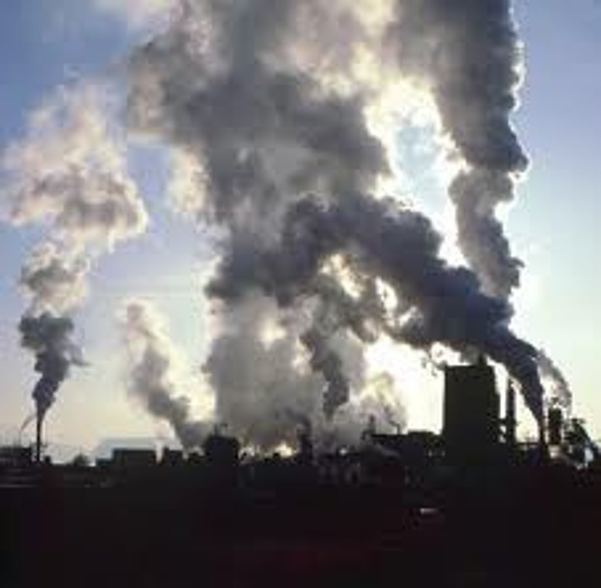
manmade sources of pollution
• Industry, cars, electrical plants, coal
• Burning of fossil fuels
primary pollutants
are harmful chemicals emitted directly into the air from natural processes and human activities
e.g. SOx, NOx, CO, VOCs, particulates, Lead
secondary pollutants
formed by some primary pollutants reacting with one another and with the basic component of air to form new harmful chemicals
e.g. O3, HNO3 (nitric acid), H2SO4 (sulfuric acid [acid rain])
Ways Air Pollution is Increased:
• Urban buildings can slow wind speed and reduce dilution and removal of pollutants
• Hills and mountains can reduce the flow of air in valleys and allow pollutant levels to build up at ground level
• High temperatures promote the chemical reactions leading to photochemical smog formation (global warming increases smog!)
• Emissions of VOCs from certain trees and plants (e.g. oak, sweet gums, poplars, and kudzu) can play a large role in photochemical smog formation
• Grasshopper effect
• Temperature inversions
Industrial smog
(gray color) consists mostly of sulfur dioxide, suspended droplets of sulfuric acid, and a variety of suspended solid particles
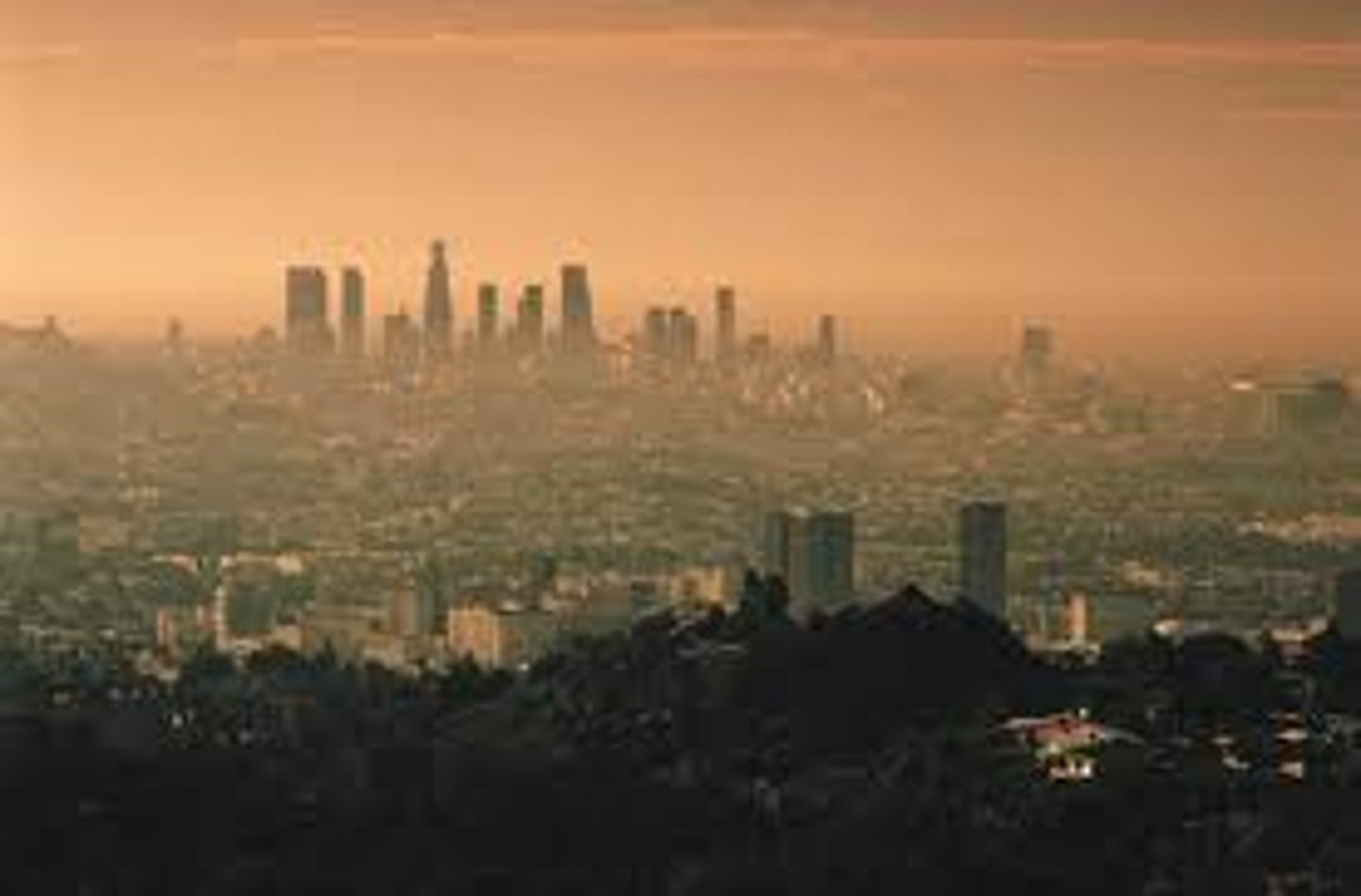
Photochemical smog
(brown color) is a mixture of primary and secondary pollutants formed under the influence of UV radiation from the sun; formation of this smog begins when exhaust from morning commuter vehicles releases large amounts of NO and VOCs into the air over a city
• VOCs + NOx + heat + sunlight → ground level ozone (03) + other photochemical oxidants + aldehydes + other secondary pollutants
Properties of Water:
• strong hydrogen bonds
• high specific heat
• high boiling point
• needs a lot of energy to evaporate
• expands when freezes
Where is our water?
• 70% of Earth's surface is covered by water
• oceans hold about 97% of all water
• 3% is freshwater
• majority of freshwater is stuck in glaciers
• 71% is saltwater, 0.024% is readily available freshwater
• 60% of the human body is water
Lake zonation:
• littoral zone
• limnetic zone
• photic zone
• profundal zone
• benthic zone
(some zones are also applicable to oceans)

littoral zone
• top layer, near the shore
• consists of the shallow sunlit waters to the depth at which rooted plants such as cattails stop growing
• most productive zone because of sunlight and nutrients from the surrounding land
• high biological diversity

limnetic zone
• sunlit surface away from shore that extends the depth sunlight penetration
• the main photosynthetic body of the lake
• produces the food and oxygen that support most of the lake's consumers

photic zone
• also called euphotic zone
• sunlight zone is the depth of the water in a lake or ocean that is exposed to sufficient sunlight for photosynthesis to occur
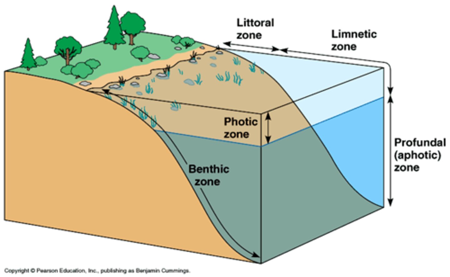
profundal zone
• deep open water where it is too dark for photosynthesis
• without sunlight and plants, oxygen levels are low

benthic zone
• bottom layer
• inhabited by decomposers, detritus feeders, and some fish
• dead matter falls here

oligotrophic lakes
lakes that have a small supply of plant nutrients
e.g. glaciers, mountains, lakes
eutrophic lakes
lakes that are well-nourished; have large supply of plants nutrients; are shallow with murky brown or green water
mesotrophic
no nutrients in lakes
hypereutrophic
too many nutrients