Looks like no one added any tags here yet for you.
an active margin of North America
West Coast
The mid ocean ridges are formed from this rock type
basalt
The calcareous ooze represents the remains of these organisms
forams
Features slopes less than a degree and water depths less than 150 m
continental shelf
These deposits are typical of the continental slope
turbidite sediments
This is a rare island on the mid oceanic ridge
Iceland
The deepest parts of the oceans where thick sedimentary wedges accumulate
oceanic trenches
a sliver of oceanic crust that has been emplaced on the continents by tectonic force
ophiolite
These undersea broad mountains and plateaus were formed from extinct volcanoes
seamounts
includes the shelf, slope and rise
continental margin
These form from the longest continuous mountain range in Earth
Mid ocean ridge
This type of reef completely encircles a lagoon due to island subsidence
atoll
diatoms and radiolarians form this pelagic sediment
siliceous ooze
the rock type of the deep oceanic crust (layer 3)
gabbro
these pelagic sediments are clastic
clay and silt
oceanic trenches form where this subducts under neighboring plates
oceanic crust
the geologic term for deep sea sediments
pelagic
the deep offshore ocean bottom
abyssal plain
These commonly cut the continental shelf and were created when sea level is low
Submarine canyons
The slope of a continental slope
2-4 degrees
These feature explosive volcanoes, seismicity, mountain building, offshore trenches, island arcs, and active faults
active margin
An active margin of South America
Peruvian Coast
The approximate mean elevation of the solid Earth surface
2km below sea level
an example of a new ocean basin trying to form
East African rift
These feature very broad shelves, no seismicity, and fishing banks
passive margin
A passive margin of North America
East Coast
A passive margin of Africa
West African Coast
This type of reef is attached to shore
fringing
The rock type of the shallow oceanic crust (layer 1)
sediment
An example of an ocean basin about to close
Mediterranean Sea
A passive margin of South America
Brazil Coast
The geologic cycle that describes the opening and closing of ocean basins
Wilson Cycle
A flat topped seamount
guyot
This type of reef has a wide deep lagoon
barrier
This scale measures the intensity of an earthquake at a particular location
Mercalli Intensity scale
(1=barely felt, 12=total destruction)
This scale measures the size of an earthquake
Magnitude (1-9 scale)
measure of the amount of energy released
The cause of most natural earthquakes
sudden slippage along a fault zone (strained)
This postulates that rocks on both sides of the fault store the energy of plate displacement by bending until their elastic strength is exceeded and they rupture and return to their former unstressed state
The Elastic Rebound Theory:
elastic strain energy builds up, when slipping occurs, causes earthquake and then returns to unstressed
A recording of ground motion as a function of time
Seismogram
shows the vibrations recorded by seismometer
The study of earthquakes
Seismology
What type of boundary is the 1812 New Madrid earthquake?
Divergent
What type of boundary is the 1906 San Francisco earthquake?
Transform
What type of boundary is the 1500 Puget Sound earthquake?
Convergent
What type of boundary are the LA Quakes?
Transform
What type of boundary are the Icelandic quakes?
Divergent
What type of boundary are the Turkey quakes?
transform and convergent
What type of boundary are the Peru quakes?
Convergent
Travels through liquids
Faster
Primary wave
Compressional
Longitudinal
P-Wave
Transverse particle motion
Travels only in solids
Second arrival
Shear
S- Wave
Number of seismographs needed to locate the epicenter of an earthquake
at least three seismographic stations at different distances from the epicenter of the earthquake
This modern magnitude scale is based on the product of the fault plane area and the fault displacement
Richter Scale (later replaced by moment magnitude scale)
Seismic Sea Waves
tsunami wave
The phenomenon of soil transforming from a solid to a liquid because of shaking
liquifaction
Fill
Sediment
Mud
amplifies ground motion
Bedrock
Granite
Mudstone
Stable in earthquakes
The study of geologic sediment and rocks for evidence of prehistoric earthquake displacement
paleoseismology
The three main types of tectonic regimes studied by structural geologists
extensional, contractional, strike-slip
The three types of stress
Compression, tensile, shear
Steel Nail
Salt Water Taffy
Hot rocks
ductile
Bricks
Cold Rocks
Brittle
A material that returns to its original shape after stress is removed?
elastic
A material that remains deformed after stress is removed
Plastic
A material that breaks without plastic flow
Brittle
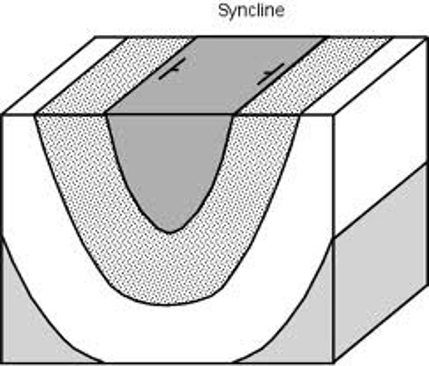
Downfold
Younger rocks in the center
Syncline
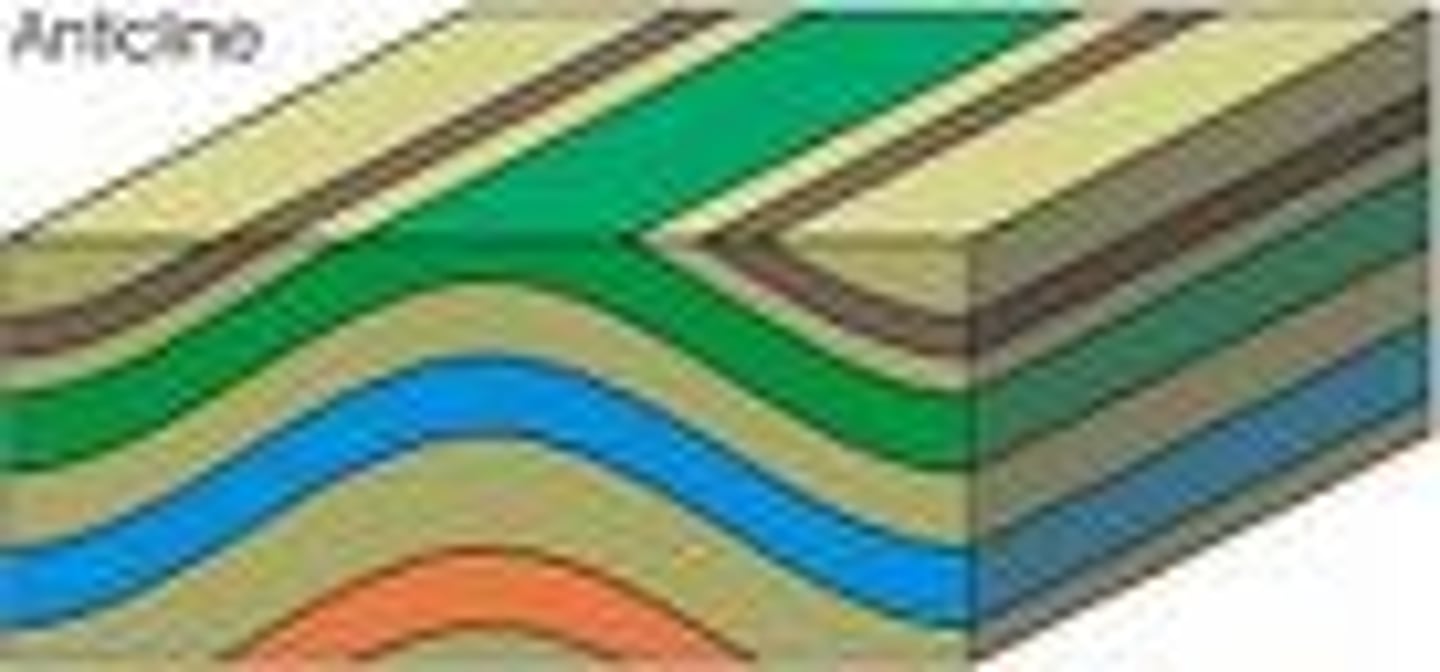
Upfold
Older rocks in the center
Anticline
Direction of a horizontal line on a dipping bed
strike
the vertical angle between horizontal and a bed as measured perpendicular to strip
true dip
The maximum vertical angle between horizontal and a bed
true dip
Any vertical angle between horizontal and a bed
apparent dip
Reverse Fault, folding
Compression (pushing together)
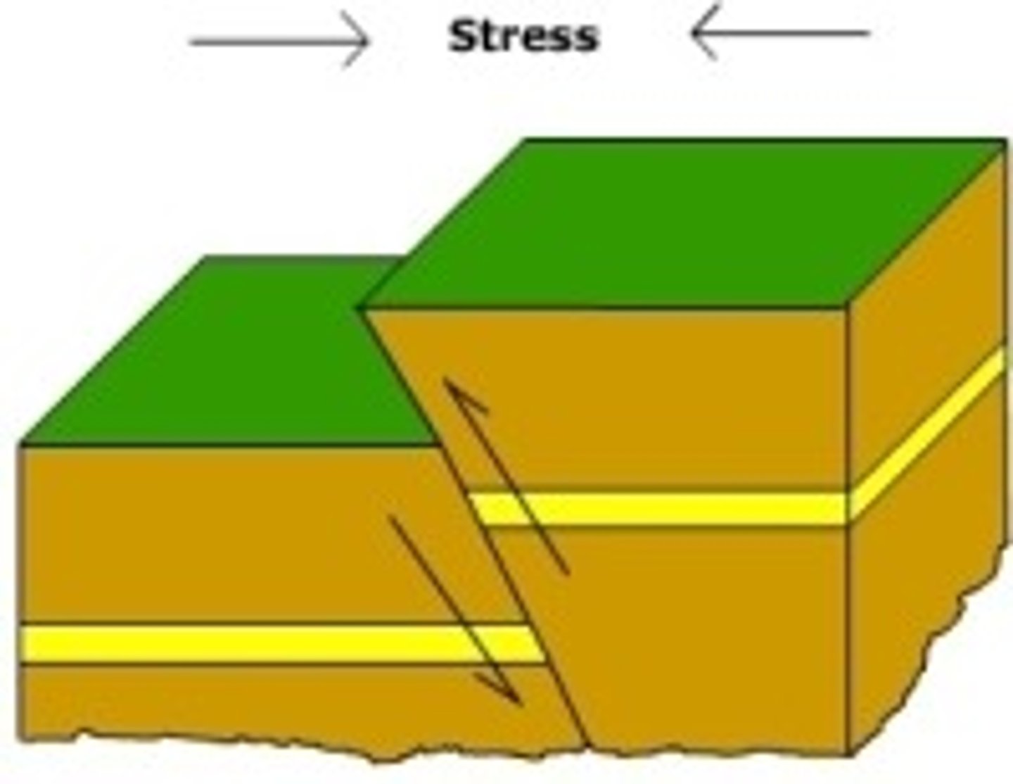
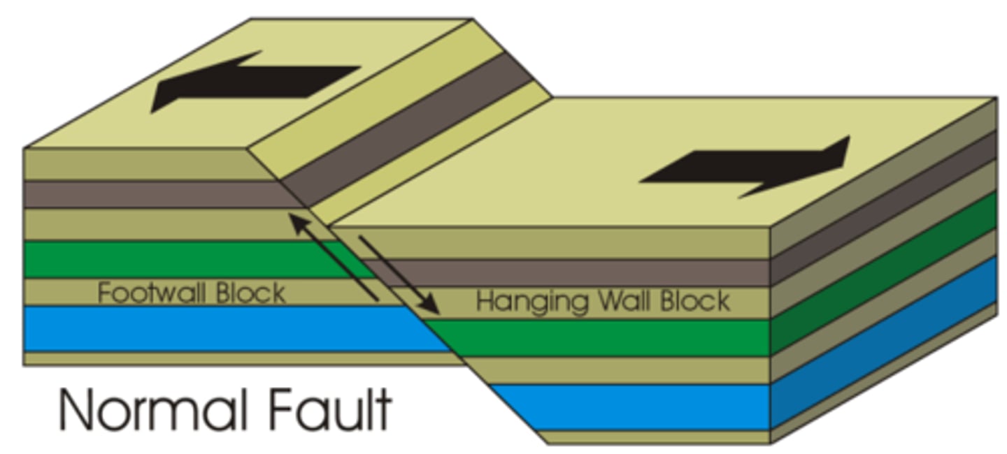
Extension, normal fault
Tensional (pulling apart)
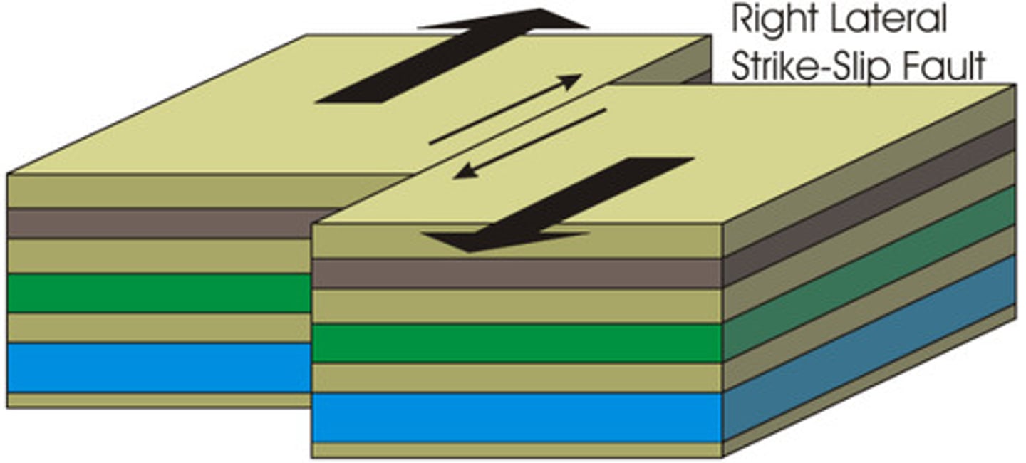
Strike Slip
Shear (sliding next or passed each other)
What type of plate boundary are the Andes
Oceanic-Continental
What type of plate boundary are the Cascades
Oceanic- Continental
What type of plate boundary are the Aleutians
Oceanic-Oceanic
What type of plate boundary are the Himalayas
Continental-Continental
What type of plate boundary are the Alps
Continental-Continental
These exotic areas of present North America actually formed in the tropical Pacific
accreted terrain
The exposed part of the North American Craton
shield
reverse fault
Normal Fault
Strike Slip
Anticline
Syncline
How many large quakes have occurred along the San Andreas fault system during historic time?
13
A large quake in a populated area of California is forecast to result in how many fatalities?
1000's
Near what city was the great M7.8 quake of 1906?
San Francisco
The geologist Lawson connected the "dots" to establish that the cause of the 1906 event was a fault line. An example of his dots might be
An offset picket fence
The epicenter of the 1906 earthquake was
Two miles out to sea from the golden gate
The San Andreas fault comes ashore 12 miles south of San Francisco at
Mussel Point
In age, the two roc units that outcrop at Mussel Point are
About 100 million years different
At Mussel Point, which rock unit is on top
North American plate
When did the California Coast shift form convergent to transform motion
20 Million years ago
Which of the following helped relate the 1906 quake to a linear fault?
Offset Features
Connecting the locations of offset features
Mussel Point outcrop
Which of the following do geologists use to study pre-historic earthquakes
Radio carbon dating of charcoal
offsets of lake sediments
offsets of surface stream valleys
What mineral decays to talc?
Serpentine
Why is talc an important mineral in active fault zones?
Talc is very slippery, lubricates faults, slides easier
What city in california has extensive damage form fault slip but has never had a major earthquake
Hollister
What city along the San Andreas fault routinely has small earthquakes but never large ones
Parkfield
What mineral was discovered on the deep San Andreas fault by the recent Parkfield borehole
Serpentine