GEOG 1010 (Physical Geography)
 Call Kai
 Learn
Learn Practice Test
 Spaced Repetition
 Match
Match Flashcards
 Knowt Play
1/285

There's no tags or description
Looks like no tags are added yet.
Name | Mastery | Learn | Test | Matching | Spaced | Call with Kai | Chat |
|---|
No analytics yet
Send a link to your students to track their progress
286 Terms
geomorphology
the study of landforms and how the interactions of Earth’s processes and surface materials contribute to landform development and modification
biogeography
the study of plant and animal distributions of the present and past and how they may change in the future
spatial discipline
type of study dealing with locational space
region
an area identified by certain characteristics it contains that makes it distinctive and separates it from other areas
regional geography
the study of the characteristics of a region or of multiple regions
cartography
the science of mapmaking
scientific method
answering questions (hypotheses) by collecting evidence, objectively analyzing the evidence, and proposing answers based on what the evidence supports
system
group of interacting and interdependent units that together form an organized whole
Earth system
set of interrelated components, variables, processes, and subsystems (e.g., atmosphere, lithosphere, biosphere, and hydrosphere), which interact and function together to make up Earth
subsystem
separate system operating within the boundaries of a larger Earth system
atmosphere
blanket of air, composed of various gases, that envelops Earth
lithosphere
a general term for the solid (rock) part of the Earth system, in contrast to the atmosphere, hydrosphere, and biosphere
biosphere
the life forms—human, animal, or plant—of Earth that form one of the major Earth subsystems
hydrosphere
major Earth subsystem consisting of the waters of Earth, including oceans, ice, freshwater bodies, groundwater, and water within the atmosphere and biomass
atmosphere, lithosphere, biosphere, hydrosphere
What are Earth’s four major subsystems?
absolute location
location of an object on the basis of mathematical coordinates on an Earth grid
relative location
a description of an object’s location, relative to the position of some other object or feature
Spatial distribution
location and extent of an area or areas where a feature exists
spatial pattern
arrangement of a feature as it is distributed through Earth space
spatial interaction
process whereby different phenomena are linked or interconnected, and, as a result, impact one another through Earth space
environment
surroundings, whether of people or of any other living organism; includes physical, social, and cultural conditions that affect the development of that organism
ecology
science that studies the interactions between organisms and their environment
ecosystem
community of organisms functioning together through interdependent relationships with the environment that they occupy
true
True or false? Natural regions can change in size and shape over time in response to environmental changes.
false
True or false? Boundaries separating different natural or environmental regions tend to be sharp.
natural hazard
any natural process that has a detrimental impact on humans and the built environment
environmental degradation
processes or results, usually related to human activities that are detrimental to an environment
pollution
the presence or introduction of a harmful substance into the environment
natural resources
any element, material, or organism existing in nature that may be useful to humans
environmental overshoot
a situation where the rate of resource use is unsustainable, given the existing supply or renewability of that resource
environmental sustainability
interacting with the environment in ways that will “. . . provide the best outcomes for the human and natural environments both now and into the indefinite future.” (EPA)
model
simplified representation of a more complex reality that is useful for analysis and prediction
pictorial and graphic models
representation of a portion of Earth’s surface by means of maps, photographs, graphs, or diagrams
physical model
three-dimensional representation of all or a portion of Earth’s surface
mathematical and statistical models
quantitative representation of an area or Earth system using statistical data
computer-generated models
a computer-developed representation of a feature, process, or an environmental system
conceptual models
image in a person’s mind of an Earth feature or landscape as derived from personal experiences
mental map
conceptual model or mental image of an area or a location in map form that people develop in their minds
systems analysis
determining the parts of a system, the processes involved, and studying how changes in interactions among those parts and processes may affect the system and its operation
open system
system in which energy and materials can freely cross its boundaries
closed system
system in which no substantial amount of materials can cross its boundaries
equilibrium
state of balance between the interconnected components of a system, an organized whole
dynamic equilibrium
constantly changing relationship among the variables of a system, which produces a balance between the amounts of energy and/or materials that enter a system and the amounts that leave
feedback
sequence of changes in the elements of a system, which ultimately affects the element that was initially altered to begin the sequence
negative feedback
reaction to initial change in a system that counteracts the initial change and leads to dynamic equilibrium in the system
positive feedback
reaction to initial change in a system that reinforces the initial change and leads to imbalance in the system
threshold
a limiting condition that if it is exceeded (or not met) will cause a dramatic, often irreversible change in the system
resilience
the ability for a system to tolerate change
feedback loop
path of change as its effects move through the variables of a system until the effects impact the variable originally experiencing change
reference map
a map that shows a wide variety of general information, useful as a reference for looking up locations, place names, and other geographic characteristics of an area
thematic maps
a map designed to present information or data about a specific theme, as in a population distribution map, a map of climate or vegetation
think geographically
giving some thought to recognizing geographic patterns, understanding why they exist, and considering their significance
oblate spheroid
Earth’s shape—a slightly flattened sphere
great circle
circle in any direction formed by dividing Earth into two equal hemispheres; the plane passes through the center of the globe. A route following a great circle that passes through two places marks shortest distance between those locations
hemisphere
half of a sphere; for example, the northern or southern half of Earth divided by the equator or the eastern and western half divided by two meridians, the 0° and 180° meridians
small circle
any circle that is not a full circumference of the globe. The plane does not pass through the center of the globe
navigation
the science of location and finding one’s way, position, or direction
coordinate system
a precise system of grid lines used to describe locations
equator
great circle of Earth midway between the poles; the zero degree parallel of latitude that divides Earth into the Northern and Southern Hemispheres
latitude
angular distance (distance measured in degrees) north or south of the equator
sextant
navigation instrument used to determine latitude by star and sun positions
prime meridian
half of a great circle that connects the North and South Poles and marks zero degrees longitude. By international agreement, it passes through the Royal Observatory at Greenwich, England
longitude
angular distance (distance measured in degrees) east or west of the prime meridian
decimal degrees
angular degrees with fractions expressed as tenths, hundredths, etc., rather than as the 60-based traditional subdivisions of minutes and seconds
the geographic grid
lines of latitude and longitude in a grid on a globe or map
parallels
circle on the globe connecting all points of equal latitude
meridians
a line of longitude that forms half of a great circle on the globe and connects all points of equal longitude; all meridians connect the North and South Poles
time zones
Earth is divided into 24 zones to coordinate time with Earth’s rotation
solar noon
the time of day when the sun angle is at a maximum above the horizon (zenith)
international date line
line roughly along the 180 meridian, where each day begins and ends; it is always a day later west of the line than east of the line
The Township and Range System
the United States Public Land Survey System used to locate and subdivide land areas, mainly in the Midwestern and Western United States
U.S. Public Lands Survey System
a method for locating and dividing land, used in much of the Midwest and Western United States. This system divides land into 6- by 6-mile-square townships consisting of 36 sections of land (each 1 sq mi) that can be further subdivided into halves, quarter sections, and quarter-quarter-sections
principal meridians
one of many lines running N–S (meridians of longitude) designated by the U.S. Public Land Survey System for locating plots of land north or south of these meridians
base lines
east-west lines of division in the U.S. Public Lands Survey System
township
a square plot of land 6 miles on a side, further subdivided into 36 sections, laid out within the U.S. Public Lands Survey System
section
a square parcel of land with an area of 1 square mile as defined by the U.S. Public Lands Survey System
36
How many sections are in a township?
Global Navigational Satellite Systems (GNSS)
the general term for satellite-based location systems, no matter which country developed them
Global Positioning System (GPS)
United States system that uses satellite data to locate positions and travel routes anywhere on Earth
map projection
any presentation of the spherical Earth on a flat surface
planar projection
map projection in which grid lines are transferred onto a plane or flat surface; most often used to show the polar regions, with the pole centrally located on the circular map, displaying one hemisphere
conic projection
map projection achieved by transferring a spherical area (typically the geographic grid) onto a cone
cylindrical projection
map projection achieved by transferring a spherical area (typically the geographic grid) onto a cylinder
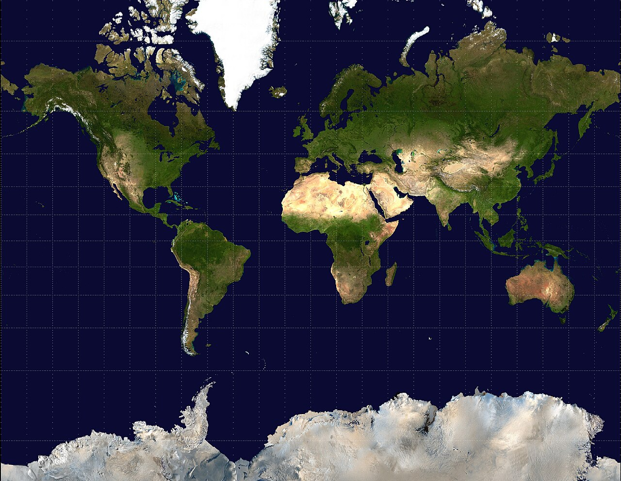
Mercator projection
mathematically produced, conformal map projection showing true compass bearings as straight lines
conformal maps
a map using a projection that maintains the true shape of small areas on Earth’s surface
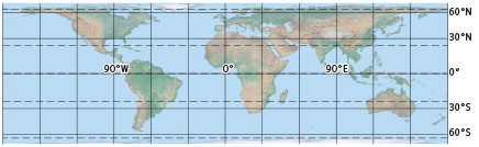
equal-area maps
a map created with a projection that preserves correct proportional sizes for any given areas of Earth’s surface
Azimuthal projections
a projection that preserves the true direction from the map center to any other point on the map
Gnomonic projections
planar projection with greatly distorted land and water areas; valuable for navigation because all great circles on the projection appear as straight lines
compromise projections
maps that compromise true shape and true area in order to display both fairly well
Mercator projection
What type of map projection is this?
equal-area projection
What type of map projection is this?
Azimuthal projection
What type of map projection is this?

Gnomonic projection
What type of map projection is this?

compromise projection
What type of map projection is this?

Interrupted projection
What type of map projection is this?
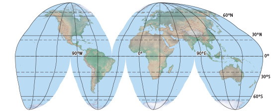
legend
key to symbols used on a map
map scale
ratio between a distance as measured on Earth and the same distance as measured on a map, globe, or other representation of Earth
verbal scale
stating the scale of a map using words such as “one inch represents one mile.”
graphic scale
a ruler-like device placed on maps for making direct measurements in ground distances
representative fraction (RF) scale
a map scale presented as a fraction or ratio between the size of a unit on the map to the size of the same unit on the ground, as in 1/24,000 or 1:100,000