MODULE 02b PL 413: FUNDAMENTALS OF URBAN DESIGN AND COMMUNITY ARCHITECTURE
 Call Kai
 Learn
Learn Practice Test
 Spaced Repetition
 Match
Match Flashcards
 Knowt Play
1/110

Earn XP
Description and Tags
PART 02: HISTORY- DEVELOPMENT PLANNING HISTORY AND INFLUENCE ON URBAN DESIGN BEGINNINGS OF URBAN DESIGN – WESTERN STREAM
Name | Mastery | Learn | Test | Matching | Spaced | Call with Kai | Chat |
|---|
No analytics yet
Send a link to your students to track their progress
111 Terms
Field of Architecture
The _______ may be one of the deepest of all environmental professions. It involves understanding the past, present, and future. It engages itself with its potential users, their behavioral patterns, desires, and needs. It also involves laws, codes, regulations, theories, and concepts in design. Design does not only concern physical form, color, texture, size, and shape, but it also concerns function
Urban Design
A building’s design is not only about the structure itself but also about how it fits and interacts with its surroundings. When multiple buildings come together in a city, their relationship creates a larger form of art—the urban environment. This understanding of buildings and their surroundings is the foundation of
Potential for natural calamities: (fire, flood, volcano eruption etc.)
Presence of fertile soil, bodies of water, and other natural resources
Slope and terrain and other forms of natural defenses
Climate
Natural factors that affect the development and growth of urban areas
The plow and rectilinear farming
Circular fencing and radio centric planning
Innovations that influenced the development of early cities:

The Neolithic Ciities
C. 7000-9000 B.
Jericho
Khirokitia
Catalhoyuk
The Neolithic Ciities ( 7000-9000 B.C.)
Jericho
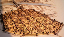
the early settlement in Israel around 9000 BC. It has 3000 people. The city was built around a reliable source of fresh water. 3 hectares in area and enclosed with a circular stone wall.

Khirokitia
is an archaeological site on the island of Cyprus dating from the Neolithic age. The site is known as one of the most important and best-preserved prehistoric sites of the eastern Mediterranean. The first documented city with streets. Main street was narrow but had a wide terminal
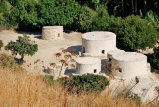
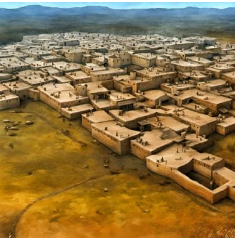
Catalhoyuk
was the largest Neolithic and Chalcolithic protocity settlement in southern Anatolia (in Turkey), which existed from approximately 7100 BC to 5700 BC, and flourished around 7000 BC. 13 hectares in area and population is about 10,000. It was an intricately assembled complex without streets
3000-4000 B.C
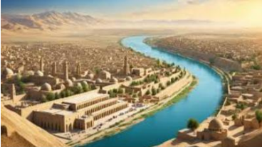
In this era cities in the fertile Cresent were formed by the Tigris and Euphrates river valleys of Mesopotamia.
The City of Eridu-oldest city
The City of DamascusOldest continually inhabited city
Babylon: The largest city with 80,000 inhabitants
3000-4000 B.C Cities
3000 B.C.
Thebes and Memphis along the Nile Valley – these Egyptian Cities were characterized by monumental architecture popularly symbolized by the pyramids
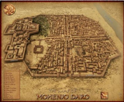
Indus Valley (present day Pakistan)
Mohenjo – Daro : administrative-religious center with 40.000 inhabitants
2500 B.C.
Yello River Valley of China – “Land within the passes”. Precursor of Linear City.
Anyang – Largest city of the Yellow River Valley
Cities also envolved in Mesoamerica, Built by the Aztecs, Mextecs, and Zapotecs
1900 B.C.
Cities spread through the Aegean Region (westward to France and Spain)
“polis” defined as a “city state,” the most famous example is the Acropolis
Finite measurements of Greeks- built to the human scale
Sparta and Athens were the largest cities
Neopolis and Paleopolis means new and old cities. Neopolis became Paleopolis once another new city was built.
GREEK CLASSICAL CITIES
700 B.C
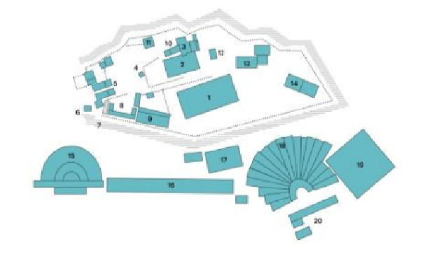
1. Parthenon
2. Old Temple of Athena
3. Erechtheum
4. Statue of Athena Promachus
5. Propylaea
6. Temple of Athena Nike
7. Eleusinion
8. Sanctuary of Artemis Brauronia
9. Chalkotheke
10. Pandroseion
11. Arrephorion
12. Altar of Athena
13. Sanctuary of Zeus Polieus
14. Sanctuary of Pandion
15. Odeon of Herodes Atticus
16. Stoa of Eumenes
17. Sanctuary of Asclepius
18. Theatre of Dionysus Eleuthereus
19. Odeum of Pericles
20. Temenos of Dionysus Eleuthereus
The city of Miletus was regarded as the first planned city.
There were 3 sections of Miletus for the artisans, farmers and military.
Hippodamus – the first noted urban planner. Introduces the grid system and the Agora or the public market
450-400 B.C.
Roman Cities
adopted Greek forms but with different scale – monumental, had a social hierarchy.
Roman Forums
Focal points of Roman City Planning
Romans as Conquerors
Built forum after forum
Roman as Engineers
Built aqueducts, public bath, utility systems, fountains, etc.
Romans as physical and social planners
developed housing variations and other spaces
Basilica
covered market; law courts
Curia
The local meeting hall; the capitol
Domus
Traditional Roman house; with a central atrium
Insular
3 to 6-storey apartment with storefronts
Romans
______were also fond of public works and arts
Feudalism
MEDIEVAL AGES: affected the urban design of most towns.
Feudalism
is the dominant social system in medieval Europe, in which the nobility held lands from the Crown in exchange for military service, and vassals were in turn tenants of the nobles, while the peasants (villeins or serfs) were obliged to live on their lord's land and give him homage, labor, and a share of the produce, notionally in exchange for military protection.
Mercantilist cities
continuous increase in size while the power of the feudal lords declined
Noble
Clergy
Ownership shifted to a new variety-that of the wealthy mechants while the church continued it’s rise thus creating two privileged classes:
THE RENAISSANCE AND BAROQUE PERIODS
In 15th century France the kings achieved unity and display their affluence and power by improving and beautifying their cities
Arts and architecture thus became a major element of town planning
Plan of an Ideal City by Vasari
Geometrical forms of cities were proposed
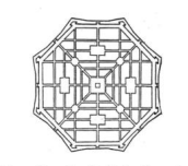
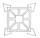
Vienna
emerged as the city of culture and the arts-the first (university town)
A plan of a palace and city of Karlsruhe by Margrave Karl II Wilhelm
Landscape architecture showcased palaces and gardens, best displayed in the plans of Lenotre for Versailles in France and its adaptation in the design of Karlsruhe in Germany
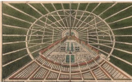
André Le Nôtre
The Versailles gardens, designed by _____ , have been a worldwide reference since the 17th century. These works of art are also a paradise representative of the ambitions of Louis XIV when he was a young king

Medieval Organic City-
taken after the "boug“ (military town) and "fauborg" (citizen's town) of the medieval ages. These towns did not have any regular street form
Medieval Bastide
taken from the French bastide. These were new towns placed in previously unsettled areas. Most bastides enjoyed locations in river valleys and were built in regular grid-like or radial form around them.
The Spanish "Laws of the Indies" town
built from King Philip II's city guidelines that produced 3 types of towns- the pueblo (civil), the presidio (military), and the mission (religious)
Speculators
The ______ Town developments were driven by speculation with emphasis on equality (Philadelphia, designedby William Penn, best exemplifies the American Speculator's Town)
WILLIAN PENN
The City of Philadelphia was founded by _____ as the Capitol of the Province of Pennsylvania. He determined that the city should be place upon the river for health purposes and easy navigation. Penn also specified that the roads and highways should be laid out first and then the lots for purchase.
Machine Age
INDUSTRIAL REVOLUTION: signified the change from manpower to assembly lines
Reform movements
Specialists
two schools of thought- the _____, that put emphasis on building from scratch to improve worker's living conditions, and the ______, who believed that the problems of cities should be tackled one item at a time, beginning with the improvement of health and sanitary systems
Robert Owens
spearheaded the Reform Movement by proposing his ideal city meant for 800 to 1200 persons on at least 600 to 1800 acres of land.
ROBERT OWENS
was a Welsh textile manufacturer, philanthropist and social reformer, and a founder of utopian socialism and the cooperative movement.
Cabet
conceptualized the city of Icarus, in Red River, Texas
Tony Garnier
also designed a hypothetical industrial town, Une Cite Industrielle, with an imaginary site consisting of a high plateau and level valley, all alongside a river. The plateau would be used for the residential component and the valley for factories, and other specialized spaces in areas where they develop a good relationship with complementary uses- these ideas may have been a precursor to modern zoning.
Ebenezer Howard
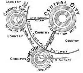
Author of “ Tomorrow: A Peaceful Path to Social Reform”, first conceptualized the “ Garden Cities”. These were new cities built in the countryside with rail access to the original city. Garden city would have a central city with an optimum size of 58,00 to 65,000 in 6,00 acres of land, with satellite cities, also connected by rail, with an optimum size of 30,00 to 32,00 persons. The cities would all be surrounded by large greenbelts of agricultural land.
Letchworth
The first developed Garden City, started in 1902
Designed by Raymond Unwin and Barry Parker
The plan was a combinations of landscaping, informal street layouts, and a main axis focusing on a town center. It was built in an area of 4,500 acres; 3000 for agricultural uses and 1500 for the city proper.
Welwyn
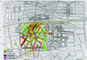
The second Garden City, built in 1920
Designed by Louis de Soisson
_____ brought formality and Georgian taste to the town built in a smaller land area of 2400 acres. The town’s focal point was a mile long mall with beautiful Georgian houses and shops facing it.
Hampstead Garden Suburbs
meant only for housing but with a variety of housing types lined along streets with terminating axes on civic buildings in a large common green
THE CITY BEAUTIFUL MOVEMENT
The exact period is vague, but theorist suggest it begun with the Columbian Exposition in 1891
Emphasis of the movement was on grand formal design, but also with social motives.
Daniel Burnham spearheaded the movement with his design of Chicago and with his famous axiom of “make no little plans, they have no magic to stir men’s blood”.
Burnham is also credited with the designs of Cleveland, San Francisco, and Manila and Baguio, among others.
THE NEW CAPITALS
The City Beautiful Movement spread to different parts of the world. Grand designs were sought after by different nations in the building of their new capitals, and proponents of the movement were invited to take part.
Brasilia
Chandigarh
Canberra
New Delhi, India
THE NEW CAPITALS
Brasilia
The new capital of ____ and a completely new twentieth century city was designed by Lucio Costa with a lot of influence from Le Corbusier.
Designed with two huge axes in the sign of the cross, with the principal multi-level traffic arteries traversing these axes. Separate centers for government, commerce, and entertainment are located along one axis, and the residential districts are distributed about the other.
Oscar Niemeyer was among the architects employed to design the buildings.
Chandigarh
With the separation of India and Pakistan, the site of original Indian Capital of Lahore was given to Pakistan, thus creating a need for a new capital.
was designed to be Capital of Punjab province of India.
The original Master Plan was by Albert Myer but Le Corbusier eventually took over.
Designed with a regular grid of major roads for rapid transport surrounding residential superblocks or sections each based on the rectangle, and measuring 800 x 1200 meters.
The whole plan represents a large scale application of Radburn principle regularized by Le Corbusier’s predilection for the rectilinear and the monumental
Canberra
The government of Australia sponsored a design competition in 1901 for the new capital and invited such top urban designers as Daniel Burnham, Sir Leslie Patrick Abercrombie, and Frederick Law Olmstead, but the winner was Walter Griffin, who was a descendant of Frank Lloyd Wright.
_____ design reflected the principles of the city beautiful movement with a triangular formation of three important building gs: Court of Justice, the Parliament House, and the Capitol Building, with each apex pointing to another important building or monument.
New Delhi
The Master Plan for ______ , designed by Sir Edward Lutyens is based on the great east west axis of kingsway, 1.5 miles long, with the Government House on a hilltop in the West end, and the eastern counterpoint a large hexagonal space reserves for palaces of the natives princes.
Kingsway form the base of a triangle, the northern point of which is a busy commercial node
The planned area covers 2650 hectares, yet growth beyond a population of 57,000 people was not contemplated as extremely low garden-city type density was envisioned.
THE CITY OF TOWERS
The problem of congestion in cities and the need for open space led to the conceptualization of high density living in tall structures that will take up less space
Unite d’ Habitation
This idea was first conceptualized by Le Corbusier in his book “ The Cities of Tomorrow”
His first plan of high density living was in Unite d’ Habitation in Marseilles, a “super building’ that contained 337 dwellings in only ten acres of land.
Le Corbusier also planned Le Contemporaine, designed for the population of 3,000,000 people
Consisted of high rise office and residential building with a greenbelt for institutions and recreational areas.
Beyond this were industrial areas
Designed with a grid pattern of superblocks, 200 by 400 meters
Transit was underground
Broadacres
Frank Lloyd Wright proposed that every family in the U.S. live in one acre of land, in a city complete with all necessary amenities.
Critics argued that there was not enough land. This led to his own translation of high density living
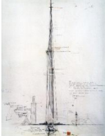
The Mile High Tower
Frank Lloyd Wright proposed to house a significant amount of Manhattan
Residents to free up space for green fields, in a building a mile high
He suggested that 10 or more of these could possibly replace all Manhattan buildings
The Floating CIty
Proposed by Kiyonori Kikutake
The Barbican Development
An early type of Planned Unit Development that had all amenities in one compound with multi-level circulation patterns.
THE NEIGHBORHOOD UNIT
Conceptualized by Clarence Perry and Clarence Stein, the neighborhood unit was defined as the physical environment wherein social, cultural, educational, and commercial are within easy reach of each other
Was not intended to segregate anybody by race, religion, or income. The unit was a template for new neighborhoods with the main objective being selfsustainability of smaller units
The elementary school as the center of development and the size of the neighborhood was dependent on the population of the school.
Pre-colonial Times
SETTLEMENT PLANNING IN THE PHILIPPINES:
Like other cities in the world the earliest Filipino communities developed out of the need for their inhabitants to band together.
They were formed for security, or to be close to critical resources like food and water.
Most of the earliest towns were by the coast for the fisherfolk or were where there was abundant agricultural land for the farmers
The community unit was the barangay, consisting of 30 to 100 families
Laws of the Indies
In 1573, King Philip Il proclaimed the Laws of the Indies that established uniform standards and planning procedures for colonial settlements.
These laws provided guidelines for site selection, layout and dimensioning of streets and squares, the location of civic and religious buildings, open space, cultivation and pasturing lands, and even the main procedural phases of planning and construction
The Plaza Complex was a result of several ordinances of the Laws of the indies.
1. Catholic church
2. Municipal or town hall
3. Marketplace and merchants’ stores
4. Elementary school
5. The homes of the "principalia"
6. Other government buildings
The plaza was surrounded by important buildings such as:
Intramuros
The city was 1.2 sq. KM in area, containing large Churches, plazas, office and residential buildings, housing 7000 residents surrounded by high walls. Because of the physical limitations in growth, decentralization occurred and settlements were built in Malate, San Miguel, and Paco, among other areas
The American Period
With the arrival of the Americans their agenda was to guide urban growth and physical development In doing so, they put more emphasis on other values such as sanitation, housing, and aesthetic improvements.
Daniel Burnham
an architect / planner who designed Chicago, San Francisco, and parts of Washington D.C. was brought in and commissioned to design Manila based on the city beautiful movement theories he was known for
design of Manila was very similar to his design of Washington D.C., evident in the Strong similarities of the Capitol mall with Luneta Park
went as far as ordering reclamation of the sea to create a better view of the ports
Manila
______ as the first chartered city
On July 31, 1903, by virtue of Act No. 183, the city of Manila was incorporated
Manila encompassed Intramuros, and the towns of Binondo, Tondo Sta. Cruz, Malate, Ermita, Paco, and Pandacan.
The population then was 190,000 people
Quiapo, Tondo. Binondo, Sta. Cruz, San Nicolas, Sampaloc, Ermita, Paco, and Pandacan
Growth of Manila
The Arrabales
Quiapo
the illustrado territory; the enclave of the rich and powerful. Also the manifestation of folk religiosity.
coastal city adjacent to Manila
Tondo
Binondo
the trading port developed by the Chinese and Arabs
Sta. Cruz
the main commercial district with swirls of shops, movie houses, restaurants, etc
San Nicolas
also a commercial town buiit by the Spanish with streets of "specialized" categories (i.e. ceramics, soap, etc.)
Sampaloc
centered on two churches (Our Lady of Loreto and Saint Anthony of Padua). Also known as the first "University Town".
San Miguel (Malacañang)
Malate
Ermita
Paco
Pandacan
Later Suburbs
San Miguel (Malacañang)
where rest-houses were built for the Spanish government
Malate
the early "summer resort" of wealthy and cultured Filipinos. Then became the first fishing and salt-making town
Ermita
early tourist belt (red-ugnt district)
Paco
first town built around a train station
Pandacan
town built by the Americans for Oil depots
Agricultural Revolution
Preindustrial Revolution
Industrial Revolution
Around 7000 BC, the development of agriculture led to permanent Neolithic farming settlements, such as Jarmo in Iraq and Jericho in modern Israel.
The growth and development of early settlements eventually led to the formation of cities and organized urban communities.
During the 18th and 19th centuries, industrialization transformed cities into urban-industrial centers, shaping the foundation of modern cities.
1. Hydraulic Theory
2. Economic Theory
3. Military Theories
4. Religious Theories
THEORIES OF URBAN CITY ORIGIN
1. Concentrated population and social surplus
2. Social hierarchy and formal institutions
3. Defenses against outsider (wall)
4. Monumental architecture (temples, places)
5. Management of resources
Creation of irrigation system, granaries, etc.
Collection of taxes/tribute
Distribution to members of the court
Distribution of subjects in time of famine
FACTORS BEHIND THE EMERGENCE OF CITIES
SJOBERG's model
Attempts to identify some common cross cultural features of the preindustrial city. Sjoberg's model is most appropriate in cities where domination by an elite occurred. It identifies three social groups with social boundaries rigidly defined and often formally codified.
Elite
Servants of the elite
Outcasts
The class pyramid
The elite occupied the central district around the ceremonial and symbolic institutions, including the religious, educational and political structures.
Interspersed within the inner core were the servants of the elite, but the major concentration of lower-class residences was in a zone outside the core.
The outcasts were relegated to the periphery, completing the spatial gradation of social status.
EARLY MODERN URBANISM
eriod, from 1500 to 1800, the economic and political powers of the European medieval city were usurped by the expansion of nation-states. Despite this relative decline in urban autonomy, however, the period witnessed increasing levels of urbanization and the gradual emergence of an urban system in Europe.
THE FORM OF INDUSTRIAL CITY
The nineteenth century witnessed the flowering of industrial capitalism in Western Europe and the rapid growth of the European industrial city. The need for a large pool of labor as well as ancillary services and markets for their products encouraged factories to cluster together in towns. Industrial capitalism also brought a major realignment of social structures with the creation of two main classes:
Capitalists
Labor
Industrial capitalism also brought a major realignment of social structures with the creation of two main classes:
Capitalists
who invested in labor with the goal of realizing a profit;
Labor
that sold its skills to the owner of capital in return for a wage. The unequal division of power between the two main classes had a direct effect on the form of the industrial city, which was developed primarily to fulfil the needs of capital.
The basic sector
The non-basic sector
The urban economy may be viewed as being made up of two interrelated sectors:
Basic sector
comprising activities that produce goods and services sold outside the city to obtain the means needed to purchase imports (e.g. manufactures);
Non-basic sector
comprising activities that provide goods and services for the city itself (e.g. retailing).
URBAN MODELS
Spatial models of urban growth have been used to describe the land use patterns in the traditional North American city. These have however, been universally used to describe most cities, including third world cities, and especially cities with a colonial past