unit 1 ap human geo
5.0(1)
Card Sorting
1/44
Earn XP
Description and Tags
Study Analytics
Name | Mastery | Learn | Test | Matching | Spaced |
|---|
No study sessions yet.
45 Terms
1
New cards
Political map
reference map that shows political boundaries
ex: countries, cities, capitals
ex: countries, cities, capitals
2
New cards
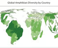
Thematic maps
maps used to display specific types of information (theme) pertaining to an area.
3
New cards
cartogram
thematic map that shows statistical data by transforming space ex: population
4
New cards
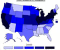
choropleth map
thematic map that uses shading or coloring to show statistical data
ex: population
ex: population
5
New cards
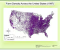
dot density map
thematic map that uses dots to indicate a feature or occurrence
ex: population
ex: population
6
New cards
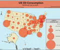
graduated symbols map (proportional symbols map)
thematic map that indicates relative magnitude of some value for a geographic region in which the symbol varies in proportion to data
ex: population
ex: population
7
New cards
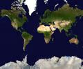
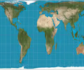
Mercator Projection
-used for navigation
-correct in direction
-size is wrong
-top and bottom are distorted
-correct in direction
-size is wrong
-top and bottom are distorted
8
New cards
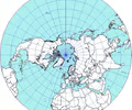
Polar Projection
-North/South poles
-center is good but then it become distorted
-not used for navigation
-center is good but then it become distorted
-not used for navigation
9
New cards
absolute distance
measurement using a standard unit of length
ex: mile, kilometer
ex: mile, kilometer
10
New cards
relative distance
measurement of the social, cultural, and/or economic connectivity between places (how connected or disconnected)
ex: USA and Iran vs USA and China
ex: USA and Iran vs USA and China
11
New cards
Goode's homosiline interrupted projection
-size and shape are excellent
-distance and direction are bad
-distance and direction are bad
12
New cards
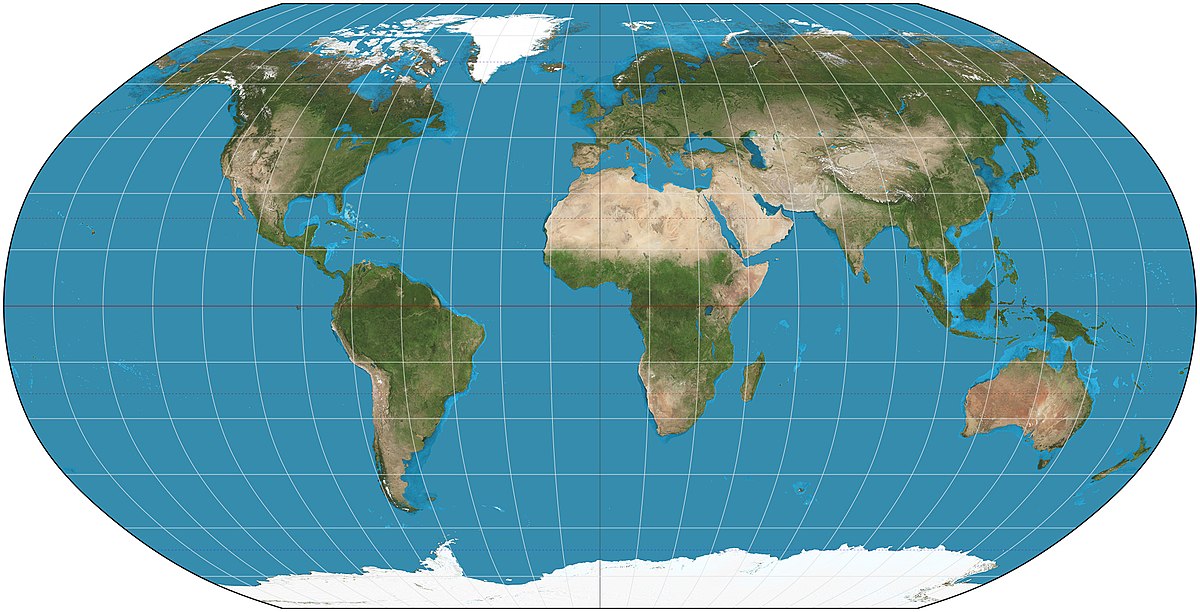
Robisons projection
-shapes are correct
-size is close
-cannot navigate
-most used for students
-everything is distorted in small amounts
-size is close
-cannot navigate
-most used for students
-everything is distorted in small amounts
13
New cards
absolute direction
finding a location using compass direction
ex: north, south, east, west
ex: north, south, east, west
14
New cards
relative direction
finding a location not using compass direction
ex: left, right, forward, backward, up, down
ex: left, right, forward, backward, up, down
15
New cards
spatial pattern
the way things are laid out and organized on the surface of the earth
16
New cards
Geospatial Technologies
technology that provides geographic data that is used for personal (navigation), business (marketing), and governmental (environmental planning) purposes
17
New cards
Largest and smallest states
Largest
-Russia
-Canada
-U.S
Smallest
-Vatican City
-Monaco
-San Marino
-Russia
-Canada
-U.S
Smallest
-Vatican City
-Monaco
-San Marino
18
New cards
domain
the area in which a particular culture is dominate but less intense
19
New cards
GIS (geographic information system)
- map created by a computer that can combine layers of spatial data
- data is displayed and analyzed to gain insights into geographical patterns/relationships
e.g. vulnerability of the Florida Aquifer, school boundaries, crime rates
- data is displayed and analyzed to gain insights into geographical patterns/relationships
e.g. vulnerability of the Florida Aquifer, school boundaries, crime rates
20
New cards
remote sensing
collecting data with instruments that are distant from the area of study
ex: satellites, planes, aircraft, ships
ex: satellites, planes, aircraft, ships
21
New cards
Why are maps essential
for highlighting and analyzing patterns
22
New cards
small-scale
show a larger amount of area with less detail
23
New cards
absolute location
describes the precise location of a place using the earths graticule (latitude and longitude)
24
New cards
Large-scale
Show smaller amounts of area with greater amount of details
25
New cards
Why are all maps distorted?
All maps are distorted because teh Earth is a sphere and maps are flat.
26
New cards
relative location
describes the location of a place relative to other human and physical features
27
New cards
Location vs place
location identifies where a specific phenomena occurs
and place is the specific human and physical characteristics of a location
and place is the specific human and physical characteristics of a location
28
New cards
Region
an area that has something in common
29
New cards
globalization
the process of increased interconnections among countries most notably in the areas of economics, politics, and culture
30
New cards
environmental determinism
theory that a society is formed and determined by the physical environment, especially the climate; the physical environment predisposes societies towards particular development; human society development is controlled by the environment
31
New cards
time space convergence
term that refers to the greatly accelerated movement of goods, information, and ideas during the 20th century made possible by technological innovations
32
New cards
Site vs situation
Site refers to the physical and cultural features of a place, independent of other places around it.
Situation describes a place's relationship to other places around it.
Situation describes a place's relationship to other places around it.
33
New cards
perceptual/vernacular region
region that exists as an idea
ex: the south, Kurdistan
ex: the south, Kurdistan
34
New cards
Cultural ecology
Geographic approach that emphasizes human-environment relationships.
35
New cards
Formal/Uniform
united by one or more traits
(Brazil in South America unites)
(Brazil in South America unites)
36
New cards
regional boundaries
transitional and often contested and overlapping
ex: Kurdistan in Turkey and Northern Iraq
ex: Kurdistan in Turkey and Northern Iraq
37
New cards
Functional/Nodal
Organized around a focal point and defined by an activity
(Pizza delivery area)
(Pizza delivery area)
38
New cards
Perceptual (vernacular)
defined by the informal sense of place that people describe to them.
(Upstate New York)
(Upstate New York)
39
New cards
Gall peters
Shape of countries especially near the equator are distorted
40
New cards
distance decay
a geographical term which describes the effect of distance on cultural or spatial interactions
41
New cards
time space compression
the increasing sense of connectivity that seems to be bringing people closer together even thought their distances are the same
42
New cards
Possibilism
The physical environment may limit some human actions, but people have the ability to adjust to their environment.
43
New cards
scale of analysis
how zoomed in or out you are when looking at geographic data
44
New cards
formal region
a region that is based on quantitative data-data (that can be documented or measured) - all states and countries are this because they share a government
45
New cards
functional region
a region based around a node or focal point- transportation or communication