IFR Oral Exam Flashcards
1/67
Earn XP
Name | Mastery | Learn | Test | Matching | Spaced | Call with Kai |
|---|
No analytics yet
Send a link to your students to track their progress
68 Terms
What does an instrument rating allow you to do?
To act as PIC in weather less than VMC
To file a flight plan
Special VFR in controlled airspace b/w sunset to sunrise (must have ATC clearance, clear of clouds , more than 1 sm visibility)
Fly in Class A airspace
Carry passengers for compensation or hire more than 50 nm or at night.
How do I maintain my Instrument currency?
Within 6 calendar months preceding the month of flight, I must have flown 6 approaches, practicing holds, intercepting and tracking radials using navigational devices.
What do you do if you’ve only logged 4 approaches in the last 6 months and want to regain IFR currency?
You must complete the remaining 2 approaches, plus:
One holding procedure
Intercepting and tracking courses using navigation systems
This must be done in:
Actual IMC or
Simulated IMC with a safety pilot (under the hood)
An approved flight simulator or FTD
Reg Reference: 14 CFR § 61.57(c)(1)
What will you do if you get a RAIM failure enroute?
Aviate: Maintain control of the aircraft.
Navigate:
Cross-check with other onboard navigation sources (e.g., VOR, DME if equipped).
If no backup is available and GPS is primary, transition to a nearby VOR-based airway.
Consider using the MON (Minimum Operational Network) to navigate via legacy ground-based navaids.
Communicate:
Inform ATC of the RAIM failure and intentions.
Request vectors or clearance to join a V-airway or conventional navigation route
RAIM failure = you can’t rely on GPS integrity.
If you’re GPS-only and lose RAIM with no backup (and no WAAS), you are effectively navigationally lost under IFR and must revert to conventional navaids or ATC help.
FAA AIM 1-1-17
What’s the last date an approach must be logged to maintain IFR currency?
6 calendar months from the date of the oldest of the 6 required approaches.
Example:
If the oldest logged approach was on January 15, you are current through July 31.
Reg Reference: 14 CFR § 61.57(c)(1) & (c)(2)
What indication do you get if GPS RAIM fails?
“LOI” (Loss of Integrity) displayed on the navigation screen
“INTEG” message in the Message (MSG) field
CDI may freeze, flag, or show a red X
Navigation guidance may stop (e.g., DTK, ETA disappear)
May enter DR (Dead Reckoning) mode if enabled
Indicates GPS position is no longer reliable—don’t use GPS for navigation
What do you need to do if you’re past 6 months from your last IFR currency?
If you’re within 6 months of losing currency:
You can regain currency by flying 6 approaches, holding, and intercept/track with a safety pilot, CFII, or in a simulator
If you’re past the 6-month grace period (i.e., 12 months total):
You must complete an Instrument Proficiency Check (IPC) with a CFII, approved examiner, FAA examiner.
Reg Reference: 14 CFR § 61.57(c)–(d)
Safety Pilot Requirements
• Be at least a Private Pilot
• Be rated in category and class for airplane
• Adequate vision forward and to each side of aircraft
• The aircraft must have fully functional dual controls (simulated instrument okay with single, functioning, throwover control wheel in single engine)
Ref: 91.109
Can you fly into known icing conditions?
Flight into known icing conditions is prohibited due to our POH because we don’t have deicing equipment.
How does icing affect flight, and what are the types?
Effects:
Increases weight
Decreases lift & thrust
Increases drag
Can cause instrument errors or loss of control
Types:
Structural Icing: Forms on airframe surfaces (wings, tail, etc.)
Needs visible moisture + freezing temps
Types: Clear, rime, mixed
Induction Icing: Forms in engine air intakes or carburetors
Can happen in clear air with high humidity
Reduces or blocks engine airflow
C-172 Anti/De-icing Equipment
Pitot Heat – Electric (anti-ice)
Carb Heat – Uses exhaust heat (anti-ice)
Cabin Heat/Defroster – Exhaust shroud heat (anti-ice)
Alternate Air Door – Manual (172P) or automatic (172S); pulls air from cowl behind filter (anti-ice)
No onboard deicing—deicing fluid used only on the ground
How would you know the alternate air door is open?
It opens automatically due to engine suction if the intake is blocked (172S)
You may notice a 10% power loss
No cockpit indication—detected by engine performance change
How does the airspeed indicator work?
Measures dynamic pressure, which is the difference between:
Ram air pressure from the pitot tube, and
Ambient static pressure from the static port
How it works:
Ram air enters a sealed diaphragm inside the instrument
Static pressure fills the case around the diaphragm
As airspeed increases, more ram air expands the diaphragm
As airspeed decreases, the diaphragm contracts
Compass Errors
Deviation – Instruments in your airplane cause interference that affects your compass. Discrepancy introduced into a compass reading due to the presence of local magnetic fields
Variation – Difference between magnetic north and true north
Magnetic Dip – The vertical pull of the earth’s magnetic field on the compass
Oscillation – Fluctuations of the compass card due to turbulence or vibration
UNOS – Undershoot North, Overshoot South (caused by the pivot point and CG difference)
Acceleration/Deceleration –
Accelerate → compass swings north
Decelerate → compass swings south
(Due to inertia affecting the magnet)
What’s the pivot point and CG difference in compass errors?
Pivot Point: Where the compass card moves.
Center of Gravity (CG): The aircraft’s balance point.
Effect: When the plane accelerates or decelerates, the compass can show errors because the pivot point and CG don’t always line up.
Accelerating north = compass may lag behind (undershoot)
Decelerating south = compass may overcompensate (overshoot)
Pitot Tube Blockage Effect
Only pitot tube blocked (drain hole open):
→ Airspeed drops to zeroPitot tube + drain hole blocked:
→ Airspeed acts like an altimeter (increases with climb, decreases with descent)Airspeed indicator malfunctions in both cases
What happens to your Airspeed indicator if your Static port is blocked?
Airspeed indicator reads inaccurately
During climb: reads lower than actual
During descent: reads higher than actual
Stuck at last known static pressure—airspeed still moves, but incorrectly
How can you remedy a static port blockage?
Use the alternate static source (if available)
In a Cessna 172: pull the Alternate Static Air knob
If no alternate source: Break the VSI or static-side glass as a last resort
Alternate Static Port Expected Indications
Altimeter – Reads higher
Airspeed Indicator – Reads faster
VSI – Shows a momentary climb, then stabilizes
(Due to lower pressure inside the cabin compared to outside)
GPS
GPS = Global Positioning System (part of Global Navigation Satellite System (GNSS) U.S.-operated)
Satellite-based radio navigation system
Uses a constellation of at least 24 satellites orbiting Earth
Requires at least 4 satellites for 3D position (lat, long, alt)
Uses time delay of signals to calculate position
RAIM
Receiver Autonomous Integrity Monitoring: GPS receiver's capability to self-monitor GPS signal integrity and availability.
Needs 5 satellites
RAIM cross checks multiple satellites to detect faults (fault detection and exclusion). Needs 6 satellites
What is WAAS and what does it allow you to do?
WAAS = Wide Area Augmentation System
Uses ground-based reference stations and geostationary satellites
Detects and corrects GPS signal errors, then sends the correction to your GPS
Improves accuracy, integrity, and availability
Enables APV approaches (Approach with Vertical Guidance) like LPV
Allows you to:
File GPS approaches at both destination and alternate
Navigate solely by GPS (no VOR/ILS required)
VOR Testing Frequency
Every 30 days.
How do you do a VOR check and who can do it?
Anyone can do a VOR check (no authorization required)
Methods and tolerances:
VODGAVOT (test signal/frequency): 360° FROM, 180° TO, ±4°
Own checkpoint: ±6° select VOR radial along centerline of VOR and prominent landmark at least 20 miles away from the VOR
Dual VOR (two independent receivers): Center navs— must differ by no more than 4°
Ground checkpoint: ±4° (tuning into VOR frequency)
Airborne checkpoint: ±6
You’re turning from 030° to 330° using a standard rate turn. How much time does it take, and when do you roll out?
Total turn: 300°
Standard rate turn: 3° per second
Time needed: 300 ÷ 3 = 100 seconds
Roll out 10° early (because the compass will lag)
Roll out heading: 340
Standard Rate Turn
3 degrees per second (360 in 2 minutes)
MEA
Minimum Enroute Altitude: The lowest published altitude between radio fixes which assures acceptable navigational signal coverage and meets obstacle clearance requirements between those fixes.
MOCA
Minimum Obstruction Clearance Altitude: The lowest published altitude in effect between radio fixes on VOR airways, off-airway routes, or route segments which meets obstacle clearance requirements for the entire route segment and which assures acceptable navigational signal coverage only within 25 statute (22 nautical) miles of a VOR.
IFR Fuel Requirements
Destination, alternate, plus 45 minutes of fuel at cruise speed.
Weather Information Sources in Flight
FSS, ATIS, FIS-B
Hold for Release
Aircraft cannot take off under IFR, but can take off in VFR conditions.
DA
Decision altitude: The specified altitude in a precision approach procedure at which a decision must be made to either continue the approach or execute a missed approach
Used in precision approaches (e.g., ILS). At DA, if the required visual reference is not established, a missed approach must be initiated.
MDA
Minimum Descent Altitude: The lowest altitude, expressed in feet above mean sea level, to which descent is authorized on final approach or during circle-to-land maneuvering in execution of a standard instrument approach procedure where no electronic glide slope is provided.
Used in non-precision approaches (e.g., VOR, NDB). At MDA, if the required visual reference is not established by the missed approach point (MAP), a missed approach must be initiated.
How do you identify the Missed Approach Point (MAP)?
MAP can be identified by the following methods:
Timer: Start a timer at the FAF (Final Approach Fix) and monitor the time specified for the approach. When the time is up, reach the MAP.
GPS Flip: On a GPS approach, the system will automatically indicate the MAP when the aircraft reaches the designated point.
To-From Needle Flip: In some cases, the to-from needle will flip (i.e., the aircraft has passed the final approach fix and is now on the missed approach course).
Aircraft and flight visibility requirements to go below MDA/DA
Aircraft is continuously in a position from which a descent to a landing on the intended runway can be made at a normal rate of descent, using normal maneuvers.
The flight visibility is not less than the visibility prescribed in the standard and instrument approach being used
91.175
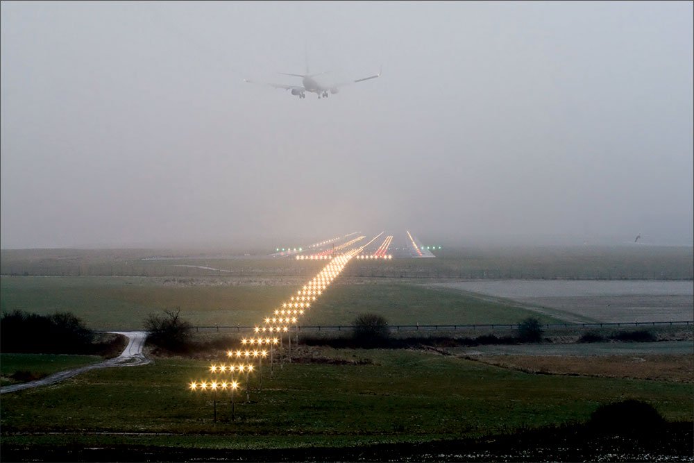
Visual references to land
The approach light system (but only to 100’ above TDZE unless it includes red terminating bars or red side row bars)
The approach light system’s red terminating bars or red side row bars (on ALSF-1 or ALSF-2 systems)
The runway
The runway markings
The runway lights
Threshold
Threshold markings
Threshold lights
The REIL (Runway End Identifier Lights)
The VASI or PAPI
The touchdown zone or its markings
The touchdown zone lights
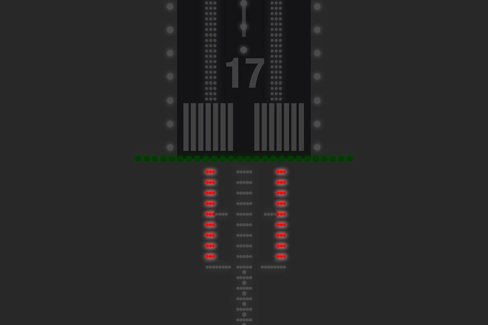
What lights are these?
Runway lights
What lights are these?
Touchdown zone lights

What lights are these?
REILs or runway end identifier lights (they're the flashing strobes on the corners of the runway's approach threshold)
What lights are these?
threshold lights
Green in the direction of approach (what you see on final)
Red in the opposite direction (to indicate the end of the runway if viewed from the other side)
What markings are these?
Threshold markings
What lights are these?
Red side row bars on an ALSF-2 system.
What lights are these?
RAILS—runway alignment indicator lights
flashing lights in line with the runway centerline, extending outward before the threshold, helping pilots visually align with the runway.
What does ALSF-1 stand for?
Approach Lighting System with Sequenced Flashing Lights – Category I, includes white lights and RAILs.
What does ALSF-2 stand for?
Approach Lighting System with Sequenced Flashing Lights – Category II/III, includes red side row/terminating bars and RAILs.
What does MALSR stand for?
Medium Intensity Approach Lighting System with Runway Alignment Indicator Lights – commonly used for Category I approaches; includes RAILs.
What does SSALR stand for?
Simplified Short Approach Lighting System – like SSALR but without RAILs
What does ODALS stand for?
Omnidirectional Approach Lighting System – simplified lighting used at smaller airports; includes two RAILs and omnidirectional strobes.
What does LDIN stand for?
Lead-In Lighting System – provides visual guidance to align with runway during offset approaches (not always straight-in).
ALSF-2 Out of Service
Increase visibility based on the TPP (Terminal Procedures Publication).
What does RAWFAT stand for?
RAWFAT for key weather sources and briefings for IFR flight planning
R – Radar (precipitation and storm movement)
A – AIRMETs/SIGMETs (significant weather advisories)
W – Winds Aloft (for performance and turbulence)
F – Forecasts (TAFs, area forecasts, etc.)
A – ATIS/ASOS/AWOS (real-time airport weather)
T – Temps (freezing levels and icing risk)
PIREPs (for actual in-flight conditions)
METARs (current surface weather)
NOTAMs (for TFRs, runway closures, etc.)
What does it mean if your GPS approach box turns yellow?
It usually means sensitivity has not increased, or you’ve lost required integrity (RAIM/WAAS) for the segment.
You may not have LPV or LNAV/VNAV available.
You must go missed if it happens after the FAF and you can’t ensure lateral/vertical guidance.
(Source: Garmin and FAA AC 90-107)
When can you continue an approach if you lose RAIM or WAAS?
Before the FAF: You must abort the approach unless RAIM/WAAS can be reestablished.
After the FAF: You may continue the approach to the MAP using current guidance, unless your equipment/software or approach procedures state otherwise.
(Source: AIM 1-1-19 and AC 90-100A)
What should you do if you lose RAIM or WAAS during an approach?
If before FAF, execute missed and coordinate with ATC.
If after FAF and no integrity warning appears, you may continue.
If there’s a “LOI” (loss of integrity) message, immediately go missed

What do navigation systems like RAIM and WAAS do for you in IFR?
RAIM: Confirms GPS accuracy is reliable using 5+ satellites. Required for basic GPS IFR navigation and non-augmented GPS approaches.
WAAS: Provides higher accuracy and integrity, enabling vertical guidance on LPV and LNAV/VNAV approaches—similar to ILS.
(Source: FAA Instrument Flying Handbook & AIM 1-1-19)
What is a Departure Procedure (DP)?
A preplanned IFR route from takeoff to enroute structure. Two types: ODPs (Obstacle DPs) and SIDs (Standard Instrument Departures).
What is an Obstacle Departure Procedure (ODP)?
Designed to provide obstacle clearance. Often textual and may be used without ATC clearance unless a SID is assigned.
What is a Standard Instrument Departure (SID)?
A graphic procedure designed to streamline ATC and provide obstacle clearance. Requires ATC clearance.
What is a STAR (Standard Terminal Arrival Route)?
A preplanned IFR arrival procedure that simplifies clearance delivery and routes aircraft to a fix where an instrument approach begins.
Altitude and speed restrictions must be complied with unless ATC clears otherwise.
What are the common failure modes of gyroscopic instruments?
Attitude indicator: vacuum failure, tumbling
Heading indicator: precession or vacuum failure
Turn coordinator: electrical failure
How do you recognize an attitude indicator failure?
Horizon bar freezes or drifts
Doesn’t match aircraft pitch/bank or outside references (if available)
Compare with turn coordinator and altimeter
How do you correct for an attitude indicator failure?
Use partial panel: turn coordinator for bank, altimeter + VSI for pitch
Maintain control using Aviate, Navigate, Communicate
What instruments are affected by a pitot-static system failure?
Pitot tube failure: airspeed only
Static port blockage: airspeed, altimeter, VSI
Use alternate static source if available
How do you recognize a heading indicator failure?
Heading drifts and doesn’t match compass
Compare with magnetic compass frequently (every 15 mins)
What is a Diverse Departure Procedure, and when can you use it?
A DDP is authorized when no Obstacle Departure Procedure (ODP) or Standard Instrument Departure (SID) is published for a runway.
It allows a pilot to depart straight ahead to 400 feet above the departure end of the runway (DER) elevation before making any turns, provided:
The aircraft can maintain a standard climb gradient of 200 feet per nautical mile (ft/NM).
There are no obstacles penetrating the 40:1 obstacle identification surface in the departure area.
If these conditions are met, the pilot may execute a DDP without ATC clearance for a specific departure procedure.
Pitot Tube Blocked, Drain Hole Open
The airspeed indicator reads zero, because air pressure escapes through the open drain.
Pitot Tube and Drain Hole Blocked
The airspeed indicator acts like an altimeter — increasing in a climb and decreasing in a descent.
Static Port Blocked
Airspeed: will read lower than your actual airspeed when you fly above the altitude where the static port became blocked, and higher than your actual airspeed when you fly below the altitude where it became blocked.
Altimeter: Freezes at altitude where blockage occurred.
VSI: Reads zero (frozen).