Edexcel Geography A-Level - coastal landscape rose
coasts
interface between land and sea where both marine and terrestrial processes interact
Discordant coastline
the layers of rock are perpendicular to the direction of the coastline.
1/102
Earn XP
Name | Mastery | Learn | Test | Matching | Spaced |
|---|
No study sessions yet.
103 Terms
coasts
interface between land and sea where both marine and terrestrial processes interact
Discordant coastline
the layers of rock are perpendicular to the direction of the coastline.
Concordant coastline
Have alternating layers of hard and soft rock that run parallel to the coast.
lithology
The make up of each individual rock type
structure
way rocks are geologically arranged
differential erosion
How different materials erode at different rates
dip
the acute angle that a rock surface makes with a horizontal plane
joint
a fracture in rock along which there has been no movement
fold
stacks of originally flat surfaces that are bent/curved due to deformation
strata
layers of sedimentary rock
fault
A break in the earth's crust
bedding plane
longer or shorter pauses in deposition
halophytes
salt tolerant plants
xerophytes
plants adapted to arid environments
sand dune
a mound of sand piled up by the wind
salt marsh
an area of coastal grassland that is regularly flooded by seawater.
pioneer communities
first species to colonise an area
climax vegetation
most established/mature community, normally when vegetation is the same as the local environment
plagioclimax
The climax community when succession is stopped artificially
succession
A series of predictable and orderly changes within an ecosystem over time.
colonise
plants establish and take over an area
dominant species
the main plants/animals found in an area
sub aerial processes
land based processes which alter the shape of the coastline
weathering and mass movement
weathering
the gradual breakdown of rock at or close to the ground surface
mass movement
the movement of weathered material down a slope, as a result of gravity
corrosion
the gradual wearing away of a metal element due to a chemical reaction
attrition
bedrock pieces are hit against one another = break apart and become more rounded
abrasion
The grinding away of rock by other rock particles carried in water, ice, or wind
hydraulic power
The sheer power of the waves breaking rock apart as they force air into cracks in the rock.
sediment cells
areas along the coastline and in the nearshore area where the movement of material is largely self-contained
traction
sediment rolls along, being pushed by waves and currents
pebbles, cobbles abs boulders
saltation
sediment bounces along, either due to the force of water or wind
sand sized particles
suspension
sediment is carried in water column
silt and clay particles
solution
dissolved material is carried in the water as a solution
chemical compounds in solution
lateral shift
net effect of the movement of sediment up and down the beach
Swash-aligned coasts
Wave crests approach parallel to the coast, so there is limited longshore movement of sediment
drift aligned coasts
waves break at an angle, so longshore drift happens consistently
gravity setting
large sediments deposited first, followed by smaller sediments as energy of transporting water becomes too low to move sediment
flocculation
depositional process that is important for very small particles, such as clay, which are so small they remain suspended in water. Clay particles clump together due to electrical or chemical attraction and become large enough to sink.
equilibrium
describes average condition of a system, as measured through one of its elements or attributes, over a specific period of time
dynamic equilibrium
when a systems inputs and outputs remain in balance - if changes do occur, then feedbacks will allow for correction
factors affecting dynamic equilibrium
supply of sand, energy of waves, changing sea levels, location of shoreline
negative feedback
control state of the system by dampening or reducing the size of the systems elements or attributes
positive feedback
mechanisms feed or increase the size of one or more of the systems elements or attributes over time
beach
small scale depositional landform consisting of loose material so morphology is altered
beach profile
the shape of a beach resulting from how waves break
factors affecting beach profiles
wave energy, size and shape of beach material, tidal range
berm
A nearly horizontal accumulation of sediment parallel to shore, caused by high tides
affect of sediment size
smaller sediment (sand) has lower infiltration rate, pebble beach has higher infiltration rate - more gaps for water to infiltrate into
offshore bar
created by waves offshore from the coast - destructive waves erode sand and deposit it as offshore bars
cuspate foreland
triangular shaped headland that extends out from the main coastline - sediment deposited at the point where they meet
stabilised by vegetation growth
tombolo
ridge of sand forms between small island and mainland
occurs by a build up of sediment from deposition
spit
sand moves along coast via longshore drift - when coastline changes direction the sediment builds up
bar
beach/spit extends across a bay to join 2 headlands
brackish
slightly salty, as is the mixture of river water and seawater in estuaries.
embryo dune
youngest dune and first stage in sand dune succession - the smallest ridge that is closest to the sea that often gets flooded by sea water
embryo dune characteristics
80% exposed sand, 1m high, very little moisture content, pH = 8+, lyme grass and sand couch found there
fore dunes
older and slightly higher dunes just shorewards of embryo dunes
mobile dunes
dunes that migrate over time as a result of the action of the the wind/ waves during storms or due to human activity
fore dune characteristics
5m high, 20% exposed sand, very little moisture, slightly alkaline, plants include marram and xerophytic species
yellow dune
early stage of dune succession, where little organic material has accumulated, so the sand is still yellow coloured
grey dunes
fixed, stable sand dunes that are covered by a continuous layer of herbaceous vegetation
grey dune characteristics
8-10m high, less than 10% exposed sand, increasingly acidic, vegetation = creeping fescue, sea spunge, marran
fixed dunes
sand dunes that are completely covered in vegetation which stabalises them and stops further movement of the sand.
dune slack
a depression in a sand dune system where ponds and lakes can form
blowout
a depression on the land surface caused by wind erosion
eustatic
global changes in sea level due to
change in amount of water
change in geometry of ocean basin
isostatic
changes in sea level resulting in the rise and fall of land masses
emergence
impact of a fall in sea level
MARINE REGRESSION
submergence
impact of a rise in sea level
MARINE TRANSGRESSION
glacial eustasy
when sea level changes in response to the amount of water stored in ice caps
LECZ
low elevation coastal zone
land area and population by country that is located in coastal zone bands ranging from 1m to 20m elevation above sea level
storm surges
short term change in sea level caused by low pressure and the pushing of water by winds
causes of storm surges
depression - as pressure drops, weight of air pressure pressing down drops = sea rises
tropical cyclone
factors affecting storm surge
high/spring tide, topography
mangrove
shrub/small tree that grows in coastal saline/brackish water
sundarbans
delta of the Ganges-Brahmaputra rivers that is a mangrove forest before flowing into the Bay of Bengal
polder
land created by the Dutch by draining water from an area
alluivum
deposits of sand, gravel + smaller sediment eg. silt
sediment cells - sources
sub-aerial processes, erosional processes + sediment brought to coastline by rivers
FLAMBOROUGH HEAD
sediment cells - transfers
longshore drift, onshore and offshore winds + tides
HOLDERNESS COAST
sediment cells - sinks
depositional landforms = spits, bars, tombolos etc
SPURN HEAD
dredging
removal of sediment for construction processes = depth of ocean increases = increased occurrence of destructive waves as they can maintain energy closer to shoreline
hard engineering
building artificial structures such as sea walls aimed at controlling natural processes
soft engineering
a sustainable approach to managing the coast without using artificial structures
sustainable coastal management
managing the wider coastal zone in terms of people and their economic livelihoods, social and cultural wellbeing, and safety from cultural hazards as well as minimising environmental and ecological impacts
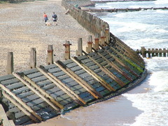
revetments
offshore
away from shore
foreshore
That part of a shore uncovered at low tide.
nearshore
extends seaward from low tide shoreline to low tide breaker line
backshore
The part of a beach above the high tide line
integrated coastal zone management (ICZM)
means of holistically managing the coastline
shoreline management plan (SMP)
ICZM plan for a stretch of coastline in England and Wales
involves detailed consultation with local interest groups so that solutions can be found that are tailored to that particular sub cell and community needs
winners
people who have gained from the decision, either economically, environmentally or socially
losers
people who are likely to lose property or perhaps see the coastline concreted over and this view is an environmental negative
factors considered when making decisions about coastal management
land use and value, engineering feasibility, environmental sensitivity, impacts of coastal processes
20 mark questions
PEACE paragraphs and SASSY conclusions
PEACE paragraph
P = point
E = example
A = application
C = criticise
E = evaluation
SASSY conclusion
S = summary
A = analysis
S = scale
S = synoptic
Y = your thoughts
hummus
Dark colored substance in soil from decayed organic material