Case Study: Extreme flood events Somerset Levels
1/10
There's no tags or description
Looks like no tags are added yet.
Name | Mastery | Learn | Test | Matching | Spaced |
|---|
No study sessions yet.
11 Terms
Where are the Somerset Levels?
South-west England
(between the Quantock & Mendip Hills)
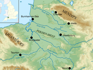
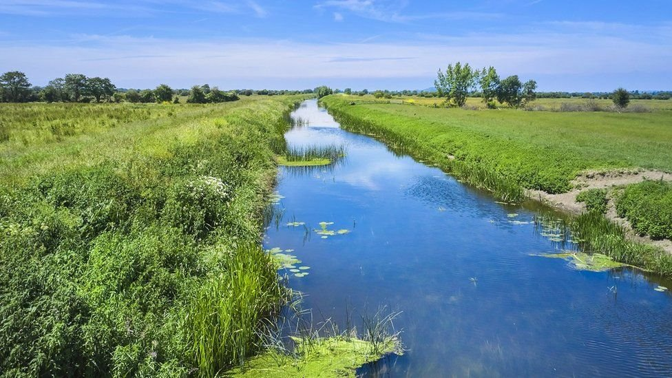
The landscape of the Somerset Levels is…
Vast (covers an area of 65km2)
Flat & very low (much of the land is below sea level & the highest altitude is only 8m)
Used for agriculture
Marshland & farmland
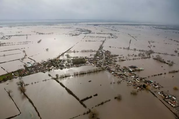
When did the Somerset Levels flood?
January 2014
How much land was flooded?
14000 hectares
(6900 hectares of which was flooded for over a month)
What were the physical causes of the flood?
12 major storms between December 2013 - February 2014 → driven across the Atlantic Ocean by high level winds (the jet stream), caused the UK to experience the wettest winter period since 1910
Prolonged rainfall → caused the ground to become saturated
Strong tidal surges → deposited huge amounts of silt into the river channels which reduced their capacity to hold water, also swept seawater into the river systems which flooded the River Tone & the River Parrett
Extremely flat & low-lying land → made it particularly vulnerable to flooding
What were the human causes of the flood?
River Parrett had not been dredged for 20 years → caused the river channel to become silted, reducing its capacity to to hold water
Building on the floodplain (houses, roads) → increased runoff into rivers
Drainage ditches used to drain the land for farming → increased the speed of water flow into rivers
What effects did the flood have on people?
- 600 homes flooded
- Flood repair costs were over £10 million
- Local businesses lost trade or closed altogether due to extra transport costs & lack of customers
- Some villages like Muchelney were cut off completely
- Roads were under water for weeks, making longer journey times
- Local farms struggled to make a living as a lot of crops were destroyed
What effects did the flood have on the environment?
- Floodwater got contaminated by raw sewage, dead animals & toxic waste
- Farm animals such as cattle had to be relocated to higher ground, changing the landscape as the grazing animals reduced growth of surrounding plants
- Once flood levels decreased, some of the water had to be re-oxygenated before it went back into the rivers or else aquatic wildlife would be severely harmed
- Despite this, wildlife was still largely unaffected
How did local homeowners respond to the flood?
- Provided support to other locals who were largely effected by the flood
- Collected & distributed food to those in need
- Helped to fund raise the £10 million required by the council to repair flood damage
- Spread awareness on social media platforms (Facebook & Twitter) to encourage others to help in the flood control efforts
How did the Government respond to the flood?
- Cautioned people in the SW of heavy rainfall when the Met Office issued an amber warning. Due to of this, many locals put sandbags outside their homes & moved valuables upstairs (in Moorland, a man even built a clay wall around his house)
- Deployed royal marines & police who helped those stranded with rescue boats & the fire brigade, as well as distributing food
- Army troupes were also situated with specialist flood equipment, sandbags & more food
- A 20 year flood action plan was developed to reduce the risk of more floods in the future
How the did Environmental Agency respond to the flood?
- Repaired 50 flood defenses, including embankments & floodgates
- Installed a tidal barrage to hold back storm surges
- Established 62 pumps which were used to drain the floodwater
- Dredged the River Parrett every 5 years to prevent the build up of silt, helping to maintain a constant river water level