map projections
1/6
There's no tags or description
Looks like no tags are added yet.
Name | Mastery | Learn | Test | Matching | Spaced |
|---|
No study sessions yet.
7 Terms
Mercator
a map projection that fairly accurately shows shape and direction, but distorts distance and size of land masses.

Robinson
a projection that maintains overall shapes and relative positions without extreme distortion.
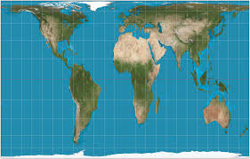
Gall Peters
a projection that displays accurate axes, but shapes are distorted. They are hard to navigate when the shapes are not accurate
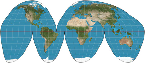
Goode Homolosine
a pseudocylindrical projection used for presenting global data. It reduces distortion of both size and shape but does not maintain consistency in scale.
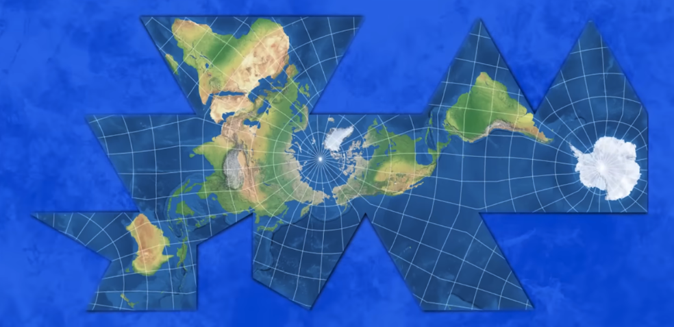
Fuller
interrupted, bad for direction, keeps size and shape
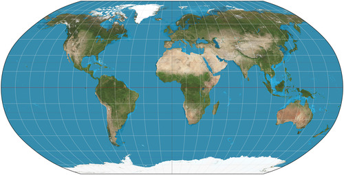
Winkel-Tripel
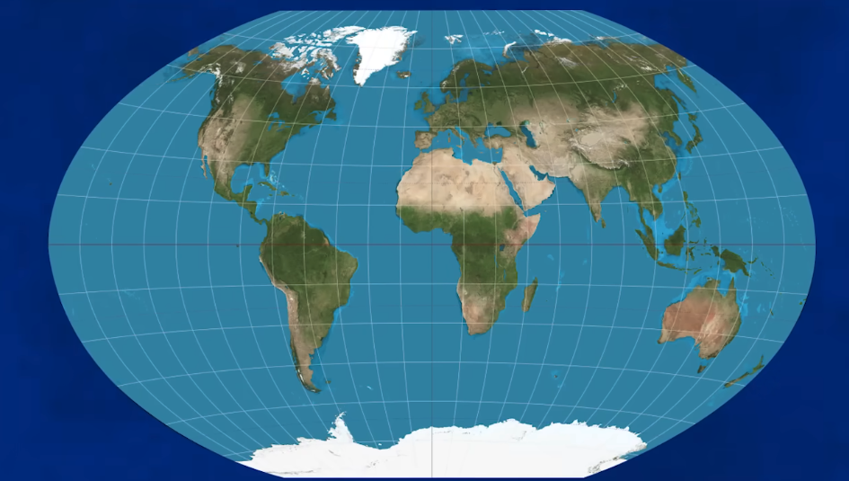
a compromise projection that minimizes distortion of area, direction, and distance. It is commonly used in world maps.
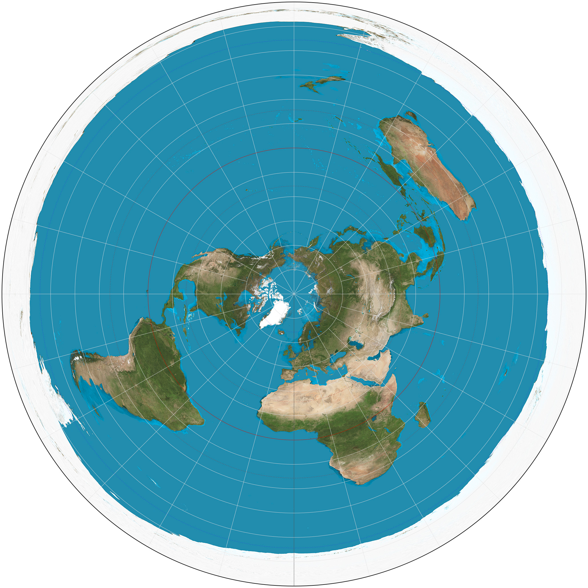
Azimuthal
planar or zenithal projection, projects the Earth's surface onto a flat plane